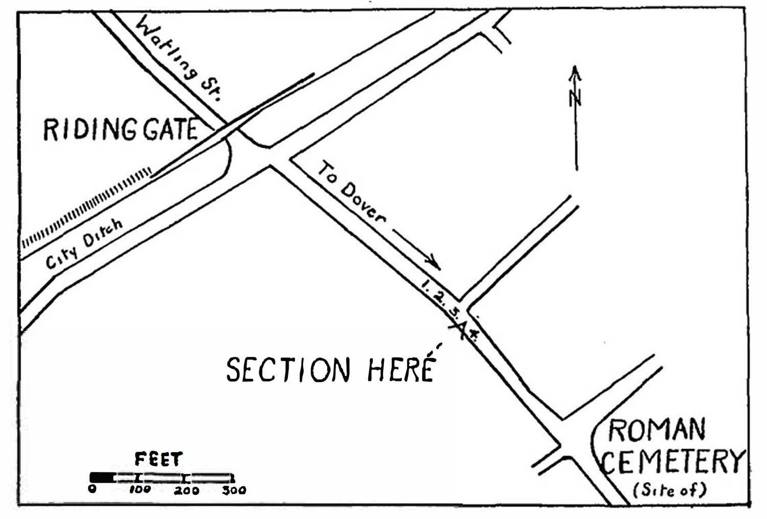
The Roman Watling Street from Canterbury to Dover

THE ROMAN WATLING STREET FROM CANTERBURY TO DOVER By FRANK JENKINS THE sketch-map and section refer to a deep trench which was dug in February, 1949, for the purpose of linking up the domestic drains of St. Bede's House with the main sewer under the Old Dover Road, Canterbury. The site is on the SE. side of the road, 215 yards from LJ ne)(ct:1>1<:,f"ed Sewer Trench ·􀀏 Top So,/ 􀀅 Br,clrth - Road Metall1n9 Section of Road looking towards Riding Gate the Riding Gate ; and c. 130 yards from the Roman Cemetery at St. Sepulchre's. The excavations were watched with great interest, especially as a tunnel was to be driven under the roadway from the edge of the pavement. The main feature encountered during this work lay at a depth of 9 ft. below the modern surface (c. 50 ft. O.D.). It was a band of tightly packed gravel containing traces of ohallc and a few small flints. A 45 THE ROMAN WATLING STREET FROM CANTERBURY TO DOVER width of 10 ft. 6 in. was exposed from a point below the pavement towards the centre of the road where it was cut by the main sewer trench. At this point it was 12 in. thick tailing off to about 2 in. at the edge. It rested on clean yellow brick earth and was sealed by a similar deposit, which out in the open trench came to within 12 in. of the surface. No finds of any period came from these deposits. These conditions agree with what was found by Pilbrow during the main drainage excavations carried out under his supervision in 1868.1 At that time ?,e reported the existence of four walls (Nos. 1-4 on map), SECTION HERt/ FiET r ,􀀇o a􀀈o s􀀉o The Old Dover Road. Canterbury. Sket

Previous
Previous

A Note on the Mead Way The Street and Doddinghyrnan in Rochester

Next
Next

The Brooke Tomb Cobham Kent