Letters
I am writing in the hope that members may be able to identify some structures I have come across while carrying out research on the biology and ecology of the saltmarsh mosquito at Pegwell Bay, near Ramsgate in Kent (Figure 3 - OS reference TR 340 624). On the site there are three large earthworks which are obviously man-made because they are shaped like the letter "E" or the number "3". They are composed of Thanet Sands which has been brought from Cottington Hill, approximately 1 kilometre away, and dumped onto the silt which comprises the saltmarsh. However, they do not appear on any Ordnance Survey maps dating from 1898, and I have not been able to find out anything about their origin or purpose. These structures are not easily seen on the ground but become obvious from aerial photographs. On the left is Pfizer's sportsground, in the middle is Stonelees Nature Reserve and at the top is the Ramsgate to Sandwich road, the A256.
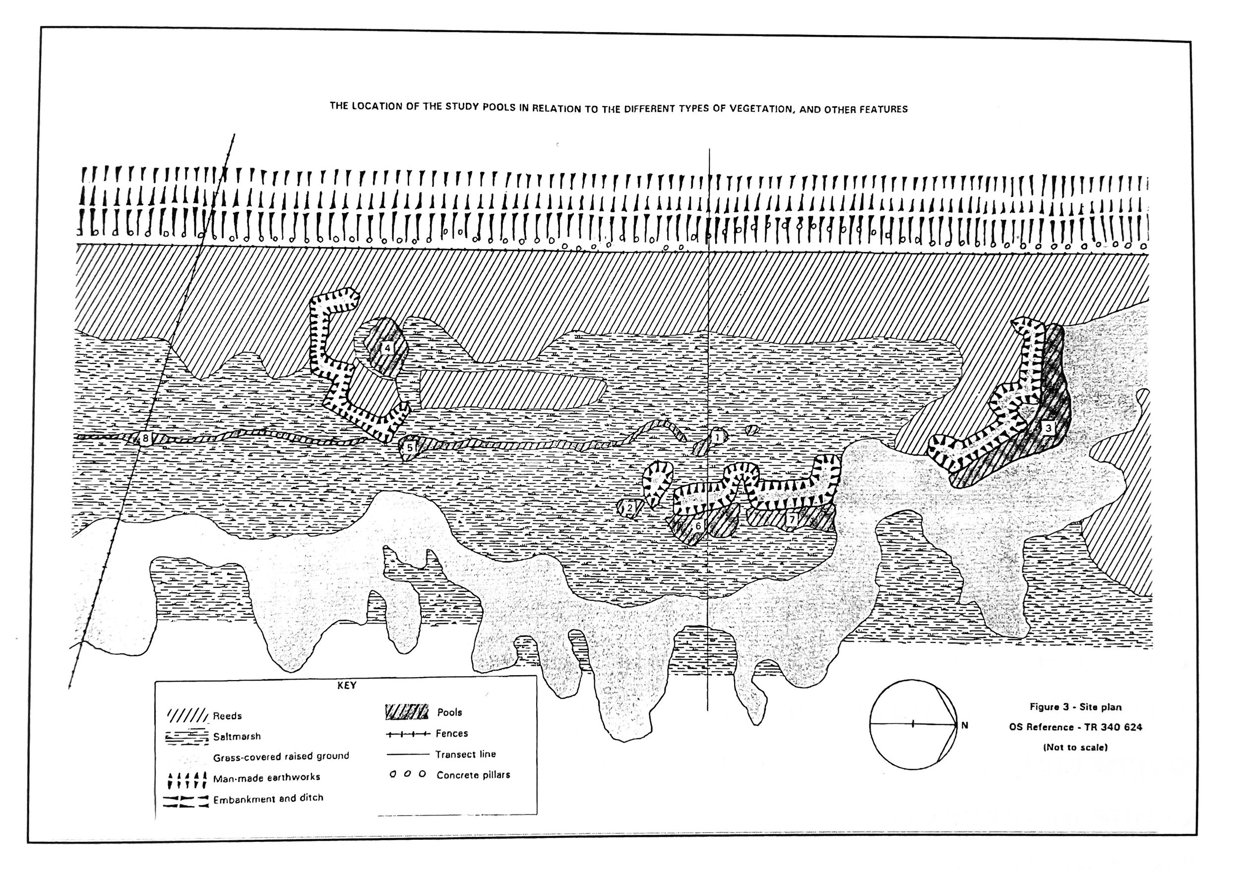
The earthworks measure approximately 20 metres by 6 metres, and are a maximum of 1 metre high. Towards the sea is an irregular line of earthworks which do appear on Ordnance Survey maps dating from 1898. These are also composed of Thanet Sands, and are therefore man-made. On the landward side is an ancient earth embankment and ditch which forms the edge of the Stonelees Nature Reserve and Pfizer's sportsground. A line of anti-tank traps was built into the embankment during the Second World War. Pools have developed against or in close proximity to these earthworks, and it is in these pools where the saltmarsh mosquitoes develop, which I have been studying (see diagram).
A metal link from an early Victorian chain was unearthed from beneath one of the "E" or "3" -shaped structures, and it is possible that this was left behind when they were made. This is the only evidence that has been found for a possible date of origin. There is a metal tower on the ancient embankment which used to support a warning (air-raid type) siren. This may have been associated with the "secret" port of Richborough, built in 1917, or may have been intended for use during the Second World War. The train ferry berth built in 1917 is only a few metres away on the estuary of the river Stour. Plans made of the area when the "secret" port was being constructed do not show these structures either. This might suggest a date later than 1917, but as I have said, the structures do not appear on maps from after this date either. It is odd that an irregular (seemingly natural) line of earthworks has been recorded on maps but not an assemblage of obviously man-made structures in the same area.
It has been suggested that the shaped earthworks were hides for duck shooting, and the irregular earthworks for helping to channel the birds into the firing line. Or that the shaped structures may have been used for target practice or for defence purposes, but these last two uses would not explain the presence of the other earthworks. The area is marshy and/or actually under water for much of the year and I feel this would make these uses impractical. There is also a large gap between two of the structures where I would have expected to find another similar earthwork (see diagram). I am therefore not convinced by any of these ideas.
These structures have had a profound influence on the development of the pools on the saltmarsh where the mosquitoes develop, and therefore on the presence of the mosquitoes. I am naturally curious to know their origin. I therefore wondered whether, if you published my letter and figures in Archaeologia Cantiana, your readers might be able to help. Or whether you might be able to suggest any other source of information on these structures. I would be extremely grateful for any help you or your readers may be able to give.
Andre Molenkamp