
Front matter, Volume 143
2022, Archaeologia Cantiana, Volume 143. Maidstone: Kent Archaeological Society.
Ringlemere: investigation of prehistoric ring-ditches, M2 and M3
Keith Parfitt, 2022, Archaeologia Cantiana, Volume 143. Maidstone: Kent Archaeological Society.
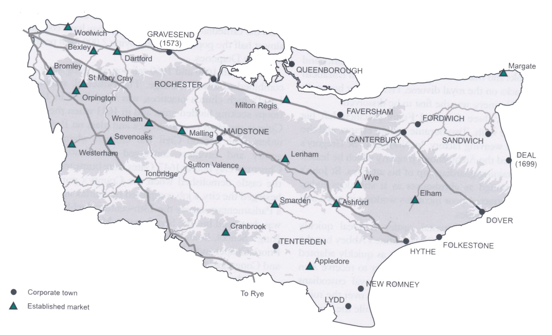
Starting a new life as artisans and traders in Ricardian and Henrician Canterbury (c.1400 and c.1500)
Sheila Sweetinburgh, 2022, Archaeologia Cantiana, Volume 143. Maidstone: Kent Archaeological Society.
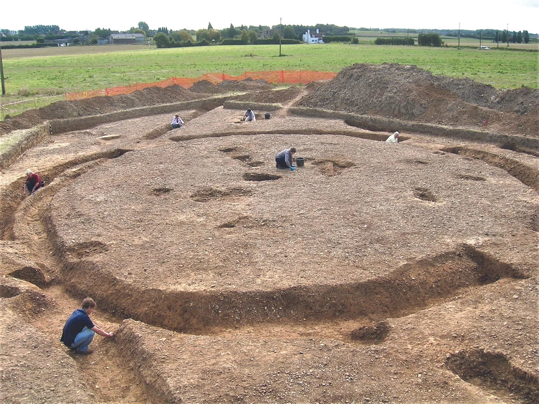
Probable SFB at Market Inn site yields first secure evidence of Early Anglo-Saxon settlement at Faversham
Patricia Reid, 2022, Archaeologia Cantiana, Volume 143. Maidstone: Kent Archaeological Society.
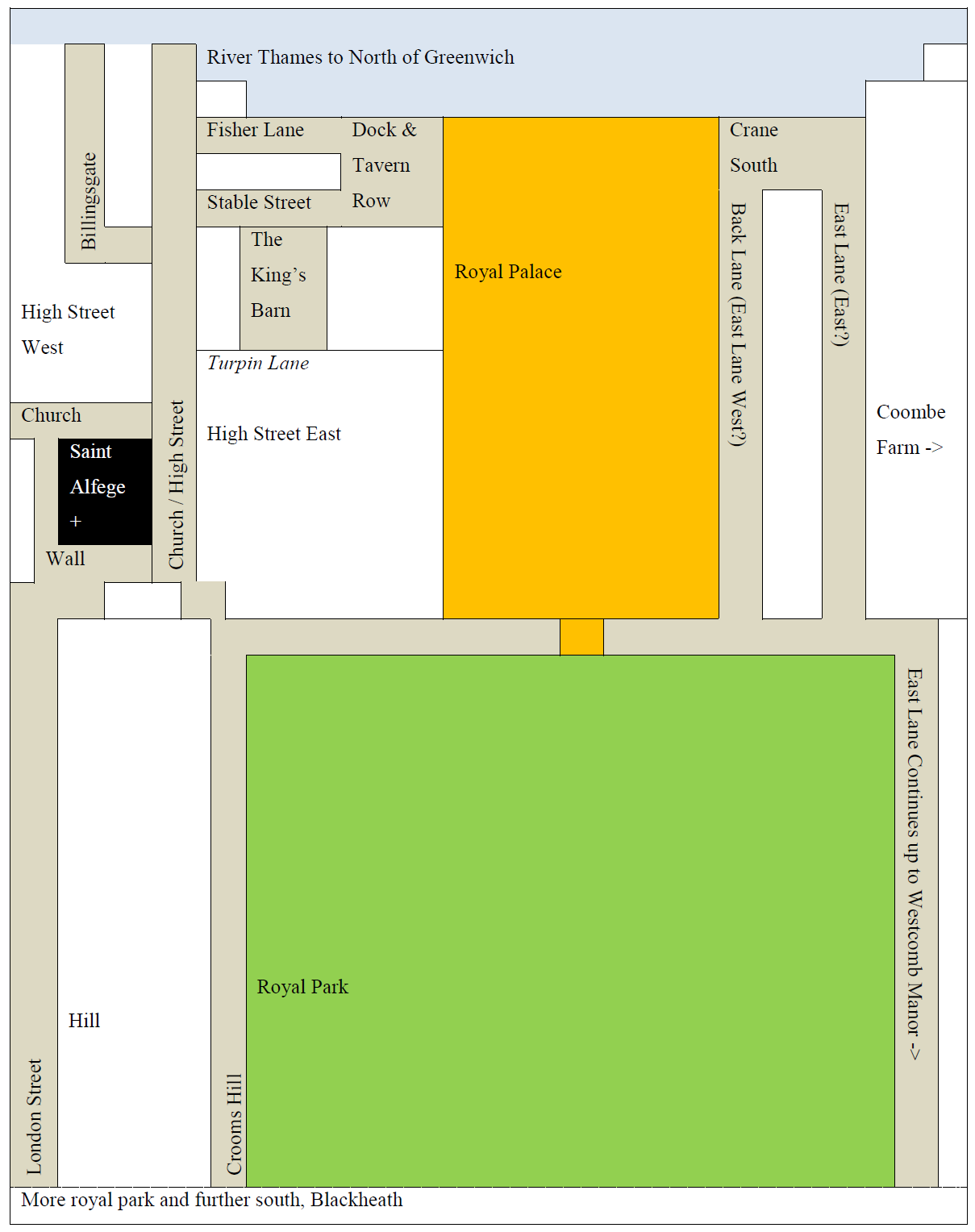
The ‘Great Plague of London’ in Greenwich and Deptford, 1665-1666
Michael Zell and Jacqueline Davies, 2022, Archaeologia Cantiana, Volume 143. Maidstone: Kent Archaeological Society.
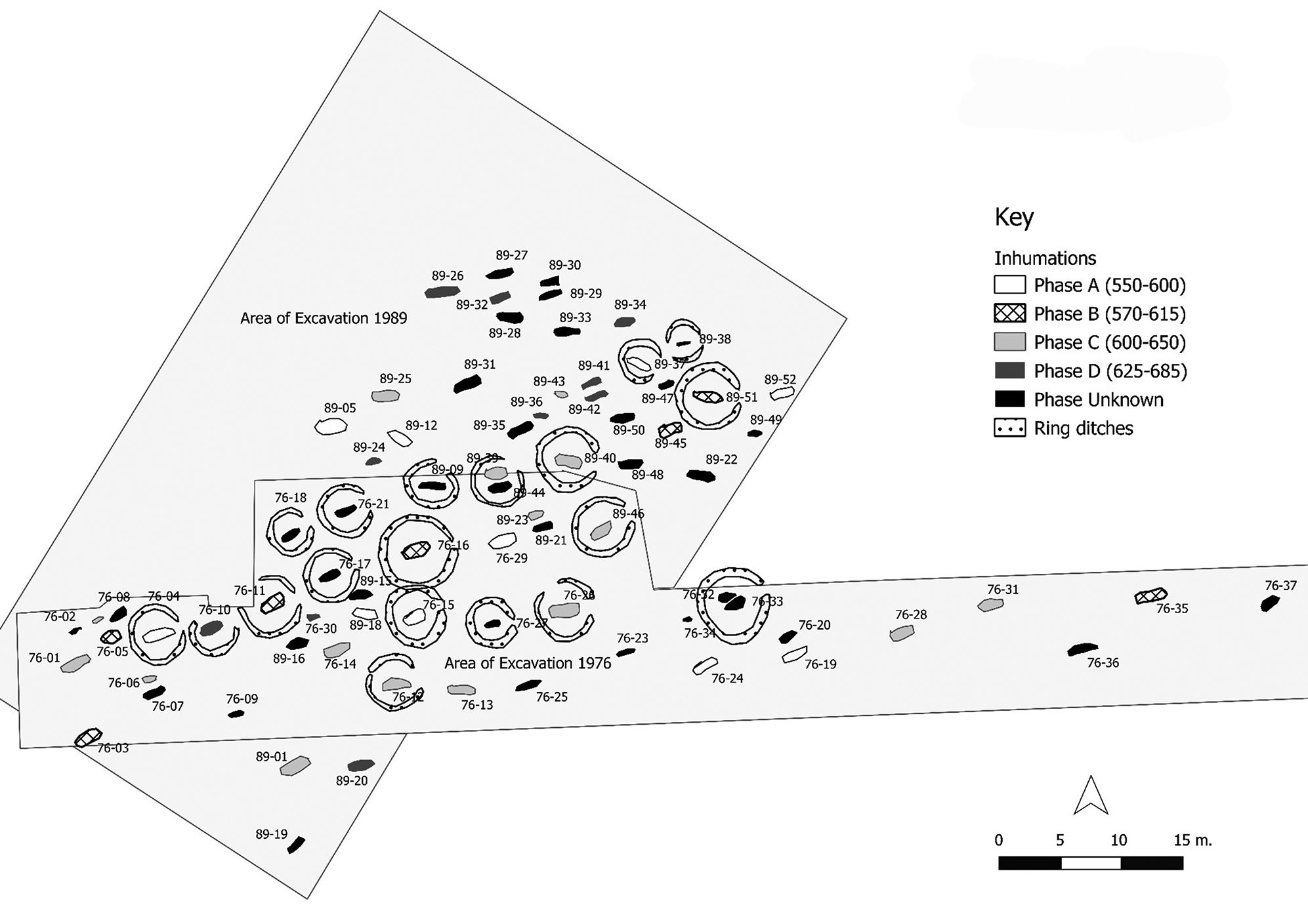
The Updown Anglo-Saxon cemetery: a revision of the site’s chronology using Correspondence Analysis
Tim van Tongeren, 2022, Archaeologia Cantiana, Volume 143. Maidstone: Kent Archaeological Society.
Knole House, Jack Cade and the ‘Battle of Solefields’
Gillian Draper, 2022, Archaeologia Cantiana, Volume 143. Maidstone: Kent Archaeological Society.
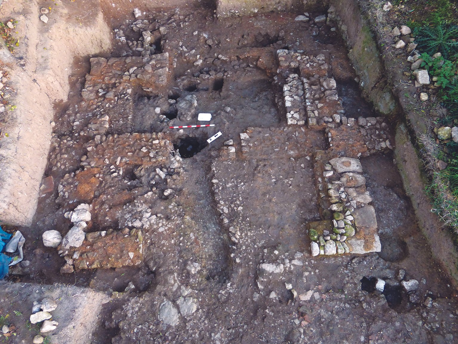
The complex of Roman buildings excavated by MAAG at East Farleigh, 2005-17: an interim report
Stephen Clifton, 2022, Archaeologia Cantiana, Volume 143. Maidstone: Kent Archaeological Society.
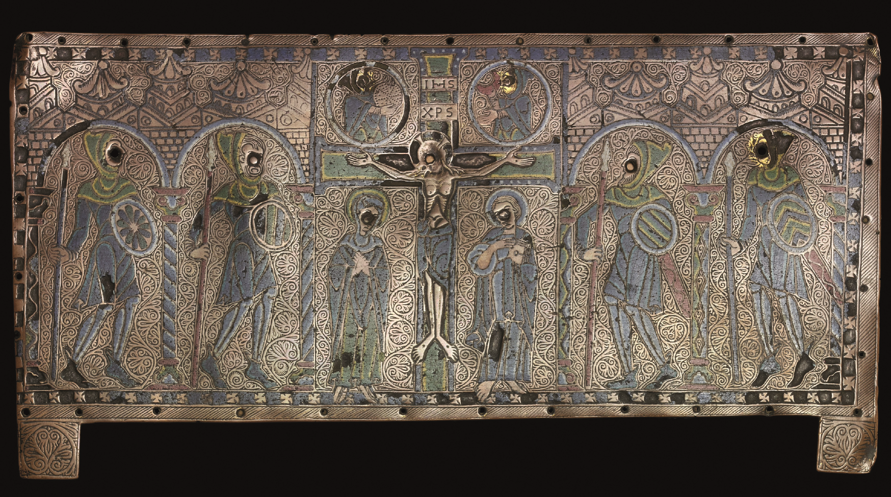
Iconography and Origin: a Twelfth-Century Limoges Enamel Plaque from Bayham Abbey in the British Museum
Eleanor Wilson, 2022, Archaeologia Cantiana, Volume 143. Maidstone: Kent Archaeological Society.

Sculpture at the Green Court gateway of Canterbury Cathedral Priory
Rita Wood, 2022, Archaeologia Cantiana, Volume 143. Maidstone: Kent Archaeological Society.
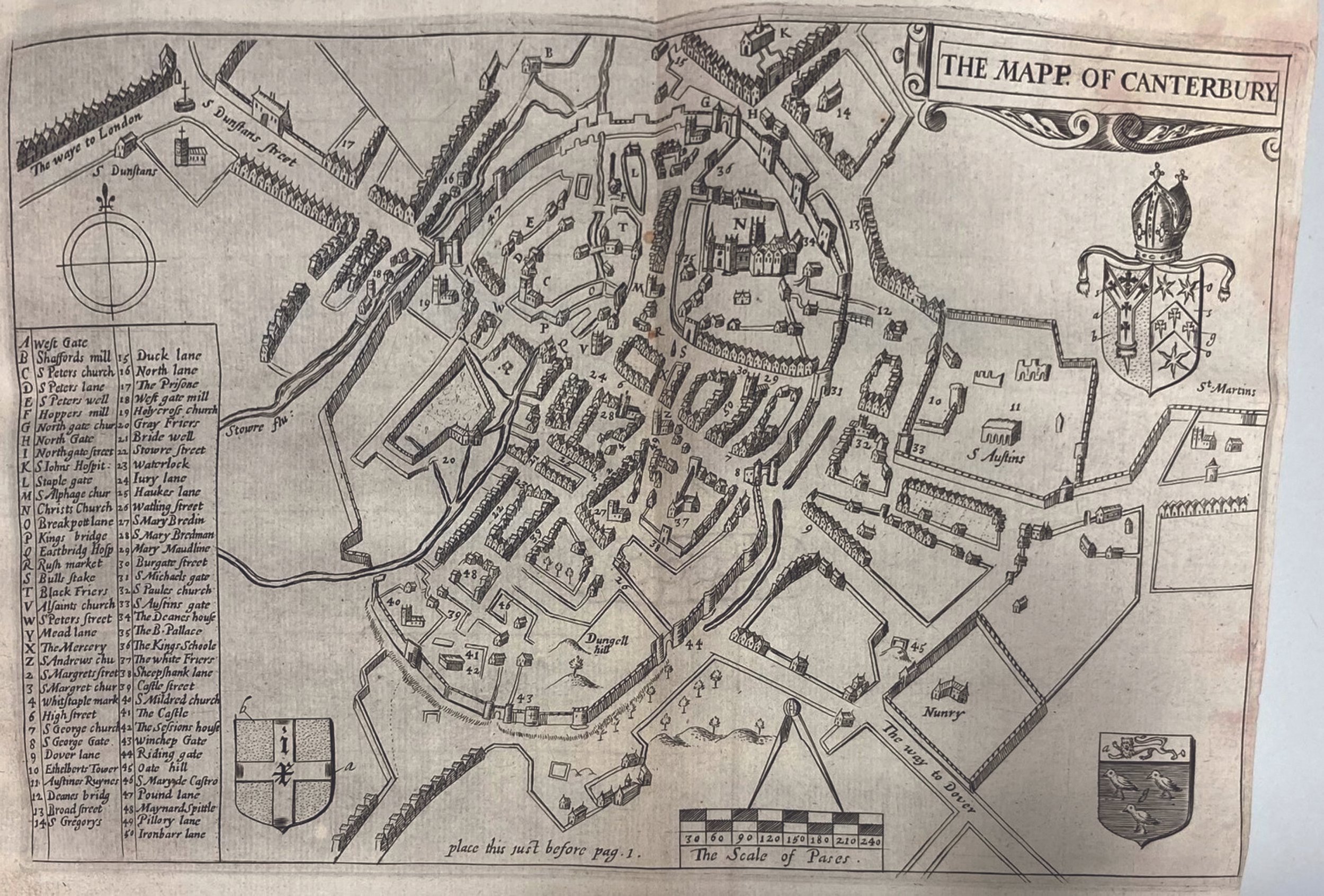
‘For the honour of that ancient Metropolis’: William Somner’s, The Antiquities of Canterbury (1640)
Avril Leach, 2022, Archaeologia Cantiana, Volume 143. Maidstone: Kent Archaeological Society.
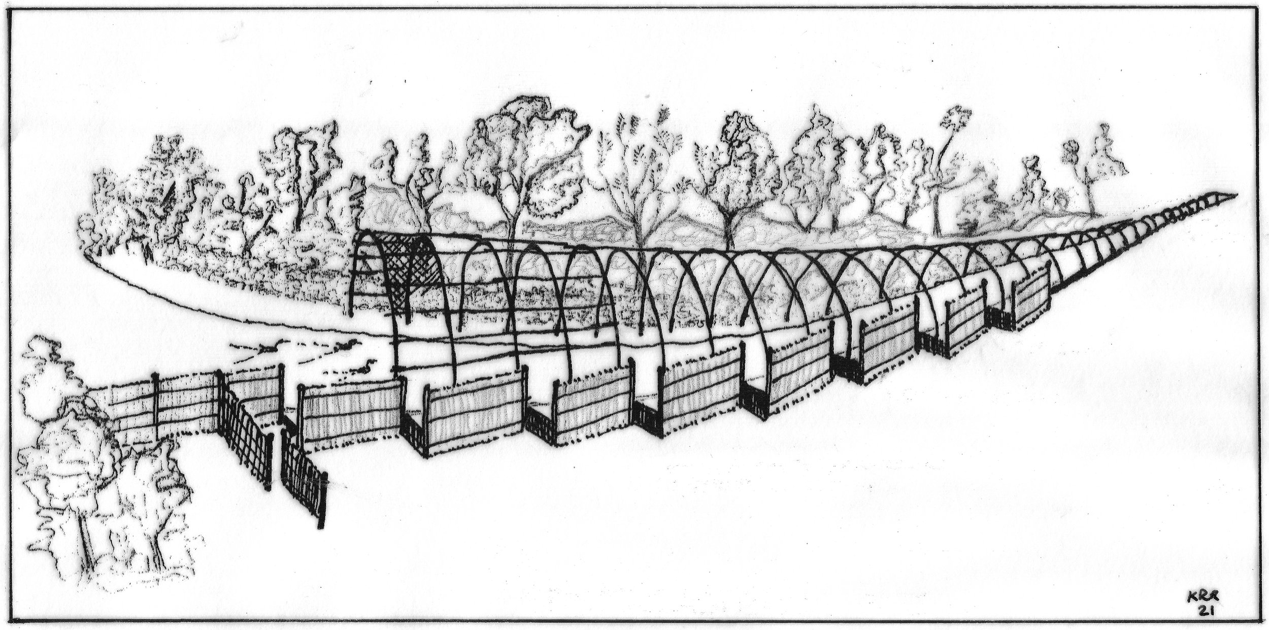
Kentish Duck Decoys
Keith Robinson, 2022, Archaeologia Cantiana, Volume 143. Maidstone: Kent Archaeological Society.
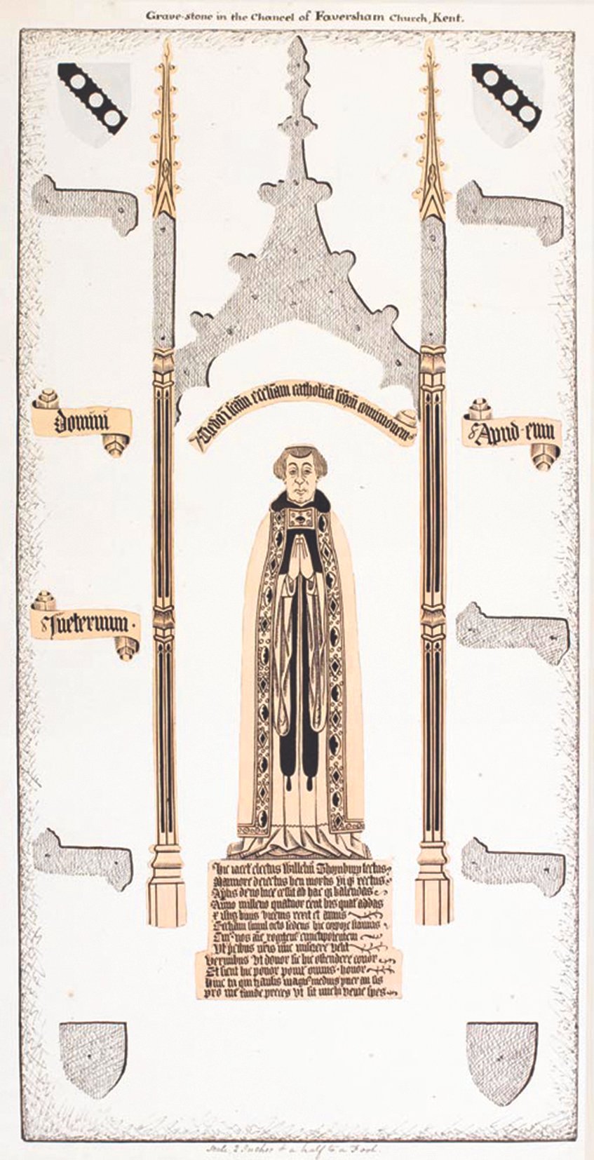
William Thornbury (d.1481), vicar of Faversham – and anchorite?
David Lepine, 2022, Archaeologia Cantiana, Volume 143. Maidstone: Kent Archaeological Society.
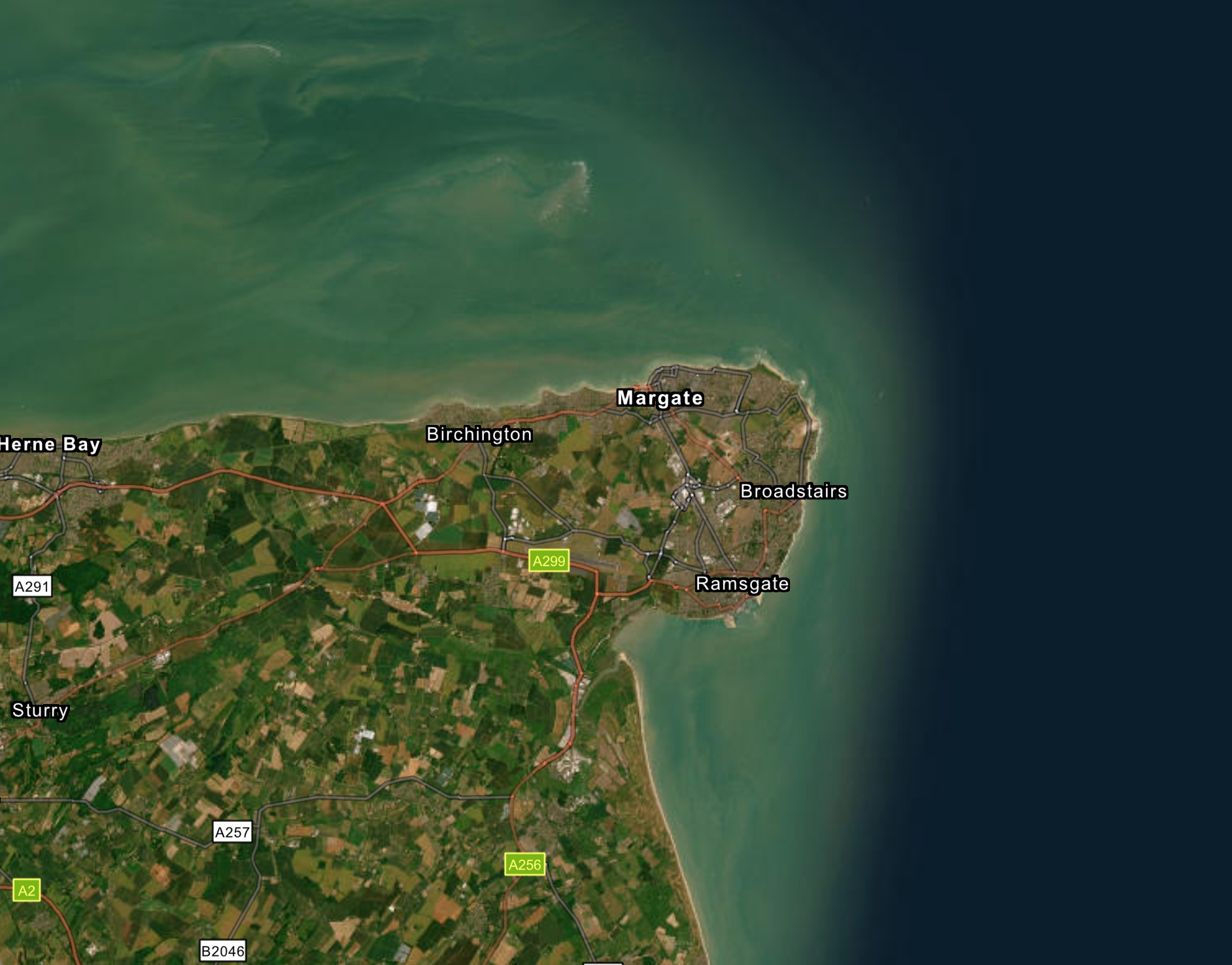
The Isle of Thanet and the 1642 Protestation Oath
Margaret Bolton, 2022, Archaeologia Cantiana, Volume 143. Maidstone: Kent Archaeological Society.

What Archbishop Bourchier acquired in his 1456 Knole transaction
Stephen Draper, 2022, Archaeologia Cantiana, Volume 143. Maidstone: Kent Archaeological Society.
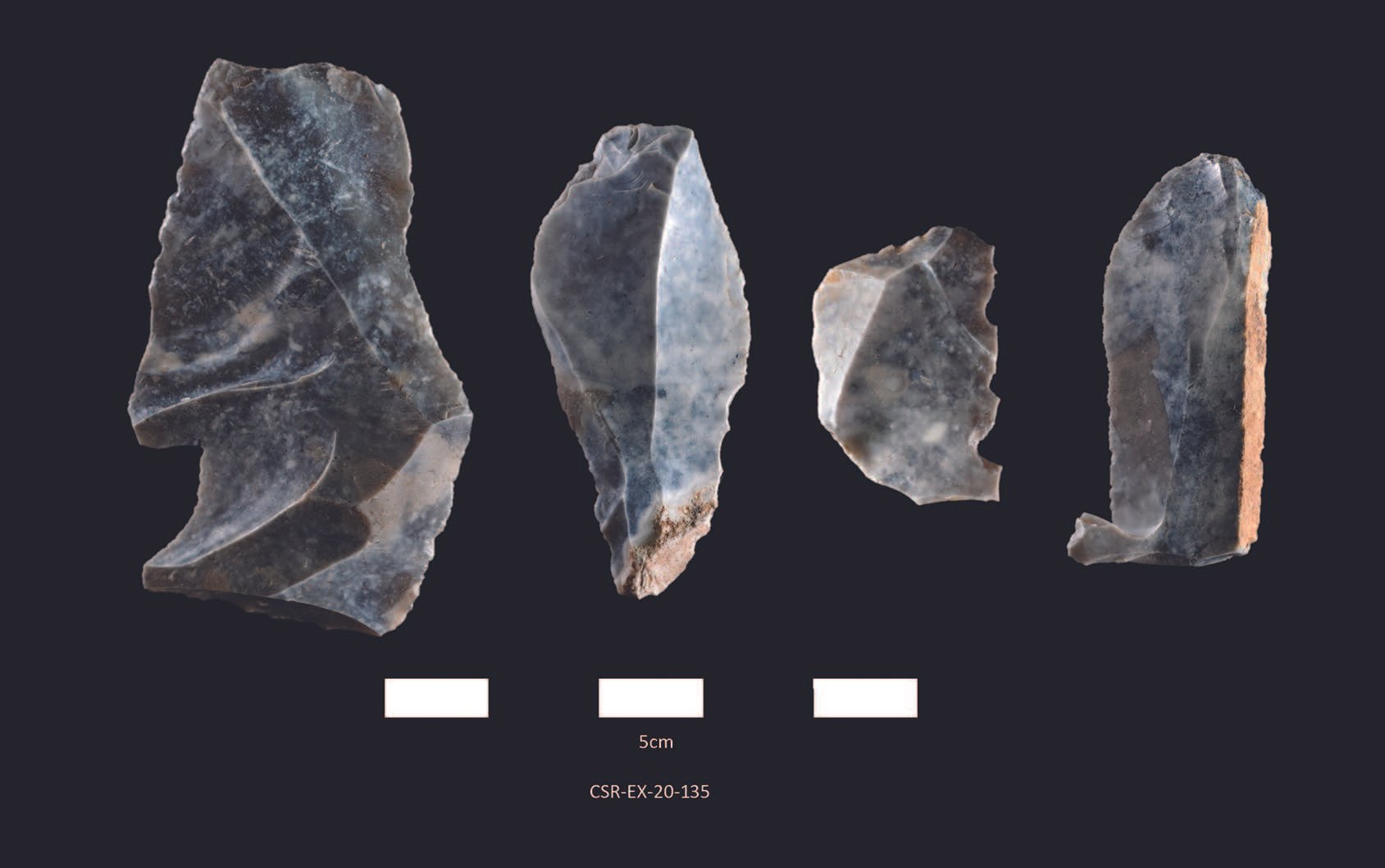
A rare Kentish example of a very early post-glacial flint-knapping site at Court Stairs, Ramsgate
Pete Knowles and Tim Allen, 2022, Archaeologia Cantiana, Volume 143. Maidstone: Kent Archaeological Society.
New light on Stephen Gray, FRS (1666-1736), Canterbury freeman dyer
Stephen Williamson, 2022, Archaeologia Cantiana, Volume 143. Maidstone: Kent Archaeological Society.

Excavations at Margetts Pit, Burham: large-scale manufacture of artefacts in late Bronze Age/early Iron Age
Erica Gittins, 2022, Archaeologia Cantiana, Volume 143. Maidstone: Kent Archaeological Society.
Researches and Discoveries
2022, Archaeologia Cantiana, Volume 143. Maidstone: Kent Archaeological Society.
Categories
- General Indexes
- Lists of Contents
- Member Access
- Obituaries
- Research
- Reviews
- Volume 10
- Volume 100
- Volume 101
- Volume 102
- Volume 103
- Volume 104
- Volume 107
- Volume 108
- Volume 109
- Volume 11
- Volume 110
- Volume 112
- Volume 114
- Volume 115
- Volume 116
- Volume 12
- Volume 120
- Volume 121
- Volume 122
- Volume 123
- Volume 124
- Volume 125
- Volume 126
- Volume 127
- Volume 128
- Volume 129
- Volume 13
- Volume 130
- Volume 131
- Volume 133
- Volume 136
- Volume 138
- Volume 139
- Volume 14
- Volume 140
- Volume 143
- Volume 145
- Volume 146
- Volume 15
- Volume 16
- Volume 17
- Volume 18
- Volume 2
- Volume 20
- Volume 21
- Volume 22
- Volume 23
- Volume 24
- Volume 28
- Volume 31
- Volume 36
- Volume 37
- Volume 38
- Volume 39
- Volume 40
- Volume 41
- Volume 42
- Volume 43
- Volume 44
- Volume 45
- Volume 46
- Volume 47
- Volume 48
- Volume 61
- Volume 64
- Volume 65
- Volume 66
- Volume 68
- Volume 69
- Volume 70
- Volume 71
- Volume 74
- Volume 77
- Volume 78
- Volume 79
- Volume 80
- Volume 81
- Volume 82
- Volume 83
- Volume 84
- Volume 85
- Volume 86
- Volume 87
- Volume 89
- Volume 9
- Volume 91
- Volume 92
- Volume 93
- Volume 94
- Volume 95
- Volume 96
- Volume 97
- Volume 98
- Volume 99
Tags
- Agriculture
- Appledore
- Ashford
- Ashford Archaeological Society
- Bexley
- Bromley
- Canterbury
- Chatham
- Church History
- Churches
- Cliffe (Hoo)
- Cobham
- Cooling
- Cranbrook
- Darent
- Darenth
- Dartford
- Dartford & District Archaeological Group (DDAG)
- Dartford Historical and Antiquarian Society
- Deal
- Defences
- Dover
- Earthworks
- Eastry
- Eccles
- Edenbridge
- Faversham
- Fieldwork and Research Grants
- Folkestone
- Frindsbury
- Genealogy
- Gravesend
- Gravesend Historical Society
- Hasted Prize
- Heraldry
- Herne Bay Historical Records Society
- Hoo
- Hythe
- Ightham
- Industrial
- Inventories
- Iron Age
- Isle of Sheppey
- Isle of Thanet
- Isle of Thanet Archaeological Society
- KAS Collections
- KAS Library
- Kent Archives Kent History and Library Centre
- Kent Family History Society
- Knole
- Little Chart
- London
- Lullingstone
- Lyminge
- Maidstone
- Maidstone Area Archaeological Group (MAAG)
- Maidstone Museum
- Maps
- Margate
- Maritime
- Medieval
- Megaliths
- Memorials
- Military History
- Milton
- Minster-in-Thanet
- Modern
- Monasticism
- New Romney
- Nonington
- Orpington & District Archaeological Society (ODAS)
- Ospringe
- Otford
- Plaxtol Local History Group
- Prehistoric
- Ramsgate
- Reculver
- Richborough
- River Medway
- Roads
- Rochester
- Romney Marsh
- Sandwich
- Sarre
- Sevenoaks
- Shoreham
- Shorne
- Sittingbourne
- Springhead
- The Faversham Society
- The Woolhope Club
- Tonbridge
- Tonbridge Historical Society
- Trust for Thanet Archaeology
- Upchurch
- Weald
- Westerham
- Wills
- Wingham
- Wye Historical Society
Archaeologia Cantiana is the Society’s annual journal dedicated to the archaeology and history of Kent. First published in 1858, the journal has long served as a leading forum for detailed research, bringing together substantial articles, excavation reports, and critical studies covering all periods of the county’s past . With contributions ranging from prehistoric archaeology to post-medieval history, it represents one of the most comprehensive collections of research on Kent ever published . We invite submissions from academics, professional archaeologists, independent researchers, and advanced students whose work contributes to this tradition of high-quality scholarship.
Submissions may include full-length research articles, excavation and survey reports, thematic studies, and critical reviews of recent publications. The journal welcomes original, well-researched work that offers new insights, reassesses existing evidence, or presents significant primary data relating to Kent. Contributions should be clearly structured, fully referenced, and supported where appropriate by illustrations, tables, or figures, in keeping with the journal’s established academic standards.
Papers may be considered for inclusion in a future volume of Archaeologia Cantiana, subject to editorial review. When submitting, please provide a complete manuscript along with author details and any supporting materials. Our editorial team may make minor edits for clarity, consistency, and formatting, and may liaise with authors during the review process. By contributing to the journal, you help sustain a long-standing record of research and ensure that new discoveries and interpretations continue to be shared with the wider archaeological and historical community.
Deadline for Submission
Contributions should reach the Editor by the end of September in the year preceding publication.
Length of Item
Papers in Archaeologia Cantiana typically contain 5,000-10,000 words. Significantly longer items are occasionally acceptable; alternatively, the Editor may prefer to agree with the author a reduction in the length of the article. With the setting up of the Society’s website another option for long papers is to publish a Summary or Introduction in Archaeologia Cantiana referenced to the full report on the Internet.
The Submitted Text
The text must be submitted in electronic form in Word – as an email attachment or on a USB/ memory stick, or where a large file by WeTransfer.
Illustrations and Photographs
The image area of a page of Archaeologia Cantiana is 7.8 x 5.1in. (197 x 130mm). Take into account the depth of the caption and whether the image is to be portrait or landscape. Please provide a sequential list of illustrations/photographs together with the captions required.
Line illustrations: if images need to be scanned a clear original in black ink on white paper/drawing film is ideal, but good quality photocopies are acceptable. Provide an imperial/metric scale and north point, as appropriate.
Photographs: for scanning, good quality originals should be provided with adequate contrast, unmounted. Colour prints/transparencies can be reproduced in b/w or in colour if this has been agreed.
Digital illustrations: both line illustrations and photographs can also be submitted on USB/ memory stick; or where a large file by WeTransfer as TIFF or JPEG files. If the original is in colour the author may need to change to greyscales unless colour reproduction has been agreed. TIFF line illustrations should be presented at 1200 dpi, if possible; JPEG line art at 600 dpi; photographs at 300 dpi. If it is not possible to save line art images from drawing programmes, good quality images can be produced as PDF or EPS files at 600 dpi.
Tables
Bear in mind the size limits of the page (see above) in designing your table(s). Tables which can be presented in portrait are preferred. Avoid over-complexity.
Some points on House Style
Where the text needs to be italicised, indicate either by underlining or type as such.
Indicate quoted material clearly.
Please do not use the first person.
Tenth century, not 10th century; dates in the form 12 November 1432; July 1675: Augustine landed AD 597 (although sixth century AD), Caesar in 55 BC.
Per cent should be spelled out.
Compass points to appear in full: e.g. south-west, north-eastward.
Old money set out as, for example, £5 14s. 9d.
Offprints
All contributors of main articles are supplied with a maximum of ten offprints of their paper, gratis. (Five only for short items or ‘Notes’.) PDF copies of papers are available through the Society.
Copyright
Authors should identify the owner(s) of any copyright material (textual or illustrative) contained within articles offered for publication; and are responsible for obtaining the appropriate permission(s).
A separate set of instructions for authors regarding house style are available from the editor.
Jason Mazzocchi
Kent Archaeological Society,
39-48 Marsham Street,
Maidstone,
Kent ME14 1HH.