KAS Newsletter, Issue 110, Winter 2018

Lynsted Kent’s literary heritage Iron Age custom and belief Fort Amherst Excavation of a V2 rocket An untapped mine of local history Interpreting Kent’s ancient finds Uncovering a Napoleonic fortification THE OLDEST AND LARGEST SOCIETY DEVOTED TO THE HISTORY AND ARCHAEOLOGY OF THE ANCIENT COUNTY OF KENT № 110 Winter 2018 06 19 25 LEES COURT ESTATE 22 2018 UPDATE 02 | Kent Archaeological Society President Dr Gerald Cramp Vice Presidents Mr L.M. Clinch Mr R.F. Legear Hon. General Secretary Clive Drew secretary@kentarchaeology.org.uk Hon. Treasurer Barrie Beeching treasurer@kentarchaeology.org.uk Hon. Membership Secretary Mrs Shiela Broomfield membership@kentarchaeology.org.uk Hon. Editor Terry G. Lawson honeditor@kentarchaeology.org.uk Hon. Curator Dr Elizabeth Blanning elizabeth.blanning@kentarchaeology.org.uk Hon. Librarian Ruiha Smalley librarian@kentarchaeology.org.uk Press Vacant Newsletter Richard Taylor 87 Darnley Road, Gravesend, Kent DA11 0SQ Richard.Taylor@kentarchaeology.org.uk WELCOME FROM THE EDITOR Welcome to the Winter 2018 Newsletter. Following a busy summer, we have a bumper issue packed with abundant and intriguing fieldwork, historical research projects and discussion. It seems such a long time ago that I was surveying in the scorching summer heat at Lees Court Estate. Indeed, much of that warm weather held out until late September enabling us to successfully carry out excavations at Woods Court Field and Stringmans Field. Shortly after that, I was excavating at a fascinating site at Fort Amherst in Chatham. What struck me most at both locations, however, was the invaluable efforts of the many volunteers that took part, and made both projects so successful. Following positive experiences at these projects, it is equally rewarding to see so many new members joining the Society. For me, the best way to increase the Society’s membership is engagement – get people involved, try new activities, learn new skills and make contributions to our County’s fantastic archaeological and historical heritage. The Newsletter remains an outlet for this fantastic heritage and the tremendous work going on out there. It exists so that you, the membership, may communicate a broad range of topics devoted to the history and archaeology of Kent. I continue to encourage as many members as possible to think about writing articles and help inform the broader historical and archaeological community of what is taking place in our heritage-rich and diverse County. Please continue to forward articles or notices to newsletter@kentarchaeology.org.uk Enjoy this issue and Season’s Greetings to all readers. Best wishes, Richard Taylor The editor wishes to draw attention to the fact that neither he nor the KAS Council are answerable for opinions which contributors may express in their signed articles; each author is alone responsible for the contents and substance of their work. Front cover image courtesy of Anthony Mak using KAS drone. Winter 2018 | 03 CONTENTS FEATURES Lynsted V2 Rocket Excavation Allen Grove Local History Fund The Ian Coulson Annual Bursary William Somner, Kentish Scholar Kent’s Literary Heritage: A (Largely) Untapped Mine A Glimpse into Iron Age Custom and Belief Dowsing at Springhead near Gravesend in the 1950s Excavations at Fort Amherst Lees Court Estate: 2018 Excavations – A Thank You from the Countess Sondes – Excavations in Woods Court Field, September 2018 – Site Administration – Geophysics at Lees Court Estate – Estate and Farming View of Archaeological Digs – Stringmans Field Excavations 2018 – Lees Court Estate 2018 06 10 14 16 19 22 24 25 33 33 34 36 37 38 39 42 № 110 Winter 2018 6 mi. 10 km 06 25 24 14 05 33 12 22 President’s Column Cobham Landscape Detectives An Interview With... Lucie Bolton Letters to the Editor The Finds Corner Membership Matters Notices REGULAR 04 05 12 13 17 32 44 04 | Kent Archaeological Society The culmination of the process started by my predecessor Ian Coulson and Peter Stutchbury in 2014 is almost here. The existing Society will merge with the KAS Charitable Incorporated Organisation (CIO) on 1st January 2019. During September the Society continued its archaeological excavations at Lees Court Estate near Faversham confirming the presence of a multiperiod Prehistoric settlement. As reported in this edition, the excavations were supervised by Keith Parfitt and the University of Kent, at Wood Court Field and Stringmans Field respectively, and carried out by many volunteers from across the county. The Membership Secretary reports that nearly 40 new members have joined the Society since the last issue of the newsletter. We must continue our efforts to recruit members. In my last column, I reported that Paul Oldham, a former President of this Society, assisted Brian Philp in the formation of the Kent Archaeological Research Groups Council in 1965, which later became the Council for Kentish Archaeology (CKA). It is with regret that I have to report that the CKA has been dissolved. The CKA has served the County well for over 50 years with its extensive work on numerous archaeological sites throughout the County. During the summer, the Shorne Woods Archaeological Group (SWAG) continued its excavations in the village of Cobham and at Spur Battery, Fort Amherst. Both excavations have produced impressive results which are detailed in separate articles. The Allen Grove Local History Fund has made grants of over £3,000 to five local history projects this year. Applications are now invited for grants to be awarded in 2019. Kent is fortunate in having many thriving local historical and archaeological projects, but in general, the County’s heritage is under threat from many quarters. Sevenoaks District Council has produced its Draft Local Development Plan and, as the document had little archaeological content, I wrote to them emphasising that archaeological assessment remains a material aspect in the planning process. During my brief research, I noticed that authorities such as Ashford District Council do include an archaeological history of their district: a practice I would encourage all planning authorities to follow. Museums have been a significant repository of the County’s historical and archaeological heritage. In the past few years, museums at Bromley, Gravesend and Canterbury have closed, and one of the museum buildings in Rochester sold. The Canterbury Heritage Museum, which told the history of Canterbury, is a significant loss. It is sad to see that during this period of financial restraint, the County’s historical and archaeological heritage is at risk. Nevertheless, it is pleasing to report that the Maidstone Museum has produced its 20-year plan for consultation, and I hope the Society and Maidstone Museum continues its association, one which dates back to 1858. Gerald Cramp, President PRESIDENT’S COLUMN The CIO Status is nearly here COBHAM LANDSCAPE DETECTIVES Welcome to the latest Cobham Landscape Detectives project update! Following on from the mammoth West Park survey, featured in Issue 109, the summer fieldwork season aimed to answer two questions: Firstly, could we identify the location of a number of the lost medieval manor sites within our project area? Secondly, could we push back the dating of Cobham village? Investigations began in June, with a number of test pits dug at Jeskyns Court, west of Cobham village. Research indicates that this could be the site of the lost medieval manor of Henhurst. A tour of the current house suggests that we could be looking at fourteenth-century timbers in the roof of the building. Is the medieval manor still standing? One of the test pits yielded medieval pottery, with the rest revealing post-medieval activity. By Andrew Mayfield Winter 2018 | 05 Further work over the summer at a second possible site for Henhurst Manor drew a blank for medieval activity, so Jeskyns Court remains our favoured candidate. Moving into the village, we gained permission from the Forestry Commission to geophys and test pit a second possible Manor site, known as North Court. Despite some promising resistivity results and a single late medieval pottery sherd, we must wait till 2019 to groundtruth the results further. At the east end of the village, the volunteers investigated the grounds of Cobhambury House. This location is a further possible Manor site, with medieval remains again proving elusive. As in all great archaeology tales, a significant flint and chalk foundation structure of some age did appear towards the end of the dig. This will require further investigation in 2019! Although the Manor sites remain somewhat elusive, we are refining our understanding of their relative locations. In Cobham village, many residents allowed us to investigate their gardens further. On the south side of the village, we recorded fourteenthcentury activity and a possible boundary ditch. On the north side, we recorded a pit, with further evidence for early fourteenth-century activity. The village itself is stubbornly refusing to reveal any earlier medieval activity. The church dates to the 12th century, but we have yet to see this early date in the wider village archaeology. There is also no sign, as yet, of earlier Saxon, Roman or Prehistory activity ‘under’ the village. Great minds have dwelt on these conundrums! The current school of thought is that the village may have developed on the joins between Henhurst, North Court, Cobhambury, Cobham and a further manor at Vyaundes (south of the village), focused around an implanted Church, originally appendant to Shorne Church. As to the lack of pre-medieval activity, it is possible that the whole area was wooded, with earlier activity focused on the ridges to the east and west of the village. Evidence for earlier activity proved the highlight of our summer season! Working at Owletts, a National Trust property west of the village, the team excavated a Gallo- Belgic site, recording ditches, pits and metalworking evidence. In the field next door, geophys suggested an extension to this settlement and a quantity of Roman building material indicated a building nearby. In this summary of current progress, I have not had a chance to detail further work on our postmedieval Great House site at the east end of the village. Nor the input and continued support from the North Downs Young Archaeologists Club. Credit, however, must be given to all the landscape detectives; whose continued enthusiasm and professionalism drives this project forwards. For further information on the project, do contact Andrew Mayfield, andrew.mayfield@kent.gov.uk, see www.facebook.com/archaeologyinkent, or @ArchaeologyKent on Twitter and our website www.shornewoodsarchaeology.co.uk Acknowledgements Aerial view image courtesy of Dean Barkley Top, left Aerial view of excavations at Owletts Top, right Rim from Gallo-Belgic pot 06 | Kent Archaeological Society As the allies attacked Germanheld territory from the west, they began to overrun sites in France and Belgium that had been built to launch these new weapons. The knowledge that Germany had been developing V-weapons had been a secret amongst intelligence and Cabinet circles since 1943, and an allied bombing campaign delayed and then hindered the V1 programme. Despite this, approximately 9,500 “Doodlebugs” were launched against England from 1944 to 1945, calling for an increasingly co-ordinated defence. The introduction of the close-proximity fuse antiaircraft shell, gun-laying radar and the careful positioning of fast fighter aircraft and anti-aircraft operating zones quenched the main offensive by September 9th 1944, prompting Duncan Sandys (Chair of War Cabinet Committee against V-weapons) to proclaim that the battle against the V1 had been won. In secret, however, the authorities knew that an offensive by another new weapon was likely to be launched. Less than three days later, the first of 1,119 V2 rockets struck Britain. There was no defence against the V2 once launched. Travelling at three times the speed of sound, LYNSTED V2 ROCKET EXCAVATION By Colin Welch the V2 was the first man-made object to reach space. Its trajectory took it to an altitude of 50 miles, reentering the atmosphere under its momentum to impact at vast speed to explode with the detonation of 1 metric ton of high explosive. At the impact site, little would remain. RAF teams responsible for formally recording the details of each V2 impact, noting features such as date, time, location, casualties, means of ordnance identification, crater size, extent of the blast, and damage to property, would comment that since only small By 1944, the German war machine was reaching its technological zenith. Adolf Hitler placed both faith and considerable resources in the development of new weapons to attack Britain, primarily the flying bomb or “Doodlebug” (V1) and rocket (V2). Both weapons would leave an indelible mark on the British psyche for many generations. fragments of the missile were identified in and around the crater, vaporisation must have occurred. Small fragments of a V2 found in and around an impact crater at Lynsted, near Sittingbourne, generated interest for the historical analysis and archaeological team, Research Resource, specialists in the study of the V-weapons and the associated countermeasure battle. Run by the author and his brother, Sean Welch, Research Resource has accumulated an archive that has enabled the construction of a point-sensitive animated timesequence computer programme, documenting every V1 and V2 that landed in England during 1944 and 1945. The ‘film’ runs for some four minutes, and shows the impact of the various phases of the offensive, and can be discriminated to highlight the component elements of attack and defence. Winter 2018 | 07 The Lynsted V2 impacted at 08:10hrs on 17th February 1945 in a small dry valley field 350 metres east of St.Peter and St.Paul’s church. The bomb census report from the time states that the L.R.R. (Long Range Rocket) “fell in (an) arable field about 250 yds. from nearest building (a school), causing slight tile, glass and ceiling damage to (the) nearest building, and slight glass and tile damage up to about 500 yds. A thorough search was done for fragments with markings, but only small fragments without markings were found.” The form states that the missile exploded (X), creating a crater 57’ x 18’ deep (17.37m x 5.48m). Evaluation excavation In July 2016, with landowner permission, a magnetometer survey indicated large magnetic responses in an area that corresponded to what appeared to be an impact site on a 1946 aerial photograph (fig 1). In October 2016 an evaluation trench 1.5m wide and 3m deep was then cut into the northwestern edge of the crater using a mini-digger, successfully defining the crater edge profile as it met the rising land of the north-west side of the valley. The trench revealed that the large magnetic responses were due to buried domestic and farmyard rubbish, but no V2 wreckage. Opposite page, top Picture of a V2 rocket Opposite page, bottom Fig 1: 1946 aerial photograph showing the Lynstead V2 crater, courtesy of Kent County Council Above left Fig 2: Evaluation trench of the crash site in 2016 Above right Fig 3: Lynstead V2 detonation layer at 5.5 metres depth, Phase 1 excavation. Phase 1 excavation In 2017, following landowner approval, and the encouragement of the Lynsted with Kingsdown Society, a detailed excavation strategy was tabled and excavation using a mechanical digger undertaken between 8th–11th April 2017. The objective being to clear the crater of infill, describe its profile and carefully search for any remaining V2 wreckage. The first fragments of V2 wreckage, discovered at a depth of 4 metres, included components of the warhead baseplate surround. At a depth of 5.5 m to 5.7m, a central ‘plug’ shape was visible, containing evidence of exposure to intense heat in the form of fused metalwork and soil, possible indications of detonation. Below this, there appeared to be clean bedrock chalk. Further evidence for detonation occurring at this depth is corroborated by the bomb census report. The finds appeared to be from the front section of the weapon. They included sections of the warhead baseplate, electrical components and associated materials from the control compartment situated behind the warhead, a gas bottle, parts of the liquid oxygen and alcohol tanks and a section of the permanganate tank. Analysis of the finds suggest that 153.5kg (5%) of the 3150kg (dry weight) of the V2 was retrieved, but none of these finds included heavy items from the tail section. 08 | Kent Archaeological Society A 3-dimensional model was built to understand the work undertaken, showing the crater, the excavation extent, and to evaluate the trajectory of the V2 in relation to the finds. The missile was launched at 08.06hrs GMT on 17th February 1945, by Artillerie-Abteilung 1./485 from a mobile launch pad in the Statenkwartier of Den Haag, Netherlands. The target, London, on a bearing of 255° (from Den Haag). However, according to radar plot returns, the Lynsted V2, for some reason achieved a trajectory bearing of 249°, somewhat offtarget. The most likely explanation for this error was that the V2 was on a steady, but faulty trajectory, from Top left Fig 4: 3D model of the Phase 1 excavation Middle left Fig 5: Radar plot returns for the Lynstead V2, fired from Den Haag 08.06hrs GMT 17th February 1945 Middle right Fig 6: Section showing the contours of the Phase 1 April 2017 excavated crater, and some of the remaining infill in situ Below left Fig 7: Plan view of the Phase 1 April 2017 excavated crater showing the areas fully excavated (green) Below right Fig 8: Phase 2, May 2018, impact crater and finds analysis plan Phase 2 excavation took place between 11th-13th May 2018. At a point 3 metres deep, on the southwestern side of the crater, past the detonation centre and in line with the incoming trajectory, half a metre into the crater wall, gas bottle remains were discovered. The bedrock below the central detonation was also excavated. At 9.5 metres depth, some 3 metres north-west of the centre, at a 125° tangent from the incoming trajectory, the shattered remains of the turbo pump was found embedded in the bedrock. At a depth of 6.5 metres, through the crater wall to a point perpendicular to the outer rim of the crater, we recovered the remains of the combustion chamber. Phase 2 excavation launch (fig 5) Given the trajectory and a belief that there must be more of the missile in the ground at Lynsted, there was much debate about where the heavy items had ended up? Most contributors to the debate believed that considering the immense forces, further wreckage would be in line with the trajectory, either in front of or behind the detonation point. After consideration of the model and trajectory, it was noted that the areas behind and in front of the trajectory of the missile leading to the central detonation point had not been fully excavated and a further search was proposed using a mechanical excavator. Winter 2018 | 09 Conclusions The excavations resulted in interesting conclusions. In the final analysis, a further 533.5kg (17%) of material in the phase 2 project, including 279kg (50.72%) of the combustion chamber was recovered, resulting in a combined finds weight of 687kg (21.80%). Work is ongoing to conserve the Phase 2 finds. In general, their condition is moderately good since the chalk had sealed them at great depth where oxidisation could not occur. Anti-clockwise from left Fig 9: Part of the V2 turbo pump Fig 10: Remains of the V2 turbo pump central drive shaft Fig 11: Burner cup from V2 combustion chamber Fig 12: Inspection approval stamp on the V2 turbo pump component The designer’s hope for the V2 was that it would explode on the surface to create maximum blast damage. However, because the missile was travelling supersonically, and the fuse train for detonation was subsonic, it punctured the ground to a depth of 5.5 metres before fully detonating. The heavy components of the V2 continued moving forward under their momentum, but the energy release from the impact and detonation deflected them from the main trajectory. Under the immense pressure of the impact, the chalk was reduced to a toothpaste like liquid which absorbed and sealed the finds in the bedrock with no visible trace of their path. A recent study of a V1 missile impact at Ham Street, Kent, showed the same tangential effect of heavier finds in relation to the incoming trajectory. Comparing the physical and archival evidence between the V2 and the V1, it is clear that due to the slower speed (400-450mph), the V1 was the more effective surface blast weapon, and had the enemy been able to bring it to readiness earlier, the ensuing “Second Battle of Britain’ (as we have come to believe that it was) would have been more difficult to overcome. 10 | Kent Archaeological Society Five local history projects received grants in 2018 from our Allen Grove Local History Fund. Every year the society awards more than £3,000, apportioned among individuals, groups, organisations and students, to help cover the cost of research, publications, exhibitions and other projects focused on Kent’s history and heritage. The successful applicants in 2018 were: Eleanor Bliss, who received £250 towards publishing a biography of Margaret Agnes Babington OBE, who became steward to George Bell, Dean of Canterbury, in 1928. In 1927 Bell founded the Friends of Canterbury Cathedral, the first organisation of its kind in the world. Miss Babington made a considerable contribution to its success, staging plays and concerts and enticing illustrious people such as John Masefield, Sir Adrian Boult, Gustav Holst, Dorothy L Sayers, Dame Myra Hess, Rudyard Kipling and George Bernard Shaw to the cathedral. ‘Miss Babs’, a Tenterden vicar’s daughter, was a “fundraiser extraordinaire and an incredible force,” said Eleanor. “She cajoled deans and bishops into getting things done! Hers was a life worth recording for posterity.” ALLEN GROVE LOCAL HISTORY FUND President’s legacy has supported local history for 24 years By Paul Tritton Folkestone and District Local History Society: £500 to help publish The Folkestone Pulpit, a brief history of the town’s churches that existed in 1875. The book will publicise the early histories of churches that were thought to have been lost, and help local historians with their research into their churches. Kent Gardens Trust: £750 towards a book on five properties in Kent on which Humphry Repton, the last great English landscape designer of the eighteenth century, worked (Bayham, Cobham, Kippington, Montreal and Vinters) and five others with which he is associated. Wealden Iron Research Group: £1,500 will help fund Adventures in Iron by Brian Awty, a book tracing the development of blast furnace technology from Belgium in the mid-fifteenth century to north Normandy and the Weald of south-east England, from where it spread into Kent after 1550. Woodchurch Ancestry Group: £325 to cover printing and publicising a collection of illustrated articles on the history of Woodchurch, including medical care in the seventeenth and eighteenth centuries, First World War recipes and smuggling. The grants are made from the legacy of Allen Grove, one of Kent’s most eminent historians of his generation who was Hon. Curator of the KAS for 26 years (and its President in 1987/88), Curator of Maidstone Museum from 1948 to 1975 and Chairman of the Kent History Federation for eight years. When Allen Grove died in 1990 he left £26,000 from the proceeds of the sale of his house to the KAS, with instructions that the society should invest the legacy and distribute the interest in ways that would promote the enjoyment of Kent’s local history (including that of the London Boroughs of Bexley, Bromley, Greenwich and Lewisham, which were once part of the county). The first grants were made 24 years ago, in 1994, mainly to support the publication of books and booklets but also for displays in heritage centres, for oral history projects, & for establishing archives and research centres. Application forms for 2019’s grants should be submitted by 31 March 2019 & can be downloaded from http://www.kentarchaeology.org.uk/ grants/ or obtained by email from allengroveadmin@kentarchaeology. org.uk or by post from the KAS c/o 8 Woodview Crescent, Hildenborough, Tonbridge, Kent TN11 9HD (please enclose a s.a.e.). Winter 2018 | 11 Humphrey Repton in Kent Who would have thought that a few lines from a story in 1917 would start me off on a research project which has now culminated, seven years later, in me writing a book? It was the last thing on my mind when I signed up with my husband, Andrew, in 2011, to join a Tenterden Church Group visiting the Somme battlefields. Rev. Keith Fazzani told us about the life and death of Humfrey Babington, a young man who is listed on the St Mildred’s Church World War 1 War Memorial. The Babington family made an impression on me. The father was Rev J A Babington, vicar of St Mildred’s Church Tenterden from 1907 until he retired in 1924. An older brother was a poet, and daughter Margaret stayed with her father throughout his ministry in Tenterden and later in Canterbury. I began to research Margaret, little suspecting where her life story would take me. A valuable source of information was the archived Parish Magazines, written by Rev Babington and his daughter. Margaret played a significant part in the history of Tenterden – indeed I found references to her being involved in 36 different groups, as secretary, treasurer or leader! She was a founding member of both the Mother’s Union and WI in Tenterden. She worked tirelessly throughout the first war setting up and supporting the War Hospital Supply Depot at Homewood; she organised the National Egg Collection scheme in the town and surrounding villages; she raised vast amounts of money for various local charities and good causes – all a rehearsal for what she achieved when she moved to Canterbury in 1924. She lived in the Cathedral Precincts with her father. In 1928 Margaret was appointed the Secretary, Steward and Treasurer of The Friends of Canterbury Cathedral, and is credited with raising over a hundred thousand pounds for various cathedral projects. This is the equivalent of £1.65 million in today’s money. In 1937 she was awarded the OBE ‘for services to the cathedral’. She wrote a bestseller – The Romance of Canterbury Cathedral. She was the driving force, along with Dean George Bell, behind the first Canterbury Festivals. Queen Elizabeth II sent a message of condolence to her family and friends when she died, and she was honoured by having two memorial plaques placed in Canterbury – one in the Cathedral and one in the Cloisters. However, this is only a part of her story. There is so much more… With the help of a grant from the Allen Grove Fund organised by KAS and a very helpful publisher – Ed Adams of Canterley Publishing – I now find that I have written a ‘proper book’ with an ISBN! I am pleased to report that I have had some encouraging comments from various people who have already bought it from me. Copies are available at £10. Postage is £1.50 for UK orders. Phone 01233 770082 or email eleanorbliss1@gmail.com Profits will all go to St Mildred’s Church, Tenterden, where this project all started. I have enjoyed researching and writing this book. I hope that you enjoy reading it. The Urgent Miss Babington As part of a country-wide celebration of the work of the 19th-century landscape gardener Humphrey Repton, the Kent Gardens Trust research team have produced a beautifully illustrated book describing Repton’s five commissions in Kent, with a short introduction to his life and artistic principles. Humphrey Repton in Kent is a companion volume to Capability Brown in Kent. It is 140 pages long and will interest not only garden historians but for anyone keen to know more about the social history of the county and the lives of the leading figures of the time. The research has revealed fascinating and hitherto unknown contemporary letters and drawings and has made extensive use of Repton’s famous Red Books. Copies are available through ww.kentgardenstrust.org.uk and all good bookshops, priced £10 (Kent Garden Trust members £8), postage and packaging £3.50 extra. Kent Garden Trust members may obtain a discount code by contacting the Secretary, Lynn Phillips at lynn. phillips@kentgardenstrust.org.uk Alternatively, a cheque for the appropriate amount may be forwarded to Lynn Phillips at Yew Cottage, Station Road, Eynsford, Kent DA4 0ER. By Kent Gardens Trust By Eleanor Bliss 12 | Kent Archaeological Society AN INTERVIEW WITH… I began by asking Lucie to tell us a bit about her background: LB: I grew up in Kent, and I remember always being aware of the tremendous amount of history and archaeology we have surrounding us. I loved History and Geography at school, and I started to think about a career in archaeology when I was around 16. It was not long after that I had my first experience volunteering on a site at Canterbury. I went on to do an undergraduate degree in Archaeology at the University of Exeter before doing a Masters in Palaeolithic Archaeology and Human Origins at the University of Southampton. I returned to Southampton for my PhD which was also in Palaeolithic Archaeology and included studying material from many well-known Palaeolithic sites from Kent such as Cuxton and Frindsbury. RT: What did you do after graduating? Did you head straight into the heritage sector? LB: After completing my PhD, I worked for a few years as a Palaeolithic Specialist in commercial archaeology and spent much time working in the Ebbsfleet area. I finally moved across to my current role as a Community Archaeologist working for Kent County Council a year ago, and I have been seconded to Kent Wildlife Trust as the Heritage Officer for the Fifth Continent since then. RT: Tell us about the Fifth Continent Project. LB: The Fifth Continent is a Heritage Lottery Funded, Landscape Partnership Scheme based on Romney Marsh. We have many projects we are delivering which focus on heritage, wildlife and community on the Marsh. RT: ‘Heritage Officer’ sounds like it possesses a broad remit of responsibilities? LB: It does! My day to day role is quite varied, but I wouldn’t want it any other way. I am the lead for three projects which are focusing on the heritage and archaeology of the Marsh. The projects are working with volunteers to carry out archaeological investigations on the churches and various landholdings. We are also investigating the possible locations of the pre- Medieval port of Romney. RT: How does the role of the Heritage Officer fit into the Fifth Continent Project? LB: I am one of three Project Officers, and there are five of us in the team altogether. My colleagues Stan Smith and Dawn Apcar are the Biodiversity and Community Officers. We also have our Scheme Manager Lisa Barrett-Smith and Team Administrator Viv Kenny. RT: I’m aware that you’ve been leading community fieldwork as part of the Project… tell us a bit more about what you’ve been up to. LB: Community fieldwork is a considerable part of the heritage projects, and all three of the projects have fieldwork planned. We have run a number of training sessions for our volunteers covering topics such as landscape survey, geophysical survey and church surveys. Over the past month we have also carried out some geophysical surveys on a couple of sites, and now we have the results we can start to think about where we would like to excavate. We also have a significant excavation planned for New Romney in summer 2019 so keep your eyes peeled for that! RT: What are the biggest challenges facing community fieldwork in Kent at the moment? LB: One of my biggest challenges at the moment is the weather! In commercial archaeology, I got used to working in all conditions but now I’m relying on volunteers I don’t feel I can ask them to work in the pouring rain. My volunteers are very dedicated, and most of them would turn up whatever the weather but I have had to rearrange a few activities at short notice over the past few weeks. Lucie Bolton Fifth Continent Heritage Officer Winter 2018 | 13 LETTERS TO THE EDITOR Dear Editor For the benefit of members, may I be permitted to add some detail to the President’s kind remarks about our past President, Paul Oldham (The President’s Column, Issue 109). In the weeks before the Society’s 1969 AGM, Paul wrote to members seeking support for his resolution: ‘The sale of any item from the collection of antiquities, pictures and documents, owned by the Society, is detrimental to the interests of archaeology in Kent. In consequence, no further sale of such articles is to take place without the consent of members at a General Meeting.’ Two years before, officers had sold an important portrait from the collection bequeathed to the Society in 1938 by Sir John Twisden. In the early 1960s, the Margary bequest was still some years away, and the Society’s Council often took big decisions about money without consulting ordinary members, who in 1969 were unaware that an asset of the Society had been lost. After a stormy AGM debate, Paul’s resolution was passed with acclamation. As a result, members can today view Sir John’s collection, which continues to be housed at Bradbourne House, East Malling. Paul certainly played an active part in the early years of the Kent Archaeological Research Groups’ Council (KARGC). However, its actual formation came about as the result of a widespread desire among field research groups working in Kent for a body that would encourage county-wide collaboration and make it easier to share information and learning. A first meeting of the ‘Ad hoc Committee of Kentish Field Archaeologists’ took place at Rochester on 21 May 1964. Recorded as being present at the meeting were: ‘Mrs Howe, Mrs Piercy Fox & Miss Waugh, and Messrs Bradshaw, Detsicas, Harrison, Horner, Howe, Jackson, Lyle, Meates, Ocock, Parsons, Philp, Tester, & one other’. My notes of the meeting reminded me that discussion was dominated by the thorny subject of a proposal to create a new Council for British Archaeology (CBA) regional group, a Group that would see Kent ‘unite’ with Surrey. The reason for this preoccupation with CBA matters was that some of those attending the May 21st meeting had been at an earlier informal gathering, also held in Rochester, at which an invitation from CBA Group 10 (London) was discussed. This unexpected communication suggested that Kent should join with CBA Group 10 and not support the creation of a new CBA Group 11B. In addition to exploring reactions to the CBA initiated problem, the earlier gathering, held under the auspices of the Lower Medway Group (of which I was secretary at the time), had gone on to discuss ideas for establishing better links between active local groups working in Kent and to consider suggestions for launching a new body to represent Kent field archaeology. The outcome was the 21 May meeting and ultimately the KARGC. The inaugural meeting of the KARGC would take place at Canterbury on Saturday 10th October 1964. Bill Penn became KARGC chairman, Graeme Horner its secretary and Brian Philp, its treasurer. The KARGC was later renamed the Council for Kentish Archaeology (CKA) which, in the years since, has benefited Kentish archaeology by adopting a novel approach to rescue excavations, public relations, media briefings and the writing up of history. Yours sincerely, Michael Ocock, KAS member RT: Having been active now for a while, what would you say are the essential characteristics of a successful Heritage Officer? LB: I think being organised is critical. Juggling three projects with 70 volunteers and multiple landowners can get quite complicated at times but I’m a big fan of to-do lists, and I’ve just discovered Bullet Journaling which is helping me to stay focused. It also helps that I’m a people person and I love talking to people about their local archaeology! RT: What legacy do you hope to leave behind once the Fifth Continent Project ends? LB: I hope this project helps people to connect with the history and archaeology of the Marsh. If by the end of this project people feel they know more about the archaeology on their doorstep, I will be happy. 14 | Kent Archaeological Society THE IAN COULSON ANNUAL BURSARY FOR LOCAL HISTORY/ARCHAEOLOGY IN KENT SCHOOLS 2017–18 By Andy Harmsworth and Marion Green On 2 October 2018, we attended a whole school assembly at St John’s Catholic Comprehensive School in Gravesend. The purpose of the visit was to present Colm Murphy, Subject Leader for History, with a cheque for £1,000 for his department’s work on the local impact of the First World War, the first award from the newly established Ian Coulson Bursary for Local History/Archaeology. This annual bursary was established in 2017 by the Education Committee of Kent Archaeological Society, of which we are both members, in memory of Ian Coulson. As many of you will know, Ian was Adviser for History in Kent schools for over 25 years and, at the time of his premature death in 2015, President of the Kent Archaeological Society. The bursary aims to support the teaching and learning of archaeology and local history, two of Ian’s great passions, in Kent and Medway schools. One bursary, worth up to £1,000, for which any Kent or Medway school (primary or secondary) may apply, will be available each academic year. To apply for the bursary teachers have to submit a short application form before the end of June. The KAS Education Committee examines all of the applications and informs schools of their decision before the end of the summer term. The successful school then has one academic year to research their chosen topic and produce related classroom materials. For the duration of the project, teachers will have access to an adviser appointed by the KAS Education Committee. They are expected to deliver in digital format: • local history/archaeology resources for children to use in the classroom over a sustained period (i.e. several hours of work in the classroom) • support materials for other teachers; for example a scheme of work, detailed explanatory notes and advice, additional resources and a bibliography Winter 2018 | 15 Opposite page Marion Green presenting the cheque to Colm Murphy with Andy Harmsworth (right) and Headteacher Matt Barroe (left) Top left Thomas Boucher, 1897–1917 Top right From the Kent Messenger, 15 December 1917 Above Front cover of the commemorative booklet produced by the students of St John’s Catholic School These materials will then be made available to other schools on the Kent Archaeological Society and Canterbury Archaeological Trust websites. The bursary will contribute up to £1,000 towards expenses incurred during the completion of the project; acceptable expenses include the costs of supply cover, the purchase of equipment, software and/ or subscriptions essential to the project, photocopying expenses and travel expenses (for example to an archive office or museum). The St John’s project was an investigation into the impact of the First World War on the locality. Using the names on their local war memorial as a starting point, Year 9 students (13–14-year-olds) carried out research to produce biographies of soldiers from their local area who died in action during the First World War. With the help of their teachers, local historians and surviving family members, they then used a variety of sources to find out about the soldiers’ lives, including the Commonwealth War Graves Commission website, military service records, census returns, local newspapers, war diaries and the histories of particular regiments and units. During their research students discovered that several local soldiers were involved in the Battle of Cambrai in November 1917, the first battle in which tanks were used on a large scale. Coincidentally, Gravesham is twinned with Cambrai and students were working at the time of the battle’s centenary. One of the first soldiers they researched was Thomas Boucher of 7 Dover Road, Northfleet, who was training to be an engineer when the war broke out. He joined the Royal Field Artillery in 1915 and was subsequently transferred to the Machine Gun Corps and then the newly formed Tank Corps. In 1917 he fought at the Battle of Messines, taking control of a Mark IV tank when its driver was severely wounded. During the Battle of Cambrai, shortly after his 21st birthday, he was shot after his tank had been hit by artillery fire and died from his wounds. He has no known grave, but his name is inscribed on the Cambrai Memorial at Louverval. Students went on to research the Battle of Cambrai and the results of their findings, together with their completed biographies, were published in a commemorative booklet ‘Gravesham and the Battle of Cambrai, November 20th – December 4th 1917’. The biographies were also published on the school website. The culmination of the project was a visit to the First World War battlefields and cemeteries in Northern France and Belgium. Pupils were able to visit the graves and memorials of the soldiers whose lives they had researched, providing added poignancy to their learning experience. A teaching and learning resource for schools based on the project, ‘Investigating the Impact of World War l in your Locality’, has now been produced. It contains detailed guidance which can be used by teachers anywhere in the country and consists of a teacher’s guide, a scheme of work and a student booklet. These materials can be downloaded, along with further information about the bursary, from the Canterbury Archaeological Trust website: www.canterburytrust.co.uk/ learning/schools/coulson-bursary/ Or follow the link on the Kent Archaeological Society website: www.kentarchaeology.org.uk Please help us to publicise the bursary by telling any teachers you know about it. We do not doubt that Ian would heartily approve of the innovative work in Kent schools which the bursary is supporting. 16 | Kent Archaeological Society WILLIAM SOMNER KENTISH SCHOLAR He spent his entire life in Canterbury, initially at the family home in Castle Street, and then in the Cathedral precincts. His father, William Somner senior, came from Boxley near Maidstone and initially drew his more famous son into the practice of a notary public after arrival in Canterbury in the 1590s. However, William junior was destined for greater things after an education at the King’s School, although a university did not follow this. As a born antiquarian he had prodigious natural energy and love for researching, recording and writing and soon knew the records, monuments and architecture of his beloved Canterbury and its cathedral better than any of his predecessors. His first masterpiece, The Antiquities of Canterbury, was published in 1640 at the young age of 34, and still stands as perhaps the best of the early borough histories, based on extensive reading and supplemented by transcripts of many post-conquest charters and other historical documents. For many years afterwards Somner gathered fresh material for a proposed second edition, but nothing would come of this until well after his death in 1703, at which time posthumous works on the Kentish Roman forts and ports, and the departure point of Caesar’s Kentish invasion would be shown to the world. Another on the Saxon Shore remains in manuscript. One of seven children, his eldest brother, Major George Somner, distinguished himself but was killed in a skirmish at Wye in 1648. Another brother, John Somner, a constable, juryman and freeman of the City, was a noted benefactor to the cathedral and paid for the erection of the Bullstake market house in the Buttermarket outside Christ Church gateway. William himself married twice and produced eight children, none scholarly, but including a clergyman and a surgeon, both died young. The Somner surname seems to have died out around the 1760s when the father of the future Archbishop John Bird Sumner arrogated the Somner coat of arms which had been granted in 1663 jointly to William and his brother John. As a close confidant in the employment of Archbishop Laud where he practised as a registrar of the consistory court and cathedral auditor, Somner was well placed to assist the prelate with ecclesiastical and other enquiries, book and record-keeping, and played no small part in saving many registers and books from loss or destruction during the 1642 sacking of the cathedral and subsequent dislocations of the civil war. Despite many demands upon his time, Somner devoted enormous energy to his next masterpiece, the Anglo-Saxon/Latin/English Dictionary of 1659, the working manuscripts for which may still be seen in the Cathedral archives. A two-volume work of profound and staggering scholarship, the Dictionary set Anglo-Saxon studies on a new path for the next three generations and laid the basis for future research and publications into By David Wright the language. The genesis of the work arose from Somner’s study or transcription of many of the most important Anglo-Saxon manuscripts (held in the famous Cottonian library and the libraries of other noted scholars), and also of contemporary English and continental printed works on philology. For several decades Somner maintained a correspondence with noted scholars, many of whom united in a close circle existing to share information about discoveries and encourage mutual research. Numerous dedications and references in their printed works are ample evidence of such relationships. Relatively little has survived following a disastrous fire in the cathedral library a year after his death when many of his deposited books and papers were destroyed. However, known connections with other scholars and their works are well established and include Somner’s great and personal local friend Meric Casaubon who offered constant help and encouragement, Sir Roger Twysden for whose Historiae Anglicanae Scriptores Decem Somner contributed the glossary, and William Dugdale’s Monasticon Anglicanum and Warwickshire on which Somner commented and contributed. Moreover, indeed, by the 1650s Somner’s name was the one above all others William Somner (1606–1669) was one of the great English scholars of the seventeenth century. Somewhat forgotten today, his reputation is in need of restoration as we approach his 350th anniversary. Winter 2018 | 17 Above Dr David Wright which scholars would consult on all matters relating to Anglo- Saxon philology and linguistics. Somner’s last major work was his A Treatise of Gavelkind of 1660 in which he described in great detail the origins, practicalities and problems of this quintessentially Kentish custom. Busy until the very end he died on his sixtythird birthday and was buried in the family parish at St Margaret’s church. His widow, now remarried as Barbara Hannington, later caused a monument to be erected in his memory and chose to be buried alongside him in preference to her two other previous husbands. A one-day William Somner colloquium will be held at the Old Sessions House, Christ Church University, Canterbury, on Saturday 23 March 2019, just one week before the exact anniversary. Proceedings will open with an exhibition of Somner manuscripts and books in the Cathedral Archives, and then be followed by five speakers, including Professors Jackie Eales and Kenneth Fincham, who will set Somner’s life into its seventeenth-century context and examine his literary legacy. A full life (in two parts) of William Somner by Dr David Wright will appear in the 2019 and 2020 volumes of Archaeologia Cantiana. All enquiries about the colloquium (and any other Somner matters) are featured in the Notices Section of this issue. For any further information, please contact Dr David Wright at davideastkent@gmail.com or visit www.drdavidwright.co.uk Images courtesy of www.drdavidwright.co.uk THE FINDS CORNER In our second piece highlighting finds from Kent reported to the Portable Antiquities Scheme (PAS) the Kent Finds Liaison Officer, Jo Ahmet, looks at non-metallic objects reported to the PAS in Kent. Anywhere you see a number proceeded by ‘KENT-’ you can use it to find the record on the PAS public database. It can often seem that FLOs are obsessed with coins, buckles, brooches and the metallic finds familiar to metal detectorists. In reality Kent, like most counties, frequently sees ceramics and lithics, from keen-eyed detectorists as well as many other finders such as mudlarks (foreshore fieldwalkers) and fossil hunters. Ceramic objects and fragments are perhaps the most common finds to most European archaeologists, and indeed they are a significant minority of finds we deal with at PAS Kent (roughly 2–3% of total finds recorded from Kent). Most such finds are scatters of ceramic fragments, oft-recorded in bulk in a similar way to site finds. About once or twice a year, however, we see complete, or near complete pots. Usually from coastal or waterlogged areas, though hoard containers o Fig 1 r cremations are known. 18 | Kent Archaeological Society Most commonly these complete vessels are late Medieval or Post-Medieval. Often these are of quite distinct and well-known types such as green glazed or salt glazed types like Bellarmine, although a Roman Samian ware bowl is currently awaiting recording. The vessel here, KENT-589236, is a rather lovely small complete jugglette dating c.1600–1850 and, unusually, has come from Spain or Portugal. It was found in Margate Bay just above the mean tide line (fig 1, previous page). After ceramics, it is lithics which dominate many archaeological sites and indeed dominate the materiality of human history. In Kent we have recorded everything from Palaeolithic handaxes and choppers, through Mesolithic tranchet axes, adzes and microliths, vast swathes of Neolithic scrapers with the occasional fine early arrowheads spreading into the Bronze Age, topped by very scrappy late Bronze Age and Iron Age tools. One last group of lithic objects to be occasionally recorded are gunflints (fig 2). Fig 2 Fig 3 Often, as gunflints tend to be dated c.AD 1600–1900, they fall outside the general pre-c.AD 1700 cut off for finds recorded with the PAS. This tends to mean that many of those recorded exhibit unusual morphology or features such as being found in lead wraps to fit the hammer lock of the firearms. KENT-AA1B15 is unique to the PAS database and indeed so far to Kent as it is a probable gunflint blank from which the gunflints could be produced. Most examples recovered seem to be directly related to gun producing areas, so this example from the wilds of east Kent makes it even more unusual. Other materials frequently recovered such as glass, bone and depositional conditions allowing leather are all represented from Kent on the PAS database albeit in small numbers. Of these materials, Roman glass is often the most striking, since despite its age and frequently being recovered from coastal or riverine locations it remains in excellent condition. This fragment (KENT-E0F864) of early Roman cylindrical (c.AD 43–100) or square/rectangular (c. AD 43–200) bottle is an excellent example of such material and was recovered from the Medway Estuary (fig 3). For more discussions on the unusual finds of Kent see our blog series ‘Kent is wyrd’ at https://finds. org.uk/counties/kent/blog/. If you want to keep up with where the Finds Liaison Officer will be, have finds to record or want to keep up with some of the discoveries being made in Kent. Keep an eye on the Archaeology in Kent Facebook page, Kent_Finds on twitter or drop the FLO an email to FLO@kent.gov.uk Acknowledgements All images courtesy of the Portable Antiquities Scheme (PAS) and Kent County Council (KCC) Winter 2018 | 19 Kent is a profoundly historic landscape, as the work of the KAS has testified to since its foundation in 1858. However, it is also one of the most important centres for literature not just nationally, but globally. That heritage is perhaps less celebrated than it should be. Also, while there is extensive knowledge of Charles Dickens and Geoffrey Chaucer, the literary roots go far deeper and are far more varied and influential. Just a haphazard list of writers native to Kent, or who have lived and worked here for significant parts of their careers over the centuries, would need to include not just the aforementioned two ‘superstars’ but figures like Joseph Conrad, Ian Fleming, Noël Coward, Sir Philip Sydney, Christopher Marlowe, H E Bates, W Somerset Maughan, E H Nesbit, H G Wells, Jocelyn Brooke, and Jane Austen. This list could also include those for whom significant things happened in their writing experience here – the fact, for instance, that T S Eliot wrote part of his immensely influential The Waste Land in a shelter still preserved on Margate seafront, or that Samuel Beckett spent time in the 1930s driving around the villages of West Kent, apparently amused by the names of places like ‘Snodland’ and the curious divergence between the spelling and the pronunciation of ‘Trottiscliffe.’ Given this heritage, it is a curious thing why it is so little celebrated in the county. Dublin, which has its collection of globally recognised writers, has a splendid museum in a Georgian house in the city centre in which the works of Top Shelter in Margate where TS Eliot wrote some of The Waste Land Above Jane Austen was a frequent visitor to Godmersham Park By Kerry Brown KENT’S LITERARY HERITAGE: A (LARGELY) UNTAPPED MINE figures like James Joyce, George Bernard Shaw and Oscar Wilde are remembered and celebrated. However, Kent lacks a focal point to bring its group of equally illustrious figures together. That seems like a lost opportunity – and a disservice to this extraordinary heritage. 20 | Kent Archaeological Society Part of this anomalous situation can be vividly illustrated by what has become of the living places of some of these world famous authors. Jane Austen, records show, was a frequent visitor to Godmersham Park which her brother inherited through marriage, and reportedly wrote much of Mansfield Park in the library there. Today, despite her being one of the most loved figures in English literature with appreciate societies in the US and Japan, the house is mostly off bounds, accommodating the Association of British Dispensing Optometrists. The other place she is closely associated with Goodnestone, near Canterbury, is a little more accessible (its gardens are often open), though it is likelier she stayed in Rowling House on the estate, now a private residence. Possibly here she wrote parts of Pride and Prejudice. For Ian Fleming, his creation, James Bond, is a global phenomenon, popular in countries as diverse as China and Australia. The sole memorial to his longstanding residence in Kent (much of the time he was also in the Bahamas where he had a house) is a metal statue on Dover beach front, depicting his most famous creation rather than him. The house he lived in for some years opposite the church in Bekesbourne, the Old Palace there, is now privately owned. A pub, the Duck Inn in Pett Bottom, commemorates how he may have written You Only Live Below left Ian Fleming’s former home, Old Palace in Bekesbourne Below right Godmersham Park Twice there. But for the many aficionados of his work and its multiple translations, a visit to the place he spent so much time in, and where he set some of this works, would prove frustrating, with bits and pieces memorialising and a lack of any central point of focus. One place he did stay at was also home to Noël Coward, on St Margaret at Cliffe’s seafront. These days, however, the house sits unmarked, seemingly let out as holiday cottages. Joseph Conrad’s habitations were of longer standing because Kent was his base for the final decades of his life. His family rented a house in Addington, which is now the home of more recent celebrities. However, the place in which one of the greatest masters of modernism in literature died, in 1924, sits next to Bishopsbourne Church. Oswald’s, as it is called, is marked by a blue plaque, but once more it is a private residence. Conrad himself is buried in Canterbury City cemetery. Some artefacts relating to him were preserved until recently in the Canterbury Heritage Museum before it closed. But for the author of Heart of Darkness, a novella that remains one of the most powerful denunciations of colonialization ever written and which was made into an epic film in the 1980s by Frances Ford Coppola (Apocalypse Now) getting global audiences, it seems an underwhelming way of remembering such a great figure. Winter 2018 | 21 While Charles Dickens gets more proportionate treatment, with at least a part of the old Restoration House and the Guildhall Museum in Rochester dedicated to him, the house in which he lived for his final decade, Gad’s Hill, while occasionally open to the public, serves as a girls’ private school. The same could be said for H G Wells, a man who was born in Bromley, then part of the Kent area, and who spent almost a decade living in Folkstone. His works predicting the future were massively successful, both during his life, but also subsequently, with The War of the Worlds having resonance to this day. Pilgrims to his home by the seaside, however, will be met with a small memorial at the gate of what is now the Wells House Nursing Home. A proper account of the literary history of Kent would need to factor in the ways in which, through figures like Chaucer, whose visits to the country were in the guises of a spy and a tax collector (an unholy dual career if ever there was one!) or Christopher Marlowe, the great contemporary of Shakespeare, it was a place that was present at the very beginning of the English literary tradition. This alone makes it unique. Another important aspect is how the county has fascinating byways, where it has been associated with figures in diverse and intriguing ways. Shakespeare may well have performed in Faversham, as his group, the King’s Players, are recorded to have visited and played there. He may well have performed at Chilham Castle, owned by the Top Joseph Conrad’s grave, Canterbury City cemetery Below left H G Wells’ house in Folkstone, now the Wells House Nursing Home Below right Shakespeare may have performed at Chilham Castle, owned by the Digges family who were patrons of the King’s Players Digges family who were patrons of the players. The German writer, Uwe Johnson, regarded alongside his contemporary Günter Grass as the most important author in German after the Second War lived mostly in obscurity in Sheerness till his death in 1984. His Anniversaries will be published in a new translation this year. In an era when tourism is so important, and where almost everywhere is attempting to promote a brand to showcase their attributes, it seems perverse that Kent, one of the truly great global literature centres, a place that can boast an authentic link with W Somerset Maugham (who went to the King’s School, Canterbury), Mary Tourtel (who is buried here), E H Nesbit and Edmund Blunden (who both had links with Yalding), Siegfried Sassoon (a student at Sevenoaks School), Vita Sackville-West (resident of Knole House and Sissinghurst), and many more, lacks a single focal point to tell this story. At best, that is a pity. At worst, it is a lost opportunity. The literary history of Kent is in many ways the literary history of Britain and the English language. It is a story that deserves being better told, and better commemorated in the place where this all happened. 22 | Kent Archaeological Society This article reviews three seemingly innocuous items – a raw un-worked lump of red iron oxide, the rather drab looking lower body of a fineware pot and part of a small perforated iron oxide disc. The first is from Dumpton Gap, Broadstairs, recovered from the base of a large pit by the present author in 1971 and before subsequent excavations by Professor Tim Champion. The second two are from pits recorded during recent 2003 and 2018 excavations in the Trinity Square area of Margate (reviewed here courtesy of the Swale and Thames Archaeological Survey Company). All three are, broadly, of Early–Mid Iron Age date – between c.600–350 BC. The cultural background to these elements lies in earlier periods – the Late Bronze and Earliest Iron Age. During the former and into the latter, sheet bronze cauldrons, tall high-shouldered storage-jars or situla and metal cups were arriving in modest quantities from the Continent. These new shiny metal objects were prestigious and highly prized. Their existence began to affect contemporary pottery styles with the production of metalwork simulates – tall highshouldered storage-jars, often similarly-shaped though not so tall cooking-jars and small variouslyshaped fineware cups and bowls. Near the beginning of the Earliest Iron Age, from around 900 BC, it became fashionable to produce fineware vessels with a bright red slip intentionally aping the glowing appearance of bronze vessels. Most contemporary settlements had at least a few red-finished pots – so that even if they could not afford, A GLIMPSE INTO IRON AGE CUSTOM AND BELIEF By Nigel MacPherson-Grant or were not socially connected enough, to own or gift-receive a bronze vessel(s), they could at least bring out their quality wares when receiving guests or on specialoccasion days. Figure 1 illustrates a fineware bowl sherd from the earlier first millennium BC settlement at Minnis Bay, Birchington. To achieve the red finish, raw iron oxide similar to Figure 2 had to be collected. Since nodules of this material were unlikely to be easily found, they were probably prized and exchanged via trading networks. Once acquired, some of the nodule would be ground down to powder and then applied either dry (rubbed on) or more probably as a wet slip painted on to a bowl’s surface, mostly with no additional decoration. This potting convention lasted throughout the Earliest Iron Age, for the next 300 years and, for a while after c.600 BC, continued into the Early–Mid Iron Age. However, this period represents a new phase of continental influences with new pot shapes and new decorative styles. The use of red-finishing continues but now in conjunction with white (ground chalk) or black (ground charcoal) paint applied as a component of polychrome-painted rectilinear schemes. With these, the red colour is used to enhance and frame various design formats – the most typical of which are spaced square unpainted panels, bordered in white and then in-filled with white or, less frequently black, painted designs. The technique is a classic diagnostic of the period – and several Thanet examples are illustrated (figs 3 & 4). The design details would be painted on using either a stick end chewsoftened into splay, bound horse Fig 2 Fig 1 Fig 3 Winter 2018 | 23 Bibliography Barber 2013 – Barber, E.W., The Dancing Goddesses, W.W.Norton and Co.(New York) 2013 Perryman 2000 – Perryman, J., Traditional Pottery of India, A & C Black (London) 2000 Rich 2017 – Rich, S.A., Cedar Forests, Cedar Ships, Archaeopress (Oxford) 2017 hair – possibly – or bound reed or dried grass heads. The latter is still used in modern Himachal Pradesh in India to skillfully paint beautiful white-on-red or blackon- red designs – the same types of design on the same types of pot as were made at Harappa in the Indus Valley over 4000 years ago (Perryman 2000, 21). The fineware pot base (fig 5), as far as I know, is currently unique. The angle of its body wall suggests that it came from an angle-shouldered bowl or drinking beaker, a common form during the Early–Mid Iron Age. It had been discarded, either cracked during firing or broken during use. Irrespective – it has had its sides chipped down roughly level and to a shape ideal for holding in one hand while painting. Inside are definite traces of red and white paint, mostly mixed and merged into a pale pink colour. There is little doubt that it was used during the decoration of polychrome finewares, although the pink colour is a little unusual. The function of the small perforated iron oxide disc (fig 6) is less readily determined. Since it was excavated, like the paint pot, from a large settlement-site site producing fragments from a number of polychrome-decorated and redpainted vessels the first thought is that it was threaded onto string or a leather thong and worn around the neck of the potter or hung from his belt during pot-painting sessions. Alternatively, since Bronze Age metal-smithing and the procurement of ores was, initially, a mysterious process imbued with a sense of magic and power some of this mystique may well have rubbed off, to some degree, not just on the production of painted finewares but more specifically on the iron oxide itself and its bright red colour. It is not entirely unlikely that this disc was worn as a protective amulet by a woman. Like the colour of the Great Mother’s blood, it could be a life-giving charm, a helpmeet during childbirth and for the rigours of life in general – a thought that met with enthusiasm from a lady at a recent workshop. With the possibility of a sense of mystique being attached to the acquisition of iron ore and its softer relation, iron-oxide nodules, an interesting adjunct to the above may be represented in some later Iron Age spindle-whorls recorded from Thanet. Four have been recorded to date, with three recovered from the late upper fills of a much, much earlier Later Neolithic ceremonial enclosure ditch at Lord-of-the- Manor, which must still have been partially visible in the landscape and respected as an ‘ancestor’ monument. All were carved from dark brown or pale pink-brown iron-oxide nodules. Compared with the majority of whorls made with tempered potting clay or chalk, these are relatively rare. Two of these whorls are decorated – one in particular with a simple cross design scored on one of its flat sides. The decoration of mid or later Iron Age spindle-whorls does not occur that frequently, most – however well-made – are rather mundane and plain. Crosses incised on objects or pots, whether as purely decorative or as a symbol have a long history in Europe and the Middle East. The association here with weaving is interesting and reminiscent, albeit rather stretched topographically, of one aspect of West Semitic belief systems current during their Bronze and Iron Ages. This involved a goddess called Asherah – related to Ashtoreth or Ishtar – who appears to be a patroness of spinning, weaving and cloth production (Rich 2017, 152–4). She, like Ishtar, is often portrayed with a crescent moon on her head, which relates to the concept of time and cyclicity. This can, in turn, be linked to a late nineteenth century AD, but ultimately probably much older, North Russian custom of embroidering aprons with calendars (Barber 2013, fig.2). These include a cross-in-circle symbol which may indicate cross-quarter days or those when the four Celtic festivals were, and still are by some, annually celebrated. It is not too far fetched to assume, or believe it is possible, that similar beliefs and customs were active in southern Britain during the Iron Age. Fig 5 Fig 4 Fig 6 24 | Kent Archaeological Society loan of equipment from the Kent Archaeological Society, this method was used. The equipment was very slow but produced reasonable results. As a small diversion, the author was tempted to dowse and, in doing so, discovered the edges of a previously uninvestigated length of Roman road, also at Springhead. When, in 1989, he came to manage an historic National Park in the Caribbean, he dowsed on the property, identifying the exact edges of previously unknown buried structures. He later found out that he had been watched and that this had begun a short dowsing craze on part of the island, with wire coat-hangers being taken by maids from the rooms of two hotels at the request of those who wished to make the rods. The author inclines to rely upon geophysics, most recently under the leadership of the Gravesend Historical Society’s Verna Row, also at Springhead. The Kent Archaeological Society has several times replaced the originally bought equipment with better, quicker and more versatile instruments. The author retains dowsing rods for very occasional and responsible ‘recreational use’, avoiding any possibility of addiction. It would be interesting for any dowsing readers to share their experiences in the pages of this newsletter. Discussion of the effectiveness of dowsing tends to go round in a circle and then back round the other way, not least because there is no universally accepted scientific validation of this method of investigation. Long forgotten and recently discovered in a photographic collection are several images of uncertain date in the 1950s showing the late Bill Penn, the Gravesend Historical Society’s Director of Excavations, trying out dowsing rods on the site of the Romano-British religious centre at Springhead. In those days archaeological prospecting at Springhead was mostly through the plotting of crop marks and the study of aerial photographs as well as augering and walking over ploughed fields to look for concentrations of surface evidence. Occasionally dowsing was attempted. Geophysical prospecting had hardly asserted itself in British archaeology. As a scientist, Bill Penn was a trained sceptic, and he decided to subject dowsing to methodological testing. Having received some initial coaching from a visiting dowser, he did this with carefully laid out traverses over part of One Tree Field at Springhead where stakes were inserted into the ground at the places where the rods closed and opened. This produced a rectangle on the ground, subsequently confirmed by excavation as a Roman building. This impressed Bill and the excavators around him but the results were not scientifically explicable. Although this was a memorable achievement, dowsing was subsequently used only fitfully at Springhead. As soon as electrical resistivity surveying became available at the start of the 1970s through the DOWSING AT SPRINGHEAD NEAR GRAVESEND IN THE 1950s By Victor Smith Author’s note: The author began excavating at Springhead in 1961 when he heard of the dowsing success on the site, now supported by the photographs (with kind thanks to the late Phillip Connolly), which appear with this article. Top Bill Penn dowsing Bottom Part of the rectangle staked out on the ground Winter 2018 | 25 EXCAVATIONS AT FORT AMHERST Background A brief introduction to the reason for the fortifications starts with the use of a Medway Reach as a mooring for out of commission Royal Navy ships in the mid-16th century, keeping the narrow Thames area at Deptford Dockyard clear. Soon the facilities to store gear for the moored vessels expanded to become Chatham Dockyard. The Dutch naval assault on the lower Medway, inflicting humiliating damage to ships at Chatham, in 1667 exposed the inadequacy of the defences. Two new forts were rapidly built to guard the river and then Chatham area Medway defences followed to protect the Naval Dockyard from the landward side. Starting with a cleared area to the east as a ‘Field of Fire’, the remains of which are the Great Lines by the mid-18th century a defensive ditch and ramparts had been built. Considerable improvements followed; some to thwart the American, French and Spanish activities in the latter third of the 18th century but mostly at the beginning of the 19th century, during the Napoleonic Wars, that included additional fortification to both north and, at the south end, Fort Amherst. By Roger Hornsby and Richard Taylor Top Fig 1: Excavations at Fort Amherst 2018 Above Fig 2: The Chatham Lines showing Spur Battery to the southwest c.1810 Right Fig 3: 1879 map showing SB17 excavation targets on Spur Battery 26 | Kent Archaeological Society This remodelling of the south-east corner expanded Prince William’s Bastion by adding Spur Battery, then forming a ditch on the western side so this area became an ‘outwork’ (fig 2). This effective separation from the Fort followed the current defensive practice. Soon rapid advances in artillery range in the early 19th century made these defences ineffective, so generating the ring of “Palmerston Forts” to the east of the Medway towns gave the Dockyard effective protection. In 1980 Fort Amherst was purchased from the MoD by the Fort Amherst and Lines Trust and public open days began; before that it had been ‘Government Property’. There are well recorded uses made of the area during both the world wars; administrative within existing underground chambers and probably anti-aircraft measures. Following WWII, neglect allowed undergrowth to flourish. The Royal School of Military Engineering (RSME) Brompton facilities are spread northwards from Fort Amherst. These remain within the Chatham Lines, albeit what was Kitchener Barracks is now a private housing development. Apart from that, the Garrison Church, married quarters and some sports facilities the RSME continues to link to the Fort within the Lines. Fort Amherst has been described by English Heritage as the most complete Napoleonic fortification in Britain and as such has great national historical significance. Generally, there is public access to most of the ‘open to the sky’ areas of the Fort but presently not to Spur Battery and some adjacent fortifications. There is a proposal to adapt an area, probably remnants of Prince of Wales’ Bastion that is incorporated into Spur Battery, that ramps down between two revetted walls to a caponier, as an open-air auditorium. The Shorne Woods Archaeology Left Fig 4: Various backfills visible as part of Spur platform make-up Above Fig 5: Various backfills visible over casemate structure of Spur Battery Group (SWAG) was invited to investigate this area in September 2016 and found a series of cross walls that elucidated the constantly evolving defences on Spur Battery. The Medway Council and HLF funded ‘Command of the Heights’ project will see the ‘ampitheatre’ space on Spur Battery transformed into an open-air auditorium. SWAG returned in 2017, under the site director Andrew Mayfield, as part of the Dig Deep community archaeology initiative at Fort Amherst, funded by Medway Council and the HLF, to investigate the scrub-covered area to the east of the proposed ‘amphitheatre’ of the courtyard casemate. SWAG was expecting to find traces of buildings that are indicated on plans (fig 3) dated later than those of the ‘outwork’. None were found, though evidence for the construction of the Spur Battery platform using vast quantities of chalk rubble and various sandy infills were detected (figs 4 & 5). Excavations 2016–18 at Spur Battery Winter 2018 | 27 In addition to the discovery of the platform make-up, other features were located and cleaned, including a probable WWII foxhole, original gun emplacement positions and possible evidence of a retaining wall associated with an earthen ramp providing access to the earliest phase of Spur Battery (figs 6, 7 & 8). It soon became clear, via a combination of the excavations and the study of aerial photography, that the Royal Engineers probably levelled much of the Spur Battery platform surface, removing remnants of 19th-century internal buildings and structures in the process. However, many exciting artefacts were discovered, hinting at a rich and varied military use for over 200 years (figs 9 & 10). What did appear in 2017, mostly by metal detection in the surface layer of low growth, where 220 or so spent blank cartridges in a comparatively small area. At first sight, (and given the former MoD location), one might assume many of these blank cartridges are evidence of military exercises or wartime training. However, following much painstaking research, the reality is somewhat different. The cartridges are likely to have been the result of private reenactments or war games, the Trust management renting this securable and isolated outwork to those Top left Fig 6: Cleaned Spur gun emplacement looking east Top right Fig 7: Probable WWII fox-hole position constructed against east wall Bottom right Fig 8: Retaining wall associated with an earthen ramp providing access from the barrier ditch during earliest phase of Spur Battery’s use who participate in such activities. Unfortunately, there are no records of by whom, how and when this area was used save that there were no public displays and these hirings of the Spur Battery area ceased some five years or so ago. Presently the area has been cleared of most of the trees that covered much of the area until this year, presumably as part of the ‘amphitheatre’ works. ‘Blank ammunition’ is almost always a casing to suit the weapon’s chamber shape without any projectile and a reduced propellant charge to suit the action of the weapon. This “action” falls into two main categories, one being the simple need for a ‘bang’ that requires manual action to reload – breaking the weapon to insert a live round, lever or bolt action in conjunction with a charged magazine or mechanical action as in a revolver – that needs a simple cartridge as, apart from fitting the chamber and ease of ejection, there is little need for other than some gas tightness. The other form of ‘blank’ round is one that needs to operate the reload action of the weapon, so a form of choke attachment to the weapon is mostly needed to ensure enough force is generated on firing to operate the working parts. Now, this type of blank round has to emulate the shape of its lethal counterpart to prevent ‘jamming’ as it cycles from the magazine to ejection. The only real difference between a ‘self-loading’ and an ‘automatic’ weapon is the former needs the trigger pulled each time to fire a single round; automatic will fire continuously once the trigger is pulled back until release, misfire or there are no more rounds to load. Spent ammunition discoveries – the value of research 28 | Kent Archaeological Society Ammunition generally is described by calibre, and case length as these broad dimensions tend to indicate which weapons are chambered to use them. It is fair to assume that much ammunition is manufactured for use by nations’ armed forces, but there are thriving forms of target and hunting shooting activity that demand ammunition for a wide variety of weapons, from the arcane to the most up to date. There a few military chamber shapes have been long-lived – the Russian 7.62 taper rimmed 57mm, German 7.92 parallel rimless 57mm, British 7.70 (303) taper rimmed 56mm to name but three. Post-WWII alliances have introduced their small arms ammunition for use in the standard chambers incorporated in national weapon designs. Headstamps are the details stamped into the base of the case – that part that has the cap or primer in the centre. They are generally manufacturers’ markings for that maker’s country and vary immensely in detail. Some of the blanks found at Fort Amherst are blank in every sense, having no markings whatsoever. The military use both headstamps and colours to indicate specific uses for a variety of specialised and upgraded rounds developed over time. Sadly there is little detail on ‘blank’ rounds, so identification has had to rely on that for lethal rounds. Top left Fig 9: Royal Welsh Fusilier tunic button Top right Fig 10: 20th Century toy soldier featuring a Vickers machine gun Middle left Fig 11: 0.303 British rounds Middle right Fig 12: 7.62 x 54mm - Russian 1891 round Bottom left Fig 13: 7.92 x 57mm German Mauser rounds Bottom right Fig 14: 7.62x 51mm Standard Nato 1957 rounds Winter 2018 | 29 The cases collected from the tiny areas investigated within Spur Battery in October 2017 mostly appear to be post-1980, suggesting no armed forces training but ‘reenactment’ by such groups. Of the cases collected only 64 are “UK MoD issue” and most of these can be dated from a 1991 supply of 7.62 x 51mm NATO blank rounds, the twilight years of the Self Loading Rifle. A quarter of the empty cases are “9 x 19” that have a vast range of weapons chambered for this ubiquitous round so no particular nation or alliance can be attributed to these blanks. There are sufficient grounds to suggest German, British and American WWII weapons have been used in re-enactments, be they solely for the entertainment of the participants or some cinematic need. Current re-enactments suggest the ‘Redcoat and Brown Bess’ era of the Napoleonic Wars. These are much more audience-friendly through encampment to demonstrations of battle formations – the vestiges of which still grace the Queen’s Birthday Parade – and may be considered more appropriate to that period generating the need for the Fort Amherst and Chatham Lines as protection for the Naval Dockyard. To summarise; there is evidence, in one of the remoter areas of the Fort, that 20th-century weaponry has fired blank ammunition probably for some form of re-enactment as the rounds seen represent mainly British, German and American chambering. Unfortunately, no records seem to exist to reveal greater detail of such usage. At the very least a musket ball for the regulation musket of the era of the Fort’s construction was also unearthed. SWAG returned in October 2018 under the Dig Deep banner to investigate an area immediately to the west of the courtyard casemate. SWAG was expecting to find traces of a building indicated on plans (fig 15). Unlike 2017, this time a building was very much in evidence, one that first appears as part of the construction of the courtyard casemates and is marked on a plan of 1813. On subsequent maps the precise location of the structure varies in its depiction but, current thinking is that it was built as latrines from the outset. There may be evidence that it was rebuilt at some point resulting in the excavated building that correlates to the 1879 OS depiction in fig 15. Excavations progressed throughout a two-week period and, in addition to a further WWII fox-hole discovered to the east of the casemate in a service trench for the proposed amphitheatre (fig 16), the main excavation gradually exposed a remarkably well-preserved buried structure. As backfill was removed and shoring applied to the walls, evidence for a multi-arched chamber with an attached access shaft, slowly emerged (fig 17). Excavations ceased at a depth of 2.0m without finding the base of the structure. However, this depth did demonstrate a well-engineered structure employing curved buttresses to the inner corners and well-preserved arched brickwork figs 18, 19 & 20). Descriptions of the Spur Battery hospital confirm the wards were in Prince William’s barracks (next door) but explicitly state that there were no internal latrines with patients having to go outside to these. The excavation structure is perhaps a little too far from this hospital building and is more likely to have been used by troops. There is a possibility that the structure might link to the 1858 period of use of Spur Battery as a summer camp to help preserve the health of the garrison. Newspaper accounts describe how the Royal Engineers laid out the camp including a piped water supply, but there is no mention of latrines. Below Fig 15: 1878 map showing SB18 excavation target on Spur Battery Right Fig 16: WWII fox-hole (darker vertical soil to left) position cut through Spur backfill platform A Nice Set of Latrines 30 | Kent Archaeological Society The Sanitary Commission condemned cesspit latrines in barracks in their report of 1861, and over the following years, these were replaced with water flushed versions connected to main sewers. The isolation of the excavated latrines may have seen the continued use of a drop arrangement and a large soakaway that would have been periodically emptied using the shaft revealed on site. The structure is demolished by the epoch 4 OS map (1919–1939). In conclusion, the excavations of 2016–18 were a success (fig 21). Much has been learned about the construction of Spur Battery, its use and, of course, answered the age-old question of “where did the soldiers go to the toilet?” SWAG wishes to extend its gratitude to Medway Council, HLF, and the Trustees of Fort Amherst for enabling the excavations, Ben Levick for his encyclopaedic knowledge of Fort Amherst, Clive Mortley of Colman & James building contractors for his patience and understanding whilst excavation works were ongoing, and Peter Kendall of Historic England for his continued guidance and input. Top Fig 17: Latrine structure exposed Middle Fig 18: Internal brick arch Bottom left Fig 19: Internal walls showing curved buttress of latrine ‘drop’ chamber Bottom right Fig 20: Internal curved wall of access shaft and internal brick arch Opposite page Fig 21: Spur Battery, showing excavation of latrines, the courtyard and surrounding casemates Acknowledgements: Figs 1 and 21 courtesy of Dean Barkley Fig 2 courtesy of Ben Levick Figs 3 and 15 courtesy of National Archives Winter 2018 | 31 32 | Kent Archaeological Society I have been in touch with many of you lately either by post or electronically and I enjoy this contact and also speaking to many of you at events and on the telephone. One of the main reasons for contacting you is because of the change of status – KAS becoming a Charitable Incorporated Organisation (CIO) from January 2019. This meant that we had to set up a new bank account so all those existing standing orders have to be ceased and new ones set up. Many of you have already helped me by doing this, but there are still many outstanding. If you are one of those who hasn’t yet changed to the new account, please do so as soon as possible especially cancelling the old standing orders. If you contact your bank this will be a great help to me – please let me know if you do this so that I can mark your record with the information. Of course, you can continue to pay for your subscription by cheque – I send out renewal letters in December in time for January 2019. Please get in touch if you need help or guidance with any of this. Thank you for the many kind comments which have helped with these extra tasks – much appreciated! Once everything has settled down, I shall be arranging for a new set of membership cards reflecting the new charity number. I am pleased to welcome the following bumper list of new members. Many of these joined because of taking part in the Lees Court Project so could experience excavating at this exciting area. Because the membership year is January to December, they have the benefit of an extra month or two membership. Even with this bonus of members we need more so that we can continue to serve Kent! My apologies if I have omitted anyone from this list! Shiela Broomfield Membership Secretary membership@kentarchaeology.org.uk MEMBERSHIP MATTERS Individual Members (including students) Mr Paul Atkinson Folkestone Mr Andrew Bates Horsham, Sussex Mr Gary Bennett Otford Miss Abigail Coskun Oxted, Surrey Mr Michael Curtis West Kingsdown Mr Malcolm Davies London WC1N Mrs Nicola Dawkins Rotherfield, Sussex Mr Keith Dorman Willesborough Mr John English Tonbridge Mr Kevin Fromings Marden Miss Kiera Greenwood Wateringbury Mrs Lene Gurney Crowborough, Sussex Mrs Emma Harker Sevenoaks Mr Stanley Hockham West Wickham Mrs Josephine Horton Sturry Mrs Fiona Jarvest Lympne Miss Lesley-Ann Jones Ramsgate Mrs Helen Kemp Oxted, Surrey Mr Anthony Mak London SW12 Mr Richard Morkill Green Street Green Mr Darren Mummery Selling Mr Patrick O’Mara St Mary’s Island, Chatham Mrs Gill Rumsey St Mary’s Island, Chatham Ms Ann Russell, Orpington Miss Rachel Stuart Hove, Sussex Mr Guy Topham Lympne Miss Olivia Vincent Canterbury Dr David Walsh Canterbury Mr Colin Welch Selsted, Dover Affiliated society Snodland Historical Society Snodland Joint Members Mr & Mrs Nigel & Venetia Jennings Gillingham Mr & Mrs Sam & Lesley Samson Finglesham Mr Michael Sanders & Ms B Kelly Faversham Mr & Ms Anthony & Minette Smith Canterbury Mrs & Mr Anne And Phil Stone Herne Bay Mrs & Mr Denise and Ray Taylor Faversham Mr & Mrs Lee & Nicola Williams Charing Heath Winter 2018 | 33 Since 2016, the Society has investigated a prehistoric multi-period landscape on the Lees Court Estate in Kent. Thanks to the drive and enthusiasm of the Society’s Patron, Lady Sondes, excavations to date have revealed a multi-period prehistoric landscape atop the North Downs overlooking Faversham Creek. Located in eastern Kent, one interpretation could be that a prehistoric community used the area as a designated space for gathering people, the treatment of the dead or a point where technological and cultural exchange took place over many thousands of years. LEES COURT ESTATE: 2018 EXCAVATIONS I am delighted to take this opportunity to thank the Kent Archaeological Society, University of Kent and all the volunteers for the ‘journey’ we have shared on the Lees Court Estate. There was a constant ‘buzz’ during the six weeks of Excavations with special excitement with every significant ‘find’ (especially the numerous features that emerged) which would spread like ‘wildfire’ making its way to the Estate Office and beyond! All the members of the Estate staff were involved – whether in a small or large capacity and embraced the Project as part of our Community. I would particularly like to thank Liz Roberts for heading the Lees Court effort working closely with Clive Drew, the outstanding Leader of the Project. We tried to make the work of those involved run as smoothly as possible. I would encourage every potential volunteer to take advantage of the opportunity to join our adventure. It is a great chance to work with Keith Parfitt, one of Britain’s top archaeologists, on what will be the largest Archaeological Project in Britain. We are all ready to welcome you to the Lees Court Estate. Phyllis Sondes A THANK YOU FROM THE COUNTESS SONDES 34 | Kent Archaeological Society Background In September 2017 a metal detecting rally was held on the Lees Court estate, with fields across the historic parishes of Badlesmere, Selling and Sheldwich being searched. A team from the Kent Archaeological Society was invited to attend the event to record any artefacts of interest. No less than four hoards of Late Bronze Age metalwork (perhaps with hints of a fifth) were found during the course of the rally. Three were discovered in the same field, Woods Court Field, at Badlesmere (Hoards I–III), with the fourth about 1.7km further to the north-east. Hoards I and II remained largely in situ and were archaeologically excavated at the time of their discovery (see Newsletter 107). Hoard I was found to be contained within an inverted pottery vessel and yielded more than 16kg of metal – mostly plate scrap and sword chape fragments of the Wilburton Industry, broadly datable to 1150–1000 BC. Hoard II (fig 2) lay some 164 metres to the north-west of Hoard I and contained thirteen pieces of broken bun-ingot, tightly packed into a very small pit. A limited excavation was undertaken around this hoard located two further pits close-by (with no metalwork). Hoard III, spread by the plough, lay 17.50m to the south-west of Hoard II. It again consisted of fragments of bun-ingot, totalling 34 in number. The distance makes it unlikely that these pieces could be derived from Hoard II, so a third discrete hoard in the same area is implied. Taken together, the Bronze Age metalwork discoveries made in Woods Court Field suggested that larger scale excavations would be informative. As part of the KAS’s long-term Lees Court Estate landscape study, an excavation was arranged for September 2018. This was focused on the area where Hoards II and III had been discovered. A range of research questions needed to be addressed by the excavation: • Can any more loose material relating to Hoards II and III be recovered from the plough-soil? • Does any in situ material relating to Hoard III remain in the ground? • Are there any more hoards buried in the immediate area? • Were Hoards II and III buried in a contemporary settlement site or open country? The excavation provided useful information concerning all these points. In particular, it would seem that Hoards II and III had been buried within a settlement area. The excavation covered some 450 square metres and was conducted as a continuous, twenty-day operation, mostly under bright and breezy weather conditions (apart from the final weekend when there was persistent, steady rain!). The natural subsoil on the site consisted of Clay-with-flints, a notoriously difficult material to work, being quick to bake like concrete in the sun or turn to a sticky porridge in the wet (we experienced both forms in the excavation, especially the concrete version!). Cutting into the natural clay below the plough soil, a scatter of 28 mostly shallow features, including the three previously recorded in 2017, was revealed (fig 3). These EXCAVATIONS IN WOODS COURT FIELD, SEPTEMBER 2018 By Keith Parfitt Fig 1: Aerial view of excavations in Woods Court Field, courtesy of Anthony Mak KAS investigations 2018 The Excavation Winter 2018 | 35 Clockwise from top left Fig 2: Hoard II as it was excavated in 2017 Fig 3: Pit F.155 Fig 4: Feature F.164 Fig 5: Pottery c.1150–600 BC features consisted of a series of variously sized pits, together with eight post-holes. There was no clear evidence to show that Hoard III had ever been contained within any of the features located, although two sizeable pits producing Late Bronze Age pottery were found in its immediate vicinity. Two adjacent pits located towards the centre of the cleared area were of substantial proportions (Fs 164 & 172), much larger than any of the other features discovered (fig 4). Both pits extended into the undug area so that their full extent was not revealed. About three-quarters of F. 172 was examined, but perhaps less than one-quarter of F. 164 was exposed. From what was seen of pit F. 164, it is at least 5 metres across and more than one metre deep, containing significant amounts of pottery and large quantities of calcined flint (pot-boilers). Although no more significant finds of Bronze Age metalwork were made, the 2018 excavation was highly successful. There now seems little doubt that Late Bronze Age hoards II and III had been deposited within a broadly contemporary settlement area, although more work is required before full details on the layout of this site can be set out. Finds discovered during the excavation included significant amounts of prehistoric pottery, together with substantial quantities of struck flint and very large numbers of calcined flints. No animal bone or marine shell had survived, however, due to the acidic nature of the soil here. Some of the pottery recovered is decorated, and all of it has been provisionally dated to within the period c. 1150–600 BC; it is thus apparently broadly Conclusions 36 | Kent Archaeological Society contemporary with the hoards previously recovered (fig 5). We are now actively preparing for next year’s excavation, equipped with an additional series of research questions, answers to which should significantly enhance our understanding of Bronze Age Badlesmere: • What is the extent of the implied Late Bronze Age settlement? • Was it seasonally occupied or permanent? • Does the area investigated in 2018 represent the most intensively SITE ADMINISTRATION By Mike Curtis inhabited part of the site or was it denser in other areas? Are there any identifiable buildings? • Did a ditch or palisade enclose the settlement? • What was the source of water for the settlement? • How does this site fit in with other Bronze Age activity in the area? Acknowledgements: The excavation was undertaken with the enthusiastic encouragement and support of Lady Sondes and the Lees Court Estate. Through the Estate Administrator, Elizabeth Roberts, much practical support and assistance was provided on the ground, making the whole project thoroughly enjoyable and mostly hassle-free. Large numbers of KAS volunteers, some new to the Society and some new to fieldwork, joined in with the excavation, enduring some hard digging conditions without complaint. The writer extends his sincere thanks to everyone concerned. We are greatly looking forward to our return next year… September 2018 saw the Society begin to undertake a significant archaeological project at Lees Court Estate. This year presented a challenge as the excavations were carried out over two sites: Woods Court Field and Stringmans Field (fig 1). While relatively close, the sites produced different archaeology with interesting findings from each. With a project as large as Lees Court Estate it was essential to get the administration of the site up and running well before the actual excavations began. Not knowing how many people would turn up made planning difficult but we hoped we had ordered enough water, toilets and tools… and first aid kits. Although it was the intention to make the site as digital as possible, several documents had to be paperbased, this included the health and safety assessment which every visitor to the site was required to read and sign. Data protection and Finds and Treasure agreements had also to be read, understood and signed. The data protection form allowed visitors to opt-in to receive updates and information about the site and the Society. For security purposes, these paper records were not computerised or kept on site. Although many packs of these documents were prepared we very quickly ran out, Lees Court Estate quickly helped, printing another 50. Then another 50! To try and keep track of the visitors to the site a signing in and out sheet for each day was used, although people remembered to sign in, signing out was often forgotten – or we have buried many archaeologists! Context sheets and cut and deposit records were entered onto a database as soon as they were completed. A link to a photograph of each sheet, plan and sketch allows the original documents to be viewed from within the database. Eventually, all finds will also be photographed and linked to the database. Our intention for season 2019 is to have all finds photographed and logged as soon as they are washed and identified; ideally, Keith Parfitt would use a tablet for all his paperwork so that would also be immediately available, but I don’t see that happening any time soon! Fig 1 Winter 2018 | 37 The excavations at Woods Court Field and Stringmans Field on the Lees Court Estate were a perfect opportunity to test out the new KAS surveying equipment. Richard Taylor, Fred Birkbeck and Andy Bates were tasked with finding out what archaeology lies hidden under the soil and how these hi-tech tools can aid project planning, recording and reporting by members of the society and its affiliated groups. Remote sensing was conducted using a magnetometer to detect minute contrasts in the magnetic polarity of soil that has been disturbed from the soil in the natural geology. Richard Taylor conducted the first survey using the equipment in the west of Stringmans Field in the spring of 2018 where he revealed a circular anomaly which was crying out for further investigation. A small team of KAS volunteers subsequently excavated the potential feature in May which revealed an astonishing prehistoric monument cut into the landscape. The implications were that there is some exciting and important archaeology in this previously overlooked part of the county. Galvanised by success and looking for more hidden ‘treasures’, myself and Andy Bates were recruited onto the survey team and set about surveying the rest of Stringmans Field. Sure enough, another circular feature was identified just south of the previous monument and this became the target of the University of Kent dig which revealed another potential monumental feature. Further potential features were also identified in the field giving the project team a ‘kid-in-a-candystore’ choice of where to direct future investigations. Conveniently, the site of the Bronze Age hoards discovered in Woods Court Field, which lies directly across the modern road, had already been selected as the location of the subsequent excavation project. Before the September excavation, the exact location of the hoards was established using a subcentimetre accurate GPS system that established an exact location at which to conduct a pre-excavation magnetometer survey of the trench area (highlighted in yellow in fig 1). The results could be used to inform the excavation strategy, and the excavation itself could be used to ‘ground-truth’ the results of the survey, a perfect complement. What the survey revealed was a heavily settled landscape to the west and south of the hoard site, evidence of pits and general occupation activity on the slope facing the valley is characterised in the survey results by contrasting black and white (high and low magnetism) readings. Intriguing linear anomalies were also detected which lay just outside the excavation area (marked in red on fig 1). All in all, it looked as though there was already some evidence to support Keith’s hypothesis of hoard burials close to settlement sites without a trowel making contact with the soil, and so it proved when several large features were excavated which precisely matched strong anomalies on the magnetometer survey. The rest of Woods Court Field was surveyed over the course of the month by the team ably assisted by volunteers from SWAG and FRAG during which, several other potential features were revealed, including an interesting rectilinear feature (fig 2) which was testpitted. Further investigation is warranted in these areas such as fieldwalking and targeted metal detecting. What is certain is that this landscape is proving to be the gift that keeps on giving and that geophysical survey will be an invaluable tool in identifying further excavation targets and answering more questions about the extent of the settlement history of the Lees Court Estate. GEOPHYSICS AT LEES COURT ESTATE By Fred Birkbeck Anyone interested in learning more about geophysical survey and how they can take part can contact Richard Taylor at: Richard.taylor@kentarchaeology.org Top Fig 1: Excavation area results Bottom Rectilinear feature further north of excavation site 38 | Kent Archaeological Society ESTATE AND FARMING VIEW OF ARCHAEOLOGICAL DIGS By Liz Roberts, Estate Administrator, Lees Court Estate The first excavation was in Stringmans Field, close to our Bronze Age Burial Mound. The site area was plotted partly over a Higher Level Scheme (HLS) field margin and a game plot. With our shooting calendar running from 1st October to 1st February and a new game plot of maize having to be drilled by June, a two-week dig was planned for May 2018. Although this site created little disturbance to the general farming calendar, permission had to be granted by English Nature to disturb an HLS field margin. We also liaised with Kent County Council (KCC) Footpath Office to explain how close the site was to a footpath. KCC were happy for the Dig to continue without having to apply for a Footpath Diversion Order; had the footpath dissected the site completely, we would have had to have waited a further six weeks to obtain the necessary permission, a matter we will have to address for 2019. The September excavation created more farming complexities due to both the size of the excavation site (20x30m) and the number of people expected each day. The dig site was in a productive arable field (Woods Court) as well as being a high habitat area for the gamebirds. Working with our gamekeeper Shayne Dean, we planned the site layout, as well as the start and finish times of archaeological work; the aim is to cause as little disturbance to the gamebirds as possible. The planning paid off, as we had reports most mornings from those first on site that they had to evict the pheasants from the centre of the dig area! In the lead up to the dig, daily communication with Clive Drew was vital to keep everything on time: status of the harvest; planning when the JCB could remove the topsoil; taking delivery of 1000 bottles of water, a portacabin and a shipping container. The portacabin and shipping container was stored temporarily in the field opposite until the harvest was completed and the site prepared. The Estate team later moved them on to the dig site. Woods Court Field was planted with a Non-Food Crop called Echium, which is one of the last crops to be harvested. To enable this crop to be combined, the Echium is cut and laid in rows to allow the crop to dry, allowing it to be processed through the combine. This drying period takes typically three to five days. Having had a long run of dry, hot weather we were confident we would have the crop off in plenty of time but, as soon as the crop was cut it rained. This left the team (consisting of KAS members and Lees Court Estate staff) only two days in which to get the site marked out, topsoil removed and containers and portacabin moved to the site. Everyone pulled together, and all was completed in time for the Dig to start on time. The second site, which we refer to as the University of Kent (UKC) dig site, is in Stringmans Field. This site causes little farming disruption, as it is on the HLS grassland margin. This site is actually of benefit to the management of the gamebirds, as having some human activity at the end of the game plot, meant that birds were discouraged from venturing out on to the road. The site will stay ‘open’ but covered throughout the winter and will be revisited by UKC students in early Spring 2019. Once the dig was underway, we took day trips out from the Estate Office to see what was happening. Every day new gems emerged, and we started to be able to look at the differences in soil structure, learnt what a potboiler was, learnt about flint knapping and, most importantly, learnt how to use a trowel, hand shovel and hand brush. And then it was all over. Once given the all clear by Keith Parfitt and Richard Taylor, the JCB returned to backfill the area. Next, it was the cultivator and drill. The 2019 crop of first wheat was drilled and is now several inches tall. This crop will be harvested in late July 2019, and we will return to the site to continue the excavation. Being asked to take a field out of farming operation for four weeks or more is an interesting dilemma. This is especially challenging when the Archaeologists have a fixed start date, and the weather can alter that start date with five minutes of rain. Winter 2018 | 39 STRINGMANS FIELD EXCAVATIONS 2018 By Richard Taylor Fig 1: Aerial view of excavations at Stringmans Field 2018, courtesy of Anthony Mak The work carried out at Stringmans Field suggests the most likely explanation for the geophysical anomaly is a Bronze Age barrow. A combination of geophysical and excavation evidence suggests the barrow has a ring ditch c.15–20m in diameter, approximately 1.0 to 1.5m wide and c.1.0m in depth. Area 1 – Slot Trench Excavations concentrated on three areas of the 25m trench. A slot cut at a right angle to a strong geophysical response soon yielded results as a ring ditch gradually appeared. The outer cut for the ring ditch 521 is clear (figs 2 & 3) in the slot trench. The most likely purpose of the ring ditch was to surround a barrow. In the slot trench section profile, the barrow structure appeared curvilinear and composed mostly of up-cast chalk from the excavated ring ditch, though the original profile of the barrow has been ploughed away. South of 521 can be seen the first indications of the barrow structure, which appears to be composed of large chalk pieces compacted in a thin brown silty clay matrix. This context is covered by a silty, chalk-flecked matrix that seems too delicate to be part of a structure, and thought instead to be an accumulated run-off from the barrow structure (fig 4). Further examination of the section reveals that there appears to be a primary ditch fill 524. 532 is a later fill that suggests the ditch has undergone a series of re-cuts over time, indicating the structure was maintained. No context numbers have been attributed to any re-cuts until further excavation reveals conclusive evidence for these potential events. Nevertheless, these recuts are hypothesised in fig 5. The excavation at Stringmans Field was carried out from 12th–24th September 2018 as part of the KAS Lees Court Estate Archaeological Project. Under the site directorship of Dr David Walsh of the University of Kent, many volunteer students from the University of Kent assisted with excavating a 25m x 5m trench over a strong geophysical response, found in 2017, thought to be a ring ditch. KAS Excavations 2018 40 | Kent Archaeological Society Top, left Fig 2: 521 cut into natural chalk Top, right Fig 3: 521 and north-facing section face No pottery was found in the slot trench, though a small quantity of lithic material was retrieved consisting of flakes and pieces of waste flint arising from the knapping process. No cores were found. The patination was uniformly white. All the flakes were small and thin, with one or two possible primary flakes. Area 2 – West A trench to the northwest reveals a continuation of the ring ditch, but this time cut through natural sandy clay. This discovery came as something of a surprise, given the ring ditch in slot trench is cut into the chalk bedrock. The chalk bedrock dives off to the northwest, which must have presented a problem for those constructing the barrow, though it appears they adapted the construction method to use the natural sandy clay deposit as part of the barrow make-up, though, again, much of the curvature has been lost to ploughing (fig 6). The fill of the ring ditch in Area 2 had a different composition than that found in the slot trench, due mainly to the lack of chalk run-off (fig 7). However, small sherds of pottery from the fill in this area reveal possible dating evidence: upper fill contained one small, but fresh sherd of possible Middle Bronze Age pot (c.1500–1300 BC) and the lower fill contained two scraps of the same pot which may be late Beaker Potter (c.2000–1500 BC). Area 3 – East East of the slot trench, Area 3 presented some issues, not least because a shallow linear ditch 505 soon became apparent which, at the time, was thought to be responsible for the magnetic anomaly in the geophysics results (fig 8). Indeed, it was not until the slot trench was excavated to a depth that indicated the presence of a much broader and deeper ring ditch, that this notion was dismissed. The relationship between ditch 505 and 521 remains unclear. 505 is partly cut into the natural chalk, but its fill was visible once the top and plough soils were machined off. Given its relatively shallow depth, it was suggested the 505 might be a Post-Medieval field boundary. However, subsequent results from the analysis of its fill 506 revealed a sherd of Later Prehistoric pottery (c.1500–600 BC). Although no more significant finds beyond the potsherds were made, the 2018 excavation was highly successful. Current evidence suggests the presence of a Bronze Age barrow from c.2000 BC that appeared to be maintained and possibly used up until c. 600 BC. We are now actively preparing for next year’s excavation, equipped with an additional series of research objectives, answers to which should significantly enhance our understanding of Bronze Age Badlesmere: • Excavate other slot trenches through 521 towards the centre of the barrow to gain further insight into re-cuts of ring ditch and increase the potential for locating stratified finds; • Deepen Area 2 to gain a better understanding of ring ditch cut into natural clays; • Discuss with LCE the possibility of cutting an evaluation trench on the south side of the fence to establish the diameter of the ring ditch; • Conduct all of the above with the University of Kent to enable students to develop their excavations skills. Conclusions Winter 2018 | 41 Acknowledgements: The excavation was undertaken with the support of Lady Sondes and staff of the Lees Court Estate. Many thanks to the numerous and willing University of Kent students who laboured through the painstaking and delicate excavation, during hot and sunny weather for a scarcity of finds. Dr David Walsh, Lecturer in Archaeology at Kent, said: ‘To have found as much as we did is amazing and an exciting opportunity for further investigation of this in future. Ideally, in years ahead, we would dig more deeply in targeted areas to try to gain a better understanding of this barrow. This is an invaluable experience for our archaeology students.’ The work throughout the summer yielded significant reward, and we now have a much better understanding of the anomaly that first appeared on the geophysics in 2017. Top left Fig 4: North-facing section of slot trench showing what remains of barrow make-up Top right Fig 5: Hypothesised re-cuts of ring ditch in slot trench Middle left Fig 6: Adapted construction method using natural sandy clay as part of barrow make-up Middle right Fig 7: Continuation of ditch fill (darker soils) to the west Bottom Fig 8: Linear ditch 505 cut into chalk in foreground 42 | Kent Archaeological Society LEES COURT ESTATE 2018 As 2018 draws to a close, I thought I would give you a quick round-up on the Society’s activities on the Estate and a flavour on what we are planning for the 2019 Season. Early 2018 was spent finalising the excavation timetable as we were going to open up three sites in the Stringmans Field – Woods Court Field area. The next task was to purchase the equipment needed, and I would like to thank Past Horizons, Opitcal, Travis Perkins and Portable Space, all of whom granted the Society generous pricing. In May an evaluation excavation was conducted over a 20m ring ditch in Stringmans Field. The initial interpretation that the ditch could be a Neolithic causewayed enclosure will be further tested in 2019 when it is proposed to excavate a 30m x 30m trench over the entire target. September saw the excavation at Woods Court Field over the site that contained two of the Bronze Age Hoards found in 2017. A 30m x 20m trench was excavated, yielding numerous prehistoric features and a collection of pottery, spot dated to c.1150–1000 BC (Late Bronze Age plainware tradition), consistent with the dating of the hoards. The School of Classical & Archaeological Studies at the University of Kent at Canterbury had a dedicated trench located on the edge of Stringmans Field to the east of the Neolithic causewayed enclosure. The initial interpretation of the students’ work here is that they found a Bronze Age barrow. Throughout 2018 both Stringmans Field and Woods Court were subject to a full magnetometry survey. The survey has thrown up more targets for further investigation at a future date. In 2019 additional survey work will commence in the hunt for “Badlesmere Castle” at Badlesmere Bottom. We will also be revisiting Woods Court Field in 2019 further excavate a large pit in the existing trench. Hoard 1 is located to the west of this field. The intention is to cut a c.150m trench between the current site and Hoard 1. Throughout the September excavations at Woods Court and Stringmans Field, 253 volunteers took part in the project. I understand that over 30 of our guests have since joined the Society, and this is a considerable success. By Clive Drew On behalf of the Society, I would like to thank Lady Sondes for her drive and enthusiasm for this project, Liz Roberts and her team from the Estate for making us most welcome. From the Society’s side Keith Parfitt for his excellent leadership, Richard Taylor and Fred Birkbeck for the surveying and mapping, and Michael Curtis for his administering the site and the digitising of all the site paperwork. However, above all I would like to thank all of you who travelled to Badlesmere and joined in this wonderful project – without you, there would be no project, and I look forward to welcoming you on site again in 2019. Winter 2018 | 43 Image courtesy of Lord Hereford If undelivered, please return to S. Broomfield, 8 Woodview Crescent, Hildenborough, Tonbridge, Kent TN11 9HD Election of Trustees 2019 A message from the Hon. General Secretary On 31st December 2018, the Society will merge with itself and become a Charitable Incorporated Organisation (CIO) with a new registration number with the Charity Commission 1176989. With the merger comes a new Constitution (in old parlance “Rules”). Each year one-third of the Trustees must retire from Council. They may seek re-election to Council. You as members of the Society are entitled to seek election to Council. The election process will be open for you to submit your application to become a candidate on Saturday 5th January 2019. On 5th January, please visit the Society’s website http://www.kentarchaeology. org.uk. The whole process and relevant forms will be available for you to download and complete. Best wishes, Clive NOTICES Complete Set of Archaeologia Cantiana – 1858 to 2016 Price £1,000 Printed annually in hardback form until very recently this full collection of Archaelogia Cantiana was brought together by a late Kent Archaeologist and his wife. It consists of every published volume since inception in 1858 until 2016. The condition is generally good although earlier books inevitably have somewhat battered or in some cases, sun faded jackets. Owing to weight and size these items are of course collection only, from the Bexleyheath area. For further details, please contact yvonnecaiger@btinternet.com William Somner (1606–1669) Colloquium with Dr David Wright Saturday 23 March 2019 Old Sessions House, CCCU, CT1 1PL This one-day colloquium to celebrate the 350th anniversary of this great Kentish scholar will be preceded by an exhibition of Somner manuscripts and books in the Cathedral Archives. Speakers include Professors Jackie Eales and Kenneth Fincham. Tickets cost £20 for the full day; £16 without the exhibition; students £10. Tickets may be obtained from: Ruth Duckworth 01227 782994 Email artsandculture@ canterbury.ac.uk Tudors and Stuarts 2019 History Weekend Saturday 13 and Sunday 14 April 2019 Mostly held at Old Sessions House, CCCU, CT1 1PL Supported by Canterbury Archaeological Trust and Canterbury Cathedral Archives & Library. This educational weekend comprises 22 ‘events’. The lectures and guided visits showcase recent research on the Early Modern period, making it readily accessible to a wide audience. Among the internationally known scholars and well-known, more popular historians are Alexandra Walsham, David Starkey and Miranda Kaufmann, who will cover topics from the Tudor Counter- Reformation to Black Tudors. Lectures and guided tours are classified under four themes: Kings and Queens; War and Politics; the Church, and Social History to allow audiences to gain access to new interpretations, ideas and knowledge in a range of early modern topics. Those attending book their chosen events using a pick-and-mix approach, using the descriptions provided on the Centre’s web pages. Any surplus from the Weekend goes into the Ian Coulson Memorial Postgraduate Award fund to aid postgraduates at CCCU who are studying Kent history topics. For details of all the events and to book: www.canterbury.ac.uk/tudorsstuarts Email artsandculture@canterbury. ac.uk Phone 01227 782994
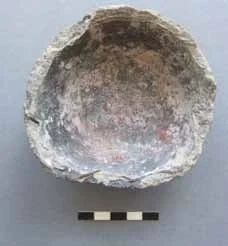
Previous
Previous

KAS Newsletter, Issue 111, Spring 2019

Next
Next

KAS Newsletter, Issue 109, Summer 2018