KAS Newsletter, Issue 24, Spring 1993
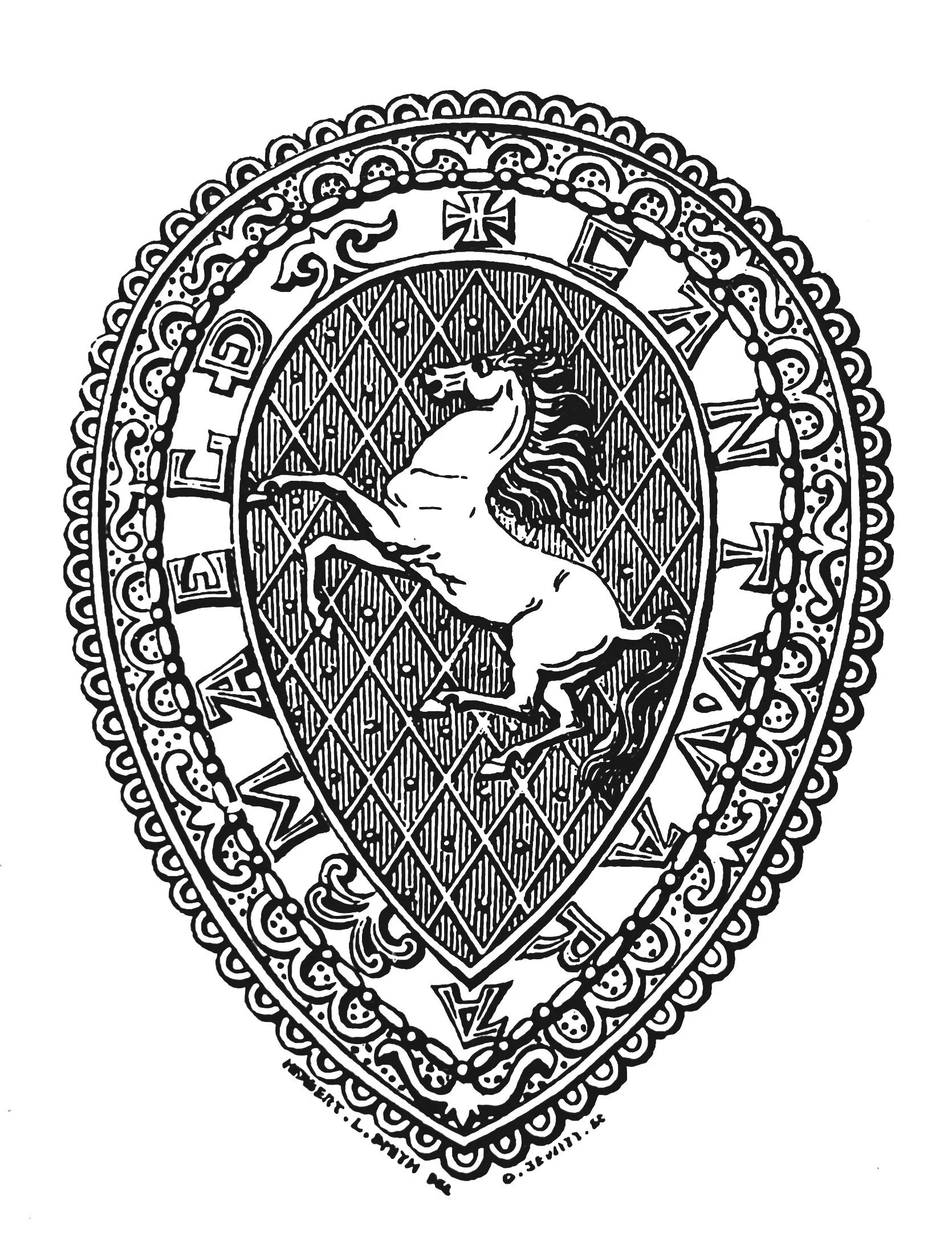
The Prehistoric Boat at Dover

In October, towards the end of a 14-month major archaeological programme connected with road and sewer construction in the middle of Dover and financed by English Heritage, the Canterbury Archaeological Trust discovered the remains of a prehistoric boat. It was described by experts from English Heritage and the National Maritime Museum as one of the best-preserved prehistoric craft in Britain, of great international importance. The timbers were found in waterlogged conditions at a depth of about 7 m. and about one-third of the approximately 15 m. long craft was initially lifted. Further extensions of time available for archaeological work enabled much of the rest of the boat, including either prow or the stern, to be rescued for conservation and eventual display in Dover Museum. Alterations in the water level resulting from the road and sewer works will mean that timbers left for future archaeologists will deteriorate.

The boat is thought to date from about 3000 bp and radio carbon dating is awaited with interest. There are technological similarities with the Bronze Age boat discovered at North Ferriby on the Humber in 1947. The Dover boat is about 2.30 m broad, with its bottom formed by two flat strakes apparently butt-jointed on the keel line; the lowest side strakes are rounded L-shape in section, set in a small rebate on the bottom strakes and stitched with possibly yew withies. Preliminary studies suggest the timber is green oak. It was probably paddled and may have been strong enough to cross the Channel. Examination of the environment in which the timbers lay suggests that the boat was abandoned in a backwater of the River Dour.

The find attracted considerable media interest and the Trust is grateful for the cooperation and assistance of the Dept. of Transport, Mott MacDonald, Nor West Holt, Dover Harbour Board, Dover District Council and Dover Museum.

Lawrence Lyle,
Hon. Secretary, C.A.T.

Geoarchaeological Facility Service

Samples from the first phase of the Dover excavation are undergoing analysis at the Wolfson Laboratories at the Institute of Archaeology, London. Some bulk samples have been processed and sorted by John Stewart of G.F.S. and specialist assessments have been conducted at a preliminary level by Dr. John Hatha (mosses, wood), Keith Williams (mollusca), Brian Irving, and Simon Parfitt (small and large mammals/fish). Detailed stratigraphic logging/X Radiography/mineral magnetic susceptibility is being conducted by Vaughn Williamson - who joined the Institute as a full-time sedimentologist employed by G.F.S. on 1st October, with assistance from Catherine Ward.

The data from the assessments were fed back to the field team in Dover (Martin Bates assisted by Jacob Czatska and Patrick Hunter) on a daily basis, and the results used to refine sampling/recording and construct clear research aims and objectives while the excavation proceeded. All of the work is funded by English Heritage, Dept. of Transport, and G.F.S. has been subcontracted by C.A.T. to undertake all stratigraphic, sedimentological, and palaeoenvironmental assessments under MAP II guidelines.

Analytical research work under the 'Assessment Phase' is expected to continue in the Wolfson Laboratories until June 1993. Anthony J. Barham of G.F.S. (Lecturer of Geoarchaeology at the Institute of Archaeology) is responsible for the palaeoenvironmental investigation on the project.

The Society's Crest and Motto

At the meeting of the Membership Committee, it was accepted that many members would like to know more about the history and significance of our badge.

As one might expect, its originator was the Rev. Lambert Larking who virtually founded the Society. Actually, he got himself into a rather difficult position by asking both Thomas Willemont of Faversham and Herbert Smith of London to produce designs - a difficulty from which he managed to extricate himself by persuading the 3 daughters of the Earl of Abergavenny to pay the costs of Herbert Smith's design, whereupon Willemot chivalrously withdrew. Smith's design, which was in the shape of the Alfred Jewel, was engraved by Orlando Jewitt (1799-1869) who also produced the excellent illustrations of the carvings in St. Mary, Stone, Church. (Arch. Cant. vol. 1 p97-154) and their names appear beneath the first version of the badge in Volumes I to V of Arch. Cant. The motto 'Cant-Wara Maegth', which was also originated by Lambert Larking, is Anglo-Saxon for 'the tribe of the Kent men', though I should perhaps add that the then Regius Professor of Anglo-Saxon at Oxford took fifteen lines of close print to explain what he considered to be its full meaning, which makes me thankful that I only had to deal with the simplicities of Latin and Greek!

The later history of the badge is as follows. The names of the designer and engraver were omitted in Volume VI of Arch. Cant. (1865) and in Volume IX (1874), the design of the horse was altered - it is not known by whom or why - being changed from one with a flowing mane to one with its mane resting on its neck.

It has continued in this form until the present day and as far as Archaeologia Cantiana is concerned, but the Newsletter has, very properly, reverted to the original design which gives credit - where credit is surely due - to Herbert Smith and Orlando Jewitt.

A. C. Harrison

Kent in the Ravenna Cosmography

This article looks at the evidence in the Ravenna Cosmography, which relates to Kent, and uses the text published by Rivet and Smith.1 For ease of usage, the references to that work are included in the text.

Ravenna is principally a list of towns, rivers and islands of the Roman Empire, which was compiled after A.D. by an anonymous monk at Ravenna for a fellow cleric (R&S 185). The major source for this work was a Roman map(s) but this apparently was not the Poutinger Table; there may have been at least three sources (R&S 190-200).

To generalize for Britain, the compiler appears to have collected his source material for towns in discrete areas, while listing rivers and islands in two separate groupings around the coastline. Not infrequently, an item from one of these three categories will appear in another category, while corrupt spellings often occur, for example, Manulodulo for Camulodumum (Colchester).

It may also be noted that the name of a settlement is often taken from the river on which it lies, for example, Exa is both the river Exa and the legionary Fortress at Exeter (R&S 378). One discrete group of town names runs from Pevensey around the coast to London and beyond, but before that is discussed, it is necessary to look at the rivers.

Rivers. The end of the British river-sequence runs Intraum, Antrum, Liar, Lenda, Vividin, Durolavi, Alauna, Cogusuveusuron, Durbis, (R. Dour) Lemana, (R. Lympne), Novia, Raxtomessa, and three other names. (R&S 213) The first five names have been placed in the Wash area,2 while the Vividin could be a corrupt form of Eidumanis, which has been identified as the Yare.3 It is widely agreed that Durolavi is both corrupt and in the wrong list, and is in fact the settlement of Durolevum which occurs in Iter II of the Antonine Itinerary and on the Peutinger Table (R&S 351). In the former case, Durovelum is listed as being 13 (Roman) miles from Rochester and 12 (Roman) miles from Canterbury; the location of this settlement has been discussed in an earlier issue of the Newsletter.4

Leaving aside Alauna for a moment, Rivet and Smith have suggested that Coguveosuron, which has a number of variant and is probably a conflation of two names, be corrected as Coccuveda and equated with the river Coquet in Northumberland, and as Isurim with Aldborough, Yorks. (R&S 311 and 380). There seems no good reason why such an extraordinary anomaly should occur and arguably, <- i>suron might be better considered to be a corruption, the original of which produced the name of the R. Stour which linked Canterbury to the Wantsum Channel, then separating Thanet from the mainland; no worthwhile suggestion is offered on the first part of the name.

There are no direct problems with the identification of Durbis (Dour) and Lemana (Lympne), while the remaining names will be left for discussion below.

The equation of Durolavi with Durolevum and its place in the list immediately before Alauna suggests that the last may be allocated to the nearby Medway which otherwise would be the only major river in Kent not to be listed. The apparent omission of the Thames may be accounted for by the late mention of Raxtomessa. Rivet and Smith have posited that the original source maps all river-names were written on the inland courses. (R&S 213). If the initial 'R' is discarded, Axtomessa may be seen as a slightly corrupt form of Aes Tamesae. (Aestuarium Tamesae (per Tacitus - R&S 98: estuary of the Thames.) which would have been written 'in the sea' and thus perhaps added as an afterthought, as were two of the final items, which appear to be islands: Senna (?Sina R&S 181) and Cunia (C1111is R&S 214); Rivet and Smith note that the British name for the Thames was Tamessa (R&S 466).

Towns. The town-sequence in Ravenna runs from Anderelio (Anderitum: Pevensey) anti-clockwise around the Kent coast to Landini, Tamese, Brinavis, Alauna, (map). The first of these name is generally accepted a a corrupt rorm or Londinium (R&S 397), but views vary on Tamese. Some commentators regard it as a river-name (R&S 207), but others believe ii to be a place-name on the Thames perhaps because Tamese seems to be in the locative case5; Raxtomessa appears to have accounted for that river already (see above). Tamese may be the name of the hypothetical settlement at the Westminster crossing which is widely accepted as the first place where the Romans reached the Thames in the Claudian invasion.6 Leaving aside the identification of Brinavis for a moment, if Alauna is a place name on the river of the same name in Kent (or even if it is a repeat of the river-name), then the compiler appears to have returned in a helical fashion in his list of towns to one on the Medway. This town was presumably written in isolation from the string of place-names along or close to the coast; such a site would need to be well inland in the circumstances and the criteria might fit Tonbridge.

To return to Brinavis - although Rivet and Smith argue that it is corrupt, being a duplication of Durobrivae (Rochester) (R&S 346), Professor Frere in his review of their book disagrees with this proposition, calling the argument over-ingenious'7 The first element of Brinavis possibly translates as 'dark' and the second as 'stream', which together has been interpreted as relating to a settlement of the same name on one of the tributaries of the Thames.8 The order of the last four place- . names indicates that Brinavis should lie "beyond" Londinium but the helical nature of the listing (if Alauna is indeed somewhere in the Kentish Weald) would appear to place the settlement on a tributary feeding the Thames from the south. Such a tributary could be the Wandle (WR on map) whose Roman name appears to be Banna (or even the Ban(n)avis);9 the possibility that the settlement on the Wandle (Wandsworth - WT on map) might be the vicus near which St. Patrick's father had a villa has been explored elsewhere.10

No parallel exists in Britain for the first element of Brinavis. but the element 'bauna' does occur five times (R&S 261-6). Brin as a first element does not feature in the list of some 6,000 placenames in the Roman Empire compiled by Miller.11 It is therefore postulated that Brinavis is a corrupt form of Bannavis - the two vertical strokes of the first 'a' may have separated into an 'r' and an 'i' through a copying error; as perhaps happened in the case of Olenacum / Olerica (R&S 430). The double nn presents no problem because it often becomes a single letter. (R&S 366).

Some further thoughts: Further support on Alauna is offered by an early sequence of place-names in Ravenna, which runs thus: Alauna silva (forest), Omire, Tedertis, Lindinia, Canza (R&S 206). Although Rivet and Smith place the last two names in the south-west of Britain, Dillmark takes them to be Londinium and Cantia ('Kent'), largely because the Parthey-Pinder edition of Ravenna lists the name as Londinis.12 If he is correct - and this writer is of the opinion as well13 - then the Alauna 'forest' could be equated with the Weald and the name would naturally apply to its main river, the Medway, and the main town on it (?Tonbridge).

In the list of river-names Novia and Lemana (R. Lympne) are adjacent, while in the towns' list Nuba (? Noba R&S 207) and Lemanis (Lympne) are next but one to each other. Now, Ptolemy describes a place on the south coast of Britain as [[Kmvoi; J\tµ�v]] Kainos Limen 'new harbour' which Rivet and Smith suggest should be Dover (R&S 116). Because Ptolemy places it due south of Canterbury, Lympne would be a better location, especially as Romney marsh had a substantial marine inlet at least as early as the 2nd. Century A.D.14 The question must arise as to whether Lemanis, whose name origin is unclear (R&S 385), is a latinised Limen and whether the Roman name for the port, rather than the late fort, was more correctly Nova Lemanis, thus echoing the Greek name. In this connection it may be noted that the Anglo-Saxon name for Lympne was Liminas (R&S 386), the name Limen is applied to the R. Rother in a charter of A.D. 741 as well as other watercourses at later dates15 and in classical Latin limen is an entrance or threshold, in limine portus (at the entrance of the harbour.)16

References

1. A.L.F. Rivet and C. Smith. The Place Names of Roman Britain (1979).

2. N. F11e11/es. 'Fresh thoughts on the Saxon Shore' in V.A. Maxfield and M.I. Dobson. (ed) Roman Frontier Studies 1989 - Proceedings of the XVth. International Congress of Roman Frontier Studies. (1991) 63.

3. Ibid.

4. N. Fuentes, 'The Location of Durolevum' Kent Archaeological Society Newsletter No. 17 ( I 990) 2.

5. I. A. Richmond and O. G. S. Crawford, 'The British Section of the Ravenna Cosmography' Archaeologia XCIII (1949) 7; R. Canham 'Ravenna Cosmography' London Archaeologist 1 91971) 179.

6. N. Fuentes. 'Of Castles and Elephants' London Archaeologist. 5. (1985) 90.

7. S. S. Frere, 'Naming of Roman Britain' Britannia XI (1980) 423.

8. Canham, op sit. fn. 5.

9. N. Fuentes, 'Roman Wandsworth: Part 2, Wandsworth Town' Wandsworth History, No. 62 (1991) 18-24.

10. N. Fuentes, 'St. Patrick, Battersea and Wandsworth' Wandsworth History. No. 63 (1992) 18-19.

11. K. Miller. Itineraria Romana (1916) 961-981.

12. M. Dillmann, Observations on Chapter V.31. 'Britannia in the Ravenna Cosmography' Archaeologia CVI (1979) 66.

13. The writer is presently writing up a more general article on Ravenna which is to be published elsewhere.

14. C. Green, 'Palaeography of marine inlets in the Romney Marsh area' in J. Eddison and C. Green (ed) Romney Marsh - Evolution. Occupation, Reclamation (1988) 168.

15. lbid.

16. Vergil, Aeneid VII 598.

Decline and Fall

In connection with the publication in Newsletter No. 23 of the pamphlet proposing the establishment of an Excavation Branch it seemed worthwhile to trace the subsequent history of this ambitious but, in the event, ill-starred project.

The idea was first put forward at the 1927 AGM where the President, Sir Martin Conway, asked members "to support the new Grants Fund, the object of which was to enable the Council to make contributions to approved investigations". The pamphlet went out to members with Volume. XL of Arch Cant. and at the AGM on 29th March 1928 Mr. Ellison Erwood explained the objects of the newly-formed Branch and asked for the support of members. However, in the Annual Report for 1929 he had to report that it "had not so far been a complete success. The total contributions from all sources to date amounted to £55 7s., of which sum more than half had been contributed by non-members of the Society. In fact, the contributions from members have been singularly small. By the following year there had been no improvement and Council decided that the Excavation Branch should be discontinued as a separate branch of the Society and that the balance of the funds be amalgamated with those of the Research Fund and be directly controlled by Council.

In spite of this, the Excavation Fund appears in the accounts for 31 December 1931 as a separate item of £51 9s 9d. and this item continues to appear annually for the next 22 years, the amount fluctuating slightly until 31 December 1953 when the balance remaining at that date was shown as £19 4s 3d - a statement entirely at variance with an entry in the minutes of the Council meeting held on 15 July 1953 recording that "the action of the President and Hon. Treasurer in transferring £19 4s 3d from the Excavation Fund to R. F. Jessup towards the excavation of the Roman Barrow at Holborough was ratified" - no-one, least of all the Treasurer, seems to have told the Auditors! Thereafter the Excavation Fund "softly and silently vanished away" with no further mention in the Annual Accounts and this rather sad story reaches its rather baffling conclusion.

A. C. Harrison

New Books

KENT MAPS AND PLANS. This book, compiled by our member Wyn Burgess A.L.A., lists maps and plans relating to the historic County held in the various libraries, institutions, repositories, etc. throughout Kent as well as in those adjoining London Boroughs formerly associated with Kent. Items included range from maps of the whole county to those of towns, villages, and small estates, as well as coastal and river charts and many archaeological, geological, military, and railway maps. The 386 pages include extensive name, subject, and place indexes. Hardback. £30 plus £3 packing and postage. (If prior notice is given, arrangements can be made to have an order delivered for collection to a nominated public library). May be obtained from Mr. K. Jarvis, Dartford Public Library, Market St., Dartford, Kent DA1 1EV. Tel: 0322 221133. Cheques payable to: The Library Association, London and Home Counties Branch.

A FARMING CENTURY. THE DARENT VALLEY, (1892-1992) by William Alexander. A fascinating account of a farming family who moved from Scotland to Kent and prospered. Hardback. Many photographs and illustrations. 176 pages. May be obtained, price £14.95 (plus postage) from Quiller Press Ltd., 46 Lillie Road, London SW6 1TN.

THE BEXLEY DENEHOLES by Rodney LeGear. Published by the Bexley Libraries and Museums Dept., Hall Place, Bexley, Kent. Price £2.00.

UNDER YOUR FEET, AN ARCHAEOLOGICAL HISTORY OF DARTFORD & DISTRICT. (See enclosed leaflet).

ROYSTON CAVE, USED BY SAINTS OR SINNERS? Local Historical Influences of the Templar and Hospitaller Movement. by Mrs. Sylvia Beamon. Mrs. Beamon's latest book is the result of many years' research into the Templar movement. Hardback. 85 illustrations (photographs and plans) 320 pp. £39.50. Limited Edition. May be obtained from Cortney Publications, 57 Ashwell Street, Ashwell, Baldock, Herts. SG7 5QT.

Library News

The Council of the Society has decided to expand the typographical holdings of the Library which is housed in Maidstone Museum and which is available for the use of Members. The Public Library adjacent to the Museum in St. Faith's Street has generously made available space which will provide the Society with storage for back runs of some journals, so releasing shelf space for new acquisitions.

Initially it is intended to concentrate on Kent typography, with determined effort being made to make good the remaining losses due to the Museum fire. Another priority is the provision of the standard manuals and monographs which form a necessary adjunct to a working library. As far as possible, acquisition will be by the exchange of publications with other societies and similar bodies. Kent Arts and Libraries have already donated copies of a number of their publications. It will undoubtedly prove necessary to purchase many parish histories and other Kent typographical works in the open market. The generosity of Members has resulted in a number of useful donations to the Library in recent years and further donations will always be most welcome. There have, however, been several promises of bequests of material to the Library which have not come into fruition. This has been due either to its not being put in writing, or to the terms of a documented bequest being interpreted in a particularly restrictive way by Executors. In the event of any Member wishing to make some provision for the Society in their will, the Hon. Librarian is willing to advise on suitable wording.

L. Ilott

The Wealden Iron Research Group. (WIRG)

This group was initially founded by Henry Cleere and David Crossley to bring together and update the work done since the publication of Ernest Straker's 'Wealden Iron' in 1931. This led to the publication of 'The Iron Industry of the Weald' by the group's two conveners. The work of this enthusiastic group continues, as much has still to be learnt about the industry, which had such an important place in the economy of the South East for two thousand years, especially during the first half of the Roman occupation and in the Tudor and early Stuart period when the Weald was the predominant iron-producing area in Britain.

The group has about 140 members with the most active element being the Field Group which has a program of fieldwork during the Winter, covering such activities as surveying work, fieldwalking, minor excavations, and allied documentary research.

The results of these are published annually in the Bulletin together with the historical researches of members. The twice-yearly Newsletter keeps WIRG members in touch, which is most important as there are generally only two meetings a year. A key aspect of the group's professional archaeological relationship is its fraternity, assisting and advising the at excavations throughout the Weald For further details, including that of membership of WIRG, contact the Secretary, Mrs Sheila Broomfield.

Sheila Broomfield .

Tebbutt Research Fund, (WIRG) This fund was established as a tribute to the life and work of the late C. F. Tebbutt, OBE., FSA., and applications are invited, from individuals and groups, for grants towards research, including associated expenses, into the Wealden Iron Industry.

It is anticipated that approximately £200 will be available from the fund and anyone interested should write a suitable letter of application giving details of themselves together with relevant information concerning the research envisaged.

Details should be sent to me not later than 31st March 1993 so that I can pass them to the panel for their consideration.

Sheila Broomfield (Hon. Sec. WIRG).

Tebbutt Research Fund, (WIRG)

This fund was established as a tribute to the life and work of the late C. F. Tebbutt, OBE, FSA, and applications are invited from individuals and groups for grants towards research, including associated expenses, into the Wealden Iron Industry. It is anticipated that approximately £200 will be available from the fund and anyone interested should write a suitable letter of application giving details of themselves together with relevant information concerning the research envisaged. Details should be sent to me not later than 31st March 1993 so that I can pass them to the panel for their consideration.

Sheila Broomfield (Hon. Sec. WIRG).

For Sale

Members are reminded that they can obtain K.A.S. 'Tote bags' £6; Tea Cloths, £3. Ties, (navy blue or green), £3.50. Please state colour required - from Mrs. Saynor. Price includes p. & p. Also available from Mrs. Saynor or from Mr. D. Coast, 127 Snodhurst Avenue, Chatham MES 0TN are KAS greeting cards. Pack of four with envelopes featuring lesser known Kentish churches £1 (includes p. & p.) Available soon1 Key fobs and Book Markers.

Fieldwork Grants

Are you planning an excavation or fieldwork within the county of Kentduring 1994? Grants are available from the KAS to assist with work carried out by Affiliated Societies or individual members.

Applications on appropriate form (obtainable from Hon. General Secretary, Andrew Moffat, by 1st October 1993).


The Hon. Editor welcomes all letters, articles and communications and would particularly like to receive more from members and others, especially requests for research information, finds, books and related topics. Illustrations, if relevant, are helpful and can assist readers in identifying objects, understanding points and following arguments. The Editor wishes to draw readers' attention to the fact that neither the Council of the KAS, nor the Editor is answerable for opinions which contributors may express in the course of their. signed articles. Each author is alone responsible for the contents and substance of their letters, items or papers. Material for the next Newsletter should be sent by 1st March 1993 to Hon. Editor, Nesta Caiger.


Published by the Kent Archaeological Society, The Museum, St. Faith's Street, Maidstone, Kent. ME14 1 LH.

Printed by Delta Press, Crayford Industrial Estate, Swaisland Drive, Crayford DAl 4HT. Typesetting by Janset 081-301 2856.

Events, Lectures, Outings

K.A.S. SI DAY EXCURSION TO BRITTANY 1993. Monday, 31st May to Saturday, 5th June. Portsmouth to Cherbourg (a ferry available). Staying 5 nights at DINAN (Hotel de Grand Bretagne). Visiting DOL, JOSSELIN, VANNES, one or two chateaux in the area and some Roman sites, river trip to St. Malo, and some stone Menhirs and Dolmans around Carnac. Approx. cost £275 (but depends on exchange rate). Interested parties s.a.e. to M. A. Crane, as soon as possible. Deposits (£100) must be in early this year.

K.A.S. CONFERENCE. ASPECTS OF KENTISH HISTORY AND ARCHAEOLOGY. Saturday, 6th March 1993 at Shoreham Village Hall. (see enclosed leaflet).

K.A.S. LECTURES 1993.

Saturday, 9th January. Peasants' Revolts. by Andrew Butcher. 2.30 pm at Sevenoaks School (Aisher Hall), High St. Sevenoaks. Entrance: £1.75 KAS members, £2 Nonmembers.

Saturday, 13th February. Faversham, The King's Port. by Arthur Percival. 2.30 pm. at The Chantry School, Ordnance Road, Gravesend. Entrance: £1.25 KAS members, £1.50 Nonmembers.

Saturday, 13th March. Medieval Houses in Kent. by Sarah Pearson. 2.30 pm. at Tenterden Town Hall, High St. Tenterden. Entrance: £1.25 KAS members, £1.50 Nonmembers.

Saturday, 17th April. The Agricultural Heritage of Kent. by Donald Sykes. 2.30 pm. at Wye College. There will also be an opportunity to see the Museum of Agriculture at Brook.

DODE CHURCH (near Luddesdown, Kent). KAS members may be interested to attend a short evening service to be held in the recently restored church (see KAS Newsletter No. 22, Summer 1992). All are welcome. Service starts at 7.30 pm. 28th July 1993.

COUNCIL FOR KENTISH ARCHAEOLOGY CONFERENCE AT SANDWICH. THE ROMAN INVASION AND CONQUEST OF BRITAIN. (or A.D. 43 and all that).

Saturday, 29th May 1993. A conference to commemorate the 1950th anniversary of the invasion of Britain by Claudius in A.D. 43.

Morning: Guided tour of Richborough Castle, the Roman fort and reputed landing place. 11.00 am. - 12.30 pm.

Afternoon: At the Guildhall, Sandwich. Illustrated talks with displays and bookstalls. 2.00 pm. - 5.30 pm. Lectures include Claudius and Britain by Mark Hassall. Britons in the Roman Empire. Prof. John Wilkes and The Roman Military Returns to Kent. by Brian Philp.

Tickets: All Day £4. Morning only: £1.20. Afternoon only: £3 from CK.A., 5 Harvest Bank Road, West Wickham, Kent BR4 9DL (payable to CK.A. with s.a.e. please).

ROMNEY MARSH RESEARCH TRUST, SPRING LECTURE. Roman Exploitation in the South-East. by Professor Barry Cunliffe, at Brockhill Park School, Hythe. Friday, 19th March 1993 at 8.00 pm. Tickets, to include a glass of wine: £3 for members, £5 for non-members. Apply: Mrs Sue Carrell, Mittell House, Church Road, New Romney TN28 BTU.

ROYAL ARCHAEOLOGICAL INSTITUTE. One day seminar SUBMERGED SETTLEMENTS AND SHIPWRECKS. The present state and future prospects of underwater archaeology. To be held at the Society of Antiquaries, Burlington House, Piccadilly, London W1V 0HS. on Saturday, 27th February 1993. 10.00 am. to 5.15 pm. Tickets £9 for RAI members, £12 for non-members. Includes Coffee and Tea. Apply to Miss W. E. Phillips, Asst. Sec. RAI, c/o Soc. of Antiquaries for tickets and full details which will be dispatched in January 1993.

COUNCIL FOR INDEPENDENT ARCHAEOLOGISTS. (CIA) are holding a two day Conference on Saturday, 24th April to 25th April 1993. At Florence Boot Hall, Nottingham University. Residential Conference fee £50. Details from Mike Rumbold, Sec. CIA.

EXHIBITIONS. Immortal Remains. Southwark's medieval past, at the Cuming Museum. 155-157 Walworth Road, SE17 1RS. until 24th April 1993. For further information telephone 071 701 1342.

Purple, White and Green. Suffragettes in London 1906-1914. at the Museum of London. A 144 page exhibition catalogue will be published, price £14.95 paperback.

Howard Carter: Before Tutankhamen at the British Museum until 31st May 1993.

Brunel's Engine House, London SE16. This Engine House was built by Sir Marc Isambard Brunel to contain the steam engines which drained the celebrated Thames Tunnel. The Tunnel was the first major underwater thoroughfare in the world and its construction between 1825 and 1842 was a triumph in the face of floods, financial losses and human disaster. The Engine House, now designated an ancient monument, contains an 1882 J. & G. Rennie steam pumping engine and an exhibition, 'Brunel's Tunnel and where it led' is in the heart of a revitalised Rotherhithe conservation area, with superb 18th Century church, restored warehouses, craft workshops, riverside walks and restaurants. Open first Sunday of every month 12.00 to 16.00. Admission £1.50. Children, OAP's 50p. Further information from: Brunel Exhibition, Brunel Engine House, Railway Avenue, London SE16 4LF. Tel: 081 318 2489 or 0322 225725.

WALKS IN LONDON. 'Citisights of London' have a varied programme of guided walks around London. Fee £4, accompanied under 14s free. Details from Citisights, 213 Brooke Road, London ES 8AB. Tel: 081 806 4325.

SUMMER ACADEMY HOLIDAY COURSES

These courses are conducted from June to September in different parts of the country and cover a great variety of subjects broadly divided in the following themes: Heritage, The Arts, Language and Culture, Countryside and Personal Development.

The holidays are fully inclusive of all tuition and seven day full board accommodation. Prices range from £260 - £320. A number of courses will be held in Canterbury. Further information may be obtained from: Summer Academy, Kent Research and Development Centre, The University, Canterbury, Kent CT2 7PD. Tel: 0227 470402.

K.A.S. LECTURES. (a reminder) By the time this is in your hands, half of the 1992/1993 programme of lectures will have been given. The first two lectures at Hythe and Faversham attracted a total of 60 members and visitors. At least a start has been made and the numbers of tickets sold for later lectures is encouraging. (Details are repeated in the Events column) If you have mislaid the application forms sent with the Autumn 1992 Newsletter, all is not lost! Send me details of your requirements with a cheque/p.o. made out to K.A.S. Lectures A/C, and a s.a.e. Alternatively, following the same procedure, you may obtain tickets from: Mr A. Rowe or Mr A. Miles.

Again, look out for posters advertising their availability locally, whenever this can be arranged.

I am actively engaged in enlisting speakers for 1993/94. May I again repeat my request for suggestions of alternative venues, speakers and subjects and your views of what so far has been attempted, if not achieved.

H. G. B. COAST, (Lectures Secretary).

KAS Fieldwork Committee Course. Underground Surveying

This very successful one day course was held in the Dartford and District Archaeological Group's headquarters, off Lowfield Street, Dartford, on Saturday, 5th September 1992.

The course was organised by the Kent Underground Research Group (a branch of the KAS) and conducted by Rod Legear, their Hon. Secretary and a fieldworker with a great deal of experience in recording and surveying underground sites. As well as the methods of underground work, basic surface surveying techniques were explained and the importance of tying in any survey to Ordnance Survey points was stressed.

The success of the day was reflected in the fact that most of those who attended also chose to come to the optional practical session on the following Saturday, to put some of the theory into practice in a true underground situation.

The organisers would like to thank the owners and manager of Chislehurst Caves for allowing KURG the use of a section of the caves away from the 'Tourist Route' for this practical session. The feedback from the two days has been very positive and a number of attendees have joined the Kent Underground Research Group.

The organisers would also like to thank Sharon and Graham Mitchell of Dartford and District Archaeological Society for their help and assistance on the first day at Dartford.

Archbishops' Palace and Heritage Centre, Maidstone

After a major restoration lasting for several years, the Archbishop's Palace in Maidstone was opened to the public in the summer of 1992.

One of the town's oldest buildings, it stands on the banks of the River Medway, next to All Saints Church. Dating back to the 14th century, the Palace was acquired by Maidstone Borough Council at the end of the 19th century. It will now offer excellent rooms for hire for all types of functions, a catering service, riverside views, and a program of events and entertainments.

Life in Maidstone - past to present times, has been brought to life by displays in a new Heritage Centre on the ground floor of the Palace, and in the 'secret garden' to the south of the palace and overlooked by All Saints Church, is a reconstructed herb or physic garden.

Opening hours are: 10.30 am to 5.30 pm (last admission 4.00 pm). Price: Heritage ticket (including Carriage museum). Adults £2.95. Children/OAPs £1.95. Family ticket £8. For further information, contact: The Visitor Services Manager, The Archbishop's Palace and Heritage Centre, Mill Street, Maidstone, Kent MElS 6YE. Tel: 0622 663006.

K.A.S. Conference 'The Palaeolithic in Kent'

On 24th October 1992, approximately 40 KAS members enjoyed this one-day meeting held at the Mid-Kent Professional Development Centre in Maidstone.

The first of four speakers, Mrs J. Cook, from the British Museum, gave a re-evaluation of earlier work on the Lower and Middle Palaeolithic in Kent. Mr J. Wymer provided an enthusiastic overview of research at Swanscombe entitled 'A Century of Investigation'. Mr F. Wenham-Smith, a postgraduate student from Southampton University, told of his research work in the Ebbsfleet valley. Dr C. Gamble, also from Southampton University, explained the aims of the Southern Rivers Project.

The intention of this project is to map the distribution of Palaeolithic landscapes in Southern Britain so that the information they offer may be properly assessed, managed and utilised.

At the end of the day, audience reaction was very positive. Most people went away having relished an archaeological day without a single mention of pottery, and with their awareness of the special considerations of the Palaeolithic greatly enhanced. As far as we are aware, not a single member was caught napping!

Gill Holt and Sheila Broomfield

Letters: North to move?

At a conference recently, I fell in with a member of the Ordnance Survey Research and Development Division. In the course of a conversation on Grid Referencing, she casually mentioned that the O.S. were thinking of changing the direction of North.

At first, I assumed that she was pulling my leg. It turned out that she was serious.

At the moment, O.S. maps show 'true north' which is constant and a 'magnetic north' which varies with successive issues as the planet's magnetic pole moves about. However, all maps are aligned to 'grid north'. This is based upon true north but modified by a formula to adjust for the fact that the United Kingdom is not flat as a board as shown on maps but wrapped around the outside of an oblate spheroid. Now that we are heavily into the E.C., the concept of a modified formula is emerging to align everything to Euro-North. This will certainly sell a lot of maps, but what about the thousands of grid references that we have been stuffing into our publications and databases over the years? Has anyone any more information to add to this somewhat disturbing prospect?

Harry Pearman

Help needed with Archaeological Survey of Kent Churches

In response to recommendations in a report produced by the Council for the Care of Churches entitled 'Archaeology and the Church of England', the two Dioceses of Rochester and Canterbury have jointly commissioned a survey to provide initial archaeological profiles on parish churches in Kent and South East London built before 1800. The aim is for each parish church to understand the building it uses. The reports are expected to be updated every five years at the same time that the fabric of the church is inspected and will be a point of reference at times when repairs and alterations are contemplated.

The project has the support of the K.A.S. as well as other notable Trusts. Heading the research work and report writing is well-known local archaeologist Tim Tatton-Brown. As work has progressed, it has become clear that a sketch plan of each church would be a most valuable visual aid to the report and in this connection, the two Dioceses are working to locate existing plans suitable for their use. It is clear, however, that some plans will need redrawing and, where no plans exist, arrangements will need to be made to provide a sketch plan.

It is in the areas of identifying the location of plans, sketch or otherwise, the redrawing or tracing of poor ones, and the production of new ones that KAS members are being asked to help. Volunteers interested in supporting the principles of the survey in the way outlined are asked to contact our Hon. Gen. Secretary, Andrew Moffat.

Andrew looks forward to hearing from you if you are able to help in this worthy cause.

Sue Haydock

Previous
Previous

KAS Newsletter, Issue 25, Summer 1993

Next
Next

KAS Newsletter, Issue 23, Autumn 1992