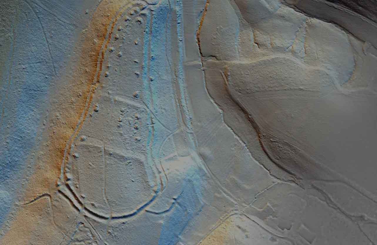
Kent LiDAR Portal
The Kent LiDAR Portal makes available imagery from various LiDAR datasets from across the county, including the recently obtained high resolution data covering over 190 square km along the Darent Valley and area of the Sevenoaks Commons, at the western end of the Kent Downs AONB.
Kent Maps Online
Kent Maps Online provides a set of themed essays about Kent, a county in South East England, which include interactive maps and images.

Kent Historic Environment Record
The Historic Environment Record is an extensive collection of information relating to Kent’s heritage. The database contains information about 40,000 archaeological discoveries and 18,000 listed buildings, landscapes, excavations and library sources. The HER also contains more than 6,500 archaeological reports as well as aerial photographs and maps.

Kent Landscape Information System
The Kent Landscape Information Sytstem (KLIS) contains details on countryside access, landscape character, identifies opportunities for habitat creation and landscape restoration, the Kent habitat survey as well as areas designated for their conservation value.

Ordnance Survey Maps
Maps published by Ordnance Survey and related bodies, including the War Office (ca. 1840s-1960s).