Archaeologia Cantiana, Volume CXL (2019)

Covers

PDF Link

Preliminaries

PDF Link

1. The Roman Villa at Minster in Thanet. Part 12: Quernstones and Millstones

Ruth Shaffrey

PDF Link

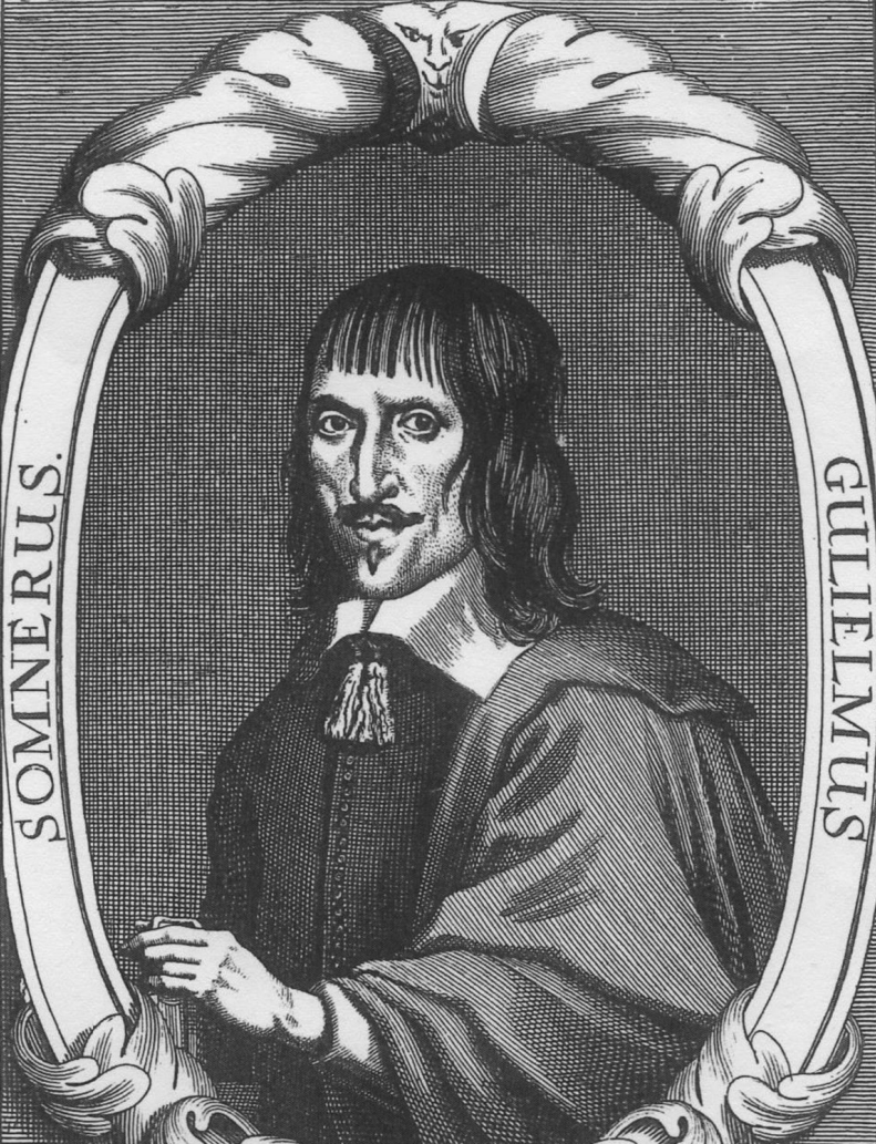
2. ‘Devotion to the uncovering and recording of a nation’s language and a city’s antiquities’: the life of William Somner of Canterbury (1606-1669). Part I

David Wright

PDF Link

3. An unusual pit and other nearby prehistoric finds at Woodnesborough

Keith Parfitt

PDF Link

4. Elizabethan and early Stuart Thanet: the Expansion of Education Provision and its impact on literacy levels

Margaret Bolton

PDF Link

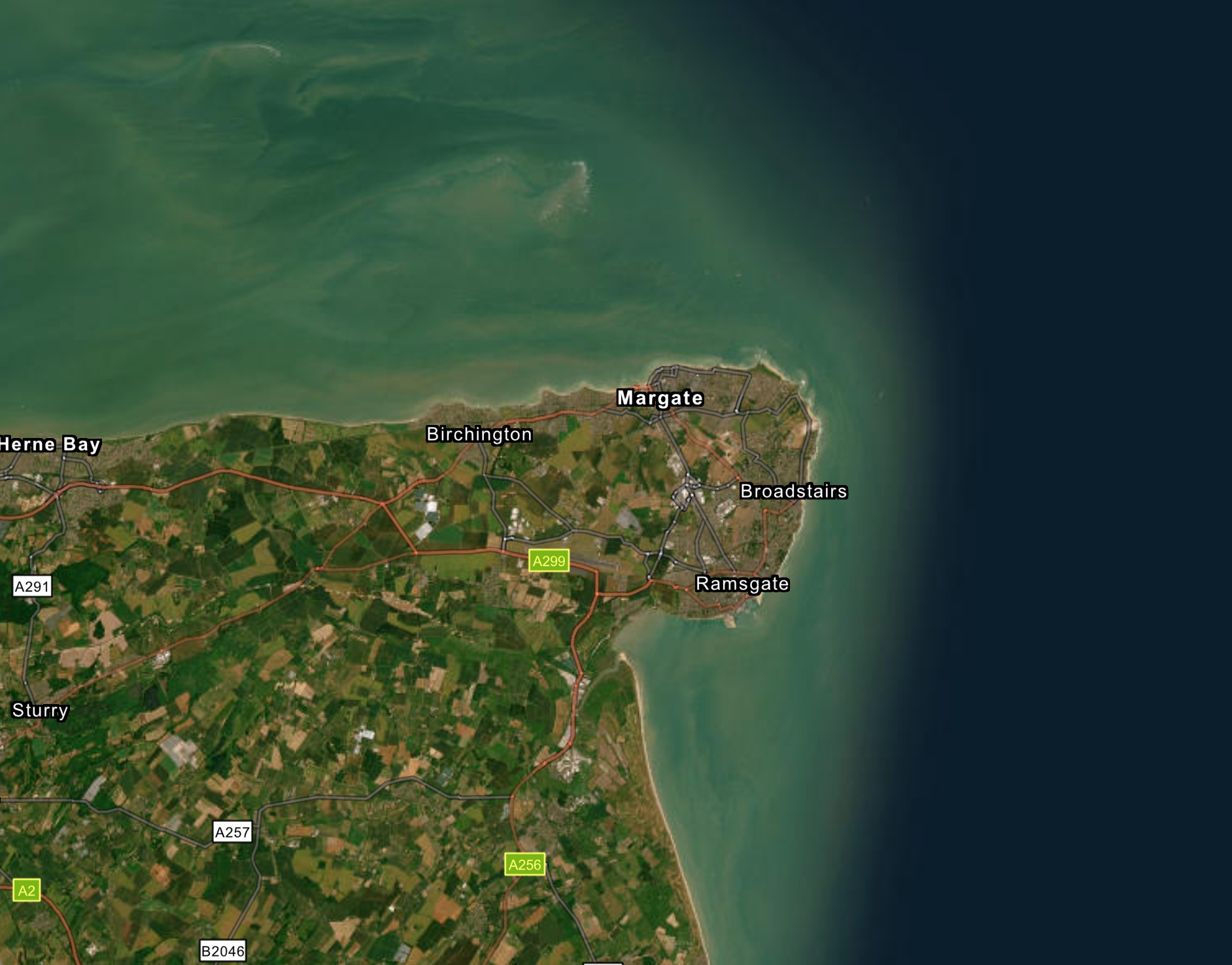
5. Late Bronze Age/Early Iron Age site on the banks of the Goresend Creek, Minnis Bay, Birchington

Trevor and Vera Gibbons

PDF Link

6. The Merchant Fleet and Ship-Board Community of Kent, c.1565- c.1580

Craig L. Lambert and Gary P. Baker

PDF Link

7. Later Prehistoric settlement and ceramics from the Downland fringes at New Thanington, Canterbury

Graeme Clarke and Matthew Brudenell

PDF Link

8. Playing the Passion in late fifteenth-century New Romney: the Playwardens’ Account Fragment

James Gibson† and Sheila Sweetinburgh

PDF Link

9. The Hive of Activity at the ‘Glasshouse’ 1585-7 – a Window on the Development of Knole

Stephen Draper

PDF Link

10. The Kentish Demonym – or, the Demonym of Kent

James Lloyd

PDF Link

11. Alphanumeric Graffiti at Rochester Cathedral

Dan Graham and Jacob H. Scott

PDF Link

12. Dorothy Johnston of Appledore: her wartime experiences and gift of a stretch of the Royal Military Canal to the National Trust

Felicity Stimpson

PDF Link

13. Bailiffs and Canterbury’s Firma Burgi in the thirteenth century

John H. Williams

PDF Link

14. The Lead Font at the Church of St Margaret, Wychling

Paula Jardine-Rose

PDF Link

15. A key figure among Kent’s fifteenth-century gentry: Sir John Fogge’s career and his motivations for rebuilding St Mary’s Church, Ashford

Gillian Draper

PDF Link

16. A re-examination of the late nineteenth-century Palaeolithic finds in the Upper Cray area, Bromley

Frank R. Beresford

PDF Link

17. Archaeological investigations at New Haine Road, Westwood, Broadstairs

Tania Wilson

PDF Link

18. The military pontoon bridge between Gravesend and Tilbury during the Great War

Victor Smith

PDF Link

19. Research and Discoveries

PDF Link

20. Reviews

PDF Link

21. Kentish Bibliography

PDF Link

22. Obituary

PDF Link

General Index

PDF Link
ARCHÆOLOGIA CANTIANA ‌CONTENTS The Roman Villa at Minster in Thanet. Part 12: Quernstones and Millstones. By Ruth Shaffrey . . . . . . . . . . . . . . . . . . . . . . . . . . . . . . . . . . . . . . . . . . . . ‘Devotion to the uncovering and recording of a nation’s language and a city’s antiquities’: the life of William Somner of Canterbury (1606-1669). Part I. By David Wright . . . . . . . . . . . . . . . . . . . . . . . . . . . . . . . . . . . . . . . An unusual pit and other nearby prehistoric finds at Woodnesborough. By Keith Parfitt . . . . . . . . . . . . . . . . . . . . . . . . . . . . . . . . . . . . . . . . . . . . . Elizabethan and early Stuart Thanet: the Expansion of Education Provision and its impact on literacy levels. By Margaret Bolton . . . . . . . . . . . . . . . . Late Bronze Age/Early Iron Age site on the banks of the Goresend Creek, Minnis Bay, Birchington. By Trevor and Vera Gibbons . . . . . . . . . . . . . . The Merchant Fleet and Ship-Board Community of Kent, c.1565- c.1580. By Craig L. Lambert and Gary P. Baker . . . . . . . . . . . . . . . . . . . . . . . . . . . Later Prehistoric settlement and ceramics from the Downland fringes at New Thanington, Canterbury. By Graeme Clarke and Matthew Brudenell . . . . . . . . . . . . . . . . . . . . . . . . Playing the Passion in late fifteenth-century New Romney: the Playwardens’ Account Fragment. By James Gibson† and Sheila Sweetinburgh . . . . . . . . The Hive of Activity at the ‘Glasshouse’ 1585-7 – a Window on the Development of Knole. By Stephen Draper . . . . . . . . . . . . . . . . . . . . . . . The Kentish Demonym – or, the Demonym of Kent. By James Lloyd. . . . . Alphanumeric Graffiti at Rochester Cathedral. By Dan Graham and Jacob H. Scott . . . . . . . . . . . . . . . . . . . . . . . . . . . . . Dorothy Johnston of Appledore: her wartime experiences and gift of a stretch of the Royal Military Canal to the National Trust. By Felicity Stimpson . . . . . . . . . . . . . . . . . . . . . . . . . . . . . . . . . . . . . . . . . Bailiffs and Canterbury’s Firma Burgi in the thirteenth century. By John H. Williams . . . . . . . . . . . . . . . . . . . . . . . . . . . . . . . . . . . . . . . . . . The Lead Font at the Church of St Margaret, Wychling. By Paula Jardine-Rose . . . . . . . . . . . . . . . . . . . . . . . . . . . . . . . . . . . . . . . . A key figure among Kent’s fifteenth-century gentry: Sir John Fogge’s career and his motivations for rebuilding St Mary’s Church, Ashford. By Gillian Draper . . . . . . . . . . . . . . . . . . . . . . . . . . . . . . . . . . . . . . . . . . . A re-examination of the late nineteenth-century Palaeolithic finds in the Upper Cray area, Bromley. By Frank R. Beresford . . . . . . . . . . . . . . . . . . . 2019 VOL. 140 Archaeological investigations at New Haine Road, Westwood, Broadstairs: further observations of a prehistoric agricultural land-scape on the Isle of Thanet. By Tania Wilson . . . . . . . . . . . . . . . . . . . . . . . . . . . . . . . . . . . . . . The military pontoon bridge between Gravesend and Tilbury during the Great War. By Victor Smith . . . . . . . . . . . . . . . . . . . . . . . . . . . . . . . . . . . . Research and Discoveries . . . . . . . . . . . . . . . . . . . . . . . . . . . . . . . . . . . . . . . Reviews . . . . . . . . . . . . . . . . . . . . . . . . . . . . . . . . . . . . . . . . . . . . . . . . . . Kentish Bibliography . . . . . . . . . . . . . . . . . . . . . . . . . . . . . . . . . . . . . . . . Obituary . . . . . . . . . . . . . . . . . . . . . . . . . . . . . . . . . . . . . . . . . . . . . . . . . . www.kentarchaeology.org.uk PAGE 1 13 37 53 72 89 111 124 137 155 181 200 214 233 250 269 285 298 309 327 341 351 ARCHÆOLOGIA CANTIANA 2019 Kent Archaeological Society image ‌Archæologia Cantiana image Images of Kent No. 15. Main Bay, Broadstairs. From the KAS Library Collections. Date and artist not known. (Since 1949 called Viking Bay, celebrating the replica Viking ship which was sailed across the North Sea and landed at Broadstairs in that year.) Archæologia Cantiana Being Contributions to the History and Archaeology of Kent image VOLUME CXL 2019 Published by the KENT ARCHÆOLOGICAL SOCIETY Charitable Incorporated Organization no. 1176989 © 2019 Kent Archaeological Society ISSN 0066-5894 Produced for the Society by Past Historic, Kings Stanley, Gloucestershire Printed in Great Britain NOTICES Neither the Hon. Editor nor the KAS Council as a whole is answerable for opinions put forward in this Work. Each contributor is alone responsible for the contents of his/her paper. ‘Notes for the Guidance of Contributors’ can be found on the Society’s website or in Archaeologia Cantiana, 135 (2014), p. iv. Members are urged to encourage friends and colleagues, interested in archaeology/history, to join the Society. Young people (under 25 years) are offered a much reduced membership fee. An expansion of membership would enable the Society to publish a larger volume of material and provide more practical assistance for private researches. Information about the Society’s activities and a membership application form may be downloaded from the website: www.kentarchaeology.org.uk. Subscriptions are due on the lst of January each year and should be paid only to the Hon. Membership Secretary. It would be a great convenience if members paid their subscriptions by banker’s order. Members who do not pay by this means are requested to settle their subscriptions promptly. (A notice will be sent out in December for renewal of membership the following January). Details of subscription rates and payment by banker’s order may be obtained from the Hon. Membership Secretary, to whom any change of address, including email address, should be notified. (Mrs S. Broomfield, 8 Woodview Crescent, Hildenborough, Tonbridge, Kent, TN11 9HD; membership@kentarchaeology. org.uk). Legacies have contributed much to the strength and independence of the Society. The Hon. Treasurer would be pleased to hear from any member who would like to bequeath money or other assets. Additional contributions in the form of donations, including those for particular activities of the Society, are also very welcome and should be sent to the Hon. Treasurer (B.F. Beeching, Holly House, Church Road, Hoath, Canterbury, Kent, CT3 4JT; treasurer@ kentarchaeology.org.uk). The Society’s room at Maidstone Museum is open to members who wish to consult its reference library. (It is essential to bring your membership card.) Any queries relating to the KAS Library and its wide range of contents should be addressed to the Hon. Librarian (Mrs R.G. Smalley, 116 Windmill Street, Gravesend, DA12 1BL; librarian@kentarchaeology.org.uk). Cover illustration: the ornately framed title, with scale in perches beneath, prominently featured on Christopher Saxton’s 1590 estate map of Homestall Farm, Faversham (see pp. 315-20). (Extract from U390/P2, courtesy of Kent History & Library Centre, Maidstone.) A perch was 16½ feet. The role of the perch, both linear and square, in the system of Kentish land measurements from the thirteenth century is discussed in an article by K.P. Witney in Archaeologia Cantiana, cix (1991), 29-39 (see p. 30). CONTENTS List of Officers and Members of Council vii-viii; Editorial Personnel viii The Roman Villa at Minster in Thanet. Part 12: Quernstones and Millstones. By Ruth Shaffrey . . . . . . . . . . . . . . . . . . . . . . . . . . . . . ‘Devotion to the uncovering and recording of a nation’s language and a city’s antiquities’: the life of William Somner of Canterbury (1606-1669). Part I. By David Wright . . . . . . . . . . . . . . . . . . . . . . An unusual pit and other nearby prehistoric finds at Woodnesborough. By Keith Parfitt . . . . . . . . . . . . . . . . . . . . . . . . . . . . . . . . . . . . . . . Elizabethan and early Stuart Thanet: the Expansion of Education Provision and its impact on literacy levels. By Margaret Bolton . . Late Bronze Age/Early Iron Age site on the banks of the Goresend Creek, Minnis Bay, Birchington. By Trevor and Vera Gibbons . . The Merchant Fleet and Ship-Board Community of Kent, c.1565- c.1580. By Craig L. Lambert and Gary P. Baker . . . . . . . . . . . . . . Later Prehistoric settlement and ceramics from the Downland fringes at New Thanington, Canterbury. By Graeme Clarke and Matthew Brudenell . . . . . . . . . . . . . . . . . . Playing the Passion in late fifteenth-century New Romney: the Playwardens’ Account Fragment. By James Gibson† and Sheila Sweetinburgh . . . . . . . . . . . . . . . . . The Hive of Activity at the ‘Glasshouse’ 1585-7 – a Window on the Development of Knole. By Stephen Draper . . . . . . . . . . . . . . . . . The Kentish Demonym – or, the Demonym of Kent. By James Lloyd . Alphanumeric Graffiti at Rochester Cathedral. By Dan Graham and Jacob H. Scott . . . . . . . . . . . . . . . . . . . . . . . . Dorothy Johnston of Appledore: her wartime experiences and gift of a stretch of the Royal Military Canal to the National Trust. By Felicity Stimpson . . . . . . . . . . . . . . . . . . . . . . . . . . . . . . . . . . . Bailiffs and Canterbury’s Firma Burgi in the thirteenth century. By John H. Williams . . . . . . . . . . . . . . . . . . . . . . . . . . . . . . . . . . . . The Lead Font at the Church of St Margaret, Wychling. By Paula Jardine-Rose . . . . . . . . . . . . . . . . . . . . . . . . . . . . . . . . . . A key figure among Kent’s fifteenth-century gentry: Sir John Fogge’s career and his motivations for rebuilding St Mary’s Church, Ashford. By Gillian Draper . . . . . . . . . . . . . . . . . . . . . . . . . . . . . . . A re-examination of the late nineteenth-century Palaeolithic finds in the Upper Cray area, Bromley. By Frank R. Beresford . . . . . . . . . . Archaeological investigations at New Haine Road, Westwood, Broadstairs: further observations of a prehistoric agricultural land- scape on the Isle of Thanet. By Tania Wilson . . . . . . . . . . . . . . . . . The military pontoon bridge between Gravesend and Tilbury during the Great War. By Victor Smith . . . . . . . . . . . . . . . . . . . . . . . . . . . PAGE 1 13 37 53 72 89 111 124 137 155 181 200 214 233 250 269 285 298 19. Research and Discoveries . . . . . . . . . . . . . . . . . . . . . . . . . . . . . . . . . . Mesolithic geoarchaeological investigations in the outer Thames Estuary . . . . . . . . . . . . . . . . . . . . . . . . . . . . . . . . . . . . . . . . . . . . 309 309 Excavations at Church Field Roman Villa, Otford, possibly a site of very early Christian worship . . . . . . . . . . . . . . . . . . . . . . . . . 311 A map drawn by Christopher Saxton of the estate owned by Henry Saker of Faversham . . . . . . . . . . . . . . . . . . . . . . . . . . . . . . . . . . 315 An exceptional late eighteenth-century assemblage from Faversham 320 20. Reviews . . . . . . . . . . . . . . . . . . . . . . . . . . . . . . . . . . . . . . . . . . . . . . John Pearce and Jake Weekes (eds). Death as a Process: The Arch- aeology of the Roman Funeral . . . . . . . . . . . . . . . . . . . . . . . . . 327 327 Simon Elliott. Ragstone to Riches: Imperial Estates, metalla and the Roman Military in the South East of Britain during the Occupation . . . . . . . . . . . . . . . . . . . . . . . . . . . . . . . . . . . . . . . . . 329 Alison Hicks and Mark Houliston. Within the Walls: The Develop- ing Town c. AD 750-1325, Canterbury Whitefriars Excavations 1999-2004 . . . . . . . . . . . . . . . . . . . . . . . . . . . . . . . . . . . . . . . . 330 Patricia Reid, Duncan Harrington and Michael Fronsdorff. Faversham in the Making. The Early Years: The Ice Age until AD 1550 . . . . . . . . . . . . . . . . . . . . . . . . . . . . . . . . . . . . . . . . . . . 332 Sir John Lushington Bt. From Men of Kent to Men of the World: A History of the Lushington Family in the Eighteenth Century . . . 334 Maureen P. Green. The Green Family of Papermakers and Hayle Mill . . . . . . . . . . . . . . . . . . . . . . . . . . . . . . . . . . . . . . . . . . . . . . . 335 Anne Carwardine. Disgusted Ladies. The women of Tunbridge Wells who fought for the right to vote . . . . . . . . . . . . . . . . . . . . . 336 Julian Wilson. Revolutionary Tunbridge Wells. The remarkable role of Tunbridge Wells in the development of revolutionary politics in Britain 1884-1919 . . . . . . . . . . . . . . . . . . . . . . . . . . . 336 Paul Tritton. Searching for Ebony. A long-lost village on an inland island . . . . . . . . . . . . . . . . . . . . . . . . . . . . . . . . . . . . . . . . . . . . . 339 George Frampton. Discordant Comicals. The Hooden Horse of East Kent . . . . . . . . . . . . . . . . . . . . . . . . . . . . . . . . . . . . . . . . . . . 339 21. Kentish Bibliography . . . . . . . . . . . . . . . . . . . . . . . . . . . . . . . . . . . . . 341 22. Committees of the Society . . . . . . . . . . . . . . . . . . . . . . . . . . . . . . . . 350 24. Obituary . . . . . . . . . . . . . . . . . . . . . . . . . . . . . . . . . . . . . . . . . . . . . . 351 24. Notes on Contributors . . . . . . . . . . . . . . . . . . . . . . . . . . . . . . . . . . . 353 25. General Index . . . . . . . . . . . . . . . . . . . . . . . . . . . . . . . . . . . . . . . . . . 357 KENT ARCHAEOLOGICAL SOCIETY officers and members of the council, 1st january 2019 President G. CRAMP, b.sc., ph.d. Patrons THE VISCOUNT DE L’ISLE, m.b.e. THE COUNTESS SONDES A.I. MOFFAT C.R. POUT, m.a. J. WHYMAN, ph.d., b.sc. (econ), assoc.cipd PROFESSOR D. KILLINGRAY SIR ROBERT WORCESTER, k.b.e., d.l. Vice-Presidents M.L.M. CLINCH, m.a. R.F. LEGEAR, m.c.i.f.a. Honorary Editor T. G. LAWSON, m.a.(cantab), dip.kent.hist. Lynwood, 102 Lower Vicarage Road, Kennington, Ashford, TN24 9AP Honorary General Secretary A.C. DREW 42 Crowhurst Road, Borough Green, Sevenoaks, TN15 8SJ Honorary Treasurer B. F. BEECHING, b.a.(hons), m.a. Holly House, Church Road, Hoath, Canterbury, CT3 4JT Honorary Librarian MRS R. G. SMALLEY, b.a., grad. dip. lib. sci., m.sc, m.a., dip. arch. 116 Windmill Street, Gravesend, DA12 1BL Honorary Membership Secretary MRS S. BROOMFIELD, f.s.a. 8 Woodview Crescent, Hildenborough, Tonbridge, TN11 9HD Honorary Curator Dr E.D. BLANNING, b.a., m.a., ph.d. 48 Town Hill, West Malling, ME19 6QN Elected Members of the Council H. Basford, b.a., m.phil. Canterbury C. Blair-Myers f.g.s., f.b.c.s. Maidstone Prof. K. Brown, m.a. (cantab.), pg dip ch, ph.d., f.r.s.a ………… Charing P. Burton Charing K.H. Kersey, b.a Bearsted A.F. Richardson, b.a. (hons), m.phil., ph.d., f.s.a. Dover S.M. Sweetinburgh, ph.d Canterbury P. Titley, m.a Maidstone C.P. Ward Otford S.H. Willis, ph.d Canterbury Editorial Personnel Honorary Editor Terence Lawson honeditor@kentarchaeology.org.uk Book Reviews Editor Dr Elizabeth Edwards Woodview, 13 Town Road, Petham, Canterbury, Kent CT4 5QT ecedwards84@googlemail.com All rights reserved. No part of this publication may be reproduced, stored in a retrieval system, or transmitted, in any form or by any means electronic, mechanical, photocopying, recording or otherwise without the permission of the Kent Archaeological Society. ‌THE ROMAN VILLA AT MINSTER IN THANET. PART 12: QUERNSTONES AND MILLSTONES ruth shaffrey The quernstones and millstones from the Abbey Farm villa, Minster in Thanet,were recorded during research for a broader study of querns from Kentish sites (Blanning and Shaffrey in prep.). The 77 quern and millstone fragments recovered during the various excavations at Abbey Farm likely represent 20 querns in total. These are discussed below with an emphasis on what they were made from, how they were used and what this tells us about grain processing in north-east Kent. Quernstones and millstones are a very significant, if often overlooked and undervalued, component of an archaeological assemblage. They enabled the vital processing of grains for food and drink – upon which all other activities rely. Whilst being very common finds on Roman sites, they are not ubiquitous, because they will only occur on or near to sites where grain was being ground into flour, where malt was being crushed for ale or malted drinks, or where other materials such as nuts, seeds, or legumes were being processed. Unfortunately it is difficult to precisely equate the number of querns found to the degree of reliance on grain as a staple part of the diet because so many factors influence the recovery of quern fragments, but where we find a significant number of querns we can at least be sure that flour and/or malt were being produced nearby. In addition, the presence of millstones is a clear indicator of the centralisation of some of this production either to create a surplus to exchange or sell for other goods, or to allow people to undertake tasks when they would otherwise be occupied grinding grain for flour. A total of 77 quern and millstone fragments was recovered during all the phases of work at Abbey Farm. Given the worn friable nature of some of the fragments, these are likely to represent 20 querns in total. The lava querns are very degraded making quantification of them problematic but for the purposes of this analysis, fragments from a single context were taken to represent one quern. Two contexts also produced multiple fragments of Millstone Grit; in none of these instances do the fragments adjoin but they have a similar general appearance and it is assumed in each case that fragments from a single context are from the same quern. No fragments from separate contexts were found to adjoin, but it is perfectly possible that fewer than 20 querns are actually represented. The querns were recorded by the author during visits to the Trust for Thanet Archaeology in April and May 2018. In the time since the excavations, four RUTH SHAFFREY image Fig. 1 Schematic drawing (by the author) showing how querns were used: a: beehive/bun querns with side handles may have been oscillated from side to side b: flat querns with lateral handle sockets may also have been oscillated c: flat lava querns with vertical handles were probably fully rotated. ROMAN VILLA AT MINSTER IN THANET: PART 12: QUERNSTONES AND MILLSTONES fragments had lost their context information, so all fragments were allocated a ‘Q’ number and the bags labelled accordingly. Multiple small fragments from a single context were only allocated a single ‘Q’ number but larger fragments from a single context were allocated different ‘Q’ numbers so that they can be distinguished in future, should the need arise. All the data was recorded into a Microsoft Access database and transferred into Microsoft Excel. A copy of the data has been filed in the project archive. A summary catalogue of the fragments is at Appendix. Description of the stones The assemblage is notable in that it is highly fragmentary making the identification of quern form problematic. However, a range of quern forms were in use in Roman Britain and a schematic drawing shows how these might have operated (Fig. 1). The thicker beehive and bun-shaped querns with side handle sockets were probably oscillated back and forth from side to side (Fig. 1a) as were those with lateral handle sockets set into the top of the stone (Fig. 1b, based on a quern from Silchester that survived with a portion of its wooden handle; Shaffrey 2003). This oscillation is suggested by the often uneven wear of the beehive querns, which tend to have suffered greater wear on the side of the quern with the handle. Those with vertical handles, almost exclusively lava querns in southern Britain, were probably fully rotated (Fig. 1c, although lava querns usually have an iron handle fitting extending beyond the circumference of the quern). In Kent, most earlier (late Iron Age and early Roman) querns were of a beehive/ bun form with side handle sockets whilst later Roman querns were of a flat disc type. Querns with lateral handle sockets (Fig. 1b) seem, on present evidence, to be rare in Kent but continued analysis of the material should establish whether this absence is real. Diameters could not be accurately determined for any of the querns. However, it proved possible to determine a minimum diameter for three examples by measuring the surviving portion. Two of these measure >57cm diameter and must therefore be from mechanically-powered millstones (Shaffrey 2015): Q11 – from a fill of Building 7’s kiln (7627) and Q3/4 from the robbed bathhouse, Building 3. The third fragment measures > 46cm diameter and is likely, but not certain, to be from a millstone (Q5, no context number recorded). A fourth fragment (previously examined only briefly), has been tentatively identified as a possible millstone (E. Blanning pers. comm.) but could not be located during this analysis for confirmation (Q23). The two certain millstones are both of Millstone Grit (see below) and the possible example is of Greensand; all are of flat disc type. Q11 has a grooved grinding surface with an inner distribution groove (Cruse 2017) positioned 60mm from the edge of the 130mm diameter eye (Fig. 2). Since this groove typically lies at around 37% of the complete circumference (Cruse pers. comm.), the diameter of the millstone may have been around 675mm originally. Q3/4 do not adjoin but are very similar in appearance and are probably from the same millstone. The larger fragment has the remains of rotational grooves on the grinding surface and there may have been a basin shaped hopper (Fig. 3). Q5 has harped radial grooves on the grinding surface but is well worn. Few diagnostic features can be identified on any other fragments. One fragment RUTH SHAFFREY image Fig. 2 Q11 with large eye and inner distribution groove. (Photo by R. Shaffrey.) (Q6) was particularly tricky to interpret and whilst it seems likely to be the edge fragment of a bun-shaped quern with circular handle socket, it is possible that it was used or reused as a large weight (Fig. 4). One other fragment (Q1) is particularly image Fig. 3 Q3 with rotational grooves. (Photo by R. Shaffrey.) ROMAN VILLA AT MINSTER IN THANET: PART 12: QUERNSTONES AND MILLSTONES image Fig. 4 Q6 with worn face and part of circular handle socket. (Photo by R. Shaffrey.) thick and has harped grooves on its grinding surface. Most of the other fragments are completely undiagnostic, retaining only sections of one of more faces or being identifiable only by their material (lava). None of the fragments can be absolutely identified as hand-powered rotary querns rather than mechanically-operated millstones and it is possible, if unlikely, that they are all from millstones. However, in order to make it clear in the following text where the known millstones are being referred to, the other fragments will be called querns. The uncertainty of the categorisation of the remainder must be borne in mind when reading this report. Lithology A likely six querns of lava are present in the assemblage, as well as six of Millstone Grit (plus the two millstones) and five of Greensand (plus one possible millstone). The Greensand querns are probably from the Folkestone Beds but they are of variable petrography ranging from fine to coarse-grained and with or without shell fragments. The exposures of this stone were extensively exploited during the late Iron Age and early Roman period at East Wear Bay, where hundreds of querns and quern blanks have been recovered (Keller 1988; Chris Green pers. comm.). It is also clear that production of querns from the Folkestone Beds Greensand continued, as evidenced by the survival of flatter style disc querns, but the precise localities of manufacture are not certain. The presence of Millstone Grit querns is typical of Kent and the use of it for millstones at Minster villa is also unsurprising because approximately half of all RUTH SHAFFREY known Roman millstones from Kent are Millstone Grit. However, it is worth noting that the term Millstone Grit has historically been used for a range of medium and coarse grained ‘gritty’ and feldspathic sandstones in Kent (as elsewhere). Major quern quarries have been identified at Wharncliffe and Rivelin in Yorkshire (Wright 1988) but the former is said to be a fine-grained sandstone (Pearson and Oswald 2000) and is therefore unlikely to be the source of many of the Kent querns and millstones, as these are typically medium- or coarse-grained. Indeed, the variability in petrography is clear evidence that these have not all come from the same quarry. It is also possible that some had Continental origins as suggested for the Millstone Grit millstone from the Blackfriars ship (Marsden 1994). Lava querns are very common in Roman Kent and they occur on sites across the county, although often in a highly fragmentary state, due to the soil conditions. Lava was not used for querns in Britain before the Roman conquest (Fitzpatrick 2017) but it remains unclear whether they continued to be imported throughout the Roman period, or if their popularity declined from the third century as has been suggested (Peacock 1980, 50). Their use at Minster villa would suggest the occupants were accessing the same supply of materials as other people in Kent. Context of recovery It is always difficult to interpret the deposition of querns and millstones in relation to activity at a given site, because unlike many other finds, which may be lost or discarded during or shortly after their period of use, querns are virtually always re-employed in some other useful function, whether that be as sharpening stones, as packing in postholes, or structurally in floor surfaces, in walls, or in wall foundations. It is not unusual for querns to be fragmented before deposition; in fact, fragmentation seems to have been the usual fate of querns, to the extent that pieces of a single quern are rarely deposited together, a behaviour that statistics would suggest is deliberate (Heslop 2008, 71). However, it is rare to have an assemblage of more than a handful of querns without at least one being sufficiently complete for its diameter to be measured. Bearing this in mind, it seems likely that fragments of former quernstone were highly prized resources in their own right, and that further fragmentation was probably deliberate to allow for reuse. Quern fragments were found across the site, in contexts associated with Buildings 3, 4, 6A, 6B and 7 and at the South Gate (Fig. 5). Several fragments had lost all evidence of their context of recovery (Q1, 2, 5 and 6) but it has been possible to determine where two of these were found (although not which two). Despite the difficulty of spatial analysis, there was a clear focus for the reuse of quern fragments in association with Building 7. A likely eight querns (ten fragments) are from Building 7 where they were found in gully 7681, postholes 7695 and 7708 and fills in the kiln. The kiln structure (7672) contained two quern/ millstone fragments (Moody 2010, fig. 2, section 3) but only one fragment is labelled as having come from this context so one of the un-labelled ones must also have been found here. One of the other un-labelled fragments was pulled out of the ground by a plough but was thought to have been used as packing in the westernmost post setting of the three forming Group 4 associated with the kiln structure of Building 7 (Moody 2010, 328). ROMAN VILLA AT MINSTER IN THANET: PART 12: QUERNSTONES AND MILLSTONES image Fig. 5 General plan showing location of quern and millstone fragments. (R. Shaffrey.) Whilst querns that were discarded in the general fill of the kiln may have been contemporary with its use for drying grain, the querns and millstones found in the structure of the kiln could not, so their original use must relate to activity predating the kiln, indicating an extensive history of crop processing in this area. Whether the querns were chosen to be incorporated into the kiln structure because of their convenient flat shape or because of the special significance they might bring to a structure with a connected function is not something we can know. However, there are clear examples of the use of quern and millstone fragments in kiln and RUTH SHAFFREY oven structures elsewhere in Kent (as well as further afield), including at Westwell (Leda Cottages), Broadstairs and Greenhithe (Keys and Shaffrey 2006; Moody 2005; Detsicas 1967, 143). Discussion The presence of both querns and millstones is evidence that crop processing was a significant part of the economy at Minster villa. No analysis of plant remains has been possible to date, so we cannot say precisely what the querns and millstones were used to process but the kiln represented by Building 2 has been interpreted as a possible malting kiln (Parfitt et al. 2009, 349) and the one in Building 7 as a classic corn dryer, also potentially used for malting (Moody 2010, 330-1). The evidence suggests that both flour and malt were being produced here but the chronology indicates that the kiln represented by Building 2 was contemporary with the main villa complex (second and early third century) whilst the Building 7 corn dryer probably post-dated the main villa (Parfitt et al. 2009, 356; Moody 2010, 329). The millstones indicate the existence of a mill and the centralisation of grain processing. The fragments identifiable as millstones were all found in late Roman contexts but given how much they appear to have been reused once they were no longer fit to serve as millstones, their original function was probably contemporary with the lifetime of the villa. Such a mill is likely to have been located somewhere very nearby. Unless it was powered by animals or humans, it cannot have been on top of the hill where the villa enclosure was constructed. However, there is a narrow valley just to the west in which a spring rises (Perkins 2004, 28). This seems a very plausible candidate to have provided water power for a mill, and although there may not have been a large volume of water, springs are known to have powered watermills elsewhere (Shaffrey 2017). Indeed, during the medieval period this stream had been dammed to create a line of three fish ponds and it is conceivable that these were the successors of a mill pond created by the Romans to power a small mill. Interestingly, Domesday Book records the presence of a Norman mill at both Minster and neighbouring Monkton, suggesting that such local streams flowing down into the Wantsum were being harnessed in later times. The presence of millstones on villa sites is increasingly being recognised and it seems likely that where grain processing was a key part of a villa estate’s economy, as here, investment in a mill would have occurred. This hypothesis is difficult to test because we so rarely identify surviving remains of mill buildings, either because they were located on rivers, many of which will have changed course over time with the result that Roman structures may have been destroyed, or because we are not excavating in the areas where they were located. Some, perhaps as at Minster, could lie deeply buried under down-washed soils subsequently accumulated on the lower valley slopes. This leaves millstones as the only consistent evidence for the existence of a mill and makes them a crucial piece of information in our quest to understand the organisation of grain processing in the Roman economy. Unfortunately, we are hindered in comparison between sites due to the inconsistency of quern retrieval. Villa sites in particular were often the focus of ROMAN VILLA AT MINSTER IN THANET: PART 12: QUERNSTONES AND MILLSTONES extensive excavation during the late 19th and early 20th centuries, when querns and millstones were commonly only retained if they were complete. This disregard for querns is exemplified by the excavation of a Victorian rubbish pit at Silchester, where the antiquarians had dumped what they considered to be uninteresting finds, amongst which were four quern fragments (Shaffrey 2002, 300). Although the Victorian excavators did retain some incomplete querns, the resulting assemblage contains a disproportionately high number of large fragments and complete specimens, and none of the small barely recognisable pieces that enter into our quantifications today. The absence of millstones and querns from villas and other sites excavated at this time is therefore not proof of the absence of grinding. It is possible, however to draw some conclusions and for Thanet it is obvious that millstones are found with unusual frequency on Roman sites compared with the rest of Kent (Moody 2008). They can now be counted on at least 11 different sites, although research is ongoing and this number is likely to increase (Blanning and Shaffrey in prep.). It is also likely that a significant number of other pieces were also millstones, given their overall appearance, but have simply become too fragmented through reuse for their original size to be determined. Nonetheless, the high number of millstones is an indicator that the processing of grain was a significant component of the economy of Thanet to which the villa at Minster contributed. As with the millstones from Minster, most of those from the rest of Thanet were recovered from features dated to the third century onwards suggesting that centralised milling became part of the economy sometime preceding that, perhaps in the second century. This chronology would make the milling comparable or slightly earlier than that at Ickham where there was a watermill from the third century (Bennett et al. 2010). APPENDIX CATALOGUE OF QUERNSTONES AND MILLSTONES (Shown in brackets are references to the various report Parts published in Archaeologia Cantiana since 2004.) Q1. Rotary quern or millstone fragment. Very thick with rough surfaces all over except one flat and slightly concave surface with harped radial grooves worn smooth. Not clear if an upper or lower stone as no centre or edges. Measures 93mm thick. Folkestone Beds Greensand. Fine-grained shelly type. Q2. Rotary quern or millstone fragment. Non-diagnostic but with a clear worked face. Folkestone Beds Greensand. Fine-grained shelly type. Q3/Q4. Millstone fragments. Two fragments, not adjoining but almost certain- ly from the same stone. Flat disc-shaped stone with possible basin shaped hopper. Larger fragment has remains of 5 rotational grooves on one face and the other is roughly dressed. Burnt/blackened and squared, presumably for reuse. Measures >570mm diameter x 51mm thick. Millstone Grit. From robbed bathhouse, Building 3. (Minster 1.) RUTH SHAFFREY Q5. Rotary quern or millstone fragment. Flat disc-shaped quern with flat faces. The principal grinding surface has harped grooves but is worn and the other face is worn very smooth towards the circumference with traces of grooving on the rest of it. Measures >460mm diameter x 59mm thick and with an eye of approximately 60mm diameter. Greensand with some pink quartz and some polished grains. Q6. Probable rotary quern fragment. Small curved fragment with circular worn perforation of 25mm and traces of grooving. This could be the edge frag- ment of a bun shaped rotary quern with the handle slot or possibly could be the upper fragment of a large weight. Folkestone Beds Greensand. Q7. Rotary quern or millstone fragments. Non-diagnostic. Millstone Grit. Ctx 7619, fill of gully, F. 7681, perhaps associated with Building 7. (Minster 7.) Late Roman. Q8. Rotary quern or millstone fragments. Non-diagnostic. Lava. Ctx 7163, fill of pit, F. 7170 an ash-filled pit within Building 6B. (Minster 4.) Q9. Rotary quern or millstone fragments. Non-diagnostic. Slightly larger than fragments from other contexts. Lava. Ctx 5007, fill of re-cut boundary ditch, F. 5014, adjacent to Building 4. (Minster 3.) Q10/18/19. Rotary quern or millstone fragments. Flat disc-type lacking centre or circumference. These three fragments appear to be part of same quern or millstone but they do not adjoin. Each measures 59mm thick. Millstone Grit. Medium-grained, well-sorted micaceous sandstone. Ctx 7623, fill of kiln. Building 7. (Minster 7.) Late Roman. Q11. Millstone fragment. Flat disc-shape with pecked and grooved grinding sur- face (possibly an inner distribution ring) with the groove 60mm from the eye. The eye is 130mm diameter. The other face is roughly tooled. Probably a lower stone. Edges not present. Measures 126mm thick x >570mm diame- ter (570mm diameter survives and it is certainly much larger. Millstone Grit. Ctx 7627, fill of kiln, Building 7. (Minster 7.) Late Roman. Q12. Rotary quern or millstone fragment. No edges and a worn surface. Measure- ments are indeterminate. Millstone Grit. Medium-grained, well-sorted sand- stone with frequent pink feldspar. Ctx 7672, fill of kiln, Building 7. (Minster 7.) Late Roman. Q13. Rotary quern or millstone fragments. Non-diagnostic. Millstone Grit. Ctx 7238, fill of main south gate post-pit, F. 7221. (Minster 6.) South Gate. Q14. Rotary quern or millstone fragments. Non-diagnostic. Lava. Ctx 4041, area of Building 4. (Minster 3.) Q15. Rotary quern or millstone fragment. Non-diagnostic. Lava. Ctx 5016, fill of boundary ditch, F. 5003, adjacent Building 4. (Minster 3.) ROMAN VILLA AT MINSTER IN THANET: PART 12: QUERNSTONES AND MILLSTONES Q16. Rotary quern or millstone fragment. Non-diagnostic. Lava. Ctx 7163, fill of pit, F. 7170, an ash-filled pit within Building 6B. (Minster 4.) Q17. Rotary quern or millstone fragment. Flat disc type with one worn and one worked face but of uncertain diameter. Millstone Grit. Ctx 7694, fill of outer post-hole, F. 7695, Building 7. (Minster 7.) Late Roman. Q20. Rotary quern or millstone fragment. Circumference is straight and has been possibly been reused. Grinding surface is pecked and some rotational grooves. Measures 62mm thick. Millstone Grit. Medium-grained moderate- ly well-sorted sandstone. Ctx 7694, fill of outer post-hole, F. 7695, Building 7. (Minster 7.) Q21. Rotary quern or millstone fragments. Three sizeable and 30 very small non-diagnostic fragments. Lava. Ctx 7120, fill of well shaft, F. 7105 to the west of Building 6A. (Minster 4.) Q22. Rotary quern or millstone fragment. Measures 34mm thick. Millstone Grit. Ctx 7009. Q23. Millstone fragment? (Unseen by author.) Millstone Grit. Ctx 7671. Q24. Probable rotary quern fragment. With one flat pecked and worn face. No other original faces. Probably from beehive. Folkestone Beds Greensand. Ctx 7690, fill of north chamber of Building 7 kiln. acknowledgments Grateful thanks go to Elizabeth Blanning for bringing this assemblage to the author’s attention and for help in recording it and to Paul Hart for helping with access to the material. Thank you also to Keith Parfitt for permission to produce this report, for suggesting it could form part of the series of articles on the Roman villa at Minster and for his helpful comments on the text. references Bennett, P., Riddler, I. and Sparey-Green, C., 2010, The Roman Watermills and settlement at Ickham, Kent, The Archaeology of Canterbury new Series V (Canterbury). Blanning, E. and Shaffrey, R., in prep., ‘The Roman disc querns and millstones of Kent’. Cruse, J. with Gaunt, G., 2017, ‘The worked stone’, in Ambrey, C. et al., A Roman Road- side Settlement at Healam Bridge. The Iron Age to early medieval evidence. Volume 2: Artefacts, Northern Archaeological Associates Monograph Series Volume 3, E-book, Archaeology Data Service. Detsicas, A.P., 1966, ‘An Iron Age and Romano-British site at Stone Castle Quarry, Greenhithe’, Archaeologia Cantiana, lxxxi, 136-90. Fitzpatrick, A., 2017, ‘‘The famous volcanic rock of the Eifel’, was it imported to Britain in Prehistory’, in R. Shaffrey (ed.), Written in Stone: Papers on the Function, Form, and Provenancing of Prehistoric Stone Objects in Memory of Fiona Roe, Highfield Press (St Andrews), 195-214. RUTH SHAFFREY Heslop, D.H., 2008, Patterns of quern production, acquisition and deposition. A Corpus of Beehive Querns from Northern Yorkshire and Southern Durham, Yorkshire Archaeological Society Occasional paper 5 (Yeaden). Keller, P.T., 1988, ‘Quern Production at Folkestone, South East Kent: an Interim Report’, Britannia, 20, 193-201. Keys, L. and Shaffrey, R., 2006, ‘Small finds from Leda Cottages, Westwell, Kent, CTRL’, specialist report series, Archaeology Data Service. Marsden, P., 1994, Ships of the Port of London, first to eleventh centuries AD, English Heritage archaeological report 3 (Southampton). Moody, G.A., 2005, ‘Land to rear of 103 Stone Road, Broadstairs, Kent’, Trust for Thanet Archaeology unpubl. report. Moody, G.A., 2008, The Isle of Thanet. From Prehistory to the Norman conquest (Tempus). Moody, G.A., 2010, ‘The Roman Villa complex at Abbey Farm, Minster-in-Thanet. Part 7: Building 7, a Late Roman Kiln and Post-Built Structures’, Archaeologia Cantiana, cxxx, 315-332. Parfitt, K., Boast, E. and Moody, G., 2009, ‘The Roman Villa at Minster-in-Thanet. Part 6: The Villa Enclosure; Buildings 2 and 5’, Archaeologia Cantiana, cxxix, 333-358. Peacock, D.P.S., 1980, ‘The Roman millstone trade: a petrological sketch’, World Archaeology, 12.1, 43-53. Pearson, T. and Oswald, A., 2000, Quern manufacturing at Wharncliffe Rocks, Sheffield, South Yorkshire, EH Report. Perkins, D.R.J., 2004, ‘The Roman Villa at Minster-in- Thanet. Part 1: Introduction and report in the Bath-House, Archaeologia Cantiana, cxxiv, 25-49. Shaffrey, R., 2002, ‘The Roman material: stone’, in M. Fulford and A. Clarke, ‘Victorian excavation methodology; the Society of Antiquaries at Silchester in 1893’, The Antiquaries Journal 82, 285-306. Shaffrey, R., 2003, ‘The Rotary Querns from the Society of Antiquaries’ excavations at Silchester, 1890-1909’, Britannia, 34, 143-174. Shaffrey, R., 2015, ‘Intensive milling practices in the Romano-British landscape of southern England. Using newly established criteria for distinguishing millstones from rotary querns’, Britannia, 46, 55-92. Shaffrey, R., 2017, ‘Roman Ewell: a review of the querns and millstones and implications for understanding the organisation of grain processing’, Surrey Archaeological Society Collections, 100, 259-269. Wright, E.M., 1988, ‘Beehive Quern Manufacture in the South-East Pennines’, Scottish Archaeological Review, 5, 65-77. ‌‘DEVOTION TO THE UNCOVERING AND RECORDING OF A NATION’S LANGUAGE AND A CITY’S ANTIQUITIES’: THE LIFE OF WILLIAM SOMNER OF CANTERBURY (1606-1669). PART I david wright It is appropriate 350 years after his death that this paper (to be published over two volumes) reviews the achievements of this celebrated Canterbury antiquarian, a fervent Royalist living in traumatic times. He seldom left, or was even far from, the cathedral and its environs during a life of prodigious legal and scholarly activity. He is little read today though he scaled noble heights with his Antiquities of Canterbury of 1640 and the ground-breaking Anglo-Saxon-Latin-English Dictionarium of 1659; and, a year later, A Treatise of Gavelkind. Despite his high standing in seventeenth-century scholarship, various matters have militated against the modern biographer, chiefly the destruc- tion of his papers in the cathedral Audit House fire of 1670 and further losses occasioned by the June 1942 air-raid. But some correspondence with like-minded friends and scholars is available, along with a considerable quantity of workaday documents from his notarial and cathedral employ- ments, and also manuscripts and printed books from his personal library. Bishop White Kennett’s Life of Somner published only a generation after its subject’s death provides the only near-contemporary account but has seri- ous shortcomings as a biography. William Somner senior, the father of the antiquary, would be the first of several generations of his family to live in Canterbury. In a deposition of September 16221 he had been a registrar in Canterbury for 33 years and was aged 50, living at the Sign of the Sun, having inhabited St Alphege parish for four or five years two decades previously. In another deposition of February 16262 he claimed to have been born at Boxley but resident in the city for 36 years, this fact further confirmed in his will of 1637 when leaving 20s. to the poor of Boxley parish ‘where I was born’ and 20s. to the poor of Detling parish ‘where I was bred up many years’.3 His baptism as one of at least five siblings is recorded at Boxley in 1572 as is the marriage of his parents, David Sumner (sic) and Alice Reeve, in 1562. On 6 September 1591, soon after arrival into St Margaret’s parish in Canterbury, he was admitted to exercise the office of notary public4 for a fee of 13s. 4d., and now started his legal career in the city at the age of 19. A future prerogative was DAVID WRIGHT that he would now enjoy devising and using his own notarial sign. Previously under the aegis of the pope, these were licensed from 1534 by the archbishop of Canterbury ‘to accepte take and recorde the knowledge of contractes’. Every notary would, in theory, devise his own unique design, often a cross on a stepped basis including his name; but if the document was in Latin he would additionally invent a uniquely shaped capital ‘E’ of the accompanying Et Ego clause which attested and authenticated what was written alongside. On 22 October 1594, he was married by licence to Ann Wynstone of Maidstone (c.1574-1637). In a deposition of 1624 she claimed to be about 50, born at Lynsted, image Fig. 1 Notarial sign of William Somner, senior, Notary Public, with attestation written out in the hand of his son and assistant, William Somner, junior, Notary Public, the antiquary. (Reproduced by kind permission of Canterbury Cathedral Archives.) THE LIFE OF WILLIAM SOMNER OF CANTERBURY (1606-1669): PART 1 and made her mark instead of signing.5 Her parentage is unconfirmed although there is a will of a Giles Winstone of St Alphege parish proved in 1602/36 where one of the witnesses is William Somner senior, perhaps acting for his father-in-law. Both of the future family homes would be in the very centre of the city and highly convenient for his several emoluments, for he was apprenticed to lawyers in the Consistory Court of Canterbury, served a seven-year apprenticeship to a senior proctor, proceeded to registrar and was then admitted proctor on 7 June 1597.7 From 1597 he acted as deputy to the registrar Francis Aldriche until the latter’s death in 1602; on 6 November 1610 he was appointed joint-registrar8 with notary public Humphrey Clerck, seemingly until at least 1614. His last day in office was 3 July 1638, about six weeks before he died, when William junior was appointed deputy registrar to take his father’s place until at least 1643.9 The first two of seven children were baptised to him and his wife at the city church of St Margaret, then three more in the early 1600s at St Alphege when the family lived in a building with the Sign of the Sun, whose wooden structure was still standing around the 1970s in Sun Yard in Sun Street10 just off Palace Street in a parish which had long housed lawyers and other city luminaries. William Somner senior then returned to St Margaret’s parish, probably in late 1605, and moved into the present 5 Castle St, then at the Sign of the Crown; the house was far more unusual, and perhaps almost unique, in lying in the three city parishes of St Margaret, St Mary de Castro and St Mildred. Such a long parochial residence ensured that after the burial of William Somner senior at St Margaret’s church on 28 August 1638 a legacy of £10 was given to ‘twenty honest labourers, poor people, the eldest and most needy of the parish of St Margaret and St Mildred’. His daughter Elizabeth (sic) Ely received a feather bedstead and £100 ‘for her long pains taken with her parents’. Further customary bequests included £10 each to sundry children, £5 to every grandchild, and 30s. apiece to the principal family mourners for rings. Early life and the beginnings of scholarship William Somner the antiquary was the sixth of his father’s seven children, and was born in the family home at the present 5 Castle Street, a pleasing Georgianised and jettied double-fronted house displaying today an appropriate small commemorative plaque on the façade. The long-held story that a certificate from St Margaret’s church made under the hand of Thomas Johnson giving his date of baptism as 5 November 1598 can no longer be countenanced as the said note has not survived and there is no corresponding entry in the contemporary parochial annual returns (the surviving original registers open only in 1653). It is perhaps likely that this baptism related to a boy who died as an infant, and we are therefore on much surer ground with the antiquary’s own memorial inscription in St Margaret’s church (reproduced in the 1726 second edition of A Treatise of Gavelkind) which gives his date of birth as 30 March 1606 and that of death as 30 March 1669, his sixty-third birthday. These dates were confirmed by his widow and son ‘who report it from tradition, and some better grounds’.11 But Somner himself is the best person to tell us his age, and he does so several times. In that same volume of Gavelkind one Samuel Norris, deputy registrar, DAVID WRIGHT auditor and chapter clerk, penned a marginal note in 1739 that, according to Somner himself, at two separate depositions in 1626, he was ‘almost nineteen a little before Lady Day’ and ‘about 19 soon after Lady Day’.12 And in a further deposition of 15 January 1663/4 Somner declared that he was born in Canterbury, had lived there ab incunabulis, and was then 56 and over.13 He grew up no doubt under the keen eye of his father who saw in him a son after his own heart and mind to be groomed as a future man of the law, but one who would concomitantly develop future literary and antiquarian interests of a remarkable order. Of these latter skills there is no evidence of them in William senior or of their encouragement in his son, who was doubtless left to pursue them as best he could in whatever free time was available to him. An atmosphere of ecclesiastical law would have surrounded him as the house in Castle Street was not only his father’s home but also a centre of diocesan business where Somner senior would execute wills, attend to clients’ other business and much else. After probable early tuition at a private school, he was elected a King’s School scholar in 1615 at the age of eight and educated under the formidable headmaster John Ludd. Here, surely, were inculcated the seeds of an initial attraction to antiquity. But no university education was to follow as the young boy probably left formal education at about fourteen to be apprenticed to his father: the King’s School (then known as the ‘Free School’) would remain as Somner’s only educational establishment, and indeed one which, as White Kennett observed in his biography, he constantly endeavoured to advance the interest and honour of ‘to as high a pitch as when he himself was a member of it’. Future lifelong antiquarian friends from those schooldays included Peter Gunning who went off to Clare Hall, Cambridge, was later Bishop of Ely, and another ardent royalist. As his father had probably bought his own position and intended to pass it to the young son, he remained at home to be apprenticed as a law clerk in his father’s office.14 No travelling was necessary as the court archives were kept in the house, an easily accessible fund of information for current cases as well as precedent, and doubtless a rich bed in which many seeds for the future antiquary would germinate. Every ecclesiastical lawyer would, with luck and diligence, become a notary public. Somner rose thus far although there is no surviving record of his admission; however, on 3 April 1623, when just seventeen, he gave evidence in a case where he styled himself Notarius Publicus.15 Now, and later when further appointed by the archbishop as registrar to the Canterbury ecclesiastical courts, his extensive practice meant that he would be in demand to exercise his skills in drawing up notarial instruments (on which he might add his individual notarial sign) and to take evidence in cases of international law as well as in the mass of more humdrum cases in which the church courts still interfered to an unseemly degree in ordinary people’s private lives – and where a notary’s word counted for that of two ordinary witnesses. Typically, on 1 January 1625/6, Somner, with his tidy legal mind, commenced a precedent book which he would continue for most of his life;16 in it one may examine hundreds of written-up cases, often neatly subdivided into a dozen or so paragraphs, and reflect on his daily business of recording the peccadilloes of ordinary mortals concerning marriage licences, house dilapidations, probate disputes, crimes, profanations, witness bonds and much else, the daily bread-and- butter of a city lawyer in the mid-seventeenth century. All of this work, much of it THE LIFE OF WILLIAM SOMNER OF CANTERBURY (1606-1669): PART 1 of a nature now undertaken by the modern civil courts, proceeded in tandem with his offices of agent to the Dean and Chapter and supervisor of the city archives. In return, Archbishop Laud expended time and money over the antiquarian collections in making them available to the public, no doubt assisted by Somner who was by now not only diligent in his legal duties but fostering great interests in the study of antiquities. Walks around the cathedral to seek out genealogies, examining the city buildings and churches, reading classical writers in manuscript or print, and no doubt keeping a watchful eye on local excavations and the coins and relics which might appear from them meant that Somner had very little time for any unrelated matters – antiquarianism was by now a consuming passion and one which would soon reap fulsome dividends. Pride in the city, its history and antiquities meant that even as a young man he was evidently fascinated by Canterbury – the huge cathedral, the abbey, the mediaeval gateways, the many parish churches, the castle – all grist to the future antiquary’s fertile and curious mind; and indeed Somner remains famous for having acted as a quasi-tourist guide in showing interested guests and visitors around the streets and buildings of his cathedral city. At the age of 28 he was married at Canterbury Cathedral on 12 June 1634 to Elizabeth (b.1599) the daughter of William Thurgar of Teversham, Cambridgeshire, and had issue: Francis (born and died 1635). Ann (1637-1679) who married Richard Pising (d.1675), chief lay clerk at the cathedral, initially a goldsmith but then a registrar in the city’s consistory court, a position probably obtained by family connections. But here was no favourite son-in-law, for in his will17 Somner stipulated that if Pising should return to Canterbury and resume goldsmithing then the £100 due to him from the succeeding registrar should be forfeit and devolve to Somner’s own wife and children. Many years later the three Pising children, Ann, William and Richard, petitioned18 that they had been rendered poor orphans by being deprived of certain properties in the precincts (bequeathed to them by their great-uncle John Somner, brother of the antiquary) by one Halden who had married the widow of John’s son George. Elizabeth (1639-?1728) who married firstly in 1675 John Lewkner, a hatter and haberdasher (d.1684) and secondly John Boughton (?d.1692), surgeon of Elham. Just a month after her first marriage, now with a new surname and in receipt of her father’s legacy of £250, she was involved in a dispute19 with her mother over her father’s will as her uncle John had taken on some duties of executorship without having been sworn, before renouncing in favour of Barbara Hannington, late Somner, her step-mother and the antiquary’s widow. Mary (1641-?). Somner and Laud Somner’s continuing position within the cathedral would have depended to a considerable degree on his ongoing, friendly and increasingly close relationship with William Laud ‘by whose favour and goodness he subsisted in his place and profession’.20 The archbishop influenced Somner’s development as a scholar, even if his patronage of learning was spoiled by a tactless and overbearing rule which in DAVID WRIGHT no small measure contributed to political dissent. Between 1634 and 1636 Somner was ill-advisedly ordered by the archbishop to send articles and injunctions to the large French and Dutch congregations in the city whose troublesome non-conformity was an ongoing matter of dispute, and one which Laud would gratefully have seen exchanged for the state religion. At this time the foreign refugees numbered perhaps as many as a third of Canterbury’s population of around 6,000, and, as they worshipped in the cathedral crypt, would have been only too well known through personal intercourse to Somner who was inevitably, and publicly, charged by the foreign congregations as an accessory to their troubles, bearing calumny and persecution from the schismatics as one of ‘Laud’s creatures’. Against the majority feeling, a commission was set up which included Dean John Bargrave, Meric Casaubon and Sir Nathaniel Brent, all well known to Somner himself, and in whose own house on 19 December they met with the refugee church delegates. On that occasion Somner father and son were both present to examine documents and act as witnesses. The relationship with Archbishop Laud manifested itself in various ways. Laud’s encouragement of Somner’s High-Church antiquarianism was naturally returned in mutual support for the Laudian movement and for the deep and ancient privileges of the church and its clergy. Somner’s profound learning and knowledge of the diocese stood him in good stead when resolving questions relating to benefices, notably on one occasion at Hoath.21 The prelate was particularly concerned to discipline ministers who lived disorderly lives, and in 1636 had instructed his registrar to inform him about such cases in Canterbury diocese. In reply Somner sent the names of thirteen men in and around Canterbury whose main offences were that of ‘playing the goodfellow’ in taverns and drunkenness, a list which included as many as seven ministers from the thirteen city parishes.22 Laud esteemed Somner for his knowledge of antiquities rather than his discharge of office, and on one occasion employed him in collecting for a consignment of ‘choice and rare’ manuscripts for onward transmission to the Bodleian library, at least eighty of which were purely on the subject of national antiquities. Kennett further considered it possible that Somner was employed in compiling a large vellum book on clergy details held at the Tower of London, temp. Edward I - Edward IV, which Laud had left in his Lambeth study for posterity.23 When in 1637 the subject arose of the safety of the cathedral archives, Laud, surely mindful of the previous depredations on the archives wrought by Sir Edward Dering, asked for the dean’s private door to the Treasury (where the archives were kept) to be fitted with two different locks in order that neither Dean Bargrave (who would in 1642 be arrested and imprisoned for his part in failing to stop the ransacking of the archives) nor the prebendaries could gain independent access. He added that the muniments should be inventoried, for ‘they cannot be kept too safe’, and brought down from the upper into the inner room of the Treasury, commenting: And it is very fitting, upon this removal, you would employ some skilful and trusty person to digest them all into some apt and good order, that you may upon any occasion, with very little trouble, make use of them as often as you shall need.24 Is anyone to doubt to whom Laud was referring? Despite the encomium, Laud had THE LIFE OF WILLIAM SOMNER OF CANTERBURY (1606-1669): PART 1 once mentioned in his works that although Somner carried out his duties with zeal, he had failed to supply the annual report on clergy conduct in the diocese, preferring rather to go shooting with his longbow – a rare distraction from a pressured life. Bearing a mandate from Archbishop Laud, Somner was admitted Proctor of the Canterbury Consistory Court on 20 March 1638, at some five years younger than his father’s admission. His father as registrar, and Sir Nathaniel Brent, the Commissary, both attended this court occasion, the latter probably a close friend as Somner’s sister Mary Ely had an only child named Brent. Following probate of William Somner senior’s will in September 1638 he unexpectedly received his father’s house: it had been bequeathed to the eldest son George who by about that time was domiciled in Margate and perhaps reluctant to come back to Canterbury. A sale was agreed and Somner would now enjoy his childhood home for much of the rest of his life before finally letting it and ending his days in the precincts. William Somner senior’s office of registrar now fell vacant, and was open to purchase. But his son had already been pre-empted by two notaries public, Benjamin Holford and Richard Cobb who, having obtained a reversion to act jointly, were established as joint-registrars in the cathedral nave on 27 February 1639/40, and added insult to injury by proceeding to Castle Street to demand the accumulated court archives and throw out everybody, including Somner himself, from the building. Later, Somner was admitted and then made a record of the proceedings, from which it would appear that the two upstart notaries actually left the office and records untouched.25 The Trauma of the 1640s No doubt in return for his many services, ‘William Somner of the city, gentleman’ was made a freeman by redemption26 on 3 March 1640, no payment being offered or received made by virtue of ‘the Freedom freely given for being his Grace’s deputy register’. A month later on 14 April 1640 at the City Council meeting Somner, returning the signal honour, presented to the city his new book The Antiquities of Canterbury. On 21 March 1641/2, amongst all his other duties, he was recorded as the Receiver General for the City of Canterbury on the returns of money collected in St Mildred’s and St Mary Magdalene’s parishes on behalf of distressed protestants in Ireland, he himself giving 10s. from his home parish of St Margaret’s.27 As a passionate monarchist and a fervent adherent of Charles I, the royal exec- ution in January 1648/9 must have been a catastrophic blow to Somner. Monarch and scholar had probably met at the cathedral when the king ascended the tower in 1640. It is not difficult to imagine how the Civil War and the Cromwellian interregnum must have affected him. During the abolition of episcopacy and the dismantling of capitular foundations Somner constantly exercised the trust placed in him and succeeded in salvaging many precious archives and ornaments of the cathedral, no more so than in August 1642 when Colonel Sandys and his troops ransacked and desecrated the cathedral, storing horses and ammunition within its fabric. The archives were ransacked and Dean Bargrave arrested and imprisoned in the Fleet; but somehow Somner managed to recover the looted archives from the military and conceal them. DAVID WRIGHT By a great and terrible irony, the fanatical blue-gowned puritan Rev’d Richard Culmer (‘Blue Dick’), whose aim was to ‘further the downefall of Babylon’, had already smashed some of the windows and, with parliamentary authority, visited the cathedral with the mayor and recorder in 1642 brandishing a copy of ‘the Proctors book’ which included ‘a register of the Cathedral Idolls’ – was this the very copy of his Antiquities which Somner had presented to the mayor in 1640 and was now utilised to destroy what its author had manifestly tried to describe and save? Culmer’s view of the cathedral with its ‘fat revenues’ were cogently put when he described the edifice as corrupt and diseased with numerous idols, or ‘dung-hill gods, as the Scripture calls them, which defile the worship of God there’. Somner’s book now served the iconoclasts as: … a card and compasse to sail by, in that Cathedrall Ocean of Images: by it many a Popish picture was discovered and demolished. It’s sure working by the booke: But here is the wonder, that this booke should be a means to pull down Idols, which so much advaunceth Idolatry’.28 Somner could only have stood by and wrung his hands as so many of the surviving artistic masterpieces were smashed under the hammer, his antiquarian passion fuelled by the casual or wilful effacing of buildings and inscriptions. In these desperate times one might well ask how he continued to survive. Naturally averse to change and innovation, his zeal for the Church of England was unshakeable; uncomplaining, all he would say was that ‘he was overtaken by the impetuous storm, and necessitated to betake himself to other thoughts; chiefly how he might secure himself against the fury, in warding off the danger’.29 His professional world was broken: church court disciplinary cases had ceased and litigation no longer brought in the accustomed fees. The local probate courts had somehow managed to keep going but would stop altogether in the 1650s. ‘The Antiquities of Canterbury’ For perhaps two decades Somner had been collecting material (to a fair degree encouraged by his scholarly and clerical friend Meric Casaubon), and making notes for his quarto The antiquities of Canterbury, or, A survey of that ancient citie, with the suburbs and cathedral, etc. This can have been no hasty production for Somner was heavily involved in a busy professional life and there can have been few moments of leisure for the budding antiquary. Lambeth Palace gave a licence for his first masterpiece on 23 October 1639 and it was published within the next few months. Its principal sources were post-Conquest Latin documents, for Somner’s Anglo-Saxon skills were still incipient and the glories of the Dictionarium two long and fraught decades away. It stands as the earliest and best and most scholarly of all the historical accounts of an English provincial borough and its great ecclesiastical monuments, and the first intensive study of an English cathedral. Kennett judiciously observed30 that Somner’s writing was like the man himself, ‘void of prejudice and passion’. But underlying it were the anxieties of the present time and the real fear that nothing could last for ever: even ancient Greece which had created and bequeathed so much of beauty then slid into a state of barbarism. Somner now strove to make THE LIFE OF WILLIAM SOMNER OF CANTERBURY (1606-1669): PART 1 the record as complete as was humanly possible in case the national mood were to swing against the church – and with excellent reason as the next decade would prove. Erasmus had visited and described the cathedral with John Colet in 1512 at a time when the shrine of St Thomas was intact and the building a great centre of pilgrimage; Somner’s descriptions of spaciousness and specific features were now complimented by his awareness of the cathedral’s history stretching both into the past, where he quotes the Dutch scholar’s comments in pre-Reformation times, and into the future (with great irony) by intimating the assured continuity of the cathedral and its treasures in times to come. The book was published at an inauspicious time on the eve of Civil War and with zealous puritan iconoclasm abounding. Criticised by some as idolatrous, it could have sold better than it did, being less read than its author might have hoped for. Many of the surviving copies show evidence of possession by Latin scholars, and others include Laud’s copy at Lincoln College, Oxford, and that of Charles II at the Huntingdon Library in California. The author would not live to see a second edition, certainly intended as his own interleaved copy survives at Canterbury showing generous notes and corrections.31 The work helped to put England on the map of modern Europe, notwithstanding a notable absence of quoted sources for the material employed. The chorographer fittingly dedicated the work to his patron archbishop William Laud (whose coat of arms appeared on the title page), where the prose matched its dedicatee in describing Becket’s shrine as the ‘glory’ of Canterbury which had been ‘cut down’ at the Reformation,32 and calling for the restoration of dedication saints for each church and chapel as were now forgotten.33 The Antiquities shows the mark of its author and his enthusiasm for Canterbury on nearly every page, especially in the opening apologia recording his enthusiasm for general, and more especially, local history – Canterbury cathedral and its archives are almost beyond compare, at least in England, and perhaps throughout the world. Somner frequently saw the value of, and cited, oral tradition in the Antiquities, at one point finding that common tradition was so unequivocal that it rendered citations from actual records unnecessary (and indeed Bede had derived information from the ‘tradition of his elders’). And therefore ‘because tradition keeps it yet in memory with some’ he could afford to quote just a single document as an additional proof; but for him, however, oral tradition was really to be used only as a last resort, and even then supported by further verification ‘as a thing uncertaine I leave it with a fides penes lectorem esto, untill further enquiry shall inable me to give him better satisfaction’.34 As the growth of Puritan opposition to good order in church and the preservation of monuments and archives became ever more obvious, such efforts would fall heavily to antiquaries, who began drawing monuments and collecting documents in various counties, a movement greatly helped by William Dugdale of Warwickshire, one of the giants of English antiquarianism. Somner became the local correspondent, and like all other historians he would go back over the works of his predecessors and keep them before him as he wrote. In 1639 he had the opportunity to expatiate on (and illustrate) the new cathedral font given by John Warner, a former prebendary, after his elevation as Bishop of Rochester. Somner observed that the font was the first thing of worth to have been offered in recent DAVID WRIGHT times by private hands, greatly contrasting it with centuries of former benefactions, and highlighting a bleak century for the church since the Reformation. After the font was torn down by Puritans, Somner managed to collect the broken parts and conceal them until they could be reassembled with new sculpture at the Restoration, in time for his daughter Barbara (by his second marriage, see Part II) to be baptised in it on 11 September 1660. Hasted recorded that she was the first baptism,35 but this claim is also given by the cathedral register to Sophia, the daughter of Dr John Aucher, on 8 October 1663. In his Life Kennett relates that Somner at about this time concealed the cathedral archives, partly in his own custody and partly in others’, as well as buying back some items from soldiers in need of money. Published just before Cromwell devastated the London city churches, the volume runs to over 500 pages, its contents all gathered from original manuscripts, and still remains as an authority for the city. The work was to no small degree inspired by Stow’s Survey of London (which in turn was based on Lambarde’s slightly earlier A Perambulation of Kent) whose textual arrangement he partly imitates. Smaller than Stow, he amply compensates by superior scholarship and professional training, especially in the comprehension of difficult legal texts. Replete with genealogy and heraldry (but alas, not his own) it soon became an indispensable work of reference and a monument to Laudian antiquarianism. It stands today as the most scholarly of the early antiquarian accounts of any borough in the country, and greatly bolstered by a bibliographical first of the inclusion of an appendix of original documents running to over 100 pages, starting with King Offa’s charter of the donation of certain lands to Christ Church, Canterbury, all transcribed in full. The introduction makes clear that the book has been compiled almost single- handedly. The very origins of the city are confusing, with convention demanding that such noble institutions should have a named founder. Now Somner shows his usual indecision in accepting British history and Geoffrey of Monmouth’s tale that Rud Hud Hudibras founded Kaerreint (to be renamed Canterbury); Camden was sceptical too, even if other antiquaries and men of judgement accepted it. No – he moves on and leaves the question open. Kennett describes Somner’s favourite practice:36 he would walk the brickfields, the suburbs and the fields to survey buildings, streets and landscapes, ever keen to observe workmen and what might be randomly dug up, and keener still to purchase coins, artefacts and relics as soon as they were disinterred: ‘ … when he had any hours reliev’d from the business of his calling, those he devoted to his beloved research into the mysteries of time: to which by the nature of his profession he seemed the more determined; he himself observing, that to the studie of Antiquitie his particular calling did in some manner lead him … walking often in the Nave … with a curious and observant eye, to distinguish the age of the buildings, to sift the ashes of the dead; and, in a word, to eternize the memory of things and Men. His visits within the City were to find out the Ancestors, rather than the present inhabitants; and to know the genealogie of houses, and walls, and dust’. Escape (and rare ones) from so much antiquarianism was Somner’s penchant for trout fishing as well as his fondness for the longbow previously mentioned. The book, as the title states, deals with antiquities: it concerns itself only with what is the work of civilization, and is therefore an urban description, not a rural or county one. We might therefore expect references to the built landscape and particular THE LIFE OF WILLIAM SOMNER OF CANTERBURY (1606-1669): PART 1 buildings, but while Somner does take some passing notice of architectural styles (as well as archival information), he does so in order to determine age and origins rather than to appreciate whatever impressions a visitor or resident might receive. General indifference to architectural and monumental details, even by one as great as Dugdale, now seems remarkable, but at that time antiquaries were so concerned with inscriptions that they could easily overlook what they were actually inscribed upon. However, on occasion, Somner did evince interest in architectural style, at one point confirming the date of certain architectural features in the cathedral that he had estimated from historical sources by comparing them ‘with other pieces of that age’.37 He knew that the choir could not be older than the Conquest because ‘the building of it upon arches, a form of Architecture though in use with and among the Romans long before, yet after their departure not used here in England till the Normans brought it over with them from France’.38 Thus he was aware of the limitations of Saxon building and their inability to raise multiple arcades of arches; from the evidence of charters he believed Saxon monasteries to have been built of wood; and he knew that the Normans had introduced Caen stone for their new buildings. It is in the description of his beloved cathedral that sentiments do occasionally break through as he endeavours to inform the reader of the periods of construction of component parts, the builder or benefactor, and the changes wrought over time. How many times did he traverse nave, aisles, choir and crypt to take in their salient points? ‘Somner walked often in the Nave, not in that idle and inadvertent posture, nor with that common and trivial Discourse, with which those open Temples are vulgarly prophaned’, but observantly, ‘to distinguish the age of the building, to sift the ashes of the Dead’.39 We can hardly doubt that he was impressed by the size, symmetry, decoration and general grandeur of one of the biggest buildings on earth, subsuming any admission of personal feelings as inappropriate to his text. Other occasional lapses revealing his sensitivities occur, for example, near the beginning where he says that the cathedral ‘raiseth itself aloft with so great a Majesty and Stateliness, that it striketh a sensible Impression of Religion in their minds that behold it afar off’.40 He was further aware of the cathedral surroundings in disapproving of encroachments over boundaries: ‘should not various edifices be made to keep their distance here, as that nothing of the grace, state and splendour of this chief of sacred structures be eclipsed or obscured?’.41 Hasted relates that in 1661 booksellers took unsold stock and reissued the volume with a new title ‘pasted over the old’, thus giving the erroneous impression of a second impression.42 By the turn of the century, and in peaceable times with more potential readers, even if general levels of learning might be lower, a new edition was being called for. This fell to Nicholas Battely (1648-1704), vicar of Bekesbourne, who had studied in the cathedral archives whilst staying with his brother and antiquary archdeacon John Battely (1646-1708), rector of nearby Adisham, whose several other city appointments must have made for a like-minded fellow scholar, and one whose light clerical duties had afforded him much time for keen study of local antiquities. Battely took the 1640 edition and produced a much augmented folio second one, incorporating his own corrections as well as the manuscript ones of Somner himself for an intended such volume, to which he added a reprint of Somner’s DAVID WRIGHT posthumous pamphlet Chartham News and also his own Cantuaria Sacra (as a self-contained ‘Second Part’), chiefly concerned with the history of the see of Canterbury, its cathedral and religious foundations, and based on much original manuscript research in the archives. To the probable relief of a new readership, many of Somner’s heavy Latin texts were relegated to an appendix, but without wholly detracting from the author’s scholarly style, the result of which was a decidedly more popular book. In the next century William Gostling (1696-1777), another King’s School scholar, Cambridge graduate and local clergyman, would not stint, when writing on deeper matters, to make frequent references to Somner’s text when compiling his A Walk In and About the City of Canterbury, published at the end of his life and running through six editions over half a century. More gossipy and most certainly less scholarly than Somner, he too guided the interested around the city on well- informed sightseeing tours. The towering monument of the Antiquities was one destined not to be exceeded, even if nobly approached, by Hasted in his vast undertaking. A county history, it must be admitted, requires that singular and all-encompassing overview given to few men, simply because of the multiplicity of sources; Somner had just the one city within his purview – but what a city! Canterbury’s venerable history, her glorious architecture and archaeology, her stupendous archives, might combine to defeat all but the most determined of writers. The revised and enlarged 1703 edition (which Hasted made use of) still stands as a unique contribution to Canterbury’s general history. Despite three centuries of later scholarship, like many other early antiquaries, his work will stand, never to be wholly eclipsed, even if just for what has been lost since his time and now remains only in the descriptions. Kennett, while denigrating some of Somner’s antiquarian predecessors,43 relates that general approbation was the order of the day. Somner’s esteemed friend Meric Casaubon called it ‘a pious and laborious work, and highly useful, not only to those who desir’d to know the state of that once flourishing City, but to all that were curious in the ancient English history’. Richard Kilburne (1605-1678), the surveyor and author of A brief survey of the county of Kent (1657), said little in his book about Canterbury because ‘Mr William Somner had so elaborately, judiciously and fully wrote of the same, and there was left but little ... which he had not there set down’. And John Philipot (1589-1645), the Folkestone-born herald and Sandwich M.P., was of the opinion that ‘Canterbury hath … so exactly in all the parts and limbs of it been describ’d and survey’d by Mr Somner.’ and therefore did not want to compete with the Antiquities which were ‘pencilled out in so large and exquisite a volume’.44 Another worthy friend was Thomas Fuller who regretted on learning of the Antiquities of Canterbury that it covered only the city: ‘I am sorry to see him Subject-bound (betrayed thereto by his own modesty) seeing otherwise, not the City, but Diocesse of Canterbury had been more adequate to his abilities. I hope others, by his example will undertake their respective Counties’.45 Antiquarianism Such was Somner’s reputation among those who had read him, but all of them to a man were inevitably of a seventeenth-century viewpoint and persuasion. No THE LIFE OF WILLIAM SOMNER OF CANTERBURY (1606-1669): PART 1 image Fig. 2 William Somner, the antiquary, published in 1693 by Michael Burghers (1647/8-1727). antiquary in the 1600s belonged to a society and there were no public libraries; Somner must needs use the evidence of his own eyes and those of his circle of intimates, but eyes only and no hands, for the concept of physically digging for information was quite unheard of. Various faltering attempts to petition for libraries and learned societies had generally come up against difficulty and suspicion because of the political and polemic use scholars might make of their knowledge of state papers and legal documents. The Tudor antiquarian society founded in about 1572 through the munificence of archbishop Matthew Parker survived for some three decades, but failed in its attempt for incorporation and saw its last members’ admissions in 1607, by which time many were dead or retired to the country. Not a few had been legal antiquaries, keener on law and heraldry than on DAVID WRIGHT politics, but others were politically motivated including Sir Robert Cotton whose tremendous research library was closed in 1629, feared as it was as a centre of political resistance to the royal prerogative. The court of James I had looked less favourably on antiquarian study as it was unlikely to glorify the House of Stuart or to praise the King’s characteristic view of religion – such men would now recall only the achievements of the Plantagenets and Tudors and the former glories of a Catholic church. After the execution of Charles I it became frighteningly apparent that war was no respecter of culture; the Commonwealth rapidly effected a deliberate programme of destruction when in 1641 the House of Commons ordered commissions for the ransacking and defacing of churches and chapels, removing all superstitious images and pictures and thereby fuelling the flames of antiquarianism. But not even the horrors of civil war could entirely extinguish men’s tastes and interests, and even the royal soldiers on their enforced marches across the countryside made time to record antiquarian observations – the unravelling of the past was still a communal activity. We have seen that Somner endlessly toured the cathedral and its suburbs in the pursuit of knowledge. In this he was truly a man of his time for antiquarianism then was a sophisticated, even arcane, field of learning, ploughing a narrow furrow of county families, heraldry, genealogy and the descent of estates, the overview of the whole of the subject of no relevance. The origins of institutions and laws, of names and families were sought from manuscripts, seals, coins, monuments, epitaphs and the representations of arms in stained glass and on tombs; for the most part the countryside and its historical features remained a closed book. Somner acted bravely in a world of rampant iconoclasm and rapid social change where all was turned upside down and the most threatened of all were the nobility and gentry, the traditional holders of political and social power and of wealth and influence, the very men who were writing and describing histories of places in which the dominant concern became the documentation of title and heritage. The immense effort of recovery in England after the Restoration was not entirely in learning’s favour and antiquarian nostalgia succumbed to the problem of re- establishing both tradition and prosperity. The importance of the great collections as well as the need to take care of them was quickly recognized; antiquaries were admitted to the Cottonian library (now in state hands), to the King’s Library, to the Harleian collections, and to the stores of the Inner Temple and the College of Arms. Catalogues of the Cottonian and Bodleian libraries were published, and bibliographical descriptions of private collections and book-sales were circulated in manuscript; men like Humphrey Wanley now drew attention to questions of ownership and provenance in their descriptions of various collections. The Commonwealth and a scholarly circle Although ardently royalist, Somner did not take up arms, and nor did Archbishop Laud’s fall from grace and execution in 1645 deter him from promoting the royal cause and, by extension, the laws of the land. In 1648 he published (by an anonymous printer) The In-securitie of Princes, considered in an occasionall Meditation upon the kings late Sufferings and Death, a passionate verse elegy describing Charles I as a ‘myrror fit for all posterity’ and ‘three Kingdoms choicest THE LIFE OF WILLIAM SOMNER OF CANTERBURY (1606-1669): PART 1 treasure’. Here, then, was an antiquary supporting the monarchy. This was followed immediately after the royal execution, probably in 1650, by the (also anonymous) The Frontispiece of the King’s Book Opened, a poetical discourse on the portrait of the King in Eikon Basilike with a call for Charles II to be recognized as the rightful monarch. The uncertainties of this time did not entirely smother Somner’s investigations and writing, even if he could complain to Sir Simonds D’Ewes in 1649 that the turbulence of the period was making access to libraries difficult.46 Now he would devote himself, at the prompting of Casaubon, to mastering Anglo-Saxon, and these new skills, coupled with his existing legal ones, progressed in 1644 to a Latin commentary and glossary on the laws of Henry I.47 The work was dedicated to Sir Roger Twysden, a scholar who had written extensively on liberty and governance and published the Henrician statutes in the same year. The text was then hardly edited, inevitably faulty, and to benefit greatly from Somner’s additions. Seventeenth-century society was still intensely local, and the appeals to county loyalty in the Kentish rebellion of 1648 had their natural counterpart in the intellectual activities of the gentry, particularly in local history and genealogy. The fact that such works as Somner’s Roman Ports and Forts were published at all indicates a wide interest in county history among Kentish families, with other works circulating as manuscripts around gentry homes and manor houses. Kennett’s lists of Somner supporters appended to his Life is ample evidence of such activities. Meric Casaubon (1599-1671), Somner’s ‘most intimate guide’ and ‘ever honoured Maecenas’,48 the great scholar and prebendary, played no small part as a close friend and companion to Somner, being ‘greatly captured’ by a man he described as ‘born of an honest family, the man himself of ancient honesty and simplicity’.49 Casaubon related how his interest in Anglo-Saxon charters was first kindled when, upon being assigned his prebendal stall and gazing with awe on the many ancient documents in the cathedral treasury, he came upon Somner, and realising their common interest in Anglo-Saxon, was encouraged to start the compilation of a dictionary.50 Almost a neighbour, he received many visits from Somner at his house in the Mint Yard, and would greatly encourage his younger friend’s investigations into Anglo-Saxon. At the final revision of his will he noted ‘my trusty friend Mr William Somner’.51 Kennett now praised the younger man in saying that ‘Mr Somner’s reputation was now so well established, that no Monuments of Antiquity could be farther published, without his advice and helping hand’.52 Casaubon was now researching the Saxon tongue when he came across a letter from Justus Lipsius to Henry Scottius53 which contained a list of early Germanic vocabulary. It was clear to him that there were affinities with Anglo-Saxon and so he immediately sought Somner’s opinion who in turn returned his fulsome thoughts demonstrating such relationships, but as they were too long to be incorporated into the main text they were published as a 72- page appendix of German words with Latin equivalents entitled Ad verba vetera Germanica in Casaubon’s De quatuor linguis commentationis of 1650. The copy at Canterbury54 is further heavily annotated with the corresponding Anglo-Saxon equivalents by Somner himself, and yet one more example of Somner’s diligence in scholarly practice. Worrying as a decade such as the 1650s must have been to a man of Somner’s DAVID WRIGHT diligence and sensibilities, not all was apathy and destruction; had not the 1530s endured the cataclysm of the dissolution but then seen the church survive and grow? Nobody could dispute that society was in extremis, and yet antiquarianism would not be extinguished. Somner’s indefatigable industry would not cease, and the natural concomitant of a scholarly and intimate circle of like-minded friends and colleagues could mean only that such ties would grow and spread, for antiquarianism was a highly social occupation. Now in his mid-forties and doubtless at the height of his powers, the attraction to other leading antiquarian minds must have been mutually irresistible. Somner had once observed that no one nation had as many histories of its own affairs, in no small part due to the many extraordinary works of scholarship appearing during his lifetime. His Kentish friend and colleague Sir Roger Twysden (1597-1672) of East Peckham was still mindful of Somner’s help and contribution to his earlier edition of the laws of Henry I and its breathtaking exposition of Somner’s mastery of mediaeval terms. In 1652, having abandoned warfare to devote himself to research, Twysden published Historiae Anglicanae Scriptores Decem, a monumental 1,700-page edition of ten Latin histories which included the first edition of Gervase of Canterbury. The volume was augmented by variant readings, a copious index, and a splendid 84-page double-column glossary of obscure words, obsolete terms and their etymologies wholly compiled by Somner (‘A Glossary in which all the more obscure words … are fully explained … by the author William Somner of Canterbury’),55 a piece of work that Somner later said had heightened his personal expectations of publishing his own Dictionarium. This signal contribution would serve as a linguistic guide not only to students of Twysden’s volume but to all other researchers into English mediaeval antiquities. Twysden fulsomely acknowledged his friend in the preface: ‘to a man of original honesty and openness, a most shrewd explorer of his native place and antiquities, and most skilled for the purpose in the Anglo-Saxon tongue’.56 He added that the Historiae would have been of little use to anyone without his friend’s glossary, which had improved and amended the Gallic Glossary of Pontanus, the Signification of Words by Skenaeus, the explanation of terms in Lambarde’s Saxon Laws, the Onomasticon of Clement Reiner, and especially Spelman’s glossary; and further, unlike former glossographers, Somner had also commented on place names. Sir John Marsham, in his introduction to Dugdale’s Monasticon, referred all puzzled readers to Somner’s glossary ‘where a barbarous word creates him any trouble’. Twysden in the preface was ‘to hope for a second Tome, if this first were well accepted’; and indeed Somner had gathered more material but it lay dead in his executors’ hands until it was purchased by John Fell, Bishop of Oxford. Even well after Somner’s death the glossary merited comment: the great Anglo-Saxonist George Hickes thought it to be the last port of call for any enquirer: ‘… provided that Somner’s incomparable Glossary in which the more obscure words are explained might be called in as a support; but much happier is it for anybody in those matters steeped in the Saxon language and about to set up his own work to have his own Glossary for himself’.57 Despite living in distant Warwickshire, William Dugdale maintained close ties of THE LIFE OF WILLIAM SOMNER OF CANTERBURY (1606-1669): PART 1 friendship and scholarship with Somner, and had already presented him with his History of Imbanking and Drayning, as well as Origines Juridicales, his work on ancient English law. Both men were interested in researching the history of the primitive church and so tended to be royalists supportive of William Laud and his reforms; in these views they differed from men such as Selden and Francis Taylor who were more interested in studying law and, therefore, its superiority over royal authority. Such antiquarian circles all around the country were similarly divided, some men inevitably being excluded from public life during the Commonwealth, but nevertheless continuing to collaborate, research and publish. Somner, when at work on his Dictionarium, assisted Dugdale in his compilation of the first volume of Monasticon Anglicanum (1655) by placing his range of extraordinary talents and especial knowledge of Anglo-Saxon at the disposal of the chief compilers. Initial publication had been planned for 1651 but a slump in the antiquarian book trade had delayed matters. Contributions sent by him from Canterbury were various, including the Christ Church and St Augustine’s charters, and that of King Stephen to Faversham Abbey as well as other Kentish religious houses, with accompanying translations into Latin of these and other Saxon originals. Illustrations included ‘the frontispiece of our Cathedral very exactly and accurately taken, for which I am to pay Mr Johnson 10s’,58 some plates being engraved by Wenceslaus Hollar. By now he and Dugdale, both non-graduate loyalists, had long enjoyed a growing interest in the Anglo-Saxon language as well as sharing religious and political views. In November 1654 Somner read, prior to publication, the draft of the first volume of the Monasticon with its learned Latin preface, the Propylaion, by Sir John Marsham, the royalist antiquary, wherein palms were given to the ‘treasurer of antiquities’.59 Dodsworth as the chief collector of materials; to Somner for his renderings of the Saxon parts and those from Leland into Latin; and to Dugdale a full proportion of the labour, merit and honour of the undertaking.60 But Somner immediately complained that the learned and elaborate introduction made little mention of Dugdale’s contributions and his own translations of the Anglo-Saxon charters into Latin (effected in order to assist the reader in his understanding), and that ‘The preface is lacking the premise of a Glossary from my hand both to this and the future volume, to come at the end of the latter of them, as taking in all the obsolete words of the whole worke’.61 Although seemingly unaware that Dugdale’s name was to appear below that of Dodsworth on the title page, Somner did attribute to Dugdale ‘if not the greater, yet the better part of the collection’, and acknowledged that his friend had certainly played a vital role in bringing the work to publication in its final illustrated form. The fact was that Dodsworth had died in 1654, before not much more than one tenth of the impression had been worked up, and so Dugdale had taken the opportunity of associating his name with the work. Some scholars have felt that Somner’s contribution was actually more than has ever been disclosed; and local adulation may well bear this out if the introductory verses of Richard Fogge of Dane Court, John Boys of Hothe, and Joshua Childrey of Faversham, all saluting Somner as joint-compiler are anything to go by, whereas Dodsworth and Dugdale do not merit a single explicit mention. Marsham added further praise for Somner for his translations and corrections, noting that ‘for the production of a most richly supplied Saxon-Latin vocabulary DAVID WRIGHT he is presently preparing a mass of type-faces’,62 thus revealing something of the gestation of the forthcoming Dictionarium. Masterpiece the Monasticon may have been, but this did not stop Somner from regretting the cost of £1 5s.: ‘doubting that in this low ebbe of most gentlemen’s fortunes, few will be so able as willing to go to the price of it; whilst the most will, I feare, be apt enough to boggle at it, in respect of the bulke’.63 Nevertheless, he requested a second copy, and if possible of ‘the larger and better sort of paper’ so that his brother John might have the first. Somner further publicly complained about much faulty Anglo-Saxon in the first volume64 where he busily made many marginal corrections, and in 1664, upon publication of the second volume, widespread errors were apparent, at which point Somner collated it with the originals and again in the margins made large numbers of emendations. Somner also helped with the preparation of Dugdale’s Warwickshire of 1656, making valuable contributions to the etymology of place names, for which he gave final approval and was rewarded with this encomium in the preface: ‘Nor should I have adventured thus far, had I not received much light from that learned gentleman Mr William Somner of Canterbury, my singular friend, unto whom I cannot attribute enough for his great knowledge in antiquities, and those commendable works, which he hath already published and is now taking pains in’ (that is, the Dictionarium). Upon receipt of the manuscript, Somner declared that the preface and two epistles were ‘smooth, handsome, learned &c; and the style sober and serious’,65 but still added minor Latin corrections and corrected other English slips and errors, all of which were adopted before publication, as also was his valuable contribution on the etymology of place names. At publication, and as a critic whose opinion was respected, he said that it was ‘so copious and well stored for the matter; so curious and well contrived for the forme; a piece indeed (without all flattery I speake it) to whose composure an industrious hand and an ingenious head have both so well concurred to render it (in one word) a Masterpiece. Seriously, you have drawne the bridge after you and left it impossible for any man to follow you’.66 It was no small wonder that Dugdale would be one of the chief promoters of Somner’s Dictionarium three years later. Somner had known Sir Henry Spelman (1563/4-1641), one of the founders of the first Society of Antiquaries. The second posthumous volume of his Concilia of 1664,67 considered inferior to the first of 1639, and part of the glossary were given to Dugdale who made considerable additions. After publication it soon became apparent that the errors of copiers and correctors had produced many faults, whereupon ‘Mr Somner, sensible of this, took great pains in collating the printed copy with many of the original records and corrected the errors in the margin of his own book’.68 Somner, ever zealous for the truth and with his reputation secure, ensured that his corrections would be accepted. The heavily corrected volume may still be seen at Canterbury.69 Four historical works Written around 1656 but not published until 1694, Iulii Caesaris portus Iccius illustratus, was a discourse on the much-disputed embarkation point of the THE LIFE OF WILLIAM SOMNER OF CANTERBURY (1606-1669): PART 1 Caesarean invasion of England. Scholars had argued variously for Calais, Etaples or Wissant, whereas Somner, in forty pages of text, favoured Gessoriacum (Boulogne), based on Edmund Halley70 who had proved the day, place and actual time of day by astronomical calculation. Then follows a refutation of ‘the late conceits’ in Chifflet’s topographical discourse on the Roman expeditions to Britain, and an assertion of Cluverius’ judgement on the same port. It was finally put into print as a Latin translation by Edmund Gibson (to some degree assisted by his friend White Kennett) at Oxford in 1694, ‘attiring it in the old Roman dress, a garb most suitable to a discourse upon such a subject’. The little book contains a fine detailed map of east Kent, the Channel, and north-western France as evidence of the author’s arguments. Two autograph manuscript versions also exist.71 From perhaps around the same time, Somner had left in manuscript the text of A treatise of the Roman Ports and Forts in Kent,72 dedicated to Henry, Viscount Sidney. The work was published in 1693 by the travel writer James Brome (1651/2- 1719), Vicar of Newington near Hythe, Rector of Cheriton and Chaplain to the Cinque Ports. It was prefixed by White Kennett’s Life of Somner which he had completed in February of that year. Intended as just a small part of a county-wide (and not just Canterbury), survey, it was an exercise in historical geography in the tradition of Camden, identifying the location of antique military stations and giving some account of archaeological discoveries relating to them. Kennett’s scholarly friend Edmund Gibson of Queen’s College, Oxford, future Bishop of London, had supplied learned footnotes which liberally pepper the text. Somner’s scholarship is evident everywhere, for example in his discussion about the etymology of Appledore on Romney Marsh, which runs to four pages and cites the Anglo-Saxon Chronicle, charters of King Ethelred, Domesday Book, and Florence of Worcester. Also perhaps from around this time there survives Somner’s treatise Litus Saxonicum per Britanniam,73 written to refute the views of John Selden (1584- 1654) in his Mare Clausum of 1635. It was never put into print, and so remained as one further unrealised part of a future county-wide survey. The late Roman Notitia Dignitatum (temp. Diocletian) was the only document to include the title of ‘litus Saxonicum’, and was first published by Gelenius in 1553 and then by Panciroli in 1593. William Camden was the first Englishman to show knowledge of it and the first to consider the meaning of the appellation. Selden’s work was occasioned by a contemporary dispute over Anglo-Dutch fishing rights. At the time there were two general interpretations of the Saxon Shore: that of Panciroli who conceived of a Saxon shore establishment in Britain; and that of Camden who thought of it as a coast exposed to Saxon piratical raids. Selden attempted firstly to show that the sea, as much as the land, was subject to the laws of private property, and then to establish English priority of possessions in the disputed areas. For the latter proposition he used the Saxon Shore as important evidence, and thus in essence was opposed to the views of Panciroli, Camden, Ortelius and other writers. Somner rejected Selden’s arguments and strove to vindicate the views of his adversaries, but in doing so managed to say very little about the dates of the Roman withdrawal, Saxon arrival and other important events. The manuscript does not represent a final draft, as there are many corrections as well as two inserts, but the relatively short text does seem reasonably finished from the point of view of its arguments. It was firstly translated by the American scholar DAVID WRIGHT Donald White,74 who noted that it was the only monograph on the subject until the twentieth century; this he then later published in a more substantial volume.75 Somner’s one other short historical treatise, remaining only in manuscript, was a discussion on the Goodwin Sands, and is housed at Canterbury.76 He cites Twine, Lambarde and others who related that the location was once a fertile and well- pastured island lying on a shelf covered by a high sea affording a safe passage for navigators, but which in 1097 was struck by a violent tempest and has ever since been little more than a quicksand after the course of currents changed and allowed more seawater to flow into Flanders and the Low Countries, leaving it ‘Charybdis- like and dangerous to navigators’. It was part of Earl Godwin’s patrimony (but merited no mention in Domesday Book), and seemingly was named after him, although Somner will not be so bold as to vouchsafe the etymology, and proposes a probable corruption of the British gwydn. But typically and not for the first time, in the absence of firm documentary evidence, beyond this he will not go, seeing it as a difficult research project with no sure prospect of certainty, and so leaving the matter open to conjecture. [Part II will be published in Archaeologia Cantiana, cxli. Ed.] bibliography Armytage G.J., ed., A visitation of the county of Kent, 1663-8 (Harleian Society, Vol. 54, 1906). Bartram, C. et al., Kentish Book Culture 1400-1660 (forthcoming). Blockley, K., Sparks, M. and Tatton-Brown, T., Canterbury Cathedral Nave: Archaeology, History and Architecture (Vol. 1 of The Archaeology of Canterbury) (Canterbury Arch- aeological Trust, 1997). Broadway, J., William Dugdale: a Life of the Warwickshire Historian and Herald (2011). Burke, B., The General Armory of England, Scotland, Ireland and Wales (2nd edn, 1884). Casaubon, M., De Quatuor Linguis Commentationis (1650). Collinson, P., Ramsay, N. and Sparks, M., A History of Canterbury Cathedral (Canterbury, 1997, reprinted 2002). Cook, J.K., Developing techniques in Anglo-Saxon scholarship in the 17th century: as they appear in the Dictionarium Saxonico-Latino-Anglicum of William Somner (ph.d. dissertation, University of Toronto, 1962). Cowper, J.M., The Memorial Inscriptions of the Cathedral Church of Canterbury (1897). Cowper, J.M., The Roll of the Freemen of the City of Canterbury from AD 1392-1800 (1903). Cozens, Z., Tour through the Isle of Thanet (1793). Cross, F.W., History of the Walloon and Huguenot Church at Canterbury (Huguenot Society Publications, Vol. XV, 1898). Culmer, Richard, Cathedrall Newes from Canterbury, shewing the Canterburian Cathedrall to bee in an Abbey-like, Corrupt, and rotten condition, which cals for a speedy Reformation, or Dissolution (London, 1644). Douglas, D.C., English Scholars 1660-1730 (1939, 2nd edn 1951). Edwards, D.L., A History of the King’s School, Canterbury (1957). Everitt, A., The community of Kent and the Great Rebellion 1640-60 (1966). Fox-Davies, A.C., Armorial Families (4th edn, 1902). Fuller, T., The History of the Worthies of England (1662). Gibson, E., The English Works of Sir Henry Spelman, Kt., Publish’d in his lifetime: together with his posthumous works relating to the Laws and Antiquities of England (1723). THE LIFE OF WILLIAM SOMNER OF CANTERBURY (1606-1669): PART 1 Giese, L.L., ‘An anonymous seventeenth-century Bodleian manuscript dictionary; its authorship and significance to Old English studies’, in Bodleian Library Record, xiv (1991-4), pp. 145-57. Gostling, William, A walk in and about the City of Canterbury (1774, et seq.). Gough, Richard, Anecdotes of British Topography (1768). Gough, Richard, British Topography (1780). Graham, T., ‘Anglo-Saxon studies: sixteenth to eighteenth centuries’, in A Companion to Anglo-Saxon literature, ed. Philip Pulsiano (Oxford, 2001), pp. 415-33. Hamper, W. (ed.), The Life, Diary, and Correspondence of Sir William Dugdale, Kt. (1827). Hasted, Edward, The History and Topographical Survey of the County of Kent (Canterbury, 1778-94). Hetherington, M.S., Old English Lexicography 1550-1659 (ph.d. dissertation, University of Texas at Austin, 1973). Hickes, G., Institutiones Grammaticae, Anglo-Saxonicae et Moeso-Gothiae (1689). Howard, J.J. (ed.) Miscellanea Genealogica, ser. ii, v, 99-100, 120-3. Hunter, M., John Aubrey and the Realm of Learning (1975). Kennett, W., Life of Somner in Somner, W., Treatise of Gavelkind (2nd edn, 1726). Lancaster, C., Seeing England: Antiquaries, Travellers and Naturalists (2008). Larking, L.B., Proceedings principally in the county of Kent (Camden Society, O.S. lxxx, 1862). Lee, P., ‘The compilation of a seventeenth-century Kentish manuscript book, its authorship, ownership and purpose’ (Archaeologia Cantiana 115 (1995), 389-411). Lowe, Kathryn A., ‘William Somner, S 1622 and the editing of Old English charters’, Neophilologus 83 (1999), pp. 291-7. Lowe, Kathryn A., ‘The oracle of his countrye’? William Somner, Gavelkind, and lexicography in the seventeenth and eighteenth centuries’, in The recovery of Old English: Anglo-Saxon studies in the sixteenth and seventeenth centuries, ed. T. Graham (Michigan, 2000), pp. 281-300. Lutz, Angelika, Zur Entstehungsgeschichte von William Somners Dictionarium Saxonico- Latino-Anglicum, Anglia, Journal of English Philology, 106 (1988), pp. 1-25. Lutz, Angelika, ‘The study of the Anglo-Saxon Chronicle in the seventeenth century and the establishment of Old English studies in the universities’, in The recovery of Old English: Anglo-Saxon studies in the sixteenth and seventeenth centuries, ed. T. Graham (Michigan, 2000), pp. 1-82. Nichols, John, Literary Anecdotes of the Eighteenth Century (6 vols, 1812-15). Nichols, John, Illustrations of the Literary History of the Eighteenth Century (1817-22). Oxford Dictionary of National Biography, sub nomine. Parry, G., The Trophies of Time: English Antiquaries of the Seventeenth Century (1995). Parry, G., ‘An incipient mediaevalist in the seventeenth century: William Somner of Canterbury’, in Mediaevalism and the Academy, 1, ed. L. Workman, K. Verduin and D.D. Metzger, Studies in Mediaevalism, 9 (Cambridge, 1999), pp. 58-65. Philipot, John, Villare Cantianum (1659). Purvis, J.S., Notarial Signs form the York archiepiscopal records (1957). Ramsay, N.L., Provisional guide to the Principal Categories of Material in the Archives of the Dean and Chapter of Canterbury (CCA: Pamphlet 54/1; 1985). Ramsay, N.L., William Somner’s Pursuit of a Missing Register in Canterbury Cathedral Chronicle, 82 (1988), pp. 43-5. Rawlinson, R., The history and antiquities of the Cathedral Church of Rochester … An appendix of monumental inscriptions in the Cathedral Church of Canterbury, supplementary to Mr Somner’s and Mr Batteley’s accounts of that church, etc. (London, 1717). DAVID WRIGHT Royal Commission on Historical Manuscripts, Ninth Report (1883). Selden, John, Mare Clausum (1635). Somner, John, A true Relation or Accompt of the whole Procedure between the Corporation at Canterbury and Mr John Somner concerning the new market-house there (London, 1666). Sparks, M., Canterbury Cathedral Precincts, A Historical Survey (Canterbury, 2007). Spelman, H., Concilia, decreta, leges, constitutiones in re Ecclesiarum orbis Britannici (1639, 1664). Todd, J.H., Catalogue of the books, both manuscript and printed, which are preserved in the Library of Christ Church, Canterbury (1802). Twysden, R., Historiae Anglicanae Scriptores Decem (1652). Urry, W., William Somner and his ‘Antiquities’, introduction to a facsimile reprint of the 1703 edition of ‘The Antiquities of Canterbury’ (Wakefield, 1977). Wanley, Humphrey, Catalogi librorum manuscriptorum Angliae et Hiberniae in unum collecti cum indice alphabetico (1697). White, Donald A., Litus Saxonicum: The British Saxon Shore in Scholarship and History (Madison, Wis., 1961). White, Donald A., ‘Changing views of the Adventus Saxonum in 19th and 20th century scholarship’, Journal of the History of Ideas, 32 (1971), pp. 585-94. White, Donald A., John Selden, William Somner and the Saxon Shore in the seventeenth century (CCAL: Pamphlet 73/2). Woodruff, C.E., A Catalogue of the Manuscript Books (which are preserved in Study X.Y.Z. and in the Howley-Harrison Collection) in the Library of Christ Church Canterbury (Canterbury, 1911). Woodruff, C.E., A Catalogue of the printed books in the library formerly belonging to William Somner (1598-1669) (1935). Woodruff, C.E. and Cape, H.J., Scholia Regia Cantuariensis; a History of Canterbury School commonly called the King’s School (1908). Woolf, D., The Social Circulation of the Past, English Historical Culture 1500-1730 (2003). endnotes 1 CCAL: DCb J/X.11.19 f.124. 2 CCAL: DCb J/X.11.16 ff.57-8. 3 KHLC: PRC32/52/76. LPL: FI/B f.151. CCAL: DCb J/X.11.14 ff.176-8. KHLC: PRC32/39/163. CCAL: DCb J/Y.3.15 f.461. CCAL: DCc Ch. Ant. S/404. CCAL: DCb J/Z.2.1-4. CCAL: DCb J/X.11.19 f.125a. Life, 119. CCAL: W2/Q-18-18, p. 119. CCAL: DCb J/X.11.18. Life, 4-5. CCAL: DCb J/X.11.14 f.108. CCAL: DCb J/Z.3.26. KHLC: PRC32/53/464. CCAL: DCc PET 144. THE LIFE OF WILLIAM SOMNER OF CANTERBURY (1606-1669): PART 1 19 KHLC: PRC18/34/124. 20 Life, 122. 21 Larking (1862), pp. 138-9. 22 TNA: SP16/330/16, 17. 23 Life, 123. Quoted in Collinson et al. (1997), p. 381. CCAL: DCb J/Z.2.1. CCAL: AC4 f.151; FA24 f.457. TNA: SP28/192. Culmer (1644), p. 22 et seq. Life, 109. Life, 115. CCAL: W/S-11-14. Antiquities, pp.245-51. Ibid., p. 510. Ibid., pp. 34-5. Hasted (1778-94), XI, p. 353. Life, 8-10. Antiquities, p. 164. Ibid., p. 168. Life, 9. Antiquities, p. 90. CCAL: Lit MS A/15 f.4v. Hasted, op. cit., XI, p. 304. Life, 19ff. Philipot (1659), p. 93. Fuller (1662), Farewell, p. 100. BL MS Addl. 22916, f.57. BL MS Harley 684; CCAL: Lit MS C/6. Life, 116. ex honesta familia natus, antiquae ipse probitatis et simplicitatis Vir: Casaubon (1650), p. 140. Ibid. KHLC: PRC32/54/37. Life, 68. Casaubon, op. cit., p. 143. CCAL: W2/X-3-12. Glossarium: in quo obscuriora quaeque vocabula ... copiose explicantur … Gulielmo Somnero Cantuariensi Auctore. pristinae probitatis et candoris viro, patri-arumque antiquitatum indagatore sagacissimo, et ad hoc linguae Anglo-Saxonicae peritissimo. si modo incomparabile istud Somneri Glossarium, in quo obscuriora vocabula explic-antur, in subsidium vocetur; sed multo felicius in iis operam suam positurus est, quisquis Saxonicis literis imbutus, sibi ipsi Glossarium est: Hickes (1689), preface. Hamper (1827), pp. 288-9; the Johnsons were a family of artists living in St George’s parish. Life, 128. Hamper, op. cit., p. 475. Ibid., pp. 282-3. ad edendam copiosissimam vocabularii Saxonico latini congeriem nunc typos parat. Ibid. Life, 104. DAVID WRIGHT Hamper, op. cit., pp. 304-5. Ibid., p. 309. Spelman (1639, 1664). Gibson (1723), unpaginated ref. CCAL: W/R-8-25. Life, 48, 69. LPL: Sion L40.2/E22; CCAL: Lit MS C5 No. 11. CCAL: Lit MS C/7. CCAL: Lit MS C/5 No. 8. CCAL: Pamphlet 73/2. White (1961). CCAL: Lit MS C/5 No. 7. ‌AN UNUSUAL PIT AND OTHER NEARBY PREHISTORIC FINDS AT WOODNESBOROUGH keith parfitt Ploughing revealed a shallowly buried prehistoric pit. Excavation of this allowed two radio-carbon dates to be obtained, indicating that the feature belongs to the Early-Middle Bronze Age period, broadly c.1650-1450 Cal bc. Also of special interest was an earlier, Neolithic stone axe found 24m away. This is apparently unrelated to the pit but represents an important new local discovery. Of the scatter of surface flintwork recovered in the vicinity of the excavated pit, some could be broadly contemporary with the Neolithic axe, but the bulk of this material is later, probably of Bronze Age date and quite possibly contemporary with the pit. Winter weathering of a ploughed field at Woodnesborough, near Sandwich (Fig. 1) revealed a distinct, localised concentration of heavily calcined flint at one point on the surface (Fig. 2). With the ready permission of the farmer, the Dover Archaeological Group undertook a small investigative excavation on the site in March 2014. This revealed the outline of a shallow prehistoric pit directly under the plough soil. A walkover survey of the adjacent ground recovered an interesting assemblage of prehistoric flintwork, together with a Neolithic polished stone axe. The excavated pit (TR 31114 57272) lies on the outskirts of the present village of Woodnesborough, about 620m ne of the parish church, and 25m ene of the site of medieval Convent Well, also excavated in 2014 (Parfitt and Clarke 2016, fig. 1). The pit lies on a very gentle east-facing slope at an elevation of about 9.40m aod (Fig. 2). The natural subsoil here is a silty clay belonging to the Thanet Formation. Although now covered over, Convent Well apparently represents the site of an ancient spring feeding the South Poulders Stream which flows eastwards towards the River Stour at Sandwich (Parfitt and Clarke 2016, fig. 1). Such a source of fresh water is likely to have been attractive to prehistoric inhabitants of the region. The excavated pit About 0.20m of plough soil was cleared by hand, down to the surface of the natural clay over an area measuring 3.10m (ne-sw) by 2.40m (nw-se). The undisturbed surface below the plough soil showed regular plough scores. Traces of natural clay brought to the surface at a number of points across the field indicated that the most recent ploughing of the field had been somewhat deeper than usual. Undoubtedly, KEITH PARFITT image Fig. 1 Plan showing location of the excavated pit and field-walked areas in relation to Convent Well. image Fig. 2 General view looking east towards Sandwich. The surface scatter of burnt flint is visible below ‘X’. AN UNUSUAL PIT AND OTHER NEARBY PREHISTORIC FINDS AT WOODNESBOROUGH this deeper ploughing had led to the truncation of the excavated pit, bringing its upper filling to the surface (Fig. 2). No other surface evidence for any additional truncated features was noted in the vicinity, suggesting that the present pit might have been an isolated one. The pit as excavated was roughly sub-square in shape and measured about 1.95m (ne-sw) by 1.85m (nw-se). Clearly truncated by the plough, as surviving, it was 0.20m deep with steeply sloping sides and a flat base. Despite much burnt material being contained within its filling there was no clear evidence for any in situ burning or scorching of the sides and base of the pit itself. This implies that the feature did not function as a hearth or fire-pit of any sort and further confirmation of this point appears to be provided by the presence of nine post-holes cut into the base of the pit (Figs 3-5). On this evidence, it would seem that the pit had originally contained image Fig. 3 Plan and section of the excavated pit showing possible post-hole arrangements. KEITH PARFITT image Fig. 4 The excavated pit with central baulk remaining showing filling of burnt flints, looking north-west. Scale, 1 metre. a series of upright timbers and that the burnt material subsequently filling it was derived from elsewhere. Post-holes in the base of the pit A scatter of nine post-holes, mostly between 0.22 and 0.28m deep, were noted cutting the base of the pit (Fig. 3; Fs 35, 37, 39, 41, 43, 45, 47, 49 and 51; Table 1). Although post-holes Fs 37, 39, 49 and 51 did occur around the edge, the overall arrangement of these features is not really consistent with that of a timber wall or lining to the pit (Fig. 5). Post-hole, F. 49, was probably a double, representing two separate, adjacent posts. Fs 35 and 41, and Fs 43 and 45, also lay side by side, in such a way as to suggest that they constituted successive replacements of a single timber upright. Fs 43 and 45 also cut an earlier post-hole, F. 47 (Fig. 3). None of these features contained any datable finds. The excavated evidence suggests that perhaps two or three separate phases of post-hole could be represented. Certainly pre-dating Fs 43 and 45, post-hole F. 47 was characterised by a filling of light grey clay, containing only occasional fragments of calcined flint and charcoal. The fillings of Fs 37 and 39 were very similar, standing in marked contrast to the other post-holes, which contained dense AN UNUSUAL PIT AND OTHER NEARBY PREHISTORIC FINDS AT WOODNESBOROUGH image Fig. 5 The pit fully excavated showing arrangement of post-holes in the base, looking south-east. Scale, 1 metre. TABLE 1. DETAILS OF RECORDED POST-HOLES IN BASE OF EXCAVATED PIT Feature No. Shape Size (m) Depth (m) Sides Base Fill 35 oval 0.22 x 0.17 0.26 steep- vert. pointed Dark grey clay, much charcoal and calcined flint 37 oval 0.37 x 0.26 0.09 steep flat Light grey clay, occasional charcoal and calcined flint 39 circ. dia. 0.16 0.22 steep- vert. rounded -ditto- 41 oval 0.16 x 0.14 0.24 steep pointed Dark grey clay, much charcoal and calcined flint 43 oval 0.22 x 0.15 0.28 very steep pointed -ditto- 45 oval 0.28 x 0.17 0.25 very steep pointed -ditto - 47 oval 0.15 x 0.09 0.24 steep pointed Light grey clay, occasional charcoal and calcined flint 49 sub- rect. 0.27 x 0.12 0.25 vertical rounded Dark grey clay, much charcoal and calcined flint 51 oval 0.19 x 0.15 0.25 vertical pointed -ditto- KEITH PARFITT amounts of charcoal and calcined flint fragments, clearly related to the main filling of the pit and perhaps derived from above as the posts rotted. On this evidence, Fs 37, 39 and 47 may be tentatively put forward as representing a primary group of post-holes, infilled before the others. The arrangement of the remaining six, potentially later, post-holes appears to be significant. These all occur in the north-western half of the pit and their layout strongly implies that they were arranged to form a small rectangular structure marked by a post at each corner. Moreover, the additional post-holes here suggest that this structure had been rebuilt (Figs 3 and 5). Thus, post-holes Fs 41, 45, 49 and 51 may be grouped together to suggest a closely rectangular structure measuring about 0.90m (ne-sw) by 0.70m (nw-se) (Fig. 3). Post-hole F. 51 showed no evidence of a successor, but F. 49 fairly certainly represents two inter-cutting, perhaps successive, features and the other post-holes show adjacent replacements. Fs 35 and 43, together with Fs 49 and 51 reused, could be linked to form a second, slightly smaller and less precise rectangular structure, measuring about 0.80 by 0.60m, that replaced the first. A sample of charcoal recovered from the filling of F. 35 gave a radio-carbon result of 3297 ± 32 bp (UBA-25927). See detailed report below. On the evidence of the apparent post settings, it seems possible that primary post-holes Fs 37, 39 and 47 could represent an earlier grouping, positioned further east on the base of the pit and set on a different axis (Fig. 3). Such an original structure could have been about 0.90m across but the absence of any northern corner post must leave this interpretation in doubt. Filling of the pit The primary filling of the pit (Fig. 3, section, Context 32) consisted of a thin layer of dark grey silty clay containing very large quantities of calcined flint and much charcoal, including some sizeable fragments. The layer was up to 0.05m thick and was confined to the central area of the pit’s base, sealing infilled post-holes Fs 35, 41, 43 and 47. A sample of the charcoal contained within Context 32 was submitted for radio-carbon dating and gave a result of 3242 ± 33 bp (UBA-25926). The main filling of the pit (Context 31) was of a similar composition to Context 32, and consisted of a medium grey silty clay containing very large quantities of calcined flint but slightly less charcoal (Fig. 4). The deposit was up to 0.16m thick but it had clearly been partially truncated by the plough. Despite subsequent damage, the upper surface appeared slightly domed, being higher at the centre, implying that this was a dumped heap of material. Around the edges of the pit, covering the slopes of the central burnt flint heap (Context 31) was a layer of fairly clean olive-grey silty clay containing only occasional small pieces of charcoal and calcined flint (Context 52). This could perhaps mostly represent weathered material derived from the upper sides of the pit. It contained no datable finds. The combined filling of the pit contained 168kg of calcined flint (not retained). The individual flints ranged in size from 1 to 15cm but the bulk were between 5 and 9cm. A significant proportion retained evidence of the outer surface, confirming that they were locally collected pebbles and cobbles, derived from the underlying AN UNUSUAL PIT AND OTHER NEARBY PREHISTORIC FINDS AT WOODNESBOROUGH Thanet Formation. Nineteen of the pieces from Context 31 showed evidence of being struck prior to heating. Amongst these were several burnt cores and core fragments and one burnt end-scraper, but most of this material is difficult to closely identify due to the subsequent heat damage. Surface discoveries A careful search of the field surface around the excavated pit (Fig. 1) failed to reveal any specific indications for the presence of other buried features but a general scatter of prehistoric struck flint and calcined flint was noted across the area. The struck flints include a range of cores, waste flakes and blades, together with hammer-stones, scrapers and other worked material. Of more special interest was the discovery of a polished Neolithic axe of non-local greenstone (Fig. 6). This was found lying on the surface some 24m nne of the excavated pit. Petrological study suggests a Cornish origin for this find. THE FINDS Excavation of the prehistoric pit produced relatively little archaeological material other than calcined flint (none retained). A few pieces of struck flint were recovered from its filling but there was no pottery or animal bone. Rather more lithic material was collected from the surface of the adjacent field and this included the polished stone axe. A brief metal-detector search of the area failed to reveal any significant finds. The material collected currently remains in the possession of the Dover Archaeological Group but will be transferred to Dover Museum in due course. The Neolithic stone axe by David Williams Just over half a Neolithic miniature polished stone axe-head was recovered from the field north-east of Convent Well (TR 31120 57294), Woodnesborough. It is light greyish-green in colour, of trapezoidal form, and has the butt missing. The sides are slightly convex in profile and flare evenly on both sides towards the cutting edge. The cutting edge when viewed in plan has an even curved profile. When viewed from the side the axe is slightly curved. It is oval-shaped in cross- section. There is no indication that the axe is small because it has been reduced in size through reuse and it appears that it was deliberately made that size (cf. Clarke 2011). Length: 43.5mm (max.); Width: 41.7mm (cutting edge) to 26.9mm (surviving butt end); Thickness: 17.1mm (max.); Weight: 51g (Fig. 6). The axe is worn and displays evidence of use along the oblique cutting edge, which shows signs of chipping, but overall it still retains much of its original polish and it is still possible to see some of the polishing striations which have been left behind on the surface of the axe. On one of the tapered edges the striations are longitudinal, whereas the striations on the blade section are more curved. In order not to further damage this small axe, a macroscopic examination with the aid of a compound microscope (x40) was made rather than a petrological one, involving sampling and thin section analysis. This strongly suggests that the axe has been made from a medium-grained altered or low-grade metamorphosed basic igneous rock, perhaps KEITH PARFITT image Fig. 6 Neolithic stone axe found on the surface. originally a gabbro or dolerite. The greenish hue of the axe most probably derives from the presence of minerals such as chlorite, hornblende and epidote. The stone may be related to the Cornish Groups I-IV of the Implement Petrology classification, though visually it lacks the plentiful dark-coloured grains of pyroxene and fibrous amphibole normally associated with the more common uralitized gabbro of Group I (Keiller et al. 1941; McK Clough and Cummins 1979, 127; Cummins, 1983, fig. 6.5). Instead, it probably belongs to the ungrouped Neolithic greenstone implements recovered from the South-East, many of which are thought to come from the South-West region (Woodcock et al. 1988, table 11). It is worth pointing out that Cornish axes appear to be the most commonly sourced polished axes found in Kent (Woodcock et al. 1988, table 10 and pp. 30-31). Prehistoric flintwork from the field surface by Geoff Halliwell The field surface around the excavated pit showed a light surface scatter of prehistoric struck flint and calcined flint. Some 6,600m2 of ground adjacent to the pit were carefully searched and this produced about 270 struck flints (11.72kg) and 355 calcined flints (10kg), together with a few Roman and medieval pot- sherds. The ground examined was subdivided into three smaller search areas (Fig. 1, Areas 26, 27 and 28), each measuring roughly 55 x 40m. The excavated pit lay towards the middle of Area 26, with the natural spring, later to become Convent Well, located at its western corner. Flints were found to be more common in the AN UNUSUAL PIT AND OTHER NEARBY PREHISTORIC FINDS AT WOODNESBOROUGH TABLE 2. OVERALL DISTRIBUTION OF STRUCK FLINT MATERIAL Context 26 27 28 Total No. (%) No. % No. (%) No. (%) Bashed lumps 7 (5) 4 (6) 2 (3) 13 (5) Cores, fragments, remnants 26 (20) 9 (13) 9 (13) 44 (16) Tools, worked, utilised & modified pieces 77 (58) 32 (45) 36 (53) 145 (53) Waste flakes 19 (14) 25 (36) 21 (31) 65 (24) Other 4 (3) - (-) - (-) 4 (2) Total Struck flint 133 70 68 271 Calcined flint 178 102 75 355 (kg) 5 3 2 10 immediate area of the excavated pit, with half the material recovered coming from this general vicinity, together with the Neolithic stone axe (Table 2). All flint material which showed evidence of being deliberately altered by man was collected. The vast majority of the flints were unpatinated and were mainly black in colour, with some brown or grey. Where cortex was present this indicated a Downland flint derivation. Some Bullhead flint was also being used. Although unpatinated, about forty of the flints recovered were stained orange-brown. These included a typical Mesolithic core and axe sharpening flake suggesting that all these stained flints could be from a somewhat earlier period than the majority. Another, uncorticated flake of grey flint with a thick orange/cream coloured patina/ staining, 50 x 30 x 10mm and weighing 20.2g, has the appearance of being much earlier than the bulk of the flintwork recovered and may be of Palaeolithic date. Following washing and marking, each flint was allocated to one of five groups, as set out in Table 2. Cores, ‘bashed lumps’, remnants and fragments Attributing lithics to this group is, by its very nature, somewhat a matter of opinion, but all have in common a flint mass showing definite signs of being struck by man, in many cases so often that only an uncorticated lump remains. Cores are the recognisable (‘conventional’) remnants of a process to produce deliberate flakes or blades for a particular function. Apart from the single Mesolithic blade core referred to above, there are no specific types of core or fragments here which can be attributed to particular periods of prehistory but the presence of the bashed lumps and fragments in a region where flint is plentiful tends to be characteristic of later, Bronze Age flint working (Butler 2005, 181). Hammerstones From Area 26 are two hammerstones, one a much battered spherical bullhead flint, KEITH PARFITT 55mm across and weighing 195g, and the other a fragment of a large nodule, 50 x 50mm of crystallised (possibly from heat) Downland flint, again with much battering and weighing 150g. Worked, utilised or modified pieces This group, which makes up half of all the collected flints has been subdivided into five sections as shown in Table 3. TABLE 3. SUBDIVISION OF WORKED, UTILISED OR MODIFIED PIECES image Context Scrapers Points (piercers, awls) Rods Misc. retouch Others (incl. axe fragment) Total No % No. % No. % No. % No. % No. 26 10 13 13 17 4 5 38 49 12 16 77 27 5 16 5 16 0 0 17 53 5 16 32 28 6 16 5 14 1 3 22 61 2 6 36 Total 21 15 23 16 5 3 77 53 19 13 145 Scrapers: Table 4 shows a breakdown of the scraper types and demonstrates the predominance of side- and multiple-faced scrapers over end- and nosed-scrapers. There are no Neolithic horseshoe-shaped types, and the two small thumbnail scrapers are not out of place for the Bronze Age period. TABLE 4. SCRAPER TYPES Context End Nosed Side Multiple-faced Thumbnail Total 26 0 0 6 3 1 10 27 1 0 3 0 1 5 28 0 2 1 3 0 6 Total 1 2 10 6 2 21 Points: these implements have been carefully made to produce a strong, sharp point not only intended for initially piercing material but also subsequently enlarging the hole by removing material through an awl or borer action. Most points are straight-forward implements with the point being at the end of a blade and awls or borers having additional working around this point. In the present collection, however, some of the flakes have been worked into points on a lateral edge of the flake, at right-angles to the main axis, and come to hand for using the point as a heavy-duty reamer, other edges of the flake being blunted. Maybe some of the items being worked were of a heavy quality necessitating more robust handling. Rods: these are robust pieces of flint, finger long, made to a triangular or oval AN UNUSUAL PIT AND OTHER NEARBY PREHISTORIC FINDS AT WOODNESBOROUGH cross-section, and usually worked on at least two surfaces. The ends are of- ten bruised or smoothed and were probably used for heavy pressure rubbing (hence the smooth end) or as a strike-a-light. Axe preform or broken axe fragment: a large fragment from Area 26, 80 x 55 x 25mm, weighing 174g, is of triangular cross-section and worked on all fac- es. It is of black unpatinated flint and would appear to represent either an axe preform or broken axe fragment, although what would be the cutting edge is undamaged. Miscellaneous retouch: it is immediately apparent that half the flakes in the worked section come under the ‘miscellaneous retouch’ group, and are defined by the fact that these pieces exhibit some, often minute, deliberate edge modifi- cation, and on only part of the flake, but not consistent enough to produce a recognisable tool. This retouch can be on any part of the flake and the lack of standardisation indicates that it is an expedient but nevertheless consistent feature of the assemblage. Other worked tools: flints are allocated to this group if it is evident that some modification has taken place on a recognisable implement possibly due to damage or change of function. For example, a side scraper can subsequently be retouched sufficiently to form a notched piece, that may be cited as a tool in its own right. Waste flakes All the non-modified flint flakes showing signs of having been stuck during the knapping process come into this category, and examination of these can also provide some information about the character of site activity as a whole. For example, the degree of cortication remaining on flakes can give some measure of how much of the original flint nodule has been knapped, and where. Flakes with a dorsal side completely corticated are termed primary flakes and are the result of the initial working of a core. Secondary flakes have some cortex remaining somewhere on the surface and tertiary flakes are completely uncortic- ated. Table 5 shows the distribution of the cortical state of the flakes from each context. The fact that 90% of the waste flake population fall into categories of secondary and tertiary cortication is a good indication that flint working to produce implements was taking place at this location, as very few of these would be present if the implements recorded were made elsewhere and brought in. TABLE 5. CORTICAL NATURE OF THE WASTE FLAKE POPULATION image Context Primary Secondary Tertiary Total No % No. % No. % 26 2 11 12 63 5 26 19 27 1 4 18 72 6 24 25 28 3 14 10 48 8 38 21 Total 6 9 40 62 19 29 65 KEITH PARFITT Conclusions and discussion of surface flints Overall, the small number of prehistoric flints recovered from an area of some 6,600m2 suggests that either prehistoric activity was quite limited in this area or that this is just part of a diffuse larger site (but see below). It may be that despite the adjacent freshwater spring this site was visited infrequently. That the modern ploughing regime had generally not been deep enough to bring more ancient material to the surface seems unlikely in view of the heavily truncated nature of the excavated pit. Not only is the surface assemblage quite small, it would also seem to include flints from more than one industry, although the bulk appear to belong to one consistent, unpatinated group. Much of this material can be seen to have been deliberately modified in some way for immediate purposes (Table 2). Taken together with the evidence from the bashed lumps, core fragments etc. and the assessment of the cortical state of the remaining flakes (Table 5), all indications are that flint flake production and modification was taking place at the site, with Area 26, in the vicinity of the excavated pit and natural spring, being the focus of this activity. Interestingly, this is also the area where most of the utilised flints were recovered. The distribution of the flint tool types (Tables 4 and 5), where the forms of the scrapers are accompanied by expedient retouched pieces are all consistent with a later Bronze Age style of flint usage with small scale activities, probably of a domestic nature, being undertaken. Generalized shaping, trimming or cleaning small material such as working with wood, hides, plants or even scraping bones would be consistent with these tool types. Evidence of heavy-duty activity needing axes, choppers or large scrapers is generally absent. The bulk of the flintwork recovered would thus appear to be broadly datable to the Bronze Age, but some other pieces are likely to be earlier. One heavily patinated flake could be Palaeolithic and there are two definite Mesolithic types – a conical shaped blade core and an axe sharpening flake. Both these diagnostic pieces have a distinctive orange-brown surface staining and similar staining is seen on about forty other less diagnostic flakes, suggesting that these might also be contemporary. Some of the other struck flints recovered could be associated with the Neolithic stone axe but few diagnostic pieces are identifiable and the axe could be an isolated, casual loss. In contrast to the situation on the south and west sides of Woodnesborough, where regular field walking has established the presence of a largely unbroken surface scatter of prehistoric flints, the extent and density of such material to the north and east of the village is less certain due to a general lack of fieldwork. Accordingly, it is difficult to gauge whether the amount of flintwork recovered during the present investigation is broadly typical of the region as a whole or reflects a more specific concentration of such material focussed on the spring at Convent Well. A few casual forays undertaken across the ground between the excavated site and Sandwich Bypass, however, have suggested the presence of only a very light surface scatter of prehistoric flints further away from Convent Well. AN UNUSUAL PIT AND OTHER NEARBY PREHISTORIC FINDS AT WOODNESBOROUGH Note on charcoal samples recovered from pit F. 33 by Geoff Halliwell Context 32, primary filling of pit: larger remnants of the charcoal lumps which re- mained and could be traced longitudinally over 5-12cm indicated that fairly thin branches, 5-15mm thick and thinner, formed the bulk of the combus- tible material represented. No traces of previously carved or shaped wood were seen. Context 34, filling of post-hole, F. 35: smaller but similar carboniferous material was obtained. Initial attempts to separate charcoal from the adhering soil by the usual method of gentle crushing of the dried material and flotation in dis- tilled water were unsuccessful, as the carbon was so intimately incorporated in the hard clay soil. Radio-carbon dates Two samples from Contexts 32 and 34 were submitted for radio-carbon dating to the Queen’s University, Belfast. These comprised identifiable ‘charcoal’ frag- ments, from which any obvious ordinary soil had been removed with forceps but no further treatment applied. UBA-25926; Primary filling of pit, CWW-14-32 Radiocarbon Age bp: 3242 ± 33. Calibration data set: intcal 13.14c # Reimer et al. 2013 % area enclosed Cal age ranges Relative area under probability distribution 68.3 (1 sigma) Cal bc 1601–1585 0.141 1542–1540 0.007 1534–1492 0.568 1482–1453 0.285 95.4 (2 sigma) Cal bc 1611–1571 0.183 1566–1442 0.817 UBA-25927; Filling of post-hole, F. 35, CWW-14-34 Radiocarbon Age bp: 3297 ± 32 Calibration data set: intcal 13.14c # Reimer et al. 2013 % area enclosed Cal age ranges Relative area under probability distribution 68.3 (1 sigma) Cal bc 1615–1594 0.260 1589–1531 0.740 95.4 (2 sigma) Cal bc 1657–1653 0.004 1644–1501 0.996 The results obtained would indicate an Early-Middle Bronze Age date for these samples. KEITH PARFITT general conclusions and discussion The surface lithic assemblage recovered appears to represent more than one industry. Of special interest is the Neolithic stone axe (Fig. 6). Seemingly unrelated to the excavated pit and perhaps an earlier stray find, this represents an important new local discovery, as there are only a few other stone axes known from this part of north-east Kent. Excavations at the major Neolithic and Bronze Age site at Ringlemere, some 1.75km to the west, have yielded fragments from three such stone axes (Parfitt and Needham forthcoming), whilst a single complete specimen comes as an isolated find from the excavations at Richborough Castle, some 3km to the north-east (Cunliffe 1968, plate LII, no. 258). Significantly, all of these local axe finds appear to have origins in Cornwall and the South-West. Although some of the surface flintwork recovered could be broadly contemporary with the Neolithic stone axe, the general impression gained is that the bulk of this material is later, probably of Bronze Age date, quite possibly contemporary with the excavated pit. Nevertheless, earlier pieces, of Mesolithic date, are also identifiable, implying at least casual prehistoric activity in the general area over a long period of time. In the absence of any diagnostic pottery in the excavated pit, the two radio-carbon dates obtained effectively provide the only useful dating evidence and indicate that the pit belongs to the Early-Middle Bronze Age period, broadly c.1650-1450 Cal bc. There appear to be few close local parallels for the discovery and the feature is presently difficult to fully understand. Pits containing dense amounts of burnt flint and charcoal have been identified at a number of other locations in this eastern part of Kent, mostly as fairly small, isolated features located high on the chalk Downs, where they have generally been regarded as temporary cooking pits. A few of these have provided radio-carbon dates, which are generally a little earlier than those from Woodnesborough (Parfitt 2006, 235; table 3). As at Crabble, previously examined in the valley of the River Dour outside Dover (Parfitt 2006), certain aspects of the Woodnesborough discovery are reminiscent of a prehistoric ‘burnt mound’ site. These sites appear to be connected with a specific activity or industrial process that involved hot stone technology. The Bronze Age dating, the proximity to fresh flowing water and an abundance of burnt material in the form of calcined flint and charcoal are all details typical of these somewhat enigmatic prehistoric monuments (Topping 2011). Most obviously missing at Woodnesborough, however, is the defining feature – an extensive spread or mound of burnt stones. Although a substantial quantity of calcined flint was contained within the excavated pit, with more in the plough soil derived from its truncated upper filling, taken together all this material is surely far too little to represent a levelled burnt mound, well preserved examples of which can be 15m or more across and 1-2m high. There was no clear evidence that the burnt material present within the pit had been heated in situ but it perhaps seems unlikely that this fire debris is completely unrelated (Fig. 4). In its original form, the flat-bottomed open pit, maybe around 0.40m deep, seems to have held a succession of fairly substantial, timber uprights (Fig. 5). These appear to have supported a small rectangular structure, probably AN UNUSUAL PIT AND OTHER NEARBY PREHISTORIC FINDS AT WOODNESBOROUGH rebuilt at least once. The presence of this internal post-hole structure indicates that the pit cannot be interpreted as being a simple fire-pit or sunken hearth or dug for storage. Indeed, its final use for containing dumped burnt debris may not closely reflect the primary function. In its original form the pit, with its upright posts, could have constituted part of a larger structure, conceivably the sunken portion of a small building not otherwise revealed within the limited area of the excavation. The general absence of domestic rubbish such as broken pottery and animal bone, however, is perhaps suggestive of a non-domestic function. Possibly, the pit with its internal timber structure, formed just one element of a more extensive industrial/manufacturing facility where heat and water were used in other associated processes nearby. At present, however, it is difficult to be much clearer as to what this site might have been. acknowledgements Acknowledgement is due first and foremost to the farmer, Mr David Ash of JP Ash & Sons, for readily allowing access to the site. Neighbouring land owner, Gary Hall, also gave much help and encouragement. Also to Geoff Halliwell and David Williams, f.s.a., Department of Archaeology, University of Southampton, who provided the specialist reporting. As ever, members of Dover Archaeological Group worked enthusiastically and efficiently throughout, allowing the site to be fully recorded, backfilled and restored over one weekend. To all the individuals involved the writer extends his sincere thanks. bibliography Butler, C., 2005, Prehistoric Flintwork (Stroud). Clarke, A., 2011, ‘Does size matter? Stone axes from Orkney: their style and deposition’, in V. Davis and M. Edmonds (eds), Stone Axe Studies III, Oxford, 309-322. Cummins, W.A., 1983, ‘Petrology of stone axes and tools’, in D.R.C. Kempe and A.P. Harvey (eds), The Petrology of Archaeological Artefacts, Oxford, 171-226. Cunliffe, B.W. (ed.), 1968, Fifth Report on the Excavations of the Roman Fort at Richborough, Kent (Rep. Res. Comm. Soc. Antiq. London 23), London. Keiller, A., Piggott, S. and Wallis, F.S., 1941, ‘First report of the subcommittee of the South- western Federation of Museums and Art Galleries on the petrological identification of stone axes’, PPS, 7, 50-72. McK Clough, T.H. and Cummins, W.A. (eds), 1979, Stone Axe Studies, CBA Res. Rep. No. 23. Parfitt, K., 2006, ‘A Prehistoric ‘Burnt Mound’ site at Crabble Paper Mill, near Dover, Archaeologia Cantiana, 126, 219-237. Parfitt, K. and Clarke, H., 2016, ‘‘Scouring the conduit head at Woodnesborough’: investigations into Convent Well, near Sandwich’, Archaeologia Cantiana, 137, 127- 147. Parfitt, K. and Needham, S., forthcoming, Ceremonial Living in the Third Millennium BC: Excavations at Ringlemere Monument 1, Kent, 2002-2006 (British Museum Research Publication). Reimer, P.J. et al., 2013, ‘IntCal13 and Marine13 Radiocarbon Age Calibration Curves 0-50,000 Years Cal BP’, Radiocarbon 55, No. 4, 1869-1887. KEITH PARFITT Topping, P., 2011, Introductions to Heritage Assets: Burnt Mounds (English Heritage). Woodcock, A.G., Kelly, D.B. and Woolley, A.R., 1988, ‘The petrological identification of stone implements from south-east England’, in T.H. McK Clough and W.A. Cummins (eds), Stone Axe Studies: Volume II, CBA Res. Rep. No. 67, 21-33. ‌ELIZABETHAN AND EARLY STUART THANET: THE EXPANSION OF EDUCATION PROVISION AND ITS IMPACT ON LITERACY LEVELS margaret bolton This paper examines the religious background and motivating factors in the expansion of education in Thanet in the early modern period. The likely number of children (boys) provided with schooling is calculated. Documentary sources provide evidence of the typical backgrounds of teachers employed and the nature of the lessons provided. Some estimate is made of the improvements in literacy levels which resulted. To the early modern mind, education marked the difference between savagery and godliness. The author of the 1616 volume The Office of Christian Parents warned that children who were not sent to school would grow up to become ‘idle … vile and abject persons, liars, thieves, evil beasts, slow bellies and good for nothing’.1 This paper looks at the spread of education in early modern Thanet. The Schools Our knowledge of schools in this period stems from church records. Teachers had to be licensed by bishops and visitations often made reference to the existence of schools as well as occasionally to disputes regarding their conduct. The Isle of Thanet consisted of seven parishes at this period and schools were opened as follows: St Peter, Broadstairs 1575 St Laurence, Ramsgate 1578 Minster 1581 St John, Margate 1589 Birchington 1603 Monkton 1607 St Nicholas at Wade with Sarre 1616 All of these schools were elementaries or petties, what we would today regard as combined infant or junior schools. Their role was to provide very basic instruction with most children leaving them to go to work though some would have gone on to MARGARET BOLTON grammar school. These early schools mostly existed within the church buildings. At St John’s and St Laurence, there is evidence on the pillars of where the screen stood which separated off the school from the nave and the first licence to Birchington parish was for the school ‘held in Monkton Chapel’. At St Laurence too, there remains evidence of graffiti on one of the columns showing where children learnt their letters. At Minster, the schoolhouse was set up within the church and there were complaints that the carpenter had failed to secure the area fully which meant it was possible for people to go through the school door into the main body of the church and rob it.2 There were two exceptions to the church-based schools. The first was that at Wood in Birchington where a separate wooden schoolhouse was built attached to the ruins of the chapel. The will of Henry Crispe which was made on 24 November 1573 refers to Woodchurch free school ‘late builded’. How it came to be built is uncertain but it was likely the gift of the Crispe family and the first on the island. The school did not last long and as there are no records of it employing any teachers, it may never have been used at all. In 1602, it was reported that the schoolhouse had been demolished on the orders of another Henry Crispe who wanted to build a house on the site.3 The second was the school endowed by Thomas Paramor in 1636 which operated from a house at St Nicholas which he left for the schoolmaster. This was established for up to ten children but did not open until October 1640.4 Motivating Factors Education was very much of a novelty in the Tudor period. In 1540, there were just six schools in the entire county of Kent.5 In the literature of the period, the reason for establishing a school was simple: it was to teach people to read so that they could study the Word of God. The great humanist scholar Desiderius Erasmus spoke in the introduction to his Greek New Testament of his dream: I would desire that all women should read the Gospel and Paul’s Epistles and I would to God they were translated into the tongues of all men so that they might not only be read and known. I would to God the ploughman would sing a text of Scripture at his plough and that the weaver at his loom with this would drive away the tediousness of time, …I would that all the communication of the Christian should be of the Scriptures.6 Erasmus’ words were written before the Reformation and his horror at the divisions unleashed by that event caused him to retreat somewhat. He remained a Catholic and nervousness about allowing all classes of people to read the scriptures grew.7 In 1543, Henry VIII restricted Bible reading to men of yeomen rank and above, women of the nobility, and even then required that they read it silently to themselves and certainly did not discuss it. Interpretation was a matter for the church alone. Cardinal Pole summed up the traditional Catholic view that people should ‘absorb the faith through the liturgy … and in attentive and receptive participation in the ceremonies and sacraments of the church’ and that Bible reading was dangerous for the masses because it ‘maketh many to fall into heresies’.8 Yet the translation of the scriptures into English created a desire to read on the part of many and meant that the reformed church now saw teaching as a duty.9 ELIZABETHAN AND EARLY STUART THANET: EXPANSION OF EDUCATION PROVISION Initially there was a hope that money from the Dissolution in the 1530s would be spent on building schools but it was to take over forty years before schools were established in Thanet and the timing may be significant. Those at St Peter’s and St Laurence were established by the Reverend Simon Stone who was the first vicar to have been born after the Reformation. In 1570, the Pope had excommunicated Elizabeth I and said that nobody should obey her laws, rather they should revolt and depose her. In April 1571, letters regarding the Ridolfi plot had been discovered in nearby Dover. In 1572, the massacre of St Bartholomew’s in France had caused Protestant refugees to stream into Kent and people in Thanet would have heard all the horrific details. This would have strengthened anti-Catholic sentiment which was already strong due to memories of the burnings in Canterbury under Bloody Mary, something still within living memory. The new schools were not only to spread the Gospel and hopefully reduce social problems by encouraging godly behaviour but they were part of national defence. However, the early schools faced a cautious response. In 1581, William Stafford noted that the more learning somebody had, the more vexations he faced. Recalling the number of people who had lost their lives or liberties in the previous thirty years as opinions changed, he wrote: ‘who, seeing instead of honour and preferment, dishonour and hindrance recompensed for a reward of learning: will put his child to that science that may bring him no better fruit than this?’.10 Thomas Cranmer had previously criticised Thomas Cheyney, Lord Warden of the Cinque Ports saying: ‘people dare not apply themselves to read God’s word for fear of your threats at assizes and sessions’.11 Fear takes time to quell and many people in Elizabethan Thanet would have remembered Mary’s commissioners coming to take the English Bibles away. Given that the Church’s desire was to spread the Word and encourage godliness, it is not surprising that teaching people to write was not seen as a priority. A person who could read might study the Bible and see what God expected of them and hopefully form their life accordingly: being able to write was not likely to contribute to them being a better Christian. For many people in early modern Thanet, the ability to write was not essential. It would not help the fisherman catch more fish or the ploughman work faster. In 1618, Nicholas Breton wrote a telling account of attitudes to education: Farmers know their cattle by the heads, and shepherds know their sheep by the brand, what more learning have we need of, but that experience will teach us without book? We can learn to plough and harrow, sow and reap, plant and prune, thrash and fan, winnow and grind, brew and bake, and all without book. He acknowledged that some education might be beneficial: This is all we go to school for: to read common prayers at church, and set down common prices at markets, write a letter, and make a bond, set down the day of our births, our marriage day, and make our wills when we are sick, for the disposing of our goods when we are dead. But qualified that by adding If we cannot write, we have the Clerk of the church, or the Schoolmaster of the town MARGARET BOLTON to help us, who for our plain matters will serve our turns well enough, and therefore what need we trouble our heads with writing of Letters?12 There are many wills made by people on Thanet which state that they were written on the testator’s behalf by the parish clerk, schoolteacher or vicar, for example the Reverend Edward Edgworth wrote the wills of John Balden who was illiterate (1609) and his colleague the Reverend Philip Harrison who was too ill to do more than sign the document (1607). Bartholomew Martindale, described as a non- practising teacher due to having been excommunicated, wrote the will of George Grant (1617). Robert Webb wrote numerous wills for the parishioners of St Peter’s including Roger Rockin (1583), Alexander Child (1597), Thomas Sprackling (1611). Despite the invention of the printing press, books remained expensive luxuries so parishioners who wanted to read the Holy Bible were most likely to need to need to look at the copy in the parish church, although the creation of the so called Geneva Bibles which were pocket sized and priced from seven shillings meant that they were within the price range of yeomen and master craftsmen by the end of Elizabeth’s reign. Whilst some people would have wanted to learn to read so they could study the Word and to follow the services in church or to lead prayers at home, others would have had different ambitions. Farmers and fishermen may have wanted to read so they could consult almanacs which provided details of tides and moon positions, sunrise and sunset times, dates of fairs and which offered advice on crops, healthcare and useful information on topics such as weights and measures, calculating interest and historical events. The popularity of almanacs amongst craftsmen was satirised by Shakespeare in A Midsummer Night’s Dream where the actors use one to find out if the moon is due to be shining brightly on the night of their performance (3, i, 45-46). It may be imagined that many in Thanet would have purchased the almanacs written each year by Gabriel Frende of Canterbury, copies of which are held in the Cathedral library. Another popular writer was Thomas Bretnor who also included details of legal terms and distances to foreign ports in his books. Priced generally around 2d., almanacs were within the price range of most people.13 A further motivator may have been the desire to sing, be it psalms in church or the latest ballads which would have been sold by travelling chapmen. Some people may have been motivated by the desire to read news broadsheets increasingly available from the 1630s onwards so they could see what was happening in the world. Yet it is evident from wills that a belief in education became increasingly popular. Valentine Culmer, a fisherman at St Peter’s, in 1625 left the income from a piece of land to keep his four sons at school. Thomas Coppin, a fisherman at St Laurence in 1643 left instructions that his four year old son was to be sent to school ‘to learn to read and write and all other education as is fit for him’.14 This increased interest in education can be shown to relate to the changes in curriculum. The earliest schools included rudimentary Latin to help prepare boys for entry to grammar schools at Canterbury or Sandwich and these did not prove especially popular to husbandmen or sailors but when grammar was dropped and replaced with arithmetic, numbers of pupils increased. ELIZABETHAN AND EARLY STUART THANET: EXPANSION OF EDUCATION PROVISION Continuity Today, we tend to assume that schools will continue to exist unless numbers of pupils on the roll fall dramatically or there is some disaster such as a fire. This was not the case in early modern Thanet. The records show that the existence of a school depended primarily on the availability of a teacher. With schools having just one member of staff, it was inevitable that if the teacher died, moved or became infirm, the school would close. In some cases, parishes were able to recruit a new teacher fairly quickly which meant that the children would have had some continuity of education but in other cases, schools closed never to reopen at all or for several years at a time. At Minster, a licence was given to open a school in the north aisle of the church in 1686 when it was described as a new foundation, the previous school on the premises clearly having been closed for decades.15 The same happened at St Peter’s where Elizabeth Lovejoy left money in 1694 to found a school for the poor in the south-west corner of St Peter’s.16 The Teachers The fact that teachers were licensed means that it is possible to learn more about some of the individuals who took up the profession in early modern Thanet. In each case, the criteria for selection was that they were men famed for their ‘learning and dexterity in teaching as for sober and honest conversation and also for right understanding of God’s true religion’.17 The first teacher to be licensed was Robert Webb at St Peter’s on 20 December 1575. He had married Avice Norwood two months earlier when his occupation was listed as a yeoman. The couple went on to have nine children of their own, seven of whom – three sons and four daughters – survived infancy. It is likely, therefore, that Robert was in his mid twenties when he was first appointed. Robert was still teaching in 1596 but it is unclear how long he continued to do so. In 1618, a year before his death, a report was made that the church had employed the services of an unlicensed teacher named Francis Ward and in Robert’s own will made on 24 June 1619, he again referred to himself as a yeoman. He left no books or money toward upkeep of the school and there is no further reference to there being a teacher at St Peter’s until 1630 when John Baker agreed to take on the role. He was forty-eight, a father of six, and the parish clerk. Baker remained in the parish until his death in 1661. The Bishop’s transcripts of the register show he was regarded as a gentleman when he died, the same status as shown on his marriage licence in 1630. The long tenure of the teachers at St Peter’s was in marked contrast to other parishes. At Minster, for example, John Busher, the parish clerk, was appointed in 1582. He was replaced by William Moss eleven months later. Moss stayed for just over two years and was followed by Robert Alcock who lasted twenty months. The next teacher was Lewis Davis who managed two years and it was not until the appointment of George Read on 4 April 1589 that a degree of stability was provided. Read stayed for almost a decade before moving to Chillenden as a farmer and subsequently becoming a merchant. After him came Richard Railton who stayed for up to six years. An unnamed teacher was present in 1607 but the next reference is to a teacher named Mills who appeared briefly in 1614 when it was noted that he MARGARET BOLTON did not have a license and the archdeacon was clearly insufficiently impressed to recommend him for one.18 The probability is that the school remained closed until Thomas Brent was appointed in 1621. He stayed in the parish until 1649 although he had ceased teaching by 1634. Not a great deal is known about these men. Busher was a thirty-one year-old yeoman and father of three. Moss was recently married and went on to have six daughters in the parish before moving to the Sandwich area. Alcock was probably approaching forty and came from Canterbury where he and his wife had had children in the 1570s. Lewis Davis was the first teacher to have a degree, something he shared with George Read. Railton was simply listed as having proved his literacy to the episcopal court. The first teacher at Margate was James Duval who was appointed in 1589. Absolutely nothing more is known about him but by 1591 the teacher was John Alsop and in 1594 it was a man named Johnson. Neither of these last two were formally licensed and it may be assumed they were just stand-ins as the parish struggled to keep the school open while they recruited. The school clearly had its problems for in 1598, Margaret Cates marched into the classroom and in front of the scholars started to stone the teacher.19 Unsurprisingly he left and in September 1599, the vicar Robert Jenkinson took over teaching. Jenkinson had an m.a. from Cambridge and must have been around fifty when he joined the school but his death in May 1601 meant he was not there long. Given he remained vicar, it must be wondered how much time he was able to devote to the job anyway. It took until October 1603 for a new teacher to be found but John Elfrith only stayed three months, moving on to teach in Dover. William Norwood senior, a yeoman well into his sixties, took on the job in January 1604 but only for a few weeks. He was followed by the new curate Nathaniel Jackson who stayed two years. The parish seemed very keen on employing clergy as teachers and Jackson was followed by Richard Read and Edward Edgworth who both served as curates. Clergy were often the best educated men in a parish but not the most wealthy so many appreciated the extra income which teaching gave them. Thomas May became the eighth teacher in ten years in 1608 and he stayed until his death in December 1615, although it cannot be known whether he was teaching to this date or had been absent due to illness for some time previous. At the time of his marriage in 1600, May had been listed as a gentleman. Another curate, Henry Tunstall, took on the job a few months after his death and he remained there for a year. William Stone, the parish clerk, taught for up to two years and was followed by Nicholas Osborne, a twenty-four year-old son of a deceased local yeoman and May’s successor as parish clerk. Osborne died in February 1629/30 but had presumably been unable to work for some time since the parish had appointed another teacher in May 1628. Two years afterwards, Edmund Cobb, the curate took over the school where he remained for three years until he moved to Ash. The parish was without a teacher for a year until Richard Sladden agreed to take on the role in the spring of 1634. He was most likely a local man given a family of that name had lived in the parish in the late Elizabethan era but he died after three years. The fact that the parish was able to appoint a new teacher just a month after his burial would suggest that he had been ill for some time giving them time to recruit. Thomas Harding, a yeoman aged thirty-six, was also the parish clerk and he remained in post until his own death in 1645. ELIZABETHAN AND EARLY STUART THANET: EXPANSION OF EDUCATION PROVISION The only other school on the island to have a reasonable degree of continuity was that at St Laurence, Ramsgate. John Cole was the first teacher and he started in 1578.20 After two years, he was replaced by Robert Bacon who moved on to a school at Hythe fifteen months later. After this precarious start, the school achieved some stability with the appointment of John Hewitt. A father of ten with three sons who survived infancy, he was around fifty and his licence shows he had a reference from the curate. Hewitt continued to teach for eighteen years when he was succeeded by William Wood, the first graduate. Wood taught for two years though he remained in the parish where he died in 1605. Thomas Crodwell took over in 1603 but he left some time before 1607. Lewis Rogers was appointed in 1612 though the visitation report shows he had started a little while before this. He had a stormy relationship with the vicar who accused him of being a ‘common ale-house haunter and gamester’. Whether this was true or not is unknown but the vicar may have been motivated by money for he added that Rogers was reducing his ‘small means of maintenance’ by taking pupils.21 Either way, Rogers left and was replaced by John Evers, a brewer aged around fifty who taught for three years. He was replaced by the graduate Francis Ward, who happily gave his occupation as schoolteacher when he married a year later, although he had by that stage moved on to St Peter’s where he was prosecuted for instructing children without a licence. Whether Ward stayed there or not is uncertain but ten years later, he was re-appointed to St Laurence. By that time, the parish had employed the services of two other teachers, Hammon Turner and Richard Kennett. Turner, almost sixty when appointed, had taught for two years then died. A year elapsed before Kennett took over. Related by marriage to the vicar, Kennett had been described as a tailor when he married four years before. He died in October 1625 and the parish remained without a teacher until the return of Ward in 1628. He seems to have departed when the Reverend William Dunkyn took over as vicar at Whitsun 1629 and as schoolteacher in 1630. Although well educated, Dunkyn was not popular in the parish. He was close friends with Adam Sprackling, a man who abused and later murdered his wife, and an eye witness described Dunkyn as ‘a drunken, scandalous, railing Priest’.22 Despite this, he was favoured by Laud and a licensed preacher across the diocese. It may be that this work prevented him continuing his teaching for by 1634 it was reported that the parish had no teacher and there is no trace of another being appointed in his stead.23 The other schools on the island were rather short-lived. Charles Stone, son of the Reverend Simon Stone of St Laurence and St Peter, was licensed to teach at Monkton in August 1607 but just six weeks later he was appointed curate at Wittersham so it is probable that he never actually taught a single lesson. In 1617, the then curate and Henry Montstephen’s wife were both reported for teaching children without due authority. This is the only reference to a woman teaching on the island. As there is no further reference to either teaching or being granted a licence, it is likely that they were ordered to cease.24 As Mrs Montstephen had twins in September 1617, she probably had other concerns. At Birchington, the curate Thomas Gifford began teaching in 1603 but his length of tenure is uncertain. In September 1614, another curate Silas Hawker took on the job for an unknown period although it was clearly less than four years for he went on to be vicar of Lower Hardres in January 1618. William Tye, curate of Birchington with responsibility for Monkton chapel MARGARET BOLTON was licensed to teach at Christmas 1598 but he had moved on by 1603. The first teacher appointed at St Nicholas was John Bright, a yeoman, in 1616. He died in 1620 and there is no indication of another teacher being appointed until 1630 when the curate William Hartley took on the job. Four years later, he moved on to Herne and a five-year interval followed before William Watts, a twenty-seven year-old recently married son of a parish gentleman, accepted the job. The length of his tenure of the role is unknown. It may be asked what prompted teachers to take up the occupation. In some of the cases quoted, they were ordained clergy who were trying to either supplement their income whilst ministering or else use their time productively while they were between parishes. In the case of tradesmen who taught, this could have been to boost income but was more likely to be a temporary move occasioned by an injury or illness which prohibited them following their usual trade. The small size of the schools would have necessarily meant that the income available to the teacher was likely to be in the region of three to five shillings a week which suggests that teaching would have been a part-time occupation. The greater part of the teacher’s income would have come from outside work such as the writing of wills. In 1639, William Curling was paid 20s. to write the will of Richard Pearce and it may be presumed teachers charged a similar amount.25 The one benefit which the Thanet teachers appeared to have judging by the various assessments was exemption from rates. Economics During this period, a professional full-time teacher in a grammar school could expect to earn £10 a year with many towns offering a house as well as an extra incentive to attract the best candidates. Teachers in elementaries or petties earned from £3 to £6.26 As the Thanet churches had annual incomes of between £10 and £30, there was no possibility of them offering a paid position and the idea that schools were expected to be self-supporting is indicated by the lack of any reference in parish records to any related expenses. The exception was that at St Nicholas which Thomas Paramour endowed providing a house and £6 per annum for the schoolmaster and capital of £80 for establishment and maintenance. Elsewhere, fees were charged to parents and these might be due weekly or quarterly with parents expected to pay even if their child was absent in order that their place in the school be kept open. It is unknown what any of the Thanet schools charged but in 1634 at Maidenhead (Berks.) the charges were 4d. a week to learn to read and 6d. a week for those who wanted to learn to write, to cast simple accounts or to be prepared for grammar school.27 Additional charges would have been made for candles, paper, quills, materials to make ink and loan of knives to cut pens. There is no evidence in the church buildings of fireplaces in the school area so it may be supposed that children were required to study in the cold, something which prevented additional cost to their parents but which probably did not assist their concentration or enjoyment of school. There is little detail available for Thanet wages at this time but it is believed that by the end of Elizabeth’s reign, labourers were earning around 5d. a day and craftsmen around 1s. 6d.28 The author of the 1616 Office for Christian Parents ELIZABETHAN AND EARLY STUART THANET: EXPANSION OF EDUCATION PROVISION condemned the working classes for their ‘niggardliness’ if they failed to send their children to school piously adding that ‘though the parents leave no goods, yet the benefit of a good education supplieth all other things’, but the cost of education could represent a third of a poor man’s household income.29 It is likely, therefore, that few labourers were able to send their offspring especially if they had more than one.30 The size of schools By tracing through the lives of all the children born on the island between 1560 and 1620, it is possible to assess the maximum potential size of the schools. Given the lack of any records, there is no way of knowing exactly the number who attended each school and there would have been considerable fluctuation in these figures anyway for a number of reasons. Seasonal factors would have affected attendance and it is possible that small parish schools actually closed during harvest tide so that the pupils, and quite possibly the teacher too, could go and earn some additional cash. Parents had to pay for their children to be educated so there would have been times when they lacked the money and had to keep the children home. Three of the parishes on the island were largely maritime in nature with many families dependent on the sea, either for trade or coastal fishing, so poor weather or a delayed ship could have a disastrous effect on income. Another factor was the geography of the parish. Children did not universally start school at a certain age but when their parents believed they were old enough. Some began as early as four while others might not start until they were eight or nine. Parents who lived nearest the school would have been happier to send their children along when they were quite young but those who lived a mile or two away would wait until their offspring were older on grounds that a very small child was not able to walk so far travelling to and from school each day. For many, education would have begun when the boy was breeched. The length of time a child attended school was also subject to variables such as whether the parents could afford to send them, what they wanted them to learn and how quickly the child was able to get the necessary skills. A bright child might learn to read in six months and leave while another might struggle on for several years. Educationalists of the time tended to assume it would take approximately a year to teach a child to read with a further year to teach them to write meaning that they would attend school for up to two years but in practice there would have been many children who received a lot less or a lot more schooling than this. Notwithstanding the difficulties of calculation and accepting the necessary limitations of such an effort, it is evident that all the schools were likely to be small. Table 1 shows the number of boys available in each parish. All the licences granted specified that boys only were to be taught and this is in line with illustrations in text books of the time and local wills where fathers left money for their sons only to be educated.31 Assuming that at most only half of the boys born were sent to school at all and that they stayed for an average of two years, it might be estimated that the schools at Margate, Ramsgate and Broadstairs generally contained between ten and twenty children while those at Birchington and Minster were nearer five to ten. The low MARGARET BOLTON TABLE 1. POTENTIAL PUPILS AVAILABLE PER PARISH (BOYS) Parish Total born Died before Known to be alive Fate not known Max. available Min. available Ave. max annual 1560- age of 5 at 5 p.a. p.a. intake 1619 Birchington 484 138 267 79 6.92 5.34 6 Minster 457 157 242 58 6.00 4.84 5 Margate 846 171 526 149 13.50 10.52 12 Ramsgate 826 173 533 120 13.06 10.66 12 Broadstairs 741 125 514 102 12.32 10.28 11 Monkton* 40 7 20 13 1.94 1.18 2 St Nicholas* 114 28 48 38 3.31 1.85 3 * Parish records are incomplete. Over the full fifty years, it is likely that 117 boys were born in Monkton and 219 in St Nicholas. number of children available in Monkton and St Nicholas would have made it very difficult for schools there to be viable. It is impossible to obtain accurate figures for families migrating into the area but there is no evidence of any great population explosion at this period suggesting that this factor did not seriously impact school numbers. The Lessons The purpose of an education was primarily to teach children to read. Letters were learnt orally and then from horn books, a sheet of paper affixed to a board which contained the alphabet and Lord’s Prayer. Children were taught to recognise the consonants first and then vowels. They went on to diphthongs and then syllables such as ba, be, bi, bo, bu, ab, eb, ib, ob, ub. Illustrations and books show children being left alone to study their horn books then working in pairs with an older child testing the younger on his letters. Once the letters and syllables had been learnt, words could be formed and children were given simple Bible verses and prayers to read. The Royal Injunctions of 1559 required that teachers ‘accustom their scholars reverently to learn such sentences of Scripture as shall be most expedient to induce them to all godliness’ and use would have been made of a primer containing key Christian texts as well as prayers for morning and bedtime and graces for meals.32 The fact that memorising texts was highly valued meant that probably a number of pupils simply learnt the texts and recited them to the teacher rather than actually reading them, a risk which contemporary polemicists recognised when they recommended teachers point to single words only to test them. Whilst there was no set standard for children to achieve, Brinsley said that after a year at school, children should know their alphabet, the Apostle’s Creed, the Ten Commandments and Lord’s Prayer, be able to read any of the metrical psalms as chosen at random by the teacher and to have read the New Testament.33 ELIZABETHAN AND EARLY STUART THANET: EXPANSION OF EDUCATION PROVISION With the exception of the primer, all of the books used to teach reading would have been available in the church itself. Each church had a copy of the Holy Bible and Erasmus’ Paraphrases plus a Book of Common Prayer and some would have had a copy of Foxe’s Acts and Monuments better known as The Book of Martyrs.34 It was recommended that reading exercises be set from Genesis and later the Gospels.35 The ease with which these could be accomplished would have been affected by the typefaces of the books themselves. St Laurence replaced its ‘old bible’ in 1634 which may mean it had been using one of Henry VIII’s Great Bibles until this date.36 Although today it is usual to teach children to write their letters alongside the act of teaching them to recognise them, in Tudor and Stuart times this was not the case. Learning to write was seen as a separate vocational skill which should only be attempted once a child was proficient in reading. Given that many children never reached this stage, the number of potential pupils for writing was small. To further reduce it, the cost of writing lessons was almost double the price of reading ones and it may be readily presumed that a number of parents who had saved up in order to have their child taught to read were either unable or unwilling to pay for them to learn to write as well. Moreover, the licences show that some of the teachers were appointed only to teach reading with writing never even being placed on the curriculum. This was the case with the first school at St Peter’s and that at St John’s from 1599 to 1601 and St Laurence from 1581 to 1582. The earliest formation of letters would have been in sand trays although it may be that as the Isle of Thanet is largely chalk based, local schools took advantage of this resource. Paper, universally used today for drawing and writing, would have been scarce in the schools due to cost. A small pack which could be cut to produce forty-eight small sheets cost 4d. Ink had to be mixed by the pupils or teacher and recipes for this were given in books of the period. One such, given in verse to help the students remember it, ran: To make common ink, of wine take a quart Two ounces of gum, let that be a part Five ounces of galls of copperas take thee Long standing doth make it better to be If wine ye do want, rain water is best And as much stuff as above at the least If ink be too thick put vinegar in For water doth make the colour too dim37 Soot could be added to make the ink blacker but that tended to clog the pens making it rather impractical in a classroom environment. Salt could be added to help the ink last longer. Pens had to be cut ideally from goose quills but from raven feathers in the case of poverty. Clement Francis’ popular The Petie Schole included three pages of instructions on how to cut the pen advising children to turn it ‘upon the inside of your right thumb and half a quarter of an inch above the rift, bring down a slash with your knife … Cut the nib upon your left thumbnail: first a slant toward you then a midslant with the knife’s edge turned more down toward your nail’.38 With regard to writing, children would have practised copying out Bible texts. Secretaryhand was the preferred style of lettering but some children may have learnt MARGARET BOLTON italic or chancery. They never indulged in creative writing and writing out their name was positively discouraged because it was recognised that names did not always follow the rules of spelling which were being taught.39 It is for this reason that it is not unusual to find people of the same family writing their name differently. Some children would have been taught ‘to cast accounts’ which meant learning to do addition and subtraction using counters or stones which were laid out on the floor in rows rather like an abacas. The sums might involve money but could also use other weights and measures such as bushels and acres. This was an additional subject for which parents had to pay an extra fee and was only available at St Laurence school from 1578 to 1581. It was not until the early seventeenth century that conventional arithmetic using pen and paper was added as a school subject and significantly it only featured on the syllabuses of the coastal schools at Ramsgate, Broadstairs and Margate and that only from 1627, 1620 and 1628 respectively. These were places where it might be thought that potential sailors and merchants would find the skill useful but the change was also to benefit the churches themselves. It was around this time that their accounts changed from using Roman numerals to Arabic and it followed that they would need people trained up in the new system of reckoning.40 Arithmetic meant that children could be taught multiplication and division also and how to solve problems such as ‘A bushel of wheat costs 3s and a 4lb loaf costs a penny. If the wheat price goes down to 2s, how much would the loaf weigh if a penny was still charged?’ The answer was 6lb which was calculated by multiplying the first number (3) by the second (4) and then dividing by the third (2) – a practice known as the rule of three.41 To check their work, children were taught to cast out nines, a method of checking which was still in use in Kent schools in the 1770s.42 Whilst we regard arithmetic as a regular part of a basic education, it was unusual at the time for it formed no part of grammar school education before the end of the seventeenth century.43 The school day began and ended with an act of worship which involved prayers, the reading of a chapter from the Holy Bible and the singing of a psalm. At Minster, it was reported in 1581 that John Busher was teaching the pupils to sing as well as to read and write. As parish clerk, Busher would have had a leading role in worship and this suggests that the school formed the nucleus of a church choir for singing psalms.44 Such song schools had existed at larger churches and cathedrals in the middle ages but were less common in the late sixteenth century when music in worship was discouraged. The catechism was taught on Saturdays by the minister not the schoolteacher. Some of the schools were also able to offer in certain years the subject of grammar. At Minster, for example, it was taught from 1586 for around twenty years but at St Laurence it was available only 1579-81, 1600-5 and 1618-25, at Margate from 1603-8 and 1630-3 and at St Nicholas 1630-4. It is impossible to know whether offering Latin was in response to local demand or if it reflected the ideals of the school founders who saw it as raising the status. With church services now in English and the increased availability of books in English, the need for it was decreasing but it remained a staple of a classical education. The entrance requirements for the grammar schools at Sandwich and Canterbury are unknown but were probably similar to that at Southwark which required a child at seven to be able to read and write English and Latin, to know the fundamentals of Latin ELIZABETHAN AND EARLY STUART THANET: EXPANSION OF EDUCATION PROVISION grammar and ideally to be able to translate a simple Latin letter from Sturmius’ collection.45 Although a considerable amount of grammar could be taught by oral repetition, translation would have required the use of textbooks and these would have cost money. Lily’s Grammar cost 5d. while works of Latin authors and dictionaries cost up to 2s. each.46 Parents would have paid extra for grammar lessons and with the costs of books plus writing equipment, the only pupils would have been sons of yeomen and gentlemen.47 Nothing is known about how the school day was organised at local level. Grammar schools operated from six in the morning to five in the afternoon six days a week with a two-hour break for lunch.48 Local parish schools may have worked to a similar schedule but few children would have attended for those hours. Not every parent who wanted their son taught to read would have chosen to have them taught to write or to do arithmetic or to learn grammar. It may be that teachers taught reading in the mornings with the last hour devoted to writing then used afternoons for arithmetic or grammar depending on demand. This would have allowed parents who wanted to give their sons some education but who could not afford to lose their labour entirely, a chance to achieve both. The Impact Trying to assess the impact of education is a controversial subject today. In quantitative terms it can be measured through testing and recording the ability of students to read and comprehend a text and through the analysis of writing covering letter formation, sentence structure, breadth of vocabulary, spelling and the ability to convey ideas clearly and in a logical manner. No such inspection reports exist for the early modern era so historians are necessarily left with having to use the data which is available despite the limitations of this. With regard the ability to read, this leaves no trace so it is totally impossible to assess how many people in Tudor and Stuart England were able to read. Studies have suggested that up to a third of English households by 1660 contained almanacs which would indicate a widespread ability but this figure would have masked regional variations.49 Literacy levels in London and trading towns and ports would have been higher than in remote rural communities. A more measurable guide can be seen in whether or not people could sign their own name. This is not clear proof of literacy since it was possible for somebody to learn just to complete this feat without having any other ability to read or write. Richard Mathew in 1576 admitted he could not read at all and nor could he write more than his name which he liked to do so he could sign agreements and appear a more learned man.50 However, given the impossibility of finding other sources of writing by people of this period, the ability to sign a document is conventionally used as an indicator of literacy. It is generally presumed that if a person could write their name, they could also read to some level and write at least simple notes as applicable to their work, for example recording grain prices or dates a ship set sail. There are five main sources for signatures at this time: Wills: ordinarily the testator and the witnesses would sign the document and many surviving wills provide this information, though some are copies which just show the names or nuncupative. The occupation of the testator MARGARET BOLTON is often given which enables some analysis to be made of literacy levels by different trades. Where the age and place of birth of the testator and witness- es are known, this information too can be fed into the analysis. A problem with this source is that wills may be written close to death by which time the person is not physically able to sign the document hence an artificially low rate of literacy could be generated.51 Such a problem is not likely to occur with the witnesses and it should not be over-stressed. The average interval between writing the will and burial for Thanet people was 215 days with a quarter of wills being composed more than a year before death. Of course, people could have been ill for this length of time but the longer the interval, the more likely it is that whether a person could sign the document or not is a fair indicator of his literacy. Throughout this period, around a third of adult men dying on Thanet left a will and one in twenty-five women. Although the higher ranks of society are over represented, from a total of 275 wills of adult men, a quarter were sailors most of whom had little left to leave but the clothes they wore and their nets, and a sixth were husbandmen. Labourers accounted for one in twenty, the same rate as gentlemen. Just over a third were yeomen and one in eight was a skilled craftsman. Church records: every church had churchwardens and overseers for the poor who were required to keep records covering church accounts, payments to the needy and also baptisms, marriages and burials. Even where the records themselves were written up by the vicar or parish clerk, the wardens and overseers and sometimes sidesmen were required to sign that they were a true record. St Laurence and Birchington have particularly full sets of data but all the parishes produced annual transcripts for the archdeacon each Michaelmas and bishop each Lady Day from around 1600 to the start of the civil war. This source generates hundreds of names and given that the individuals were then employed as parish officials, it may be assumed that they were in reasonable health at the time although someone having a tem- porarily injured arm cannot be ruled out. Official oaths: in June 1643, all males over the age of fifteen were required to sign the Vow and Covenant. Although these records survive in the House of Lords, the Thanet pages are all copies so there are no original signatures to be seen. The only parish to possess such a record is Birchington which has copies of the 1643 Vow and the 1644 Solemn League which cover 171 people of whom a quarter were able to sign their name. Marriage licences: from 1619 onwards, it was usual for the groom to be asked to sign the marriage licence. The bride was never asked, even when she was a widow or otherwise ‘at her own government’ or known to be literate.52 Where either party was under age, the guardian was also asked to sign the licence but again, mothers were excluded. The licences, therefore, not only provide evidence of literacy amongst men who were normally in the prime of life but they have the advantage in that they often give the age and occup- ation of the groom. ELIZABETHAN AND EARLY STUART THANET: EXPANSION OF EDUCATION PROVISION Depositions: although the church courts used Latin, deponents gave their state- ments in English and were required to sign them. Since the documents gener- ally give details of a person’s age and place of birth, they offer the chance to look at the literacy of people who grew up on the Isle of Thanet and moved away and to see the literacy levels of those born before the schools opened. All of the above sources are limited by the fact that they involve almost exclusively men. Few women made wills or witnessed them and none served as parish officials or were required to take official oaths though some appeared in court cases. A further problem is that they largely exclude the poorer classes since wills were ordinarily made by people with something to leave and parish officials were normally recruited from local landowners and prominent tradesmen. Another issue is that people’s occupations did sometimes change over time – such as husbandmen prospering to become yeomen or yeomen losing money and becoming husbandmen – or by season.53 Camden famously spoke of the men of Thanet being sailors for part of the year and agricultural workers the remainder and that is shown in wills. For example, Stephen Sampson of Ramsgate in 1592, who described himself as a fisherman, owned a third share in a boat named The Thomas plus various items of fishing equipment and a sea chest as well as a house in Ramsgate with a garden and twenty acres of land. He also owned a second house in Ramsgate with two acres of land attached which he rented out.54 Nonetheless, the sources represent the only window which we have on the world of early modern Thanet and as such they represent an important guide to the maximum literacy levels of the period and the impact of the schools. How far the schools succeeded in broadening the minds of the pupils or increasing their faith must inevitably remain a total mystery. From the above sources, a database of 1,397 individuals has been created which shows how literacy levels changed over time (Table 2). Whilst clergy, gentlemen and merchants were literate throughout, others born before the schools were opened were rarely so but they soon came to see education as a bonus. Amongst women, just one in twelve were able to write their own name and the rate did not alter between the 1520s and 1620s. The only women found able to write were the daughters and wives of gentlemen. Women from other groups such TABLE 2. LITERACY RATES (PER CENT) BY OCCUPATION AND BIRTH PERIOD Decade of birth Tradesmen Husbandmen Sailors Yeomen 1500-59 9.1 20.0 15.8 30.2 1560s 30.0 0.0 0.0 31.6 1570s 42.9 22.2 41.7 46.3 1580s 35.3 23.1 35.7 51.1 1590s 44.4 16.7 34.3 62.0 1600s 50.0 33.3 42.9 68.4 1610s 44.4 62.5 60.0 58.3 1620s 33.3 50.0 60.0 75.0 No. of cases 109 104 164 310 MARGARET BOLTON as tradesmen’s widows who left wills or serving women who gave evidence in court, were clearly invited to sign the documents but they invariably made a mark. This suggests that literate working men did not find time to teach their wives or daughters. No labourers were found to have been literate and only one servant though it is unclear what function the man held within the household of Sir James Oxenden. It is likely that he was a senior member of staff rather than a scullion. Within the tradesmen, the literacy rates of the main groups were: masons, glaziers and slaughtermen 100%, bakers and cobblers 66.7%, innkeepers and brewers 57.1%, tailors 45.5%, millers 42.9%, blacksmiths 36.4%, butchers and 33%, carpenters 31.8%, coopers 20%, bricklayers 18.2%, weavers 16.7%. Unsurprisingly, the data also shows that literacy levels rose following the establishment of a school though it is worth noting that a number of people were literate before. As there were never any chantry schools in the area, tuition could only have been private, perhaps from the parish priest or by a tutor hired by the parents. In the areas where the schools operated with a reasonable degree of continuity, the rates were as shown in Table 3. TABLE 3. MALE LITERACY RATES BY SELECTED PARISH Minster St John St Laurence St Peter % literacy of those born before the school opened 35.7 46.8 50.0 18.2 % literacy of those born after the school opened 54.8 59.6 53.3 48.6 Number of cases 56 161 204 197 It may have been expected that the difference would be greater but the later figures incorporate a much wider section of the population. Deposition evidence plays a much greater part in the early data than the latter and over half of deponents were from the higher levels of society who may have been able to afford private lessons. The figures also show that the literacy rates fell when the school was closed. Children born in Minster in the first half of the 1610s had less than half the literacy of those born in the second half who had the opportunity to attend school. In the smaller villages, the irregularities in schooling provision combined with the smaller amount of data makes figures less reliable. Monkton, for example has a steady forty per cent literacy rate despite rarely having a school but a third of the sample were gentlemen who would have been privately educated. A similar picture exists at St Nicholas. It is important to note, that not everyone who learnt to read and write did so at school. Edward Wildbore was the son of a husbandman and born in Minster in 1581. In 1611 he witnessed a will and in 1621 he approved church accounts, both times by making his mark. By the time of his death in 1640, he had risen to be a yeoman and he was able to read and write as is shown by his signature on his own will and by the inventory which shows he owned two complete Bibles, a New Testament and a Puritan book called The Practice of Piety. Edward had two sons who reached school age in the 1620s and he may have learnt when they did. With regard to what people did with their learning, there is some evidence ELIZABETHAN AND EARLY STUART THANET: EXPANSION OF EDUCATION PROVISION of children from local schools going on to professional careers. The son of the Reverend Simon Stone went on to be ordained as did Richard Culmer, a yeoman’s son from St Peter’s. Alexander Norwood became a notary. Generally, few parents would have had the resources to send their sons on to grammar school and even less to send them on to university. Henry Robinson, a gentleman of Monkton, in his will of 13 May 1642 established four scholarships for able children born anywhere on the Isle of Thanet to go on to King’s School at Canterbury.55 Book Ownership Another way of looking at the impact of education is to consider book ownership. Amongst the gentry, it is clear that books did exist and they were highly valued. The wife murderer Adam Sprackling spent the morning of the day he killed his wife ordering books, a rational act which helped the jury conclude he was not insane at the time he committed the crime but simply evil.56 The will of the Reverend Philip Harrison, vicar of St John’s Margate, provides remarkable evidence of book ownership. In this document he refers to owning the following: Desiderius Erasmus, Adagiorum Chiliades William Camden, Britannia Sebastian Brant, Ship of Fools Pomeramus, Interpretatio in librum Psalmorum Enea Vico, Omnium Caesarum verissimae imagines ex antiquis numismatis Alexander ab Alessandro, Genialum dierum Raimundi de Sabunde, De theologia naturali Petrius Substuda, De Cultu Vine In addition, he had an unspecified work of philosophy by Seneca and books by Lodovico Vives and an unnamed Latin translation of a work by the Greek satirist Lucian, a herbal, and various books of law and precedents. Although some of these works had been published in England, others could only have come from the continent. He also notes that he had borrowed a Hungarian story from Sir Peter Manwood, two volumes of Hus’ sermons and Polycraticon by Joannes Sarisburiensis from Sir William Browne whom he describes as Lieutenant-Governor of Flushing.57 He distributed these as bequests to five different people: Browne and Manwood plus the Reverend Edward Edgworth, Alexander Norwood and George Newman who were both employed at the church courts in Canterbury. It is possible that his reference to loans shows that he was part of a group aiming at studying the word.58 References to books otherwise are scarce. James Bromwell, vicar of Minster in 1597 left a Bible and a volume of Calvin’s sermons. Samuel Shinton, a gentleman at Monkton, left a Bible in 1637. Lewis Rogers, the ex-schoolteacher, left a Bible and unspecified books in his cupboard. One of the reasons for the scarcity is because there were no booksellers on the island. Residents would have had to journey to Canterbury or send to London if they required works. For the most part, people who had learned to read would only have had access to the books available in churches, the Holy Bible, Erasmus’ Paraphrases and Foxe’s Acts and Monuments, better known as the Book of Martyrs. endnotes MARGARET BOLTON Anon, 1616, The Office of Christian Parents (London), 73-4. Arthur Hussey, 1902, ‘Visitations of the Archdeacon of Canterbury’, Archaeologia Cantiana xxv, 34. (The visitations continue in xxvi, 1904). Ibid., 13. The lead from the chapel was taken to Quex and the timber of the school incorporated into Crispe’s new building at Wood. W.K. Jordan, 1961, ‘Social Institutions In Kent 1480-1660’, Archaeologia Cantiana, lxxv, 83-84; Richard Parker, 1957, The Schools of St Nicholas at Wade (Millbank), 7; Probate Records Canterbury [hereafter PRC] /31/107 P/13. Jordan, ‘Social Institutions’, 73. None of these were on the Isle of Thanet and there was no chantry provision either. Desiderius Erasmus, 1529, An Exhortation to the diligent study of Scripture (London), fol. 6. He noted that many might laugh and ridicule them but said some would take them to heart. His works such as De Pueris Instituuendi, De Ratione Studii and Enchiridion Militis Christiani show he believed education should be based on the classics not the Bible. He warned that the Bible was often difficult and interpretation should be left to theologians and clergy whilst the masses should be taught just morality and the basics of faith in order to avoid disputes that disturbed Christ’s peace. Eamon Duffy, 2005, Stripping of the Altars (Yale), 530. In the middle ages, church schools had generally taught choristers to read just enough Latin so they could sing the services. William Stafford, 1581, A Compendious or briefe examination of certayne ordinary complaints (London), f. 10d. Diarmaid Macculloch, 1996, Thomas Cranmer (Yale), 199. Nicholas Breton, 1618, Court and Country (London), f. 20, 27. Lauren Kassell, 2011, ‘Almanacs and Prognostications’, in Raymond Joad (ed.), The Oxford History of Popular Print Culture, Volume 1 (Oxford), 438. PRC/16/180 C/15; PRC/16/239 C/4. Hussey, 1902, ‘Visitations’, p. 34. PRC/17/78/407. Walter Howare Frere and William Kennedy, 1910, Visitation Articles and Injunctions of the Period of the Reformation, vol. 3 (London), 21. In June 1535, Cromwell had insisted that teachers promote the royal supremacy, G.R. Elton, 1972, Policy and Police, (Cambridge), 232. Hussey, 1902, ‘Visitations’, 34. Hussey, 1904, ‘Visitations of the Archdeacon of Canterbury’, Archaeologia Cantiana, xxvi, 23. It is likely that she had a child at the school though there is no record of this. The family only appear to have moved to the parish a year or so before where their son Richard was born in December 1597. A John Duckett had been teaching for a few months prior to this date probably as the school was in process of being established. Hussey 1904, ‘Visitations’, 31. John Cole appears to have been a litigious individual who had a number of difficulties in his relationships with parishioners, see Margaret Bolton, 2016, St Laurence in Thanet (Thanet), 96-7; Hussey, 1904, ‘Visitations’, 34. Richard Culmer, 1657, A Parish Looking Glasse (London), 18. For more on Dunkyn and his removal from the parish see Bolton St Laurence, 96-100. Hussey, 1902, ‘Visitations’, 37, names the curate as Henry Montstephen but this is incorrect as he was a husbandman. The curate was not named in the indictment. PRC/16/224 P/6. Curling was not a teacher but a literate man. Joan Simon, 1966, Education and Society in Tudor England (Cambridge), 232-4, 378-82. John Bruce (ed.), 1864, Calendar of State Papers, Domestic – Charles I, HMSO, London, vol. cclxx, item 13, p. 90. Rosemary Quested, 2001, The Isle of Thanet Farming Community (Thanet), 58-59. Anon, 1616, The Office of Christian Parents (Cambridge), 78-79. Of 1,014 couples marrying on Thanet from 1600-20 where the bride was of childbearing age, 229 had more than five children – almost a quarter. ELIZABETHAN AND EARLY STUART THANET: EXPANSION OF EDUCATION PROVISION For example John Twyman 1653, Roger Salmon 1657, Hugh Bachelor 1580, Thomas Coppin 1643. A census of the poor conducted in 1597 Ipswich showed that parish paying for the education of a poor man’s daughter but this is likely to have reflected a slip on the part of the enumerator since all the other poor girls were listed as being at knitting school rather than regular elementary; John Webb (ed.), 1966, Poor Relief in Elizabethan Ipswich (Suffolk Records Society) The female scholar is recorded on p. 125 but see also 133-134. Frere and Kennedy, Visitation Articles, 21. John Brinsley, 1619, Ludus Literarius (London), 17-18. St Laurence church still had its copy of Foxe on display for parishioners to read in the nineteenth century, Stephen Glynne, 1877, Notes on the Churches of Kent (London), 38. Charles Hoole, 1660, A new discovery of the old art of teaching schoole (London), 22-3. Canterbury Cathedral Archives-U3-19/5/1. Mary Tudor had ordered the destruction of English Bibles but many would have been removed from churches and hidden only to find their way back after her death. Geneva Bibles were much easier to read but were aimed at private users. Alternatively, the church may have had a Bishops’ Bible. The Authorised Version appeared some forty years after the schools started so it could be that churches bought a copy of that for services and gave the old one to the school although if they did so, it was prior to 1613 when the accounts start. The sale of the ‘old bible’ at St Laurence would fit in with the closure of the school. Jehan de Beauchesne, 1571, A booke containing divers sortes of handes (London), 3. Clement Francis, 1587, The Petie School (London), 54. David Cressy, 1980, Literacy and the Social Order: reading and writing in Tudor and Stuart England (Cambridge), 25. The change was made at Birchington in 1614 and St Laurence in 1628. Humfrey Baker, 1568, The Wellspryng of Sciences (London), 42. See the exercise book of John Curling at Deal (CCA-U3-95/28/1). It did not become a core subject at Eton until 1851. Keith Thomas, 1987, ‘Numeracy in Early Modern England’, TRHS, vol. 37, 109-110. Hussey, 1902, ‘Visitations’, 25. He received his licence a year later. Foster Watson, 1908, The English Grammar Schools to 1660 (Cambridge), 346. Francis Johnson, 1950, ‘Notes on English Retail Book Prices 1550-1640’, The Library, vol. 5, no. 2, 83-112; R.C. Simmons, 2002, ‘ABCs, almanacs, ballads, chapbooks, popular piety and textbooks’, Cambridge History of the Book, vol. 3 (Cambridge), 506. For more on teaching methods and examples of exercises set, see Margaret Bolton, The Tudor and Stuart Lesson Book (forthcoming). Stephen Greenblatt, 2004, Will in the World (London), 26. Kassell, ‘Almanacs and Prognostications’, 431. Peter Clark, 1977, English Provincial Society from the Reformation to the Revolution (Hassocks), p. 212. Only two such examples were found. The Reverend Philip Harrison was too ill to sign his will in 1607 and the maltster John Ticknor who died aged 75 in 1646 was unable to sign his despite having witnessed those of others with a clear signature. Women were not able to claim ‘benefit of clergy’ prior to 1624 even if they could read Ps. 51:1. The authorities never chose to ask if they were literate. For example, William Goldfinch was a husbandman when he gave his deposition in 1621 but a yeoman when he died thirty years later. William Camden, 1610, Britannia transl. by Philemon Holland (London), 340; PRC 17/49/244. PRC/16/238 R/2. His will asked for two scholarships and two fellowships at Cambridge to be established but there was insufficient funds in his estate so four scholarships were created instead. Edmund Calumy, 1653, The Bloody Husband (London), 7. As part of Elizabeth I’s intervention in the Revolt of the Netherlands the Dutch did at one stage accept the idea of appointing a foreign governor of this strategically important place. For more on the phenomenon of such groups see Alec Ryrie, 2013, Being Protestant in Reformation Britain (Oxford), 394. LATE BRONZE AGE/EARLY IRON AGE SITE ON THE BANKS OF GORESEND CREEK, MINNIS BAY, BIRCHINGTON trevor and vera gibbons Following the overview of the intertidal archaeology of Minnis Bay in the 2017 volume, the Bronze Age and Early Iron Age part of the site has been examined in more detail. The finds relating to the site have been reviewed – both at the Powell-Cotton Museum (PCM) and British Museum (BM), together with the school magazine report written by Jimmy Beck, who discovered the site in 1938, and the report by Worsfold published in the Proceedings of the Prehistoric Society in 1943. Maidstone Museum’s (MM) ‘Worsfold Papers’ relating to the site, which include the original field book diary by F.B. Byrom (Worsfold’s right hand man) and the full critique by Christopher Hawkes, then an Assistant Keeper at the British Museum, have also been revisited. Two significant letters, dated 1970, have recently been found in the PCM’s extensive archives. These were addressed to Ronald Jessop following the publication of his book, South East England, in that year. Jessop passed the letters to Antoinette Powell-Cotton, knowing her involvement at Minnis Bay, with a covering note saying that ‘he had met with the writer of the letters once only’. He accepted the contents of the letters as fact. The letters were from E.H. Newcome Wright, who explained that in 1932-33, when he was 14-15 years old, he had an interest in archaeology and had found some early pieces of pottery during the building of the new houses on the clifftop between Minnis Bay and Grenham Bay. In the summer, when there was a very low tide, he saw some men, possibly ‘Fathers-on-holiday with their families’, digging some 300 yards from the shore out beyond the 1895 wreck of the Hero (Fig. 1). The letter continues: The main site on which the men worked comprised a series of hollows some large (8 feet across?) some smaller in the rock area. In at least one of these, perfectly preserved woven wood ‘floors’ – I was so told they were – came to light. I recall my astonishment at seeing even the bark on the wood, which appeared to me to be cherry, as I thought, or possibly willow. It looked to me exactly like the woven hurdles then to be seen on the marshes between Birchington and St. Nicholas erected to provide shelter for the sheep. I was told by one of the men that bronze tools and an axe (axes) had been found and I myself saw the men find two or three bronze ‘needles’, or now I think more probably large pins, from between the weave of the woodwork. For my part I was told to work at the edge, or rather told to get out of the way … LATE BRONZE AGE/EARLY IRON AGE SITE ON GORESEND CREEK, MINNIS BAY image Fig. 1 Plan showing location of Minnis Bay creek and the BA and EIA pits. (© Courtesy Trustees of the Powell-Cotton Museum.) It was however rewarding. All along the perimeter of the site where the sand ended and the rocks began I uncovered what even I recognized to be a low protective bank to the site as if what now formed the sands of Minnis Bay had then been lower, probably marshy land. I uncovered the bank to a depth of some 18ʺ and of some 6ʹ or more in length. It sloped at about 45 degrees and what has always stuck in my memory is my amazement at its apparent construction. It appeared to me to be made of tamped chalk faced with broken flint and put me in mind of the appearance TREVOR AND VERA GIBBONS of many Kent churches, old farm buildings and walls. It remained firm and solid leading me to think that there must have been a good depth of each flint behind its black outer face driven into the chalk. Newcome Wright’s reason for writing to Jessop was to ask his opinion as to whether what he had seen and found could be a new Bronze Age site in Minnis Bay. Jessop deduced from the information given that the pits in question were part of the Beck site, much to the disappointment of Newcome Wright. This revelation by Newcome Wright preceded the find of Jimmy Beck’s Bronze Hoard by 5-6 years but no record of the finds made at the time exists. Antoinette Powell-Cotton, assisted by John Clements, did however excavate a hollow, Pit K, in 1966. This pit was 300 yards from the shore out beyond the wreck. It was 5ft 0in. in diameter, depth 2ft 0in.-2ft 6in., with a filling of dark mud with some chalk and flint knobs, but no signs of worked flint. Finds included small pieces of bone and one small black rim sherd with herringbone decoration made by finger (nail) or stab. This sherd (Fig. 2), when washed in clean water, showed up a white infill in the decoration indents, which was definitely intended and was not surface chalk as first thought. Antoinette Powell-Cotton established that this sherd was similar to one illustrated in E. Cecil Curwen’s book, The Archaeology of Sussex (1938, p. 247, fig. 79). image Fig. 2 Early Bronze Age sherd, 2000-1600 bc, found in Pit K in 1966. (© Courtesy Trustees of the Powell-Cotton Museum.) In 2017 Nigel Macpherson-Grant re-examined this rim sherd and assessed it as being from a large diameter storage jar, giving it a likely date of 2000-1600 bc. He concluded that it was ‘from a Potbekker similar to rusticated Beakers from East Anglia’ (cf. Bamford H. 1982). The Bronze Hoard Site The finding of the Minnis Bay hoard in April 1938 by 14 year-old Jimmy Beck and its subsequent excavation recovered 51 pieces of bronze, and many sherds. During these excavations Beck began to think that he had found the site of a Bronze Age fishing village built round an open space on the banks of the creek that once LATE BRONZE AGE/EARLY IRON AGE SITE ON GORESEND CREEK, MINNIS BAY flowed out to sea at this point in Minnis Bay (Fig. 1). All this and the subsequent excavations indicated that Minnis Bay was a flourishing port during the Bronze Age. Some of the finds give evidence that this navigable creek at Minnis Bay close to the northern mouth of the Wantsum Channel, was part of the important shipping route connecting the English Channel with the Thames Estuary trading with Northern Europe (Allen 2012). As previously recorded (Gibbons 2017, 257), F.H. Worsfold had contacted Christopher Hawkes of the BM in March 1939 and invited him down to visit Minnis Bay. Hawkes commented after seeing the site, ‘the circumstances of the discovery I really think likely to make the scientific value of it quite exceptional’. On Hawkes’ advice, Worsfold formed a team including Beck and his friend R. Grace, together with F.B. Byrom and Roy Carr, both amateur archaeologists, to excavate the site further. Despite grave illness, Beck was able to help on the Bay and answer questions about his original discovery of the hoard. Beck had read The image Fig. 3 Page from Beck letter showing sketches of BA tools. (© Courtesy Trustees of the Powell-Cotton Museum.) TREVOR AND VERA GIBBONS Bronze Age by W.F. Walker (1938), loaned to him by Antoinette Powell-Cotton’s father. Beck’s letter of thanks to him, dated 7 October 1939, (Fig. 3) describes what he had observed and relates it to the comments made in Walker’s book: Mr. Walker says that towards the end of the Bronze Age, types of tools began to increase. New tools being the gouge and chisel (see Fig. 4). At Minnis Bay there is an immense amount of woodwork. In the collection of bronzes there are two gouges, one chisel, but no adze or flat axe. He says that the adze was for the shaping of woodwork and hollowing out dugout canoes. As Minnis Bay site was probably a trading village, trading with Gaul…’ Beck had already located 16 pits or hollows where Bronze Age (BA) artefacts were found before the team began excavating. A further seven new pits adjacent to the hoard site were added to Beck’s list. It appears that Worsfold left the task of recording the dig to Byrom, who wrote it as a dig diary. The 1939 excavation began on 10 June and ended on 23 August. The pits were excavated over 19 days. Byrom recorded the names of the participants each day as well as recording the finds. He also produced drawings of the pits. A trench was excavated to provide a west to east section of the site, 3ft north of an established base line (Fig. 5). image Fig. 4 Photo of gouges etc., from Beck Bronze Hoard, photographed at BM 2016. (Copyright Trustees of the British Museum.) LATE BRONZE AGE/EARLY IRON AGE SITE ON GORESEND CREEK, MINNIS BAY image Fig. 5 Worsfold’s team digging the trench in 1939 for west/east section. (Reproduced courtesy of Maidstone Museum.) image Fig. 6 Byrom’s 1939 scale plan of Bronze Age site. (Reproduced courtesy of Maidstone Museum.) image TREVOR AND VERA GIBBONS 78 Fig. 7 Cross section of BA site, west half (top), east half (bottom). (Reproduced courtesy of Maidstone Museum.) LATE BRONZE AGE/EARLY IRON AGE SITE ON GORESEND CREEK, MINNIS BAY image Fig. 8 Pit BA 11; detailed plan and section showing profile. (Reproduced courtesy of Maidstone Museum.) It was the Byrom general plan (Fig. 6) and the excavated section (Fig. 7) that enabled Hawkes to provide a constructive critique for Worsfold’s final publication. Samples were also taken by Worsfold for analysis by experts recommended by Hawkes. Some of the pits were only shallow depressions being at the most 1ft 0in. in depth, with one pit being 4ft 0in. deep. The size of the pits ranged from 42ft x 24ft across to 2ft 6in. x 3ft 0in. The shallow nature of some of the pits probably meant that they had been eroded over the years, in 1939 Pit BA 11 (Fig. 8) measured 12ft 0in. in diameter but it had been reduced to 9ft 0in. by 1966! Several of the pits had a common profile. The sides were vertical and the base was level over part of the pit with a section sloping up to the top edge. As the excavation progressed the team was surprised by a freshwater spring appearing just over 1ft below Ordnance Datum in the upper edge of the gravel adjacent to the Beck Hoard site. Late Iron Age (LIA) shaft bases in the seabed to the east had evidence of seeping fresh water. (Gibbons 2017, 260). Worsfold included in his report a schedule of all the pots together with a list of 32 other sherds all of which were fully recorded and drawn (Proceedings of the Prehistoric Society 1943, p. 36). Timber was a key feature in this group of pits. Hawkes on being consulted summed up Pit 10 (Fig. 9) as follows: No. 10. The structure here appeared to be a ‘sturdy platform’ built towards the N. end of the pit, consisting of upright stakes on piles driven into the chalk bottom, with three courses of horizontal timbers lying between them. The top course including a squared timber like a railway sleeper in the middle, and long roughly trimmed boughs on either side of it leading off towards the N and SE edges of the pit. These are supposed to be as it were joists for a wattle floor, which will have been secured to the pit edges all round. The plan on Pl[ate] 15 shows that 5 upright stakes were found forming the TREVOR AND VERA GIBBONS image Fig. 9 Pit BA 10: detailed plan and section showing timber construction. (Reproduced courtesy of Maidstone Museum.) vertical members of the platform … (The plan Pl[ate] 6 shows them arranged a little differently). I imagine that you presume that these are just the survivors of a larger number, making the structure more substantial and perhaps extending over more of the pit. image Pit BA15 contained a wattle panel with a timber baulk beyond (Fig. 10) similar to that described by Newcome Wright. Fig. 10 Drawing by Byrom of wattle and timber in BA 15. (Reproduced courtesy of Maidstone Museum.) LATE BRONZE AGE/EARLY IRON AGE SITE ON GORESEND CREEK, MINNIS BAY The first report on the BA site written by Worsfold Work on the site came to a halt when war was declared on 3 September 1939. Worsfold set about the task of collating all the information recorded in Byrom’s notes together with any photographs taken by him or any other helpers. His subsequent report laid out all this information together with his own interpretation of the site. In early 1940 he sent the finished report, drawings and photographs to Hawkes. His first comment was on the length of the typewritten report, approximately 22,000 words, which meant that in the light of the wartime paper shortage, the report would not be accepted for publication in PPS. He then suggested that it could be cut to 18,000 words including the expert reports. Worsfold incorporated some of Hawkes’s recommendations in his final submission to PPS. Hawkes found the plans and sections of the site a little confusing. A letter to Worsfold dated 9 April 1942, succinctly outlines his views, prior to the fully detailed nine-page ‘Queries & Comments’ that followed a few days later: I think the occupation must be divided into two periods. Both are Late Bronze Age, and by the same people. But the first was before the site was flooded, and is represented by the big excavation 15 and the pits. There must also have been timber buildings in this period, but they cannot be identified. The site then suffered some amount of flooding, leaving some amount of clayey silt behind it, and after that the inhabitants returned, built the gravel bank and rammed chalk flooring over 15, and constructed a new lot of buildings, for which stakes were driven into the wet chalk, where necessary down through the flood-silt into the bottoms of some of the pits, and also into the rammed chalk flooring just mentioned – also, besides, into the chalk surface itself, but the sea must subsequently have planed most of the traces here away. Finally, the site was completely flooded and abandoned. My view is, in fact, that the pits and the timbers do not go together, but are successive features. The settlement thus began as a dry-land village, and ended as a wet pile settlement. Of course, this will give a very close dating to the subsidence which caused the flood, and to the further subsidence which drowned the site altogether. The earliest pottery is so Continental in type that it cannot be appreciably later than the first arrival of the Late Bronze Age immigrants from the direction of the West Alpine region, and I think we may safely put this about 750 B.C. One can hardly allow less than half a century for the first period, though it might be as much as a century – thus, 750 to 700 or 750 to 650 B.C. The flood will then be dated 700-650 B.C., with the second period following, for another half century or century, this will leave the renewed, final flooding, causing the abandonment of the site, to follow about 600 B.C. The Bronze Hoard must belong to the second period, of course, and this agrees with the types represented in it, the socketed sword, in particular, being not a primary associate of the Late Bronze Age immigration typologically, but a slightly later British development. You will of course realize that in putting forward this interpretation I am going against you in several important respects, as well as in details. I take your conception of the site as a dry-land one as correct, but only for the first period, and I take the pits then dug as not the ‘basements’ of little huts, but as pits, for storage or what not, as we know them in this same period at Scarborough [Yorks.], and in more developed form in the Iron Age farmsteads like Little Woodbury, or villages like All Cannings TREVOR AND VERA GIBBONS Cross [both Wilts.]. The big excavation 15 seems then most naturally explicable as a working-hollow for hand threshing of grain, as at Little Woodbury. Hawkes concluded in his letter that what did remain of the timber showed that oblong or rectangular buildings once existed. He was sceptical about the horizontal wattle-work being flooring. He saw it as ‘fallen wattle walling, as at Glastonbury Lake village’. Throughout his analysis Hawkes emphasizes that these were his considered opinions and that they were ‘solely to help make the published account worthy of the devoted labour you all put in the actual work of excavation’. He had also made a caveat in his analysis that it may be cut quite heavily by the editor as space was at a premium. This did happen (see PPS 1943) and was a great disappointment to Worsfold who felt that the published article did not fully reflect his original report. Excavation resumes After the War in 1953 Antoinette Powell-Cotton returned to Quex Park from London and with encouragement from Hawkes she resumed excavating at Minnis Bay in her spare time. It was not until 1957 that she decided to re-open the Bronze Age pits excavated by the Worsfold team (Fig. 11). She felt that the original excavations may not have been cleared out thoroughly due to the military restrictions. She extended the Late Bronze Age (LBA) site by excavating a further five pits. She found a few pieces of bronze, which were given to the BM, together with a few pottery sherds including pieces of briquetage. image Fig. 11 The re-opened BA site, Pit 10 (1957 photograph by Antoinette Powell-Cotton). (© Courtesy Trustees of the Powell-Cotton Museum.) LATE BRONZE AGE/EARLY IRON AGE SITE ON GORESEND CREEK, MINNIS BAY Antoinette Powell-Cotton additionally found a series of Early Iron Age (EIA) pits in a line running south-east from the BA site along the eastern edge of the creek. These pits were coded as the alphabet pits. The first of these pits, Pit A (or ‘orange pit’ as labelled by Byrom on his plan) is 54 yards to the south-east of the Hoard site. A few of the early alphabet pits on the east bank, some being hollows without finds were re-lettered as satellites of an adjacent significant pit. Others were located on the west bank (see Fig. 1) and beyond towards Reculver. The east bank of the creek Like the BA pits several of the EIA pits on the eastern bank contained large baulks of horizontal wood and posts. Plotting these timbers on a plan shows a line running from the north-west and the BA site to the south-east along the eastern creek edge. Wooden remains were found in the majority of the pits in this series. Items found included posts of various diameters together with obvious post holes. The pot sherds from the foreshore alphabet pits confirmed EIA, with the exception of Pit Q, which contained largely Late Iron Age (LIA) to Mid Roman (MR) sherds but it did have 51 sherds from the EIA to Middle Iron Age (MIA). Four of the pits yielded animal remains including two cattle skulls and other bones from ox, sheep or goat (identified by the BM). Some human bones were also found. Botanical remains occurred including patches of decayed straw or thatch and grass in Pit D; what appeared to be a small patch of rushes and a piece of skin from a puffball fungus of the genera Calvatia or Lycoperdon was found in Pit E (Fig. 12). Despite the age of these pits, well-preserved beetle remains could still occasionally be found, along with a few small land snail shells, within the filling of the pits. No seashells were recorded in the eastern bank pits. image Fig. 12 Chalk foreshore showing Pits D and E, with Hero wreck at sea edge. (© Courtesy Trustees of the Powell-Cotton Museum.) TREVOR AND VERA GIBBONS image Fig. 13 Plan of Early Iron Age Pit N showing the cells as excavated. (© Courtesy Trustees of the Powell-Cotton Museum.) Pit N was the largest and the most south-easterly of the EIA pits (Fig. 13). The pit was excavated as a series of 22 cells to accommodate the timescale for excavation between tides. The finds attributed to Pit N include some more generally located material found on the surface. The impression gained from the fill of this pit is that it contained a fairly high quantity of small sized, sometimes very abraded body sherds, which could suggest an initial deposition of ‘sweepings’ that predate the arrival of the fresher elements. The latter comprises at least 1 near-complete coarseware jar, the greater part of a fineware highly decorated fineware bowl elements and 2-3 other part profiles of coarsewares, all of which are near fresh and may represent the latest arrival, suggesting that the pit could have been open for some time. Although dated here between 950 and 750 bc on the basis of radiocarbon dates from the recent Cliff Farm excavations (Wessex Archaeology), the presence of the red finished pottery could, technically, suggest a date after 900 bc (Macpherson-Grant, 2017). In all, this pit contained nearly 9kg of varying types of sherds, the greater majority of flint tempered coarseware. Seven red-finished fineware sherds were of especial LATE BRONZE AGE/EARLY IRON AGE SITE ON GORESEND CREEK, MINNIS BAY note and were analysed by the BM Department of Scientific Research. Three particular sherds, two conjoining, were from a remarkably concave-necked angle- shouldered bowl with heavy unifacial external abrasion. Notably, the pit also contained: 2 fresh conjoining sherds forming a fairly large unit from rim and upper body of an MBA type bucket jar, heavy coarse flint tempering, but thin walled. Decorated externally below rim with single horizontal line of spaced fingertip impressions, with 2 vertical lines of similar descending from latter downwards. Unique in context. The vertical aspect is similar to the example from Bon Secours, Ramsgate (BSE03). Also similar to a number from Ardleigh, Essex (Macpherson-Grant, 2017). This example has been dated as 1550-1350 bc. Pit N also contained an intrusive sherd of organic tempered ware, which was very worn, possibly Saxon, 7th-century ad. In Cell Group 10-13, towards the north-west corner, three pieces of wood were found (Fig. 14). One piece, which showed on the surface appeared to be rubbish, but image Fig. 14 Detail scale plan and section of cells 10-13 of Pit N locating timbers. (© Courtesy Trustees of the Powell-Cotton Museum.) TREVOR AND VERA GIBBONS below it lay a slender rod. The third piece of timber was a substantial square-ended baulk, about 30cm x 30cm, which lay on the bottom 750cm down. Another 12.5cm x 68cm plank of timber found in cell 22 of Pit N has a square hole in the centre. The west bank of the creek On the low-lying west bank of the creek is EIA Pit U. Its dimensions were 2.13m x 2.45m, depth 60-73cm, and it yielded 256 sherds (2kg+), which have been recently re-assessed (paraphrasing notes made for the PCM by Macpherson-Grant in 2014 and 2017): The assemblage contained fairly large quantities of elements from briquetage evaporation vessels, including body sherds, knife trimmed tops and ends and base angles (Fig. 15). Overall the assemblage includes both worn and mostly near fresh elements, of small to frequently large size. Some of the sherds showed both horizontal and in some cases vertical finger wiping, which is similar to another assemblage at St Mildred’s Bay about 2.75 miles to the east of Minnis Bay. Some pieces show exterior salt deposits or staining and some have very worn interior surfaces. … virtually nobody in the academic world knows that Minnis Bay, together with image Fig. 15 Briquetage sherds from Pit U, some showing salt deposit. (© Courtesy Trustees of the Powell-Cotton Museum.) LATE BRONZE AGE/EARLY IRON AGE SITE ON GORESEND CREEK, MINNIS BAY St Mildred’s Bay, has produced the largest assemblage of c.1000-700 bc salt-making briquetage in the county and that the form of the evaporating vessels used has links all the way to contemporary settlements along the Atlantic coast of western France. Vessels of this type were used in northern Europe for the production of salt, used for the preserving of food and in the tanning of leather from 2000 bc through to Mediaeval times. Salt was produced by collecting sea water in large open tanks and leaving it to evaporate naturally. When the brine was sufficiently concentrated it was transferred into smaller coarseware ceramic tanks, briquetage, that could be placed over fires and heated to concentrate and dry the solution even further. Many more briquetage sherds were found amongst the other EIA pits and on the BA site. Pit U also contained sherds of various sizes, in a fairly fresh condition, of both fineware and coarseware from two other pottery vessels. One group forms a part profile of an elegant jar and the other is a jar rim with a neat cable style decoration on the rim and horizontal fingertip impressions on the shoulder. There was one piece of sub fineware. The sherds show signs that these vessels were either used in the salt making processes or had been contaminated by them. A remarkable find in this pit was part of a wooden ladder (Gibbons 2017, 273). The ladder was leaning upright against the wall of the pit. The two uprights of the ladder are about 36cm apart at the level of the one remaining rung, which was mounted at a slight angle and wedged in place. There are three other rung positions, spaced at varying intervals ranging from 15cm to 24cm. In addition to the specific pits covered above are larger areas where Antoinette Powell-Cotton gleaned the foreshore and found a considerable amount of Early Iron Age pottery. Two areas are within the confines of the original creek. Area V is associated with a specific pit where more briquetage was discovered together with similar sherds to the ‘south of V’. The second area is more general and is designated ‘central’. Beyond the west bank of the creek is area ‘S’, where in 1959 she discovered human remains. A kilometre further west is an area she refers to as ‘north west of P’, Pit P being an EIA feature close to the Brooksend Stream and offshore sewage outfall pipe. Much human as well as animal bone was noted. This was investigated in 1971 but not fully excavated. The evidence of later occupation To the east of the creek beyond the EIA pits are the group of LIA ‘Belgic’ pits/ shaft bases in the chalk sea bed (Gibbons 2017, 260) and the relevant clifftop pits above (Gibbons 2017, 266). The authors are completing the more detailed analysis of these excavations by Jimmy Beck in 1938 and Antoinette Powell-Cotton from 1954. Surrounding and extending southwards on both sides of the creek are 42 Mediaeval pits which show the continuing occupation and importance of this site. These pits will be part of the continued collating and researching of Antoinette Powell-Cotton’s collection, which will be the subject of a future report. acknowledgement TREVOR AND VERA GIBBONS The authors would like to thank Nigel Macpherson-Grant and Paul Hart for the support they have provided with further detailed analysis of the artefacts and in assessing their significance within Kentish/Thanet contexts. bibliography Allen, T., 2012, ‘Bronze, boats and the Kentish seaboard in Prehistory: the role of coastal Kent in a major trans-continental trade route’, Archaeologia Cantiana, 132, 5. Bamford, H., 1982, ‘Beakker domestic sites in the Fen edge in East Anglia’, East Anglian Archaeology, 16. Gibbons, T. and V., 2017, ‘The remarkable multi-period finds at Minnis Bay, Birchington: the major contribution to inter-tidal zone archaeology made by Antoinette Powell-Cotton (1913-1997)’, Archaeologia Cantiana, 138, 257-278. Hawkes, C.F.C., 1942, Maidstone Museum archives, ‘Worsfold Papers’ – unpubl. document. Macpherson-Grant, N., 2014, ‘Powell-Cotton Museum archives’ – unpubl. Macpherson-Grant, N., 2017, additional analysis for Gibbons, T. and V.; ‘The Archaeological pits of Minnis Bay, Birchington – Bronze Age & Early Iron Age’, PCM archives (unpubl.). Walker, W.F., 1938, The Bronze Age, p. 10. Wessex Archaeology, 2015, Cliffs End Farm, Isle of Thanet: a mortuary and ritual site of Bronze Age, Iron Age and Anglo-Saxon period with evidence for long-distance maritime mobility. Worsfold, F.H., 1943, ‘A report on the Late Bronze Age Site, excavated at Minnis Bay, Birchington, Kent, 1938-1940’, PPS, vol. IX, 28. ‌THE MERCHANT FLEET AND SHIP-BOARD COMMUNITY OF KENT, c.1565-c.1580 craig l. lambert and gary p. baker Until recently, knowledge of Kent’s merchant fleet in Tudor times relied heavily on ship surveys such as those of 1566 and 1572. However, records of individual ship voyages (both overseas and coastal), which began to be systematically collected at ports countrywide from 1565, can now be exploited thanks to the creation of a national database covering the period to 1580 at the University of Southampton (www.medievalandtudorships. org). The Kentish data contained therein is fully analysed here, from which the patterns of coastal trade and voyages overseas emerge together with details of the activities of individual masters. In 1570 the antiquarian and lawyer, William Lambarde, produced a history of Kent (published in 1576).1 Organised as a history of the county’s towns, Lambarde’s Perambulation shows that ports and coastal settlements were an important part of Kent’s political, social, and economic fabric, and subsequent generations of scholars have agreed with his assessment. According to Mavis Mate, five of Kent’s towns operated as major urban centres in the 1520s.2 Apart from Canterbury these were all ports (Rochester, Maidstone, Faversham, and Sandwich).3 A further seven of Kent’s ports and coastal and riverine towns can be classified as small market centres (Dartford, Gravesend, Dover, Folkestone, Hythe, New Romney and Lydd). In all there were perhaps twenty-five settlements in early modern Kent which can be described as towns.4 Therefore, nearly half of Kent’s major and minor towns were ports or coastal and riverine settlements that relied on maritime trade, both overseas and coastal, and fishing. Unsurprisingly, given its status as one of the original Cinque Ports, those studying the maritime history of Kent have, from the earliest times, focused a good deal of attention on Sandwich. In the late eighteenth century, William Boys collected and published a series of documents that charted the town’s religious and civic developments.5 More recently, Helen Clarke and others have enriched the history of the town through the exploitation of national records and sources of local provenance, providing an in-depth social, economic, and archaeological survey of one of Kent’s most important ports.6 Dover has also attracted interest from historians. In 1813 John Lyon produced the first major history of the town, but, unlike Sandwich, a more comprehensive history of Dover has yet to be written.7 Another strand of the historiography of Kent has naturally focused upon naval CRAIG L. LAMBERT AND GARY P. BAKER aspects of the county; unsurprising considering that four of the original members of the Cinque Port confederacy were in the county. Much ink has been spilt on their history and what role they played in the wars of late medieval and Tudor England, and debate on their contributions to naval warfare still rages.8 What we can say is that some Kentish ports, such as Sandwich and Dover, did play an important role in the Hundred Years War.9 In the short-term, war proved profitable for some members of the Cinque Ports. As important embarkation points, the mobilisation of thousands of men in the environs of Kentish members of the Cinque Ports no doubt provided an opportunity for local brewers and food producers to supply armies awaiting embarkation. The use of Kentish ships in naval operations also provided a ready source of employment for the county’s maritime labour force, and the prestige that came with aiding the king’s war meant that many Cinque Port men were amply rewarded for their service. The key role played in the wars also enabled the men of the Kentish Cinque Ports to acquire considerable political influence. Not only were the barons of the ports summoned to each parliament by right, but the capital and manpower resources they contributed to the war effort (ships and men) meant that many men involved in the business of shipping were appointed to important civic offices and sat as MPs for the boroughs.10 Of course, being such an important centre of military activity naturally placed the harbours of Kent in harm’s way. In August 1457, for example, the French raided Sandwich and in 1514 they threatened Kent’s coast after raiding Sussex.11 In the Tudor period the Cinque Ports continued to play a role in the crown’s naval operations. From the spring of 1512 to the spring of 1514 Henry VIII put to sea a fleet of 268 ships of which 198 vessels were requisitioned from the English merchant fleet; thirty-one (16 per cent of the English contingent) were contributed by the Cinque Ports, and Dover and Sandwich acted as the principal embarkation ports.12 In 1513 men from Dover also helped to transport 3,000 horses, numerous cattle and helped to move soldiers from the shore to the ships.13 One Dover man, Thomas Prowde, was paid 3s. 4d. for writing a proclamation for the king.14 In the preparations for the 1513 campaign the men of Sandwich informed the Lord Treasurer that sixty ships could anchor in the harbour and 500-600 vessels could ride in Sandwich haven, which shows why Henry’s government chose Sandwich as one of the key ports from which to launch the invasion of France. The Cinque Ports continued to function as important entry and exit points for armies and diplomats. Indeed, on 26 May 1520, the emperor Charles V landed at Dover, and his entourage was largely transported in Dover ships.15 In 1588 the Cinque Ports provided well-manned ships to the English fleet that faced the Spanish Armada.16 But even though the Cinque Ports continued to be utilised by the crown during the sixteenth century, the reality was that since the end of the Hundred Years War their importance had begun to wane.17 From the early to mid-sixteenth century the government gradually encroached on the Ports’ long held liberties, other regional harbours emerged to challenge their position, and some of the ports were vulnerable to physical changes to their harbours. Yet as one door on Kent’s naval importance shut another was opened. Gravesend was developed as a bulwark against any possible attack on London, and other ports in Kent such as Deptford, Gillingham/Chatham, Erith, and Dover became part of the growing infrastructure of the Royal Navy.18 THE MERCHANT FLEET AND SHIP-BOARD COMMUNITY OF KENT, c.1565-c.1580 The Economy of Kent in the Sixteenth Century The economy of Kent from the advent of the Tudor regime up to the 1560s can best be characterised as turbulent. From the late fifteenth century the county suffered periods of population decline and economic recession which did not improve until the 1560s, and the Reformation and the Hapsburg-Valois wars had a negative impact on Kent’s overseas trade.19 Yet, despite such setbacks, over the 1520s and 1530s imports of salt and wine, and exports of beer, kerseys, and grains continued.20 Individual ports did however have their own problems. Sandwich suffered from the mid-fifteenth century and into the early sixteenth century when Genoese and Venetian ships carrying luxury goods, such as spices, fruits, and sweet wines, ceased to arrive.21 For Sandwich silting was another problem. Some of this was natural, some man-made. John Leland pointed out in the 1530s or 1540s the man- made problems when he blamed the silting of the haven on the ‘caryke that was sonke yn the haven, in Pope Pauls tyme which did muche hurt to the haven, and gether a great bank’.22 Dover also suffered from silting, and despite some efforts at dredging in 1533 the harbour was reportedly ‘utterly destroyed’.23 Similar problems of ‘decay’ were attributed to other places in Kent. In 1563 for example Romney was described as ‘once a good fisher town, and now utterly decayed, and not a fisher boat remaining’.24 In the same year Dover, Folkestone, and Sandwich were equally described as being in a bad state, and Hythe’s fleet had been reduced from eighty ships previously to only eight.25 The 1566 survey (discussed below) does not include any returns from New Romney which suggests that by the mid-1560s the fishing fleet of the port had disappeared, or was too inconsequential to record.26 Due to changing environmental conditions Romney, as a port, had been in decline since the early to mid-fifteenth century, and the surviving port books for New Romney are blank.27 The only conclusion to draw is that by the 1560s New Romney’s merchant fleet ceased to exist. By the 1540s merchants in the north Kentish ports seemed unwilling to risk any more than only a few shipments each year, and overseas trade became dominated by alien shippers and merchants.28 In the 1550s however things seemed to improve, as some of Kent’s ports increased their exports of grain and livestock which helped to offset the decline in the luxury trades of the earlier period.29 Moreover, an influx of Protestant refugees from the Continent helped to increase the population of skilled craftsmen.30 Hythe developed a key stake in the shipment of animals to Calais and, with Sandwich and other north Kentish ports, became important for the shipment of grains into London.31 War could disrupt the grain trade as the English government often prohibited its export so it could be used to provision English armies and stop food supplies potentially reaching enemies of the realm. Embargoes of grain in England often created shortages on the Continent, which in turn led to higher prices.32 Higher prices offered an incentive to ignore government prohibitions and some shippers no doubt took the risk of smuggling cargoes of grain to these foreign markets. The loss of Calais in 1558 certainly had a detrimental impact on the trade of some of Kent’s ports, but at the same time there were also investments in new industries, principally on the north Kent coast.33 As noted above, the county became an important part of the burgeoning Royal Navy’s infrastructure, particularly through CRAIG L. LAMBERT AND GARY P. BAKER the establishment of royal dockyards which created economic opportunities for Kent’s population and traders, and alongside the important trade in woollen cloth, new industries like paper and gunpowder manufacture developed. With a growing population to feed these industries with labour, and the growth of London, there was a ready market for any goods re-shipped coastwise or imported by Kentish ships into the capital. Geography also played its part. The River Medway acted as an artery allowing easy shipment of products from the Weald to the harbours of north Kent and London. Fishing too was an important industry. Smaller coastal settlements had developed an interest in fishing since the eleventh century. In places such as Lydd and Folkestone fishing was a central part of the economy and underpinned the socio- economic fabric of the towns by providing labour and a source of income for both men and women.34 The coastal survey of Kent in 1566 showed that fifteen ports (Hythe, Folkestone, Dover, Sandwich, Ramsgate, Broadstairs, Margate, Whitstable, Swalecliffe, Herne, Faversham, Queenborough, Milton, Upchurch, Halstow, Gillingham, and Rochester) listed fishing as an important part of their commercial enterprise, and five settlements, including Broadstairs, were said to rely only on fishing.35 The survey of 1566 might seem to be providing definitive information, but as we shall see below Broadstairs ships did engage in trade, so fishing was perhaps only one aspect, albeit the main one, of the town’s maritime activities. Determining the Size and Geographical Distribution of Kent’s Merchant fleet c.1565-c.1580 Historians have long taken an interest in the merchant fleet of Kent. In the 1920s Michael Oppenheim examined a series of ship surveys from the reign of Elizabeth I to reconstruct the county’s merchant fleet.36 The first survey he examined was compiled in 1560, but this only recorded ships of 100 tons and over and the only ship of Kent to appear was the 140-ton John of Sandwich. As noted above, in 1563 the investigation into Kent’s merchant fleet described a state of general decay, but three years later a coastal survey in 1566 paints a far less gloomy picture. It showed that Kent had 293 ships, although the vast majority (eighty-six per cent) were under 20 tons, and one in five just 1 ton.37 Fewer than seven per cent of Kent’s ships were forty tons and over, and only one per cent were 100 tons and upwards. By far the most important survey which highlighted Kent’s merchant shipping was, however, the kingdom-wide survey compiled in 1572 by Thomas Colshill. Oppenheim used this survey to make an estimate as to the size of Kent’s merchant feet, but failed to notice that Hythe was recorded under the Sussex customs head port of Chichester.38 Additionally, Oppenheim was of the opinion that the survey only recorded coasters (ships that only traded between English ports) and did not include vessels engaged in overseas trade and fishing.39 There is no evidence to support that assertion; Colshill himself tells the reader that the survey includes ‘the number of shippes and vessels and the maisters names beinge in all the portes and crekes within the Realme of England’.40 The 1572 survey is a complicated document and the issues with it are far too detailed to develop here; but a recent examination of this survey has revealed that Colshill did not record all the ships THE MERCHANT FLEET AND SHIP-BOARD COMMUNITY OF KENT, c.1565-c.1580 or ports in England.41 For example, Ramsgate appears in the customs accounts (port books) but not the ship-survey of 1572, the ships of Erith are recorded under London’s ships, and those of Creeksea in Essex are listed with those from Kent. All told, the survey of 1572 tells us that twenty-four ports in Kent held 163 ships at a total of 3,656 tons.42 Of these, twenty-one were of 40 tons and upwards. Given the long-established scholarly interest in Kent’s historic merchant fleet it is surprising that up until now the mass of evidence contained in port books, first collated from Easter 1565, has not been exploited. These records provide an unrivalled source that allows estimates of both the size and geographical distribution of Kent’s merchant fleet to be made, and together with details of the trade routes it operated on. They record for each ship its name, size, master, the date it entered or left port, and the direction of its travel (where it sailed from or where it was going to), along with information by some customs officials of the names of the merchants using the vessel, the goods being carried, and the customs duties levied on those goods. The port books are also the first national accounts to systematically record coastal trade.43 Earlier studies into Kent’s maritime economy, while valuable, are hindered by the fact that, apart from a few isolated examples, the particulars of customs accounts cover only overseas trade. For the late Middle Ages it has been estimated that two-thirds (if not more) of trading voyages were coastwise.44 This pattern undoubtedly continued into the sixteenth century.45 Of course, in the sixteenth century, there were some regional variations and one port might have more overseas voyages than coastal, but as a whole the majority of sailings by English vessels were to and from English ports. The value of imports and exports might be greater than the goods which were moved coastwise (as only overseas trade was subject to paying customs duties), but that does not take away from the likelihood that most English shippers were more interested in the coastal trade. The information contained in port books supplements the ship surveys mentioned earlier, principally that of 1572. Using the information provided in these two classes of document can allow us to pose, and answer, three important questions. How many Kentish ships were there and what size were these vessels? Which Kentish ports possessed the most ships? Which were the most favoured destinations for Kentish ships? At the core of this article lies a computer database that records approximately 53,000 ship voyages from over 600 ports and creeks in England, Wales, and the Channel Islands during the period 1400-1580.46 In using a large database to estimate the size and geographical distribution of Kent’s merchant fleet there is the need to adopt a method that avoids double counting ships (counting the same vessel twice and thus over-estimating the number of ships), or conflating ships (mistakenly counting two or more vessels as one, thus under-estimating the number of ships). There are three principal ways in which this can be done. The first one is called the three-identifier method. Using the ‘three identifiers’ of a ship’s home port, name, and master’s name, and linking these together, it is possible to identify separate ships. Within a specified time-frame, records of ships that are identical according to these three ‘identifiers’ are deemed to be referring to the same vessel. As an example; in 1565 Humphrey Atkinson commanded the Peter of Faversham (recorded under his command in 1565 at 8-18 tons) on four occasions; CRAIG L. LAMBERT AND GARY P. BAKER so although he made four voyages he did so in command of one ship.47 Of course, this method might double count the Peter if this vessel was commanded by another master. Indeed, it looks as though this might be the case because in 1570 a 12- ton Faversham ship, also called Peter, was commanded by Lawrence Austin.48 Important in this three-identifier method are the service patterns of shipmasters. If masters stayed with the same ship(s) for most of their career the instances of double counting would be much reduced. In Sandwich, of the ninety-eight known masters that served between 1565 and 1580, three-quarters (seventy-three) only commanded one ship. In Dover from 1565 to 1580, fifty-two of the fifty-eight masters only commanded one ship. The three identifiers of ship name, master, and ship’s home port were also the key pieces of information recorded by the clerks. If the master was an unstable component, why did the customs clerks not give the name of the owner instead? It is true a that ship might have multiple owners, but listing the principal shareholder would surely have sufficed. If any inconsistency in the cargo or voyage occurred the crown obviously felt that it could trace the vessel back to its owners through the recording of the master’s name. We should not underestimate their judgement in this regard as these were the men on the quayside. The second way to measure the size of Kent’s merchant fleet is to adopt another methodology developed by the Southampton research team; the ‘ship name/tonnage’ methodology. This involves discounting the shipmaster and using the ship’s name, its tonnage, and home port. This means that a single vessel commanded by multiple shipmasters will not be duplicated in any calculation of the size of the fleet. As we can see with the example of the Peter, however, tonnages of ships were recorded without any real precision. The vessel commanded by Humphrey Atkinson was recorded with four different tonnages ranging between 8 and 18 tons. Moreover, what are we to make of the 30-ton Peter of Faversham recorded in the ship survey of 1572 commanded by Humphrey Atkinson; is this the same Peter recorded at 8, 10, 14, and 18 tons in the customs accounts?49 The only conclusion is that this is indeed the same ship. If we applied the ‘ship name/tonnage method’ to the study of Kent’s fleet there is the danger that the Peter would be classified as several ships. Even if we applied a 5-ton leeway either side of 10 or 12 tons (the most frequent tonnages at which the ship appears) it would still count the vessel more than once at 10, 18, and 30 tons respectively. The third method is the ‘ship name’ method which links a ship name with its home port and discounts the tonnage and master. In this approach all ships with the same name from the same port within a specified time period are counted as one ship. On the surface this looks like it would address issues of double counting ships that occurs in the two aforementioned methodologies, yet if we look at the ships of Hythe we can see that the ship name method is also not without its problems. Take the Edward of 40 tons and the Edward of 4 tons.50 Even if we accept the problems of how tonnages are recorded, the range here from 4 to 40 is too high for this to be the same ship. Of course, all methodological approaches are reliant on a ship keeping its original name. If a ship changed its name through the course of its working life all three methods would double count it. Francis Drake’s renaming of the Pelican to the Golden Hind during his circumnavigation of 1577-80 is perhaps the most THE MERCHANT FLEET AND SHIP-BOARD COMMUNITY OF KENT, c.1565-c.1580 famous example of this occurring. As we shall see below a ship bequeathed by William Ferrers of Erith might have had its name changed by the beneficiary. Yet, evidence has been found that when people bequeathed ships to family members, and the vessel was retained in family service, the name of the ship was unlikely to be changed, probably because the name held some significance to the family, or for sentimental reasons.51 Ships, especially large ones, were also owned by numerous individuals, and if a few shares were sold to a new investor it is unlikely that this would result in the vessel changing its name. Moreover, as we can see from the example of the Peter of Faversham, it is clear that vessels used one name for several years; which means if we examine the merchant fleet of Kent over a period of one or two years the findings are unlikely to include instances of ships changing their names. Sometimes the same ship may have operated out of more than one place, especially in areas where several ports were clustered together, and this may produce instances of double counting. There are ways to address this potential issue, such as using the county as one of the identifiers and not the port; although this practice would reduce the numbers of ships considerably. Examining snap- shot periods however reduces the problem of double counting ships serving out of more than one port because usually only one or two port books for each port is used for such short period examinations.52 We can explore the differences between the various methodologies by examining Kent’s merchant fleet over two well documented years. Table 1 shows that between the highest (three-identifier) and lowest estimates (ship name method) of ship numbers, there is a difference of fifty-five ships, with the ship name/tonnage method nestling in between the two. TABLE 1. NUMBERS OF KENTISH SHIPS AND TOTAL TONNAGE, 1571-1572 (1 JANUARY 1571-31 DECEMBER 1572) image Three-Identifier Method Nos (tons) Ship Name and Tonnage Method53 Nos (tons) Ship Name Method54 Nos (tons) image 212 (5,292) 175 (5,192) 157 (3,881) image It is clear that each of the three methodologies have their issues. However, for this article, as the authors are only analysing a sub-set of a large body of data, we can apply a more nuanced approach to the analysis, moulding together the best attributes of all three methodological approaches. This involves applying the methodology that produces the most results (three-identifier) and checking each entry for each port to eliminate any ships that were double-counted or conflated. For example, in Hythe in 1580 there is a ship called the Bundel commanded by George Hallet, and one of the same name commanded by Michael Buckland.55 The three-identifier method would count these as two separate ships, but as these were both recorded at 12 tons we can be confident that this was one ship commanded by two masters. In Sandwich over 1565-1566 there was a James recorded at 50 tons, one at 25 tons and one at 16 tons.56 The ship name method would count this as only one ship and the ship-name-tonnage method would count three ships. In this case it was judged that over 1565-66 there were two ships called the James; one vessel at 50 tons, and one somewhere in the range of 16 to 25 tons.57 CRAIG L. LAMBERT AND GARY P. BAKER Table 2 examines Kent’s merchant fleet across the period 1565-158058 and shows the differences between the more nuanced approach discussed in this paragraph and the original figure provided by the three-identifier methodology. It demonstrates that the three-identifier methodology overestimates the numbers of ships and the tonnage total. It also seems less reliable when applied to the shipping capacity of larger ports where there was a larger pool of manpower and many ships sharing TABLE 2. NUMBER OF SHIPS AND TONNAGE OF KENT’S MERCHANT FLEET, c.1565-c.1580 Port Number of Ships Tonnage Preferred measure Using three- identifier method Preferred measure Using three- identifier method Thames Dartford 3 3 50 50 Deptford 5 5 109 109 Erith 4 6 220 275 Gravesend 3 3 46 46 Milton 34 60 740 1,255 Stoke (Hoo) 1 2 6 12 Woolwich 1 1 18 18 Medway Estuary Chatham 3 3 70 70 Frindsbury 1 1 10 10 Gillingham 10 11 309 369 Lower Halstow 1 1 8 8 Rainham 7 17 157 395 Rochester 24 38 698 1,125 Strood 2 2 16 16 Lower Medway Aylesford 3 3 116 116 Holborough 1 1 40 40 Maidstone 16 45 506 1,440 Millhall 6 15 221 511 New Hythe 7 13 260 460 Snodland 1 1 25 25 Isle of Sheppey Harty 7 8 101 117 Leysdown 3 3 23 22 Queenborough 10 14 555 606 Sheppey other 1 1 30 30 THE MERCHANT FLEET AND SHIP-BOARD COMMUNITY OF KENT, c.1565-c.1580 Port Number of Ships Tonnage Preferred measure Using three- identifier method Preferred measure Using three- identifier method North Kent Faversham 43 109 828 2,088 Herne Bay 2 2 21 21 Oare 4 4 37 37 Reculver 1 1 4 4 Sittingbourne 8 9 152 156 Whitstable 10 15 162 218 Isle of Thanet Broadstairs 8 11 132 171 Margate 16 24 222 307 Ramsgate 14 13 247 222 Sarre 1 1 70 70 Thanet other 2 2 48 48 East Kent including Romney Marsh Ash 1 1 8 8 Dover 46 65 1,229 1,777 Finglesham59 2 2 40 40 Folkestone 9 15 159 243 Fordwich 1 1 30 30 Hythe 35 81 676 1.314 Lydd60 1 1 16 16 St Mary’s Bay 2 2 26 26 Sandwich 59 137 1,526 3,051 Total 419 753 9,967 16,972 common name forms. Furthermore, looking at Kent’s merchant fleet over a fifteen- year period produces skewed results as only a small number of ships may have been operational at the same time throughout. Even when applying the more nuanced methodology from Table 2 and examining a series of ports over three snap-shot years (Table 3) is problematic. As can be seen, Broadstairs’s estimates are relatively stable across the three periods, but Dover’s fleet ranges from six to nineteen vessels, and Sandwich from thirty-eight ships to nine. Such discrepancies can be explained by the fact that some of the port books do not survive in the sample years, and that on occasion the records which do survive are for overseas voyages only. The absence of coastal accounts for some ports in some years (which include more English ships given the numerical predominance of coastal voyages) can also skew the figures.61 Of the snap-shot periods of Table 3, 1571-72 has the best coverage of data because not only do we CRAIG L. LAMBERT AND GARY P. BAKER TABLE 3: NUMBERS OF SHIPS AND TONNAGE OF A SAMPLE OF KENT’S PORTS AT VARIOUS DATES Port 1565-6 1571-2 1574-5 Broadstairs Ships 2 2 2 Tonnage 19 48 46 Dover Ships 6 19 6 Tonnage 268 524 192 Faversham Ships 12 22 11 Tonnage 254 436 208 Hythe Ships 1 19 8 Tonnage 60 451 190 Maidstone Ships 10 9 6 Tonnage 308 306 150 Sandwich Ships 22 38 9 Tonnage 519 809 261 have the port books, but we can also draw upon the large ship-survey that was compiled for those years. Taking the better documented period of 1571-72 as our guide, therefore, we can estimate that Kent’s merchant fleet numbered a minimum of c.200 ships in any one year in the decade 1565-75. It might have numbered more ships, for the 1566 survey records more vessels (293) than the highest estimate of 212 (using the three-identifier methodology) given in Table 1. However, in the 1566 survey one in five of the vessels were one-ton fishing boats, and such ships do not appear in the port books.62 Nonetheless, the 1566 survey is valuable because what it suggests is that perhaps as much as thirty per cent of Kent’s ships went un-recorded in the customs accounts. Granted these were small fishing boats, and they would have little effect on the tonnage figures presented in the tables above, but nevertheless it is worth bearing in mind that in addition to Kent’s merchant ships there were a large number of small fishing boats providing a living for many of the county’s coastal inhabitants. We can be confident that Kent’s fishermen who owned, or part- owned, ships of over one ton bolstered their income by operating as freighters in the coastal trade; indeed, when examining ships of three or more tons it is difficult to differentiate between one used for fishing and one used for trade: the reality is that many were employed in both types of activity.63 Across the whole period, and if we include the many small fishing craft, there were likely to have been approximately 500 Kentish ships entering or leaving various ports. Of course, this fluctuated as old ships were retired and new ones commissioned, but there would also have been times when an old vessel’s trading life overlapped with that of a new ship. Using the average size of Kent’s ships of 25 tons (discussed more fully below) the total tonnage of the county’s merchant fleet can be estimated at 4,500-5,000 tons in any one year from c.1565-75. In terms of tonnage distribution, the ports THE MERCHANT FLEET AND SHIP-BOARD COMMUNITY OF KENT, c.1565-c.1580 TABLE 4. TONNAGE DISTRIBUTION OF KENT’S SHIPS 1572 No. of ports No. of ships Under 10 tons 10-19 tons 20-29 tons 30-39 tons 40-49 tons 50-99 tons 100+ tons 28 115 19 32 23 18 10 12 1 (Per cent) (16.5) (27.8) (20) (15.6) (8.7) (10.4) (0.9) of Sandwich, Dover, Hythe, Rochester, Queenborough, and Faversham had pre- eminence; Sandwich alone probably held between a tenth and a fifth of Kent’s merchant ship tonnage.64 We can also look further at the ship-size patterns of Kent’s ports more broadly. Again, taking the best documented year of 1572, Table 4 highlights the tonnage distribution of Kent’s merchant shipping from which it is clear that nearly two- thirds of Kent’s ships in this snap-shot year were 29 tons or less, with most falling in the 10-19 ton range. The ‘big’ ships – that is to say to say those of 50 tons or more – constituted just above ten per cent of Kent’s merchant marine, the biggest being the 100-ton Luke Evangelist of Erith (which actually appears under London in the 1572 ship survey).65 Overall, the average tonnage of Kent’s ships in the period was approximately 25 tons, compared to a nationwide average from 1565- 80 of 30 tons. This has led some historians to be critical of Kent’s merchant fleet. For example, when Oppenheim looked at the 1572 ship survey he assumed that it only recorded coastal traders, presumably because he expected to find a greater number of larger ships.66 Unsurprisingly the more important ports in Kent had a higher proportion of larger ships. From 1565-1580 thirty-nine per cent of Dover’s and Sandwich’s ships were 30 tons or more; a significant proportion above the national average.67 Kent’s merchant fleet might have been smaller in terms of ships and tonnage than that of Bristol, London, or other major centres of overseas trade, but presumably its size and geographical distribution was perfectly adequately matched to the trades and routes its ports specialised in. Applying the same methodological approach that is used to generate the low figures in Table 2 (the preferred/more nuanced methodology) we can compare Kent’s fleet with the neighbouring county of Essex. Such an exercise is valuable for several reasons. Essex, like Kent, is close to London and so the impact the growth of London was having on Kent’s ports should also have been felt by Essex towns. Taking 1571-72 as a case study shows that 123 Essex ships measuring 4,641 tons sailed from twenty ports. The average tonnage of Essex ships was approximately thirty-eight. This means that while Essex probably had fewer ships (bearing in mind once more the vagaries of documentary survival), the vessels were larger than those of Kent. Partly, this is because Essex ports such as Leigh- on-Sea, Harwich, Maldon, Brightlingsea, St Osyth, and Colchester had a greater proportion of ships 40 tons and over. Indeed, from c.1565-c.1580 over thirty per cent of Essex ships were over 40 tons, whereas in Kent twenty per cent of ships fell into that bracket. Direction of Trade, c.1565-c.1580 The above discussion has shown that Kent’s merchant fleet probably numbered CRAIG L. LAMBERT AND GARY P. BAKER some 200 merchant vessels and 5,000 tons in any given year. Ships, however, are just one aspect of Kent’s maritime history. The range of Kent’s merchant ships is also an important point to address. Mate has shown that before 1565 export markets for Kentish goods were centred on two principal areas; the Low Countries and Calais. But from 1565 with the port book evidence we can both measure the direction of coastal trade and examine in more detail the overseas places that Kent’s ships visited. Over the period 1565-1580, Kent’s ships performed a minimum of 1,380 ship-voyages, of which 1,185 (86 per cent) were coastwise. The most popular coastal voyages for Kent’s ships was to London. Indeed, twenty-nine per cent of all voyages undertaken by Kentish ships either left or entered London. Not all these voyages started from Kent’s ports. In July 1566 the 55-ton Trinitie of Erith, commanded by William Ferrers (a Kentish master), left Bristol bound for London with a cargo of wine and other materials.68 Indeed, Ferrers had an established connection with the ports of the South-West, because three years later, in command of the same ship, he sailed out of Bristol into Truro.69 Ferrers was not the only Kentish master journeying to and from the south-western ports. In November 1576 the Kathern of Ramsgate left Exeter for London.70 Kent ships also freighted goods coastwise from London to places such as Falmouth, or made short journeys from Exeter to Falmouth.71 Three per cent of voyages by Kent ships were made to or from the ports of Dorset, Devon, Cornwall, and Bristol; sometimes these began in Kent’s harbours, sometimes the voyages started in London, Bristol or Exeter.72 After London, the bulk of voyages undertaken by Kent’s ships came in or out of Sandwich (twelve per cent), Faversham (eleven per cent), Milton (eight per cent), Newcastle (five per cent), and King’s Lynn (five per cent). Apart from the London trade, the voyages to the south-west, and those sailing to Newcastle for coal, most of Kent’s ships sailed no further than Sussex (three per cent of voyages) and East Anglia (six per cent of voyages), although some Dartford, Dover, Gillingham, Hythe, Lydd, Faversham, Folkestone, Rochester and Sandwich ships sailed to Boston and Southampton. Indeed, in terms of destinations, the coasting trade of Kent’s ports c.1565-c.1580 remained relatively stable. London and sailings to and from other Kentish ports accounted for most of this trade, but the two East Anglian counties of Norfolk and Suffolk consistently remained important. Interestingly, Kent’s ships did very little trade with Essex, with only a few voyages to Maldon and one to Manningtree.73 Some Essex ports were becoming prominent in both coastal and overseas trade at this point. Leigh-on-Sea, for example, rose from obscurity in the late Middle Ages to become one of the principal ports in Essex. Perhaps Kent shippers viewed Essex men as competitors for the expanding coasting trade into London and so shied away from visiting the ports of their Essex rivals. Many of the coastal masters followed a routine pattern of voyages. Humphrey Atkinson of Faversham only ever sailed between the ports of London, Sandwich, Faversham, and Milton.74 Henry Austin, also of Faversham, specialised in runs to the ports of Lincolnshire and the North-East.75 Richard Gurdishe (Girde; Gyrde) of Dover sailed between his home port and London, King’s Lynn, Rye, and Sandwich.76 On these coastal routes masters were keen to make turnaround times in port as quick as possible. This was because some bulk cargoes meant low profits and thus required frequent journeys to achieve good returns. On 26 October 1576 THE MERCHANT FLEET AND SHIP-BOARD COMMUNITY OF KENT, c.1565-c.1580 Maurice Jones in command of the 30-ton Anne of New Hythe arrived in King’s Lynn from Newcastle; on the same day he set off from King’s Lynn to London.77 Overseas voyages Of the 1,380 Kentish ship voyages recorded in the period, 195 involved trade with the Continent. In terms of exports, the most frequent journey was out of Hythe to Boulogne-sur-Mer in France, a short trip across the Channel, followed by Rouen and Flushing (Vlissingen).78 Not all Kent’s ships left for Flushing out of a Kent port, and some left from Ipswich and King’s Lynn. Many also left from London and were sometimes recorded as London vessels. In 1572 the 100-ton Luke Evangelist commanded by William Ferrers entered London from Hamburg with a cargo of butter, and the clerk recorded this as a London ship, although in the ship survey of 1572 it was listed as an Erith vessel.79 Some of Kent’s ships made the journey from Southampton to La Rochelle. On 14 May 1566 the 25-ton James of Sandwich commanded by Robert Moundey left Southampton for La Rochelle with a ‘piece of Cornishe teyne weyinge thre hundred pound’ belonging to William Everes of Sandwich.80 Some of Kent’s ships sailed even further. On 23 August 1565 the 60- ton Elizabeth of Rochester left London bound for Andalusia with a cargo of tin.81 Most import voyages made by Kent’s ships arrived into the county from Antwerp, Dunkirk, and Hamburg. Some overseas voyages, however, were made from further afield. On 26 July 1572 the 80-ton Mari Thomas of Dover commanded by Robert Bennett entered London from Gdansk carrying, amongst other things, nineteen firkins and nineteen kegs of sturgeon.82 Bordeaux was also frequented by Kentish ships. On 25 September 1574 the 50-ton Sweepstake of Dover commanded by Germain Doves left Southampton with a cargo of cloth and Cornish tin bound for Bordeaux.83 At the same time Robert Bennett, this time in command of the 50-ton Elizabeth of Dover, left Southampton for Bordeaux carrying a cargo of Devonshire and Cornish tin and a large cargo of cloth.84 Unsurprisingly, the return cargo from Bordeaux often consisted of wine. In January 1571 the 40-ton Anne Galant of Milton arrived into Bristol from Bordeaux carrying thirty-nine tons of Gascon wine.85 One of the longest voyages made by any ship in this period was performed by the 60-ton Barke of Sandwich which on 24 July 1565 arrived into London from the Barbary Coast with a cargo of dates weighing 200 pounds.86 Most of the imports carried by Kent’s ships went either into London or Faversham. As with the coasting trade, some masters were keen to ensure a quick turnaround in port. On 2 June 1574 Alan Salmon of Milton left for Dunkirk in command of the 8-ton Jesus, and on 15 June he arrived back from Dunkirk. Salmon journeyed to Dunkirk, unloaded his cargo, loaded another cargo and sailed back to Milton in under two weeks.87 Other masters came in from overseas and made a quick coastal voyage on arrival. On 16 July 1574 Gregory Wright of Sandwich, in command of the 40-ton William, entered Southampton from Calais with a cargo of hops, and on the same day he left Southampton for Sandwich with a cargo of firewood.88 If we examine the voyages of vessels from smaller Kentish ports we see a more restricted zone of movement. The ships from Broadstairs, for example, went no further north than Rochester, and no further south than Hythe, with the most popular voyage being Sandwich to London and Sandwich to Rochester.89 The John (10 tons) CRAIG L. LAMBERT AND GARY P. BAKER and Julian (30 tons) of Chatham are only ever recorded as sailing from Rochester to London.90 The ships of Dartford specialised in runs from Boston (Lincs.) and London.91 Most ships from Gillingham sailed within the London and Kent area, with some voyages to Devonshire and East Anglian ports.92 In the summer of 1571 the 60-ton Trinite Richard commanded by Richard Goram, however, made a trip from London to Goes (near Flushing); but he also made coastal journeys from Beaulieu and Dartmouth.93 From 1565 to 1575 the seven recorded ships of Harty on the Isle of Sheppey undertook twenty-four voyages, only six of which went outside Kent, to Sussex ports and London.94 Likewise, the ships of Rainham predominately sailed to Milton, London, and Dover, although a few sailed from and to Newcastle, Hull, and Pevensey.95 The range of Whitstable’s ships was also limited, running to Great Yarmouth, King’s Lynn, London, Faversham, and Rochester.96 In short, with the exception of ships from Faversham, Hythe, Sandwich, Dover, and Rainham, most of Kent’s ships sailed to London, Sussex, and East Anglia. Kent’s Shipmasters Based on the 1566 returns Gibson estimated that Kent’s ship-board community numbered 924 masters, mariners and fishermen,97 which seems a reliable estimate. Geoffrey Scammell showed that in 1538 some ships were manned at one man per eight tons, and in 1577 one man for every thirteen tons.98 The latter figure seems too low and one man per six tons probably reflects the manning of ships over this period. This article argues that in any given year over this period there were approximately 200 Kentish ships totalling 4,500-5,000 tons; a fleet that would have required a workforce of at least 800 people. Given the large numbers of small boats identified in the 1566 returns there were probably more than 924 members of Kent’s ship-board community because some people must have escaped the attention of the assessors. Indeed, in addition to the mariners that sailed overseas and laboured in the coastal trade there were likely to be a significant number of fisher-farmers who mixed smallholding with inshore fishing; these were probably the men that owned and operated the multitude of one-ton boats. With the evidence of the port returns we can look at the career patterns of typical Kent masters over this period. Clearly, most specialised in one or other branch of trade, either coastal or overseas. From 1573-94 William Cooke of Sandwich worked the coastal routes of Sandwich to London, or Sandwich to Newcastle; as far as the records show he sailed to no other destination.99 Moreover, he did so in command of only two ships, the Margaret (18 tons) and the Bark Sara (12 tons), suggesting he may have owned these vessels, or at least had shares in them. A handful of masters on the other hand performed both overseas and coastal voyages. Robert Bennett of Dover undertook voyages from King’s Lynn to Rochester (1568), Southampton to Dover (1569), Gdansk to London (1572), and Southampton to Bordeaux (1574).100 For these voyages he commanded three ships: the Elizabeth (50 tons), the John (36 tons) and the Mari Thomas (80 tons). The route to and from Southampton was well known to Bennett, and he probably used Southampton as a staging post for voyages to France before re-shipping goods back to Kent coastwise from Southampton. On his voyage from Southampton to Bordeaux in 1574, Bennett transported (amongst other things) ‘foure little slabbes THE MERCHANT FLEET AND SHIP-BOARD COMMUNITY OF KENT, c.1565-c.1580 of Devonshire tynn, wayinge five hundred pounds’ and ‘eighte slabbs of Cornyshe tynn, wayinge one thousand eighte hundred pounds’, as well as horses for the Earl of Leicester.101 Leicester had connections with Southampton and had invested in ships as a means to expand his income.102 We can penetrate further into the socio-economic world of Kentish shipmasters by exploiting evidence from wills. We have already covered some aspects of the career of William Ferrers of Erith. Although he sailed to Hamburg in 1572 he specialised in voyages from London to the south-west ports of Helford/Helston, Falmouth, Truro, and Bristol.103 In all of his coasting voyages he commanded the 55-ton Trinity. His last recorded voyage in command of the Trinity was in July 1569, but we know he was still working in 1572.104 Unfortunately we are not given the specifics of the 1569 cargo, but the named merchants were haberdashers and pewterers.105 His will was sealed in 1575, meaning his 1572 journey from Hamburg might have been one of his last before he retired. In his will he revealed that he owned the Trinity, and he bequeathed this vessel to his brother, Henry.106 He gave his two daughters, Joan and Charity, two featherbeds with bedsteads and sheets as well as ‘one halfe or halfe parte of all my shipping un-bequeathed with all the tackle, furniture and apparel belonging to the same and the halfe and halfe parte of the gayne and profit of three viogys’.107 His wife, Joan, was to gain profits from the said ships too, but had to pay his debts. None of the ships could be sold until the daughters reached twenty-three years of age or got married. He also left 40s. to his mother-in-law, 40s. to the poor men of Erith, and differing amounts to relatives, servants, and business partners. He named two business partners, Peter Hill of Radcliffe and Thomas Andrews of London, both of whom were to be his ‘true overseers to see this same [will] executed’. The naming of Hill and Andrews in Ferrers’s will provides us with an opportunity to investigate a trading partnership between the three men that centred on the ports of the south-west. On 23 July 1579 Thomas Andrews, in command of the eighty-ton Elizabeth Bonaventer, arrived in Helston from London carrying various products including haberdashery wares, bags of feathers (presumably for bed making), and ironmonger wares; he left Helston on 8 August and sailed back to London.108 Interestingly, on 13 August 1579 and in July 1580, the 60-ton Marigolde of London commanded by Robert Andros (Andrews) left Truro for London; by 16 November 1580 Robert was back in Truro commanding the same ship, but this time Thomas Andrews was the sole merchant involved in shipping goods.109 We can infer from these voyages that Robert was a relative of Thomas (perhaps a son or brother). In 1580, Peter Hill commanded the 60-ton Blessinge of God from Truro to London.110 What we do know is that even a cursory search of the Cornish port books shows that Ferrers, Andrews, and Hill had developed an important stake in the coastal trade from Cornwall to London. On their outward voyages to Cornwall they shipped haberdashery products, and, although we lack evidence of return cargoes, they most likely freighted back Cornish tin to be used in Kent’s pewter industry. Combining the evidence from William’s will with the data from the port books reveals the connections that shipowners/masters forged in order to trade. For a Kent-based shipper like William Ferrers, the London connections that came with Hill and Andrews would have provided much business and a way into a large and growing market, and given that William left Thomas Andrews money so CRAIG L. LAMBERT AND GARY P. BAKER his son, Lancelot, could buy a ring, shows that the relationship between these three men went beyond mere business. Other seafarers from Kent were not as wealthy as Ferrers. In 1564 Thomas Gybson, mariner of East Malling, left 10s. to the poor men of the town, 12d. to his god children, and £20 to his son to be paid to him when he reached the age of twenty-one.111 In 1574 William Peacock of Faversham left to his family some limited profits from voyages he had made, but he also owed money. All told he had £28 of wealth to bequeath, but £7 of this was for an unpaid debt to one John Giles.112 In 1575 Giles Rage of Lewisham, mariner, bequeathed to his ‘thre children twentie nobles a pece to be paid out of my shippes parte’.113 Unfortunately he does not name the ship, but as he fails to mention future profits from voyages it looks as though Giles had made prior arrangements to sell his share in the ship so that the money could be given over to his three children. However, he did leave his brother, William Rage, 40s. and his mother-in-law a featherbed with sheets and pillows. It is difficult to know what position Thomas Gybson, William Peacock, and Giles Rage had on-board ships. Rage seems to have invested in a ship, but Peacock and Gybson left no ships or shares in ships; are we to assume that they were humble mariners? We can never know, for they may have possessed ships and sold them in the years leading up to their deaths. However, since Rage, Peacock, and Gybson do not appear as shipmasters in the port books we can surmise that they were ordinary mariners, taking wages and, when possible, shipping small amounts of goods to make extra income, or as in the case of Rage investing in ship-shares. William Ferrers by contrast was a successful entrepreneur who made partnerships and created business strategies focused on a small selection of ports underpinned by the ownership of vessels. That William took command of the Trinity probably reflected the fact that this was his most important asset, a prized possession not to be entrusted into the care of another shipmaster.114 Given the fact that the Trinity was such a central part of the Ferrer’s family income it is therefore surprising that after William made his will the ship no longer appears in the records. Did Henry Ferrers sell the ship after he was bequeathed it? Was it lost in an accident, or broken up because of old age? Given the inaccurate recording of tonnages it is a possibility (admittedly a small one) that the 50-ton Trinity was the 60-ton Blessing of God commanded by Peter Hill; Henry might have sold the ship to his brother’s business partner who re-named it. If this was the case it truly was a blessing from God because this vessel came via a will and from a deceased business partner. conclusion The merchant fleet and shipboard communities of Kent made an important contribution to the county’s economy. In the late Middle Ages and Tudor period, the ports of Kent were used as springboards for armies, diplomats, and trading ventures across Europe. From the mid-to-late fifteenth century and into the sixteenth century Kent’s shippers gradually reacted to changing economic circumstances, and shifted their focus to shipping grains, livestock, and other commodities to ports in Northern Europe. The growth of London during the sixteenth century also provided new opportunities for Kent’s shippers. The development of the north Kentish ports meant they could re-ship goods into and out of London, while other places in Kent THE MERCHANT FLEET AND SHIP-BOARD COMMUNITY OF KENT, c.1565-c.1580 could supply the expanding population of London with much needed foodstuffs. In short, the ports of Kent were ideally placed to exploit the increasing demands of an ever-growing capital city. To do this Kent’s merchants needed access to plenty of shipping. This article has demonstrated that Kent’s shipowners invested in ships to meet the demands of merchants. Most of the tonnage of Kent’s ships was employed in the coastal trade, mainly running short voyages into and out of London and East Anglia; although some Kentish shippers plied the longer coastal routes to the commercially expanding ports of the South-West. Nonetheless, many of Kent’s shippers and merchants maintained close trading links with France, and some vessels even sailed to the Barbary Coast for more exotic products. The shippers of Kent were, unsurprisingly, of mixed social and economic standing. Some like William Ferrers achieved a relatively good standard of living through the ownership of vessels and through the development of trading routes between the West Country ports and London. Others, such as Thomas Gybson, obviously found a living on the ships leaving and entering Kent’s harbours each day. By the 1560s the heyday of the Cinque Ports might have been a distant memory, but Kent’s shippers continued to do a brisk business via maritime trade. The merchant fleet of Kent in terms of size and geographical distribution probably changed little from the fourteenth century to the sixteenth century.115 Kent’s shippers also showed themselves to be adaptable to changing economic circumstances, and once the richly laden Italian galleys ceased to arrive they gradually shifted their focus to cross-Channel trading and supplying the city of London. acknowledgement The authors gratefully acknowledge the support of the project from which this article is derived: ‘The Evolution of English Shipping Capacity and Shipboard Communities from the early Fifteenth Century to Drake’s Circumnavigation (1577)’, sponsored by the Arts and Humanities Research Council, based at the University of Southampton and headed by Dr Craig Lambert (AH/L004062/1). endnotes W. Lambarde, A Perambulation of Kent: Conteining the Descrption, Hystorie and Customes of that Shire. Collected and Written (for the most part) in the Yeare. 1570. By William Lambard of Lincolnes Inne Gent. And Nowe Increased by the Addition of Some Things which the Author Him Selfe Hath Observed Since That Time (London, 1576). Lambarde completed his first draft in 1570: J. Alsop (2004-09-23). Lambarde, William (1536-1601), antiquary and lawyer. Oxford Dictionary of National Biography. 13 Apr. 2018, from http://www.oxforddnb.com/view/10.1093/ ref:odnb/9780198614128.001.0001/odnb-9780198614128-e-15921. M. Mate, Trade and Economic Developments, 1450-1550: The Experience of Kent, Surrey, and Sussex (Woodbridge, 2006), p. 10 (Map 2). Ships did sail into Canterbury, but too few to classify it as a port of any significance, see The National Archives, Kew [hereafter TNA] Exchequer, King’s Remembrancer: Port Books E 190/388/4 f.10r; E 190/738/2 f.3r. Additionally there was not much activity in Fordwich; the only Fordwich ship in the records appears in 1573 and sailed from King’s Lynn to Dover: E 190/427/4 f.3; E 190/639/4 f.1r. J. Bower, ‘Kent Towns, 1540-1640’, in Early Modern Kent, 1540-1640, ed. M. Zell (Woodbridge, 2000), pp. 141-176, p. 142. W. Boys, Collections for an History of Sandwich (Canterbury, 1792). CRAIG L. LAMBERT AND GARY P. BAKER H. Clarke, S. Pearson, M. Mate and K. Parfitt (with contributions from S. Sweetinburgh and B. Jones), Sandwich: The ‘Completest medieval Town in England’: A Study of the Town and Port from its origins to 1600 (Oxford, 2010). J. Lyon, The History of the Town and Port of Dover and of Dover Castle with a Short Account of the Cinque Ports (Dover, 1813). N.H. Nicolas, History of the Royal Navy: From the Earliest Times to the Wars of the French Revolution, two vols (London, 1847) who discusses the Cinque Ports throughout his work; F.M. Hueffer, The Cinque Ports: A Historical and Descriptive Record (London, 1900); M. Oppenheim, ‘Maritime History’, in The Victoria History of the County of Kent, ed. W. Page (London, 1926), pp. 243-369; F.W. Brooks, ‘The Cinque Ports’, in The Mariner’s Mirror, 15 (April, 1929), pp. 142-191; N.A.M. Rodger, ‘The Naval Service of the Cinque Ports’, English Historical Review, 111 (1996), 636-51; S. Rose, ‘The Value of the Cinque Ports to the Crown 1200-1500’, in Roles of the Sea in Medieval England, ed. R. Gorski (Woodbridge, 2012), pp. 41-58. C.L. Lambert, ‘Naval Service and the Cinque Ports’, in Military Communities in Late Medieval England: Essays in Honour of Andrew Ayton, eds, G.P. Baker, C.L. Lambert and D. Simpkin (Woodbridge, 2018), pp. 211-36. Ibid.; A. Ayton and C. Lambert, ‘A Maritime Community in War and Peace: Kentish Ports, Ships and Mariners, 1320-1400’, Archaeologia Cantiana 134 (2014), 67-104. Oppenheim, ‘Maritime History’, pp. 278, 282. The naval expeditions over 1512-14 are not easy to reconstruct. There are several overlapping and interlinking exchequer and letters and papers records, which repeat many of the same ships but commanded by different men over different periods of service. Additionally, there are problems of the same ship given different names in the documents (for example, the Sweepstake was also known as the Katherine Pomegrante; A. Spont, Letters and Papers Relating to the War with France 1512-1513 (London, 1897), p. 78 n.9) and the fact that several vessels are not allocated a home port. There might have been more ships because some of the accounts are mutilated and sometimes numerical totals of ships are given without providing the names of the vessels, but repetition across the records suggests that the number of 268 vessels is probably accurate. There were thirty-seven ships hired from Spain and the Low Countries (one ship, the Leonard Frescobald, might have had Italian owners), nine are not given names, and the king contributed twenty-four ‘royal ships’ and row-barges. The Cinque Port ships were from Dover, Hythe, Folkestone, Winchelsea (Sussex), Sandwich, Romney, Hastings (Sussex), Faversham, and Brightlingsea (Essex); one ship, the 50-ton Trinite, was supplied by Erith. The Cinque Ports might have supplied fewer (22) ships because some vessels in the document that concerns the Ports are not designated home ports so we can never be certain if they came from the Cinque Ports. Exchequer King’s Remembrancer: Accounts Various E 101/56/15; E 101/56/16; E 101/56/18; Spont, Letters and Papers, pp. 6-15, 81-88, 171-72; Letters and Papers, Foreign and Domestic of the Reign of Henry VIII, vol. 1, part 2, eds J.S. Brewer and R.H. Brodie (London, 1920), nos. 1413, 1453, 2304, 2686. TNA E 101/56/18 f.5r. Ibid. Oppenheim, ‘Maritime History’, p. 282. J.S. Corbett, Drake and the Tudor Navy, vol. I (Aldershot, 1988), pp. 32-33 and vol. II, pp. 138-39. G.J. Mayhew, ‘Rye and the Defence of the Narrow Seas: A 16th-Century Town at War,’ in Sussex Archaeological Collections, 122 (1984), 107-126; Clarke, et al., ‘Sandwich’, p. 146. Elizabeth’s war against Spain naturally drew on the shipping resources of the South-West ports. D. Childs, Tudor Sea Power (Barnsley, 2009), pp. 136, 167; D. Loades, The Tudor Navy: an Administrative, Political and Military History (Aldershot, 1992), p. 74, 91 n.3. Bower, ‘Kent Towns, 1540-1640’. Mate, Trade and Economic Development, Chapter 6. Clarke et al., Sandwich, pp. 121-30. The Itinerary of John Leland in or About the Years of 1535-1543, Parts VII and VIII, with Appendices including Extracts from Leland’s Collectanea, ed. L.T. Smith (London, 1909), p. 48. This could be Paul II (1464-71) although there was more than one wreck creating problems; see Clarke et al., Sandwich, p. 123. THE MERCHANT FLEET AND SHIP-BOARD COMMUNITY OF KENT, c.1565-c.1580 Mate, Trade and Economic Developments, p. 93. Oppenheim, ‘Maritime History’, p. 298. Ibid. J.M. Gibson, ‘The 1566 Survey of the Kent Coast’, Archaeologia Cantiana, 112 (1993), 341- 53, pp. 346-53 prints the survey. M. Burrows, Cinque Ports (3rd edition, London, 1892), pp. 210-15. In 1563 Romney did gain full borough privileges. There are many blank port books for New Romney which date from the 1560s-90s: TNA E 190/737/1; 737/21; 738/8; 738/16; 742/18; 742/39; 743/2; 744/7; 744/16; 745/11; 745/18; 746/15; 746/18; 746/22; 747/9; 747/18; 747/22; 749/15; 749/18. Mate, Trade and Economic Developments, pp. 96-101. Clarke et al., Sandwich, pp. 121-30; Mate, Trade and Economic Developments, pp. 96-101. E.W. Brayley, The Beauties of England and Wales; or Original Delineations, Topographical, Historical and Descriptive of each County, Vol. VIII (London, 1801), pp. 1000-1; Bower, ‘Kent Towns, 1540-1640’, pp. 141-76, p. 143. Mate, Trade and Economic Developments, Chapters 4 and 6. Ibid., pp. 90-96. J. Andrewes, ‘Industries in Kent, c.1500-1640’, in Early Modern Kent, 1540-1640, ed. M. Zell (Woodbridge, 2000), pp. 105-140. S. Sweetinburgh, ‘Strategies of Inheritance among Kentish Fishing Communities in the Later Middle Ages’, The History of the Family, 11 (2006), pp. 93-105. Gibson, ‘The 1566 Survey’. Oppenheim, ‘Maritime History’, pp. 298-300. Gibson, ‘The 1566 Survey’. Oppenheim, ‘Maritime History’, p. 297. Sandwich was the head port of Kent. Ibid., p. 299 n.380. In his A History of the Administration of the Royal Navy and of Merchant Shipping in Relation to the Navy from 1509 to 1660 (London, 1896), p. 173, Oppenheim suggested that the survey also only recorded ships that traded, but this is not the case. The Castell of Comfort is listed under the port of Southampton (TNA SP 15/22 f.17v) and this ship never entered in lawful trade. On the Castell, see J.A. Williamson, Hawkins of Plymouth: A New History of Sir John Hawkins and of the other Members of his Family Prominent in Tudor England (London, 1949), p. 195; M. Lewis, The Hawkins Dynasty: Three Generations of a Tudor Family (London, 1969), p. 63; K. Andrews, Elizabethan Privateering: English Privateering During the Spanish War, 1586-1603 (Cambridge, 1964), p. 17. TNA SP 15/22 f.1r. C.L. Lambert and G.P. Baker, ‘The Tudor Merchant Fleet: a Case Study of 1571-72’, in J. Davey and R. Blakemore, eds, The Maritime World of Early Modern Britain (Amsterdam University Press, forthcoming, 2019). As noted there are some errors with the survey. For example, the Jhesus of Hythe (5 tons) commanded by John Holford is from Hythe on Southampton Water and not Hythe in Kent (TNA SP 15/22 f.17r). There are customs accounts before 1565 that record the coasting trade, but their survival is patchy and they do not provide the same amount of detail as the port books. M. Kowaleski, Local Markets and Regional Trade in Medieval Exeter (Cambridge, 1995), pp. 224-32; R.H. Britnell, Growth and Decline in Colchester, 1300-1525 (Cambridge, 1986), p. 70. The importance of the coasting trade in this period is highlighted in this present article and in a forthcoming piece: G.P. Baker, ‘Domestic Maritime Trade in Late Tudor England c.1565-85: A Case Study of King’s Lynn and Plymouth’, in Claire Jowitt, Steve Mentz and C. Lambert, eds, The Routledge Research Companion to Marine and Maritime Worlds, 1400-1800: Oceans in Global History and Culture (Routledge, forthcoming, 2020). This can now be freely accessed at: www.medievalandtudorships.org. TNA E 190/3/1 fols 1v-30v; E 190/638/3 fols 1r-2r. TNA E 190/588/7 f.3v. TNA SP 15/22 f.13v. CRAIG L. LAMBERT AND GARY P. BAKER 50 TNA SP 15/22 f.16v; E 190/739/13 f.3r. C.L. Lambert, ‘Maritime Communities, 1550-1600’, in Claire Jowitt, Steve Mentz and C. Lambert, eds, The Routledge Research Companion to Marine and Maritime Worlds, 1400- 1800: Oceans in Global History and Culture (Routledge, forthcoming, 2020). This aspect of the methodology will be dealt with in more detail in a forthcoming publication: A. Ayton, G.P. Baker and C.L. Lambert, Ships and Seamen: England’s Merchant Fleet and Maritime Communities from the Late Middle Ages to the Age of Drake, 1300-1580 (Oxford, 2021). Port books usually run from Michaelmas to Michaelmas, however for some larger ports Easter to Michaelmas books might be produced, and in London some port books sometimes recorded only the freightage of certain commodities like wool. A margin of up to 10 tons has been used for this (i.e. a ship at 15 tons and one at 30 tons with the same name are counted as two ships; but one at 25 tons and one at 30 tons with the same name is only counted once). When removing ships with the same name the one with the largest tonnage was used to calculate the tonnage. TNA E 190/741/26 f.1v; E 190/742/6 f.1r. TNA E 190/638/3 f.5v; E 190/4/1 f.7r; E 190/814/3 f.25v. One at between 25 and 50 tons, the other at 16 tons. There are still difficulties because tonnages could vary widely: the Elizabeth of Dover commanded by Robert Benett was recorded in 1569 at thirty tons and in 1574 at fifty tons; TNA E 190/814/5 f.10r; E 190/814/9 f.46v. Kent’s ships in this period can be found in the following TNA records (E 190/): 1/4; 1/5; 3/1; 3/2; 4/1; 4/5; 5/5; 5/6; 303/2; 303/4; 304/2; 304/4; 304/9; 304/10; 304/12; 305/4; 305/5; 305/12; 306/1; 306/4; 306/7; 306/8; 306/9; 306/10; 306/11; 306/16; 306/17; 307/2; 307/3; 307/9; 307/12; 307/18; 307/19; 387/10; 387/2; 387/4; 387/7; 388/1; 388/4; 388/7; 388/12; 389/4; 425/1; 425/2; 425/3; 425/5; 425/6; 425/10; 426/1; 426/4; 427/2; 427/4; 427/5; 427/8; 427/9; 428/2; 428/3; 428/4; 471/2; 472/4; 473/3; 473/7; 473/10; 587/2; 587/11; 588/5; 588/7; 589/4; 589/6; 589/10; 589/13; 591/4; 591/18; 638/1; 638/3; 638/6; 638/7; 638/8; 639/1; 639/2; 639/3; 639/4; 639/5; 639/6; 639/7; 639/7; 639/8; 639/9; 639/10; 737/10; 738/2; 738/6; 739/2; 739/8; 739/9; 739/13; 739/14; 739/16; 739/19; 739/21; 739/24; 739/25; 739/30; 740/1; 740/4; 740/6; 740/14; 740/15; 740/18; 740/24; 740/28; 740/29; 741/12; 741/17; 741/19; 741/21; 741/25; 741/26; 741/46; 742/10; 742/5; 742/6; 814/2; 814/3; 814/5; 814/6; 814/8; 814/9; 814/10; 814/11; 815/2; 864/7; 864/8; 864/9; 865/1; 927/3; 928/2; 928/4; 930/9; 930/16; 930/26; 931/3; 1010/12; 1010/13; 1010/14; 1010/23; 1011/12; 1011/19; 1011/21; 1011/23; 1011/4; 1011/8; 1013/20; 1128/12; 1128/15; SP 15/22. or by searching: www.medievalandtudorships.org. Gerald Grainge, who lives in Finglesham, writes: the precise location could have been West Street, a little hamlet about half a mile north-west of the main village of Finglesham. The contour lines on a modern OS map show that in times past there would have been a creek linked to the sea here and, of course, West Street is the location of the Anglo-Saxon (Jutish?) settlement associated with the Finglesham cemetery. The contour lines indicate a further such creek a mile or two south of Finglesham at Northbourne Court. Hasted, vol. 9, 583-604, quotes Leland as saying: ‘A ii myles or more fro Sandwich from Northburn cummeth a fresch water yn to Sandwich haven’. Beryl Coates, ‘Some thoughts on the Harbour(s) at Lydd’, The Romney Marsh Irregular, no. 26, Autumn 2005. Symonson’s map of Kent, 1596 shows a waterway (‘Wainway’) running towards Rye harbour; see extract in Archaeologia Cantiana, 138, 2017, 158. Oppenheim, ‘Maritime History’, p. 300, noted similar problems with regard to the numbers of ships for Kent’s ports recorded in ship surveys. In 1582 Margate was said to have only one vessel, but in 1584 it had eight. The smallest ships in Kent recorded in the port books were the 3-ton William of Milton and the 3-ton Peter of Sandwich (TNA E 190/3/1 f.48v; E 190/814/5 f.11v). N.J. Williams, The Maritime Trade of the East Anglian Ports, 1550-1590 (Oxford, 1988), p. 165. As noted it is difficult to be more precise with tonnage estimates. TNA SP/15/22 f.12r. In 1539/40 the French ambassador reported that there were only seven or eight English merchant ships over 400 tons, Loades, Tudor Navy, p. 93. This may have indeed been an overestimate as for the period 1571-75 the authors here could find only three ships of 400 tons upwards, see E 190/639/9 THE MERCHANT FLEET AND SHIP-BOARD COMMUNITY OF KENT, c.1565-c.1580 f.5v; E 190/1129/3 f.9v; E 190/1129/5 f.4r; E 190/1129/6 f.10v; E 190/1129/7 f.4r. One of these (the Golden Lion of Bristol) was measured at between 350 and 450 tons. The size of the average Elizabethan merchantman c.1565-c.1580 has probably been over- estimated. For example, Gibson seems to be surprised that only (authors’ italics) seven per cent of Kent’s merchant ships weighed forty tons or more. TNA E 190/1128/12 f.8r. TNA E 190/1010/12 f.3v. TNA E 190/930/26 f.2r. TNA E 190/927/3 f.4r; E 190/3/1 f.23v; E 190/4/1 f.2r. TNA E 190/927/3 f.4r; E 190/1010/13 f.4r; E 190/1128/12 f.8r. TNA E 190/638/1 f.2v; E 190/589/4 fols, 1v,3v, 4r, 4v; E 190/587/2 f.3r. TNA E 190/3/1 f.30v; E 190/588/7 f.2v; E 190/591/4 f.3r; E 190/638/3 f.1r. He commanded the 20-ton Anne, the 15-ton John and the 18-ton Peter. TNA E 190/306/8 f.1r (Grimsby); E 190/306/10 f.4r (Hull); E 190/588/7 f.3r (Newcastle). He commanded the 30-ton George on all these occasions. TNA E 190/4/1 f.11v; E 190/426/1 f.15r; E 190/638/6 fols, 1r, 3r. He commanded the 30-ton John and 30-ton Thomas. TNA E 190/428/3 f.13v; E 190/428/2 f.1v; E 190/428/2 f.9r. From Newcastle he carried a cargo of thirty-five ways of salt and left with a cargo of Icelandic fish. TNA E 190/739/25; E 190/740/29; E 190/741/25; E 190/739/19; E 190/425/1; E 190/589/6 f.8r; E 190/639/10 f.6r. TNA E 190/5/5 f.30r; SP 15/22 f. 12r. It was also listed as 80 tons in the port book and 100 tons in the ship-survey. TNA E 190/814/3 f.25v. TNA E 190/1/4 f.23r. TNA E 190/5/5 f.37v. TNA E 190/814/9 f.46v. TNA E 190/814/9 f.46v. TNA E 190/1128/15 f.2v. TNA E 190/3/2 f.20v. TNA E 190/639/10 f.6r. The port book does not list the cargo. TNA E 190/814/9 f.28v; E 190/814/9 f.9r. Sometimes clerks referred to Cadiz as Callyce (or variants of), but the cargo of hops suggests Calais. TNA E 190/638/1 f.7r; E 190/639/2 f.1r; E 190/639/3 fols 2v, 5r, 5v; E 190/639/9 fols 2v, 4v; E 190/741/17 f.2v. TNA E 190/3/1 f.70v; E 190/639/3 f.3r. TNA E 190/3/1 fols 13v, 52v, 67r; E 190/4/1 f.53v. TNA E 190/1/5 fols 1r, 3r; E 190/3/1 fols, 23r, 39r, 45v, 48v, 71r; E 190/5/6 f.1r; E 190/305/12 f.5r; E 190/473/7 f.22v; E 190/5/6 f.1r; E 190/741/19 f.1r; E 190/814/8 f.8r; E 190/814/9 f.5; E 190/815/2 f.3r. TNA E 190/5/6 f.1r; E 190/473/7 f.24v; E 190/741/19 f.2r; E 190/741/21 f.3r; E 190/814/8 f.8r; E 190/814/9 f.5r; E 190/815/2 f.3r. TNA E 190/3/1 f.39v; E 190/638/1 fols 3r, 3v, 4v, 5r; E 190/639/9 fols 1v, 2v, 3r, 4v; E 190/741/12 f.2v. TNA E 190/307/12 fols 4r, 5r; E1 90/639/10 fols 1v, 2r; 6v; E 190/639/3 f.2v; E 190/639/8 f.5v; E 190/639/10 fols 3r, 4r; E 190/740/18 f.1r. TNA E 190/3/1 f.16v, 43r; E 190/4/1 fols 8v, 43r, 51r; E 190/426/4 f.7v; E 190/473/7 f.14v; E 190/589/10 f.3v; E 190/589/13 f.5v; E 190/638/3 fols 1r, 2v, 3r, 3v; E 190/639/9 fols 4r, 4v. Gibson, ‘The 1566 Survey’, p. 344. G.V. Scammell, ‘Manning the English Merchant Service in the Sixteenth Century’, in Mariner’s Mirror, vol. 56, n. 2 (1970), pp. 131-54, pp. 131-32. TNA E 190/639/2 f.4r; E 190/185/6 f.32r. CRAIG L. LAMBERT AND GARY P. BAKER 100 TNA E 190/426/1 f.17v; E 190/814/5 f.10r; E 190/5/5 f.37v; E 190/814/9 f.46v. 101 TNA E 190/814/9 f.46v. S. Adams, ‘Dudley, Robert, Earl of Leicester’, Oxford Dictionary of National Biography (published 23 September 2004), https://doi.org/10.1093/ref:odnb/8160; accessed 28/11/2017. TNA E 190/3/1 f.68r, 68v, 69r; E 190/4/1 fols 2r, 41r, 54r, E 190/1010/12 f.3v; E 190/1010/13 f.4r; E 190/1010/23 f.2r; E 190/1011/4 f.8v; E 190/1011/8 f.3r; E 190/1011/19 f.5r; E 190/1128/12 f.8r. TNA E 190/5/5 f.30. He commanded the Luke Evangelist (80 tons) of London from Hamburg into London. Pewterers had an established presence in Maidstone, Sandwich and Faversham and it is possible that these men were based in one of the aforementioned towns, see Mate, Trade and Economic Developments, p. 12. TNA PROB 11-57-291. The un-bequeathed shipping might relate to the 80/100 ton Luke Evangelist noted above. TNA E 190/1014/19 fols 1r, 2r. TNA E 190/1014/10 f.3v E 190/1014/21 f.1r; E 190/1015/3 f.3r. TNA E 190/303/4 f.1v; E 190/425/5 fols, 3r, 4v, 6r, 12r, 13r, 15v; E 190/1011/14 f.3v. TNA PROB 11-56-452. TNA PROB 11-56-452. TNA PROB 11-57-611. Given the wording of the will it is likely that he held shares in the Luke Evangelist. Ayton and Lambert, ‘A Maritime Community’. ‌LATER PREHISTORIC SETTLEMENT AND CERAMICS FROM THE DOWNLAND FRINGES AT NEW THANINGTON, CANTERBURY graeme clarke and matthew brudenell Although a significant number of later prehistoric settlement sites are now known along the north Kent coastal plain and across the Great Stour headwaters at Ashford, adjacent landscapes have witnessed lower levels of archaeological investigation, leaving apparent gaps in the regional settlement record. Recent excavations at New Thanington go some way to addressing this bias in the geography of investigation, providing further evidence of later prehistoric occupation and activity upon Kent’s Downland fringes. This paper offers a summary of the excavations, focussing on the later Bronze Age and Early Iron Age archaeology. It provides an overview of the occupation sequence and highlights a series of key pottery assemblages, each with associated radiocarbon dates. Between June-July 2017 Oxford Archaeology East (OA East) carried out excavations at land off Cockering Road, New Thanington, Canterbury, centred TR 1358 5607 (Site Code/Canterbury Museum Accession No. XKTTHA17). The investigations were focused on a 73ha parcel of arable land on the eastern side of Great Stour valley, with a bedrock geology of chalk, overlain by superficial deposits of sand, gravel and clay. These rested along the lower lying contours, or otherwise filled the bases of dry valleys that bisected the site, with the topography broadly rising from 18m aod in the north, to a plateau of 64m aod in the south (Fig. 1). Previous finds from the site and surrounding area announced the potential for prehistoric activity. These included a Bronze Age razor (MKE 57157) and a copper alloy ‘object’ (MKE 57161), whilst an assemblage of worked flint spanning the Neolithic and Bronze Age was recovered immediately to the north-east (KHER reference: TR 15 NW 614). Other stray finds of prehistoric date from the site include Iron Age coins (MKE 57031 and MKE 57674) and a copper alloy brooch (MKE 57151), with remains of similar date being recorded in a watching brief immediately to the east (KHER reference: TR 15 NW 215). In January 2017 OA East conducted an archaeological trenched evaluation across the site, identifying the two areas of significant later prehistoric remains. These were subsequently targeted for open area excavation, with Area 1 (1.27ha on river terrace deposits) in the southern central upslope plateau of the site, and Area GRAEME CLARKE AND MATTHEW BRUDENELL image Fig. 1 Site location map. 2 (0.35ha on head deposits) focused on the lower contours in the north of the site (Clarke 2018). Both excavations exposed components of a ditched Middle Bronze Age field system, together with a series of earlier prehistoric features dating from the Neolithic to Early Bronze Age (Fig. 2). In Area 2, the Middle Bronze Age enclosures were succeeded by Late Bronze Age settlement represented by two loosely clustered groups of pits. A scatter of Early Iron Age pits was also found to extend across part of Area 1. Significantly, several of the settlement-related features contained relatively substantial assemblages of well-preserved pottery image Fig. 2 The prehistoric remains found in excavation Areas 1 and 2 GRAEME CLARKE AND MATTHEW BRUDENELL (discussed below), along with varying quantities of associated flintwork. Organic remains did not survive due to the acidic nature of the soils on the site. Reports on both the evaluation and excavation phase of the investigation are freely available to download from the OA Library (http://library.thehumanjourney.net/4407/). Early-Middle Neolithic and Early Bronze Age beginnings Evidence for earlier prehistoric activity at the site was attested by a series of dispersed pits, and finds of residual pottery in later contexts. The earliest features in Area 1 comprised three pits (Pit Group 1), amongst which was a pit [262], which yielded 41 sherds (270g) of Early Neolithic pottery (c.3700-3350 bc), largely characterised by coarse flint-tempered wares from a variety of plain shouldered vessels. The pottery was recovered alongside a range of flintwork (polished axe head, cores, blades and retouched items) indicative of at least transient occupation. Foraging was also evidenced by the presence within the pit fill of charred hazelnut and crab apple remains. Within Area 2, a pit [158] contained 10 sherds (17g) of pottery, including an impressed herringbone–decorated rim related to the Middle Neolithic Peterborough Ware tradition (c.3350-2800 bc), whilst four fragments (16g) of Early Bronze Age Beaker pottery (c.2200-1900) were recovered from a pit to the north of Area 1. Middle Bronze Age remains The excavations revealed evidence for widespread and more sustained activity during the Middle Bronze Age. Within Area 1, a large ditched enclosure (Enclosure 1) was partly revealed extending beyond the northern and western limits of the excavation. It was defined by two parallel ‘inner’ ditches (Ditches 1 and 2) placed c.10m apart that measured up to 1.6m wide and 0.7m deep; Ditch 1 yielded a total of 46 pieces of flintwork comprising flakes and blades along with a scraper and denticulate tool. The partial remains of three further ‘outer’ ditches (Ditches 3-5) also shared the alignment of the enclosure, that as a whole, delineated a larger concentric arrangement of enclosed land measuring at least 120m by 95m in extent. Combined, the excavation of the Area 1 ditch system yielded 108 sherds (1,956g) of Middle Bronze Age pottery, 85 per cent (by weight) of which was recovered from the north to south aligned segment of Ditch 3. The pottery is unambiguously related to the Deverel-Rimbury ceramic tradition (c.1600-1150 bc) and is characterised by hard-fired wares with abundant, coarse burnt flint inclusions. Diagnostic sherds include fragments of vessel bases, a flat-topped rim and fingertip decorated sherds from straight-sided bucket-shaped vessels. The partial profile of a crushed bucket- urn from Ditch 3 refitted. This vessel stood over 32cm tall with a plain flat-topped rim and mouth diameter of c. 20cm (Fig. 3, No. 1). The exterior of the urn is sooted, indicating that it had been used in cooking activities. The surrounding fill yielded charcoal (unidentified) that was radiocarbon dated to 1440-1300 cal bc (95.4 per cent confidence; SUERC-76181; 3112 ± 27 bp). A further rectilinear arrangement of ditches was revealed in Area 2 along the lower/gentler contours of the site. Another enclosure (Enclosure 2) was defined by a group of ditches (Ditches 6-8), measuring up to 1.5m wide and 0.8m deep; LATER PREHISTORIC SETTLEMENT AND CERAMICS FROM NEW THANINGTON image Fig. 3 Middle to Late Bronze Age pottery: Middle Bronze Age 1. Bucket urn, Area 1, Ditch 3. Late Bronze Age 2. Coarseware jar, Area 2, Pit Group 2, pit 202. 3. Coarseware jar with plain neck cordon and fingertip impressions on rim-top and shoulder, Area 2, Pit Group 2, pit 202. 4. Coarseware jar with fingernail impressions on rim-top and shoulder, Area 2, Pit Group 3, pit 205. 5. Fineware cup, Area 2, Pit Group 2, pit 202. each displaying single fills. These yielded a further 23 sherds (226g) of Deverel- Rimbury pottery, with Ditch 6 producing the vast majority of flintwork from the area (59 pieces), including four scrapers. Outside the enclosure, the c.8m-wide gap formed by parallel east to west aligned Ditches 9 and 10 could potentially have defined a trackway that led eastward from the enclosure. These had similar fills and dimensions to Ditches 6-8 (up to 1.5m wide and 0.4m deep). GRAEME CLARKE AND MATTHEW BRUDENELL Late Bronze Age remains Enclosure 2 was encroached upon by a phase of Late Bronze Age pitting. A total of 19 pits were revealed across Area 2, with diameters ranging from 0.3-2.0m and depths of 0.1-0.5m. Two loose spatial grouping were defined (Pit Groups 2 and 3). Pit Group 2 focussed on either side of Middle Bronze Age enclosure Ditch 6 and consisted of 10 pits: two of these were intercutting and another cut into the upper silts of the earlier enclosure ditch. Pit Group 3 lay broadly within the confines of the earlier enclosure and comprised nine pits. Single deposits of grey brown silty clay characterised the majority of pit fills, but those of Pit Group 2 were more variable in composition. Despite this, there was nothing evident from the matrix of any fills or the nature of any individual finds assemblages to indicate the primary function of the pits. It is clear, however, that many acted as repositories for an artefact-rich refuse upon disuse, with significant quantities of burnt flint and pottery being recovered. In total, six pits in Pit Group 2 and a single pit in Pit Group 3 were found to contain large quantities of burnt flint, an indicator for possible ‘industrial’ activity/craft processes taking place within the settlement. Charcoal of Corylus avellana (hazel) was found within the fill of pit 205; a tree species that may have been coppiced for firewood. Sherds of unabraded Late Bronze Age pottery were recovered from both pit groups, with Pit Group 2 yielding 513 sherds (8,839g) and Pit Group 3, 113 sherds (1,412g). These form coherent assemblages, both belonging to the Plainware phase of the Post Deverel-Rimbury (PDR) ceramic tradition (c.1150-800 bc). The pottery is dominated by sherds in flint-tempered fabrics (88 per cent by weight), varying in grade and density according to vessel size and quality of ware. In terms of composition, the assemblage is characterised by a typical repertoire of Late Bronze Age vessels forms, with fineware and coarseware jars, bowls and cups being represented (Barrett 1980; Brudenell 2012). Fineware partial vessel profiles comprise two thin-walled burnished bowls and a shouldered cup (Fig. 3, No. 5). The latter has a crudely dimpled base, similar to a ‘true’ omphalos form (of which there are three examples in the assemblage). The other partially intact vessels are all coarseware jars (Fig. 3, Nos 2-4), two of which are decorated and display marked shoulders and concave hollowed necks (Nos 3-4). A slurry-like slip (eclabousée) is evident on two rusticated coarseware sherds, whilst cabling and fingertip/nail applications appear on a range of others; the overall frequency of rim decoration being comparatively high for a Plainware PDR group (Brudenell 2012). Importantly, three key groups of Late Bronze Age pottery were radiocarbon dated from charred plant remains recovered from their associated contexts. These provide a scientific date for 45 per cent of the pottery by sherd count or 63 per cent by weight (283 sherds, 6,437g). Within Pit Group 2, unidentified charcoal from pit 166 was dated to 910-810 cal bc (95.4 per cent confidence; SUERC-76175; 2705 ± 29 bp) and charred grain (Triticum sp.) from pit 202 was similarly dated to 980-830 cal bc (95.4 per cent confidence; SUERC-76180; 2756 ± 29 bp). Within Pit Group 3, charred remains of hazel from pit 205 (Corylus avellana) were dated to 850-790 cal bc (90.3 per cent confidence; SUERC-76176; 2650 ± 29 bp). Whilst the dates have not been subject to modelling, all fall within a tenth to ninth century bc bracket, and therefore within the accepted currency of PDR Plainware (Needham 2007). LATER PREHISTORIC SETTLEMENT AND CERAMICS FROM NEW THANINGTON Early Iron Age remains Within the confines of the excavation area, there was no evidence that activity continued across the Bronze Age-Iron Age transition or was attributable to the Earliest Iron Age (c.800-600 bc). Occupation did, however, resume in the Early Iron Age ‘proper’, from c.600 bc, as evidenced by a group of four sub-circular pits located along the north-eastern extremities of Area 1 (Pit Group 4). These pits displayed a shared morphology of near vertical sides and flat bases that measured between 1.0-1.8m in diameter by 0.28-0.76m deep. Whilst all four contained datable finds, the vast majority derived from an artefact-rich secondary fill of a single pit [299]. This deposit yielded 335 (6,520g) of the 411 (7.701g) sherds of Early Iron Age pottery recovered from the site, and contained a large assemblage (3,229g) of structural fired clay/daub, with some pieces displaying smoothed surfaces and wattle/withy impressions. The pit also yielded an assemblage of charred barley, wheat, oat grains and weed seeds; one wheat grain (Triticum sp.) delivering a radiocarbon determination of 540-390 cal bc (95.4 per cent confidence; SUERC-76182; 2365 ± 29 bp). This date accords well with that assigned to the pottery on typo-chronological grounds (c.600-350). The ceramic assemblage itself is characterised by fragments of a series of medium- and large-sized vessels, predominantly in burnt flint-tempered fabrics. Intact were the partial profiles of eight vessels (five from pit 299), comprising two burnished bowls, one comb decorated burnished fineware jar (Fig. 4, No. 9), and five plain coarseware jars (Nos 6-8, 10); one with heavy exterior wiping and clay slurry smeared across the lower walls of the vessel (No. 6). Other sherds of note included two flat bases that are heavily gritted with flint on the underside, tool-impressed shoulder sherds, and a small number of red-finished haematite coated sherds. Overall, the assemblage is typical of the period and wider region, falling broadly within Cunliffe’s Highstead-Dolland’s Moor ‘style’ (2005, 103), and sharing affinities with Macpherson-Grant’s ‘East Kent Rusticated Tradition’ (1989; 1991). Discussion Whilst the later prehistoric excavations at New Thanington are relatively limited by contemporary standards, the context of the site on the fringes of the North Downs elevates their significance as they lie within a landscape zone which has witnessed fewer investigations than those regions further north along the coastal plain and Thames estuary. This bias in the geography of Kent’s fieldwork is now widely acknowledged (Champion 2007, 294-95; Booth et al. 2011, 176) but, until the balance is redressed, the implications for understanding prehistoric settlement patterns, intra-regional differences and possible divergences in landscape history, remain grounded. The New Thanington excavations are significant in this respect, since the results begin to correct these imbalances and provide some glimpses into the potential of this landscape zone. Of immediate significance, they have successfully dated a series of Middle Bronze Age field system ditches/enclosures and have extended the known distribution of such boundary systems. These are widely recorded along GRAEME CLARKE AND MATTHEW BRUDENELL image LATER PREHISTORIC SETTLEMENT AND CERAMICS FROM NEW THANINGTON the north Kent coastal plain and across the Great Stour headwaters at Ashford (Yates 2007, 23, fig. 3.3), but have hitherto been more elusive in the landscapes in between. Viewed another way, however, New Thanington’s valley-side location along a major watercourse is entirely in keeping with other Bronze Age field systems, and fits comfortably within a wider pattern for Kent. Indeed, with the ancient coastline being in greater proximity to the site than it is today (Fig. 5 and see Middleton 1995, fig. 18.1; Andrews et al. 2015, 116 fig. 3.21; Moody 2008, figs 17-19), the Great Stour would have formed a major arterial route way during the later Bronze Age, bisecting the North Downs and linking landscapes known to be intensively occupied during this period. It is therefore a little less surprising that this particular section of the Downland fringe displays field systems/enclosures and traces of later Bronze Age settlement than perhaps the Downland interior itself. New Thanington’s mid second millennium bc ditch system does not appear to have been maintained into the Late Bronze Age. This is suggested by the presence of a Late Bronze Age pit cutting the upper silts of enclosure Ditch 6, and a total absence of PDR pottery from any of the ditch fills. Land use continuity cannot therefore be demonstrated, and instead there appears to have been a shift from bounded field enclosures to ‘open’ settlement characterised by loosely defined pit groups. The form and footprint of this occupation is similar to that observed in other parts of the county, where low density swathes of pits and postholes are typical (e.g. Shrubsoles Hill, Sheerness (Coles et al. 2003); Hillborough Caravan Park, Reculver (Allen 2009, 194); Willow Farm, Herne Bay (SERF Seminar 2007, 4); Sandway Road, Lenham (Booth et al. 2011, 177, 230); Kemsley Fields (Diack 2006); and Iwade (Bishop and Bagwell 2005) (Fig. 5). Many of these settlements can be broadly categorised as open/unenclosed and, like New Thanington, often lack tangible structural remains such as roundhouses or four-post buildings (Andrews et al. 2015, 109). This may be a product of later plough truncation and feature survival, or could otherwise reflect the constraints of excavations undertaken thus far. Either way, the number of pits and the content of their artefact-rich fills indicate sustained occupation, as opposed to transient/sporadic activity. In some instances, the content and condition of the pottery from the pits suggests that vessels may have been singled out for ‘formal’ treatment in deposition. This is arguably the case for the ceramics from pits 202 and 205 in Pit Group 2 (Fig. 3), and chimes with patterns of deposition observed at many of the above mentioned sites. In terms of chronology, this pottery is securely dated to the tenth to ninth century bc, making it broadly contemporary with published groups from Monkton Court Farm (Macpherson-Grant 1994), Highstead (Couldrey 2007), Cobham Golf Course and White Horse Stone (Champion 2011), Cliffs End Farm (Leivers in McKinley et al. 2014), and Zones 4, 7 and 12 along the East Kent Access Scheme (Leivers in Andrews et al. 2015) (Fig. 5). Other changes are evident across the Bronze Age-Iron Age divide at New image Fig. 4 (opposite) Early Iron Age pottery: 6. Coarseware jar with clay slurry on lower walls, Area 1, Pit Group 4, pit 299. 7. Coarseware jar, Area 1, Pit Group 4, pit 299. 8. Coarseware jar, Area 1, Pit Group 4, pit 299. 9. Fineware jar with combed shoulder, Area 1, Pit Group 4, pit 299. 10. Coarseware jar, Pit Group 4, pit 299. image GRAEME CLARKE AND MATTHEW BRUDENELL 120 Fig. 5 Topography of later prehistoric Kent, showing the key sites mentioned in the text. LATER PREHISTORIC SETTLEMENT AND CERAMICS FROM NEW THANINGTON Thanington. Again, the impression is one of disjuncture, with no evidence for activity in the Earliest Iron Age (c.800-600 bc), and a clear shift in the location of occupation/settlement thereafter. Whereas in the Late Bronze Age remains were focused on the lower lying contours of the site at c.23m aod, in the Early Iron Age activity centred on the higher elevations of the Downland slopes at c. 52m aod. Interestingly, similar fractures in settlement sequence and site location have been observed between these periods in Kent (Allen 2009, 201-202; Bishop and Bagwell 2005, 126; Booth et al. 2011, 182; Champion 2007, 299), and may be tied into wider social, economic and environmental changes across the Bronze Age- Iron Age transition (Needham 2007). Whatever the reason for these transformations, the Early Iron Age settlement itself was announced by a very limited scatter of pits (although these may have extended beyond the limits of the excavation). In fact, were it not for pit 299 and its artefact-rich fills, activity in this period would have been virtually invisible. However, the range and quantity of pottery, structural fired clay and charred cereal from this one pit alone would appear to meet thresholds suggestive of settlement, and attest to a range of food preparation, processing and consumption activities common to sites of the period. It is therefore possible that the limited number of surviving features simply reflects the limited scale and brevity of settlement here. In truth, it is difficult to define precisely what kind of occupation over what kind of timeframe such remains represent. What is known is that sites with similar widely scattered pits or single features containing artefacts have been recorded in Kent (e.g. Eyhorne Street, Tutt Hill and Blind Lane (Booth et al. 2011, 181) as well as Gravesend (Allen et al. 2012, 317)). These seem to form a distant component of the region’s settlement geography, existing alongside larger unenclosed sites (e.g. White Horse Stone, Booth et al. 2011, 199, fig. 4.24; Thanet Earth, Monkton, Champion 2007, 302). At present the relationship between the two scales of settlement remains to be resolved, but as the excavation at New Thanington have shown, further work on the North Downs fringes has potential to shed further light on such issues. acknowledgements Oxford Archaeology East would like to thank Nigel Borrell of Pentland Properties Ltd for commissioning the work and for his practical help and organisation on the ground, and Charlotte Dawson of Wardell Armstrong for overseeing the project. Thanks are also extended to Rosanne Cummings, who monitored the work on behalf of Kent County Council, for her advice and guidance. The project was managed for OA East by Richard Mortimer and Matthew Brudenell. The fieldwork was directed by Graeme Clarke and Malgorzata Kwiatkowska, who extend their gratitude to the excavation team. The illustrations were produced by Séverine Bézie with the exception of Figure 5, which was created in collaboration with Stuart Ladd. Finally, the efforts of the contributing specialists are gratefully acknowledged: Rona Booth (lithics), Matt Brudenell (prehistoric pottery), Carole Fletcher (fired clay), Rachel Fosberry (plant macrofossils) and Hayley Foster (faunal remains). This report was edited for OA East by Lawrence Billington and Elizabeth Popescu. bibliography GRAEME CLARKE AND MATTHEW BRUDENELL Allen, T., 2009, ‘Prehistoric Settlement Patterns on the North Kent Coast between Seasalter and the Wantsum’, Archaeologia Cantiana, 129, 189-208. Allen, T., Donnelly, M., Hardy, A., Hayden, C. and Powell K., 2012, A Road Through the Past: Archaeological Discoveries on the A2 Pepperhill to Cobham Road Scheme in Kent. Oxford Archaeology Monogr. No. 16. Andrews, P., Booth, P., Fitzpatrick, A.P. and Welsh, K., 2015, Digging at the Gateway: Archaeological landscapes of south Thanet. The Archaeology of East Kent Access (Phase II), Volume I: The Sites. Oxford Wessex Archaeology Monogr. No. 8. Barrett, J., 1980, ‘The pottery of the later Bronze Age in lowland England’, PPS, 46, 297- 319. Bishop, B. and Bagwell, M., 2005, Iwade. Occupation of a North Kent Village from the Mesolithic to the Medieval Period, Pre-Construct Archaeology Monogr. 3. Booth, P., Bingham, A.M. and Lawrence, S., 2008, The Roman Roadside Settlement at Westhawk Farm, Ashford, Kent: Excavations 1998-9, Oxford: Oxford Archaeology. Booth, P., Champion, T., Foreman, S., Garwood, P., Glass, H., Munby, J. and Reynolds, A., 2011, On Track: The Archaeology of High Speed I Section I in Kent, Oxford Wessex Archaeology Monogr. No. 4. Brudenell, M., 2012, Pots, Practice and Society: an investigation of pattern and variability in the Post-Deverel Rimbury ceramic tradition of East Anglia, unpubl. doctoral thesis, University of York. Brudenell, M., 2018, ‘Prehistoric Pottery’, in Clarke, G., Land off Cockering Road, New Thanington, Canterbury, Kent. Archaeological Excavation Report, OA East Rep. 2108 (unpubl.). Champion, T., 2007, ‘Settlement in Kent from 1500 to 300 BC’, in Haselgrove, C., and Pope, R. (eds), The Earlier Iron Age in Britain and the near Continent, Oxbow Books. Champion, T., 2011, ‘Chapter 4: Later Prehistory’, in Booth, P. et al. Clarke, G., 2018, Land off Cockering Road, New Thanington, Canterbury, Kent, Archaeological Excavation Report. OA East Rep, 2108 (unpubl.). Coles, S., Hammond S., Pine, J., Preston, S. and Taylor, A., 2003, Bronze Age, Roman and Saxon sites on Shrubsoles Hill, Sheppey and at Wises Lane, Borden, Kent, Thames Valley Arch. Services Monogr. 4. Reading, 2-55. Couldrey, P., 2007, ‘The Late Bronze Age/Early Iron Age pottery’, in Bennett, P., Couldrey, P. and Macpherson-Grant, N., Highstead near Chislet, Kent. Excavations 1975-1977, 101-175, CAT. Cunliffe, B., 2005, Iron Age communities in Britain: an account of England, Scotland and Wales from the seventh century BC unit the Roman Conquest (4th edn), London: Routledge. Diack, M., 2006, Bronze Age Settlement at Kemsley near Sittingbourne, Kent, CAT Occas. Paper No. 3. Leivers, M., 2014, ‘Prehistoric pottery’, in McKinley, J, I., Leivers, M, Schuster, J., Marshall, P., Barclay, A.J. and Stoodley, N., Cliffs End Farm Isle of Thanet, Kent: A mortuary and ritual site of the Bronze Age, Iron Age and Anglo-Saxon period with evidence for long-distance maritime mobility, Wessex Archaeology Monogr. 31. Leivers, M., 2015, ‘Prehistoric pottery’, in Andrews, P., Booth, P., Fitzpatrick, A.P. and Welsh K., Digging at the Gateway. Archaeological landscapes of south Thanet. The Archaeology of East Kent Access (Phase II), Volume 2: The Finds, Environmental and Dating Report, 167-191, Oxford Wessex Archaeology Monogr. 8. Macpherson-Grant, N., 1989, ‘The pottery from the 1987-89 Channel Tunnel Excavations’, Canterbury’s Archaeology 1988-89, 60-3. LATER PREHISTORIC SETTLEMENT AND CERAMICS FROM NEW THANINGTON Macpherson-Grant, N., 1991, ‘A re-appraisal of prehistoric pottery from Canterbury’, Canterbury’s Archaeology 1990-91, 38-48. Macpherson-Grant, N., 1994, ‘The pottery’, in Perkins, D.R.J., Macpherson-Grant, N. and Healey, E., ‘Monkton Court Farm Evaluation, 1992’, Archaeologia Cantiana, 114, 248- 88. Middleton, A.P., 1995, ‘Prehistoric red-finished pottery from Kent’, in Kinnes, I. and Varndell, G. (eds), ‘Unbaked Urns of Rudely Shape’, Essays on British and Irish Pottery, Oxbow Monogr. 55, 203-210. Moody, G., 2008, The Isle of Thanet: from Prehistory to the Norman Conquest, Tempus. Needham, S.P., 2007, ‘800 BC, The Great Divide’, in Haselgrove, C., and Pope, R. (eds), The Earlier Iron Age in Britain and the near continent, Oxford: Oxbow, 39-63. SERF Seminar, 2007, Discussion notes from the South-East Research Framework (SERF) Public Seminar on the Neolithic to early Bronze Age (08/12/07). Available: http:// www.kent.gov.uk/leisure-and-community/history-and-heritage/south-east-research- framework. Accessed: 3.10.18. Yates, D.T., 2007, Land, Power and Prestige: Bronze Age Field Systems in Southern England, Oxbow Books. PLAYING THE PASSION IN LATE FIFTEENTH-CENTURY NEW ROMNEY: THE PLAYWARDENS’ ACCOUNT FRAGMENT james gibson† and sheila sweetinburgh Drama, including plays of Christ’s passion, became popular in Kent from at least the later Middle Ages. Nevertheless, very little is known about the format of these early dramatic performances. Evidence is particularly rare for the fifteenth century. However, a fragment of the New Romney playwardens’ rough accounts has survived among other account fragments and memoranda at the end of the 1469-92 chamberlains’ account book. This paper’s assessment of the New Romney fragment is thus an important addition to the history of drama, especially the identities of the playmakers and the role of Christ’s tormentors, for scholars studying Kent and late medieval plays more widely. Drama has been popular in Kent from at least the later Middle Ages and numerous references to players and playing can be found in the civic archives of the county’s towns and cities. Parish records, too, contain evidence of such activities suggesting that plays were not solely performed by townsmen in urban settings, but equally were part of rural society. For example, in 1484-5 Dover townspeople could have seen the town’s own players, as well as those visiting from Sandwich and from Boghton [Boughton].1 Moreover, the high level of survival of these sources in Kent compared to many other counties means that it is hardly surprising the Canterbury diocese generated a three-volume compilation of records linked to drama whereas Sussex and Devon each comprise a single volume.2 These compilations are part of the Records of Early English Drama [REED] series covering England, Scotland and Wales for the medieval period to 1642 (when the authorities closed the theatres), the Canterbury diocese volumes produced under the editorship of one of the authors, James Gibson. After the publication of these Kent volumes, he worked on compiling a comparable set of records for the Rochester diocese. Although not published at the time of his death in February 2018, it is likely that in the near future this will become an online resource for scholars and those interested in Kent’s dramatic traditions. Yet, even though these Kentish records offer valuable insights concerning which towns and villages performed plays, where they may have been performed and before whom, very little is known about the format of this drama or the names of those taking part. Furthermore, only on rare occasions does the evidence indicate PLAYING THE PASSION IN LATE FIFTEENTH-CENTURY NEW ROMNEY the name of the play or any other details and, unlike the sources for Chester and York, it is extremely difficult to ascertain how these plays were performed.3 For example, as Spencer Dimmock has discussed in his study of Lydd, the town’s St George play did comprise a written text in the form of a playbook in the early sixteenth century, but this is now lost.4 Elsewhere, although there may never have been a playbook for Canterbury’s St Thomas pageant from the same period, some details about the performance can be gleaned from the city’s chamberlains’ accounts.5 Comparable evidence is even rarer for the previous century, which means this assessment of the New Romney fragment is an important addition to the history of drama in late medieval Kent.6 Only a few references to the town’s medieval Passion play appear in the fifteenth-century court records and chamberlains’ accounts for New Romney: a court case brought by the playwardens for recovery of debt in 1456,7 a payment ‘pro ludo interludij passionis domini’ in 1463,8 the election of playwardens in 1475,9 payments for watching the town during the play performance in 1476,10 a payment for hire of play garments in 1490,11 repayment of play debts to various townspeople in 1497,12 and an order regarding proclamation of the banns of the play in 1498.13 Although these sporadic references in the civic records indicate several performances of the play during the second half of the fifteenth century, the detailed records of these performances at New Romney were clearly kept elsewhere and have not survived. However, an undated fragment of the New Romney playwardens’ rough accounts has survived among other account fragments and memoranda at the end of the 1469-92 chamberlains’ account book.14 Much of the text is difficult to read, for in common with other leaves at the end of this volume, the folios have suffered in the past from damp and mutilation, and many of the entries are incomplete or disorganised. Nevertheless, even given these limitations, the playwardens’ account fragment does contain the recoverable names of forty-five New Romney residents who received money or raised revenue and does reveal certain clues about the administration and performance of the New Romney Passion play. In the REED volumes the fragment was tentatively dated c.1483-6;15 however, further analysis of probate data has now narrowed that window for the composition of the account to spring 1486 and a probable performance date in the week beginning Pentecost Sunday 1486 (14 May).16 The Populace and Play Participation Each year New Romney residents were assessed for taxes known as scots, levied and collected at various times during the year; and maletotes which were usually due at the end of the financial year on 25 March, the feast of the Annunciation of Our Lady. During the financial year beginning 25 March 1486 and ending 25 March 1487, in addition to the annual maletote, one scot was levied on 20 July 1486, half to be paid before the feast of St Laurence (10 August) and the other half before the feast of the Exaltation of the Holy Cross (14 September).17 The custumal remains silent concerning who was liable to pay these taxes and how the taxes were calculated, except for stipulating that residents who were not freemen of the town should pay twice as much as freemen for their scot.18 Not every resident was JAMES GIBSON† AND SHEILA SWEETINBURGH assessed for scots,19 and in the maletotes names were sometimes recorded but the assessment amount left blank. Nevertheless, even with their limitations these two assessments do give a valuable indication of the relative financial status of New Romney residents during the 1486-7 accounting year. The scot assessed on 20 July 1486 raised a total of £5 19s. 6d. from 109 people. The 8d. tax band containing eighteen people (16%) was the median assessment while forty-nine people (45%) fell below that point in the 4d. and 6d. tax bands and forty-two people (39%) were ranged above that point in the twelve tax bands rising from 10d. to 6s. The maletote collected later during the accounting year raised an almost identical total of £5 2s. 10d. from the same number of people, although in the maletote no tax was recorded after twenty of the names and not all the names were the same on both assessments. For the eighty-nine people who were assessed, the median was once again the 8d. tax band. Comparison of the names in the 1486 scot with the forty-five names mentioned in the playwardens’ account fragment reveals that the thirty-three residents involved with the play came predominantly from the higher tax bands. Twenty-nine people were assessed at or above the median tax rate of 8d., and only four people (12%) were assessed below (see Table 1).20 Thus almost 50% of the sixty New Romney residents assessed at the median tax rate or above, were involved in some way with the Passion play. TABLE 1. FINANCIAL STATUS OF PLAY PARTICIPANTS Tax assessment bands 1486-7 scot Less than 1s. 1s.-2s. 2s. 6d.-6s. Total scot taxpayers 69 29 11 Taxpayers in Playwardens’ account fragment 9 16 8 Recipients of play expenses only [Group a] 7 5 - Donors towards play expenses [b] 2 3 1 Loan providers towards play expenses [b] - 4 4 Money gatherers on play days [b] - 6 3 Recipients of expenses and revenue raisers [b] - 5 5 The Playmakers The level of involvement of individuals in the production of the play varied considerably; consequently, the people mentioned by the playwardens have been divided into two groups (see Table 1): those whose only role was to provide supplies or render services for which they were paid. people who also financed the production or exercised responsibility by collecting play receipts. In the first group, those who only received payment for play expenses, are twenty- three of the forty-five names in the playwardens’ account fragment, including all but one of those whose names do not appear in the tax assessments, such men as PLAYING THE PASSION IN LATE FIFTEENTH-CENTURY NEW ROMNEY John Bluett and William Bukherst, two of several mowers paid ‘for mowynge of grasse’ and ‘pro collecting de le Grasse’;21 or John Castelake, who was paid 1½d. ‘for brede’;22 or John Holle, who was paid 18d. ‘for j barell of bere’.23 The twelve people in this group whose names do appear in the tax assessment fall in the low to mid tax bands from 4d. to 24d. The second group, the raisers of play revenue, contains the remaining twenty- two people, all but one of whom also appear in the 1486 scot. Apart from two contributors in the median tax band, people in this second group of play participants were taxed in the upper tax bands between 1s. and 5s. Six people in the group made donations toward play expenses – George Halsnoth contributed 1s. 4d., John Hamon, Laurence Norkyn, and Edmund Kelett gave 12d. each, and Margaret Burston and Richard Feldiswell 8d. each – while Margery, Stephen Baker’s widow, also contributed her late husband’s maletote.24 A further nine men each loaned 3s. 4d. to the playwardens to meet initial expenses and were reimbursed from the play receipts: Dominus Richard, Thomas Bursell, Thomas Coupar, William Dobyll, William Gregory, William Melhale, Richard Randislowe, William Swan, and William Wodar.25 On the play day itself money gatherers worked in pairs to collect play receipts. Vincent Fynche and William Taylour gathered 21s., William Melhale and John Adam 24s. 1½d., Thomas Bursell and Thomas Galion 28s. 7½d., and Robert Eve and John Melhale 20s. 6d., making a total of £4 14s. 3d.26 At the second play William Melhale and John Adam collected 10s. 7½d., Thomas Galion and Edmund Kelett 8s. 5½d., and Thomas Bursell 24s. 8½d., making a further total of £2 3s. 8½d.27 These revenue-raising activities were not mutually exclusive. Edmund Kelett gave a donation towards play expenses, but he also was a money gatherer. Thomas Bursell and William Melhale were money gatherers but also made loans to the playwardens. Because of such deep involvement of this second group in the play’s production, the remainder of this section will focus principally on these twenty-two playmakers who financed the Passion play and raised the revenue; and will seek to explore their motivation for working together to produce the play. The playmakers may have viewed the play as a devotional event within the town’s liturgical calendar, as well as perhaps being especially public-spirited residents on Romney’s behalf, but it appears many of them also stood to gain financially from the large influx of visitors into the town on the play days.28 For example, among the seven vintners of the town taxed in the 1486-7 maletote, five made contributions or loans toward play expenses – Margaret Burston, William Dobyll, George Halsnoth, Richard Randislowe, and William Swan – and a sixth, John Melhale, served as one of the money gatherers.29 Among the thirteen vintners assessed the previous year in the 1485-6 maletote, twelve were involved in the play at Pentecost 1486.30 For the publicans and innkeepers of the town this represented a major financial opportunity, and they banded together to support the play. Moreover, ten men, mostly at the upper end of the 1486-7 tax assessment, not only took a leading role in financing the play and collecting the play receipts, but also themselves received one or more payments for their expenses or rewards for their work on behalf of the play: Thomas Bursell, William Dobyll, Robert Eve, Vincent Fynche, William Gregory, John Melhale, Laurence Norkyn, Richard Randislowe, William Swan, and William Wodar. To cite just one example, Thomas JAMES GIBSON† AND SHEILA SWEETINBURGH Bursell, himself a vintner in previous maletote assessments and a playwarden for the Pentecost 1476 performance, not only provided a loan to the playwardens and gathered money on both play days; but was also rewarded or reimbursed six times for services ranging from providing food and drink to building scenery.31 Thus, for these leading residents of New Romney, the Passion play was good for business, yet seemingly also provided a means to express individual and collective religious piety. In an age that viewed such performances as pious acts, the scenes concerning Christ’s Passion potentially enhanced the spiritual lives of both actors and audience through their emotional response to Christ’s suffering.32 Even though there are methodological problems using the last will and testament to ascertain personal devotions, the testamentary records of the eleven playmakers whose extant wills pre-date 1500 do yield some indication of the nature of their piety.33 Most of them requested burial in their parish churchyard or, if they were of St Lawrence’s parish, in the hospital churchyard of St John the Baptist.34 In 1486, however, Thomas Coupar sought burial inside St Lawrence’s church.35 Similarly three of his peers from the other New Romney parishes desired interment within their respective churches: William Gregory in 1487 in the chancel of Our Lady in St Nicholas’ Church, Thomas Galion in 1490 before the image of St George in the same church, and William Taylor in 1495 before the pulpit in St Martin’s church.36 In part this is likely to reflect their socio-economic status locally, but equally may reflect devotion to a particular saint or a concern for another aspect of the parish’s liturgical life. Many of the playmakers similarly made pious bequests in their wills. In addition to the universal gifts to the high altar, just over half of this cohort made further bequests to the work of at least one New Romney church. William Dobyll’s post mortem gifts of twenty ewes to the church work at St Lawrence’s and another twelve ewes to St Martin’s may imply that he had similarly aided his own parish of St Nicholas before his death, because his will contains nothing for St Nicholas’ beyond 12d. to the high altar.37 In this he is the exception, for almost all of the other ten testators made multiple bequests to their home parish church, including Thomas Coupar’s bequest of a girdle decorated with silver to the fraternity of Our Lady in St Lawrence’s church. Notwithstanding such testamentary giving might be considered standard in this period, as a group the playmakers were more generous than their peers among the town’s leading citizens. For during the same period only 60% of New Romney’s testators included bequests of this type. Even more striking is the playmakers’ interest in the provision of new vestments. Four of the eleven gave between 5s. and £10 towards the making of new copes and other vestments at St Lawrence’s and St Nicholas’ churches, a wish that was apparently shared by only one other local testator from outside this group.38 Although this desire to enhance the liturgical life of the parish may merely suggest parochial concern, it does seem to reflect a considerable interest in church ritual and performance especially appropriate for those deeply involved in the 1486 play production.39 Business interests and religious piety were not the only common denominators amongst these prosperous residents of New Romney who were primarily concerned in the Passion play’s production. Another important factor uniting the playmakers was seniority in civic governance and the related issue of age. In New Romney the PLAYING THE PASSION IN LATE FIFTEENTH-CENTURY NEW ROMNEY twelve jurats together with the bailiff formed the highest level of local government. In 1486, eight of the jurats – Thomas Coupar, Thomas Bursell, William Dobyll, Thomas Galion, William Gregory, William Melhale, Richard Randislowe, and William Wodar – were directly involved in the play’s finances, and a ninth jurat, John Castelake, received several payments for play expenses.40 Vincent Fynche had recently held the bailiwick, represented New Romney in Parliament in November 1485, and in 1487 was elected as one of the jurats.41 Fynche was one of several playmakers who were not natives of New Romney, having originally come from the Kentish parish of Brabourne,42 but his relatively recent status of freeman by gift in 1481 is worth contrasting with that of fellow jurats Lawrence Norkyn, who had become a freeman by redemption in 1456, or William Gregory and Thomas Galion, who had become freemen by birth in 1465 and 1468 respectively.43 In addition, this cohort of senior civic officers included Thomas Bursell and William Dobyll, who as treasurers were ultimately responsible for the Passion play, their selection perhaps a reflection of their long service to the town. Both men had served as jurats for at least a decade, although not continuously, a distinction they shared with Thomas Coupar, William Gregory, Lawrence Norkyn, and Richard Randislowe. Moreover, these same men had also been members of the Cinque Ports’ court of Brodhull, which, as well as bringing them into contact with the barons of the other Ports, would have meant that they were well informed about regional and national politics.44 The Cinque Ports had been implicated in many of the political events involving the houses of York and Lancaster, and Henry VII’s recent coup d’etat had meant that in the months before the play’s performance representatives from New Romney had sought royal confirmation of the town’s liberties.45 Even though the current senior civic officers constituted a minority among the playmakers, others such as John Melhale, William Swan, and the late husbands of Margaret Burston and Margery Baker had been freemen since the 1460s.46 Furthermore, Dominus Richard, whether he had been an earlier incumbent at St Nicholas’ or the long-serving warden at St Stephen and St Thomas’ Hospital, was presumably a man of at least middle age.47 Consequently, John Adam was the exception. He was apparently far younger than any of his fellow contributors to the play, having become a freeman by birth as recently as 1482, thus making him comparable to several of those whose sole play participation was payment for services.48 His scot assessment at 16d. and maletote at 2s. were also lower than those of most of the playmakers.49 His age and junior status may explain his more limited role compared to most playmakers, for on the two occasions he acted as a money collector he was paired with William Melhale, a leading citizen who had held the office of town chamberlain three years earlier.50 As senior and perhaps relatively elderly men, some of the playmakers may have considered that the time was ripe to produce a new performance of the town’s Passion play. From the civic archives it appears that the play had been performed in New Romney at about ten-year intervals, and the last known staging before 1486 was 1476. Such men as Thomas Coupar, William Gregory, and Richard Randislowe may feasibly have believed this would be their final opportunity, a sentiment perhaps shared by Robert Eve, who made his will in 1485, although he did not actually die for another decade.51 Those seemingly slightly younger JAMES GIBSON† AND SHEILA SWEETINBURGH men among the playmakers (many of whom became freemen by redemption in the 1470s and died in the 1490s) may, too, have believed that 1486 was an auspicious year, both because of the time lapse since the previous performance and because of the opportunity to celebrate the overthrow of Richard III for whom there had been little popular support in the county, as evidenced by the Cinque Ports’ involvement in Buckingham’s Rebellion three years earlier.52 Thus, as well as financial gain and religious piety, many of the playmakers may have been influenced by political and age-related factors. Even though New Romney by the late Middle Ages had a population of little more than a thousand souls, place of residence within the town may still have played a role in the creation and maintenance of networks amongst the playmakers. The importance of neighbourliness has been discussed by several social historians, and the residential pattern of the playmakers in 1486 does seem to substantiate such an idea. It is possible to ascertain with some degree of confidence the ward and parish for eighteen of the twenty-two playmakers. Topographically, the greatest concentration (five people) was in Bocherie Ward and St Lawrence’s parish, an area slightly to the west of the town centre but one of the commercial foci and close to the site of the early guildhall.53 Thomas Coupar lived to the east of Bocherie Ward in central Holyngbroke Ward, the location of the town’s second guildhall and the western end of the ‘new’ High Street.54 Perhaps as many as five of Coupar’s ward neighbours resided in the adjacent south-eastern parish of St Nicholas. In total probably fourteen of the playmakers lived within this west-central sector. Furthermore, from the 1381 poll tax returns it seems this area was synonymous with the town’s most prosperous and complex households, an observation that tallies with the financial status of the playmakers outlined above.55 Of the four people outside this sector, Thomas Galion and William Gregory lived in Olberd Ward in St Nicholas’ parish, another area close to the ‘new’ High Street,56 while William Taylour and Vincent Fynche were in Sharle Ward. These latter two wealthy men may have been viewed somewhat as ‘outsiders’ because of their considerable interests beyond Romney Marsh,57 which may partly explain William Taylour’s sole contribution to the play production as a money gatherer with fellow ward member Vincent Fynche on the performance day.58 The relationships fostered by place of residence are corroborated by the testamentary sources that also indicate relationships of regard among some of these playmakers. For example, Richard Feldiswell chose Thomas Bursell as one of his executors, and Bursell also acted as a feoffee for William Dobyll.59 Thus, whether bound together by geographical relationships, the shared responsibility of civic office, religious piety, or business interests, this tightly knit, small group of influential people at the top of New Romney society were the playmakers who organized and produced the Passion play. The Play Performance The playwardens’ account fragment contains over seventy payments for play expenses. Because of the loss to the folios, some of these payments are irrecoverable, such payments as, ‘Item payd to a<…> mayew for <…> ij d,’60 where the recipient can be identified from the 1486 scot as Andrew Mayew but PLAYING THE PASSION IN LATE FIFTEENTH-CENTURY NEW ROMNEY not the reason for the payment, or ‘Item solutum <…> vj d,’61 where neither the person nor the purpose can be known. Even when the whole entry does survive, a frustrating lack of detail can leave the purpose of some payments enigmatic, such as the 16d. paid to the common serjeant Richard Fuller ‘in a reward,’62 or the 3s. 4d. to the common clerk John Humfrey ‘for his labour,’63 or the unusually large sum of £3 18s. 4d. paid without comment to Thomas Vsbarn, who was chosen to be one of the playwardens in 1475, but who had held no other significant town office during the intervening decade.64 Nevertheless, even with the limitations of an incomplete and damaged manuscript and the laconic style of many entries, the account fragment does offer fascinating and often tantalizing glimpses into the play-world of the 1486 Passion play. As well as the revenue-raising activities of the playmakers, the numerous references in the fragment to the pre-performance crying of the banns presumably also offered ways to advertise the play.65 Thus, receipts from the bann-criers formed an important source of finance during preparations for the play: 3s. 4d. each from the nearby parishes of Brookland and Ivychurch, 5s. from the parish of Folkestone, and 6s. 8d. each from the towns of Lydd and Hythe.66 On the debit side of the ledger, however, were the expenses incurred in raising this revenue: for example, an unspecified 20d. to John Castelake ‘for the Banys’;67 1½d. reimbursed to George a Gate ‘for shoyng of his mare whan he proclaymed the banys’;68 4d. paid to Robert Eve ‘pro shoyng equi thome Sedle & Iohannis ffermour’;69 3s. 1d. ‘in expencis apud ffolkstone quando Bannarij fuerunt ibidem’,70 and another 9d. ‘in expencis apud apoldore pro le horsmete’.71 the payments of 2s. to John a Forde ‘pro labore suo <…> vsque Sandwiche’ and 3s. 4d. to Dominus Iacobus ‘<…> labore suo vsque winchilse’ may be related to expenses of bann-criers traveling to the Cinque Port towns of Sandwich and Winchelsea.72 Not only the bann-criers but also the money gatherers on the play days were paid as well for their expenses, as suggested by the damaged entry ‘Item solutum in e<…>cis super Collectores pro labor <…>’.73 There are also payments in the account fragment for minstrels and musicians: 3s. 4d. ‘for the expencys of the Ministrall & reward’,74 and a defective payment to William Swan ‘pro Mensa Ministral<…>’75 at the first play day and reimbursement of 20d. to William Swan ‘for the expencys of the Ministrallis’,76 and a defective payment ‘in expencis super Iohannem a fforde pro Ministrall<…> vj d.’,77 at the second play. An incomplete payment ‘to Robert Cokke for h (blank)’ may also indicate a performance by the New Romney minstrel Robert Cocke.78 Although his name is not listed in the town scots and maletotes, it does appear in the White Book of the Cinque Ports in a memorandum dated 27 July 1456: ‘Item it is graunted & assented by this present Brodhull that Robert Cocke of Romene Luter shall were & beare the whole Armes of the portes’.79 In addition to generic payments for copious amounts of wine and beer, bread and pasties, and such supplies as nails, pins, and paper, other payments for certain stage properties and costumes provide clues to the content of the Passion play. The payment for ‘ij. halters for the asse j d.’80 suggests staging of Christ’s Entry into Jerusalem. Payments to Thomas Bursell ‘pro le pasch lambe xij d.’81 and ‘pro assacione (roasting) agni pascallis in domo Iohannis humfrey iij d.’,82 and a defective payment to William Dobyll ‘pro vino pro le maundy & pane <…>’83 JAMES GIBSON† AND SHEILA SWEETINBURGH indicate staging of the Last Supper. The payment to John Mylefe ‘for makyng of skochynnys ij d.’84 and two payments for carrying ‘harneys from the Ness’,85 presumably to array the Jewish and Roman soldiers, indicate staging of the Arrest of Jesus and the Crucifixion. Payments of 3s. 4d. to Thomas Taylour ‘for makyng of the Tormentours garmentys’,86 4d. to William Bukherst ‘for makyng of the Tormentours hodys’87and 8s. to Thomas Sedle for ‘vj yerdys of Blankett of Ba for the Bisshoppys gownys’88 indicate the staging of the Trial before Annas and Caiaphas, who were traditionally portrayed as bishops.89 A sixteenth-century memorandum for building of the stages confirms that the tormentors in the New Romney Passion play did indeed appear on stage with Annas and Caiaphas.90 The payment to Thomas Bursell ‘pro Campanis pro inferno v d.’91 suggests devils with morris bells strapped to their arms and legs during a performance of the Harrowing of Hell, and the further payment to Thomas Bursell of 2½d. for ‘garnysshynge de heven & pro le takyng down’92 implies that the play ended with the Ascension performed on the heaven stage. Looking at the sources and the light they can shine on how the play was performed, most of these expenses might be found in any staging of a Passion play. However, it is the reference to the ‘Tormentours hodys’ and the possible making of masks which is important and may indicate that one of New Romney’s unique contributions to the medieval Passion play genre was already part of the play by the late fifteenth century. Meg Twycross and Sarah Carpenter note that in the mystery plays masks were usually reserved for God or the devils, but were occasionally worn by such wicked characters as Herod or the tormentors.93 Calling attention to the expenses for masks and face painting by the Smiths, who played the Passion in Coventry,94 and the Shoemakers, who played most of the Passion in Chester,95 they conclude, ‘The presumption is that the Tormentors and Herod were masked or painted in order to make them look sub-demonic’. They also comment that: Putting human characters in masks clearly involves different problems and effects from the masks of devils. Since devils, like God, clearly belong to a different order of being, it seems neither surprising nor disconcerting that their non-human quality should be demonstrated in masks. But Herod and the gaolers, being human, offer a different case. A mask will inevitably set the wearer apart from the unmasked players. The interactions of a mobile human face with a static mask or inexpressive face-paint, whether grotesque or naturalistic, tend to produce striking and often sinister effects. If Herod and the tormentors are so distinguished, they are apparently given a different status from the other characters.96 Moreover, the sinister masked or hooded tormentors in the New Romney Passion seem to have been playing something other than the traditional buffeting game noted in the Gospels and developed with devastating cruelty in such English biblical plays as the Towneley Buffeting and the York Trial plays, as well as elsewhere in the continental Passion plays.97 Although no text of the New Romney Passion survives to compare with other plays, the mid sixteenth-century players’ recognizances identify the New Romney tormentors as personifications of psychological torment: Mischaunce, Falce at Nede, Vntrust, Faynthart, Vnhappe, and Evyll Grace.98 Through their ‘Tormentours garmentys’ and their ‘Tormentours hodys’, and no doubt through their speeches, these personified tormentors must have portrayed mental and emotional torture strikingly different from the physical PLAYING THE PASSION IN LATE FIFTEENTH-CENTURY NEW ROMNEY blows and beatings in other dramatizations of the trial scene. Thus, if another instance in medieval religious drama of personified tormentors were identified, it might provide a clue to the source of the now lost New Romney Passion play, as well as perhaps casting light on the ways these characters were deployed within performances in different cultural eras.99 In conclusion, even though the playbook of the New Romney Passion play is not extant, the fortunate survival of the fragment of the playwardens’ accounts does provide valuable information about the 1486 performances of the Passion play. If the entire account had survived, or if the manuscript had not been damaged by damp, or if the damage had been more expertly repaired, then much more would be known about the play and its playmakers. Nevertheless, even with its limitations the playwardens’ account fragment does reveal many clues about the funding and performance of the play and gives a fascinating glimpse into the lives of the playmakers who administered and performed the New Romney Passion. In addition, and perhaps even more significantly, these references to the portrayal of the tormentors, especially when considered alongside later sources for the play, may point to a more sophisticated staging of certain scenes within the Passion sequence. Yet, as Diane Wyatt has warned regarding the Beverley plays, it is important not to speculate where the evidence cannot sustain such analysis.100 endnotes J.M. Gibson, ed., Kent: Diocese of Canterbury, Records of Early English Drama [REED], 3 vols (Toronto and London, 2002), 2, p. 368. C. Louis, ed., Sussex, REED (Toronto and London, 2000); J.M. Wasson, ed., Devon, REED (Toronto, 1986). For an example of just how much can be achieved in terms of York, see P. King, The York Mystery Cycle and the Worship of the City (Cambridge, 2006); whereas Diane Wyatt demonstrates the problems of interpretation of the fragments from early Tudor records for Beverley, eadem, ‘The Untimely Disappearance of the Beverley Cycle: What the Records Can and Cannot Tell Us’, Medieval English Theatre 30 (2008), pp. 26-38. S. Dimmock, The Origin of Capitalism in England, 1400-1600 (Leiden, 2014), pp. 350-62. S. Sweetinburgh, ‘Looking to the Past: the St Thomas Pageant in early Tudor Canterbury’, Archaeologia Cantiana, cxxxvii (2016), pp. 163-4, 170-3. For an assessment of the New Romney Passion Play when it was performed almost a century later, see J.M. Gibson and I. Harvey, ‘A Sociological Study of the New Romney Passion Play’, Research Opportunities in Renaissance Drama 39 (2000), pp. 203-21. For an early examination of the late medieval drama records, see Canon Scott Robertson, ‘The Passion Play and Interludes at New Romney’, Archaeologia Cantiana, xiii (1880), pp. 216-26. Kent History and Library Centre [hereafter KHLC]: NR/JB 2, f 23v; see Gibson, Kent 2, p. 737. KHLC: NR/FAc 3, fol. 50v; see Gibson, Kent 2, p. 738. KHLC: NR/FAc 4, fol. 105v; see Gibson, Kent 2, p. 739. KHLC: NR/FAc 4, fol. 119; see Gibson, Kent 2, p. 740. KHLC: NR/FAc 4, fol. 275v; see Gibson, Kent 2, p. 751. KHLC: NR/FAc 5, fol. 77; see Gibson, Kent 2, p. 755. KHLC: NR/FAc 5, fol. 80v; see Gibson, Kent 2, p. 755. KHLC: NR/FAc 4, fols 310r-2r; see Gibson, Kent 2, pp. 745-50. The following textual corrections should be noted: Gibson, Kent 2, pp. 747, line 26 Castlelake] Castelake; 2, p. 748, line 34 ffoldiswell] ffeldiswell; 2, p. 749, line 2 viij d] viij s; 2, p. 749, lines 12, 24 Ebe] Eve; 2, p. 749, line 16 fauendo] formando; 2, p. 750, line 2 mamnay] maundy. JAMES GIBSON† AND SHEILA SWEETINBURGH Gibson, Kent 3, pp. 1356-7. KHLC: PRC 32/3, fols 74, 116, 118, 127, 142, 186, 196, 204, 248, 250, and 258. KHLC: NR/FAc 4, fol. 119; see Gibson, Kent 2, pp. 740, 746; KHLC: NR/JB 6, fols 215-16; see Gibson, Kent 2, pp. 779-82; KHLC: NR/JB 7, fols 40, 67v; see Gibson, Kent 2, pp. 783, 794. KHLC: NR/FAc 4, fols 247v-50v. KHLC: NR/LC 1, fol. 11v. For example, during the 1486-7 financial year neither Richard Fuller, the common serjeant, nor John Humfrey, the common clerk, was assessed, although they may have been exempt because of their office. In some years servants were assessed, in other years, including 1486-7, they were not. Only thirty-three of the forty-five names in the playwardens’ account fragment appear in the 1486 scot. As noted above, Richard Fuller and John Humphrey may have been exempt as part payment for holding civic office. Dominus Jacobus and Dominus Ricardus may have held clergy exemptions. John a Forde, former New Romney resident and jurat from the 1460s to the early 1480s, was no longer included in the tax assessments after 1484 because he had moved to the neighbouring town of Hythe at the beginning of 1485. Nevertheless, he did take part in the play at Pentecost 1486, and his name appears four times in the playwardens’ account fragment. John Fermour is included in the 1486 maletote in a list headed ‘Nomina aduocantium hoc anno’; however, the significance of this list, which appears in some but not all maletotes, is not certain. Why the other six names do not appear in the scot is not known. KHLC: NR/FAc 4, fols 310r, 310v, 312r; see Gibson, Kent 2, pp. 745, 747, 750. KHLC: NR/FAc 4, fol. 310r; see Gibson, Kent 2, p. 745. Ibid. HLC: NR/FAc 4, fols 310, 311v; see Gibson, Kent 2, pp. 746, 748. Ibid. KHLC: NR/FAc 4, fols 311v–1; see Gibson, Kent 2, pp. 748-9. KHLC: NR/FAc 4, fol. 310v; see Gibson, Kent 2, p. 746. The play day receipts of £4 14s. 3d. and £2 3s. 8½d. listed above represent an audience of 1,655 at a penny a head or 3,311 at a halfpenny a head. KHLC: NR/FAc 4, fol. 250. KHLC: NR/FAc 4, fol. 240v. KHLC: NR/FAc 4, fols 231v, 240v, 310v, 312. Perhaps the most vivid contemporary example of such responses to the torment of Christ is to be found in: S.B. Meech and H.E. Allen, eds, The Book of Margery Kempe, Early English Text Society [EETS], old series 212 (London, 1940). There is a sizeable literature on the value and use of these sources. For example, R. Lutton, Lollardy and Orthodox Religion in Pre-Reformation England: Reconstructing Piety (Woodbridge, 2006); R. Lutton and E. Salter, eds, Pieties in Transition: Religious Practices and Experiences, c.1400-1640 (Aldershot, 2007); C. Burgess and C.M. Barron, eds, Memory and Commemoration in Medieval England (Donnington, 2010). S. Sweetinburgh, ‘The Social Structure of New Romney as Revealed in the 1381 Poll Tax Returns’, Archaeologia Cantiana, cxxxi (2011), p. 8. KHLC: PRC 32/3, fol. 127. Although no longer resident in New Romney in 1495, Edmund Kelett wished to be buried in the churchyard of St Nicholas’ church rather than at Appledore where he was then living; KHLC: PRC 17/6, fol. 139. KHLC: PRC 32/3, fol. 142 (Gregory); KHLC: PRC 32/3, fol. 258 (Galion); and KHLC: PRC 32/4, fol. 45 (Taylor). KHLC: PRC 32/4, fol. 64. Coupar bequeathed £10 (KHLC: PRC 32/3, fol. 127); Galion, 20s. (KHLC: PRC 32/3, fol. 258); Randislowe, 6s. 8d. (KHLC: PRC 32/3, fol. 186); and Halsnoth, 5s. (KHLC: PRC 32/3, fol. 196). Although charitable rather than devotional, the symbolic importance of clothing was well understood in medieval society; S. Sweetinburgh, ‘Clothing the naked in late medieval east Kent’, Clothing Culture, 1300-1600, ed., C.T. Richardson (Aldershot, 2004), pp. 109-22. PLAYING THE PASSION IN LATE FIFTEENTH-CENTURY NEW ROMNEY KHLC: NR/FAc 3, fols 98v-9. A mandate from Archbishop Bourgchier, dated 19 June 1482, required the archbishop’s town of New Romney to obey Vincent Fynche the younger, who had been appointed bailiff. See F.R.H. Du Boulay, trans. and ed., The Register of Archbishop Bourgchier, 1454-1486 (Oxford, 1957), p. 46; KHLC: NR/FAc 4, fols 232v, 237v, 251. For an assessment of the extent of the town’s hinterland in terms of those becoming freemen, see A.F. Butcher, ‘The Origins of Romney Freemen, 1433-1523’, Economic History Review 2nd series 27 (1974), pp. 16-27. KHLC: NR/FAc 3, fol. 26v (Norkyn), fol. 54 (Gregory), fol. 58v (Galion), fol. 93v (Fynche). F. Hull, ed., A Calendar of the White and Black Books of the Cinque Ports, 1432-1955, Kent Records 19 / HMC Joint Publications 5 (1966), pp. 68-96. See KHLC: NR/FAc 4, fols 242, 245v, for memorandum about sealing the ‘Indentures between the Kyng and the Barons of Romene’ and payments to John Castelake, William Gregory, and Thomas Bursell for taking them to London. Melhale became a freeman in 1469 (KHLC: NR/FAc 3, fol. 61v), Swan in 1466 (KHLC: NR/ FAc 3, fol. 52), Richard Burston in 1468 (KHLC: NR/FAc 3, fol. 58v), and Stephen Baker in 1462 (KHLC: NR/FAc 3, fol. 34). Richard Bargrove became vicar at New Romney in 1474 but resigned the living three years later, when he moved the short distance to Newchurch; see Du Boulay, Register of Archbishop Bourgchier, pp. 319, 329. Richard Berne was appointed as warden of the hospital in 1458; see ibid., p. 249. KHLC: NR/FAc 3, fol. 94v. KHLC: NR/Fac 4, fols 248, 249v. KHLC: NR/FAc 3, fol. 96v. KHLC: PRC 32/4, fol. 55. M. Mercer, ‘Kent and national politics, 1461-1509’, Later Medieval Kent, 1220-1540, ed. Sheila Sweetinburgh (Woodbridge, 2010), pp. 261-5. For the relationship between parishes and wards, see Sweetinburgh, ‘Social Structure’, p. 18. For the site of the guildhalls, see G. Draper and F. Meddens, The Sea and the Marsh: The Medieval Cinque Port of New Romney, Pre-Construct Archaeology Ltd, Monograph 10 (London, 2009), p. 24. Draper and Meddens, New Romney, p. 24. Sweetinburgh, ‘Social Structure’, p. 18. Draper and Meddens, New Romney, pp. 16-18. KHLC: PRC32/4, fol. 45. Fynche was a member of an armigerous family, originally of Netherfield in Sussex, his interests stretched across Kent. In addition to Taylour and Fynche, Stephen Baker before his death had also lived in Sharle Ward in St Martin’s parish, and his widow presumably continued to reside there. For Feldiswell see KHLC: PRC 32/3, fol. 248; for Dobyll, KHLC: PRC 32/4, fol. 64. KHLC: NR/FAc 4, fol. 310v; see Gibson, Kent 2, p. 747. KHLC: NR/FAc 4, fol. 311v; see Gibson, Kent 2, p. 749. KHLC: NR/FAc 4, fol. 310; see Gibson, Kent 2, p. 745. Ibid. KHLC: NR/FAc 4, fols 105v, 310; see Gibson, Kent 2, pp. 739, 745. For an assessment of the meaning and value attached to these banns, with special emphasis on their revenue-gathering purposes, see M. Sergi, ‘Beyond Theatrical Marketing: Play Banns in the Records of Kent, Sussex and Lincolnshire’, Medieval English Theatre 36 (2014), pp. 3-20. KHLC: NR/FAc 4, fol. 311v; see Gibson, Kent 2, p. 748. In addition to collecting 6s. 8d. at Hythe toward play expenses, the New Romney banncriers were suitably entertained by the men of Hythe, for the 1486-7 Hythe accounts include a payment of 7d. ‘in expensis panis & seruisie in domo Willelmi lunce pro lusoribus de Romene’ (‘in expenses of bread and ale in the house of William Lunce for the players of Romney’). See, Gibson, Kent 2, p. 621. KHLC: NR/FAc 4, fol. 311; see Gibson, Kent 2, p. 747. KHLC: NR/FAc 4, fol. 310; see Gibson, Kent 2, p. 745. KHLC: NR/FAc 4, fol. 312; see Gibson, Kent 2, p. 749. JAMES GIBSON† AND SHEILA SWEETINBURGH Ibid. Ibid. KHLC: NR/FAc 4, fol. 311v; see Gibson, Kent 2, pp. 748-9. KHLC: NR/FAc 4, fol. 312; see Gibson, Kent 2, p. 750. KHLC: NR/FAc 4, fol. 310; see Gibson, Kent 2, p. 745. KHLC: NR/FAc 4, fol. 312; see Gibson, Kent 2, p. 749. KHLC: NR/FAc 4, fol. 311; see Gibson, Kent 2, p. 747. Ibid. KHLC: NR/FAc 4, fol. 310; see Gibson, Kent 2, p. 745. KHLC: CP/B1, fol. 25; see Gibson, Kent 2, p. 737. KHLC: NR/FAc 4, fol. 310v; see Gibson, Kent 2, p. 747. KHLC: NR/FAc 4, fol. 312; see Gibson, Kent 2, p. 749. KHLC: NR/FAc 4, fol. 310v; see Gibson, Kent 2, p. 747. KHLC: NR/FAc 4, fol. 312; see Gibson, Kent 2, p. 750. KHLC: NR/FAc 4, fol. 310; see Gibson, Kent 2, p. 745. KHLC: NR/FAc 4, fols 310v–11; see Gibson, Kent 2, p. 747. Dungeness, the coastal headland where the men of Romney regularly mounted their watch of the English Channel, evidently had a store for the town’s armour. KHLC: NR/FAc 4, fol. 310v; see Gibson, Kent 2, p. 747. Ibid. The defective payment to John Castelake ‘for makyng of peccys’ (KHLC: NR/FAc 4, fol. 311; see Gibson, Kent 2, p. 748) and the payment to Thomas Bursell ‘pro ij hominibus laborantibus a formando le peccys’ (KHLC: NR/FAc 4, fol. 312; see Gibson, Kent 2, p. 749) may also have been payments for making masks or moulds for the masks of the tormentors. KHLC: NR/FAc 4, fol. 311; see Gibson, Kent 2, p. 747 See, for example, stage directions for Annas and Caiaphas in Play 26 in: S. Spector, ed., The N-Town Play: Cotton MS Vespasian D.8, 2 vols, EETS old series 11-12. (Oxford, 1991), 1, pp. 252-3, where the clerical costume is described in detail. KHLC: NR/JB 7, fol. 68; see Gibson, Kent 2, p. 794. KHLC: NR/FAc 4, fol. 310v; see Gibson, Kent 2, p. 747. Ibid. M. Twycross and S. Carpenter, Masks and Masking in Medieval and Early Tudor England (Aldershot, 2002), pp. 191-232. R.W. Ingram, ed., REED: Coventry (Toronto, 1981), pp. 59, 93, 96, 104, 111, 177, 181, 200. L.M. Clopper, ed., REED: Chester (Toronto, 1979), pp. 50, 60. Twycross and Carpenter, Masks and Masking, p. 218. In ‘Suffering and the York Cycle Plays’, in his Festivals and Plays in Late Medieval Britain (Aldershot, 2007), pp. 141-67, especially pp. 152-4, https://dx.doi.org/10.4324/9781315255293 Clifford Davidson sets the violence and brutality of the buffeting and scourging depicted in the English cycle plays within the European tradition generally. KHLC: NR/JB 6, fol. 215; see Gibson, Kent 2, p. 780. For even though England was once again Catholic under Mary when the Passion play was performed at Pentecost 1556, for the townspeople of New Romney and its hinterland, the intervening period had brought considerable changes, albeit some influential townsmen and their neighbours from Lydd had seemingly sought to retain the ‘old faith’; Gibson and Harvey, ‘Sociological Study’, pp. 211-12, 214, 218. See also, S. Sweetinburgh, ‘Eternal Town Servants: Civic Elections and the Stuppeny Tombs of New Romney and Lydd’, Negotiating Heritage: Memories of the Middle Ages, eds, M. Baum et al. (Turnhout, 2009), pp. 149-72. Wyatt, ‘Untimely Disappearance’, pp. 26-7, 37-8. ‌THE HIVE OF ACTIVITY AT THE ‘GLASSHOUSE’ 1585-7 – A WINDOW ON THE DEVELOPMENT OF KNOLE stephen draper In Elizabethan times ‘glasshouse’ denoted a large, temporary structure covering the furnaces and work areas necessary for making glass. John Lennard, a wealthy Bencher of Lincoln’s Inn, was the tenant of Knole (owned by the Crown) from 1570 to 1590 during which time he undertook huge restoration. This included reglazing the house for which a very substantial manufacturing facility on site was required. A wealth of correspondence between Lennard in London and his stew- ard at Knole detailing the progress of glass production during 1585-7 has survived. This is summarised below together with a brief description of the techniques of glass production at the period, the materials required and the Continental origins of the itinerant ‘glassmen’. Knole is a very large house, with a ground-plan area of buildings of 4.4 acres, arranged around seven courtyards (Fig. 1); there is a walled garden of 26 acres, set image Fig. 1 ‘Knole, more like a town than a house’, Virginia Woolf Orlando. (Photo by S. Draper.) STEPHEN DRAPER in a Park of 1,000 acres. Since the Park was created in about 1460 it has roughly doubled in size. There has been very little disturbance to the land after being brought within the paling. The house itself has been subject to several building, restoration and improvement projects. John Lennard, tenant of Knole, had chambers in Lincoln’s Inn because of his legal work. He was a Bencher at Lincoln’s Inn and had been called to the bar, but under a special procedure as he was a court administrator. He held various roles in the Court of Common Pleas, gaining influence and money as his responsibilities increased. Thus, when Wales was divided into shire counties, Lennard set up the court system there, for which Edward VI awarded him a standing fee and enlarged his letters patent – allowing Lennard opportunities to get richer. When the post of Custos Brevium (Keeper of Writs) of the Court of Common Pleas became available, Lennard was able to pay the rights holder, Sir William Cecil, an annuity of £240 for the post.1 In the early 20th century, Lennard’s family historian, Thomas Barrett Lennard, studied John’s web of leases and properties bought and sold, and other business dealings and accounts, and reckoned John to have had an annual income of £2,000.2 As Lennard was often at Lincoln’s Inn, many estate matters that would normally have been reported verbally were written down. That is why the glasshouse at Knole is the best-documented glasshouse of its period. Lennard’s original documents referred to in this paper (and hundreds more) are in the County Archives in Maidstone and Chelmsford. Transcripts of some were published by Thomas Barrett Lennard in 19053 and 1908.4 Lennard’s lease of Knole had been taken over from Thomas Rolf four years after Rolf’s death in autumn 1566.5 Earlier, in 1561, the Earl of Leicester had commissioned a survey of Knole which detailed its ruinous state.6 Rolf’s lease7 required the Crown to repair Knole and allowed its tenant to make changes to the house. Before taking over the residue of the lease in 1570, Lennard commissioned his own survey which valued the necessary restoration work at £304 5s. 5d. [£900k] and a covenant was put in place that the Crown would do the work. However, by 1587 the Crown had done nothing, deterioration had continued and Lennard had himself now undertaken all that was necessary. He wrote that ‘I will take my oath before you that I have laid out in repairing it standing with the covenant £400 & more, besides stone walling the house, & garden, & other voluntary acts for the which I ask no thing’. The Chancellor, on behalf of the Crown, had offered Lennard too little money, and Lennard was not prepared to release the Crown from the covenant. He asked Lord Burghley to rebate his rent by £400 [£1.2M] (i.e. two years free), or to reduce the annual rental by double the Chancellor’s offer. He commented that he had saved the Crown money by doing the repairs over the 15 years of his tenancy: ‘if it had not been done in time but let go, £1000 [£3M] would not now have done it’. Lennard also notes that he has developed the estate. Lennard’s statement that he had spent, on his own account, large sums on ‘stone walling the house and garden’ is very significant for our understanding of the development of Knole House.8 If the stonewalling of the house refers to significant work on Green Court, this would make sense. Lennard spent a lot of money on having window glass made in the late 1580s. THE HIVE OF ACTIVITY AT THE ‘GLASSHOUSE’ 1585-7 – DEVELOPMENT AT KNOLE The wood recorded as supplied to the glassmen was valued at today’s equivalent of £517,000. He had a lot of windows to put it in, and we find window glass of the right type and period in many of the leaded diamond windows on the inner and outer walls of Green Court. In the following sections some aspects of making window glass in England at the period are explored, the manufacturing process described and Lennard’s unique and detailed records of the Knole glasshouse operations summarised. Quality problems of English window glass The best English window glass in the Medieval period came from the Weald of Surrey and Sussex, and from Shropshire and Staffordshire. In 1351 and 1355 white glass from Chiddingfold, near the Surrey/Sussex border, was used for the glazing of St Stephen’s Chapel, Westminster, and for the new chapel at Windsor Castle.9 From the Medieval period onwards, Chiddingfold was one of the foremost English locations for glassmaking. In addition to documentary records of glassmaking, the remains of a number of furnaces from different periods have been found there.10 The places favoured by the glassmakers were wooded, low and with water nearby – to the point of being boggy. There is a source of white sand very nearby at Hambledon.11 However, English glass was often considered inferior.12 Window glass from Normandy was considered superior to English and other foreign glasses, and fetched the highest price. Indeed, in 1567 the master of a glasshouse at Chiddingfold claimed that he could not make window glass, only ‘bottles and other small wares’.13 The problems with making sheet glass were well known, and foreign experts had presented themselves to the Crown to offer a solution. Lord Burghley favoured the application from a Huguenot glassmaker, Jean Carré of Arras, to pay the Crown for a monopoly on glassmaking.14 In 1567 his company gained 21-year rights in making window glass, with conditions on pricing and the training of English glassmakers. From 1570 Carré brought a number of French and Venetian glassmakers into the country and, in spite of a number of complications with the commercial arrangements, and Carré’s death, glasshouses were built and began to produce window glass of a very high quality. Production continued, making the now-fashionable large windows for the great houses, and devouring wood at a rate which began to threaten the vital iron industry. The solution was to adapt the process to use coal, which allowed even higher furnace temperatures and better glass to be made.15 A monopoly was granted in 1615 and the use of wood for the so-called Forest Glass was banned and had ceased by 1620. Many of the Huguenot glassmakers had moved to places like Staffordshire, where the forests had allowed a glass industry to develop, but where coal was also available, enabling the industry to modernise. Technique of making Forest Glass Forest glass made between the arrival of Carré in 1570 and its final demise in 1620 is known as Late Period glass. The manufacture of large quantities of glass took place in the forests for the simple reason that a lot of wood was used in the process STEPHEN DRAPER image Fig. 2 A medieval ‘glasshouse’; drawing made in Bohemia c.1420. Men are collecting wood, sand and vegetation to make the ash. There is a shingled roof over the furnace, and a much stronger structure on which furnace wood is drying. (Reproduced, with permission © British Library Board Add. MS 24189-f016r.) THE HIVE OF ACTIVITY AT THE ‘GLASSHOUSE’ 1585-7 – DEVELOPMENT AT KNOLE in the form of ash and fuel. Sand was used, but does not melt and fuse into glass at the temperatures that can be obtained in a furnace. All glass requires an alkaline ‘flux’ that reacts with the sand to help it to melt. That flux could be soda – making high-quality soda glass – potash or lime. For making fine glass vessels the ash was often refined to extract the alkali in concentrated form. Unrefined wood ash contained a mix of minerals that made more robust, green glass and this is what was generally made in England. The Late forest glass was clearer, stronger and weathered better than anything previously made in England. Fourteenth-century window glass had to be at least 3/16in. thick, which required very strong window structures. Late Glass could be made to 1/16in. or less, and be readily cut into diamond ‘quarries’ and mounted in a lead matrix.16 This improvement was achieved by higher and more constant temperatures from improved furnace design, and by raising the calcium content by burning wood that contained more lime, i.e. oak rather than beech, or possibly the secret was to add lime itself. The basic recipe for glass required two parts by weight of ash and one of sand. If the furnace was burning the right wood, its own-derived ash could be used. The efficient, high temperature, Late Glass furnaces could make a unit of glass with only 100 units of wood. Earlier glassmaking required 200 units of wood. In either case only 1 unit of sand went into every 3 units of glass. For centuries, glassmakers had used a 3-chamber process to make the glass. All access to the working areas of the furnace took place through apertures made as small as possible to retain heat. Long ladles, stirrers and other tools were used to reach the working pots inside the furnace (Figs 2 and 3). The furnace is the centre of activity, starting from the right, a boy is stoking the furnace. In the first chamber, held at 900°C,17 the founder has put the ingredients into a pre-heated pot. Once it started to melt, the mixture had to be stirred continuously, for a day and a night, until it had consolidated into ‘frit’. The frit was ladled into one of the working vessels in the main furnace, kept at about 1300°C. Each side of the working furnace had two pots, one having frit added to it and forming glass, the other having glass taken out, blown and worked. The final stage took place in the annealing furnace, where the finished glass was first heated to 900°C, then cooled over a day. This allowed the tensions in the glass to be released without any loss of form. All wood-fired furnaces were reverberatory, they relied on confining the heat inside and maintaining temperature for months at a time so that all the structure, interior shelves and pots were maintained at the working temperature. Late furnaces were constructed from a sandy stone with an outer shell of neat brickwork or stone, at least 30cm thick in total. The top corners were curved so that there were no cold spots and the maximum heat was reflected down into the pots. Brick could not be used for the lining because it would have become glass, and melted. Inside the furnace the pots stood on a shelf which had circular indentations so the pots were kept in place during stirring. Finding suitable clay for the pots, and making pots that would withstand the heat, had been a major issue before the Late Period. Good Green glass required an extra-hot furnace: one glassmaker remarked that it was twice as hot for the workers as when making other types of glass.18 Pipe clay from sites such as Purbeck was mixed with fire clay from Worcestershire or the Forest of STEPHEN DRAPER image Fig. 3 Drawings of glassmens’ tools. (Reproduced from Jean Haudicquer de Blancourt, The Art of Glass, First translated into English (London, 1699), p. 32. From ). Dean to make a strong and resistant pot.19 Late pots were usually large, often tapered bucket shapes, 30 cm diameter at the base, 35-38 cm at the top and 30-40cm high. The walls were 2-2.5 cm thick and the base 5cm, although some Late pots have been found with walls only 1.5 cm thick.20 A full pot would hold about 75kg of glass. The furnace had to have an aperture big enough to allow pots to be changed, and which could be much reduced in size to keep in the heat. This was done with a plug of clay shaped on a frame of sticks and with a ‘glory hole’ just big enough to allow insertion of ladles, pipes, etc. This plug baked in place and the sticks burned away. It would be removed for pot changing and replaced if it broke. Ash from different woods has different amounts of sodium, potassium and calcium, and made glasses with different characteristics. Oak, for example, has much higher levels of calcium than beech, so should make glass that weathers better. However, there can be huge variations between batches of ash. The founder made his frit in batches which consolidated to a smaller volume, and then added it to the ‘metal’ in the main furnace to form glass. There was much testing: tasting to check the alkalinity,21 and pouring to check the viscosity and quality of the product. He could use, for example, a different sort of ash for one portion of frit to adjust the quality of the metal. It had to have the right characteristics to be blown into good window glass. THE HIVE OF ACTIVITY AT THE ‘GLASSHOUSE’ 1585-7 – DEVELOPMENT AT KNOLE Glass makers reported that even adding colour could make a significant difference to the behaviour of the glass. There were two methods of blowing glass to make a flat sheet - crown and muff. Crown glass is made by blowing a large, thin sphere, then switching the pipe and working and spinning the crown to make a flat disc. The furnace had to have an aperture large enough to allow the disc to be reheated. The remaining bull’s eye centre used to be a feature of some old shop windows, but was mainly returned to the melting pot as cullet. The muff technique was used by the Romans and by most Late Period glassmakers to make ‘broad glass’. It produces a neat, rectangular sheet of fairly even thickness and is therefore very efficient in its use of materials, both in manufacture and in cutting. The muff was made by blowing a bubble, then whirling it around to stretch it into a sausage balloon shape. This could be re-introduced into the working furnace as needed, until the desired thickness of glass was achieved. It was then made into a cylinder by opening the bubble end, forming that into a figure of eight, switching the pipe to that end and heating and working the other end until an even cylinder was formed. This was then heated, laid on a last and cut down its length so that it could be opened and flattened onto the last. The sheets were typically 3ft long and 1ft wide. The wooden lasts were smoothed, then soaked in water for a long time before use. In crown glass, any bubbles are in a radial pattern, while muff glass shows bubbles elongated in parallel lines. The plumber used flint tools to cut the glass, and had his own moulds to make sections of lead matrix. John Lennard’s Glasshouse at Knole Sometime before June 1585, Lennard and the glassmakers had reached an agreement to produce glass at Knole for the House. The whole operation was carefully planned. We have the record of the first stages of the plan as they were carried out. A memo of account records the volumes of wood delivered to the glasshouse, and the value of the wood charged to the glassmakers’ account.22 A price had clearly also been agreed for the glass produced, which allowed the glassmakers a good profit. We know the value of some of the glass produced, but not the quantities. Lennard’s steward at Knole was Roger Puleston. He kept accounts and wrote reports to Lennard at Lincoln’s Inn. As a result we know more about the operation of the Knole glassmaking facility, and especially about its consumption of wood, than for any other. In 1905, Thomas Barrett Lennard published three documents concerning the Glasshouse.23 These were Puleston’s account for wood and the glassmen’s initial supplies. In the archives there are also some account entries that shed further light on the glasshouse, and a heated correspondence about wood supplies, between Lennard and Edward Cranewell, with whom Lennard jointly owned parts of Whitley Forest, west of Sevenoaks. The glassmaking operations at Knole were huge, both in scale and in their demands on Lennard’s resources and business relationships. Between June 1585 and February 1586 a total of 697 cords of wood were delivered to the glasshouse. A cord is a standard measure for firewood. Where the wood was being cut, the woodsmen used a measuring cord 4ft long to set up sturdy posts 8ft apart and marked at 4ft high. Wood, cut into 4-foot lengths, was tightly image STEPHEN DRAPER Fig. 4 Cord of wood (https://en.wikipedia. org/wiki/File:Cord_of_wood.jpg). stacked. Typically, this wood came from coppices. Where logs were used, they were split down their length into suitable thickness. A cord of wood is 3.26 cubic metres (Fig. 4), and, once dry, the wood weighs about 1.37 tonnes. The cords gathered up to February 1586 would have been dry enough for burning from autumn 1586 and their weight reduced to 930 tonnes. The wood was stacked loose at the glasshouse site to dry. With logs in alternate directions and space between logs and stacks to allow air circulation, the wood store occupied 2¼ acres.24 The last 28 cords (about 38 tonnes) to arrive, on 19 February 1586, were with a complete glassmaking ‘starter kit’. The glassmaking operation was relatively mobile. Teams moved into the estate of a large house and worked there for a year or two, making glass for the now-fashionable large windows. The kit comprised specialist items including: Pot clay: two loads of clay to make 12 pots, but we don’t have information about where this clay came from, nor how big the load was. Zaffran: 4lb of ‘safron’, a cobalt pigment, often called ‘zaffran’, from Iran or the Levant and traded through Venice. The 4lb would be enough give a good colour to 1.8 tonnes of glass. The glass at Knole shows the natural green of forest glass, purple from manganese (which could also balance the green to produce a colourless glass), and cobalt blue (Fig. 5). 6 glass-blowing pipes, ‘4 stones for making an oven, 3 siles’ and other materials and equipment. The 4 stones may be the ‘sieges’ (shelves) within the furnace chambers, and the ‘siles’ (sills) for the working area outside the furnace chamber. The Knole glassmakers also brought leftovers from their previous project, 178 bushels of ash (6.5 cubic metres),25 which would allow the founder to get started and to assess and incorporate the local ash and 4 bushels of ‘frit’. The whole set of materials brought onto site was valued at £18[£54,000].26 A kit of that size occupied many carts and wains, and took some time to arrive. By the time all was delivered, everything necessary for the glasshouse was on site. Local stone, bricks and construction timber, and shingles were easy to provide. Suitable sand was readily available locally. White sand from Maidstone was used THE HIVE OF ACTIVITY AT THE ‘GLASSHOUSE’ 1585-7 – DEVELOPMENT AT KNOLE image image Fig. 5 Mauve and green-tinged leaded glass in situ at Knole; a) internal view, b) external. (Photo by S. Draper.) in 1662 and sand from Reigate and Fairlight had been used from the 13th Century.27 The Knole sand is from the same geological formation as these last two, and may well have been suitable. The glassmakers were able to build their furnace and accommodation, and get ready to make and fire pots. Once the heat of summer was over, the furnace was fired and glass production could begin. However, all was not well. Knole is a very big house and needed a lot of glass – more than the furnace could make in a single winter, and hundreds of tons more firewood were needed, to dry ready for a second winter of production. To be ready in time, in July 1586 Lennard’s staff had to begin cutting and stacking the wood that would be burned from autumn 1587. Rights to the wood from some parts of Whitley and Milrodde Woods came with the Manor of Knole. This is where Lennard had harvested much of the first year’s 900 tonnes. Earlier in his career, in partnership with Edward Cranewell, he had bought rights to timber in other parts of Whitley from the Manor of Otford. Income from these woods was enormous (equivalent to £150k per partner, per annum) and the partners were very jealous of their own rights and responsibilities in maintaining the hedges and fences and ensuring that they received payments from STEPHEN DRAPER image Fig. 6 Cranewell’s letter with Lennard’s red-ink draft reply. (Reproduced by courtesy of Essex Record Office D/DL C44; photo by S. Draper.) each other for every piece of work and cutting operation carried out. Letters were exchanged with escalating accusations of bad faith, cheating, not paying for work, damaging the regeneration of the woods, and more. Lennard kept Cranewell’s letters and drafted his replies on them in angry red ink (Fig. 6). A great deal about the management of the woodland can be gleaned from these letters, both men liked to be on top of every detail and included every scrap to promote their cause. Cranewell’s correspondence provides the vital information that the woods were coppiced. Coppices are created by cutting relatively young trees just above ground level. Fresh shoots spring from around the stump and grow rapidly into long, straight timbers. They must be harvested before they get too heavy. The ideal harvesting period varies from 7 years for chestnut and hazel up to 20 years for oak. Beech doesn’t coppice well. With a seven-year harvest the landowner divided the woodland into seven sections harvested yearly, in turn. Cranewell complained about his ‘spring’, the new shoots produced from recently harvested wood. Lennard’s carriers had opened the bars of the fences and damaged the hedges, allowing stock and wild animals in to eat the tender shoots and leaves, and endangering future income. In woodlands with livestock, such as the deerpark at Knole, the ‘lop and top’ method of pollarding would succeed where coppicing could not (Fig. 7). The low branches were removed and the entire top of the tree cut off. The logwood image THE HIVE OF ACTIVITY AT THE ‘GLASSHOUSE’ 1585-7 – DEVELOPMENT AT KNOLE image Fig. 7 The two types of coppicing, (above) conventional and (right) ‘lop-and-top’. (Photo by S. Draper.) produced could then be cut up at leisure. New shoots, safely above the reach of livestock, grow quickly, but harvesting requires the use of ladders and takes much longer than in a coppice. A new deal was forged between Lennard and Cranewell, but by April 1587 it was under strain. As before, Cranewell provided lots of detail about quantities of wood, revealing that only 351 cords, about 480 tonnes, were sent from Whitley and Milrodde. In other letters Cranewell writes of thefts of wood from Whitley.28 In one he states that if certain tenants in Whitley are searched, ‘you shall not fayle to fynd corde wood uppon their fyers & in their houses’. Lennard needed the glazing project finished quickly, so he commissioned a second glass furnace. He needed a further 500+ tonnes of wood. He had to return to Lincoln’s Inn just as the glasshouse went into production about the end of October 1587. In the twelve months up to 1 October 1587, Henry Croucke, shingler, made 10,000 shingles in Knole Park, 600 of which were carried to the upper glasshouse, the rest remained within the Park.29 These 600, laid overlapping 3-deep, would cover a roof of about 30m2. This is plenty to cover a new furnace and its working areas, which were within the existing glasshouse complex, as Puleston’s letters in November make clear.30 These summarise the situation on glass production, security, and the shortage of wood. Glass production was getting underway, and the value of glass produced was already outstripping that of the wood supplied. Wood was being produced only within the Park, and the woodcutters weren’t able to cut it half as fast as it was carried away because they were having to ‘lop and top’, or to harvest from pollards. The Park was recently secured with new palings and shores for the fence. Puleston wrote: The outward Courte gate is locked evry night at supper tyme and all the night after supper also; the Towne gate and all the gates in the park are kepte locked both STEPHEN DRAPER night and day. I spake with Lawe and he came thether where Adams worketh and vyewed the treese and he sayed he would take up as much as would suffice his torne. All the glass he brought home not by horse load but by carte loads and he handsomely placed in the Chamber where your worshipp apointed as you shall see at your retorne – there are two locks on the dore to make all fast. Puleston was at pains to report that the key glasshouse personnel were working diligently and effectively. Uniquely, he tells us exactly who was there, and what they were doing, which is more than we know of the operation of any contemporary glasshouse. In charge was Mr31 Onoby (see below).32 Mr Valyan had returned on Friday 3 November 1587, and Puleston wanted him to work as before. Onoby consented: ‘Valyan hath undertaken the charge of the one halfe of the glashowse and Ferris worketh with him on the same side, and the other half Onoby hath, but he doth not worke, for on that side Mr. Brusell and the other younge man worketh and Onoby is dressing and heatinge his furnesse for on Monday next he meaneth to begin to worke there.’ Onoby was evidently dressing his new furnace in the upper glasshouse, which took a little longer than hoped. He was to be assisted by Mr Brussell, his son. The origins of the glassmen Jean Carré brought both Huguenot and Venetian glassmen to England to work on his glassmaking enterprises. The Knole team’s senior two, Valyan and Onoby, appear in records elsewhere before 1587. Valyan has been identified as Pierre Vaillant.33 On 7 October 1576 he was one of the ‘glassworkers from the glasshouse at Buckholt’ admitted to communion at the Walloon church at Southampton.34 Mr Onoby is of particular interest, as he constructed and worked the second furnace at Knole. His son was Mr Brussell, so Onoby appears to be his first name. At the Burgate estate in Hampshire a record has been found,35 dated 8 December 1586, of Ognybene Luthery, a Venetian, who had ‘of late erected a house, furnace, and oven on the wood of Henry Smyth gent. of Burgate’. At that time, the Burgate estate included Vann Copse, where a Late furnace has been found.36 Given that Puleston used a phonetic system for names, Ognybene might easily have become Onoby.37 There is no direct link between our Onoby, Ognybene, and that furnace, but it is highly suggestive. The Vann Copse furnace is unusually narrow, as if it could hold only two pots and would be worked from just one side (Fig. 8). Onoby’s new furnace at Knole was to be worked by just Onoby and his son, which suggests it might be similar. Evidence of the Knole Glasshouse? Attempts have been made to identify the exact site of the Knole glasshouse;38 investigators looked for heaps of ash and quantities of leftover glass in, and outside, Knole Park. However, it was generally assumed that these facilities would normally be sited on the top of the hills, to get maximum draught.39 As shown above, this siting assumption is incorrect. Sites are low down, maybe on a slight THE HIVE OF ACTIVITY AT THE ‘GLASSHOUSE’ 1585-7 – DEVELOPMENT AT KNOLE image Fig. 8 Excavation of Vann Furnace, 1931. (Reproduced, with permission, from Glass Industry of the Weald, Plate XXII.) slope just above water. Without a chimney, and needing to keep the glass hot while it was worked, a low, more sheltered site was used. Valuable stone shelves, ash, frit and any cullet were carefully removed from the sites when the team moved on. A site outside the Park is most unlikely, every gate to the Park being locked, and the STEPHEN DRAPER valuable wood and the glasshouse were kept within it. At least the bases and fire chambers of furnaces might still be found. If one of the furnaces is narrow, as at Vann Copse, then Onoby’s involvement in both is even more plausible. Much of Knole Park has been largely undisturbed since 1460, with little tree growth on the floor of the valleys, which were clear for riding and deer hunting. Post holes from the Glasshouse structure may be identifiable. ‘The early excavations were confined to examinations of melting furnaces. Little attention has been given to exploring other important elements of the glasshouse, such as the layout and relationship of subsidiary furnaces, the areas in which materials were prepared and stored and the arrangements for assembling fuel. This information would be of particular interest in relation to a post-immigrant, window producing, glasshouse’.40 At Knole, we just might have exactly what archaeologists are hoping to find! APPENDIX CALCULATIONS OF QUANTITIES AND VALUE OF GLASS PRODUCED The purpose of this section is to address the economics of the glassmaking activity at Knole. Only for Knole do we have enough data to form a complete model of the economics of Late period glassmaking. Three questions are addressed, all are cross-checked with other records to ensure the answers are reasonable: How much glass could have been produced by the men and materials available? What was the probable value of that glass? What profit was made by the glassmakers to pay their team? Quantities of Glass – Carré’s Estimate: Jean Carré and Anthony Becku were given the exclusive right to make window glass in England for a term of 21 years in return for a payment to the Crown of one halfpenny for ‘each glass of three squares’(trois tables carrées). This was the same tax as on a square foot of imported glass. Carré’s application estimated an annual tax return of £40-50 for a furnace operated by four men.41 Presumably these four were just the Masters, and were assisted by apprentices, stokers and others. Glass was normally priced per sq. ft. Taking a ‘glass of three squares’ as 1 sq. ft., Carré was estimating production of up to £50 x 480 (halfpence per pound) = 24,000 sq. ft. per annum of glass from a double-sided furnace. Quantities of Glass – What could have been made: from the Knole glassmaking accounts, we have complete figures for the quantity of wood delivered between June 1585 and February 1586:42 679 cords or 930 tonnes dry weight. This wood was burned in the glassmaking campaign of autumn 1586 to summer 1587. We have incomplete figures for wood delivered to the glass house for burning from autumn 1587. Carré’s patent application says ‘at certain times of the year as at the height of summer the furnaces will be out for eight or ten weeks during the great heat’.43 The furnaces therefore ran for about 42 weeks, during which they burned all 930 THE HIVE OF ACTIVITY AT THE ‘GLASSHOUSE’ 1585-7 – DEVELOPMENT AT KNOLE tonnes, a rate of 3.16 tonnes per day.44 Quite a few stokers would be needed, even equipped with the wheelbarrow which came as part of the ‘starter kit’. A typical yield of ash from wood is only about 1-2%, so using the recipe of two parts of sand to one part of ash means it would take 67kg of wood to produce ash for one kilo of glass. It has been estimated that, including fuel, 150-200 kg of wood would be needed per kilo of glass.45 That assumes that the wood for ash had to be burned separately from the fuel in the furnaces in order to ensure quality. Late window glass is characterised as ‘high lime, low alkali’, making it consistently stronger and more weather resistant.46 At Knole there are three obvious ways the glassmakers could have boosted their lime content with local materials: burning oak fuel, using lime-rich sand from ragstone, or adding lime from the Downs. Any of these would allow furnace ash to be used for the glassmaking and reduce the requirement for wood to 80-130 kg per kg of glass. The calculations below assume that the ideal of 80 kg is optimistic, and are based on 200 and 100 kg of wood per kg of glass. Wages: in 1569, Carré’s co-patentee, Becku, complained of the glassmakers, ‘Their wages be greate, for the principall workeman hath 18s daylie and for that he is bounde to make 3 cases of glass which is of his part not accomplished and yet paid for’.47 With a wage for a skilled workman at that time of 1s. daily, this 18s. must have been for the whole team, which is confirmed by the value calculations below. Lennard’s arrangement with Onoby was more financially astute. He charged the glassmakers for the fuel wood, and credited them for the glass produced. The more efficiently they operated, the more profit they would make. A profit of 18s. daily is a reasonable guide to what was needed to pay the team. Price of Glass: there are a number of records of window glass prices for the end of the Late period (1600-1620). The inventory of a Petworth glass merchant priced window glass at 3d. per sq.ft.. The proposed new house at Petworth had 9,732 sq. ft. of glass, estimated at 6d. a sq.ft. and the same price was quoted for new glass at what is now Southwark Cathedral. Both the latter included lead and fixing, so 3d. a foot for ‘window glass is not far out’.48 Between 1601 and 1620 the price of window glass in the lower Thames area (Windsor to Kent) was about 75% of the price in 1581-1590.49 Becku’s complaint (see Wages, above) was that the glassmakers should have made 3 cases of glass worth 30s. daily. At 4d. per sq. ft. this comes to 90 sq. ft., or 22,640 sq. ft. per working year50 – very much in line with the patent application.51 A 1580s price of 4d. per sq. ft. therefore seems a good basis for estimating the value of the Knole glass. The calculations below compare prices of 4d. and 6d. per sq. ft. of glass. Table 1 compares the amounts of glass produced and the profits made at different glass prices. Two different rates of wood consumption per kg of glass are assumed. Although glass was produced only for 42 weeks of the year, the workers had to live on this money for the whole year, so daily profits are calculated for 52 6-day weeks’ work. With efficient operation of the furnace, using 100kg of wood to make 1kg of glass, and a price of 4d. per square foot, the glassmakers would get 19s. per day STEPHEN DRAPER TABLE 1. AMOUNTS OF GLASS PRODUCED AND PROFITS MADE 200kg wood per kg glass Cords Value Wood Weight (tonnes) Glass (tonnes) Glass52 (sq.ft.) Glass value 4d/sq.ft. Glass value 6d/sq.ft. Jun 1585- Feb1586 679 £113 930 4.65 12,298 £205 £307 Profit £92 £194 Profit/day 5s 11d 12s 6d 100kg wood per kg glass Cords Value Wood Weight (tonnes) Glass (tonnes) Glass (sq.ft.) Glass value 4d/sq.ft. Glass value 6d/sq.ft. Jun 1585- Feb1586 679 £113 930 9.30 24,595 £410 £615 Profit £297 £502 Profit/day 19s 0d 32s 2d over a full year. These figures were established above as the most plausible. The area of glass produced is also consistent with Carré’s patent application and with Becku’s complaint (see Wages, above). In comparison with the 9,732 sq. ft. required for the proposed new house at Petworth, the amount produced for Knole seems very great, especially as a second production campaign was needed at Knole. However, Knole is exceptionally large – ‘more like a town than a house’53 – with an enormous area of glass that has not changed significantly since Lennard’s project. endnotes 1 Thomas Barrett-Lennard, 1908, An Account of the Families of Lennard and Barrett. Compiled largely from original documents (privately published), pp. 15-16, 128-131. From https://www.scribd. com/document/159147885/An-Account-of-the-Families-of-Lennard-and-Barrett. £240 is worth £720,000 today, converting by a wage/income equivalence of £1 in 1580 to £3,000 in 2017. Barrett-Lennard, An Account of the Families, p. 87. (Worth £6 million today.) The Antiquary Magazine, Vol. 41 (London 1905), from http://www.archive.org/details/antiquary magazin41londuoft. Barrett-Lennard, An Account of the Families, p. 139. Essex Record Office, Chelmsford [hereafter ERO] D/DL F155 Copy of Will of Thomas Rolf of [no parish given]. Lennard’s copy of Rolf’s will shows that Rolf left everything to his executors, which is why Lennard offered them each 600 marks for the residue of lease of Knole. Kent History and Library Centre, Maidstone [hereafter KHLC] U269/E336/1 c.1561 ‘The manor of Knole’. States that Knole House is ‘rainous’ [ruinous] and in decay, made for the Earl of Leicester. KHLC U1450/T6/30 Manor of Knole; Panthurst park in Sevenoaks and Chevening; Whitclif wood in Sevenoaks Weald; Skenehill; Westwood; Hurste; Jenkyns Commons. Earl of Leicester to Thomas Rolf; landlord and heirs only to occupy mansion house when they like but not upper gate house or any other premises. Tenant has power to alter and rebuild mansion house as he thinks THE HIVE OF ACTIVITY AT THE ‘GLASSHOUSE’ 1585-7 – DEVELOPMENT AT KNOLE proper: draft (1566). Thomas Rolf’s 99-year lease began on 25th March 1566, but he died in the autumn of 1566. Mathew Johnson (ed.), 2017, Lived Experience in the Later Middle Ages, The Highfield Press (St Andrews), pp. 119-120. G.H. Kenyon, 1967, The Glass Industry of The Weald (Leicester University Press), pp. 27-29. Ibid., pp. 154-170. Ibid., p. 35. John Blair and Nigel Ramsay (eds), 1991, English Medieval Industries: Craftsmen, Techniques, Products (London), p. 266. Kenyon, Glass Industry, p. 84. Ibid., pp. 120-124. Jean Carré and Anthony Becku were given the exclusive right to make window glass in England for a term of 21 years in return for a payment of one halfpenny for ‘each glass of three squares’ (trois tables carées). Carré’s patent application estimated an annual tax return of £40 to £50 per furnace. Carré set up permanent glassworks at Crutched Friars in London and at Fernfold (near Chiddingfold, Surrey). Calendar of Patent Rolls 9 Elizabeth I: Part XI, pp. 146-147: ‘8 Sept. 1567. Licence for 21 years for Anthony Beccku alias Dolyn and John Carr, born in the Low Countries under the dominion of the King of Spain, to erect in any place in England, wherever they can agree with the owner of the place, furnaces, buildings and machinery for making glass for glazing and to make there glass for glazing as made in France, Lorraine and Burgundy ; from the present date ; no others to practise the art, unless employed or licensed by them, on pain of forfeiture to the Crown of the glass so made, and instruments and 100l. for every offence ; the licensees to pay for all glass made the same sums as are payable by stranger merchants for the same glass when imported, and to render account of glass made to persons appointed by the Crown for that purpose; the licence to be void, if the licensees shall not before Christmas, 1568, make such glass or set up and keep working two furnaces for that purpose ; the licensees to instruct fully in the art a convenient number of Englishmen apprenticed to them according to the custom of the City of London, for which purpose the licensees are hereby licensed to take apprentices. At their suit: they have undertaken to make enough of such glass for the use of the realm and cheaper than that imported, and also to teach the Queen’s subjects their art’. Hugh Willmott, 2005, A History of English Glassmaking AD 43-1800 (Stroud), p. 95. The diamond-shaped pieces of glass were known as ‘quarries’ or ‘quarrels’, their shape being the same as that of the head of a crossbow bolt, also known as a quarrel. Ian James Merchant, 1998, ‘English Medieval Glass-Making Technology: Scientific Analysis of The Evidence’, ph.d. thesis (University of Sheffield), pp. 167-170. Temperatures actually achieved in the furnaces were measured by analysis of the formation of different minerals and crystal structures in frit, crucible fragments and glass deposits recovered from Medieval and Late furnace sites. In Tudor times furnace temperatures could be gauged by colour, 900°C is orange, 1300°C is light yellow. From https://www.paragonweb.com/Kiln_Pointer.cfm?PID=464. Michael Cable (ed.), 2006, The Art of Glass by Antonio Neri (1662), translated into English by Christopher Merrett, with an Introductory Essay by W.E.S. Turner, The Society of Glass Technology (Sheffield); Merrett in The Art of Glass, p. 303, which is Merrett’s p. 245. Merrett The Art of Glass, p. 304, which is Merrett’s p. 246 ‘those for Green Glass are made of Non-Such clay, mixed with another clay brought from Worcestershire, which bears the fire better than Nonsuch, but both together make the best pots’. Kenyon, Glass Industry, pp. 55-58. Turner, The Art of Glass, p. 10. Ibid., p. 127. The Antiquary Magazine, vol. 41, pp. 127-129. Stacking the logs in alternate directions, with plenty of space between logs to allow quick drying, each cord would make four stacks. Each stack would be 4ft square and 4ft high (a practical height for an unsupported stack). Allowing a 2ft passage between stacks means that each cord would occupy four, 6ft square spaces, 144 square ft. With 679 cords delivered by February 1586, that is 97,776 square ft, 2.24 acres. A bushel was a standard basket for holding loose goods, such as grain or peas, and held eight gallons. Ash was used in a tanning, fulling and other processes and sold for 6d. a bushel. STEPHEN DRAPER The Antiquary Magazine, vol. 41, p. 128. The glass makers were given 108 cords of wood (at 3s. 4d. per cord = £18) without charge to their debt, in exchange for the kit. Turner, The Art of Glass, p. 28. Barrett-Lennard, An Account of The Families, p. 139. ERO D/DL E61 Bundle of accounts and miscellaneous papers mainly relating to Kent tied together by leather thong. Item 23. ERO D/DL C44 Letters of John Lennard, pinned with contributor’s proofs for The Antiquary Magazine. Puleston appears to have use Mr as the title for a Master glassmaker. Barrett-Lennard calls him Oneby, but every reference in Puleston’s letters, except the first, is clearly written as Onoby, with the ‘o’ and ‘b’ written as separate characters. In the first instance alone, the ‘o’ and the ‘b’ are joined up, which often makes an ‘o’ look like an ‘e’. The Antiquary Magazine, vol. 41, p. 164, note of a letter in the Sevenoaks Chronicle of 9 April 1905 by Mr E. Wyndham Hulme, of Sevenoaks. Willmott, English Glassmaking, p. 79. Ibid., p. 78. The Vann Copse furnace is of the distinctive, ‘winged’ design. Very few remnants of glassmaking were found, as if the site had been carefully cleared and all the specialised stones removed. Ognybene is still a name that appears in Italy near Venice. Gordon Ward, 1980, Sevenoaks Essays (Sevenoaks, 1980), pp. 17-19; ‘At The Painted Gate’; David Eve, 1998, ‘Reinterpreting the Site of Knole Glassworks, Kent’, Post-Medieval Archaeology, 32:1, 139-142. Mr. E. Wyndham Hulme also wrote in The Antiquary Magazine Volume 41 p164 ‘It would also be interesting to fix the site of the furnaces, which would probably have been built on the highest ground in the park so as to obtain a forced draught’. Colin Jeremy Clark, 2006, ‘The Glass Industry in the Woodland Economy of the Weald’, ph.d. thesis (University of Sheffield), pp. 258-260. Kenyon, 1967, p. 121. The Antiquary Magazine, Volume 41, p. 127. Kenyon 1967, p. 121. Clark, 2006, p. 191, ‘a drop in temperature by more than 200-300°C could seriously affect the working life of a furnace’. Michael Cable, 1998, ‘The operation of wood-fired glass-melting furnaces’, in P. McCray and D. Kingery (eds), The Prehistory and History of Glassmaking Technology, pp. 315-330. Clark 2006, pp. 175-176. Late glass ‘has a higher lime content (‘high lime, low alkali’ type). It is not clear how a greater volume of lime was introduced without a corresponding rise in alkali concentrations, and raises the question of whether this was achieved by the introduction of a different ash source, or a lime product such as chalk or limestone, available locally from the Downs’. Kenyon 1967, pp. 110-111. Kenyon 1967, p. 89. D.W. Crossley, 1972, The Performance of the Glass Industry in Sixteenth-Century England, The Economic History Review, Vol. 25, No. 3, p. 423. Stable URL: https://www.jstor.org/stable/2593430. All glass production calculations assume a working year of 42 weeks of 6 days. Furnace consumption is based on 42 weeks of 7 days. At 100 kg of wood per kg of glass, that 90 sq.ft. would use 3.4 tonnes of wood, so 2.48 cords valued at 3s. 4d. a cord, total 8s. 3d. With 18s. for the glassmakers, that makes total costs of 26s. 3d., leaving Becku with 3s. 3d. for himself, if the glass was made. Assumes an average thickness of 1/16in. Kenyon, 1967, p. 30. A lot of the observed Late glass at Knole contains bubbles which show that it was made in haste. The ‘metal’ needs to be left in the furnace at full temperature for longer to allow the bubbles to clear. Bubbled quarries are relatively thick, others are irregular in thickness. Virginia Woolf, Orlando, Kindle Edition (2012), p. 115. ‌THE KENTISH DEMONYM – OR, THE DEMONYM OF KENT james lloyd In Box 16 of the Kent Archaeological Society Archive of Past Members’ Papers are those of the Hon. Henry A. Hannen, a barrister and JP but also a Council member of the KAS, whose collections include a file entitled ‘A Man of Kent: A Kentish Man. Collected notes thereon’. This paper re-opens and concludes his investigation by cataloguing the demonyms used for the inhabitants of Kent from the Anglo-Saxon period to the present, in order to establish definitively how old this terminological distinction is and the rationale behind it. It is a question that the outsider often asks the native of this county: is he a Man of Kent or a Kentish Man? More often than not, the answer is followed by another question: what exactly is the difference? The Association of Men of Kent and Kentish Men designate the difference as the River Medway, with Men of Kent being those who are born east or south of it and Kentish Men those born west or north.1 This is the interpretation to be found in most modern introductions to the county. The definition has not, however, always been so simple. Victorian correspondents in Notes and Queries were much exercised by the question (see below) and the Honourable Henry Hannen investigated it, though his research remains unpublished.2 This paper proposes to re-open and conclude his investigation by cataloguing the demonyms used for the inhabitants of Kent. Old English It has long been argued that the kingdom of Kent was divided into two major districts, the main kingdom in the eastern half of Kent and a sub-kingdom in the west. This is hinted by Saint Augustine’s foundation of two dioceses in Kent (by contrast, most other newly converted kingdoms would be given only one bishop, to go with their one king) and dual kingship is occasionally observed in royal charters.3 More recently, archaeological finds have been interpreted as suggesting that east Kent was settled mainly by Jutes and west Kent by Saxons.4 Some commentators have tried to attribute the distinction between Men of Kent and Kentish Men to these political and ethnic divisions.5 A variation on this theme imagines two separate waves of settlers, with Men of Kent being descended from the first wave and Kentish Men from the second.6 Does contemporary evidence support any of these claims? The earliest demonym used for an inhabitant of Kent is ‘Cantwara’, coined by JAMES LLOYD combining the Brythonic name of the area with the obscure Old English word ‘wara’, which can appear as ‘waran’, ‘ware’ or ‘waras’ in the plural. It should not be confused with the similar word ‘wer’, meaning a man. ‘Wara’ is extremely rare as an independent word and is almost always used as a suffix, being comparable to the Old High German suffix ‘–wari’, Old Norse ‘–veri’ and ‘–verjar’ and Latin and Germanic ‘–varii’. Connections have been suggested with the verb ‘werian’, meaning ‘to protect’ or ‘to guard’, the adjective ‘wær’, meaning ‘wary’ or ‘attentive’ and the noun ‘waru’, meaning ‘shelter’ or ‘custody’.7 One of its few uses as an independent word is as a gloss on ‘civis’, citizen.8 The word is almost always found in compounds, such as the near-interchangeable terms ‘portware’,9 ‘ceasterware’10 and ‘burgware’,11 all meaning the inhabitants of a town. These clues suggest that ‘wara’ meant someone who belonged somewhere or was under the protection of something. It is difficult to translate the word precisely, as it has no modern form but some of the same idea (and etymology) may survive in the legal term ‘ward of court’. For the purposes of this paper, ‘Cantware’ will be used as the standard plural form and will be translated (uninspiringly but non- committally) as ‘Kent-people’. The earliest examples of the compound are to be found in the law-code of Hlothhere and Eadric (issued between 673 and 685), which uses ‘Cantware’ in genitive phrases in a fashion that seems to preclude the notion of any fundamental geographical distinction. Hlothhere and Eadric are themselves referred to as ‘Cantwara cyningas’, kings of the Kent-people, in both the preface to the law-code and the prologue,12 despite the likelihood that Hlothhere was king of east Kent and Eadric of the west.13 Judgement over a charge made at a public assembly is assigned to ‘cantwara deman’, the judges of the Kent-people, yet it is obvious from the joint nature of the law-code that this cannot refer only to the judicial procedure in one half of the kingdom. Another clause concerning the buying of property in London refers to ‘cantwara ænig’, any of the Kent-people.14 Those born west of the Medway would have been in the most convenient position for such transactions but it is hardly likely that the kings meant to exclude easterners from these provisions. These examples make it quite clear that the law-code used ‘Cantwara’ to mean anyone from the whole of Kent. This usage is continued in Wihtred’s law-code of 695, which describes itself as ‘domas’, judgements, added to the ‘Cantwara rihtum þeawum’, legal customs of the Kent-people. The law-code stresses that both the archbishop of Canterbury and the bishop of Rochester were present at the meeting at which the law-code was agreed, emphasising the involvement of west Kent as well as east.15 In conclusion, the law-codes do not acknowledge any distinction, ethnic or terminological, between the inhabitants of east and west Kent but use the term ‘Cantware’, Kent-people, indiscriminately to cover all the inhabitants of the entire kingdom. This interpretation is supported by the titulature of royal charters, which generally Latinize ‘Cantware’.16 The most pertinent example is a charter of 689 from Swæfheard, ‘rex Cantuariorum’, giving land in Sturry to Minster in Thanet. Yet the following year Oswine, ‘rex Cantuariorum’, granted different land in Sturry to Minster in Thanet in a charter attested, after Oswine, by one Swæfheard, THE KENTISH DEMONYM – OR, THE DEMONYM OF KENT witnessing without a title but obviously Oswine’s partner on the throne.17 These two men are believed to have been joint-kings of Kent and their charters suggest that, even in a time of dual kingship, Kent was not necessarily administered in two parts.18 Particularly instructive is a charter of around 763, in which King Sigered granted land to Rochester Cathedral. Sigered is believed to have been the joint-king based in west Kent,19 so it is significant that in this charter he described himself as ‘rex dimidie partis prouincie Cantuariorum’,20 king of a half-part of the province of the Kent-people, phraseology which implies that the other half-part was inhabited by people called ‘Cantware’ too. The charter is said to enjoy the consent of the ‘optimatum et principum gentis Cantuariorum’, nobles and princes of the nation of the Kent-people. The only alternative title that charters sometimes used is ‘rex Cantiae’21 but this indicates nothing. Æthelberht II was known to use both the titles ‘rex Cantuariorum’ and ‘rex Cantiae’ in the same charter.22 After his brother and joint-king Eadberht succeeded him as senior ruler, he described himself as ‘Dei dispensatione ab uniuersa prouincia Cantuariorum constitutus rex et princeps’, by the gift of God appointed king and prince of the whole province of the Kent-people.23 Sigered was his own junior partner and a charter that they granted jointly to Rochester Cathedral calls them both ‘rex Cantiae’.24 Despite the traditional partition of the kingdom between two kings, it was still regarded as one kingdom and one people. The conquest of Kent by Mercia and Wessex brought about no change in its terminological practices. Around 806, Cuthred, ‘rex Cantuuariorum’ (sic), granted a charter with the consent of Coenwulf, ‘rex Merciorum’. Coenwulf himself later became ‘rex Merciorum atque prouincie Cancie’ and a charter of his was taken to Canterbury to be confirmed by the ‘satrapes Cantuariorum’, nobles of the Kent-people. Egbert, calling himself ‘rex Occidentalium Saxonum necnon et Cantuariorum’, granted land ‘in prouincie . Cantuariorum’. His son and sub- king Æthelwulf referred to himself, in both the text and the witness-list of another charter, as ‘rex Cancie’. Once he had succeeded to the throne of Wessex, his title became ‘rex occidentalium Saxonum et Cantuariorum’.25 Like the law-codes, the charters show no indication that the people of east and west Kent were regarded as fundamentally distinct. The division of Kent into two sub-kingdoms was an administrative, rather than an ethnic, distinction and was not reflected in official terminology except by cumbersome circumlocutions. There was only one Kentish nation, for which the term ‘Cantware’ was applied indiscriminately. ‘Cantware’ is also the preferred term of the Anglo-Saxon Chronicle. Entries for 694 and 725 (among others) use the expressions ‘Cantware’, ‘Cantawara rice’26 and ‘Cantwara cyning’.27 ASC 853 reports that ‘Ealhere mid Cantwarum, [and] Huda mid Suþrigu[m]’28 fought the heathen in Thanet and ASC 865 describes how the ‘Cantware’ made peace with the Danes in Thanet.29 This was translated ‘Cantuarii’ by Asser in his equivalent account.30 Other vernacular sources also support this usage. Edward the Elder’s wife Eadgifu, in a writ to Christ Church, described how her father, Ealdorman Sigehelm, set his affairs in order before his death in the Battle of the Holme in 904: ‘Þa gelamp emb þa tid þæt man beonn ealle Cantware to wigge. to Holme’.31 The JAMES LLOYD will of Eadgifu’s son King Eadred in 955 granted 400 pounds to the archbishop of Canterbury for the relief of the ‘Cantwarum [and] Suþrigum [and] Suþseaxum [and] Bearrucscire’.32 Even sources that do imply an administrative distinction between west and east Kent make it explicitly clear that the same demonym applied to both. The record of a shire court held around 985 describes it as a court of ‘ealra East Cantwarena [and] West Cantwarena’.33 The use of constructions based on –ware was common in Kent. Canterbury is the ‘Cantwaraburh’,34 stronghold of the Kent-people. Similar terms are used in the early names of the lathes: the Wiware (Wye-people), Limenware (Limen- people),35 Burhware (Borough-people)36 and Eastriware (eastern district-people).37 There were also the Merscware (Marsh-people),38 the Hooware (Hoo-people), the Dæneware (dens-people),39 the Doferware (Dover-people),40 the Tenetware (Thanet-people)41 and the Caesterware (Rochester-people).42 Nicholas Brooks suggested that the Caesterware may have belonged to a lathe that originally covered the whole of west Kent, which would later evolve into the Domesday Book’s lathes of Aylesford, Sutton-at-Hone and Milton.43 If he was correct, then the special demonym for the inhabitants of west Kent would have been ‘Caesterware’. One might suggest that –ware compounds were a Jutish usage, since they are also found of the Wihtware (Wight-people)44 and Meanware (Meon-people).45 One should hesitate, however, before identifying the –ware construction as a peculiarly Jutish usage since one also finds many examples outside Jutish areas.46 There was, as a matter of fact, an alternative to ‘Cantwara’ but it was not ‘*Centiscman’ and it, too, was used indiscriminately for the whole shire. The Anglo-Saxon Chronicle records that in 999 the Danes raided the ‘Weast Centingas’ but the annal for 1009 says that the ‘East Centingas’ made peace with the Danes on their own account. Other annals refer to ‘ealle Centingas’.47 The –ing suffix had several different related uses, some of them only subtly different from one another. It was originally a kind of genitive but denoted association, rather than possession.48 It could function as a surname, with either a patronymic or locative meaning. For example, Badanoth Beotting, a royal reeve active in Canterbury in the mid-ninth century, was the son of Beotta.49 For similar reasons, it was also used as a kind of clan name, denoting a group claiming descent from, or associated with, a common ancestor. This was an ancient usage, employed to name numerous pre-migration Germanic tribes50 and it frequently appears in English place names, such as Eastling (from ‘Eslingas’, the descendants of Esla)51 and Hastingleigh (‘lea of the descendants of Hæsta’).52 ‘Centing’, therefore, would literally mean something like ‘belonging to Kent’ or ‘child of Kent’, an attractive name and one that did not discriminate in either its literal meaning or its known examples. Old English, as an inflected language, could also use the adjective ‘Centisc’ as a noun.53 Middle-English ‘Cantware’ would enjoy a long life, appearing as late as the turn of the twelfth century in Layamon’s Brut.54 This does not, however, prove that the term was still current then, for Layamon’s vocabulary and written style were consciously archaic.55 For THE KENTISH DEMONYM – OR, THE DEMONYM OF KENT example, he also used the term ‘Rom-ware’56 but, of the two surviving manuscripts of the Brut, only London, British Library, Cotton Caligula A.ix preserves this reading. The scribe of London, British Library, Cotton Otho C.xiii, whose policy it was to modernize Layamon’s archaisms,57 changed it to ‘Romanisse’58 and his attitude towards ‘Kent-wærre’ appears to have been equally negative, since he replaced it with a reference to Canterbury on at least one occasion (but a lacuna in his manuscript at the word’s other appearance prevents certainty on the point).59 That the term ‘Kentish Man’ was used in Old English cannot be ruled out60 but the earliest examples known to the author of this paper are from the Middle-English period. A reference to Kentish Men fighting in the Battle of the Holme in Robert of Gloucester’s Metrical Chronicle uses ‘Kenters’ or ‘Kenteys’ in manuscripts of the fourteenth century but manuscripts dating from the first half of the fifteenth century change this to ‘Kenteys men’, ‘Kentysche men’ etc.61 This suggests that, in Middle-English, as in Old, the adjective alone could be used as a noun, though this usage would become rarer as the English language became less reliant on inflection and more reliant on syntax. In the same account, Robert of Gloucester had also used the phrase ‘þat folc of kent’, apparently interchangeably with ‘Kenteys’ and ‘Kentysche men’.62 This confirms that analytical terms for the Kentish did exist in the Middle-English period but, as such terms can be invented for any county ad hoc, that is hardly a revelation and Robert does not seem to have intended it as a demonym as such. Latin works can be cited as implying multiple English terms for people in Kent. Some authors used ‘Cantuaritus’ to mean Kentish,63 others preferred ‘Centensis’.64 There can be, however, little doubt that these varied Latin usages were not reflected in the vernacular, as is demonstrated by John Trevisa’s 1387 translation of Ralph Higden’s Polychronicon.65 The original text included numerous references to ‘Cantuaritae’, ‘Kentenses’ or the old ‘Cantuarii’, all of which Trevisa translated as ‘Kentisshe men’ or ‘men of Canterbury’ indifferently.66 In its feminine singular form, ‘Cantuaria’ also served as the medieval Latin name for Canterbury, which in turn was made into the adjective ‘Cantuariensis’, still used today (in the abbreviation ‘Cantuar’) in the archbishop’s official signature. This, which properly connotes belonging to the cathedral city, might apparently also be used as a demonym for the people of Kent, though examples are rare. One such case is in the historical novel Vitae duorum Offarum, written at St Albans in the mid-thirteenth century.67 This mentions the ‘Rex Cantuariensium et Kenttensium’ as one of several English kings who allied themselves (on two separate occasions) with King Charles of the Franks against Offa of Mercia.68 Michael Swanton translated this title provocatively as ‘king of the Eastern and Western Kentish men’ and explained it as ‘A racial distinction since the time of the Settlements, reflected to the present day in the separation of the respective dioceses of eastern Canterbury and western Rochester ...’.69 Swanton has inserted into his translation a geographical distinction that is not explicit in the original text. Translated more accurately, it means ‘king of the men of Canterbury and of the Kentish’, which cannot be made to carry the connotations that Swanton attributes to it. Compare a later chapter title: ‘Rex Cantuariensium uel Kentensium a Rege Offa conteritur’,70 i.e. ‘the King of the men of Canterbury, or of the Kentish, is crushed by King Offa’ and the phrase ‘Regem Cantuariensem JAMES LLOYD uel Kentensem’ used in the subsequent text, i.e. ‘the Canterbury, or Kentish, King’. ‘Cantuariensis’ and ‘Kentensis’ are distinct in meaning but similar in appearance and their awkward employment in a text written in Hertfordshire, far from proving ‘a racial distinction since the time of the Settlements’, is far likelier merely to reflect an outsider’s uncertainty about the correct terminology. English and Latin were only two of the languages used in medieval England. The third was French and its word for the inhabitants of Kent was ‘Kenteys’,71 which is found in twelfth- and thirteenth-century sources.72 It was derived from vernacular ‘Centisc’,73 so was really an adjective that could function grammatically as a noun and could serve as either singular or plural.74 Its most significant appearance is in the Consuetudines Cancie. This is a codification of Kentish customs (supposedly those preserved from before the Norman Conquest by special agreement with William I) and is traditionally dated to the Quo Warranto inquest of 1293, though an earlier version was apparently produced during the inquest of 1279.75 Around ten manuscripts were written in the thirteenth, fourteenth and fifteenth centuries (though not all are known still to exist).76 Most manuscripts are written in Anglo-French but one is in Latin. No two of them are exactly alike and one of their most significant variations is in the provocative opening clause, which was published by Lambarde and later by the Statutes of the Realm as ‘... tou[te]z les cors de Kenteys seyent francs ausi cu[m] les autres francs cors de Englet[er]re’.77 This clause has occasioned much controversy. There is (sadly) no doubt that serfdom did exist in medieval Kent, so this version of the clause, which appears in only three manuscripts,78 is usually dismissed as erroneous. All other manuscripts of the Consuetudines Cancie say not ‘les cours de Kenteys’ but ‘les cours gavelikenders’. Gavelkind was a form of freehold tenure and it is to the freedom of their tenures that the clause refers. ‘To suggest that Kentish birth made a man free ipso facto ... is difficult to sustain against accumulated evidence, but to state that gavelkinders were free is a clear statement of a fact’.79 Felix Hull identified two distinct traditions behind these manuscripts, one developed by common lawyers, which laid emphasis on the Quo Warranto proceedings as their authority and an ecclesiastical tradition, which emphasised the authority of pre-Conquest custom.80 It is the ecclesiastical version that uses ‘Kenteys’ and the common lawyers’ version that prefers ‘gavelkinders’, in turn implying that ‘Kenteys’ is a more conservative term for the free class of Kent.81 In other words, that ‘the bodies of all Kenteys are free’ is a slight tautology but one necessitated by the introduction of Norman-French and feudalism. The common lawyer’s version needed to use a more up-to-date and legally specific term, so it employed ‘gavelkinders’, which in context meant the same thing as ‘Kenteys’. If Hull’s theory is correct, then this would be the earliest indication that different terminology was used for different classes of people in Kent but it was a social distinction between the free and the unfree, not a geographical distinction between the east and west or an ethnic distinction between Saxons and Jutes. Furthermore, there was no alternative demonym to the free ‘Kenteys’. The unfree were neither Men of Kent nor Kentish Men. They were simply the unfree. The Consuetudines Cancie, though claiming to codify customs that pre-dated the Norman Conquest, do not narrate the legend of the ambushing of Duke William at THE KENTISH DEMONYM – OR, THE DEMONYM OF KENT Swanscombe, to which the preservation of Kentish customary law was traditionally attributed. The earliest narrative of that legend, however, was written in the late thirteenth century, by Canterbury monk Thomas Sprott82 and its role in informing Kentish identity and culture cannot be overstated. It is the inspiration for Kent’s motto ‘Invicta’ and its boast to be the Unconquered County, free of serfdom. As hyperbolic as these claims may be, they profoundly influenced Kent’s sense of itself and will re-surface more than once as this investigation progresses. Modern English It takes no special genius to make a genitival phrase out of the name of a county, so to try to put a date on when the term ‘Man of Kent’ was coined would be a fool’s errand. What may be possible (and would be more to the point) is to work out when the genitival phrase usurped the adjectival as the normal demonym for Kentish natives. John Trevisa’s was not the only translation of the Polychronicon. The manuscript London, British Library, Harley 2261 contains the only surviving copy of another translation and continuation, apparently written in the first half of the fifteenth century by an unidentified historian.83 Whereas Trevisa had usually rendered ‘Cantuaritae/Kentenses/Cantuarii’ as ‘Kentisshe men’, the anonymous translator preferred ‘men of Kente’, a phrase that he also used in several original passages.84 One must, however, hesitate before hailing the arrival of a new demonym. This translator’s style was ‘... bombastic, and can hardly represent the spoken English of any period ...’.85 His preference for the translation ‘men of Kente’ may thus be owed more to his flamboyant tastes than to contemporary diction. The translator also did not rigidly adhere to it, sometimes using Trevisa’s alternative ‘men of Canterbury’ instead.86 Finally, the translator did not confine such elaborate demonyms to Kent. For example, when faced with Higden’s ‘Northimbrensibus’, which Trevisa had translated as ‘Norþhumbres’, the anonymous translator conjured up ‘men of Northumbrelonde’.87 By contrast, William Caxton, who issued a revised version of Trevisa’s trans- lation in 1482, retained ‘Kentisshe men’, despite his general tendency to update the language.88 It may not be irrelevant to note that Caxton was himself Kentish, whereas the provenance of the anonymous translator is unknown (Trevisa, incid- entally, was Cornish). These facts seem to suggest that ‘Men of Kent’ was more of an arch literary motif than part of the ordinary parlance and later evidence supports this interpretation.89 A vernacular history, probably written in the late 1460s, once substitutes ‘men of Kent’ for its preferred ‘comynes of Kent’ in its account of Jack Cade’s revolt.90 Lord Berners’s rendition of Froissart’s Chronicles (published in two volumes in 1524 and 1525) has King Richard II address the Kentish peasants of a different revolt as ‘you good men of Kent’.91 This is a reasonable approximation of Froissart’s original ‘boines gens de la conté de Kemt’ (sic).92 The similar phrase ‘meschans gens de la conté de Kemt’93 was, however, rendered ‘unhappy people of Kent’.94 These examples show that ‘Men of Kent’ was not yet fixed as a demonym. Another early source to employ the phrase, this time not as a translation, appears to treat it as interchangeable with ‘Kentish Man’. In one scene in The Second Part of King Henry the Sixth (apparently written in 1591 or 1592),95 the Duke of JAMES LLOYD York refers to Jack Cade of Ashford as ‘a headstrong Kentishman’;96 by contrast, later on in the play, Lord Say addresses Cade’s mob as ‘You men of Kent’.97 One commentator has charged Warwickshireman William Shakespeare with putting the terms for the two halves of Kent the wrong way round98 but the same charge cannot be levelled against the author of The Kentish Fayre, a short, satirical play on the subject of the Kentish Rebellion of 1648. Though the author is unidentified, he viewed the rebels favourably and the text was published in Rochester, so he was probably Kentish himself, yet he used the terms ‘Kentish-men’ (sic) and ‘men of Kent’ on the same page without distinction of meaning.99 In other sources of this period, ‘Kentish Man’ remains by far the more common term. Shakespeare used it again in Henry VI Part Three, when he referred to Lord Cobham’s leading ‘the Kentishmen’ in support of the Yorkists.100 Thomas Stapleton’s 1565 translation of Bede’s Historia Ecclesiastica Gentis Anglorum (the first in modern English) rendered ‘Cantuarii’ in several ways, his most adventurous being the elaborate circumlocution ‘Diocesans of Canterbury’ but he also used ‘people of Kent’, ‘kentish man’ and, for ‘de prouincia Cantuariorum’, ‘a kentishman borne’.101 William Lambarde consistently used the term ‘Kentish men’ in his Perambulation of Kent, including in his translation of the Consuetudines Cancie’s ‘Kenteys’. The term also appears in his index, denoting a portion of his text where the characteristics of the people of the county are discussed.102 There is no entry for ‘Men of Kent’. A ballad on the legend of the ambush of William of Normandy at Swanscombe, written between 1576 and 1600, uses the term ‘Kentish men’ for an army gathered from all over the county.103 It may be instructive to compare William Camden’s Britannia, originally published in Latin in 1586, to Philemon Holland’s translation of the same from 1610, which consistently renders an original ‘Cantiani’ as ‘Kentish men’.104 In particular, Camden translated ‘Cant-wara-ryc’, perfectly accurately, as ‘Cantian- orum virorum regnum’; Holland in turn translated this as ‘kingdome of the Kentish men’.105 A similar interpretation was used by Richard Kilburne in his 1659 Topographie of Kent, where he derived ‘Canterbury’ from Welsh Caergant, ‘or the Court of Kentish-men’.106 These examples are significant because they use the expression ‘Kentish Men’ for the very capital of east Kent, which according to the modern definition is the home of the ‘Men of Kent’, a term that has so far been largely eschewed, even by historians of the county. The earliest clear uses of the term ‘Men of Kent’ as a demonym do, however, date from around this time. A ballad, apparently written in 1637 to celebrate the building of H.M.S. Sovereign of the Seas at Woolwich, contains the verse Kent was never conquered yet, Kent was thought a place most fitt To build this goodly arke in it, Soe stronge. Kent and men of Kent have showne By sea, by land, that of their owne Which other countries have not knowne Soe long.107 THE KENTISH DEMONYM – OR, THE DEMONYM OF KENT There is no indication yet that ‘Men of Kent’ was for any reason confined to a particular part of the county but it may be significant that it was in the context of Kent’s unconquered status and the liberty arising from it that the term was employed. These associations were reiterated by the Reverend Thomas Fuller (1608-61), who in his posthumously published Worthies of England was the first to discuss ‘Men of Kent’ specifically as a term. He suggested that ‘Men of Kent’ ‘... may relate either to the liberty or to the courage of this county men ...’.108 The claim in the Consuetudines Cancie that gavelkind was a form of freehold tenure had by this date been misconstrued as an assertion of the freedom of all the county’s inhabitants from serfdom.109 Fuller, citing the maxim that ‘servi non sunt viri, quia non sui juris’ (serfs are not men, since they are not of their own right), concluded ‘... the Kentish for their freedom have achieved to themselves the name of men’. His alternative explanation cited the tradition that the Kentish formed the vanguard of the English army.110 Both explanations rest on the principle that ‘Man of Kent’ is a term of dignity. An editorial by Fuller’s 1840 publisher noted that ‘There is a dispute between East and West as to which part of the county attaches “Men of Kent”, and to which only “Kentish Men”’. It is significant that the editor used the present tense and did not claim that the question was settled in his own time. Fuller himself had implied no geographical distinction at all. On the contrary, he implied that, just as all inhabitants of Kent were freemen, so were all entitled to call themselves ‘Men of Kent’. Fuller accorded the term ‘Kentish Man’ no special discussion but he did later refer to the inhabitants of the county as ‘the Kentish men’ (while discussing their forming the vanguard)111 and called Sir Anthony St Leger a ‘Kentish man’,112 without suggesting any loss of dignity or ethnic distinction. The earliest appearance of the two terms in apposition (at least, the earliest that Henry Hannen could identify) is in the Reverend Samuel Pegge’s Proverbs Relating to Kent, which he compiled while Vicar of Godmersham and presented, annexed to his Alphabet of Kenticisms, to his friend Thomas Brett around 1735 or 1736. The relevant entry is curt: ‘A man of Kent, and a Kentish man’.113 Pegge merely noted the existence of two separate terms. He did not explain their difference and he himself used the term ‘Kentish men’ to refer to the inhabitants generally.114 The earliest explicit statement of a division between Men of Kent and Kentish Men is to be found in a poem by Old Maidstonian Christopher Smart. The English Bull Dog, Dutch Mastiff, and Quail (written in 1755 and published in 1758) is a satire on perceived differences among men and on nationalism in particular. The reference to Kentish Men and Men of Kent comes early in the poem and is best understood on the context of the verse that surrounds it: Are we not all of race divine, Alike of an immortal line? Shall man to man afford derision, But for some casual division? To malice, and to mischief prone, From climate, canton, or from zone, Are all to idle discord bent, These Kentish men — those men of Kent; JAMES LLOYD And parties and distinction make, For parties and distinction’s sake. Souls sprung from an etherial flame, However clad, are still the same; Nor should we judge the heart or head, By air we breathe, or earth we tread. Dame Nature, who, all meritorious, In a true Englishman is glorious; Is lively, honest, brave and bonny, In Monsieur, Taffy, Teague, and Sawney. Give prejudices to the wind, And let’s be patriots of mankind. Biggots, avaunt, sense can’t endure ye, But fabulists should try to cure ye.115 This seems to make it quite clear that, by the middle of the eighteenth century, not only were both the terms ‘Kentish Man’ and ‘Man of Kent’ in currency but they were thought to mean different things. Smart does not explain the difference but he strongly implies that it was a sharp one and a cause of social discord. Clarity was provided thirty years later by Francis Grose, who recorded in his Local Proverbs that ‘All the inhabitants of Kent, east of the river Medway, are called Men of Kent, from the story of their having retained their ancient privileges … by meeting William the Conqueror, at Swanscomb-bottom … The rest of the inhabitants of the county are stiled [sic] Kentish-men’.116 This explanation continues the association, apparent since the seventeenth century, between ‘Man of Kent’ as a title of dignity and the Swanscombe legend. Variations on this theme will re-appear several more times in the evidence to follow. In 1828, the High Sheriff of Kent summoned a meeting at Penenden Heath to debate Catholic emancipation. Irish lawyer Richard Sheil attended the meeting and gave an account of it. His account consistently refers to those in attendance as the ‘Men of Kent’, always in inverted commas. His editor, Robert Mackenzie, explained that Men of Kent were natives from south of the Medway, Kentish Men west of it and ‘The former are locally accounted superior to the latter’.117 The irrational note of snobbery recalls Fuller’s belief that the more analytical designation had particular connotations of dignity. This geographical distinction is not, however, reflected in contemporary election ballads, which usually addressed the voters as ‘Men of Kent’,118 presumably because they were being respectful. The address ‘Kentishmen’ in this context was less common but was not unknown.119 The nineteenth century would see a flurry of attempts to explain the difference between a Man of Kent and a Kentish Man, with the pages of Notes and Queries becoming a particularly bloody battlefield. In 1852, an inquiry on the subject solicited a reply from the editor, W.J. Thoms, who reported having in his youth heard a story from ‘a very old man’ who in turn had heard the explanation from a man who had been alive in James II’s reign. Even allowing for elasticity in these three men’s memories, it should still be safe to date the information to the early eighteenth century.120 Only a full quotation can convey its import properly: When the Conqueror marched from Dover towards London, he was stopped at THE KENTISH DEMONYM – OR, THE DEMONYM OF KENT Swansconope [sic], by Stigand, at the head of the ‘Men of Kent’, with oak boughs ‘all on their brawny shoulders’, as emblems of peace, on condition of his preserving inviolate the Saxon laws and customs of Kent; else they were ready to fight unto the death for them. The Conqueror chose the first alternative: hence we retain our Law of Gavelkind, &c., and hence the inhabitants of the part of Kent lying between Rochester and London, being ‘invicti’, have ever since been designated as ‘Men of Kent’, while those to the eastward, through whose district the Conqueror marched unopposed, are only ‘Kentish Men’.121 Thoms confessed to being sceptical of the accuracy of this explanation and rightly so. Not only is the ambush at Swanscombe a legend but this is not even an accurate re-telling of Thomas Sprott’s account, which had William marching from London towards Dover and being met, though in the west of the county, by men gathered from all around it. It would appear that the legend had been adjusted to assign the more desirable designation to the inhabitants of west Kent, rather than those of east Kent. It also apparently dates the development of the distinction to a time between the evidence of Fuller and Pegge. Thoms’s own suggestion was that the two terms had been devised to distinguish families settled in the county since time immemorial (‘Men of Kent’) from recent arrivals (‘Kentish’). Both of these explanations provoked a riposte from George Corner and Charles Sandys.122 Corner had always understood that it was the men of east Kent who gloried in the more analytical designation, ‘... because in East Kent the people are less intermixed with strangers than in West Kent, from its proximity to the metropolis ...’, an interpretation which had some sympathy with Thoms’s. Canterbury native Charles Sandys was confident that the distinction was even older than that, arguing that Saint Augustine’s foundation of two dioceses created a fundamental distinction between west Kent and east Kent that led to differing terminology. In support of this contention, he fired a salvo of annals from the Anglo-Saxon Chronicle, which he quoted not in the original Old English but in modern translation, allowing him to render both ‘Cantware’ and ‘Centingas’ as either ‘Men of Kent’ or ‘Kentish Men’ according to the requirements of his desired conclusion. It is a textbook example of evidence massaging, yet it would be quoted extensively in several later discussions of the subject.123 It was also adopted by Thoms for Notes and Queries, who reiterated it in answer to a question on women’s rights under gavelkind tenure.124 Sandys’s argument in turn provoked an indignant response from the son of the Reverend Thomas Streatfeild, who confused the matter even further by claiming the more honourable appellation for natives of the Weald.125 He asserted this on the evidence that it was what his father, ‘an authority in our county history’, had told him and was ‘... too widely spread to be probably a fiction imagined by some antiquaries for their own benefit’ – a catty but not undeserved swipe at Sandys. Streatfeild’s novel explanation was accepted by the 1888 Dictionary of the Kentish Dialect and Provincialisms126 but is seldom repeated today. Sandys found another enemy in George Pryce, who tellingly confessed to being a native of west Kent and ‘… jealous of its rights and usages, which I am always prepared to defend’.127 In his angry rebuttal of the East Kenting’s thesis, he reintroduced the ambushing of William of Normandy at Swanscombe (which he JAMES LLOYD treated as historical) ‘... and from that day until the present the men of West Kent, who alone went out to meet him, being “Invicta” (Invincible), have ever been designated “Men of Kent”; while those of East Kent ... who offered no opposition to the Conqueror, are simply “Kentish Men”’. Like previous commentators, he attributed to the Swanscombe legend a distinction among the people of Kent that is not apparent in Sprott’s narration but which seems to have crept into popular re-tellings in order to account for the alternative demonym. He also seems to have believed that the motto ‘Invicta’ (which he slightly mistranslated) pertained only to west Kent, an arbitrary restriction. Robert Furley also believed that the distinction dated back to the Norman Conquest but he reversed the respective positions of the terms and argued that it was simply an administrative convenience and connoted no difference in honour.128 Given this confusing array of interpretations and supposed origins for the distinction, it is hardly surprising that non-Kentish commentators found themselves at a loss what to believe. The Reverend Ebenezer Brewer, in the first edition of his Dictionary of Phrase and Fable, defined a ‘Man of Kent’ as ‘One born east of the Medway. These men went out with green boughs to meet the Conqueror, and obtained in consequence a confirmation of their ancient privileges from the new king. They call themselves the invicti’; a ‘Kentish man’ he defined as ‘A resident in Kent, without regard to his birthplace’.129 This is an attempt at a compromise between the historical evidence and the conflicting contemporary views. As a result, it does not quite fit any of them. The English Dialect Dictionary in 1902 hedged its bets by giving three definitions, all lifted from Notes and Queries and mutually irreconcilable.130 The Medway definition was accepted by Walter Jerrold in 1907 but he also recorded the suggestion that ‘Men of Kent’ are those born in the Diocese of Canterbury and ‘Kentish Men’ natives of the Diocese of Rochester.131 It is evidence of how artificial all these distinctions were that they could slip between these three different ways of dividing Kent – by the east and west banks of the Medway, by east Kent and west Kent and by the dioceses – as though they were interchangeable concepts. In reality, they too contradict one another: the Diocese of Rochester includes (obviously) Rochester, yet that town lies on the eastern bank of the Medway.132 West Kent and East Kent are technical terms, denoting the Quarter Sessions divisions, which ignored both the Medway and the dioceses, instead defining themselves by lathe and bailiwick.133 The Quarter Sessions divisions, the dioceses and the banks of the Medway are not and never have been co-extensive areas, so distinctions between Men of Kent and Kentish Men based on them, even if they agree on the sides to which each group should be assigned (and they do not), are bound to be inconsistent with one another. In 1893, James Simson wrote ‘In olden times natives of Kent were variously designated as Men of Kent or Kentish Men, the former appellation being given to natives or residents on the southern side of the Medway, and the latter reserved for those on the northern side. The more honourable of the designations appears to have been Men of Kent, seeing that those entitled to that name affected some degree of scorn for their neighbours on the other side of the Medway’.134 This misplaces cause and effect: ‘Man of Kent’ was an honourable term first and then THE KENTISH DEMONYM – OR, THE DEMONYM OF KENT became geographically confined, since an honour ceases to be an honour when everyone has it. Some definitions are grounded on a personal, rather than a geographical, basis. In 1896, G.O. Howell revived the idea that Men of Kent are people of long-standing residence in the county, whereas Kentish Men are those born to non-Kentish parents.135 Variations on this theme became popular for a while136 and it inspired Henry Hannen’s conclusion that the distinction arose from west Kent’s absorption of foreigners as London expanded: these incomers and their descendants in the west called themselves by the standard English expression ‘Kentish Men’, while the purer, unadulterated and long-established families of the east retained the more traditional local expression ‘Men of Kent’.137 As ingenious as these attempts at defining the terms authoritatively are, they are all misconceived. What the competing articles in Notes and Queries really show is that, for as long as the inhabitants of Kent had believed that there was a meaningful distinction between the two terms, they had also disputed what that distinction was. The only point of agreement was that the title ‘Man of Kent’ was the more desirable. Hence it was claimed by all parties on whatever rationale they found to be most in their favour. The answer to the question ‘Are you a Man of Kent or a Kentish Man?’ always seemed to be ‘A Man of Kent,’ and the reason was whatever would justify that answer. As early as 1865, this same conclusion was advanced, in acidic language, by one reader of Notes and Queries who had grown exasperated with the debate.138 It was also the conclusion of the Reverend Walter Skeat, who edited Pegge’s Proverbs in 1874 and expanded upon his predecessor’s Spartan entry by noting that ‘... the current idea is that “a man of Kent” is a term of high honour, whilst a “Kentish man” denotes but an ordinary person in comparison with the former’. After considering a smattering of other views and examples (including some of the arguments in Notes and Queries), he concluded ‘... it appears the men of East Kent have borne both titles, and no doubt the same may be said of the men of other parts of the county. The phrases merely involve “a distinction without a difference”’.139 Skeat would be forced to return to the question yet again twenty years later, when, responding to another plea for information in the pages of Notes and Queries, he despaired ‘The question is utterly hopeless, and the conclusions are useless ...’.140 The author of the present work feels the same way and, by this point, so must the reader. The Honourable Men of Kent The question of how far back the distinction between ‘Men of Kent’ and ‘Kentish Men’ dates has been answered as being the late seventeenth or early eighteenth century. The question of what the authoritative definition is has also been answered with the explanation that there is none. There are only claims made selfishly by those who wanted to appropriate the grander term for their own group. Therefore, the question that really deserves to be answered is: what is the origin of the term ‘Man of Kent’ and why is it considered preferable? It is difficult to put a date on the term ‘Man of Kent’. The earliest examples presented in this paper date from the fifteenth century and the assumption of JAMES LLOYD the term’s relative lateness is supported by the preference not only of outside commentators but even of Lambarde (not a native of the county but amply familiar with it) and Kilburne (who was a native) for the term ‘Kentish Man’, which they used indiscriminately. Thoms suggested that ‘Man of Kent’ was invented merely because Kent’s uniquely monosyllabic name lent itself to such a phrase in a way that other counties’ names do not.141 This in turn suggests that there is no more reason for the term’s perceived preferability than the mere fact that it sounds formal. There is a second possibility. The idea that the Men of Kent were the descendants of those who defied William of Normandy at Swanscombe is persistent, being found in the oldest explanation (from the reign of James II, supposedly). Some of the earliest appearances of the term associate it with the honour conferred on the county by that act of defiance and Fuller had defined it expressly as a term for freemen, connecting it to the county’s supposed immunity from serfdom. As such, it may represent a continuation of the usage that Felix Hull perceived in the Anglo- French term ‘Kenteys’, used in the Consuetudines Cancie to denote not merely anyone from Kent but specifically gavelkinders and freemen. Such connotations would have been reinforced by the term’s resemblance to the phrases ‘yeomen of Kent’, ‘freemen of Kent’ or ‘liegemen of Kent’.142 The ‘yeoman of Kent’ is a figure familiar for his proverbial wealth, as expressed in the traditional verse: A Knight of Cales, and a Gentleman of Wales, And a Squire of the North Countrey; A Yeoman of Kent, with his yearly rent, Will buy them together three.143 Since this wealth was owed partly to gavelkind tenure and the relative freedom allowed to yeomen under Kentish customary law compared to other counties, the phrase ‘yeomen of Kent’ might have assumed connotations related to the Swanscombe legend. Indeed, Lambarde commented on the freedom and ‘jollity’ of the yeomanry of Kent, which he attributed to their ancestors’ defiance of the Normans144 and Philemon Holland used the term ‘Yeomanrie of Kent’ in place of William Camden’s ‘Cantiani’ in his rendition of the Swanscombe legend.145 ‘Freemen of Kent’ or ‘liegemen of Kent’ would have had similar connotations and may have lent these to ‘Men of Kent’ (indeed, these phrases actually are ‘Men of Kent’, prefixed by adjectives). Conclusion A ‘Man of Kent’ and a ‘Kentish Man’ are exactly the same thing. The terms were originally interchangeable and their supposedly ancient distinction is a modern artifice. The Old English evidence is unequivocal: There were two terms for the inhabitants of Kent, ‘Cantware’ and ‘Centingas’ but they were perfectly synonymous and were used interchangeably without regard to ancestry, birthplace, residence or social station. In the Middle-English period both terms fell out of use, to be replaced by the one term ‘Kentish Man’. ‘Man of Kent’ seems to have developed by the THE KENTISH DEMONYM – OR, THE DEMONYM OF KENT fifteenth century and was originally a synonym for ‘Kentish Man’, its only apparent distinction being its slightly more respectful register. An unfortunate consequence of according positive connotations to one expression is that the connotations of any other expression with the same meaning become correspondingly negative. It is hinted in the late seventeenth century that the two terms were starting to diverge but the evidence on the matter is not clear until the middle of the eighteenth century, when the idea had grown up that the designation ‘Man of Kent’ was so desirable and that therefore the designation ‘Kentish Man’ was so otiose that it was impossible to be both and different parties from different parts of the county started claiming the former label for themselves and condemning their rivals to the latter. In order to justify this distinction, the claim developed that the Men of Kent were the descendants of those who had opposed William of Normandy, while the Kentish Men were the descendants of those who had surrendered to him, a late variation on the legend that is not apparent in Thomas Sprott’s original account. This explanation remained fashionable throughout the nineteenth century but what it did not resolve was how to identify the respective descendants, leaving different commentators to offer different paradigms, such as the Quarter Sessions districts, the sides of the Medway or the lowland and the Weald, invariably assigning the Men of Kent to their own division. As the nineteenth century shifted into the twentieth, the Swanscombe explanation fell out of favour in exchange for more pseudo-academic explanations, such as the two dioceses, the difference between long-established families and incomers or even the difference between the Saxons and the Jutes. These explanations proceeded from the assumption that the distinction was an ancient one. They are therefore fallacious and without merit. Meanwhile, the Men of Kent themselves (and, for that matter, the Kentish Men) lost interest in the original reason for the distinction and just wanted to know what the distinction was. In recent years, consensus has gathered around the Medway as the dividing line, with the Men of Kent assigned to its eastern side and the Kentish Men to its west but, despite its adoption by the eponymous Association, even this rule is no more authoritative and no less arbitrary than any of the others. The true explanation is that there is no explanation, for there is nothing to explain. The distinction between Men of Kent and Kentish Men is an invented tradition. They are and have always been the same people. APPENDIX: THE MAIDS OF KENT The conventional use of ‘Men’ as a generic term for a large group consisting of people of both sexes means that the female form of the Kentish demonym is relatively rare and consequently harder to date. The terms ‘Women of Kent/ Kentish Women’ are occasionally found in nineteenth-century sources146 but in modern times the usual female equivalent is ‘Maids of Kent/Kentish Maids’. It was used, for instance, as both the title and refrain of a flattering song by Richard Ruegg in 1839: JAMES LLOYD ‘The maids of Kent, the maids of Kent– The pencil hath no art To shadow forth in all their grace These idols of the heart ...’147 A Kentish cricketer in 1773 was similarly distracted when he ‘... spy’d the pleasing MAID OF KENT, In whom the mental beauties shine And candour speaks her all divine ...’148 This usage was probably influenced by the titles given to certain famous (or infamous) women of Kentish history, of whom two in particular spring to mind. Joan, wife of Edward the Black Prince and mother of King Richard II, is known as ‘the Fair Maid of Kent’ but it is unclear if this title was used in her own lifetime. The closest contemporary reference is one by Froissart, who called her ‘jone damoiselle de Qent’.149 ‘Fair Maid of Kent’ is a rough translation of this but Froissart’s phrase is a description, rather than a cognomen. Her vernacular sobriquet was certainly in use by 1631.150 For a woman who was married thrice (twice clandestinely and once bigamously), the title ‘Maid’ was perhaps intentionally ironic151 but another Maid of Kent, this time qualified as Holy, was certainly a virgin. Elizabeth Barton was an ecstatic visionary whose doom-laden prognostications concerning Henry VIII’s divorce from Catherine of Aragon brought her, fatally, to the king’s attention. She has come to be known variously as the ‘Holy Maid of Kent’, the ‘Mad Maid of Kent’ or just the ‘Nun of Kent’, according to the religious persuasions of the commentator. She was called ‘the Maid of Kent’ in her own time but this usage was a commonplace for celebrity virgins and reveals nothing about the contemporary Kentish demonym.152 Just as the female equivalent of an Englishman is an Englishwoman, so the logical equivalent of a Kentish Man ought to be a Kentish Woman. The preference for ‘Maid’, which appears not to be of any antiquity, was probably influenced by the cases of these famous female Kentings. There are those who aver that there are no ‘Kentish Maids’ at all but that a lady native to the county is a ‘Maid of Kent’ regardless of her birthplace. There is no obvious rationale for this additional complication. One arbitrary tradition has begotten another. bibliography Allchin, J.H., A Glance at the Early History of Kent (Maidstone, 1903). Andresen, H. (ed.), Maistre Wace’s Roman de Rou et des Ducs de Normandie, 2 vols (Heibron, 1877-9). Anonymous, The Kentish Fayre. Or, The Parliament sold to their best worth (Rochester, 1648). Babington, C. and J.R. Lumby (eds), Polychronicon Ranulphi Higden Monachi Cestrensis; together with the English Translation of John Trevisa and of an Unknown Writer of the Fifteenth Century, Rolls Series 41, 9 vols (London, 1865-86). Barber, N., ‘Joan, suo jure countess of Kent, and princess of Wales and Aquitaine [called the Fair Maid of Kent] (c.1328-1385)’, ODNB, 30, pp. 137-9. THE KENTISH DEMONYM – OR, THE DEMONYM OF KENT Bately, J.M. (ed.), The Old English Orosius, Early English Text Society, Supplemental Series 6 (Oxford, 1980). Bell, A. (ed.), L’Estoire des Engleis by Geffrei Gaimar, Anglo-Norman Texts 14-15 (Oxford, 1960). Bignell, A., Kent Lore: A Heritage of Fact and Fable (London, 1983). Bignell, A., Tales of Old Kent, 2nd edn (Newbury, 2011). Bouterwek, C.W. (ed.), ‘Angelsächsische Glossen 1: Die ags. Glossen in dem Brüsseler Codex von Aldhelms Schrift De Virginitate’, Zeitschrift für deutsches Altertum und deutsches Literatur 9 (1853), 401-530. B.M. and Editor (W.J. Thoms), ‘Men of Kent and Kentish Men’, Notes and Queries, 1st Series, 5 (1852), 321-22. Brewer, E.C., Dictionary of Phrase and Fable, 1st edn (London, 1870). Brook, G.L. and R.F. Leslie (eds), Layamon: Brut, Edited from British Museum MS. Cotton Caligula A.ix and British Museum MS. Cotton Otho C.xiii, 2 vols, Early English Text Society 250 and 277 (Oxford, 1963-78). Brooks, N.P., ‘The creation and early structure of the kingdom of Kent’, in The Origins of Anglo-Saxon Kingdoms, ed. S. Bassett, Studies in the Early History of Britain (London, 1989), pp. 55-74. Brooks, N.P., ‘Rochester Bridge, AD 43-1381’ and ‘Appendix C’, in Traffic and Politics: The Construction and Management of Rochester Bridge, AD 43-1993, ed. N. Yates and J.M. Gibson, Kent History Project 1 (Woodbridge, 1994), pp. 3-40 and 362-9. Brooks, N.P. and S. Kelly (eds), Charters of Christ Church Canterbury, 2 vols, Anglo- Saxon Charters 17 (Oxford, 2013). Bushell, J.A., Kent, Barracuda Guides to County History 1 (Chesham, 1976). Camden, W., Britannia sive Florentissimorum Regnorum Angliæ, Scotiæ, Hiberniæ, et Insularum adiactentium ex intima antiquitate Chorographica descriptio, 4th edn (London, 1607). Campbell, A. (ed.), Charters of Rochester, Anglo-Saxon Charters 1 (London, 1973). Campbell, J., ‘What is not known about the reign of Edward the Elder’, in Edward the Elder 899-924, ed. N.J. Higham and D.H. Hill (Abingdon, 2001), pp. 12-24. Canterbury Cathedral Library, Register B. Chambers, Sir E.K., William Shakespeare: A Study of Facts and Problems, 2 vols (Oxford, 1930). Colgrave, B. and R.A.B. Mynors (eds and trans), Bede’s Ecclesiastical History of the English People, Oxford Medieval Texts Series (Oxford, 1969). Corner, G.R. and C. Sandys, ‘Men of Kent and Kentish Men’, Notes and Queries, 1st Series, 5 (1852), 615-16. Cornwall, R.D., ‘Brett, Thomas (1667-1744)’, ODNB, 7, 503-4. Davidson, J., ‘Gavelkind’, Notes and Queries, 3rd Series, 7 (1865), 324-5. Dodgson, J.McN., ‘The Significance of the Distribution of the English Place-Names in –ingas and -inga- in South-East England’, in Medieval Archaeology 10 (1966), 1-29; reprinted in Place-Name Evidence for the Anglo-Saxon Invasion and Scandinavian Settlements, ed. K. Cameron (Nottingham, 1977), pp. 27-54. Dolman, F.T., ‘Men of Kent’, Notes and Queries, 8th Series, 8 (1895), 467-8. Dunkin, A.J., History of the County of Kent (London, 1856). Ekwall, B.O.E., The Concise Oxford Dictionary of English Place-Names, 4th edn (Oxford, 1960). Firth, Sir C.H. (ed.), Naval Songs and Ballads, Publications of the Navy Records Society 33 (London, 1908). Fuller, T., The History of the Worthies of England, originally published 1662; 2nd edn ed. P.A. Nuttall, 3 vols (London, 1840). JAMES LLOYD Furley, R., ‘“Men of Kent” and “Kentish Men”’, Notes and Queries, 5th Series, 4 (1875), 400. Gairdner, J. (ed.), Three Fifteenth-Century Chronicles with Historical Memoranda by John Stowe, the Antiquary, and Contemporary Notes of Occurrences Written by him in the Reign of Queen Elizabeth, Camden Society New Series 28 (London, 1880). Glover, J. (ed.), Le Livere de Reis de Brittanie e le Livere de Reis de Engleterre, Rolls Series 42 (London, 1865). Greenway, D. (ed. and trans.), Henry, Archdeacon of Huntingdon: Historia Angorum The History of the English People, Oxford Medieval Texts (Oxford, 1996). Grose, F., A Provincial Glossary; with a Collection of Local Proverbs and Popular Superstitions, 3rd edn (London, 1811). Hales, J.W. and F.J. Furnival (eds), Bishop Percy’s Folio Manuscript: Ballads and Romances, 3 vols (London 1867-8). Harris, O.D., ‘William Camden, Philemon Holland and the 1610 Translation of Britannia’, The Antiquaries Journal, 95 (2015), 279-303. Hasted, E., The History and Topographical Survey of the County of Kent, 2nd edn, 12 vols (Canterbury, 1797-1801). Hawkes, S.C., ‘Anglo-Saxon Kent c.425-725’, in Archaeology in Kent to AD 1500, ed. P.E. Leach, BAR Report 48 (1982), pp. 64-78. Holland, P. (trans.), Britain, or A chorographicall Description of the most flourishing Kingdomes, England, Scotland, and Ireland, and the Ilands adioyning, out of the depth of Antiquitie, 1st edn (London, 1610). Holthausen, F., Altenglisches Etymologisches Wörterburch (Heidelberg, 1934). Howell, G.O., ‘Kentish Proverbs’, The Kent Magazine (1896), 59-68, 238-46, 266-75 and 358-68. Howell, J., Lexicon Tetraglotton: An English-French-Italian-Spanish Dictionary (London, 1659-60). Hull, F., ‘The Custumal of Kent’, Archaeologia Cantiana, 72 (1958), 148-59. Hull, F., ‘John de Berwyke and the Consuetudines Kancie’, Archaeologia Cantiana, 96 (1980), 1-15. Irvine, S. (ed.), The Anglo-Saxon Chronicle: A Collaborative Edition, vol. 7: MS E (Cambridge, 2004). Jerrold, W., Highways and Byways in Kent (London, 1907). Kelly, S.E. (ed.), Charters of St Augustine’s Abbey Canterbury and Minster-in-Thanet, Anglo-Saxon Charters 4 (Oxford, 1995). Kennedy, E.D., A Manual of the Writings in Middle English 1050-1500, Volume 8: Chronicles and Other Historical Writings (New Haven, 1989). Kent County Society, ‘Men of Kent or Kentish Men’, http://kentcountysociety.co.uk/ Copied-History.php (accessed 28 June 2017). Kilburne, R., A Topographie, or Survey of the County of Kent (London, 1659). Lambarde, W., A Perambulation of Kent: Conteining the Description, Hystorie and Customes of that Shire (London, 1826 edn; first publ. 1576). Lambeth Palace Library 419. Le Saux, F.H.M., Layamon’s Brut: The Poem and its Sources, Arthurian Studies (Cambridge, 1989). Liebermann, F. (ed.), Die Gesetze der Angelsachsen, 3 vols (Halle, 1903-16). Lloyd, J.W., ‘The Origin of the Lathes of East Kent’, Archaeologia Cantiana, 133 (2013), 83-113. Lloyd, J.W., ‘Reeves as Agents of Royal Government in the English Shires, from the Reign of Alfred to Domesday Book’ (unpubl. ph.d. dissertation, Cambridge, 2014). London, British Library, Cotton Tiberius A.ix. THE KENTISH DEMONYM – OR, THE DEMONYM OF KENT London, British Library, Harley 667. London, British Library, Harley 2261. Lower, W., Medway Tales: Life on the Dividing River (Stroud, 2010). Luce, S. et al. (eds), Chroniques de J. Froissart, 15 vols (Paris, 1869-1975). Luders, A., T.E. Tomlins, J. Raithby et al. (eds), Statutes of the Realm 1235-1713, 11 vols (London, 1810-28). Macaulay, G.C. (ed.), The Chronicles of Froissart Translated by John Bourchier, Lord Berners (London, 1904). Malone, K. (ed.), Widsith, Anglistica 13 (Copenhagen, 1962). Matheson, L.M., ‘Historical Prose’ in Middle English Prose: A Critical Guide to Major Authors and Genres, ed. A.S.G. Edwards (New Brunswick, NJ, 1984), pp. 209-48. Matthew, H.C.G. and B. Harrison (eds), Oxford Dictionary of National Biography, in Association with the British Academy, 60 vols (Oxford, 2004). Miller, S. (ed.), The Charters of the New Minster, Winchester, Anglo-Saxon Charters 9 (Oxford, 2001). Miller, T. (ed. and trans.), The Old English Version of Bede’s Ecclesiastical History of the English People, 2 vols, Early English Text Society, Original Series 95-6 (London, 1890- 1). Mynors, R.A.B., Thomson, R.M. and M. Winterbottom (eds and transl.), William of Malmesbury: Gesta Regum Anglorum The History of the English Kings, 2 vols, Oxford Medieval Texts Series (Oxford, 1998-9). Nuda Veritas and R. Furley, ‘Men of Kent and Kentish Men’, Notes and Queries, 5th Series, 4 (1875), 428-9. Oakden, J.P., Alliterative Poetry in Middle-English: A Survey of the Traditions (Manchester, 1935). Oliver, L., The Beginnings of English Law (Toronto, 2002). O’Sullivan, M., ‘Pegge, Samuel (1704-1796)’, ODNB, 43, 438-9. Oswald, A., Country Houses of Kent (London, 1933). Parish, W.D. and W.F. Shaw, A Dictionary of the Kentish Dialect and Provincialisms Used in the County of Kent (Lewes, 1888). Plummer, C. (ed.), Two of the Saxon Chronicles Parallel, 2 vols (Oxford, 1892-9). Pryce, G., ‘Men of Kent and Kentish Men’, Notes and Queries, 3rd Series, 8 (1865), 92. Richardson, A., ‘The Third Way: thoughts on non-Saxon identity south of the Thames ad 450-600’, in Studies in Early Anglo-Saxon Art and Archaeology: Papers in Honour of Martin G. Welch, ed. S. Brookes, S. Harrington and A. Reynolds, BAR British Series 527 (Oxford, 2011), pp. 72-81. Russell, T. (ed.), The Works of the English Reformers: William Tyndale and John Frith, 3 vols (London, 1831). Sawyer, P.H. (ed.), Anglo-Saxon Charters: an Annotated List and Bibliography, Royal Historical Society Guides and Handbooks 8 (London, 1968). Schin, ‘Men of Kent and Kentish Men’, Notes and Queries, 3rd Series, 8 (1865), 131-2. Sheil, R.L. and R.S. Mackenzie, Sketches of the Irish Bar, 2 vols (New York, 1854). Skeat, W.W. (ed.), ‘Dr. Pegge’s MS. Alphabet of Kenticisms, and Collection of Proverbial Sayings Used in Kent’, Archaeologia Cantiana, 9 (1874), 50-147. Skeat, W.W. (ed.), The Gospel According to Saint Matthew in Anglo-Saxon and Northumbrian Versions Synoptically arranged, with collations exhibiting all the readings of all the MSS (Cambridge, 1887). Skeat, W.W., ‘Men of Kent’, Notes and Queries, 8th Series, 8 (1895), 512. Simson, J., Eminent Men of Kent (London, 1893). Sinclair Williams, C.L., ‘The Codification of the Customs of Kent’, Archaeologia Cantiana, 95 (1979), 65-79. JAMES LLOYD Smith, A.H., English Place-Names Elements, 2 vols, English Place Name Society 25-6 (Cambridge, 1956). Stanley, E.G., ‘Layamon’s Antiquarian Sentiments’, Medium Ævum, 38 (1969), 23-37. Stapleton, T. (trans.), The History of the Churche of Endlande, Compiled by the Venerable Bede (Antwerp, 1565). Stevenson, W.H. (ed.), Asser’s Life of Alfred (Oxford, 1904). Streatfeild, J.F., ‘Men of Kent and Kentish Men’, Notes and Queries, 3rd Series, 7 (1865), 423-4. Swanton, M.J. (trans.), The Anglo-Saxon Chronicles, rev. edn (London, 2000). Swanton, M.J. (ed. and trans.), The Lives of Two Offas (Crediton, 2010). Taylor, G. et al., The New Oxford Shakespeare – William Shakespeare: The Complete Works Modern Critical Edition (Oxford, 2016). Taylor, J., The Universal Chronicle of Ranulph Higden (Oxford, 1966). Twysden, Sir R. (ed.), Historiæ Anglicanæ Scriptores X, 2 vols (London, 1652). de Vaynes, J.H.L. and J.W. Ebsworth (eds), The Kentish Garland, 2 vols (Hertford, 1881- 2). Wallenberg, J.K., Kentish Place-Names: A Topographical and Etymological Study of the Place-Name Material in Kentish Charters Dated Before the Conquest, Uppsala Universitets Årsskrift (Uppsala, 1931). Wallenberg, J.K., The Place-Names of Kent (Uppsala, 1934). Watt, D., ‘Barton, Elizabeth [called the Holy Maid of Kent, the Nun of Kent] (c.1506- 1534)’, ODNB 4, pp. 201-4. Watts, V. (ed.), The Cambridge Dictionary of English Place-Names (Cambridge, 2004). Webb, C.C.J. (ed.), Ioannis Saresberiensis Episcopi Carnotensis Policratici sive de Nugis Curialium et Vestigiis Philosophorum Libri VIII, 2 vols (Oxford, 1909). Weever, J., Ancient Funerall Monuments within the United Monarchie of Great Britaine, Ireland, and the Islands adiacent, 1st edn (London, 1631). Weiss, J. (ed. and trans.), Wace’s Roman de Brut / A History of the British, 2nd edn, Exeter Medieval English Texts and Studies (Exeter, 2002). Welch, M., ‘Anglo-Saxon Kent to AD 800’, in The Archaeology of Kent to AD 800, ed. J.H. Williams, Kent History Project 8 (Woodbridge, 2007), pp. 187-248. Whitelock, D., English Historical Documents, Vol. I, c.500-1042, 2nd edn (London, 1979). Williamson, K. et al. (eds), The Poetical Works of Christopher Smart, 6 vols (Oxford, 1980-96). Winnifrith, A., Men of Kent and Kentish Men: Biographical Notices of 68 Worthies of Kent (Folkestone, 1913). Wright, J., The English Dialect Dictionary, 6 vols (London, 1898-1905). Wright, T., Anglo-Saxon and Old English Vocabularies, 2nd edn, ed. and collated by R.P. Wülcker, 2 vols (London, 1884). Wright, W.A. (ed.), The Metrical Chronicle of Robert of Gloucester, 2 vols, Rolls Series 86 (London, 1887). Yorke, B.A.E., ‘Joint Kingship in Kent’, Archaeologia Cantiana, 99 (1983), 1-19. LIST OF ABBREVIATIONS ASC Anglo-Saxon Chronicle (ed. Plummer, transl. Swanton) Bede, HE Bede, Historia ecclesiastica gentis Anglorum (eds Col- grave and Mynors) CantCC (with no. of document) Charters of Christ Church, Canterbury, ed. Brooks and Kelly) THE KENTISH DEMONYM – OR, THE DEMONYM OF KENT CantStA (with no. of document) Charters of St Augustine’s Abbey, Canterbury, and Min- ster-in-Thanet, ed. Kelly Hl (with no. of clause) Law-code of Hlothhere and Eadric ODNB Oxford Dictionary of National Biography, ed. Matthew and Harrison Roch (with no. of document) Charters of Rochester, ed. Campbell S (with no. of document) Sawyer, Anglo-Saxon Charters Wi (with no. of clause) Law-code of Wihtred WinchNM (with no. of document) Charters of the New Minster, Winchester, ed. Miller WW with column/line nos Wright-Wülcker, Vocabularies I endnotes Kent County Society, ‘Association of Men of Kent or Kentish Men’, http://kentcountysociety. co.uk/Copied-History.php (accessed 28 June 2017). He was a KAS member 1904-33. The most comprehensive case for the theory of the two Kents is given by Barbara Yorke, ‘Joint Kingship’. See in particular Brooks, ‘creation and early structure’, pp. 68-74; Welch, ‘Anglo-Saxon Kent’, pp. 209-35; Richardson, ‘Third Way’, pp. 75-8; and Hawkes, ‘Anglo-Saxon Kent’, pp. 70-4. E.g. Lower, Medway Tales, p. 7 (though he speaks of Angles, rather than Jutes); Brooks, ‘creation and early structure’, p. 73 (though expressed in such frustratingly allusive terms that it is not clear how seriously he meant this). Bignell, Kent Lore, pp. 15-16; Bignell, Tales of Old Kent, p. 29; Bushell, Kent, p. 4. Holthausen, Altenglisches Etymologisches Wörterbuch, pp. 380, 384 and 391. ‘Waru’ itself, like ‘wara’, was frequently compounded to create a singular count noun meaning a group or corporation of people (e.g. ‘ceaster-waru’, used to translate Matthew VIII.34’s ‘civitas’ in the Bath Old English Gospels (ed. Skeat, Gospel According to Saint Matthew, p. 68)). Upon inflection, however, ‘waru’ becomes indistinguishable from ‘wara’ and there is no evidence that the term ‘*Cantwaru’ was ever used. Bouterwek, ‘Angelsächsische Glossen’, pp. 498 and 518. E.g. in an Alfredian endorsement to S 287 (839 and 871 x 888; ed. CantCC 71(b)), where it refers to the citizens of Canterbury. E.g. as a gloss for ‘cives’: WW 140.39 and 333.11. E.g. as a gloss on ‘cives’ (WW 110.39) or ‘municipes’ (WW 440.29). Ed. Oliver, Beginnings of English Law, p. 126. This usage is repeated in Wihtred’s law-code (ed. ibid., p. 152). Although not specifically assigning either man to either half, Yorke did identify Eadric as the junior king (‘Joint Kingship’, p. 7), which would normally put him in the west. Hl 6 and 11 (ed. Oliver, Beginnings of English Law, p. 132). Wi Prol. (ed. Oliver, Beginnings of English Law, p. 152 and see p. 164). This is found as far back as the earliest surviving authentic Kentish charters: S 7 (CantStA 6; 675), the earliest authoritative copy and S 8 (CantCC 2; 679), the earliest surviving original. S 10 (CantStA 40); S 13 (CantStA 42). Yorke, ‘Joint Kingship’, p. 8. Ibid., p. 11. S 33 (Roch 8; 762 x 764). Cf. S 26 (CantStA 48; 727), in which Eadberht uses a similar title. E.g. S 20 (CantStA 10; 699). S 24 (CantCC 11; 741). S 28 (CantStA 13; 762 x 763). On Eadberht, see Yorke, ‘Joint Kingship’, pp. 8-11. On the unity of Kent, see comments ibid., p. 16. S 32 (Roch 5; 762). JAMES LLOYD Charters quoted in this paragraph: S 41 (CantCC 39; 805 x 807); S 164 (CantCC 41; 809); S 282 (CantCC 61; 845 for c. 825 x 832); S 286 (CantCC 68; 838); S 286a (CantStA 19; 838 for 839?). ASC 694 (ed. Plummer I, pp. 40/41). Specific recensions of the Chronicle are not cited for annals that are common to two or more recensions, unless the provenance of the recensions is relevant or there are material differences in spelling. Specific recensions are cited for unique annals. ASC 725 (ed. Plummer I, pp. 42/43). ‘Ealhhere with the inhabitants of Kent and Huda with the men of Surrey’ (ed. Plummer I, pp. 64/65; transl. Swanton, p. 62). Ed. Plummer I, pp. 68/69. Vita Ælfredi regis §20 (ed. Stevenson, p. 18). S 1211: ‘When it came about, at around this time, that all the men of Kent were summoned to the battle at the Holme’. Ed. and transl. CantCC 124. This battle (also recorded in ASC AD 905 (= 904) and BC 902 (ed. Plummer I, pp. 93-5)) was fought when King Edward the Elder chased the Danes (and his rebellious nephew Æthelwold) across the east Midlands into the Fens. The king eventually ordered withdrawal but the Kentish contingent disobeyed and engaged the Danes alone. It was a Pyrrhic victory for the Danes, in which both the ealdormen of Kent (the last men to hold the office) were killed. S 1515: ‘people of Kent and Surrey and Sussex and Berkshire’ (WinchNM 17; 951 x 955 (transl. Whitelock, English Historical Documents I, p. 555)). It is, incidentally, interesting to see how the former kingdoms were defined by their inhabitants, whereas the historic shires of Wessex were regarded purely as areas; cf. ASC 860 (ed. Plummer I, pp. 66-9). S 1458 (Roch 34). For the date, see Lloyd, ‘Reeves as Agents of Royal Government’, p. 115. Ekwall, Dictionary, p. 85. These two groups both appear for the first time in S 1180 (CantStA 47), which notionally dates to 724 but the relevant section may be a later addition (see Kelly, Charters of St Augustine’s, p. 165). First recorded in S 125 (CantCC 23; 786), which is in fact an eleventh-century forgery (Brooks and Kelly, Charters of Christ Church I, p. 407). S 128 (CantCC 24; 788); cf. Watts, Cambridge Dictionary, p. 206. S 111 (CantCC 20; 774). The main text of this charter is a mid tenth-century forgery (Brooks and Kelly, Charters of Christ Church I, pp. 389 and 394) but cf. ASC 796 (= 798) (ed. Plummer I, p. 57), where the Merscware are named alongside the Cantware, as though a distinct nation. Both in S 1481d (ed. Brooks, ‘Appendix C’, pp. 362-3; c. 1014). All of these groups are discussed in Lloyd, ‘Origin of the Lathes’, pp. 83-5 and in the sources there cited. S 1044 (CantCC 167; 1042 x 1044). These are commemorated in Tenterden, originally *Tenetwaradenn, the swine-pasture of the Thanet-people (Wallenberg, Place-Names of Kent, pp. 355-6). S 30 (Roch 4; 762 for 747), S 31 (CantCC 14; 748 x 762) and S 157 (Roch 16; 801). Brooks, ‘creation and early structure’, pp. 71-3. See also Brooks, ‘Rochester Bridge’, pp. 33-4. ASC 449 (Plummer I, pp. 12/13), in which they are mentioned alongside the Cantware and both are derived from the Jutes; cf. Bede, HE i.15: ‘Cantuari [sic] et Uictuarii’ (ed. Colgrave and Mynors, p. 50). The Old English Bede, by contrast, translated this passage ‘Cantware, and Wihtsætan’ (ed. Miller, p. 52). Old English Bede: ‘meanware mægðe’ (ed. Miller, p. 302); cf. Bede, HE iv.13: ‘Meanuarorum prouinciam’ (ed. Colgrave and Mynors, p. 372). For example, the Lundenware (ASC E 616 (ed. Irvine, p. 23)); Lindisware (Lindsey-people) (ASC E 678 (ed. Irvine, p. 33)); Romware (Old English Orosius i.10 and ii.2 (ed. Bately, pp. 31 and 39)). ASC 999 (ed. Plummer I, p. 133); ASC 1009 (ed. Plummer I, p. 139); ASC 1011 (ed. Plummer I, p. 141) and 1052 (ed. Plummer I, pp. 178/179). Smith, English Place-Name Elements I, pp. 285 and 291-8. S 1510 (CantCC 78; 845 x 853); cf. S 296 (CantCC 77; 845). See further Smith, English Place- Name Elements I, pp. 290-1. Such as those listed in the Old English poem Widsith (ed. Malone, pp. 23-7). THE KENTISH DEMONYM – OR, THE DEMONYM OF KENT Wallenberg, Place-Names of Kent, pp. 284-5, though he also suggested derivation from ‘ós’, meaning a minor deity. Ibid., pp. 424-5 and Wallenberg, Kentish Place-Names, pp. 340-1, though he also suggested that ‘hæst’, meaning violent, might simply have been a nickname or that the ‘hæstingas’ might have been warriors. On ‘–ingas’ place-names generally, see e.g. Smith, English Place-Name Elements I, pp. 298-303; Dodgson, ‘Significance of the Distribution’. E.g. ASC AD 905 (= 904) (ed. Plummer I, pp. 94/95), an account of the Battle of the Holme. Brut, ll. 4,158: ‘al þa Kent-wærre’; and 14,853: ‘Cantuaren aðeling’ (ed. Brook and Leslie I, p. 218 and II, p. 778). A wide range of dates has been suggested for the Brut, which are discussed by Le Saux (Layamon’s Brut, pp. 1-10), who tentatively concluded that the likeliest parameters were 1185 x 1216. Oakden, Alliterative Poetry, pp. 20-2; Stanley, ‘Layamon’s Antiquarian Sentiments’, esp. pp. 25-6, 28-30 and 32-3. Brut, ll. 3,957 (ed. Brook and Leslie I, p. 208) and 11,975 (ed. Brook and Leslie II, p. 626). Stanley, ‘Layamon’s Antiquarian Sentiments’, p. 29. Ed. Brook and Leslie I, p. 209. On the second occasion he went even further, changing it to ‘men’ (ed. Brook and Leslie II, p. 627). The Otho scribe replaced ‘Cantuaren aðeling’ (prince of the Kent-people) with ‘Cantelburi his aþe...’ (prince of Canterbury) (ed. Brook and Leslie II, p. 779). ‘Engliscmon’ was certainly used (e.g. Ine 24 and 74 (ed. Liebermann, Gesetze I, pp. 100 and 120)). Robert of Gloucester, Metrical Chronicle, l. 5,458 (ed. Wright I, p. 398 and see n.). On the dates of the manuscripts, see Wright, Metrical Chronicle, pp. xl-xlvi. The Metrical Chronicle itself apparently dates from shortly before 1300 (ibid., pp. ix-xiv; Kennedy, Manual of the Writings, pp. 2617-18). The source for this particular episode was Henry of Huntingdon (see Wright, Metrical Chronicle, p. xix), who had used ‘Centenses’ at this point (Historia Anglorum v.14 (ed. Greenway, p. 300)), in turn translating from the Anglo-Saxon Chronicle, which used the inflected adjective ‘Centiscan’ (ASC AD 905 (= 904) (ed. Plummer I, pp. 94/95)). Robert of Gloucester, Metrical Chronicle, l. 5,455 (ed. Wright I, p. 397). E.g. William of Malmesbury, Gesta Regum Anglorum i.15 (ed. Mynors et al. I, p. 36) etc. E.g. Henry of Huntingdon used ‘Centenses’ to translate both ‘Centiscan’ and ‘Cantwara’: Historia Anglorum v.14 and v.16 (ed. Greenway, pp. 300 and 304); cf. ASC AD 905 (= 904) (ed. Plummer I, pp. 94/95) and BC 902 (ed. Plummer I, p. 93). Other terms, such as ‘Cantianus’ and the continuing ‘Cantuarius’, will be encountered over the course of this paper. Trevisa himself gave the date of the work’s completion as 8 April 1387: Babington and Lumby, Polychronicon VIII, p. 352. Ed. Babington and Lumby, Polychronicon II, pp. 112/113; V, pp. 264/265 and 354/355; VI, pp. 6/7, 242/243 and 406/407; and VII, pp. 4/5, 88/89 and 492/493. Trevisa also used ‘men of Canterbury’ more correctly to translate ‘Cantuarienses’ (Polychronicon II, pp. 112/113 and VI, pp. 164/165), though on the latter occasion Higden actually meant the people of Kent. For more on this use of ‘Cantuarienses’, see the following paragraph. It is often attributed to Matthew Paris but, though he composed the best surviving manuscript, the text probably pre-dates him (Swanton, Lives of Two Offas, pp. xxix-xxxi). Swanton, Lives of Two Offas, p. 51. Although Swanton seems to take the appeal to King Charles seriously, the romantic tone of the novel and its numerous historical errors (chronologically, this Charles should be Carloman but he has been attributed the deeds of Charlemagne; ibid., pp. xc-xci and 56, n. 305) make it unclear why he should. Ibid., p. 52 and n. 289. The letter that the kings sent to Charles, however, uses the title ‘rex Cantii’. Ed. ibid., p. 59. Also spelt ‘Kenteis’, ‘Kenteytz’ and ‘Kentois’. E.g. Geoffrey Gaimar, Estoire des Engleis, ll. 974 and 2,427 (ed. Bell, pp. 30 and 78); Wace, Roman de Brut, l. 4,075 (ed. Weiss, p. 102); Livere de Reis de Brittanie, ed. Glover, p. 198. JAMES LLOYD This is proven by Statutes of the Realm I, ed. Luders et al., pp. 223 and 224a, where ‘kentey[t]z/Kenteys’ is used to refer to the Kentish dialect. The previous examples are grammatically plural but it also appears grammatically singular in Statutes of the Realm I, ed. Luders et al., p. 225. Sinclair Williams, ‘Codification’, pp. 66-8. The Consuetudines Cancie are ed. Luders et al., Statutes of the Realm I, pp. 223-5. The manuscripts are listed in Luders et al. Statutes of the Realm I, p. 223, n.; Hull, ‘Custumal of Kent’, 148-50 and 158; Sinclair Williams, ‘Codification’, pp. 65-6. Discrepancies amongst the surviving manuscripts and early published editions make it unclear how many manuscripts once existed. ‘all the Bodies of Kentishmen be free, as well as the other free Bodies of England’. Ed. and transl. Luders et al., Statutes of the Realm I, p. 223. Cf. Lambarde, Perambulation, p. 514. Viz. London, British Library, Harley 667, 83v; Canterbury Cathedral Library, Register B, 418r; and a manuscript used by Lambarde, now lost; see Hull, ‘Custumal of Kent’, p. 51 and Hull, ‘John de Berwyke’, p. 8. Hull, ‘Custumal of Kent’, pp. 151-2. Ibid., pp. 157-9. Hull, ‘John de Berewyke’, 9. The relevant section in the earliest manuscripts of Sprott’s chronicle is London, British Library, Cotton Tiberius A.ix, 120r-120v and Lambeth Palace Library 419, 123v-124r. The chronicle has not been published but chunks of it were used by the later historians Thomas Elmham and William Thorne. Of these, only Thorne reproduced the Swanscombe episode: Gesta Abbatum vi.9 (ed. Twysden, Scriptores X II, cols. 1,786-7). Babington and Lumby believed that contemporary references that follow the translation dated it to 1432 x 1450 (Polychronicon I, pp. lxvii–lxix) but the wisdom of relying on such references in a manuscript known not to be original has been challenged and a date as early as 1401 is possible (Matheson, ‘Historical Prose’, pp. 214-15; Kennedy, Manual of the Writings, p. 2661). See also Taylor, Universal Chronicle, pp. 139-40. ‘Men of Kente’ is used as a translation (or paraphrase) at Babington and Lumby, Polychronicon II, p. 51; V, p. 411; VI, pp. 165, 243 and 407; and VII, p. 89. It appears in original passages at Polychronicon VII, p. 53 and VIII, p. 495. Babington and Lumby, Polychronicon I, p. lxix. Ed. Babington and Lumby, Polychronicon II, p. 113; V, p. 265; and VII, p. 5, in all cases translating ‘Cantuaritae’. Ed. Babington and Lumby, Polychronicon VII, pp. 290/291. On Caxton’s edition, see Babington and Lumby, Polychronicon I, pp. lxi–lxvii. Caxton’s variant readings are noted in the footnotes to the Babington and Lumby edition. Harley 2261 contains the earliest uses of the phrase ‘Men of Kent’ that the author of this paper has been able to find but, as is so often the case when trawling for evidence in what may be the wrong waters, this is the result of chance. Any reader who knows of earlier examples is encouraged to bring them to his attention. Ed. Gairdner, Three Fifteenth-Century Chronicles, p. 68. The last events in this apparently contemporary chronicle date from 1465 (ibid., p. 80 and cf. p. ii) but it does not mention the readeption of Henry VI in 1470. Ed. Macaulay, Chronicles of Froissart, p. 257. Chroniques ii.220 (ed. Luce et al. X, p. 113). Chroniques ii.213 (ed. Luce et al. X, p. 99). Ed. Macaulay, Chronicles of Froissart, p. 252. Chambers, William Shakespeare I, pp. 287-9. Act III, Scene I, line 356 (ed. Taylor et al., New Oxford Shakespeare, p. 292). Act IV, Scene VII, line 41 (ed. Taylor et al., New Oxford Shakespeare, p. 315). Bignell, Kent Lore, p. 16. Anonymous, Kentish Fayre, p. 3. THE KENTISH DEMONYM – OR, THE DEMONYM OF KENT Act I, Scene II, line 41 (ed. Taylor et al., New Oxford Shakespeare, p. 343). Stapleton, History of the Church of Englande, 75r: cf. Bede, HE ii.20 (ed. Colgrave and Mynors, p. 206); 54r: cf. Bede, HE ii.5 (p. 148); 90r: cf. Bede, HE iii.14 (p. 256): 97r; cf. Bede, HE iii.18 (p. 268). Lambarde, Perambulation, pp. 4, 358 and 514; see index, p. 536, referring to p. 6. Thomas Deloney, William the Conqueror, ll. 69, 81 and 97 (ed. de Vaynes and Ebsworth, Kentish Garland I, pp. 8-9. On authorship and date, see ibid., p. 3 and Hales and Furnival, Bishop Percy’s Folio Manuscript III, p. 151). Camden, Britannia, p. 230; Holland, Britain, p. 324. Camden, Britannia, p. 231; Holland, Britain, p. 325. Kilburne, Topographie, p. 301. Ed. Firth, Naval Songs and Ballads, p. 39. For the date, see ibid., p. xxv. Fuller, Worthies II, p. 122. Hull, ‘Custumal of Kent’, pp. 151-2. This dubious privilege was first recorded c. 1170 in the Policraticus of John of Salisbury (ed. Webb II, p. 47) and in the contemporaneous Roman de Rou of Wace (ll. 7,841-6 (ed. Andresen II, p. 341)). As romantic as this tradition sounds, there is some tentative evidence for its historicity dating back to c.903 (Campbell, ‘What is not known’, p. 17). Fuller, Worthies II, p. 180. Ibid., p. 140. Ed. Skeat, ‘Dr. Pegge’s MS. Alphabet of Kenticisms’, p. 119. On the date of the compilation, see Pegge’s introductory letter and Skeat’s note thereon, ibid., p. 61. Pegge himself was from Derbyshire but Brett (a nonjuring bishop) was born in Betteshanger; see O’Sullivan, ‘Pegge, Samuel (1704-1796)’ and Cornwall, ‘Brett, Thomas (1667-1744)’. ‘Dr. Pegge’s MS. Alphabet of Kenticisms’, pp. 56 and 59. Ed. Williamson et al., Poetical Works of Christopher Smart IV, p. 299. Grose, Provincial Glossary, p. 72. This is quoted from the third edition of 1811. The entry is also present in the original edition of 1787 but that does not use page numbers. Sheil and Mackenzie, Sketches of the Irish Bar II, p. 316, n. De Vaynes and Ebsworth, Kentish Garland I, pp. 337-8 and 344. The selection is taken from 1769 to 1831. De Vaynes and Ebsworth (Kentish Garland I, p. 342) provided only one example, from 1790. Thoms was born in 1803. If he heard the story at the age of around ten from a man who was around eighty and if this man in turn had heard the story when he was around ten, then that would date the initial conversation to about 1743, when someone even born in James II’s reign (never mind old enough to remember it) would have been fifty-five at least. This is not impossible but it is likelier that at least one of these three men had over-estimated his own or another’s age. B.M. and Editor, ‘Men of Kent and Kentish Men’, p. 322. Corner and Sandys, ‘Men of Kent and Kentish Men’. E.g. Dunkin, History of the County of Kent, p. 8, n.; de Vaynes and Ebsworth, Kentish Garland I, p. 242; Allchin, Glance at the Early History of Kent, pp. 21-3. Davidson, ‘Gavelkind’. The correspondent apparently believed that the existence of these rights depended on whether she were called a ‘woman of Kent’ or a ‘Kentish woman’! Streatfeild, ‘Men of Kent and Kentish Men’. Parish and Shaw, Dictionary of the Kentish Dialect, pp. 86 and 98. Pryce, ‘Men of Kent and Kentish Men’. Furley, ‘“Men of Kent” and “Kentish Men”’, quoted from ‘a Kent paper’. This solicited a polite rebuke from a correspondent pretentiously calling himself ‘Nuda Veritas’ (the Naked Truth), who offered his own, preposterous alternative from a bizarre misunderstanding of both the history and geography of the Swanscombe legend. This was rightly slapped down as ‘incomprehensible’ in Furley’s rebuttal: Nuda Veritas and Furley, ‘Men of Kent and Kentish Men’, quoted from The Maidstone and Kentish Journal. JAMES LLOYD Brewer, Dictionary of Phrase and Fable, p. 473. Wright, English Dialect Dictionary III, p. 421 and IV, p. 25. Jerrold, Highways and Byways in Kent, p. 16. Pace Bignell, Kent Lore, pp. 15-16, who did treat the dioceses as defining East and West Kent and so (by implication) the distinction between Men of Kent and Kentish Men. Hasted (History and Topographical Survey I, p. 253) defined West Kent as the lathes of Sutton- at-Hone and Aylesford, with the lower division of the lathe of Scray (the bailiwick of the Seven Hundreds) and East Kent as the remainder of the lathe of Scray, with the lathes of Shipway and Saint Augustine’s. Hasted treated the hundreds of Calehill, Chart and Longbridge, Felborough and Wye as part of the lathe of Shipway (ibid., p. 255) but this is because the justices for Shipway presided over the petty sessions for those hundreds. Contemporaries continued to treat these hundreds as part of the lathe of Scray; see Kilburne, Topographie, pp. 311-13. Simson, Eminent Men of Kent, p. v. Howell, ‘Kentish Proverbs’, pp. 59-61. E.g. Winnifrith, Men of Kent and Kentish Men, pp. 17-19. Hannen, ‘A Man of Kent: A Kentish Man’. See also Oswald, Country Houses of Kent, p. xiii. Schin, ‘Men of Kent and Kentish Men’. His tartness has to be read to be believed but his closing suggestion, that the preferable title be awarded annually on the basis of a cricket match, gives some idea of his low opinion of the disputants’ arguments. Skeat, ‘Dr. Pegge’s MS. Alphabet of Kenticisms’, p. 119. Skeat, ‘Men of Kent’, responding to Dolman, ‘Men of Kent’. B.M. and Editor, ‘Men of Kent and Kentish Men’, p. 320. No other county in England has a monosyllabic name. Jack Cade’s manifesto (or, rather, his men’s), the Complaint of the Poor Commons of Kent, issued in 1450, describes his band as ‘the Kynges lege men of Kent’ (ed. Gairdner, Three Fifteenth- Century Chronicles, p. 94; see also ibid., p. x). Since the ‘liege’ in ‘liegeman’ is really an adjective, this might actually be another early example of the phrase ‘Men of Kent’. Howell, Lexicon Tetraglotton, p. 17. Perambulation, pp. 7-8. Holland, Britain, p. 325, translating Camden, Britannia, p. 231. This was not, however, a fixed usage, since an additional passage in Holland’s translation with no equivalent in the original text also discusses Swanscombe and the ‘Kentish men’ on p. 329. (Holland’s translation contains numerous such expansions, of which the majority were probably suggested by Camden himself: Harris, ‘William Camden, Philemon Holland and the 1610 Translation of Britannia’, pp. 293-5.) E.g. Davidson, ‘Gavelkind’. Ed. de Vaynes and Ebsworth, Kentish Garland I, p. 160. For an earlier but less fulsome example from 1785, see ibid., p. 357. Ibid., p. 423. Chroniques i.43 (ed. Luce et al. I, p. 304). Weever, Ancient Funerall Monuments, p. 419. The only English translation of Froissart’s Chronicles to pre-date this reference, that of Lord Berners, was taken from a redaction that did not include the relevant passage. As was suggested by Barber, ‘Joan, suo jure countess of Kent’, p. 137. Tyndale, Answer to Sir Thomas More’s Dialogue, §18 (ed. Russell, Works of the English Reformers II, pp. 94-6), which also discusses the similar case of hysterical Essex teenager Jane Wentworth, dubbed ‘the Maid of Ispwich’ ‌ALPHANUMERIC GRAFFITI AT ROCHESTER CATHEDRAL dan graham and jacob. h. scott The 2018 volume of Archaeologia Cantiana featured a report on a photographic survey of over 800 pictorial and symbolic graffiti at Rochester Cathedral. This second article provides a summation of results from a survey of the alphanumeric graffiti; to date this diverse dataset encompasses 2,166 examples of names, dates, initials, letters and text either inscribed or marked in ink, pencil and chalk. The final report, to follow next year, will feature a survey of the estimated 2,500 twelfth- and thirteenth-century masons’ marks. It is estimated that some 5,000 graffiti inscriptions survive at Rochester Cathedral from the twelfth to the twenty-first century. 1,692 of these alphanumeric graffiti are inscribed (78 per cent), 336 are in pencil (16 per cent) and 80 chalk (4 per cent). The volume and diversity of this 800-year archaeological record lends itself to typological and statistical analysis. The methodology for photographic recording of alphanumeric graffiti is consistent with that outlined in the report on the survey of pictorial and symbolic graffiti (see Scott 2018, 48). In addition, a transcription of each legible alphanumeric graffito has been recorded in the index of records spreadsheet. This spreadsheet and accompanying archive report have been made available on the Research Guild website. Thirteenth-century decorative scheme A large graffiti decorative scheme dating to c.1200 adorns the medieval fabric of the nave and crypt (Swanton 1979), the sanctuary and the west façade (Scott 2018, 49). Over 100 figures and scenes from the bible show a particular focus on the four evangelists. In December 2017, shortly after the report on pictorial and symbolic graffiti had been completed and submitted, the Perry Lithgow partnership removed a framed wooden panel from the wide pier in the south quire transept closest to the chapter library doorway for conservation work. This fragment of medieval painted wooden panel was removed from the quire and framed during restoration work in 1867 (Robertson 1876). The removal of this panel revealed the presence of a previously unidentified thirteenth-century graffito, part of the wider biblical scheme. The positioning of this example in the top east corner of the south face of this pier suggests that several other figures were once present. On the completion of restoration work the framed panel was replaced, although it is planned eventually to be moved to the opposite face of the pier. This example serves to remind us that DAN GRAHAM AND JACOB H. SCOTT image image Fig. 1 Digital trace of thirteenth-century graffito of St Mark with his lion emblem on the east face of the easternmost Caen stone pier of the north arcade of the nave, showing recently identified text flowing from the writing desk. whilst our survey has been thorough and encompasses all areas of the building, the placement of fixed furnishings and elements of post-medieval decorative schemes likely obscure a significant number of surviving graffiti. New finds are likely to be uncovered on a regular basis long into the future, revealed by conservation work and the decay of these later schemes. It has since been identified that inscribed text is in close proximity to several of the figures and scenes within the scheme, and in at least one example the text appears to be in interaction with the image itself. On the east face of the furthest east Caen pier of the northern arcade of the nave sits an image of St Mark at a writing desk, identifiable by a large adjacent lion emblem. Letters and possibly words flow from beneath St Mark’s writing implement – either a reed pen from antiquity or a medieval quill – onto the desk and into the space above his head (Fig. 1). Given its estimated early thirteenth-century date the text is almost certainly Latin. Frustratingly, however, it has not yet been possible to even partially decipher. It may be that these few lines of ‘text’ are representative of words, rather than consisting of actual prose, but other inscriptions within the same scheme are more extensive (Fig. 2). The context of these inscriptions, in association with biblical imagery with an emphasis on the four evangelists, suggests it may be verses from the gospels. A technique known as Reflectance Transformation Imaging (RTI) would almost ALPHANUMERIC GRAFFITI AT ROCHESTER CATHEDRAL image image Fig. 2 (Left) Thirteenth-century graffito of seated figure, possibly another Evangelist, with several lines of undeciphered script. (Right) Further text above an image of an unidentified standing figure. certainly aid in the decipherment of this text, the oldest in the building. RTI is a computational photographic method that captures a subject’s surface shape and colour and enables the interactive re-lighting of the subject from any direction. The cumulative effect of the images and text in this scheme may have been as though the architecture of this recent construction was rising from the words and images of the gospels themselves. Similar and extensive schemes also survive on Norman fabric at Canterbury Cathedral, St Clement’s Church in Sandwich, St Mary the Virgin in Newington and the then Abbey Church of St Alban in Hertfordshire (Scott 2018, 57). It seems possible that all these schemes may have been created by the same artist/s at work at Rochester Cathedral. The identification of text accompanying the scheme at Rochester is of significance to the interpretation of these decorative schemes elsewhere. Attention should be paid to identifying any text in association with the schemes at these other sites. Dates and dating Four-hundred legible anno Domini dates have been recorded, from the sixteenth to the twenty-first century. Although included in just 18 per cent of alphanumeric inscriptions, these dates provide the means for creating a typology of the palaeography, content and medium of post-medieval graffiti inscriptions (Fig. 3). DAN GRAHAM AND JACOB H. SCOTT image Fig. 3 (Top) Dated graffiti at Rochester Cathedral by decade. (Bottom) Dated graffiti by medium, form, seriffed/non-seriffed and the inclusion of antiquated letter styles. 54 calligraphic angular inscriptions are interpreted here as possibly late-medieval (c.1300-1540), or early post-medieval (c.1540-1650), although none are dated (Fig. 4, left). Many are fragmentary and exceptionally difficult to decipher, but largely appear to consist of forenames. One late sixteenth-century dated inscription in the Lady Chapel suggests the continuation of this calligraphic tradition into the early post-medieval era. 577 inscriptions (27 per cent of alphanumeric) have ALPHANUMERIC GRAFFITI AT ROCHESTER CATHEDRAL image image image Fig. 4 (Left) Angular inscription, possibly late-medieval or early post-medieval. (Centre) Seventeenth-century seriffed inscription resembling printed type. (Right) Late nineteenth- century non-seriffed inscription. been identified as seriffed. They largely seem to date from the seventeenth and eighteenth centuries (Fig. 4, centre). 489 of these seriffed inscriptions (85 per cent) are in the form of one or two-letter initials. Several antiquated letter forms have also been identified within seventeenth- and eighteenth-century inscriptions at the cathedral, discussed below. A spike in dated inscriptions in the nineteenth century coincides with its shift in acceptance. We can also observe a palaeographic shift over the nineteenth century, as elaborate and time-consuming seriffed inscriptions in very public areas of the building give way to non-seriffed inscriptions more likely to be found in corners of the nave and crypt, or in the upper rooms. Creating inscriptions becomes more of a hurried, clandestine act, being formed largely of straight, single lines and losing any extraneous portions (Fig. 4, right). 1053 non-seriffed graffiti have been recorded to date, being 49 per cent of all alphanumeric. Although graphite has a long post-medieval history, the earliest dated pencil graffito recorded at the cathedral is 1830. Ink and chalk graffiti are dated twentieth-century, although a chalk pictorial scheme described below may at its earliest be late nineteenth-century. This observed shift from calligraphic angular inscriptions to seriffed and then to non-seriffed inscriptions is supported by stratigraphic evidence in the form of medieval paint or Early Modern whitewash surviving over earlier inscriptions or within their inscribed lines. Such evidence identifies inscriptions as being earlier than these decorative schemes and whitewashing campaigns and establishes a terminus post quem for many undated inscriptions. A terminus ante quem for many post-medieval and Modern inscriptions and sgraffiti (inscriptions formed by scratching through one layer of pigment or whitewash to reveal another beneath it) can occasionally be provided by documented building, furnishing or decorative campaigns. DAN GRAHAM AND JACOB H. SCOTT When enough examples of particular pictorial and symbolic graffiti forms survive they can be seen to cluster around several spiritually significant areas of the cathedral such as shrines and altars (Scott 2018, 61). In contrast, alphanumeric graffiti clusters in only two or three locations in the publicly accessible areas of the building (Fig. 5). This is to be expected given the removal of altars and chapels in the post-medieval era. Alphanumeric inscriptions are also almost exclusively created from a standing height, as opposed to medieval devotional graffiti which can often be seen to have been created from a kneeling height, as if in the act of prayer itself. As elsewhere, it is highly unlikely that multiple altars were re- established within the cathedral until the advent of the Oxford movement in the nineteenth century, and possibly even later. This lack of multiple spiritual foci within the building can be observed in the largely disperse nature of public-area post-medieval inscriptions. However, several alphanumeric graffiti clusters are located in the non-public areas of the building, reflecting the newly clandestine nature of graffiti. The inclusion of anno Domini dates within inscriptions from the sixteenth- century on allows for a more precise appreciation of graffiti cluster formation and growth within the context afforded by documented building and furnishing campaigns over this time. The archives of the Dean and Chapter of Rochester Cathedral are kept by the Medway Archive Office. Invoices, receipts, surveys and correspondence within these records for the years 1540 to 1983 has been indexed by Holbrook (1994). When we have referenced an indexed document here, the Medway Archives refence number is given. Holbrook’s index has also been made available on the Research Guild website. Eighteen of the earliest dated graffiti in the building are within a dense cluster on the north arcade wall of the Lady Chapel, from almost every decade between 1595 to 1723. In 1724 the Bishop’s Consistory Court was moved to the north- east corner of the Lady Chapel from the south aisle of the nave. A plan of its new form survives, and it was reconstructed directly in front of this cluster (DRc/ Emf/27). It is perhaps the preservation provided by the wainscoting of the court that has preserved such early inscriptions. There are three dates, 1731, 1750 and 1767 which indicate cluster growth continued for some time past its construction. The court remained here until well into the nineteenth century (Palmer 1897, 30). Another cluster of alphanumeric inscriptions survive across the piers of the central crossing. Many of these inscriptions in this highly-visible area of the building feature decorated borders in the style of buildings, discussed below. The south-west crossing pier was extended and partly reconstructed in the 1820s. Several blocks have been re-used within the lowest two courses of ashlar. One features alphanumeric graffiti that has since been placed upside down. Five dates on the west crossing piers range from 1705 to a partially legible date in the 1880s, although most are eighteenth century. The construction of semi-permanent benches and an extension of the altar platform in the nineteenth-century marks the termination in growth of this graffiti cluster. An early cluster appears on the square pier to the east of the south quire transept. This was in close proximity to the site of the medieval and post-medieval high altar, which was further west than its present site. Dated inscriptions include 1707, 1720, 1738 and 1754. Surviving fragments suggest many more inscriptions were ALPHANUMERIC GRAFFITI AT ROCHESTER CATHEDRAL once present in the vicinity, including within the sedilia. Those that survive include one partially illegible date, possibly seventeenth-century, and the dates 1732, 1742, 1729. Within the crypt, a disperse collection of seriffed inscriptions include the dates 1623, 1701, 1760 and 1875. The majority of other dated graffiti around piers and shafts, clustering particularly to the north and west of the main crypt body, include dates from the 1960s to 2014. A scattering of seriffed inscriptions are located on the furthest east piers of the Ithamar Chapel, although none are dated. The comparatively sparse early inscriptions in the crypt may reflect public access being periodically restricted over the post-medieval and Early Modern eras. Letters and initials Some 1,094 graffiti (51 per cent of all recorded alphanumeric) are two or three letter initials, and another 254 examples (12 per cent) appear to consist of a singular letter. The survey of pictorial and symbolic graffiti identified 127 examples of recurring stylised letters A, C, I and W with the aim of identifying potential cult marks (Graham and Scott 2017a, Scott 2018, 65). The letter W does not exist in Latin and so a portion of these ‘letters’ have traditionally been interpreted as instead representing a VV monogram: the initials of a Latin name for the Virgin Mary Virgo Virginum. Evidence for an apotropaic function of the VV monogram in folk magic traditions over the post-medieval and Early Modern periods is abundant (Easton 1999). Caution needs paying to this interpretation, however, as this same form is also a common representation of the letter W, as can still be seen in some fonts in use today. The letter J is also not present within Latin, being an evolution of the letter I. It has previously been suggested that the high occurrence of this single letter signifies an abbreviation of Iesus. The inclusion of these letters within inscriptions is believed to be apotropaic (Champion 2015). The completion of the alphanumeric graffiti survey makes possible a statistical analysis of letter recurrence with the aim of confirming the identification of spiritually significant letters and initials. If single-letter seriffed inscriptions were created from a broad sample of forenames it would be expected that the most common letters to occur would be I, given that there are three male names on a list of 25 most-popular names since 1530 (nos. 1. John, 5. James, 9. Joseph) and one female name from a list of 25 most popular female names (no. 6. Jane) (Ancestry 2016). Given the absence of the letter J in Latin, this is reflected in the largest number of first-letters in two-letter seriffed inscriptions at Rochester Cathedral being I (Fig. 6). The most common letter to occur within single-letter non-seriffed inscriptions is W, mostly in the form of the VV monogram. In many examples, a non-seriffed W/VV monogram occurs within a seriffed inscription. This confusion of categories may explain why an overabundance of W/VV is less apparent within the seriffed inscriptions analysis. Only William makes it into a list of the 25 most popular forenames, as the second highest ranked. This overabundance of the letter W apparently confirms a ritual significance at Rochester. Although there is a huge quantity of initials beginning with I, with a significant portion of them being IC, the high ocurrence of names beginning with J within the DAN GRAHAM AND JACOB H. SCOTT image ALPHANUMERIC GRAFFITI AT ROCHESTER CATHEDRAL image Fig. 5 Nave, quire, nave triforium and quire clerestory plans, showing density of alphanumeric graffiti. (Graphic design: Alan Minnerthey.) DAN GRAHAM AND JACOB H. SCOTT image Fig. 6. Letter occurrence within single and two-letter seriffed and non-seriffed graffiti at Rochester Cathedral. most common male names makes identifying I as spiritually significant from this analysis problematic. A quantitative analysis of the most common forenames over the period would be required to confirm an overabundance of I letters, although the first comprehensive census was conducted only in 1881. The lack of any comparatively sizeable proportion of other letters within single- letter inscriptions suggests that no other letters served as cult marks at Rochester Cathedral in a comparable number. Small numbers of recurring stylised letters A (several of which could be interpreted as incorporating an M in their design) and C (Christ?) may indicate rarer modifications of the more common VV monogram and crossed I. The most common letters to occur as the second letter in two-letter inscriptions are relatively evenly proportioned. This is consistent with the first letter proportions of the most common English surnames within the 1881 census. The significance of the crossed letter I and the VV monogram at the cathedral is supported by the diverse arrangements and settings in which these letters can be found (Fig. 7). Although difficult to identify within dense clusters of inscriptions, they can often be found within the same inscription as other sets of initials (Fig. 7, A-C). Some occur larger than these initials, or smaller, but can be identified from similarities in hand-styles and the means and execution of inscribing. Several may have been created alongside crucifix and one may be in interaction with a, presumably significantly earlier, medieval heraldic design (Fig. 7, D and E). There are instances with the VV monogram right-side down (Fig. 7, F), or more image ALPHANUMERIC GRAFFITI AT ROCHESTER CATHEDRAL 191 Fig. 7. A selection of inscriptions incorporating the VV monogram, sometimes upside-down into an approximation of an M, or A and M. DAN GRAHAM AND JACOB H. SCOTT commonly upside down in an approximation of an M (Fig. 7, F). They cluster in the Lady Chapel but can be found in diverse settings around the building. Two heavy wooden doors restrict access to the room above the aisle to the east of the north quire transept, suggesting that the it once served as a treasury. The room is devoid of modern graffiti, but there are half a dozen seriffed inscriptions on the east wall arcade. These include several combinations of the VV monogram and crossed I (Fig. 7, G). A large IW also marks the entrance to the short passage leading to the room (fig. 7, H). Their location within what may have served as a treasury in the post-medieval and early modern era could indicate an apotropaic function against theft or fire. The initials IW or WI incorporating the VV monogram are the most common to occur within seriffed inscriptions. Several non-seriffed monograms may be later modifications of the VV monogram, sometimes taking the form of the overlapping letters A and M, possibly for Ave Maria (Fig. 7, I-K). Names or initials written backwards or in mirror image have previously been interpreted as curses. Only one example of such a backward inscription has been identified at Rochester Cathedral, on the east wall of the south quire aisle. An upside-down VV monogram is accompanied by the initials Sf, which are mirrored about 5cm away to the west (Fig. 7, L). Was a curse inscription later neutralised by the addition of the corrected initials? It was not appreciated before the submission of the pictorial and symbolic graffiti report that arc, circle and multifoil graffiti have previously been interpreted as Marian symbology. These are the most common forms of symbolic graffiti at the cathedral. If this is the case, the 178 examples recorded to date is further evidence of Marian devotion at the cathedral. Many of these designs can be found within Early Modern graffiti clusters but only one or two within the Lady Chapel, constructed in the 1490s. Initials within a square border with a triangular two-dimensional architectural canopy or pitched roof have traditionally been interpreted as funerary (Fig. 8). These inscriptions have been thought of as small and inexpensive replicas of the wall monuments appearing for the upper and middle classes from the later medieval and Early Modern periods. Although often difficult to decipher, most of these designs include a letter or a set of different initials outside the border, interpreted as those of the person creating the inscription (Fig. 8, A). However, these often take the form of a crossed I or VV monogram (Fig. 8, B and C). Champion (2015) notes that attempts to match the initials within inscriptions of this type with parish burial records have largely been unsuccesful. So it has been suggested that these inscriptions commemorate those who died abroad and their bodies not returned home. A faux-monument within the house of God may have offered some form of much-needed consolation. Around 50 of these pitched borders have been recorded at Rochester, out of a total of 117 bordered inscriptions (Graham and Scott 2017b, Scott 2018, 67). The most detailed of these bordered inscriptions frequently include tiled roofs (Fig. 8, D and E) and flags (Fig. 8, E to G). An example of particular interest to the interpretation of these designs is one amongst a small group inscribed into the sedilia. A paved pathway apparently leads to the ‘front’ of the structure crammed into the narrow stone shafts dividing the canopied seats (Fig. 8, F). Another example substitutes two small crucifix for the more typical flags, springing from the bottom 192 image ALPHANUMERIC GRAFFITI AT ROCHESTER CATHEDRAL 193 Fig. 8. Decorated inscriptions, a form traditionally interpreted as an imitation of a commemorative wall monument or plaque, although the more intricate examples closer resemble a building with a pitched roof. DAN GRAHAM AND JACOB H. SCOTT of its double-pitched roof (Fig. 8, H). There is also one inscription on a shaft to the south of the entrance to the north quire aisle which appears to depict a three- dimensional building (Fig. 8, I). Such examples make a funerary interpretation of these decorated inscriptions less certain. The tradition of leaving votive ships and other images close to shrines in the Middle Ages to assure safe passage or other benefit may offer an ethnographic analogy. As the VV monogram and crossed I are being incorporated within the earliest seventeeth-century bordered inscriptions, could they be commemorating (and immortalising) a visit during which a form of spiritual protection for the creator was sought? An evolution of medieval votive tradition, extinguished at the Reformation less than a century before. Names and events Graffiti including forenames and/or surnames totalling 558 have been recorded within the cathedral, of which 240 inscriptions also include dates. Matching named and dated graffiti to the cathedral’s records is a relatively simple process, but these records are largely restricted to baptisms, marriages and burials. The vast majority of the cathedral community have gone completely unrecorded. Matching graffiti names with those in the census has proved unproductive, when no link can be established to Rochester or the cathedral. Matching undated names with noted historical figures has proved problematic. A partially-illegible pencil graffito in the nave apparently records the name and rank of a Col Heslop. A Colonel Richard Heslop was a Special Operations Executive who spent much of World War II in France fighting with the resistance. He was awarded the Distinguished Service Order, Chevalier de la Legion d’Honneur (Fr), Croix de Guerre (Fr), and the Medal of Freedom (US) for his service. Was this a memorial left by a friend or family member? A fellow soldier? Or the man himself during some visit prior to his death in 1973? Or perhaps, since tour groups regularly visit Rochester Cathedral from France, a member of the resistance who served with him in France left it? This could even be an entirely different ‘Col Heslop’. Without identifying some connection of his to Rochester there is likely to be no definitive way of knowing. On the north wall of the Lady Chapel a large, crude inscription reads ‘Terrible Fb24 1760’ along with four sets of initials, two partially legible: ‘IC, PN, O?, D?’. The well-documented Battle of Bishops Court (aka ‘The Defeat of Thurot’) was fought between three British ships (HMS Aeolus – Captained by squadron commander John Elliott, HMS Pallis under Captain Clements, and HMS Brilliant under Captain Logie) and three French ships (the Maréchal de Belle-Isle under François Thurot, the Terpsichore under Captain Dessauaudais and the Blonde under Captain La Kayce). The Rochester connection to this battle comes from the frigates themselves. HMS Aeolus was a 32 gun, 5th rate frigate of the Niger class. Ten of these frigates were commissioned early in the Seven Years War, of which seven were built in Kent dockyards. On the 21st of February 1760 the French landed a force of some 600 French soldiers at Carrickfergus, County Antrim. The British squadron set sail from Kinsale, County Cork in response on the 24 February 1760. When the two forces met the French were soundly defeated, and Thurot was killed during the battle. French losses were heavy, with 90 men killed and a further 135 wounded. HMS Aeolus suffered only 4 men killed, and 15 wounded (Cust ALPHANUMERIC GRAFFITI AT ROCHESTER CATHEDRAL 1862, 47). If these initials are found to correspond to those lost crew members, this inscription would serve as a valuable example of an Early Modern commemorative and funerary inscription tradition. Graffiti at Rochester Cathedral consists overwhelmingly of single names or single sets of initials. 160 graffiti (7 per cent of all alphanumeric) record two names within a single graffito, 23 record three names and 13 record four or more. John Brindley Parker Hopkins became a chorister in 1880 and George Frederick Hopkins in 1881, the sons of Cathedral Organist John Hopkins. Three pencil names in the crypt in the same handwriting record ‘G. Hopkins / G. Hopkins / J. Hopkins’. As their mother’s name is recorded in the 1881 census as Pauline Louise Dressler, the identification of one of these G. Hopkins remains a mystery. A cluster of 28 pencil graffiti behind a purbeck shaft at the east end of the south quire aisle records the names of choristers from the late nineteenth century. In many the date ‘entered’ and the date ‘left’ are recorded. The south quire aisle is used today by the choir as they wait to process into services. Several of the largest graffiti clusters can be found within the non-public, seldom-used or most difficult to access areas of the cathedral such as the triforium, upper rooms and roof spaces. These areas are often self-contained and intimate environments in their own right. Some are likely to have been entered by only a few hundred people over the last 500 years. There is a sense of privilege upon entering a space which few others have before, accompanying an urge to mark the occasion. The obvious lack of redecoration, weathering or erosion of many thousands of hands such as which afflicts the lower areas of the building results in crisp inscriptions and a compression of time in such spaces. Both have seemed to act as a catalyst for the growth of these clusters. Hundreds of names of glaziers, plasterers, bricklayers, bell ringers and clergy are recorded. It has been possible to match many of these with those named in documented building campaigns over the last two hundred years. The triforium – a gallery below the level of the windows – runs through the nave arcades and below the west window, around the nave and quire transept, and the centre quire and presbytery. At least 288 names and initials of workers adorn the reverse of shafts and piers, invisible from ground-level. They most often occur in small groups of just a few graffiti. Dated inscriptions occur every decade from the 1790s, with two legible inscriptions of 1703 and 1704 and possibly earlier partially obscured by thick whitewash. A Thomas Collier left three inscriptions on the quire triforium on the same pier, in 1798 and 1799 with a third date illegible. A. Edney inscribed their name in the Indulgence Chamber four times, in 1880, 1881, 1887 and at another indiscernible time in the 1880s. Other inscriptions by an A. Edney can be found on the nave triforium and on a wooden handrail in the south quire transept attic. An artful but undated ‘James Oram’ is inscribed on the obscured face of a shaft at triforium-level in the southern arcade of the nave. A James Oram is recorded as a plasterer employed from 1843 to 1848 (DRc/FTb/174, DRc/FTv/199, DRc/FTb/175, DRc/FTv/203). An S. Oram features in receipts for decoration and plastering from 1847 (DRc/FTv/202). Perhaps it was a relation of either of these that neatly inscribed ‘Wm Oram’ in the north nave transept triforium. H. Cronk created six inscriptions, in 1888, 1889, 1890, 1891, 1892 and 1898. A pencil cow graffito at the east end of the south nave arcade appears to be signed by an M.C. DAN GRAHAM AND JACOB H. SCOTT image image Fig. 9. (Left) Graffiti inscriptions behind a pier in the triforium. (Right) High-contrast negative photograph of chalk graffito cavalryman on the wooden casing of the clock mechanism in the Bellringer’s Chamber. Cronk. Several other doodles are present amongst the triforium inscriptions, some crude and some skilfully crafted (Fig. 9, left), including a bird, a stick figure, and several sexfoil. These are the most likely inscriptions within the building to include an occupation, significantly aiding their identification within the maintenance records. W. Carter lists their occupation as painter in 1815 in an inscription on the quire triforium. E. Holding and H.J. Parfit list their occupations as glaziers in an 1872 pencil graffito in the Indulgence Chamber. ‘WNF’ is recorded as a painter in an 1888 inscription on the quire triforium. Another painter – G Lane – lists their occupation twice, once in paint on the quire triforium in 1910, and again in an inscription in the Indulgence Chamber in 1916. The largest graffiti cluster on the triforium is that on either side of the Great West Window where the wider passageway and enclosing walls provide a more secure walkway for the faint-hearted. Here 42 dated inscriptions occur almost every decade between the years 1731 to 1997. A chamber above the small aisle to the east of the south quire transept is colloquially known as the Indulgence Chamber. This seems to be a modern naming and any evidence for an association with medieval indulgences is not apparent. An inscription on Caen stone at the south-west corner of the room is dated 1623, although there are no other early inscriptions here. The stairways leading up to this chamber from the transept and crypt below were filled with red brick by L.N. Cottingham during strengthening works in the 1820s (DRc/Emf/135). Access to ALPHANUMERIC GRAFFITI AT ROCHESTER CATHEDRAL this room has since been limited to a route via the triforium, making this one of the most difficult areas in the building to access. Cottingham also had installed several iron braces and a red brick wall which now divides the chamber in two for structural purposes. It is this wall which has accumulated the largest modern graffiti cluster in the building. 224 inscriptions, many on their own brick, include 80 dates every few years from 1848 to 2017. It contains the most full-name inscriptions of any area of the building, including several members of the clergy leading up to the last 30 years. In several examples it is possibly to identify the same names every year or two for a decade or more. G. Hilburn may have started this tradition with an inscription dated 5 January 1848. The earliest of these inscriptions are seriffed. A. Edney, who’s name features in six inscriptions around the building in non-seriffed inscriptions, has added serifs to the N of their name in an inscription dated 1881. This inscription is close to several mid-nineteenth century seriffed inscriptions. An inscription mimicking other seriffed inscriptions, apparently in an attempt to appear more formal, is of interest in our typological dating. The large nineteenth-century wooden case of the clock mechanism within the Bell Ringers’ Chamber features at least 80 chalk graffiti. They are among the most fragile graffiti within the cathedral. Amongst an untidy cluster of names and bell ringing diagrams are dozens of drawings of grotesque faces, men in bowler hats, flowers, a swan and a skilfully drawn cavalryman (Fig. 9, right). The central tower, within which the Bell Ringers’ Chamber forms the lowest level, was used as a lookout during the First and Second World War and as a fire watch for some time after. The dates and times of bombing raids have been noted in a small cupboard in its north-east corner; May 29th, July 22nd, January 25th, February 1st, 15th, with two further days 1st and 8th of indeterminate month. Also within this cupboard are the pencil names of several bell ringers and members of clergy from the early twentieth century; ‘Archdeacon Cheetham 1908’, ‘Archdeacon Rowe 1915’ and ‘Dean Storrs 1928’. The crypt was used as an air raid shelter during the world wars for those in the vicinity (DRc/Ac/26), although no inscriptions have been found dating to these periods. Access to the triforium and the roofs is granted via eight spiral staircases; four within the west façade, two at the north of the north quire transept and two at the east end of the presbytery. In addition, the stairs to the Indulgence Chamber were blocked by Cottingham at the same time as another set of steps from the south quire transept to the crypt. Some of these access towers contain their own graffiti clusters. A disperse cluster can be found within the access tower at the north-east corner of the north quire transept, with 16 dates from 1856 to 1915. A door halfway up this tower leads onto the triforium, with the doorway including two partially legible seventeenth-century dates. The wear of the stone steps in this tower suggests this was a main access route to the Treasury, roofs and Bell Ringer’s Chamber for many years. Conclusion The earliest identified alphanumeric graffiti at Rochester Cathedral dates to c.1200, part of a biblical decorative scheme with an emphasis on the gospels and their writers. The 400 inscriptions at the cathedral including an anno Domini date make DAN GRAHAM AND JACOB H. SCOTT possible a typographic analysis of palaeographic styles and graffiti forms from the late sixteenth century on. Elaborate and time-consuming calligraphic angular scripts in the Middle Ages appear to give way to seriffed inscriptions in very public areas of the building dateable to the Early Modern period. In the nineteenth- century another change to predominantly non-seriffed inscriptions coincides with graffiti more likely to be found in corners of the nave and crypt, or in the upper rooms. Distinguishing between seriffed and non-seriffed inscriptions within large graffiti datasets may then aid identification of earlier inscriptions and clusters at other sites. The majority of all graffiti in the building are in the form of single or two- letter initials. A high occurance of the stylised letter W within seriffed single-letter inscriptions supports a traditional interpretation that this ‘letter’ actually represents two overlapping V letters, a monogram formed of the initials of a Latin name for the Virgin Mary – Virgo Virginum. An appreciation of the diverse way in which this monogram is added to sets of initials appears to confirm an apotropaic use of this mark. Although difficult to quantify, the letter I also appears to be overabundant in the early graffiti record. Likewise, the manner in which this letter is used in conjunction with other sets of initials suggests an apotropaic function. Our analysis of letter occurrence within abbreviated inscriptions has been a very limited and preliminary analysis. A dataset should be identified providing a quantitive study of the most common names in Early Modern England, and preferably Kent, for comparison with the graffiti dataset from Rochester. Inscriptions within a border with a pitched roof are a common form of seventeenth- and eighteenth-century graffiti at ecclesiastical sites nationwide. The most intricate of examples at the cathedral suggests that these images may be in imitation of buildings rather than monuments as has traditionally been interpreted. Instead then, might these decorated inscriptions be interpreted as immortalising a visit to the building? The frequent inclusion of the VV monogram and crossed I suggests that the act of visiting the cathedral and memorialising it in this fashion was spiritually significant, perhaps a form of ritual protection. Alphanumeric graffiti presents a huge dataset with which to interpret Rochester Cathedral and other large ecclesiastical sites, and is a valuable historic record in its own right. Its decipherment poses the biggest challenge of all the graffiti in this survey and many inscriptions will never be fully understood. Nevertheless, the clustering of graffiti within public and non-public areas of the building allows us to understand the changing layout of the building and how generations of worshippers, workers and staff have related to the structure and its features over the last 800 years. This dataset is a diminishing resource, with photographic recording offering the only chance of preserving much of the most fragile graffiti. It has been within this project’s list of ongoing aims to build a robust yet manageable methodology that other groups can use and build upon within their own buildings and archaeological sites, so that the data within these corpora is not lost entirely. acknowledgments This report is the product of an 18-month recording programme. Thanks are extended to the volunteers, staff and friends of the cathedral, without whom the ALPHANUMERIC GRAFFITI AT ROCHESTER CATHEDRAL Guild’s ongoing research would not be possible. Particular thanks also to Graham Keevill, the Cathedral Archaeologist, for continued advice and supervision of the Guild’s work. Alan Minnerthey for graphic design of the Guild’s report drawings. Dr Christopher Monk for advice on paleographic nomenclature. Joseph Miller, Sarah Taylor and Alan Ward for their editing of this report. Interpretations of graffiti forms have benefited from the advice and researches of Alan Anstee of the Kent Medieval Graffiti Survey. bibliography (All Research Guild archive reports are available online at www.rochestercathedral researchguild.org.) Ancestry, 2016, Press Release. Available at: www.ancestryeurope.lu/press/press-releases/uk/2016/2/Keeping-up-with-the-Joneses--- John-and-Mary-Smith-officially-the-most-popular-names-since-1530/#_edn1. Champion, M., 2015, Medieval Graffiti: The Lost Voices of Britain’s Churches, London: Ebury Publishing. Champion, M., 2017, ‘The Priest, the Prostitute, and the Slander on the Walls; Shifting Perceptions Towards Historic Graffiti’, Peregrinations: Journal of Medieval Art & Arch- itecture, Vol. VI, No. 1. Cust, E., 1862, 1760-1783: Volume 3 of Annals of the Wars of the Eighteenth Century, London: Mitchell’s Military Library. Easton, T., 1999, Ritual Marks on Historic Timber, Weald & Downland Open Air Museum. Graham, D. and Scott, J.H., 2017a, A photographic survey of bordered inscription graffiti at Rochester Cathedral, Rochester Cathedral Research Guild archive report rcl17r10. Graham, D. and Scott, J.H., 2017b, A photographic survey of cult mark graffiti at Rochester Cathedral, Rochester Cathedral Research Guild archive report rcl17r11. Holbrook, D., 1994, Rochester Cathedral 1540-1983; A record of maintenance, repair, alteration, restoration, decoration, furnishing and survey of the fabric. Available at: www.rochestercathedralresearchguild.org/bibliography/1994-01 Palmer, G.H., 1897, The Cathedral Church of Rochester: A description of its fabric and a brief history of the episcopal see. London: George Bell & Sons. Rose, M., Thomas, G. and Wells, J., 1998, A Short Graffiti Tour of St Albans Abbey, St Albans: The Fraternity of the Friends of St Albans Abbey. Scott, J.H., 2016a, A photographic survey of a thirteenth-century figurative decorative scheme at Rochester Cathedral, Rochester Cathedral Research Guild archive report rcl16r01. Scott, J.H., 2016b. A photographic survey of fragments of thirteenth-century figurative decorative schemes at St Clement’s Church, Sandwich: with a similar fragment at the church of St Mary the Virgin, Newington, Rochester Cathedral Research Guild archive report rcl16r02. Scott, J.H., 2018, Pictorial and symbolic graffiti at Rochester Cathedral, Archaeologia Cantiana, cxxxix, 47-74. Scott-Robertson, W.A., 1876, ‘Wall-Painting around the Choir of Rochester Cathedral’, Archaeologia Cantiana, x, 70-74. Swanton, M.J., 1979, ‘A Mural Palimpsest from Rochester Cathedral’, The Archaeological Journal, 136, 1. Turner, J.H., 1967, ‘Medieval graffiti of Canterbury Cathedral’, Canterbury Cathedral Chronicle 1967. DOROTHY JOHNSTON OF APPLEDORE: HER WARTIME EXPERIENCES AND GIFT OF A STRETCH OF THE ROYAL MILITARY CANAL TO THE NATIONAL TRUST felicity stimpson Dorothy Johnston, photographer, traveller and philanthropist, was not born in Kent, but her family connections led to a life-long love of and interest in the county. She became a generous benefactor, donating a stretch of the Royal Military Canal and later her home, Hallhouse Farm in Appledore, to the National Trust along with her possessions and much of her estate. Living in Appledore during the Second World War, she kept a diary, recording in detail how village life was affected by the war. She built up a comprehensive library of books relating to all aspects of Kent life and history, which she intended for the use of future researchers, and lectured on local history. This article outlines the life and interests of an extraordinary woman. Family background and early life Dorothy Edith Johnston was born in London in 1880, the third daughter of William Archibald and Bertha Harriet Johnston. William was a clergyman who died relatively young in 1885, but he came from a wealthy background, and this provided the financial security that in time enabled Dorothy and her sisters to lead interesting and independent lives. The Johnston family papers, now housed in the London Metropolitan Archives, provide a fascinating insight into the family. William Archibald Johnston, Dorothy’s father, graduated from Emmanuel College, Cambridge with a b.a., and was ordained in 1867, becoming curate of Battle in East Sussex. He served here for two years, and in 1871 was installed as Rector of Acrise, a small village six miles north of Folkestone, although just before this, at the time of the 1871 census, he was living, or probably staying, at Wootton Court near Dover. His sister Sophia is also listed there, along with a friend, Lucy Prescott, and five servants. Dorothy’s affection for Kent must relate to this period of her father’s life. Perhaps William’s health was never strong, because in all he served as a priest for a relatively short time. On 13 September 1872 he married Bertha Harriette Saward at St James’ Church, Croydon. She was just nineteen. William remained at Acrise until 1879. By the 1881 census, the couple were living at 11 Eversfield Place, Hastings, Sussex, a large terraced seafront house. He is described as ‘without care of souls’. The family was complete by this stage, with DOROTHY JOHNSTON: WARTIME EXPERIENCE AND GIFTS TO THE NATIONAL TRUST image Fig. 1 Dorothy Johnston as a young woman, dressed for fencing. (Courtesy KHLC.) Bertha Caroline aged 8, Mary Sophia aged 5 and little Dorothy Edith, born the previous year. Nurses and two domestic servants are also listed on the census. Sadly, William died on 19th November, 1885, leaving Bertha and her three children. The trustees of a family will (great-uncle Edmund’s) allowed her £450 per annum out of the income which the children would eventually inherit and she moved to Brighton.1 In the 1891 census Bertha is described as a widow living on her own means, with her three daughters, her sister-in-law Sophia and six servants. They were still there in 1893 when the eldest daughter, Bertha, was able to release her share of the trust funds, but they moved to Wimbledon in south-west London a few years later. We know little of Dorothy’s childhood, but we do know from bookplates and inscriptions in some of her books that she was educated partly at Levana, in Wimbledon, a well-known girls’ school of the time, memorably described by Gwen Raverat in her autobiography.2 Dorothy’s school books date from 1897 and 1898 FELICITY STIMPSON while Gwen was a pupil between 1902 and 1904, but the experience must have been very similar. During Gwen’s time there were 42 pupils. There was a rule that, outside lessons, the girls should talk in either French or German and, interestingly, Dorothy’s books from this period are either French or German texts, one with a prize label for French. After Prayers each day, the girls would be asked to raise their hands if they had spoken any English during the day, and bad marks given to those who had lapsed. Mademoiselle apparently pounced on anyone she heard speaking either English or ungrammatical French, but Gwen Raverat admitted ‘she really did teach us to speak French without false shame, which is half the battle’.3 One by one, the three Johnston girls came into their inheritance, Bertha in 1893 and Mary in 1896. Mary, Dorothy’s other sister, was perhaps the one with whom Dorothy had more in common. Mary was educated privately, and when her mother moved to Wimbledon around 1897 (presumably when Dorothy attended Levana) she was able to pursue a previous interest in geology more deeply.4 In 1901, at the age of twenty-one, Dorothy came into her inheritance from her great-uncle Edmund. She was entitled to around £450 of annuities, and a quarter of various investments in railway companies, her share amounting to around £5,500 of stock, £200 of console plus £109 in cash. This equates to almost £600,000 now and clearly gave her independence and the ability to pursue her interests. These interests are represented in the unusual bookplate that she had printed in 1906 and which can be found in a number of her books in National Trust properties today. The plate was a photographic still life which included a framed portrait, possibly of herself, a violin, tennis racquet, paintbox, riding crop and horseshoe, a pile of books and magazines (one is possibly a photograph album), a small teapot, possibly Indian, and some sort of fencing weapon. The bookplate is lettered ‘Dorothy E. Johnston 1906’. In the same year Mary had a similar design made into a bookplate, in her case the items revealing her interest in palaeontology, geology, riding and photography. Like Dorothy, there is a pile of books and pamphlets in the corner. It is interesting that the two girls chose similar bookplates and perhaps indicates that they were particularly close. Fencing was a major interest for Dorothy. She was taught by Felix Bertrand, whose father Baptiste was a world-famous master of the sport who established the Salle Bertrand in Warwick Street in West London.5 A studio portrait of Dorothy exists in which she appears as a serious young woman, appropriately dressed and equipped for the sport (Fig. 1). One assumes that she must have been a good student, since M. Bertrand gave her a scrapbook, now at Hallhouse Farm, of late eighteenth-century engravings of fencers and reproductions of portraits of masters of the art. The binding has the date ‘1763’ on the upper board, and it is inscribed : ‘Offert à Mademoiselle Dorothy Johnston. Souvenir de sa Salle et son Père, Felix Bertrand le 8 Avril 1911’. He also presented her with a number of Napoleonic items which meant a great deal to her. They included a Böhne statuette of the dying Prince Imperial, an ink pot in the form of the head of Napoleon and a bullet taken from the pistol case of Napoleon after his death on St Helena. When Dorothy decided to give her house to the National Trust, she was adamant that these should remain in the house, and wrote a Memorandum to this effect.6 Although it has not proved possible to construct a complete record of how Dorothy DOROTHY JOHNSTON: WARTIME EXPERIENCE AND GIFTS TO THE NATIONAL TRUST spent the next few years of her life, we can tell from a variety of sources that she spent much time travelling and recording her travels in photographs. For example, there is a set of five photograph albums from this period in the Billiard Room at Polesden Lacey, with the monogram DEJ on the covers, filled with photographs taken by Dorothy at home and abroad, alongside commercial photographs of places and art works. They depict views of Italy, Germany, Denmark, the Netherlands, Belgium, Switzerland, France, Egypt and the Holy Land, as well as various parts of England, Wales and the Channel Islands. The earliest record we have of Dorothy’s travels is from May 1901 when her name appears on the passenger list of the Sicilian, one of the Allan Line ships, sailing from Glasgow to New York. Since her name cannot be found in the 1911 census, it is very likely that Dorothy was abroad at that time. In February 1913, Dorothy and her sister Mary became part of the first cohort of 163 women to be admitted as Fellows of the Royal Geographical Society. Until 1913 women could give papers but could not be formally admitted. Dorothy was recommended by A.E. Kitson, G.W. Lamplugh and John W. Evans. Kitson, who claimed personal knowledge of her, stated on her election for candidate certificate: Miss Dorothy Johnston is a student of geography and is greatly interested in the subject. She has travelled in nine countries of Europe, in Syria, Egypt, South Africa including Rhodesia - as far north as Livingstone, and in parts of Canada and the United States. I strongly support her candidature. The title ‘student’ is probably not meant in a formal sense. There is no record of Dorothy studying at university although it is possible that she attended lectures. Since women could not matriculate until the 1920s, university student records cannot necessarily be taken as accurate. In 1914, Dorothy donated twelve of her Egyptian photographs to the RGS library and these are noted in the September issue of The Geographical Journal as ‘very good enlargements of photographs taken by Miss Johnston in January and February of this year. They measure 6 by 4½ inches’. She also presented twelve photographs of Turkey. Dorothy was still living in Wimbledon in 1915, but at some stage she moved into her own accommodation. Presumably the Great War prevented further travel for a period. While it is certainly not possible to compile a comprehensive list of all her trips, her name appears on passenger lists throughout the 1920s: in October 1923 she visited Jamaica, and on 13 January 1924, probably a return journey, she set sail to Liverpool from Cristobal, Venezuela, on board Oroya, of the Pacific Steam Navigation Co. On 13 December 1929 she boarded the P&O liner, the Maloja to Bombay, returning at the end of May from Colombo, a trip she documented thoroughly. We also know from RGS records that she visited Russia in 1933, presenting a set of thirteen photographs to the Society.7 Dorothy Johnston was a great chronicler of certain periods of her life but the only record so far discovered is that of her 1930 Indian trip, when she went specifically to study the crafts and industries of that country. In 1960 Dorothy presented her Indian material, which included guide books, photographs and lantern slides, to the RGS. Some of her Indian photographs were used in a 1930s book8 and others illustrated Lady Hartog’s Living India (1935) and Sir Firozkhan Noon’s India in the British Commonwealth in Pictures series (1939). FELICITY STIMPSON Dorothy Johnston and Appledore By 1936 Dorothy had already moved to Appledore, giving her address as Westwood Cottage. Electoral rolls place her at Westwood for 1936 and 1937, and at ‘Hillhall Farm’ in 1938 and 1939. ‘Hillhall’ is almost certainly a mis-transcription of ‘Hallhouse’. There were no elections during the war, so it is not until 1945 that Dorothy gave Hallhouse as her address. She remained resident in the village for all but the last two years of her life. One can only guess at the reason for this move into the country: her father had been a rector at Acrise (near Folkestone) and as a girl she had lived in both Kent and Sussex. Her aunt Sophia had lived in the nearby village of Swingfield between 1873 and 1896. Now in her fifties, Dorothy undoubtedly wished to settle down in a house of her own and, for whatever reason, she chose Appledore. There is no documentary evidence to show that she had a connection with this village before 1936, and yet her response to the sale of the Royal Military Canal, explored below, would seem to hint at prior familiarity with the area. Sir John Winnifrith describes Dorothy as having ‘lived for many years in Appledore’ by 1935, but there is nothing to substantiate this claim.9 Intriguingly, Dorothy was living very close to Porchester Square, where at one time Dr Frederick William Cock, a well-known medical practitioner and antiquarian whose family lived in Appledore, had practised medicine. Dr Cock published in both medical and local history topics, and Dorothy was eventually given his archive by his family, but it is not possible to tell whether they were acquainted in 1936. Perhaps she simply got to know the village through her involvement in the Royal Military Canal. Hallhouse Farm where Dorothy eventually settled lies towards the end of The Street, the principal road in Appledore. This leads down to the Royal Military Canal, built between 1804 and 1807 to provide a defence against invasion by Napoleon. Hallhouse is a late fifteenth-century timber-framed house, now grade II listed, and was extended in the nineteenth century (Fig. 2). Downstairs were a study and two living rooms, kitchen and bathroom while upstairs were four bedrooms, a box room and bathroom. There was a large garage and land, which Dorothy leased to a local farmer for grazing. Appledore is an ancient village, first mentioned at the end of the 9th century, lying just off a small road running between Tenterden and Rye. Before the Norman invasion the archbishop and monks of Canterbury owned the manor, and it was once a prosperous place, being a port on the River Rother, but in the great storm of 1286 the river changed its course and Appledore lost its river trade. Disaster struck the village in 1380 when many of the wattle and daub houses were destroyed by fire and the church damaged during one of the French raids on the south coast. The population declined over the centuries, being affected by plague and other epidemics such as marsh fever, a type of malaria. Hasted, quoted by Winnifrith, writes that the village ‘is situated very low, close to the marshes … the houses are but meanly built … The vast quantity of marshes which contiguous and come close to it, make it very unhealthy, and this is rendered much more so by a large tract of swamp called the Dowles … the large quantity of stagnating water continually on these engenders such noxious and pestilential vapours as spread sickness and frequent death on the inhabitants …’.10 It took the construction of the Royal Military Canal and wider drainage schemes to bring about a change to a healthier environment. DOROTHY JOHNSTON: WARTIME EXPERIENCE AND GIFTS TO THE NATIONAL TRUST image Fig. 2 Hallhouse today. (Copyright Joanna Duran.) Although, being largely a farming community, there continued often to be poverty in Appledore, throughout the second half of the nineteenth century it was a lively place with twenty tradesmen in the village, four pubs and two mills which fell into disuse after the railway arrived in 1851, and it was not until the advent of the motor car that village trades began to disappear in any number. Even so, Sir John Winnifrith noted that as late as 1983 ‘the village is lucky still to have not only its four pubs but also its baker, two grocers and a champion blacksmith – and of course a large garage operated by the Bates family who once ran the barge service on the canal’.11 The Royal Military Canal Dorothy Johnston seems first to have become associated with the village when in 1935 the stretch of the Royal Military Canal west of Rye was sold by the War Office, who took the view that they no longer had any need for it. They changed their minds a few years later when they were obliged to requisition the canal as a line of defence against Nazi invasion. The stretch from Iden Lock to West Hythe had already been leased to the Lords of the Romney Marsh for 999 years at an annual rent of one shilling, while the town of Hythe had purchased the remaining stretch. Dorothy Johnston was very concerned about the new sale, fearing that the War Office had made no stipulations to prevent building on the land. The first 8.5 mile stretch between Giggers Green and Appledore was sold on September 17th (the sale catalogue with Dorothy Johnston’s name written on it can be found at KHLC) to Mr Richard Price of Hythe for £1,675. Asked by a reporter from the Kentish Express if he had any plans for development, Price said he had nothing definite in mind. FELICITY STIMPSON In October 1935, from her London flat, Dorothy sent a guinea for associate membership of the Council for the Protection of Rural England and wrote to ask for their opinion on the matter.12 D.C.L. Murray, the Assistant Secretary, replied that the CPRE would bring the matter to the attention of the War Office when they were considering future sales. Very soon she must have decided to take events into her own hands, because by July 1936 she had moved to Appledore, bought the three-mile stretch between Appledore and Warehorne, and presented it to the National Trust, a wonderfully philanthropic gesture of conservation. Her mother, Bertha, had died two years previously, leaving Dorothy a share of her £22,837 estate, and this undoubtedly was a factor in her purchase. A.E.W. Salt of the Committee for the Preservation of Rural Kent wrote ‘I consider it one of the most effective gestures that has ever taken place in Kent with a view to the preservation of its amenities … Kent owes you a great debt of gratitude’. The gift was reported in The Times of 22 July and in various local papers. After the sale, Dorothy was involved with the running of the Canal as part of the local National Trust committee. During the war, it was she who was approached by the military when they wanted to cut the lower branches off the elms along the Canal. ‘I asked if it would save England. He couldn’t say it would’. She kept a close eye on the military to ensure that the trees were not cut, regularly visiting the banks and listing war damage. She joined the KAS in 1936 and remained a member for the rest of her life. The war years in Appledore By 1938, Dorothy was firmly settled in Appledore, now living at Hallhouse Farm. We know a great deal about her life during the next few years, thanks to a diary which she kept regularly throughout the war years. The war diary begins in an old Levana school exercise book, originally intended for her Harmony class. Only one such book seems to have survived, but towards the end of her life she had two copies of the diary typed up, and one of these is in the National Trust archives, beginning on 23 September 1938 until 16 August 1945, when a bonfire was lit on the cricket field to celebrate V.J. day. She had it typed because she considered this record one of her most important possessions, as indeed it is.13 Every bit as significant as Mass Observation records, it describes the life of a small Kent village and the profound effect that the war had on everyday life. Kent was very much on the front line during the war, with the Battle of Britain being fought overhead, and the ports of Ramsgate, Dover and Folkestone under constant attack. The diary comprises 145 pages14 and it has proved difficult to make a selection for this article, since the whole document deserves a wider audience, as she clearly intended. What follows is simply a selection to indicate the immediate impact of the war on the lives of all the villagers, many of whom are mentioned by name in her pages. During the brief ‘phoney’ war period which started in September 1938, the villagers were immediately fitted with gas masks, and asked to prepare for the billeting of 267 children. As a result of the Munich conference this was not necessary at that point, but preparations for war continued, with lectures on gas poisoning, the organisation of a First Aid post, Air Raid Patrol meetings, sandbagging and thick curtains brought in for blackouts. Eventually, 75 children and their mothers arrived DOROTHY JOHNSTON: WARTIME EXPERIENCE AND GIFTS TO THE NATIONAL TRUST on 3rd September, the day when Chamberlain announced that Britain was at war with Germany. Dorothy took in a Mrs Cutting with her three young boys, all under school age, and a Mrs Spicer and her baby girl of 5 months. Mrs Spicer stayed only for a fortnight until a more suitable arrangement in the form of a bungalow was found for her at Wittersham, five miles away. Mrs Spicer returned to Catford at the end of October, and Dorothy was alone once more. Her diary mentions problems with her eyes, possibly cataracts: her oculist, a Mr Heath in Rochester, ‘was not pleased with the operated eye, and thought the right eye very advanced’. She was not to be overworked, but there is little indication that she followed this advice, or indeed that she was able to. Each day brought new challenges: January was cold with snowdrifts up to 5 feet high. Travelling in the blackout was problematic. On February 2nd she ‘went to town. Coming back, owing to the blackout, got out at Ham Street instead of Appledore: had to go back to Ashford and start again’. A Mr Temple from the Ministry of Education arrives late in the village to give a talk, having lost his way there due to the lack of signposts. She saw three sunk ships in Folkestone harbour, showing only their funnels and masts. During May there was the constant sound of explosions and bombing ‘but this house shakes very little’. Fierce fighting in northern France which led later to the evacuation at Dunkirk led to ‘all sorts of rumours, one being that Appledore was to be evacuated to allow the B.E.F. from France to be brought over here. In the evening [of May 22nd] it looked as though the sheep were being evacuated from the Marsh … Went on putting [paper] crosses on the windows’. On 24th May it was ‘announced on the wireless that the Germans had taken Boulogne’. The First Aid post was moved from the village hall to Dorothy’s sitting-room when the hall was needed to feed a hundred soldiers billeted in the village, and in the confusion, ten were allocated to Hallhouse without warning. ‘I put 3 in loft over garage, 5 in the large bedroom and 1 in the little one, the n.c.o. in my proper bedroom’. Soldiers continued to be billeted with her on and off throughout the war, for which she was paid 2d. a day per man. The diary is full of references to her attempts to ensure that they do not damage her house or behave inappropriately and to the constant cleaning up after them, with the help of her cleaner Mrs Balcombe. At one point she tells the quartermaster: ‘If I had not been here the place would have been reduced to a slum’. The outhouses were occasionally used to practice manoeuvres. In 1943 she took in two WAAFs, Joan Wilkinson and Myra Preston. Dorothy does not dwell on the catastrophic position of the Allies, but succinct remarks such as ‘May 26th - Sunday. Special day of prayer’ and ‘May 28th … The surrender of the King of the Belgians has had a sobering effect’ point to the gravity of the situation. On 17th June, a neighbour Mrs Ainger tells her that ‘the French Command had ordered the cease fire: we were fairly flummoxed’. For the next few months there are many references to the air battles overhead. One typical day in August, she is ‘spudding on the bank’ when the sirens sounded. She could hear explosions as the planes moved towards Hastings, sheltered for a few minutes, but soon carried on with her work. Returning that evening, the siren sounded again ‘and immediately ‘planes could be heard coming from the sea. Some soldiers playing football could see them overhead and said there were about 50. Miss C. who was up on the hill said she could see some of them were ours and were diving FELICITY STIMPSON amongst the Germans. I came in and changed; had got down to the kitchen again when I saw the soldiers pointing over the Parish Hall. They shouted ‘There’s one for Appledore!’ There was the scream of bombs twice, and two lots of thuds sounded like great hits on the floor upstairs, but not the crashes of Monday’s raid [which she had described as ‘the worst raid we’ve had here’]. I was told the nearest bomb was 800 yds from Jenner’s cottage on the station road’. The following day ‘There seemed heaps of ‘planes going over. There was constant whirring while I was getting lunch. The soldiers are now made to put on their tin hats whether on duty or not’. Dorothy recounts stories of German pilots. ‘One came down in [the nearby village of] Ruckinge, a boy of 14 ran out to reach him before anyone else came up. The pilot was 19. He said to the boy ‘Are there any soldiers here?’ The boys answered ‘Yes, hundreds and hundreds!’ ‘Will they shoot me?’ ‘No’, said the boy, ‘more likely to give you a cup of tea’. Bombs fall on nearby farms, killing livestock, ceilings collapse in Horne’s Place,15 the station house is destroyed. The raids and noise must have been relentless, exhausting and terrifying, and yet she suppressed any sense of fear in the diary. Instead, she continued her daily routines: gardening, visiting neighbours and helping in every way with the war effort. In October the planes were still flying over every day and night, with bombs dropped in Rye, Folkestone (killing members of Mr Balcombe’s family) and Maidstone. By April 1941 there was still a good deal of fighting in the air ‘but they are so much higher than last year, one does not notice them so much’. By June 1940, Dorothy had become involved with the work of the Women’s Voluntary Service in the Tenterden Rural District Area, becoming Appledore representative. The WVS had been set up in 1938 to assist civilians during and after air raids, to help with evacuation and billeting arrangements and to collect salvage and knit clothes for the troops. She made frequent references to her work in the diary: in July she was organising the collection of aluminium, in August learning to make ‘pullthroughs’ for cleaning rifles. The 1941 and 1942 entries continue in the same vein, with troop exercises in the village, references most days to aircraft overhead and the sound of heavy artillery from the other side of the Channel. Plans were drawn up to protect the cornfields from fire in the event of bombs being dropped. ‘It is said one million men are on manoeuvres in Kent’. Everyday life went on with Dorothy taking over the role of Treasurer for the Girl Guides Committee, delivering pies for the agricultural workers, organising the mending of underwear for the troops, and choosing her books from the mobile library. After a visit to Canterbury in August 1942 she wrote of smashed windows in the Cathedral, the lead hanging down, the Library wrecked and many of the houses around the close bombed. When she took the bus to Folkestone, she missed a bombing raid at Hythe by just one hour. Although Dorothy had her own car, petrol rationing (just six units, representing one gallon per unit to last three months) prevented all but the most necessary driving. By 1943 the news overseas was improving and a service of thanksgiving for victory in Tunisia was held. The Wings for Victory sub-committee16 held a meeting in Hallhouse Farm in order to organise a fete. Altogether, with auctions and raffles, fortune telling and produce stalls, there was over £50 clear profit. By September Italy had surrendered. But the war continued: on 14th January 1944 Dorothy counted 70 planes overhead ‘and there were many more’. DOROTHY JOHNSTON: WARTIME EXPERIENCE AND GIFTS TO THE NATIONAL TRUST By March 1944, Dorothy’s eye was causing a problem once more. She had been warned by the ophthalmic hospital in Maidstone in February the previous year not to do prolonged periods of darning. Now she needed to go into a nursing home for an operation. For several weeks she was unable to read or write. At least one friend, Miss Massey, came to Hallhouse to read for her. When she returned to activity, the village was busy raising funds for Salute the Soldier week, which fell at the end of a momentous week. June 6th was D-Day, the date of the Normandy landings, and Dorothy listened to the News ‘nearly every two hours’. The fund-raising fete at the weekend must have taken place amidst renewed hope: it raised £75.3.0. It was on 13th June that Dorothy first mentioned V-1 bombers, or doodlebugs, referring to them in a perplexed manner first as gliders, then as pilotless planes, which the Home Guard attempted to shoot down. ‘The guns were going off seemingly almost under one’s windows, and were almost more disturbing than the things themselves’. By June 21st she is calling them doodle-bugs, soon abbreviated to D.B.s. These were terrifying weapons, flying overhead before the engines cut out when there was an ominous silence before the bombs detonated. They began to do serious damage to the village. On 23rd June, around 4 o’clock in the afternoon: ‘… a D.B. crossed the Street, several fighters after it; then a burst of fire from them and just beyond Westwood Cottage it dived steeply in flames, and fell, in the field, just behind the Agricultural Hostel. I was in the garden and felt little blast, but the large panes in Poplar Hall, Maclachlan’s shop windows and in Scotland’s garage were broken. Miss Clement came over and asked me to go with her to see the Hostel. It is mostly smashed flat, especially the kitchen and women’s side. The matron and cook were badly hurt (the latter lost an eye), and the Matron’s son slightly. He, probably, was outside mowing the grass, as I picked up a scythe lying in it. There was an enormous crater with the remains of the D.B. in it. At least two cows in the field were lying dead. … Park House, opposite the Hostel, where the Mardens still are, had windows blown in, conservatory smashed, trees knocked over, staircase destroyed and, I believe, only the kitchen had a ceiling left. … Some of the Shop windows were broken, and many at the School. Fortunately, the children have a fortnight’s holiday, otherwise they would have been just coming out …’. Dorothy began to sleep in extra clothing in case she needed to leave the house in a hurry, putting her tin hat over her face when she heard the doodlebugs coming. Once again Appledore began to make plans to receive children from London, although as Dorothy continued to report that doodlebugs were still falling all round the village, one wonders whether this really was a sensible idea. On the evening of 22 July, the noise of doodlebugs, fighters and guns was so loud that Dorothy could no longer hear the News and turned it off. Almost immediately, at 9.15, a burst of firing sounded overhead following by an explosion. Hallhouse had suffered damage: windows blown out with broken glass all over the floor and a large hole in the bedroom wall. Large holes had blown through the weather tiling on the road side and many of the old fish-tail tiles were broken.17 Dorothy rushed out into the road when ‘Mr. Rivers came past on a bicycle shouting that there was another bomb on fire, passing behind my house. Everything and everyone seemed to stand still, then a great ball of fire broke over the road just this side of New Town - the bomb had exploded in mid-air’. However, although bombs continued to fall, with further damage to people and property in the village, the tide had turned, with FELICITY STIMPSON shorter attacks and the occasional quiet night. On September 4th, Brussels was liberated but the fighting continued. When Kew was hit by the new V-2 rockets, ten people were killed, and Dorothy offered to take in her sister, but Mary turned down the offer feeling that the neighbourhood would not be targeted again. By March 1945, there was a general feeling that the long years of war were coming to an end. Dorothy took down her black-out curtains, and the concrete road blocks were removed. The diary entries are now shorter, and the one for the 7th May is almost peremptory: ‘About 7.30, heard the official announcement that tomorrow would be Victory in Europe Day, that Mr Churchill would be making his announcement at 2.00 p.m. and the King’s speech would be at 9.00 p.m’. The following day the church bells began to ring from 7.00 in the morning for the first time since the war had begun, and Dorothy found a number of flags to fly. The diary ends wearily and with understatement. There is a sense of exhaustion, almost of anti-climax. Post-war years Although Dorothy had lived in Hallhouse for only eight years, by December 1946 she was already considering the future. She had already decided to bequeath her house to the National Trust, however she was now minded to give the house while she was still alive, maintaining a life interest in it. The reason for this was that, following the war, there was clearly a need for new housing and she was afraid that Tenterden Rural District Council would requisition the land attached to Hallhouse, and maybe even the land adjoining the RMC as well. Although she was assured in January the following year that there were no specific plans as yet, and in fact none ever materialised, her solicitor advised her to make contingency arrangements in case such plans were to come to fruition. The suggestion initially was that Hallhouse Farm and the adjoining fields would be conveyed to the Trust as a gift, and the Trust would grant a lease to Dorothy for life at a peppercorn rent, on the understanding that she would continue to pay all outgoings and to keep the house in good structural order. The Trust was usually reluctant to accept properties that were under threat from Government proposals for construction, but if the Trust already owned the land, then they would vigorously oppose any such developments. The arrangement was later altered so that the transfer was made by settlement rather than direct gift, as section 31 of the Finance Act of 1937 permitted exemption from death duty where there was a life interest in property that went to the Trust, and there would be financial advantages for the Trust to proceed in this way. Despite the many problems foreseen by the National Trust in such a gift, it was accepted at the meeting of the Executive Committee in May 1947. There was never any question of opening the house to the public: it was always intended to be let to tenants, and the fact that Dorothy donated not only her house but also her furniture and books, created problems in such a situation. An analysis of Dorothy’s books and their subsequent treatment by the National Trust are the subjects of another article.18 Around 750 books and pamphlets still remain, the majority still at Hallhouse and a further 90 at Polesden Lacey near Dorking, where they were moved by the National Trust in the early 1970s. Many of the Hallhouse books relate to Dorothy’s profound interest in Kent: its history, geography, topography DOROTHY JOHNSTON: WARTIME EXPERIENCE AND GIFTS TO THE NATIONAL TRUST and inhabitants. From bookplates and inscriptions we can tell that her family had been collecting on this topic long before the move to Appledore. She had amassed a substantial collection of books on the subject, in the main not rare in the established sense, but extremely comprehensive in scope. The intention was always that the collection would remain in the house for use by researchers (she categorically did not wish the books to be placed in a public library, although her will stipulated that material relating to Acrise and Swingfield could be offered to Folkestone Public Library), although this stipulation has proved difficult for the Trust to administer. Dorothy provided an endowment to help maintain the condition of the books and to reduce the rent the tenants would pay, since they might consider themselves inconvenienced by the presence of the library. However, the archive material, some of which had been given to her by Dr Cock’s family following his death in 1943, was in danger of deteriorating after Dorothy’s death and in the 1970s this was moved to the Kent Records Office. Dorothy Johnston’s last years Dorothy’s last years in Appledore continued to be fulfilling. She went on summer field trips with the Royal Archaeological Society for several years from 1948 until 1958, and on a South Cotswold Tour with the Historical Association in 1953. She was active in village affairs and lectured on local history. Notes for one such lecture are in the KHLC. But in 1959, it had become clear that her health had deteriorated further and it was now proving very difficult for her to continue living at Hallhouse. She approached the National Trust once again, this time with a view to relinquishing her life interest. The Trust was sympathetic to her situation and arranged for the house to be let to tenants at £150 per annum exclusive of rates, with Dorothy having a say in who the tenant should be. The advertisement specified that ‘The tenant must be prepared to house and care for an interesting collection of documents appertaining to local history collated by the donor of the property, Miss Johnston, who has been living in the house. He will be expected to continue to chronicle local events of interest; in consequence the market rate of this attractive property is reduced to the figure quoted below’. In 1960, Dorothy bought a three-bedroomed flat in Folkestone for £3,100 and this, with the help of a daily cleaner, proved more manageable for her than Hallhouse. She continued to visit the village and her former home regularly. Dorothy Johnston died on 6th March 1962, and a memorial service was held in the village on 28th March. Her estate was £50,988 net, a substantial figure at that time. Personal legacies to family and friends totalled £7,600, and she left £1,000 to each of the following: CPRE, Kent Archaeological Society, Friends of Kent Churches, and the Rural deanery of Elham in Kent for the upkeep of St. Peter’s Swingfield, where her aunt had worshipped, and her father’s church of St Martin’s, Acrise. Legacies of £500 each were given to the Society for the Protection of Ancient Buildings, Kent County Playing Fields Association, and Kent County Association for the Protection of Ancient Buildings. £2,000 had been earmarked specifically for upkeep of the Royal Military Canal, but the National Trust received the remainder of the estate, which, allowing for the high death duties at that time, amounted to FELICITY STIMPSON around £20,000. The legal adviser to the National Trust noted in a letter to Ivan Hills on 29th March that ‘while I have little doubt that she would have wished Kent to figure prominently as a beneficiary from her residue I cannot say I feel at all optimistic as to the result of any attempt to divert even part of the residue from the all-devouring Cow!’. Dorothy Johnston’s life and contribution to Kent have been largely forgotten, and yet virtually everything she did from the mid-1930s onwards seems to have been done with a purpose: to preserve Kent’s rich history for future generations. This was true of the books she acquired as well as her home and land which she bought and gave to the National Trust. At the time of her first great gift of the three-mile stretch of the Royal Military Canal, her foresight and practical help as an early conservationist was widely recognised in the national press and elsewhere. Her interest in local history must have impressed the family of Dr Cock who felt that she was the appropriate recipient of his papers. She played an active role in village life during the war and after, and recorded the effects of the military campaigns on everyday life in her diary, a document she considered to be among her most significant possessions. She made the best provision she was able to do to continue her work after her death, but it is not clear that her legacy is as well-known or has been appreciated as much as it deserves. There is a great deal more to be discovered about the life of this generous woman. acknowledgements The author would like to acknowledge in particular the assistance received from staff at the library of the Royal Geographical Society, Kent History and Library Centre and the London Metropolitan Archives; from Howard Chester for invaluable assistance in helping to research Dorothy’s family background, and members of both the Appledore and Tenterden and District Local History Societies. endnotes Edmund was Dorothy’s great-uncle who died in 1864. His will left almost his entire estate in trust to his nieces and nephew, the capital to pass in turn to their children after their death, and should they die without issue, the third shares were to pass to the remaining siblings and then to the following generation. Edmund’s estate is therefore of great significance to Dorothy and her sisters who eventually inherited this wealth and were able to live interesting and fulfilling lives without financial worries. Raverat, Gwen, 1952, Period Piece, Faber. Ibid. p. 74. She joined the Geologists’ Association and took classes in geology at University College, London. Geology became her passion and she served the Association as Illustrations Secretary (1910-1925), Librarian (1932-1936) and member of Council (1918-1924). She published on the subject with her great friend, Margaret Crosfield, and on field trips often acted as the official photographer. Mary was a member of other learned societies: a Fellow of both the Geological Society and the Royal Geographical Society, and a member of the Palaeontological Society. She travelled widely attending international conferences, and amassed a large collection of geological material, maps, books and photographs which she willingly lent to other geologists to support their work. She corresponded with the Natural History Museum about her specimens, later donating fossil specimens to them and geological material to a range of national and regional museum and universities. Mary died in 1955. DOROTHY JOHNSTON: WARTIME EXPERIENCE AND GIFTS TO THE NATIONAL TRUST Morton, E.D., 1992, Martini A-Z of fencing, Queen Anne Press. National Trust archives A2/T/16/9. Supplement to the Geographic Journal: recent geographical literature, maps and photographs added to the Society’s collections. Vol. 5, no. 44 (November 1933), pp. 137-153. Wonderful India and three of her beautiful neighbours, Ceylon, Burma , Nepal, Bombay: Statesman and Times of India Book Dept. Dorothy Johnston notes in manuscript on the copy at Polesden Lacey that she provided photographs for this. Winnifrith, Sir John, 1983, A history of Appledore, 2nd edn, Phillimore & Co., p. 56. Ibid., p. 51. Ibid., p. 69. This section is drawn from material in the KHLC, file U3213/Z33. Letter from DEJ to Ivan Hills, Feb. 4 1961: ‘I have probably told you I thought it might in years to come prove to be the most interesting document in the collection…’. In fact 144, since 143 ff were misnumbered. Horne’s Place is a late fourteenth-century house with a private chapel attached. Wings for Victory committees were formed all over the country to raise funds for the manufacture of aircraft. When the damage was repaired in October, Dorothy noted that the new fish tail tiles were longer than the old, and did not fit as well. The bedroom was not replastered until December, and since the oiled paper that had been used as a makeshift repair made the room very cold, Dorothy started to sleep downstairs. Stimpson, F., ‘Dorothy Johnston of Appledore and her books: the National Trust’s acquisition of a private library’, in Library and Information History, 2018, vol. 34, no. 2, 89-103. BAILIFFS AND CANTERBURY’S FIRMA BURGI IN THE THIRTEENTH CENTURY john h. williams A prime source of income for the Crown during the Middle Ages was the fee farm collected annually from each county by the sheriff. Major towns increasingly gained the right to raise or farm their part of the county’s assessment themselves and pay it directly to the Exchequer. Canterbury acquired that right in 1234. The city officers responsible for raising this fee farm and paying it to the Exchequer were the bailiffs. Written records concerned with town governance are rare before the end of the thirteenth century with financial records constituting but a small part of the corpus. Canterbury is fortunate in having three documents concerned with the city’s fee farm in the thirteenth century: A later copy of an inquest probably dating to 1234 relating to the time when the city was granted by royal charter the fee farm of the city. Part of the bailiffs’ accounts for the city probably dating to 1256-7, one of the earliest financial records for an English medieval town. Keeper’s accounts for 1278-80 while Canterbury was in the hands of the king. This paper considers these documents and what they can tell us about the city’s finances during the thirteenth century. It also looks at the roles and responsibilities of the bailiffs and adds some further names to the list compiled by William Urry. Perhaps only eleven English boroughs, including London, have preserved original administrative records from the period before 1272, when Edward I acceded to the throne, with another eleven having records earlier than 1300, although there are later copies of similarly early documents and the records of the Crown chronicle aspects of local administration at this time.1 Financial records, including bailiffs’ accounts, are but a small part of this corpus; there is a fine series of bailiffs’ accounts for Shrewsbury starting in 1256,2 but otherwise for the period before 1300 we really have only a limited number of such records for towns, for the most part those kept on behalf of the Crown when they were in the hands of the king (see below). Throughout the Middle Ages royal revenues from each county, constituting their fee farm, were collected annually, generally by the sheriff of the county. Major BAILIFFS AND CANTERBURY’S FIRMA BURGI IN THE THIRTEENTH CENTURY towns, alongside other moves they made towards at least partial self-governance, increasingly gained the right to raise, or farm, their part of the county’s assessment themselves and pay it directly to the Exchequer, without interference from the sheriff, who might be interested in a financial consideration for himself. From 1234 Canterbury paid its fee farm directly to the Exchequer, except during those intervals of months or years when the city might be ‘taken into the king’s hands’, that is subjected to direct control by the Crown, for financial or other irregularities or misdemeanours, with a financial charge subsequently being imposed on the citizens if they wished to regain their liberties. The key officers in the financial administration of the fee farm for the city were the bailiffs. For Canterbury a few interesting documents have survived relating to the collection of the fee farm of the city (firma burgi) by the bailiffs in the thirteenth century. This paper considers the roles and responsibilities of the bailiffs at Canterbury before looking in more detail at an inquisition (probably dating to 1234), the bailiffs’ accounts perhaps dating to 1256-7 and those produced for the time when the city was in the king’s hands in 1278-80, all of which provide some insight into the financial administration of the city during the reigns of Henry III and Edward I.3 An Appendix extends the list of known bailiffs relating to this time. Canterbury’s bailiffs and their responsibilities Canterbury had a long series of bailiffs or their equivalent, stretching back certainly to 780 where we find Aldhune as prefect (prefectus) of the king in Canterbury. A number of other portreeves (portgerefa) can be identified between then and 1100. Up to this time there appears to have been only a single office-holder at any time and he was clearly an appointee of the Crown, the king’s official representative in the city. About 1156 we find two bailiffs (prepositi) in office together for the first time. From around 1200 the bailiffs appear to change on an annual basis and William Urry suggests that this may indicate that they were elected by the citizenry from this time, although it is only in Canterbury’s charter of 1234 that there is a formal grant of election.4 In looking to see the election of bailiffs as indicating some manifestation of a town taking steps toward local democracy and self-government it is important, however, to remember that the bailiffs, even though they might be elected by the burgesses, were very much considered by the king to be his agents, responsible to him for safeguarding his financial interests, in particular in respect of the annual fee farm for the town, ensuring that accounts of monies due to him and expended by him balanced at the local level.5 From the early thirteenth century onwards towns obtained the right to elect a mayor and it was indeed the mayor who would be expected to represent the burgesses’ interests. In this respect it is interesting that although there are two references to a mayor at Canterbury around the year 1215 the office then apparently disappears and Canterbury only had mayors continuously from 1448.6 Canterbury was certainly unusual among the larger old established towns in this respect, although Norwich also did not have a mayor until the early fifteenth century.7 The important role of the Canterbury bailiffs in collecting the fee farm of the city and then in making disbursements from it at the command of the Crown can be JOHN H. WILLIAMS clearly seen in the bailiffs’ accounts which are considered more fully below in this paper. They can also be found acting in other ways on behalf of the Crown. They acted as law officers of the Crown and in the Pipe Roll summary for 1278- 80 they are recorded as holding the pleas in the city.8 They were also responsible for the city’s prison; in 1251 they were instructed firstly to free from the city’s prison Susanna, the wife of Henry Baldwin, and then to hold her there.9 In 1254 they were instructed to deliver Ralph, the son of John le Turnur, to London, since, although he was arrested in Canterbury, the robbery of which he was accused was committed in London.10 In 1261 the ‘negligence of the bailiffs of Canterbury, as of others of the county of Kent deputed to keep the peace’, is recorded.11 The bailiffs were also expected to implement royal decisions. In 1247 the bailiffs were instructed to hold an inquest into whether the proposal of the Friars Preacher to enclose a way in Canterbury and create an alternative route to the mill of the abbot of St Augustine’s would be to the harm of the city: this was found not be the case and they were then required to implement the decision.12 In 1252 the sheriff of Kent was instructed to hold an inquest before the bailiffs as to whether Sall’, a Jew of Canterbury, had caused damage to the exchange at Canterbury as a result of his building works.13 In 1251 the bailiffs were instructed to release to John de Vallibus the four horses seized from him, if he could demonstrate that they were his.14 In 1253 the bailiffs were instructed to return Henry Baledewin’s messuage and possessions to him after he had cleared himself before the archbishop.15 The bailiffs might be required to organise the supply of foodstuffs and other items for the king. They might requisition wine, transport it or arrange payment for it.16 In anticipation of the king spending Christmas 1254 at Canterbury or Dover instructions were given to the bailiffs to supply large quantities of good bread as well as corn and oats, much smaller quantities of bread to be provided by the bailiffs of Sandwich, Sittingbourne and Wye. The sheriff of Kent had to furnish 1,000 hens, 200 eggs, four boars, 60 hares, two cranes and four swans, with other sheriffs from the South-East also contributing.17 In 1260 the bailiffs had to find, utilising the fee-farm revenues, provisions for the king’s horses and those looking after them.18 In 1254-5 the bailiffs were ordered to buy 150 pairs of shoes for the poor and 165 pairs of shoes were similarly ordered in 1262-3.19 The bailiffs frequently appeared at the head of the list of witnesses to deeds, which would have been published in the borough court20 and they would have had a variety of more routine local roles not evidenced by the surviving records. In carrying out their responsibilities the bailiffs had a clerk and three or four serjeants to assist them, all apparently full-time posts.21 The clerk would have kept the records and the serjeants would certainly have helped with the maintenance of law and order. Some insight into the election process and also into social make-up of the city can be seen in a case coram rege dating to 1259.22 It would appear that on St Matthew’s Day (21 September) the commonalty of Canterbury met to choose the bailiffs for the following year, who would begin their term of office at Michaelmas (29 September). On this occasion the ‘greater and more sensible part’ of the citizens (maior pars et sanior) elected Thomas Chiche and Daniel le Draper while the ‘smaller and more unsound part’ (minor pars et infirmior) chose John Dodekere. After the assembly had dispersed Hamon Doge made John Dodekere swear the BAILIFFS AND CANTERBURY’S FIRMA BURGI IN THE THIRTEENTH CENTURY bailiff’s oath alone. He was subsequently deposed and the case came to court, where Thomas Chiche and Daniel le Draper were confirmed as bailiffs. The election process in an assembly of the citizens appears as a straightforward procedure, but it is worth considering further the phrases maior pars et sanior and minor pars et infirmior. We are perhaps dealing here simply with the majority, which is identified as being more sensible, and a minority, which is labelled more unsound, but is there perhaps some indication here of formal or semi-formal social stratification within the burgess class? It is interesting that two apparently separate choices were made. At Exeter in the elections for a council in 1267 a distinction was made between the majores, the more wealthy citizens and the mediocres, the ‘middle class’, with a number of the members of the council being chosen by the mediocres (Isti sunt electi per mediocres).23 For the 1274-5 Hundred Rolls’ inquisitions at Stamford there were two juries, of majores and minores, those of greater and lesser standing in the town. Northampton similarly had two juries while Lincoln had three.24 Elsewhere tensions between the majores and the minores or between the wealthy office-holding minority and the wider body of burgesses can be noted.25 Could we possibly be witnessing in Canterbury, in no way unexpectedly, the more substantial citizens holding sway over their lesser brethren? The fee-farm accounts: the documents In 1234 Canterbury was granted by royal charter the fee farm of the city, which was set at £60 per annum, payable in two instalments at Easter and Michaelmas. The citizens were also granted the right to elect bailiffs, who would in effect be responsible for the raising of the fee farm and its payment to the Exchequer. William Urry argued that an inquisition within the City Archives, in a fifteenth- century copy but purporting to date from 1371-2, on the basis of the floruit of the jurors listed actually belonged to the time of the granting of the charter and was specifically drawn up to establish the financial framework for raising the farm.26 This is our earliest insight into the sources of the income streams for the farm. It is subsequently referred to in this paper as the 1234 inquest. Within Canterbury City Archives housed within Canterbury Cathedral Archives are two membranes, stitched together, which constitute CC-F/Z/2 (hereafter referred to as F/Z/2 A and B; a translation can be found on the KAS website.) The two membranes list tolls, profits of the court and revenue from the king’s mill as well as other income collected by the bailiffs, together with payments made. The lists on both membranes, given the consistency of their layouts, would appear to constitute a fair copy taken from one or more originals, although membrane B is less formal (Fig 1). The membrane B hand is very similar but slightly more cursive than that of the main text of membrane A. The various sub-totals are interlined on both membranes and would appear to be in the hand of the main list on membrane B. Membrane A relates to thirteen weeks either side of Christmas; with Christmas Day shown as occurring on a Monday, the number of years to which the document could refer is limited.27 Gregory Palmer is not named as a bailiff but in four instances is recorded organising deliveries of corn from the king’s mill, a responsibility appropriate to a bailiff. Gregory le Paumer was a bailiff with Walter de la Porte in 1252-328 and Gregory Palmer was a bailiff alongside Robert Burre JOHN H. WILLIAMS in 1256-7.29 In 1252 Christmas Day was on a Wednesday but in 1256 it occurred on a Monday. Membrane A also contains an entry referring to the Saturday after the feast of Carniprivium. While Carniprivium usually relates to Shrove Tuesday it can also refer to Septuagesima or Sexagesima Sunday30 and the calendar described in membrane A is consistent with Carniprivium having occurred on Septuagesima Sunday in 1257. image BAILIFFS AND CANTERBURY’S FIRMA BURGI IN THE THIRTEENTH CENTURY Membrane B was laid out a little differently to Membrane A, with only Sundays appearing in the left-hand column, other days being indented and mostly introduced by two vertical lines, two vertical lines also introducing the subtotals on both membranes. Perhaps there was a second clerk at work. This membrane relates to a week and a half probably immediately before the feast of St Michael the Archangel (Michaelmas), which is mentioned in two entries. The first week only notes Sunday, Wednesday and Thursday and omits other days of the week, unlike the usual pattern in Membrane A. The following part-week refers in a group to Sunday, Monday and Tuesday for seemingly the final entry of income for the year. In 1252 Michaelmas occurred on a Sunday, in 1253 on a Monday, in 1254 on a Tuesday, in 1255 on a Wednesday, in 1256 on a Thursday and in 1257 on a Saturday. It could be argued, therefore, that Membrane B relates to 1254-5, 1255-6 or 1256- 7. In the expenditure listed on Membrane B a ‘Gregory’ features prominently as making payments on behalf of the city and it would appear that Membrane A refers to 1256-7, the year that Gregory Palmer was known to be bailiff. Could Membrane B be part of the same account roll and also date to 1256-7? The payment from the king of 63s. 3d. for shoes should, however, perhaps be noted. As described earlier, in 1254-5 the bailiffs were ordered to buy in Canterbury 150 pairs of shoes for distribution by the king to the poor at Christmas31 and 165 pairs of shoes were similarly ordered for Christmas in 1262-3.32 Between 1248 and 1262 Henry III seems to have spent little time at Canterbury33 and it could be that the 63s. 3d. recorded was delayed payment for the shoes ordered for Christmas 1254-5, for the king was regularly far from prompt in paying for goods ordered or taken by prise.34 The two membranes almost certainly both refer to 1256-7 with perhaps a second clerk finishing off the year and adding totals and sub-totals on both membranes. Between Michaelmas (29 September) 1278 and the feast (probably of the Nativity) of St John the Baptist (24 June) 1280 Canterbury was in the king’s hands, with responsibility for the fee farm of the city being that of a keeper (custos), Robert de Scotho, who was sheriff of Kent at this time. A summary breakdown of the fee farm for this period, paid to the Exchequer, is recorded in the Pipe Rolls35 and the image Fig. 1 (opposite) The bottom of membrane A recto and the top of membrane B recto of bailiffs’ account CCA-CC-F/Z/2 (Reproduced by courtesy of the Chapter of Canterbury). On membrane A (above the stitching) one can see in the left-hand column the successive days of the week, in the second column a description of the income source (for example Eodem die thol’ equor’ ex’m : On the same day the toll of strangers’ horses), in the third column the sum collected and in the right hand column some sub-totals introduced by S’a = Summa : Total. At the top of membrane B (below the stitching) only Sundays are in the left-hand column, other days being noted before entries in the second column. Sums collected are again in the third column, with sub-totals in the last column. There are a number of larger payments here such as 1 mark from the bakers, and 17s. for stallage, probably payments for a period made on that day. Below in a separate section are a number of payments for expenses (Exp’n) incurred over a period, such as the maintenance of the mill for the half-year and stipends of a clerk and three serjeants. The hand of the entries on membrane B is slightly different to that for the entries on membrane A but the same as that of the sub-totals on both membranes. JOHN H. WILLIAMS roll of particulars from which the summary was drawn can also be found in the National Archives.36 This roll, or the contents of it, may well have been produced by bailiffs of the city but for the time being reporting directly to the sheriff. Similar summaries of fee farms during the reign of Edward I while towns were in the king’s hands, for example for Ipswich, Lincoln, Newcastle, Northampton, Southampton, Winchester and York, can be noted in the Pipe Rolls. Apart from that relating to Canterbury thirteenth-century examples of more detailed rolls of particulars are known to the author only for Northampton (1293-4), Lincoln (1293-4 and 1296-7) and York (1293-6).37 The Canterbury example is thus a rare survival and it is the earliest. Canterbury was also in the hands of the king in 1275-6,38 from May 1282 possibly through to June 1286,39 and again in 1305.40 Details of the composition of the fee farm at these times do not, however, appear to have survived. The bailiffs’ accounts and the Canterbury fee farm The 1234 inquest is transcribed in Canterbury under the Angevin Kings.41 William Urry notes42 that the sources of revenue for the fee farm, which totalled £54 0s. 5½d. annually, fell under four headings: pleas and similar cases producing £20 13s. 2d. These were presumably, for the most part at least, issues of the borough court. stallage producing 20 marks (£13 6s. 8d.). a mill and 10 acres of land producing £18. Urry commented that it seemed to be an annual render. thirty-one dwellings and parcels of land producing £2 0s. 7½d. in total. Urry discusses these individual properties in relation to Domesday Book and charters and other documents relating to Canterbury.43 It is best to consider next the fee farm accounts for 1278-80 as these provide a reference point for the earlier bailiffs’ account F/Z/2. On the Pipe Roll for 1279- 8044 the summary of income is as follows: Account of the same sheriff of the issues of the city of Canterbury from the feast of St Michael, year 7 beginning, up to the feast of St John the Baptist this year before the king returns [the city]. The same sheriff renders account of 74s. 2½d. from assessed rent in the same town from the feast of St Michael, year 7 beginning, up to the same feast immediately following, that is for the whole of year 7. And of £21 14s. 6d. [of 61½ quarters of corn and 13½ quarters of rye and mixed corn]45 from the issues of the mill of the king sold during the same time. And of £8 19s. 8d. from stallage during the same time. And of £6 15s.11½d. from the custom of various things for sale during the same time. And 1 mark from the toll for weighing (tronagium) there during the same time. And 40s. from hay sold during the same time. And 14d. from the sale of the hide of one horse at the mill. And £4 from payment (perquis’) from the bakers from the said feast of St Michael, year 7 beginning, up to the feast of St John the Baptist next following and it does not relate to the whole year because the itinerant justices then came there to hold the common pleas. And £11 17s. from the pleas and profits of the court (curie) there during the same time. Sum of this year £59 15s. 10d. And £59 6s. 9½d 46 from the same issues of the same town from BAILIFFS AND CANTERBURY’S FIRMA BURGI IN THE THIRTEENTH CENTURY the feast of St Michael, year 7 finishing, up to the feast of St John the Baptist next following, as is contained in the roll of particulars (particul’) which the sheriff delivered to the Exchequer. Overall total £119 2s. 7½d. There then follows the list of expenditure by the sheriff for the same period. It can be noted that, while the income is broken down for 1279-80, there is only a total for the part-year 1279-80. The expenditure to be set against the income, apart from monies allocated to the monks of Pontigny and Harbledown, is only given for the whole period. Within the National Archives is a roll (perhaps the roll of particulars referred to in the Pipe Roll summary and now referred to here as the roll of particulars)47 which provides the details behind the Pipe Roll entry separated into 1278-9 and the part-year 1279-80. Using the Pipe Roll summary and the roll of particulars it is possible to provide an overall breakdown of the accounts (Table 1). It can be noted that the year and part-year are for the most part consistent, the main differences being the significantly higher income from the court and lower revenue from ‘various customs’ in 1279-80. The roll of particulars provides considerably more information, which can now be examined against the headings in the left-hand column of the table. The rent of assize, or assessed rent, was collected in four unequal parts: 4s. 4d. at the feast of St Andrew (29 November), 29s. in the middle of Quadragesima (the middle of the 40 weekdays preceding Easter), 10½d. at the feast of the Nativity of St John the Baptist (24 June) and 40s. at Michaelmas (29 September), the last figure only appearing in the full year accounts. The income from the mill is listed in terms of quarters and bushels of corn, mixed corn and rye delivered from the mill. Stallage was paid in roughly three equal parts, at the feast of St Andrew, at the middle of Quadragesima and at the feast of the Nativity of St John the Baptist. Stallage is normally what butchers and other tradesmen paid for having a stall in the market; the figures of £8 19s. 8d. for the full year and £7 19s. 8d. for the part-year compare with the £8 3s. 4d. paid by seventeen butchers from outside the city for stalls in the market place of Canterbury (in communi foro Cantuar’) in 1394-5.48 The bakers collectively paid £4 3s. 4d. for the part-year 1279-80 but only £4 for the whole year 1278-9, in that they were not charged while the itinerant justices were present in the city.49 The round sums, in multiples or fractions of a mark (13s. 4d.) suggest a collective group contribution, perhaps from some sort of trade association. The profits from the court, which the bailiffs probably oversaw alongside the coroners, are listed in detail in the roll of particulars, there being 156 separate entries for 1278-9 and 223 entries for the part-year 1279-80 (see Table 2). Description of the matters coming before the court is rather limited but it is possible to go a little beyond the information given and some explanations for the terms employed in the table are offered here. The largest number of entries relates to what can be termed court proceedings. In order to eliminate unjustified accusations those prosecuting a case needed to provide pledges for continuing with it, and defendants needed pledges that they would appear in court. Failure to come to court to pursue an action whether as plaintiff or defender, or indeed for failing in an action, would result in a fine and this could also be adjudged as making a false claim. Those coming to court could pay for the assistance of the court to sort out a dispute. A significant group of entries concerns debt and the recovery of debt and, indeed, JOHN H. WILLIAMS TABLE 1. CANTERBURY CUSTOS ACCOUNTS 1278-9 AND 1279-80 1278-9 ¾ x 1279-80 income Rent of assize £3 14s. 2½d. £1 14s. 2½d. Revenue (exitus) from mill £21 14s. 6d. £22 6s. 3d. Stallage £8 19s. 8d. £7 19s. 8d. Profits (perquis’) from bakers £4 £4 3s. 4d. Profits (perquis’) of the court £11 17s. £17 5s. 2d. Various customs £6 15s. 11½d. £2 19s. 2d. Weighing 13s. 4d. 10s. Hay sold £2 £2 10s. Hide of a horse 1s. 2d. TOTAL £59 15s. 10d. £59 6s. 9½d. expenditure Monks of Pontigny £13 6s. 8d. £13 6s. 8d. Harbledown leper hospital £13 6s. 8d. £10 Exchequer (by means of tallies) £14 £16 Expenses: bailiff @ 2d. per day £3 0s. 10d. £2 5s. 7½d. 4 serjeants @ 2d. per week £1 14s. 8d. £1 6s. serjeants’ Christmas/Easter boxes 2s. 4d. 2s. 4d. clerk’s salary £1 6s. 8d. £1 feeding mill’s horse @ 2d. per day £3 0s. 10d. £2 5s. 7½d. shoeing horse 4s. 4d. 3s. 1d. maintenance of mill 4s. 2d. tithes of mill £2 3s. 4d. £2 5s. 3d. managing salt marshes 5s. 5s. lease of house £1 12s. £1 4s. purchase of horse 15s. Expenses total (£14 11s.) (£11 7s. 1d.) TOTAL £54 18s. 4d. £50 7s. 9d. The total and the various items of income for 1278/9 are those on the Pipe Roll summary. The total for 1279-80 is that given in the Pipe Roll summary; addition of the individual items on the roll of particulars gives a total of £59 7s. 9½d. The expenditure figures are taken from the roll of particulars. It can be noted, however, that £20 is apparently equally divided in the Pipe Roll summary of expenditure between the monks of Pontigny and Harbledown leper hospital whereas in the roll of particulars £13 6s. 8d. is allocated to the monks of Pontigny and £10 to Harbledown leper hospital. BAILIFFS AND CANTERBURY’S FIRMA BURGI IN THE THIRTEENTH CENTURY TABLE 2. CANTERBURY 1278-80 ROLL OF PARTICULARS PERQUISITA No. of entries Value of entries 1278-9 ¾ x 1279-80 Total 1278-9 ¾ x 1279-80 Total court proceedings Pledge 1 1 1s. 1s. Pledge of a stranger 1 1 6d. 6d. For not coming to court 4 4 8 3s. 2s. 6d. 5s. 6d. For default 19 19 10s. 6d. 10s. 6d. For not pursuing a claim 1 1 1s. 1s. For default in law 1 1 6d. 6d. For failing to win an action (quia cecidit versus ...) 34 69 103 £1 7s. 6d. £3 19s. 6d. £5 7s. For false claim 2 5 7 5s. 4s. 9s. For receiving aid of court (pro auxilio habendo) 15 8 23 18s. 15s. 8d. £1 13s. 8d. For receiving mercy (pro gratia habenda) 5 21 26 9s. 8d. £1 16s. 6d. £2 6s. 2d. For contempt 8 15 23 7s. £3 1s. 2d. £3 8s. 2d. For bail (pro manucaptione) 2 2 2s. 2s. debt Promise 12 27 39 18s. 6d. £1 14s. 6d. £2 13s. For recovering a debt 9 8 17 16s. 2d. £1 1s. 4d. £1 17s. 6d. offences For trespass 26 10 36 £1 15s. £1 16s. 4d. £3 11s. 4d. For forestalling 5 5 4s. 6d. 4s. 6d. For practising a trade without a licence 2 1 3 5s. 4s. 9s. For unjust detention 6 25 31 4s. £1 4s. 8d. £1 8s. 8d. For selling unsound meat 1 1 2 1s. 2s. 3s. payments to the court Fines (misericordiae) 11 1 12 9s. 6d. 1s. 10s. 6d. Perquisites (perquisita) 14 14 £1 16s. 5d. £1 16s. 5d. other For the sale of an ox 1 1 5s. 5s. For pleas and perquisites in the time of Ralph le Fraunceys 1 1 £1 16s. £1 16s. Not specified 1 2 3 9d. 1s. 1s. 9d. TOTAL 156 223 379 £11 16s. £17 5s. 8d. £29 1s. 8d. JOHN H. WILLIAMS some of the entries included within court proceedings may well relate to actions in respect of debt. Among what have been grouped as offences trespass was a general term for minor criminal misdemeanour, as opposed to a felony. It could include acts of violence and bloodshed, affrays, lesser acts of dishonesty and nuisance.50 A common practice in financial disputes was for a creditor to distrain, or seize goods from a debtor against what was due; excessive or wrongful detention of goods was, however, an offence.51 During the later thirteenth and fourteenth centuries forestalling acquired the sense of a consensual but illegitimate bargain, in particular the buying up of produce on the way to market to create a monopoly situation, thereby raising prices and profits.52 Three cases of practising a trade without a licence and two of selling unsound meat are recorded. There are also a number of fines and payments to the court for unspecified offences and/or services provided by the court. Other records help us to appreciate the probable range of the court’s competence and the income generated by it. The city’s court was certainly in existence by the mid- twelfth century and references to the conveyancing of property being recorded there are frequent from that time. The earliest plea rolls, however, date to around 1300.53 Unfortunately the rolls are not complete and few details of the cases are given, the record often just showing them being carried forward to the next court. We can see, however, that the court certainly dealt with property, debt, distraint and trespass. There are examples of pledges being given, agreements being reached, inquisitions being held, of an appellant who withdrew an action being sent to prison with his pledges fined, and of wills being enrolled.54 No mention, however, is made of the role of the bailiffs in the court. In the earliest account book of the city chamberlain or cofferer dating to 1393-4, some hundred years later, we can also see payments by ward members for becoming a citizen, as well as some larger sums from individuals presumably from outside the city for the purchase of the freedom of the city.55 It is unfortunate that the components of ‘various customs’ are not specified but they are likely to have included tolls on the sale of goods in the market places of Canterbury other than those that had to be weighed or measured before sale (tronage), that income being separately listed. The round figures of a mark (13s. 4d.) for 1278-9 and 10s. for 1279-80 for tronage perhaps indicate that this function had been leased out, with the person undertaking the weighing paying a fixed sum for the year and retaining the daily receipts; such an arrangement was not unusual.56 Throughtoll, the taking of toll on goods passing through the city, was common elsewhere and seems to be well evidenced on bailiffs’ account roll F/Z/2 (see below); it may have been a component of ‘various customs’. Various charges imposed in other towns at this time are noted in the discussion below although there would appear to be little evidence for them at Canterbury. The account also provides details of how the monies raised at Canterbury were to be utilised. A ‘paper accounting system’ was at work with real money in the form of coins not being required to be taken to the Exchequer. Rather the Exchequer was credited with the balance after outgoings by means of tallies. Expenses were deducted for the bailiffs’ remuneration and that of their staff and there were also expenses in running the mill and for its maintenance. Annual payments were made to Pontigny abbey, where Thomas Becket spent time in exile, and also to Harbledown leper hospital. BAILIFFS AND CANTERBURY’S FIRMA BURGI IN THE THIRTEENTH CENTURY Whereas the fee-farm accounts for 1278-80 provide an overview of income and expenditure F/Z/2 is very much a daily calendar of income collected by and payments made by the bailiffs. It is unfortunate that it relates only to fourteen and a half weeks in total, belonging to probably one fiscal year. The analysis below treats the document as referring to a single year (Table 3). The largest number of entries relate to tolls of strangers’ horses, packs and cloths, with simple entries such as Toll of strangers’ horses 6d. It is probable that these tolls do not concern sales at Canterbury but rather are throughtolls.57 Although throughtoll as such is not otherwise mentioned in any of the accounts discussed in this paper one can note that in 1251 the bailiffs were instructed by the king to allow Pilgrim of Lucca and his fellow foreign merchants to pass through Canterbury with one pack each without payment.58 A toll on woad was perhaps similarly a throughtoll but that on onions might rather have been a toll on sales. In comparison with the revenue from the borough court in 1278-80 that listed TABLE 3. F/Z/2 ANALYSIS OF INCOME No. of entries Value tolls Toll of strangers’ horses and packs 7 12s. 11½d. Toll of strangers’ horses 44 £1 4s. 9½d. Toll of strangers’ packs 2 8¾d. Toll of strangers’ cloths 6 3s. 1½d. Toll on woad 3 16s. 10d. Toll on onions 1 4d. court income Debt recovery 8 10s. Amercements 4 2s. 6d. Perquisites (perquisita) 3 5s. 1d. Agreements 4 8s. Failure in court 2 1s. Chattels of a thief 2 1s. 8d. Trespass 4 4s. Selling sub-standard bread 1 1s. other Rent 2 £1 14s. 10d. Bakers 2 £1 6s. 8d. Weavers 1 11s. 6d. Stallage (and other) 2 £10 17s. Customary payments 1 ½d. Perquisites of chattels (perquisita catalli) 1 10s. Other 9 £3 14s. 4d. JOHN H. WILLIAMS here seems rather meagre, even when a full year’s payments are projected. Again the entries are simple such as From Robert Prophet for trespass 6d. or Amercement of Humfrey Scissor 6d. or From Nicholas le Blakier for a fine for failing against William Russel 6d. A fine of 12d. was imposed for substandard bread. There are also a number of payments that are made probably half-yearly or quarterly. Thus there are two entries for rent: 32d. from the term of St Andrew and 32s. 2d. at the middle of Lent; in the 1278-80 fee-farm accounts rent was paid at four times in the year. The bakers twice contribute 1mark (13s. 4d.). There is 11s. 6d from the weavers.59 There are two payments for stallage, of 17s. and of an unspecified amount within a payment of £10 received from Richard the clerk. As in 1278-80 it presumably represents the sum paid by butchers from outside the town to sell meat in Canterbury. Further income worth £3 14s. 4d. cannot be attributed to a particular income stream. A number of deliveries of corn from the king’s mill are noted, these being accounted for through the use of tallies. We do not have the full list of outgoings for the year but they are similar to those on 1278-80 accounts. There are stipends for a clerk (8s. 4d.) and for three serjeants (13s.), rather than the four of 1278-80. There are also expenses in running the mill (37s. 6d. for the mill horse at 2½d. a day, 28d. for shoeing the mill horse, 12d. for maintenance of the mill for half a year, 4d. to the miller and 4d. to the carter). A sum of 20 marks is paid to Pontigny abbey, as in 1278-80, but there is no payment to Harbledown leper hospital, but rather two, of 32s. and 17s., to the chaplain of Dover castle. The three documents compared The three documents are rather different in content but common income streams can be identified. All contain an element of rent and all include stallage; perhaps the relatively high figures on the two earlier documents indicate trades other than the butchers making a payment. The mill figures prominently in all three accounts; on the first and last it provides over a third of the income but no monetary value is given for the corn delivered in F/Z/2. In F/Z/2 and the 1278-80 accounts there is a payment from the bakers. In F/Z/2 there is also a payment from the weavers. Throughtoll is only present in F/Z/2 where it is in fact the most frequent entry. Tolls on goods sold in the market are, surprisingly, not really in evidence although they presumably formed part of the ‘various customs’ of the 1278-80 accounts, which doubtless also included throughtoll. Canterbury’s fee farm income compared with that of other major towns It was noted earlier that breakdowns of fee farm income of some other major towns for the period when they were in the hands of the king during the reign of Edward I can be found in the Pipe Rolls as well as in some associated documents.60 One cannot be absolutely certain about the relative prosperity of these various towns in the later thirteenth century but a useful reference point is the taxable wealth of the lay subsidy of 1334: York £1620 (the 3rd highest), Newcastle £1333 (4th), Lincoln £900? (9th), Winchester £625 (14th), Canterbury £599 (15th), Southampton £511 (17th), Ipswich £510? (19th), Northampton £350 (29th).61 In looking at the fee BAILIFFS AND CANTERBURY’S FIRMA BURGI IN THE THIRTEENTH CENTURY farms of the various towns, however, we must be aware of historical and other factors. Northampton, despite its relatively lowly position, paid a farm of £120 against £200 for Southampton, £180 for Lincoln, £160 for York, £66 13s. 4d. for Winchester and £60 for Canterbury;62 this reflected Northampton’s previous considerable importance and prosperity in the late twelfth and early thirteenth centuries. Lincoln, for its part, was suffering some decline in the later thirteenth century, in great measure as a result of the collapse of the cloth industry.63 How then does the fee farm income for Canterbury compare with that of these various leading towns? Some income from property is a common feature in all the towns, whether as rent, landgable or housegable. The courts of all the towns raised (on an annual basis) between £10 and £20 in fines and other payments for services of the court. Those practising trades or crafts within the towns might be expected to contribute to the fee farm. Bakers and those selling bread regularly made payments, as at Canterbury, and brewing, though not at Canterbury, was also taxed. At Lincoln and Northampton it was a sizeable component of income.64 The contribution of weavers at Canterbury can be paralleled at Winchester and Northampton and fullers were also charged at Winchester and possibly Northampton.65 Throughtoll could raise over £30 annually at York and Newcastle but less than £1 for Northampton; if repeated across the country it would represent a very unwelcome surcharge for merchants travelling long distances with their goods. In addition, those carrying goods into or out of the country might expect to pay port duties, as at Ipswich (£10) or Newcastle (£68 18s. 10d.).66 Charges for the sale of goods at market were a common feature but the income generated varied considerably as indeed do the details of charges made. At York in 1292-3 over £50 was raised on charges for wool; wool was also significant at Lincoln. Tolls on wine, hides, woad, ashes, gloves and cloths are individually mentioned in the various account summaries but at Southampton a single figure is given for 1275-6 of £81 0s. 9½d. for tolls coming from wine, corn, wool. skins, cheese and other things. The weighing of goods for sale (tronage) is specifically noted at Newcastle, Northampton, Southampton and York. Only at Canterbury (over £20) and Ipswich (£5 10s. for the half year) is income from a town mill mentioned. A wide range of income sources can thus be seen to contribute to the fee farms of major towns in England during the reign of Edward I. What seems to be significant about the make-up of the Canterbury fee farm income is the major contribution from the town mill and the generally moderate percentage of income coming from the sale of goods and foodstuffs. Conclusion Canterbury was one of the leading towns in England throughout the Middle Ages and the fee-farm accounts are interesting in being able to shed a little light on the governance and financial administration of the city in the thirteenth century. In spite of its prominence in the affairs of state and as a religious centre and pilgrimage destination, the picture that seems to emerge from the accounts is a fairly ordinary one; perhaps the burgess community, not unexpectedly was somewhat overshadowed economically and otherwise by the major religious houses in the city and indeed the royal presence represented by one of the leading mints of the JOHN H. WILLIAMS realm, and this could help to explain the late permanent appearance of a mayor able to represent the interests of the burgesses. APPENDIX Some further bailiffs for the reigns of Henry III and Edward I As a result of trawling through relevant sections of the aalt website and also original documents at the National Archives it has been possible to extend and refine William Urry’s list of bailiffs for the reigns of Henry III and Edward I as presented in the Chief Citizens. At the beginning of the pleas of the Crown for the city of Canterbury heard by the visiting justices in eyre in autumn 125567 is a list of bailiffs, given by year, for the period since the last visitation.68 The list relates to the seven civic years 1248-9 to 1254-5. The list confirms the bailiffs listed by Urry for 1248-9, 1251-2, 1253-4 and 1254-5. For 1249-50 it is now possible to add Robert Polre alongside John Dodekere, for 1250-1 we now have Richard Samuel and William Samuel and for 1252-3 Gregory le Paumer and Walter de la Porte. There is a similar list at the beginning of the pleas of the Crown for the city of Canterbury heard by the visiting justices in eyre in the first half of 1279.69 The list relates to the eight civic years 1271-2 to 1279-80. It confirms the bailiffs given by Urry for 1271-2 to 1273-4 but there is valuable additional information, including ‘new’ bailiffs for the subsequent years. The text reads: Daniel son of Hubert and Stephen Chiche were bailiffs from Michaelmas Edward 3 [1274] up to the following Easter [1275] when the city was taken into the king’s hands and handed to William de Valennes, who was then sheriff, who held the city as custos for a year and a half [i.e. including 1275-6]. John Holt, Thomas Reynald and William de Stoppesdon were bailiffs for the one year, Edward 5 [1276-7], of which William was only bailiff for seven weeks. Simon Payable and Peter Duraunt were bailiffs during the time that Henry Perot was sheriff, that is Edward 6 [1277- 8]. Robert de Scothor, who is the present sheriff, now has custody of the city.70 A key source for the reigns of Henry III and Edward I comprises the records of the Exchequer. Those accounting for the fee farm of a county or one of the major towns had to make a payment or profer at Easter and Michaelmas, something that is recorded on the memoranda rolls of the king’s remembrancer and also the lord treasurer’s remembrancer under the adventus vicecomitum.71 The process is discussed in the Introduction to The Pipe Roll for 1295, Surrey Membrane.72 The citizens of Canterbury appear in in the adventus vicecomitum making their profer, often through a named person who may or may not be designated ‘bailiff’. Where an individual is referred to as a bailiff one might expect such a designation to be consistent with lists of bailiffs established from other sources and this is very much the case in respect of Northampton73 and would appear to be the case for Canterbury at the end of the thirteenth century. Indeed, using the information contained in the adventus vicecomitum one can reasonably extend the named list of bailiffs gathered from other sources. It should be noted that those offering a profer at Michaelmas did so in respect of the previous civic year while those doing so at Easter did so for the first half of the then civic year. BAILIFFS AND CANTERBURY’S FIRMA BURGI IN THE THIRTEENTH CENTURY John de Oddeker is recorded as prepositus at Michaelmas 1238, indicating that he was bailiff for 1237-8.74 Since John Dodekere is known to have been bailiff in 1236-7 (and indeed 1242-3, 1244-5, 1247-50 and later) it is reasonable to assume that it is the same person having two consecutive terms in office (1236-8). There is a problem relating to the period of the list of bailiffs recorded at the 1279 eyre, where there is what would clearly appear to be a correct list (see above). In the adventus comitum entries at Michaelmas 1273 John le Usser is recorded as bailiff, as is John de Sancto Andree at at Easter 1277 and William de Wenham at Michaelmas 1277.75 The most probable explanation is that a wrong assumption was made by the Exchequer clerk that the men acting on behalf of Canterbury were in these cases bailiffs. Between 1289-90 and 1298-9 there are seven instances where the bailiffs on the list compiled by Urry and named ‘bailiffs’ in the adventus vicecomitum are in agreement and there is no clear discrepancy. It seems reasonable, therefore, to add a number of names cited as bailiffs in the adventus comitum in the late thirteenth and early fourteenth centuries to Urry’s list: Stephen le Espicer for 1288-9; Adam Bel for 1292-3 and 1296-7; Henry Danyel for 1299-1300; John Loverd for 1300-1; Robert de Sheleford for 1303-4; Henry Danyel for 1304-5; John Payable for 1305- 6 and John de Staundon for 1306-7.76 Adam Bel is given as bailiff for 1296-777 but Urry names Reginald Hurel and Adam of Bishopgate as bailiffs for the year. Urry wondered whether the ‘plenitude of Adams around this date’ meant that they were not all different men, but the three are present together on one of Canterbury’s earliest rolls of freemen admissions.78 Equally difficult is the appearance of John Lord as bailiff in the adventus vicecomitum for Michaelmas 1303.79 John Loverd, perhaps the same person, was noted above as being bailiff in 1300-1 and we do not know the names of the bailiffs for 1301-2; perhaps there was some overlap of duties. bibliography Britnell, R.H., 1996, The Commercialisation of English Society 1000-1500 (second edn). Butcher, A.F., 1979, ‘Canterbury’s Earliest Rolls of Freemen Admissions, 1297-1363: A Reconsideration’, in F. Hull (ed.), A Kentish Miscellany, 1-26. Cal Cl R: Calendar of Close Rolls, HMSO (London 1892-1963). Cal Lib R: Calendar of Liberate Rolls, HMSO (London 1917-64). Cal Pat R: Calendar of Patent Rolls, HMSO (London 1901-86). Cheney, C.R. (ed.), 1978, Handbook of Dates for Students of English History. The Chief Citizens of Canterbury, compiled by William Urry, 1978, updated as https:// www2.canterbury.gov.uk/media/678220/City-of-Canterbury-Portreeves.pdf. Crook, D., 1982, Records of the General Eyre (Public Record Office Handbooks 20). DMLBS : Dictionary of Medieval Latin from British Sources (London 1975-2013); see also http://www.dmlbs.ox.ac.uk/publications/online. Drinkwater, C.H., 1891, ‘Bailiffs’ Accounts of Shrewsbury from May 1275 to April 1277’, Trans. Shropshire Archaeol. and Natural History Society, 3 (3rd series), 41-92. Drinkwater, C.H., 1907, ‘Shrewsbury Paving and Other Accounts 54 Henry III, 1269-70’, Trans. Shropshire Archaeol. and Natural History Society, 7 (3rd series), 193-218. Dyer, A., 2000, ‘Ranking Lists of English Medieval Towns’, in D.M. Palliser (ed.), The Cambridge Urban History of Britain, volume 1, 600-1540, 747-770. Easterling, R.C., 1931, ‘Introduction’, in B. Wilkinson, The Mediæval Council of Exeter, xiii-xxxiv. JOHN H. WILLIAMS Frost, R.H., 2004, ‘The Urban Elite’, in Medieval Norwich, C. Rawcliffe and R Wilson (eds), 235-53. Furley, J.S., 1923, City Government of Winchester. Hill, F.W.F., 1948, Medieval Lincoln. Itinerary Henry III: The Itinerary of Henry III 1215-1272 (bound typescript in TNA: 1923; ref. 942.034 PRO). Lilburn, A.J., 1958, ‘The Pipe Rolls of Edward I’, Archaeologia Aeliana, 36 (4th series), 271-95. Martin, G.H., 1961, ‘The Origins of Borough Records’, Journal of the Society of Archivists, ii, no. 4, 147-64. Martin, G.H., 1963, ‘The English Borough in the Thirteenth Century’, Transactions of the Royal Historical Society, 13 (5th series), 123-44. Martin, G.H., 1997, ‘English Town Records’, in R. Britnell (ed.) Pragmatic Literacy, East and West, 119-30. Miller, E., 1961, ‘Medieval York’, in A History of the County of York: The City of York, P.M. Tillott (ed.) (VCH), 25-116. Miller, E. and Hatcher, J., 1995, Medieval England: Towns Commerce and Crafts 1086- 1348. Mills, M.H. (ed.), 1924, The Pipe Roll for 1295, Surrey Membrane, Surrey Record Society 7. Platt, C., 1973, Medieval Southampton. Pollock, F, and Maitland, F.W., 1968, The History of English Law before the Time of Edward I (2nd edn reissued with a new introduction and select bibliography by S.F.C. Milsom). Rees Jones, S., 2013, York, the Making of a City 1068-1350. Richardson, H.G. and Sayles G.O. (eds), 1941, Select Cases of Procedure without Writ under Henry III. Roffe, D. (ed)., 1994, Stamford in the Thirteenth Century, Two Inquisitions from the Reign of Edward I. Tait, J., 1936, The Medieval English Borough. Urry, W., 1967, Canterbury under the Angevin Kings. Warren, W.L., The Governance of Norman and Anglo-Saxon England 1086-1272. Williams, J.H., 2014, Town and Crown: The Governance of Later Thirteenth-Century Northampton. endnotes Martin 1963, 128; Rees Jones 2013, 218. See also Martin 1961 and 1997; Williams 2014, 4. By the time of Edward I there was a growing royal requirement to see written proof of title or of transactions undertaken. Shropshire Record Office: SA3365/308-323; Drinkwater 1891; 1907. In Canterbury under the Angevin Kings and The Chief Citizens of Canterbury William Urry primarily utilised published calendars of state papers, the borough and cathedral archives and cartularies relating to St Augustine’s abbey and Canterbury’s other religious houses, of all of which he had a deep and intimate knowledge. Since the time that he undertook his research the records relating to the business of the Crown have become more accessible, both through the computerisation of indexes and catalogues at the National Archives (formerly the Public Record Office) and also the making available of an increasing number of documents as digital images on the web. A most valuable internet site in this respect is that of the O’Quin Law Library of the University of Houston Law Centre, which, by arrangement with the National Archives, has been scanning legal records from the time of Henry II onwards and making them available at http://aalt.law.uh.edu/ and this source has been used by the author in preparing this paper. It is not always possible, however, to establish from the digital images the membrane number within a given roll, particularly for a verso, and so references to aalt frame nos within a given document have been given. Urry 1967, 82ff; Chief Citizens, 16ff. BAILIFFS AND CANTERBURY’S FIRMA BURGI IN THE THIRTEENTH CENTURY 5 Warren 1987, 219;cf. Williams 2014, 60. 6 Urry 1967, 87. 7 Miller and Hatcher 1995, 307; Tait 1936, 291; Frost 2004, 236. 8 TNA E 372/124 aalt 8083. 9 Cal Cl R 1251-1253, 60, 200. 10 Cal Cl R 1253-1254, 98. 11 Cal Pat R 1258-1266, 229. 12 Cal Cl R 1242-1247, 502. 13 Cal Cl R 1251-1253, 225. 14 Cal Cl R 1247-1251, 547. 15 Cal Cl R 1253-1254, 5. 16 Cal Cl R 1242-1247, 133; Cal Lib R 1226-1240, 273; Cal Cl R 1254-1256, 16; Cal Lib R 1251- 1260, 325. 17 Cal Cl R 1254-1256, 149-53. 18 Cal Cl R 1259-1261, 245. 19 Cal Cl R 1261-4, 16; Cal Cl R 1261-4, 167. Urry 1967, 89; Chief Citizens, passim. Cf. Tables 1 and 3; TNA E 372/124 aalt 8083; TNA E 199/19/6. Richardson and Sayles 1941, clxxv, 38; Urry 1967, 90. Easterling 1931, xxix. Roffe 1994, 15; Williams 2014, 335. Miller and Hatcher 1995, 359. See also Hill 1948, 296. Urry 1967, 42, 87, 443. Cf. Cheney 1978, 83ff. TNA JUST 1/361 aalt 3367. Chief Citizens, 33. Cheney 1978, 46; DMLBS: Carniprivium. Cal Cl R 1254-6, 16. Cal Cl R 1261-4, 167. Itinerary Henry III. Cf. Williams 2014, 316. TNA E 372/124 aalt 8083; cf. also TNA E 159/52 aalt 1325; E 368/53 aalt 2701. TNA E 199/19/6. Pipe Roll summaries: Ipswich 1284-5 – TNA E 372/131 aalt 3914. Lincoln 1292-3 – TNA E 372/137 aalt 1866; 1293-4 – TNA E 372/138 aalt 2128; 1294-5 – TNA E 372/139 aalt 2388; 1295- 6 – TNA E 372/140 aalt 3027; 1296-7 – TNA E 372/141 aalt 0209; 1297-8 – TNA E 372/142 aalt 0280; 1298-9 – TNA E 372/143 aalt 0694; 1299-1300 – TNA E 372/144 aalt 0969. Newcastle 1292-3 – TNA E 372/138 aalt 2386; Lilburn 1958. Northampton 1293-4 – E 372/138 aalt 2132, E 372/139 aalt 2145; Williams 2014, 104. Southampton 1275-6 – TNA E 372/120 aalt 6846. Winchester 1275- 6 – TNA E 372/120 aalt 6846. York 1292-3 – TNA E 372/139 aalt 2230; 1293-4 – TNA E 372/139 aalt 2230. Rolls of particulars: Lincoln 1293-4 – TNA E 101/505/24; 1296-7– TNA E 101/505/28; Hill 1948, 214. Northampton 1293-4 – TNA SC 6/1248/8; SC 2/195/57; Williams 2014, 104-56. York 1293-6 – TNA SC 6/1088/13. The author is most grateful to Paul Bischoff for discussing the York accounts with him and providing a transcript of them. It can be noted that the Northampton detailed account is introduced as being that of the two bailiffs of Northampton, even though the sheriff was accounting at the Exchequer. Perhaps the real change was that the bailiffs were now accountable to the sheriff although the daily round continued unchanged. A similar situation can be noted at Lincoln (Hill 1948, 214). Associated with the Northampton account is a rental of property within the town: TNA SC 12/133/38; Williams 2014, 157-98. For towns being taken into the king’s hands, see also Miller and Hatcher 1995, 319. TNA E 159/49 aalt 1007; E 159/50 aalt 1141 (here actually in man’ regine – in the hands of the queen; cf. parallel entry in E 368/49 aalt 1526 in manu R); E 159/50 aalt 1139; E 368/50 aalt 2424. JOHN H. WILLIAMS 39 Chief Citizens, 38 for 1282-3; TNA E 159/57 aalt 1846; E 159/58 aalt 1936; E 159/58 aalt 1937; E 159/59 aalt 1159. Urry queries whether John Payable and John de Staudone could be bailiffs in 1283-4 but also gives 1278-9 as a possibility, which perhaps is more likely, given that the city was in the king’s hands in 1283-4. 40 A E 159/79 aalt 0217. 41 Urry 1967, 443. 42 Urry 1967, 43. 43 Urry 1967, 44ff. 44 TNA E 372/124 aalt 8083. Added above the line. £59 7s. 9½d. is the total adding sub-totals on the detailed account. TNA E199/19/6. CCA CC F/A/1. A similar charge can be noted at Northampton where the bakers were again not charged at the time of the fair, a separate toll on bread also being raised (Williams 2014, 108, 115, 130). Pollock and Maitland 1968, II, 511ff. Williams 2014, 122. Britnell 1996, 92ff; Williams 2014, 123. Urry 1967, 88ff. CC J/B/1, 2, 100iii. CCA CC F/A/1. Williams 2014, 115. cf. Williams 2014, 115. Cal Cl R 1247-1251, 515. An annual charge of 6d. per loom can be noted at Northampton and a similar one was made at Winchester (Williams 2014, 125). For sources in the following para, unless otherwise specified, see endnote 37. Dyer 2000, 755. Platt 1973, 15; Tait 1936, 175, 184; Tait 1936, 184 and Hill 1948, 184; Miller 1961, 34; Furley 1923, 8; Urry 1967, 82. Pers. comm. Paul Bischoff. Williams 2014, 126. Williams 2014, 123. Lilburn 1958. Crook 1982, 124. TNA JUST 1/361 aalt 3367. Crook 1982, 158. TNA JUST 1/369 aalt 0724. TNA E 159; E 368. Mills 1924, i-ii; see also Williams 2014, 357. Cf. Williams 2014, 362ff. TNA E 159/17 aalt 0032. TNA E 159/48 aalt 0874; TNA E 368/50 aalt 1141; TNA E 159/51 aalt 1239. TNA E 368/61 aalt 6938; TNA E 368/64 aalt 7902; TNA E 159/71 aalt 0264; TNA E 159/74 aalt 0192; TNA E 159/75 aalt 0199; TNA E 368/74 aalt 0509; TNA E 159/78 aalt 0212; TNA E 159/79 aalt 0219; E 159/80 aalt 0253; TNA E 368/77 aalt 1747. TNA E 159/71 aalt 0264. Chief Citizens, 40; cf. Butcher1979, 1. TNA E 368/74 aalt 0506. ‌THE LEAD FONT AT THE CHURCH OF ST MARGARET, WYCHLING paula jardine-rose This report on the Wychling lead font includes new research and analytical tests carried out on the vessel, concluding that the vessel is likely to have been built using a Roman lead decorative panel, possibly from a sarcophagus. It explains that the vessel was constructed during the early Saxon period using known Saxon lead working methods and that the XRF evidence supports the deposition of bone material within the vessel, suggesting that its original function was related to a funerary process. The Church of St Margaret (NGR 592 156) borders managed coppiced woodland to the south and west and open arable fields to the north. It is on the dip slope of the North Downs characterised by a drift deposit of ferruginous clay and profuse flint overlaying the Upper Chalk. The church is approached over a grassed field to the east, which was once part of a larger area called ‘Playstool’ on the 1841 tithe map an area probably used by the widespread community for gatherings, fairs and the like. The village of Wychling consists of a dispersed collection of farmsteads and later residential dwellings. Archaeological work undertaken by the Wychling, Doddington and Newnham Historical Research Group (WDNHRG) has proved that there are no signs of medieval occupation in the area around the church, though an earlier Iron Age settlement has been found.1 Evidence of smelting iron along with EIA roundhouses and a very early dew pond have been discovered. This feature could well have been the reason for the church being located here.2 The church’s origins almost certainly relate to the network of drove ways in this area. The drove routes were served by a few isolated churches, known to historians as ‘wilderness churches’.3 A church here is recorded in the Domesday Survey, implying that a Saxon church existed on the site. This was possibly a timber construction, though recent excavations of a flint-built Saxon building, possibly a chapel, around three miles away in Newnham, show similarities with the Chancel at Wychling in plan ratios, wall thickness and construction elements.4 The fact that we have the remains of Roman material in the fabric of the church, notably the east wall of the Chancel, would also hint at this. There is also the odd patch of opus signinum in the wall. There is further evidence of a Roman phase of occupation in the immediate vicinity with hypocaust flue tile found in the woodland next to the church. PAULA JARDINE-ROSE The church as it stands today is largely Norman in plan with a north aisle, later incorporated into the main body of the Nave. An infilled Norman Romanesque doorway remains on the north side of this aisle opposite the main south door. The church by the time of the late nineteenth century was seemingly in a bad state of repair and major work was undertaken during the incumbency of Reverend Thomas Norton (1881-1912). This saw, not only the repair of the walls, but also the original beaten earth floor raised and replaced with a plain tiled floor to the Nave housing an underground heating system.5 It is likely that during the first phase of the restoration the Chancel and Sanctuary were raised above the general ground level. The amount by which it has all been raised can be seen by the current position of the Piscina relative to the floor level in the Sanctuary. It would appear that the new floor to the Nave was installed to be level with the outside ground level, which in common with most other burial grounds, had been caused to be higher than the average ground level due to the process of burial. It is reasonable to assume that there was a step down into the main body of the church, with the original ground level being that of the remaining floor level of the underground heating vault. A new tower to the north of the Chancel was also built during the Victorian restoration to hold the remaining two out of three bells, that were originally contained in a short bell spire on the west end of the nave roof (Plate I). This rather poor photograph of an original watercolour shows the church with an earlier stone porch and that the church itself was, as far as one can tell, in a good condition. The Discovery of the Font The font is reported to have been discovered during the Victorian restoration work at St Margaret’s (1882-3). There are several references that tell us the circumstances PLATE I image 1809 photograph of a watercolour depicting the church. https://www.kentarchaeology.org.uk/Research/Libr/ VisRec/W/WIH/01.htm. THE LEAD FONT AT THE CHURCH OF ST MARGARET, WYCHLING by which this was found, the first being the near contemporary report from Alfred Cooper Fryer, a nineteenth-century historian specialising in ecclesiastical history: The leaden bowl in the church at Wychling, in Kent, was dug up a few years ago from out of a mass of brickwork. The Rev. Thomas Norton M.A. informs me that there were signs of a leaden lid which could not be found although the ground was trenched in search of it … Some experts believe that this font dates from Saxon times. I venture to suggest that this is far too early a date to assign it and I have little doubt that it was constructed about the end of the Early English or beginning of the Decorated period.6 The second account is taken from Lawrence Weaver’s book:7 The Wychling Bowl is a good deal disfigured by the rather aggressive modern woodwork which has been added, presumably to keep the leadwork in shape. It is the simplest of the pre-Reformation fonts, and, though difficult to date (the stringy ornament has a curiously modern look), it is probably of the end of the thirteenth century. It is an example of the chequered history of metal fonts. The rector states that it was found when he restored the church, built into a lot of brickwork and ‘providentially saved from the bricklayers and smashers’. Restorers have so often proved the most finished of ‘smashers’ that it is refreshing to find a church where these vocations have been kept distinct. The main theme common to both the Fryer and Weaver articles is that the font was discovered underground within brickwork. The brickwork could allude to grave vaults sunk into the natural soil of the Sanctuary/Chancel area, though there is an implied suggestion that it might have been deposited in a separate niche of some form. The fact that Fryer’s version states that the ground was ‘trenched’ in search of a possible lid, implies that the true context of its deposition was uncertain, possibly as a result of the demolition methods employed. This could also be interpreted to mean that the vessel was either in the undisturbed earth surrounding the vault or even beneath it. It is of note that W.R. Letharby does not include it in his comprehensive list of lead fonts, finally published in 1893,8 for at the time of his earlier survey and research work it remained undiscovered beneath ground. Hasted also fails to mention the font,9 no doubt for the same reason. At the time of the church restoration it is likely that the wooden arcading was made to enclose the font and the current pillar plinth constructed for it to stand upon. This can be seen from an early photograph of the font and plinth taken in 1910,10 followed by two recent photographs showing plinth and font and detail of pattern (Plates II and III). These show the Font as it has been seen since the Victorian restoration and remains its present condition. Recent developments The church of St Margaret had been subject to a consultation for imminent closure during 2012 and 2013. During this period of uncertainty when the church was closed and not regularly monitored, the Parochial Church Council were urged to have the font removed from the church to a safer place. This relocation was primarily amid fears of metal theft at that time and that the church was vulnerable PAULA JARDINE-ROSE PLATE II image Font on plinth as a display in The Fleur De Lys Heritage Centre, Faversham. (Photo by P. Jardine-Rose.) PLATE III image Detail of pattern with arcading. (Photo by P. Jardine-Rose.) due to its isolated position. The font was duly moved to the Fleur Heritage Centre in Faversham and put on display there (Plate II). In May 2015 the Font had to be moved back to the church. During the interim period the church had been saved from closure and was re-establishing its place in the community. When the font returned to the church it was noticed that the Victorian wooden arcading needed attention. A decision was taken to remove it and clean the accumulated dust from it and repair the pillar fixings. It was only on the removal of the arcading that the full detail of the font could be appreciated, which again brought into question its actual age. Description of the Vessel The Vessel is 30cm in height (with slight variations around the circumference) and 52cm diameter (also slightly variable). The thickness of the sheet metal is approximately 3mm and the overall weight is in the region of 30kg. The decoration takes the form of ten divisions on the top section of the vessel, each displaying a foliate design crowned with a ‘Fleur de Lys’ type shape showing similarities to an emerging shoot (Plate III, Plates IV and V). The lower part of the design takes the form of opposing tendrils with a lower boss from which THE LEAD FONT AT THE CHURCH OF ST MARGARET, WYCHLING PLATE IV image The font without arcading. (Photo by P. Jardine-Rose.) PLATE V image Detail of the design. (Photo by P. Jardine-Rose.) they emerge. The lower section of the vessel is further subdivided creating a plain rectangular decoration. Each foliate design is identical, which implies that all impressions were created from a single stamp when making the original mould. PAULA JARDINE-ROSE PLATE VI image Detail of the seam and cut panel. (Photo by P. Jardine-Rose.) Adjacent to the long seam (see Plate VI) the design has been cropped to the left and also to the right, suggesting that the panel may have been slightly longer than is now evident. The crude manner in which this has been fashioned belies the fine craftsmanship of the cast panel itself, strongly suggesting that the fashioning of the panel and construction of font were two distinct episodes. The lead vessel itself is constructed from several component pieces. Firstly the main decorative part of the font is composed of one sheet of lead joined with one long flared-top seam. Plate V shows a flared top main seam to the left of the vessel and a triangular outline that forms the opposing handle mount. This seam exhibits a flared top within which are the remains of a square section iron staple let into the section at the casting stage. With the use of a magnetic compass it has been possible to trace the outline of the submerged staple section which appears to be triangular in shape. This fitting has been sawn off, slightly below rim level where there now remains a dip and the clear lines of the saw (Plate VII). This is most likely to have taken place during the restoration period when applying the Victorian wooden arcading, as the saw marks look quite fresh and the ancient patina has been removed as a result. On the opposing side where no join has been necessary, a triangular section of lead has been heat welded to the outside of the vessel. The section has been applied to carry the iron staple as in the long seam. The section is quite poorly fixed with space between it and side wall towards the lower end. The base has been formed of a plain circular panel which has been attached by means of an ‘L’-shaped length of lead that is heat welded to both the wall and the base. The base has also had a later addition in the form of a brass drain plug. It THE LEAD FONT AT THE CHURCH OF ST MARGARET, WYCHLING PLATE VII image Top of sawn seam. (Photo by P. Jardine-Rose.) would appear that a small rectangular section was removed from the base, the plug inserted and the section soldered back in place. It is likely that this was done at the time of restoration as the plug is a common Victorian ¾in. example with brass loop attachment. The main stone pillar designed to hold the font has provision for drainage in the shape of a hole bored down through the centre (Plate VIII). The plinth latterly sat upon a stone slab which would not have let water drain to the PLATE VIII image The plug detail and the two handle mounts. (Photo by P. Jardine-Rose.) PAULA JARDINE-ROSE PLATE IX image Repairs above the midline. (Photo by P. Jardine-Rose.) ground. On removal of the slab it was clear that earth remained underneath, so we might assume that the slab was perhaps used to stabilise the heavy structure. The top rim has been constructed by a simple strip of lead that has been folded over the top edge of the vessel. The bottom edge of this lies very close and in places slightly overlapping the top part of the panel decoration, suggesting that the panel was not cast with the rim position in mind. The vessel shows signs of repairs just above the midline division (Plate IX) which corresponds to an etched line inside, which may denote where the contents have laid. Comparisons with leadwork elsewhere The Wychling vessel has several defining features that assist in dating the object: 1: the provision of handles 2. the lead seam 3: the top rim 4: the side to bottom joint These various features are paralleled on Saxon lead vessels from a number of sites in Eastern England including Flixborough11 and Riby12 (both Lincs.) and Cottingham (East Yorks.). Handles: the handles on these Saxon vessels are constructed of a loop of square image Fig. 1. The Flixborough Vessel. (Humber Archaeology Partnership.) THE LEAD FONT AT THE CHURCH OF ST MARGARET, WYCHLING section iron which is an integral part of a triangular section of flat iron that has been cast into the flared end of the seam. The seam on one side joins the single lead panel together, the other handle has been cast into a triangular section of lead which has then been heat welded to the vessel. The design of handle is typical of the Saxon period, with parallels to the two Lincolnshire examples. Fig. 1 shows the handle arrangement for the Flixborough lead vessels, identical to the iron triangular handle mount on the Wychling vessel. The iron staples of the Wychling vessel having been sawn off, leaving two visible ends of the iron ring (Plate X). The presence of the staples, extant at the time of discovery and having subsequently been removed, may explain why Rev. Norton looked for an accompanying lid. It may have been thought that these were the means to lock the cover of the ‘font’. Archbishop Edmund of Canterbury in 1236 made it law for all fonts to be covered and locked, as fonts of this period retained their water.13 The Seams: the flared nature of the top of the seam visible in the Wychling vessel (Plate XI) (and also Flixborough vessel No. 2469), allows for the provision of the handle mount and is not present on any later lead vessels/fonts which have a narrow lead joining seam with no flared end. PAULA JARDINE-ROSE PLATE X image The sawn off handles. (Photo by P. Jardine-Rose.) PLATE XI image Flared top seam – Wychling. (Photo by P. Jardine-Rose.) This feature is only present on Saxon-period vessels. The Cottingham tank that shares this same feature (Plate XII).14 The Top Rim: the top rim of the Wychling vessel is essentially a ‘U’ shaped piece of lead, folded over the raw edge of the lead to form a tidy rim to THE LEAD FONT AT THE CHURCH OF ST MARGARET, WYCHLING PLATE XII image Flared top seam – Flixborough. (Humber Archaeology Partnership.) the vessel. This is also a typical construction feature of Saxon vessels, as seen in the Cottingham tank (see Plate XIII). The rim may have originally been everted, forming a flat rim. Later vessels/fonts have a rim and base decoration as part of the casting design and are not added separately. PLATE XIII image Flared top seam – Cottingham. (Birmingham Museums Trust: https://creativecommons.org/licenses/by-sa/4.0/legalcode.) The Side to Bottom join: the base of the Wychling vessel is joined to the sides by an ‘L’ shaped piece of lead. This is identical to vessels of the Flixborough Hoard and also the Cottingham tank (Plate XIV). PAULA JARDINE-ROSE PLATE XIV image Base of Cottingham Tank. (Birmingham Museums Trust: https://creativecommons.org/licenses/by-sa/4.0/legalcode.) Construction Method The Wychling vessel’s decorative panel would have started life as a wooden, or ceramic, block with the relief pattern upon it. A sand or clay mould /tray was then constructed and divided up into sections with a separate rod or batten placed into the moulding medium. The patterned block was then pressed into the mould to make a negative image of the pattern. The molten lead was then poured into the mould to create a positive image. In the case of the Wychling vessel, the panel is cast in one long sheet at least 1.63m long and possibly would have been longer, as it appears to have been reduced in length. In an attempt to discern where this panel might have originated, it soon became apparent that the length of it is consistent with lead sarcophagi sections. At a much later date, the Saxon lead worker has curved this panel around to make a cylinder and a long seam with the handle has been fashioned to join the two edges. A separate handle mount was applied to the opposing side and the base was heat welded on using an ‘L’ shaped strip of lead. Metallurgical analysis Scientific analysis was undertaken on the vessel to establish the characteristics of the lead used in the construction. The aim of this was to discern differences in the lead used for various parts of the vessel, thus determining whether there were differences in the source/age of lead used. This would support the view that there was a well-established process of reusing materials in the Saxon period. A handheld X-ray Fluorescence Analyser (XRF) was used for the non-destructive testing of the vessel. The model was a Niton XL3 GOLD and was undertaken by the University of Kent at Canterbury. There were limitations to this analysis, namely that it was being used for ‘general metals’ only. This covered the initial aim of the survey. Other non-metal minerals and elements were thus not looked for. The results of the XRF analysis give a very clear indication of the purity of the lead used in construction, making it possible to date the component pieces based on THE LEAD FONT AT THE CHURCH OF ST MARGARET, WYCHLING the methods that were employed for lead smelting and refining at different periods. The analysis also allows the observer to glimpse the possible environmental conditions that the object has been subjected to in the past. It is clear that the base has been constructed from lead sheet with a very different profile to the decorative side panel. The lead of this side panel is very pure (99.3%), unlike the lead of the base that has silicon and zinc as its main contaminants with the interior also being contaminated with aluminium, phosphorus and iron. The presence of these trace contaminants are consistent with the deposition of human bone which breaks down in an acid environment15 generated by the soil profile of the location and churchyard. The resultant carbonic acid would also explain why there is significant corrosion to the vessel above the midline, being one of the few acids that will attack lead. The midline denotes the interface between the anaerobic contents in the lower half of the vessel and the aerobic conditions above it. The Victorian drain plug alteration has simply cut out a section of the base, as both base and plug sections exhibit the same profile. The section has then been soldered back in. The base joint and also the small handle mount have used the same material as the base, having, in the case of the handle mount, been melted down to form the triangular section which has then had the iron handle cast within it. The iron of the handle has been contaminated by the lead of the rib when it was sawn off, but otherwise reflects the usual profile for Iron with inclusions of Sulphur and Silicon. It could be suggested that the vessel was not watertight when it was first used as a font explaining the presence of lead/tin solder mostly on the base joint, together with the small repairs to the panel above the midline division. In addition to this, solder has also been used under the external part of the rim, possibly to keep it in position. General traces of solder on the lead probably only reflect the environment in which it was mended or altered, though the small handle may have been partly soldered at the same time. Dating the Font Lead vessels were made in a similar fashion from the Roman period to the later medieval era, though each period has its own unique method. The Wychling vessel is identical in construction to the examples that have been found in a Saxon recycling context dating to the 8th century. The panel, however, has a very fine decoration unlike any surviving Saxon examples, which are either simply plain lead or exhibit a heavy style of decoration as in the Cottingham tank (Plates XIII and XIV). The Wychling embellishment shares many more similarities with fine Roman lead cast decoration. Another issue arises in the fact that all larger Roman and Saxon lead tanks are made of two panels and not one. The majority of later lead fonts are made using four panels with only a handful being made in one section. Although the decoration of the Wychling font has some comparisons with the imagery in Saxon manuscripts, such as the Codex Aureus of Lorsch (Laurensius) written ad 778-820, the detailed casting is unlike any Saxon lead vessels. Professor Rosemary Cramp, Anglo-Saxon scholar at Durham University, is of the opinion that it is more likely to be Roman than Saxon (pers. comm), an opinion shared by the author based on the fine casting detail compared with the quite brutal, heavy construction. PAULA JARDINE-ROSE PLATE XV image St Eanswythe’s Reliquary. (Image in Canon Scott Robertson, ‘St Eanswith’s Reliquary in Folkestone Church’, Archaeologia Cantiana, xvi (1886), 322.) There are several Roman equivalent decorations of vines with tendrils, which the Wychling vessel displays, these are seen in mosaics such as those at Ostia Antica and also at Hadrian’s Villa in Tivoli. The designs are also evident on some Roman sarcophagi.16 The only long Roman lead panels that were manufactured are from these coffins and it seems possible that the Wychling font forms a vessel made in the Saxon period that has used a ‘recycled’ Roman coffin panel. It has a possible parallel with the St Eanswythe reliquary (Folkestone) where the vessel appears to have been constructed using a Roman sarcophagus panel but has all the construction detail of Saxon methods. The very fact that the St Eanswythe reliquary holds bones could explain and substantiate the XRF results. Plate XV shows the reliquary and remains and has the typical Saxon type flared top seam.17 Lead in Roman Britain: its purity, decline in production and consequent recycling The mining of lead during the Roman era in Britain was a major industry and together with other northern hemisphere Roman and Greek producers, caused considerable and measurable pollution. A gauge of this can be seen in ice core samples taken from the Greenland ice sheets. Samples taken show an increased activity of smelting during the period of 500 bc to ad 300, with a peak of Roman production being during the height of the Roman Empire around ad 140.18 This high pollution concentration was not seen again in the ice cores until the Industrial Revolution. The lead mined during the Roman period was refined in order to de-silver it. The THE LEAD FONT AT THE CHURCH OF ST MARGARET, WYCHLING quantities of silver varied across the country but as an indication, the silver content of Yorkshire and Derbyshire ore was 32-62 g/tonne, Shropshire 62-93 g/tonne and Cornwall 1.25kg/tonne and Glamorgan a staggering 4.80kg/tonne. With perhaps the exception of Cornwall and Glamorgan, most lead ore in Britain was mined for its lead content.19 The ore used in the production of lead is Galena (lead sulphide PbS). The smelting of lead produced a very pure material up to 99.9% purity where it had been de-silvered, but still of high lead content even where it was not refined. It appears that it was not economic to de-silver lead which yielded under 560g/ tonne of silver. Therefore many Roman lead artefacts contain some silver. This is in contrast to the higher silver yielding ores of Cornwall and Glamorgan, whose lead would have been totally de-silvered.20 At its height, the Roman imperial territory produced around 100,000 tonnes of lead annually. Towards the end of the Roman Empire there came a complete halt to the industry.21 The population was left with no freshly processed lead and were forced to seek out other sources. This resulted in the scavenging of lead from buildings and objects to recycle into new products. An example of recycling Roman lead comes from the excavations at Mucking in Essex where lead has been fashioned into ring shaped ingots that have subsequently been found traded to former lead producing areas.22 The Mucking settlement appeared to be awash with lead, as they are using it in many applications, but notably in funerary rites making vessels to accompany the dead but also to seal coffins and cremation urns. Lead was certainly plentiful in its recycled context during the late fifth and early sixth centuries, but by the seventh century, lead, along with other metals had become a scarce commodity.23 The Kent Vessels Apart from the Wychling font/vessel, there are the two other known comparable vessels, one from Rochester (Plate XIV) and one at Folkestone (see above). Unlike the various other vessels that have been discovered in the country, these three appear to have been made using Roman decorative lead panels. This may be a regional peculiarity, but referring to the interpretations of the XRF results, and in particular data from the base sample, there are indications that the Wychling vessel had bone deposition within. In the case of the Folkestone vessel, the bones remain inside. Perhaps this explains their original purpose. Further research will be required to gather a full data set for the other vessels to consider this aspect, but access to the Folkestone vessel remains, quite rightly, a sensitive issue, due to the likelihood that it houses the bones of St Eanswythe. Conclusion To conclude, it is important that we do not just view the Wychling Font as an historic object alone, however magnificent an example it is. The context of the vessel is uniquely linked to the site as a whole and as such remains sacred. For over a hundred years it has been the Baptismal Font of our church and as such continues to be a treasured item in the life of all who have been baptised in it and in the life of the church community itself. PAULA JARDINE-ROSE PLATE XVI image Rochester Vessel. (Photo by P. Jardine-Rose, courtesy Maidstone Museum.) As in all research, it is likely that more will be discovered about these lead vessels in the future but for the present this statement from an authority underlines the place currently held by the Wychling font:24 The Wychling font … leaves no room for doubt that it is one of the Anglo-Saxon bucket-like tanks found on various archaeological sites in eastern England … the Wy- chling font is primus inter pares: the fact that it is complete, undamaged and so magnif- icently decorated puts it firmly at the head of the league. endnotes P.K. Jardine-Rose, 2011, ‘Wychling Wood Iron Age Settlement’, WDNHRG. The name of Wychling comes from the Saxon name of Winchelesmere. This when analysed etymologically can mean either a pond belonging to someone called Winchel, or it is more likely to mean that there was a pond ‘mere’ in a corner ‘Wincel’, directly alluding to the dew pond, already mentioned, which sits in the corner of the enclosure close to the church. A. Everitt, 1986, Continuity and Colonization – the evolution of Kentish settlement, Leicester University Press. WDNHRG Site notes CC 2015/16 – c/o P.K. Jardine-Rose. www. KentChurches.Info (John Vigar). Alfred C. Fryer, 1900, ‘Leaden Fonts’, Archaeological Journal, vol. 57, p. 49. Lawrence Weaver, 1909, English leadwork, its art and history.) W.R. Letharby, 1893, Leadwork Old and Ornamental. E. Hasted, 1798, The History and Topographical Survey of the County of Kent, Vol. 5. University of Kent Photo Archive – ID: UKC-CHR-MUG-BW.F213232. D.H. Evans and C. Lovelock, 2009, Life and Economy at early medieval Flixborough c.600- 1000, Oxbow Books. K. Steedman, 1994, ‘Excavations of a Saxon Site at Riby Crossroad Lincolnshire’, The Archaeological Journal, Royal Archaeological Institute, 151. THE LEAD FONT AT THE CHURCH OF ST MARGARET, WYCHLING Francis Simpson-Prowett, 1828, A Series of Ancient Baptismal Font Chronologically Arranged. Portable Antiquities Scheme – ID: WAW-A4D8D4. Cottingham, Northants, 9th-century lead tank. E.M. White and L.A. Hannus, 1983, Chemical Weathering of Bone in Archaeological Soils. See, for example, ‘Roman Lead Sarcophagus design from Tyre’, M. Haarsh, 2007, Metropolitan Museum of Art – https://creativecommons.org/licenses/by-nc-sa/2.0/. Weaver, English leadwork. Hong, Candelone, Patterson and Boutron, 1994, ‘Greenland Ice Evidence of Hemispheric Lead Pollution Two Millennia Ago by Greek and Roman Civilisations’, Science, Vol. 265. R.F. Tylecote, 1964, ‘Roman Lead Working in Britain’, The British Journal for the History of Science, Vol. 2. Ibid. R. Fleming, 2012, ‘Recycling in Britain after the Fall of Rome’s Metal Economy’, Past and Present, Vol. 217. H. Hamerow, 1993, Excavations at Mucking II: The Anglo-Saxon Settlement, English Heritage. S. Hirst and D. Clark, 2009, Excavations at Mucking III – Anglo-Saxon Cemeteries, London. By Warwick Rodwell, consultant archaeologist for Westminster Abbey. A KEY FIGURE AMONG KENT’S FIFTEENTH-CENTURY GENTRY: SIR JOHN FOGGE’S CAREER AND HIS MOTIVATIONS FOR REBUILDING ST MARY’S CHURCH, ASHFORD gillian draper The general appearance of St Mary’s, Ashford, today was the work of Sir John Fogge between 1475 and 1483 with the rebuilding of the central tower, the transepts, the choir with its sixteen medieval misericords, the porch and nave. The octagonal font also dates from the time of John Fogge and bore the arms of the Fogge family, alternating with roses.1 It was at Fogge’s request that in 1464 Edward IV had granted a licence for the establishment of a chantry college of priests who sang in the choir. They were accommodated in the college building which still partly survives and is adjacent to the church in the surrounding rectangular close known as The Churchyard. Near the college was a small door giving the priests direct access to the chancel (choir) of the church (Draper 2018; Newsome 2013, 25).2 The existence of the choir and the surrounding close gives Ashford the air of an important urban church, perhaps even a small cathedral. The paper examines Sir John Fogge’s reasons for rebuilding Ashford church and founding the linked college. This paper sets out more of the life of Sir John Fogge (c.1417-1490) in Kent – his political career, marriages, household and cultural life together with his own and his family’s connections with other influential local gentry in south-east Kent. It stems in large part from a recent review of his will and the provisions for remembrance which his second wife Alice Haute made in late life. Also reviewed were the seventeenth-century records of the heraldic and figurative painted glass set in the church and college windows during Fogge’s rebuilding, and early studies of Fogge in the light of more recent studies of gentry family commemoration in Kent and beyond (e.g. Bellinger and Draper 2010; Barron and Burgess 2010).+3 This has enabled a deeper consideration of the monumental and heraldic culture which expressed the Fogge family traditions and contemporary values within which Sir John was working in his rebuilding of Ashford church (Fig. 1). It has been suggested that Sir Thomas Fogge II, d.1407, was probably the first in his family to come to Kent and to become lord of Repton, a manor about mile westward from Ashford town centre,4 by his marriage to Joan de Valence SIR JOHN FOGGE’S CAREER AND THE REBUILDING OF ST MARY’S CHURCH, ASHFORD image Fig. 1 Ashford Church Plan and Perspective View made for the Incorporated Church Building Society c.1827 to show new seating after nave-widening had taken place (Lambeth Palace Library ICBS 582, reproduced by kind permission). (Valoins), daughter of Sir Stephen de Valoignes (Woodger 1993a; Fleming 2010, 228). However a longer and deeper connection between the Valoins family and the Fogges – deriving from an earlier marriage between Sir Francis Fogge and Joan, heir of Warentius de Valoigns of Repton – as in Table 1 – was presented by Pearman (1868, 23-25) who drew on Hasted (1797, VII, 531-32).5 Sir John Fogge would later make the most of the Valoins connection on the tomb he commissioned for himself, and in his new church windows, a connection which was certainly made by his grandfather’s marriage to Joan de Valence, whether or not it had earlier been initiated by Sir Francis Fogge’s marriage. In the south cross aisle window a Valoins figure was depicted along with two wives and children,6 and in the north cross aisle window Fogge himself was represented, showing the Valoins arms quartered with those of Fogge (Fig. 2).7 Sir Thomas Fogge II was a soldier of fortune, a retainer of John of Gaunt, Duke of Lancaster, and briefly under him a captain of Calais in 1376-77. Subsequently his skills derived from military experience were used in county administration on commissions of array between 1379 and 1402 (Woodger 1993a), like Sir Thomas GILLIAN DRAPER TABLE 1. REPTON, THE VALOIGNES AND FOGGE FAMILIES FROM THE REIGN OF EDWARD III (1327-77) Sir Francis Fogge m. Joane, heir of Warentius de Valoigns of Repton? Sir Thomas Fogge I, his son., m. Anne Count of Joyeux Sir Thomas Fogge II (d.1407), of Repton, son of above m. Joan de Valence (d.1420), d. of Stephen de Valoignes | | Son (William?) John Fogge m. Joan Leigh | | William (d. by 1447) john fogge (c.1417-1490) m. (1) Alice Kyriell (2) Alice Haute | | John Fogge (d.1501) Thomas Fogge image Fig. 2 A Valoins figure along with two wives and children from a now-destroyed window in the south cross aisle (transept) window, as sketched by John Philipot, Somerset Herald (from Councer 1960, pl. III). SIR JOHN FOGGE’S CAREER AND THE REBUILDING OF ST MARY’S CHURCH, ASHFORD Kyriell (see below). By the late 14th century the Fogges had risen significantly in status through increased landholding from the profits of war and their regular engagement in county politics. Sir Thomas Fogge II was repeatedly an MP between 1376 and 1388 despite ‘political upsets’ (Webster 1984, 228), not least his unpopularity in the Peasants’ Revolt (Woodger 1993a). Lady Joan Fogge (born Joan de Valence/Valoins), Thomas’ widow, was assessed in a major taxation of 1412 at £47 13s. 4d. This was quite substantial even though it apparently represented only her dower, a holding of four landed estates or manors (Webster 1984, 223; Woodger 1993a). Sir Thomas and (perhaps) Lady Joan Fogge were buried in Canterbury Cathedral, of which they were both benefactors, he contributing to the building of the new chapter house and she to the rebuilding of the nave. Lady Joan’s will of 1419, recorded in Archbishop Chichele’s register, bequeathed a silver gilt cup to the cathedral priory and 20d. to each monk (Woodger 1993a). They were commemorated in the cathedral by a ledger stone and a brass memorial with the date of Thomas’ death in 1407 which read ‘Thomas Fogge jacet hic, jacet hic sua spousa Johanna’, i.e. ‘Here lies Thomas Fogge, here lies his wife Joan’.8 The Fogge family was among many lesser landholders in Kent in a county ‘without great resident nobles’ in the late fourteenth century and early fifteenth century (Webster 1984, 219). Yet the Fogges were people of substance even at this period, on a par with the Septvans and Brenchelse families, for whom there is unusual surviving evidence of their literate administration of their estates, which were on Romney Marsh to the south of Ashford where the Fogge family also had land (Draper 2004, 127-8). The Fogges’ wealth in 1412 was comparable with that of the Septvans family with whom the Fogges associated (Webster 1984, 219). ‘Sir William Septvenn’ [sic] requested in his testament of 1407, ‘as a Canterbury man’, to be buried next to Sir Thomas Fogge in Canterbury Cathedral (Brown 1976, 147n.) and in fact this occurred.9 John Fogge, the grandson of Sir Thomas, was probably born in 1417, and was ordained to the first tonsure in Canterbury Cathedral in 1425 (Jacob 1938 IV, 367-68). This was a first step into the six or seven holy orders, but many boys took it and it did not mean they were firmly destined for the priesthood. Rather it represented a stage in their early education; for some boys it occurred about age seven to eight years. John Fogge was one of several boys or young men ordained to the first tonsure in 1425 including William Fogge, presumably John Fogge’s cousin, and one John Cobbes (see below). John Fogge’s marriages and children Fogge’s first wife and mother of his son John (d.1501) was Alice, the daughter and heir of the Sir Thomas Kyriell or ‘de Criol’, an old Kent family. Alice Kyriell and John Fogge were married by the early 1440s (Curry 2008). She was still alive in February 1462 but must have died in the next few years because Fogge had remarried by 1468, by which time he had been knighted. His second wife, Alice Haute, was a daughter of Sir William Haute (I) of Kent and his second wife Joan Wydeville/Woodville (Woodger 1993b). Joan herself was a daughter of Richard Wydeville the elder (d.1441), of Maidstone who was captain of Calais when Joan married William (Fleming 2004). Her brother, Richard Wydeville/Woodville the GILLIAN DRAPER younger, first Earl Rivers (d. 1469) was –among much else – lieutenant of Calais in 1454-54 (Hicks 2011).10 Richard, Earl Rivers, married Jacquetta de Luxembourg, Duchess of Bedford, in an extraordinary alliance for the Woodville/Wydeville family and one of their daughters, Elizabeth, became Edward IV’s queen. Alice Haute was Elizabeth’s first cousin. As Queen, Elizabeth’s extensive family, including siblings and cousins such as the Hautes, had to be generously provided for by Edward IV, and Alice Haute became one of the Queen’s five ladies-in- waiting in the 1460s (Hicks 2011; Harris 2002). As Sir John Fogge’s wife, Alice became the mother of their son Thomas, and also of three daughters who were unmarried at his death (see below). Alice’s brother Sir William Haute II (d.1497) patronized musicians and was a noted composer including carols and polyphonic settings of the Benedicamus domino, in his leisure from life as a member of the Kentish gentry and mainstay of the county administration (Fleming 2004).11 Political allegiance and career John Fogge was of legal age c.1438 but only came to prominence when he inherited the Fogge lands and properties of the senior line, primarily Repton manor, on the perhaps-early death of his cousin, William, Sir Thomas’s grandson and heir (Horrox 2004). This had occurred by 1447. The leading gentry of Kent at this time were supporters of the Lancastrian Beaufort family (Mercer 1999). John was appointed an esquire of Henry VI’s household by 1450, in which year he was involved in the military activity suppressing Cade’s rebellion (Sweetinburgh 2004). In November 1453 he was appointed sheriff of Kent. However, by 1460 the Yorkist successes nationally led to a weakening of Lancastrian loyalties among various Kentish gentry (explored further below). Despite his rise in Henry VI’s service, Fogge defected to the Yorkists in June 1460, and was rewarded with the grant of Tonford (in Chartham, Thanington and Harbledown parishes) and Dane (Tilmanstone), of which he had claimed the reversion (Horrox 2004; Driver 2011). Fogge fought on the Yorkist side at the battles of Northampton (July 1460), St Albans (February 1461) and Towton (March 1461), for the fallen of which the college he founded at Ashford church was a chantry (Ruderman 1994; Mercer 2010, 252). Following the crushing Yorkist victory at Towton and the accession of Edward IV, Fogge emerged as a leading royal associate in Kent, and he headed all the commissions named in the county. His connection to the new queen’s family by his presumably calculated marriage to Alice Haute sometime between 1462 and 1468 undoubtedly further reinforced his position. His possession of Tonford and Dane manors was confirmed and he was given the custody of Rochester Castle. Fogge was Treasurer of the Household from the beginning of Edward IV’s reign until 1468 and also a royal councillor. He was knighted in 1462 when he was elected to Parliament as knight of the shire for Kent and in 1467 was MP for Canterbury.12 He served further terms of office as sheriff of Kent in 1472 and 1479. Indeed, by the late 1460s the exercise of power in Kent had passed primarily to Fogge and his Haute kinsmen. This pre-eminence was however interrupted by the short-lived restoration of Henry VI in 1470-71 (the Readeption). His name features on none of the commissions appointed in this period and it seems likely that he went into exile with Edward IV. Fogge was certainly well rewarded on Edward’s return, SIR JOHN FOGGE’S CAREER AND THE REBUILDING OF ST MARY’S CHURCH, ASHFORD receiving further lands and a grant of the gold and silver mines in Devon and Cornwall (Horrox 2004; Mercer 2020, 258-60, 265). Clearly, it was this influx of wealth that allowed him to undertake the ambitious rebuilding of Ashford Church between 1475 and 1483, supplemented by that which he had received from his first wife who was the heir of Sir Thomas Kyriell (Curry 2008). During Edward IV’s second reign Fogge built up links with the Prince of Wales. Edward’s sudden death in 1483 made Fogge’s Woodville connection rather a liability, when Richard, Duke of Gloucester, made himself protector of the young Edward V and accused the Woodvilles of conspiracy against him. Fogge apparently took sanctuary, then joined the rebellion against the new regime of October 1483. He was attainted and much of his forfeited land was granted to Richard’s ally Sir Ralph Ashton (already in dispute with Fogge over the Kyriell inheritance of his first marriage). In late 1484 to 1485 however, Richard III was reconciled with the Woodville circle, and in February 1485 Fogge was pardoned and re-granted four of his confiscated manors. Fogge played little role in national affairs after Henry VII’s accession in 1485, at which time he was nearing his seventies, and probably because of age rather than loss of favour. He made his will on 9 July 1490 and was dead by 9 November (Horrox 2004). Some local associates It was noted earlier that John Cobbes was one of the young men with whom John and William Fogge were ordained to the first tonsure. It is likely that they were also educated together. John Cobbes was not a knight or even of the gentry but he became the receiver, or general manager, of the landholdings of All Souls College, Oxford, in the Romney Marsh area which by the mid-to-late fifteenth century was closely linked to the butcher-grazier economy of the Weald and Ashford area (Draper 2004, 249). Cobbes negotiated leases of land and he collected the rents. He even persuaded or prompted these lessees to make their own written lists of the expenses which they could claim against the rent of their land. He recorded his own accounts as All Souls’ receiver, at a time when the ability to write Latin was not widespread across England. One can see the application of John Cobbes’ own education throughout his life. Part of Fogge’s local circle, he had risen to wealth and the status of gentleman (Draper 2007, 228-32). The rebuilding of the church for which Fogge is chiefly remembered included exceptional windows with royal, aristocratic and gentry figures and heraldic symbols, as did Ashford College.13 None of these figures and heraldry are now extant, having been lost in the iconoclasm of the mid-seventeenth century.14 These windows were sketched both by Sir Edward Dering (1598-1644) and by John Philipot, Somerset Herald, in his book of church notes between c.1603 and 1642 (Fig. 3).15 On page 21 of his book Philipot sketched and named Edward III, the Black Prince, Lord Hastings, Richard, Duke of Gloucester, Sir John Fogge himself, Sir John Peche, Roger Manstone [?] and Richard Horne. On page 22 of his book Philipot sketched, in addition, Sir William Hawte (Haute), Lord Scales, Richard [Woodville/Wydeville] Earl Rivers, and his wife, ‘the Duchess of …’ [Bedford] (Councer 1960, 82-83, Pl. IV). The representations of Edward and probably the Black Prince were in the great west window of the church until removed in 1861. GILLIAN DRAPER image Fig. 3 John Philipot’s sketches of the royal, aristocratic and gentry figures in the now- lost windows of Ashford Church (from Councer 1960, plate IV). In contrast, the aristocracy and gentry figures were in the windows of the cross aisle (the north and south transepts) which were part of the rebuilding of the church by Sir John Fogge (Councer 1980, 4). Sir Edward Dering also drew the window in which Sir John Fogge was represented, wearing armour, surcoat and spurs, and kneeling in prayer at an altar with an open book on it. This was in much more detail than Philipot’s sketch, and probably a much better likeness of the window, including an interpretation of the steeples and windows of Fogge’s rebuilt church tower. This was the north window in the cross aisle i.e. at the end of the north transept (Councer 1980, xii, 4-5). In this position, Fogge’s portrayal as a pious and knightly ‘founder’ would have been most visible to those entering this part of the building, which was also the route to the Fogge chapel next to the chancel (see below) (Fig. 4). All the figures in the transept windows were expressions of Sir John Fogge’s political and personal friendships and (marriage) alliances, for example with the Horne family. Sir John’s brother-in-law, Sir William Haute II, was married to Joan Horne, daughter of Henry Horne, who was the kinsman and heir of William Horne of Appledore (Woodger 1993b). The representation in one of Fogge’s windows at Ashford of one ‘Richard Horne’ perhaps recalled a personal friendship and even shared pious concerns for remembrance, expressed by the Horne family in image SIR JOHN FOGGE’S CAREER AND THE REBUILDING OF ST MARY’S CHURCH, ASHFORD Fig. 4 Sir Edward Dering (d.1644) drew the figure of Sir John Fogge which appeared in coloured glass in the north transept, noting ‘In the North Window of the crosse Isle This Figure subscribed Sir John.. Fogg- -----’. This window is among the large amount of medieval glass now lost from Ashford Church and College. Reproduced from Smith 1859; it was also reproduced by Councer 1980, fig. 1 (p. 5), both from Society of Antiquaries MS. 497A, f.14. the commissioning of their own chapel with painted commemorative windows. The Horne’s seat at nearby Appledore Heath overlooking Romney Marsh, was a notable early stone house whose chapel had been built or rebuilt in the late fourteenth century following the Black Death. William Horne received a licence for its chapel in 1366 and the stonework dates it to that period. Horne’s chapel had two painted likenesses in windows and the names of William and Margaret Horne (Scott Robertson, 1882, 363, 366). At Ashford church Fogge’s transept window showing ‘Richard Horne’, as recorded by Philipot, possibly referred to of a branch of this important gentry family of Kent at Westwell (Councer 1960; Scott Robertson 1882, 366; Pearman 1868, 50). However, as the window and record of the name ‘Richard’ Horne exists only as sketched by Philipot, it leaves open the possibility that it was actually one Robert Horne who was represented in the window, the son of Henry Horne, and Fogge’s known close associate. The extent of Fogge’s circle was apparent in the events of 1460 when the leading gentlemen of Kent, Robert Horne, John Scott, Sir Thomas Kyriell, Sir John Fogge himself and his second father-in-law Sir William Haute I abandoned their support of the crown and ensured the Yorkist earls’ safe passage from Sandwich to London leading to the eventual accession of Edward, Earl of March, as Edward IV in March 1461.16 Whereas such Kent gentry had been loyal to the crown at the time of Cade’s rebellion in 1450 and in its aftermath in 1450-52, their views had apparently been turned by a serious French raid on Sandwich in 1457, seen off by Sir Thomas Kyriell and the county levies, and the subsequent support of the barons of the Cinque Ports for ‘the Kingmaker’, the Earl of Warwick and his warlike privateering exploits in the Channel (Grummitt 2008, 11, 68). Sir Thomas Kyriell was primarily a soldier, with a contemporary reputation for skill and ruthlessness as a field commander in Normandy. Because of his military credentials Kyriell had been appointed lieutenant, i.e. captain, of Calais in 1439-42, the crucial town for English wool exports and bridgehead for invasions of France from 1475 onwards (Grummitt 2008, 1, 10n, 67-8). Later in life Kyriell was MP for Kent, and also lieutenant of Sir Humphrey Stafford, Duke of Buckingham, as constable of Dover GILLIAN DRAPER castle and warden of the Cinque Ports, 1456-60.17 Kyriell was executed after the battle of St Albans of 17 February 1461 which the Yorkists lost. Robert Horne died at the battle of Towton in 1461 and so was among those remembered by Fogge’s chantry and college at Ashford (Mercer 2010, 249, 252). It was also thus that Sir John Fogge, his Haute kinsmen and John Scott ended up with political leadership in the county, holding important royal and Kentish offices. Sir John Fogge was buried under a fine tomb chest between the chancel and the Fogge chapel to its north side, with his tomb forming the division between them (Fig. 5). This tomb still exists although its huge carved and painted canopy of wood was removed in 1697 due to decay. Most of the original brass effigies on the tomb top which showed Fogge and his two wives are no longer extant, although they were described by Pearman from the work of John Weever in 1631 in his Ancient Funerall Monuments, before the removal of most of the brass effigies and mutilation of the tomb by Puritan iconoclasts. In brief summary, Fogge was represented wearing rich plate armour with a Yorkist collar, and in a conventional pious attitude with his hands in prayer and his head on his helmet (Pearman 1868, image Fig. 5 The rather mutilated tomb of Sir John Fogge lying east-west between the Fogge chapel and the choir with the high altar, by courtesy of Ashford Museum. SIR JOHN FOGGE’S CAREER AND THE REBUILDING OF ST MARY’S CHURCH, ASHFORD 42-4; Smith 1859, 105-6). A tilting helmet said to be Fogge’s is now mounted high on the church wall close to the Fogge chapel (Newsome 2013, 17). There were also four verses engraved in brass ‘about the Verge’ of the tomb of which two are missing, and the third survives in part, describing Sir John as a ‘special friend of Edward IV’ who ‘departed this world universally esteemed by the common people’ (Faussett 1863, 117-18; Smith 1859, 107), echoing Sir John’s representation in the Ashford college window. However the fourth verse, a notable eight-line Latin verse engraved in brass on the north side of the tomb is still present and complete. The verse praised Fogge’s rebuilding of the church, including the bell-tower, and the enriching of the church porch (vestibulum), and his gifts of many choir books, altar decorations and ornaments to it.18 There was a porch on the north side of the image Fig. 6 The brass plaque recording Fogge’s rebuilding of the church and his many gifts to it (see Pearman 1868, 42) by courtesy of Ashford Museum. Translated from Latin: Here follows more at large what things this John had done; At his own charge this Church he hath restored Along with the Bell-Tower, which from the foundation he hath reared. Here through him the Choir with many a Book and Ornament Adores: the Altar of God he decorates, Enriching the entrance thereto and many gems bestowing there upon (As it is clearly to be seen) for after ages to be told of, To the glory of the Lord, to whom be praise both now and evermore. Amen. GILLIAN DRAPER nave until it was demolished in 1827 before the nave was widened, and this was presumably the porch constructed or enhanced by Fogge.19 On the south side of the tomb within arched stone panels in the stone were the arms of his two wives and of Valoins impaling Fogge, and also four large bosses with Tudor roses (Pearman 1868, 42). The Fogge family vault lies adjacent to Sir John’s tomb and when it was opened, apparently about 1680, it contained an old sword and a pair of spurs besides small remnants of bones and coffins. Sir John may have been laid in the vault rather than under the tomb, of course. Faussett said the vault was under the north end of the choir, i.e. the chancel, under the great east window. Equally the vault could have been under the altar of the Fogge chapel just on the other side of the tomb, as the floor-levels rather suggest, although the extensive nineteenth-century alterations to this church must been borne in mind.20 After John Fogge died, his local lands, held by lease, continued to be leased by his executors, who included Richard Knatchbull.21 The Knatchbulls were exceptionally wealthy yeoman farmers in this part of Kent between Ashford and Romney Marsh. This family had undergone the same kind of rise in prosperity and status as the Fogges. Unlike many yeoman families, they had the money to educate all the sons of their family, not just the eldest. Richard Knatchbull possessed and bequeathed books, including service books, and contributed to the new steeple at Aldington church, rather like Fogge’s more extensive works at Ashford (Draper 2004, 291; Du Boulay 1966, 127, n.5, 236). It is easy to see how the Knatchbulls became part of Sir John Fogge’s circle and executors of his estate. John Fogge had set up his college and chantry at Ashford in the 1460s for the commemoration of the souls of men, like Robert Horne, who had died fighting for Edward IV (Draper 2018). Thus when he came to write his testament and will in July 1490 he was able to ensure his own commemoration there by requiring burial in the tomb for which he had already arranged, and providing 3s. 4d. to the vicar and his successors for a yearly obit (memorial service) for himself for ever, with two tapers of a pound apiece to burn on the great candlesticks on the high altar in the choir ‘every high double feste moste principall in the yere’.22 He also provided for church repairs and made arrangements for twelve of the ‘best disposed’ Ashford men to oversee the care and keeping of the jewels and ornaments he had given to the church so that they would always be available for the churchwardens to set out for the honour and worship of God. John’s will, made shortly before his death in 1490, gives a view of life and culture in the family home, the manor house of Repton. John’s second wife Alice Haute was still alive and they had three unmarried daughters, Anne, Elisabeth and Margaret, who were left to her governance and guiding and for whose marriages monetary provision was made.23 Not only was Dame Alice to hold almost all the family properties for life even though her stepson John and Thomas, her own son of the marriage to John Fogge, were of full age (see below), but also other specific financial provision was made for Dame Alice during her lifetime: an income from land rents, including some recently purchased by her, and woodlands for fuel. Thomas Fogge, the son of Sir John’s second marriage to Alice Haute, received an extensive land and property grants in his father’s will including the manors of Oven (in Selling), Hepynton (Heppington in Nackington) and Krykkessale (Crixall SIR JOHN FOGGE’S CAREER AND THE REBUILDING OF ST MARY’S CHURCH, ASHFORD in Staple).24 While Dame Alice, Thomas’ mother, received them for her lifetime, the initial profits were to be dedicated to providing £300 for the marriage portions of the three daughters, Thomas’ sisters.25 Thomas also received all his father’s musical instruments except a pair of clavichords (the usual early term) and a pair of clavicymballis (a harpsichord), which went ‘wyth goddes blessyng and myn’ to John Fogge junior, the son of Sir John’s first marriage to Alice Kyriell, along with much land and property. These included Dane Manor which John junior was to receive immediately after his father’s death (presumably his home) and, after the death of Dame Alice his stepmother, the manors of Repton and Cheriton, plus lands in Stone near Romney Marsh, and lands and tenements purchased in Ashford and West Hythe. John junior was also to receive the manors of Ostenhanger, a manor adjacent to Westenhanger, Walmer and Mongeham. However he would first have to deal with legal aspects and costs surrounding their recovery (towards which he received £50) and once recovered pay an annuity of 20 marks for life to one John Kyriell, esquire. An earlier John Kyriell was brother of Sir Thomas Kyriell of Westenhanger, whose daughter and heir, Alice, was John Fogge junior’s mother.26 The John Kyriell to whom John Fogge bequeathed Ostenhanger, Walmer and Mongeham – assuming these manors were recovered – was presumably a son or other descendant of John Kyriell, brother of Sir Thomas Kyriell (above), since these two brothers had been active in the mid fifteenth century.27 Sir John Fogge had a private chapel at the manor house of Repton as well as the Fogge chapel in Ashford church. His bequests of the ecclesiastical equipment used at the chapel at the house reveal aspects of life at the manor and the way in which he considered that equipment to be both family possessions and dedicated to service in the chapel. Fogge left his wife Alice a vestment of velvet, a mass book which she was to choose from the two in the chapel, two basins of silver for the altar, a cross and two cruets all of silver and gilt, and a gilt sacring bell. Alice was to keep all of these for her whole life and most of them – apart from the velvet vestment and the mass book – were then to pass to Fogge’s son John or his heirs with the intention that they should remain for the use of the chapel at Repton. The velvet vestment could have been considered a personal item with which Alice may have had some involvement, say in its embroidery, or something she might convert for her own wear, and thus unsuitable to pass on. The fact that Alice was to choose the mass book and keep it for her whole life but that it would then not pass to Fogge’s son suggests two things: firstly, that she was literate, and secondly that she might herself bequeath the book to whomever she chose, perhaps a daughter, since mothers were the earliest teachers of children, both girls and boys. Sacred books were very important since the ‘dynamic of literacy was religion’ (Clanchy 1993, 13), although parents such as the Fogges also required their children to learn pragmatic literacy for letter-writing and estate management (Carlin and Crouch 2013, 14-15; 321-52). Eastern Kent, where the Fogges lived and held lands and manors, was an area of extensive literacy mainly because of the proximity of the Cinque Ports with their early traditions of civic record-keeping (Draper 2007, 216). Apart from a special decorated ‘Standyng Cuppe of gilt’ which Sir John bequeathed to John junior, Dame Alice was to receive all the rest of the domestic goods and chattels at Repton to keep or give away as she chose. Alice Fogge apparently left no will and testament proved in the Archdeaconry, Consistory nor GILLIAN DRAPER Prerogative Courts of Canterbury so it has not been possible to follow up to whom she bequeathed her effects. Instead however, on 18 August 1512, Alice made a detailed indenture with John Roper, esquire, and ten other men, including two gentlemen, to fund an obit by enfeoffing them with the income of a messuage, two acres of land and two acres of meadow in Ashford.28 This confirmed the obit for the soul of Sir John Fogge for another 60 years and extended it to the souls of herself, their children, Sir William Haute I and his wife (Joan Woodville, i.e. her parents), and their friends – those already dead and those still to die. This remembrance of friends, while traditional, echoed the concern of Sir John in founding the college and having friends or allies painted in its windows and those of the church, men with whom he had been through difficult political times and indeed battles. The total cost of Alice’s plans was 10s. 6d. a year with the obit to be organised and paid out by one Richard Smith. The arrangements were to be reasonably substantial and undoubtedly carried out in the Fogge chapel: the singing of the three traditional obit services, mass, Dirige, and morrow-mass, by the Master of the college and three priests, two child choristers, two clerks (all receiving 8d. each) with 6d. to two other priests. The clerk was to ring the Great Bell of the church and six wax tapers were to be lighted. Thirteen poor people of Ashford attending the obit each year were to receive 1d. in cash, and a total of 31d. worth of ‘Sothen’ (southern) beef, bread and ale was to be provided for them for the meal after the obit. Provisions were made for someone to take over from Richard Smith if necessary, and after the 60 years were up the churchwardens were to take over, although in fact Alice was being realistic about the length of time active commemoration of the dead lasted – a few decades while family and friends who remembered them were themselves alive (Sweetinburgh 2007, 78). Conclusions Dame Alice Fogge’s indenture of 1512 de facto replaced the spiritual provisions of a testament at least as regards the commemoration of souls. Like her husband in his testament, Alice did not specify gifts to the altars of saints, although this was not so very unusual at this period. Indeed, neither had John done so in his testament, leaving only the small sum of 6s. 8d. for forgotten tithes and offerings to the high altar, and bequeathing his body to God, the whole company of heaven and St Mary, the patron saint of the church. Alice, who survived her husband by at least 22 years, lived in a time of rapidly-changing devotional practices surrounding death, particularly in central and eastern Kent. In particular the founding of chantries, as Sir John had done in 1464 was no longer fashionable, being replaced by arrangements for prestigious funerals and subsequent commemorations, and increasingly so by the 1520s (Lutton 2007, 24). Sir John Fogge was a key and long-lived figure among the Kentish gentry of the 15th century. He bent to the wind with much of the other Kentish gentry and turned to support the Yorkist cause, not least because of special position of Kent as regards the coast, its ports and Calais. Surviving the turbulent times – as some of his friends and associates did not – Fogge was able to make a very significant foundation which was unusual in being prompted by deaths in civil war rather than – as was more common – by high mortality in the Black Death and subsequent SIR JOHN FOGGE’S CAREER AND THE REBUILDING OF ST MARY’S CHURCH, ASHFORD plague outbreaks. Really his was a double foundation, firstly that of Ashford College as a chantry for the dead in battle and secondly the rebuilding of the central part of Ashford church starting over a decade later. The focus of the rebuilding was the choir where the priests, clerks and boy choristers of the college sang, and at a time where there were new developments in church music and liturgy, particularly processions, which the enlarged church would facilitate.29 The interest of Sir John and his family in books, including sacred books, and in music is clear from his will as well as the accoutrements of the private chapel in Repton manor. Both the grandfather of Sir John Fogge, Sir Thomas Fogge, and his first father- in-law, Sir Thomas Kyriell, were career soldiers. Kyriell, as well as William Haute I and Richard Wydeville I and a number of others, combined service in Normandy and Calais with political responsibilities at home, i.e. involvement in local affairs and domestic politics. A chivalric ethos and identity with its notions of honour, loyalty, courage, generosity and virtue developed during the decades of their military service and helped shape English political culture. Furthermore, this culture was transmitted in literary texts, translated into English, which were owned by these men towards the end of the fifteenth century. This included, notably, the Haute family into which Sir John Fogge married and which had a copy of Christine de Pizan’s Livre du Corps de Policie (1407), a text which discussed the roles of king as leader and the military in society. The process of translation of such texts was not a ‘politically neutral process’ but rather engaged the reader in discussion of the military service, the English defeat in the Hundred Years War and the nature of chivalric behaviour (Grummitt 2008, 100). While Sir John Fogge himself was not a lifelong soldier in the same way as Kyriell or Thomas Fogge, this chivalric ethos was part of what Sir John wanted to present when he invested his wealth from property transactions, royal and county service and careful marriage choices in a rebuilt church. Both his tomb and the transept windows expressed the Yorkist allegiance to which he turned, and the deep relationships also built up by marriage and activity at a military and Kentish level. The tomb and windows also emphasised the status of the valued Valoins connection, a family with deep connections to Repton, and pointed – in the helmet on his effigy – to Fogge’s own military adventures. Most of all, perhaps, the church’s rebuilding and functioning, linked so closely with Ashford college as a chantry to the dead of the battles in 1460-61, expressed the chivalric culture which valued courage and generosity. GILLIAN DRAPER APPENDIX In 2010 Canterbury Archaeological Trust carried out a limited excavation of the available floor spaces of Ashford church nave and aisles during reordering of the nave and both the north and south aisles, as well as inspecting small areas in the north transept and north quire aisle. CAT also excavated an area of the churchyard’s south-east corner to aid in the installation of a ‘grey-water harvest tank’ and its associated service trenching between it and around parts of the church’s exterior, all within the churchyard confines. Andy Linklater, the project manager, kindly provided the following information which is reproduced with CAT’s permission. CAT uncovered the footprint of the earlier nave comprising either surviving masonry foundations or rubble filled ‘robber-trenches’, all of which created the unmistakable rectangular nave of a small-moderate sized nave with a slightly later narrower aisle along its southern side. As was to be expected, this had all been heavily influenced by later major rebuilding schemes to the nave and aisles, through both widening the church and then lengthening it westwards, all in the nineteenth-century. Unfortunately, due to the nature of church archaeology and the limited depth excavated to, dateable material was scant and CAT had to rely more on the phasing of the masonry and its later development to suggest that it was probably of early-mid Norman date (c.1100-1150) with the south aisle added possibly c.1150-1200? It would appear that this earlier church was not of a traditional two-celled nave and chancel structure, but possessed a secondary chamber, possibly a tower, immediately to the east with a chancel beyond. This reasoning came about when a detailed plan of the present church was examined to show the footprint of the present tower crossing piers is slightly askew to the remainder of the surrounding church walling, but it followed a misalignment noticed in the foundations of the earlier nave. From this it was deduced that the footprint of the present tower, and possibly the masonry core itself, was of the same phase of construction as the earlier nave? This would then suggest that a smaller chancel would have projected from the eastern face of the tower beneath the present choir stalls. A further report on a further external drainage scheme of 2017 to alleviate damp from around the south transept, all of which was of fairly shallow depths, is available (Linklater 2017). references and sources Barron, C.M. and Burgess, C., 2010, Memory and Commemoration in Medieval England, Shaun Tyas, Donington. Bellinger, T. and Draper, G., 2010, ‘ “My boddye shall lye with my name Engraven on it” ’: remembering the Godfrey family of Lydd, Kent’, in Martyn Waller, Elizabeth Edwards and Luke Barber (eds), Romney Marsh: Persistence and Change in a Coastal Lowland (Romney Marsh Research Trust, 2010) [available via https://kent.academia. edu/GillianDraper]. Carlin M. and Crouch D. (eds), 2013, Lost Letters of Medieval Life, English Society 1200- 1250, University of Pennsylvania Press. Clanchy, M., 1993, From Memory to Written Record, England 1066-1307, Blackwell. Connor, M., 2008, ‘Brotherhood and Confraternity at Canterbury Cathedral in the 15th cent- ury: the evidence of John Stone’s chronicle’, Archaeologia Cantiana, cxxviii, 143-164. SIR JOHN FOGGE’S CAREER AND THE REBUILDING OF ST MARY’S CHURCH, ASHFORD Councer, C.R. (ed.), 1960, ‘A Book of Church Notes, by John Philipot, Somerset Herald’, in A Seventeenth-Century Miscellany, Kent Records 17, Kent Archaeological Society. Councer, C.R., 1980. Lost Glass from Kent Churches: a collection of Records from the Sixteenth to the Twentieth Century’, Kent Records 22, Kent Archaeological Society. Curry, Anne., 2008, ‘Sir Thomas Kyriell’, Oxford Dictionary of National Biography. Draper, G., 2004, ‘Literacy and its transmission in the Romney Marsh area c.1150-1550’, University of Kent ph.d. thesis, unpubl. Draper, G., 2007, ‘Writing English, French and Latin in the fifteenth century: a regional perspective’, The Fifteenth Century (ed. L. Clark), VII, Boydell Press, https://kent. academia.edu/GillianDraper. Draper, G., 2018, ‘Education, Ashford College and the other late medieval collegiate churches of Kent’, Archaeologia Cantiana, cxxxix, 75-88. Driver, J.T., 2011, ‘The Kentish Origins and Connections of Sir George Brown (c.1438- 1483), Archaeologia Cantiana, cxxxi, 65-83. Du Boulay, F.R.H, 1966, The Lordship of Canterbury: an Essay on Medieval Society, Nelson. [Faussett], ‘T.G.F’., 1863. ‘Family Chronicle of Richard Fogge, of Danes Court, in Tilmanstone. From a MS. in the Faussett Papers’, Archaeologia Cantiana, v, 112-132. Fleming, P., 2004, ‘Haute Family’, Oxford Dictionary of National Biography. Fleming, P., 2010, ‘The Landed Elite, 1300-1500’, ‘Kent and National Politics, 1399-1461, in Later Medieval Kent 1220-1540, ed. S. Sweetinburgh, Boydell, 209-33. Grummitt, D., 2008, The Calais Garrison: War and Military Service in England, 1436- 1558, Boydell. Grummitt, D., 2010, ‘Kent and National Politics, 1399-1461, in Later Medieval Kent 1220 1540, ed. S. Sweetinburgh, Boydell, 235-50. Harris, Barbara J., 2002, English Aristocratic Women, 1450-1550, Oxford University Press. Hasted, E., 1797-1800, The History and Topographical Survey of the County of Kent, I, VII, W. Bristow, Canterbury (via British History Online). Hay, T., 1991, ‘The Ledger Slabs of Canterbury Cathedral, 1991’, Archaeologia Cantiana, cix, 5-28. Herbert, M., 2018, ‘The Painted Glass at East Sutton Church and the Arms of a Duke of York’, Archaeologia Cantiana, cxxxix, 1-16. Hicks, M., 2008, ‘Stafford, Humphrey, earl of Devon’, Oxford Dictionary of National Biography. Hicks, M., 2011, ‘Woodville [Wydeville], Richard, first Earl Rivers’, Oxford Dictionary of National Biography. Horrox, R., 2004, ‘Sir John Fogge’, Oxford Dictionary of National Biography. Jacob, E. (ed.) with the assistance of Johnson, H., 1938, The Register of Henry Chichele Archbishop of Canterbury 1414-1443, Oxford: Clarendon Press. Lindley, P., 2007, Tomb Destruction and Scholarship: Medieval Monuments in Early Modern England, Shaun Tyas. Linklater, A., 2017, ‘St Mary’s Church, The Churchyard, Tufton Street, Ashford, Kent’, Archaeological Watching Brief Summary Report, CAT unpubl., Archive no. 4045. Lutton, R., 2007, ‘Geographies and materialities of piety: reconciling competing narratives of religious change in pre-Reformation and Reformation England’, in Lutton, R. and Salter, E. (eds), Pieties in Transition: Religious Practices and Experiences, c.1400-1640, Ashgate. Mercer, M., 1999, ‘Lancastrian Loyalism in Kent during the Wars of the Roses’, Archaeologia Cantiana, cxix, 221-243. Mercer, M., 2010, ‘Kent and National Politics, 1461-1509’, in Later Medieval Kent 1220 1540, ed. S. Sweetinburgh, Boydell, 251-72. GILLIAN DRAPER Newsome M., 2013 [revising Burden, B., 1996], St Mary the Virgin, Ashford Guidebook. Pearman, A.J., 1868, History of Ashford, pub. H. Igglesden, Ashford. Pollard, A.J., 2008, ‘Yorkists’, Oxford Dictionary of National Biography. Rawcliffe, C.1978, The Staffords, Earls of Stafford and Dukes of Buckingham, CUP. Richmond, C., 2008, ‘Beaufort, Edmund, first duke of Somerset’, Oxford Dictionary of National Biography. Ruderman, A.R., 1994, A History of Ashford, Phillimore. Saul, N., 2009, English Church Monuments in the Middle ages: History and Representation, OUP. Scott Robertson, W. 1882, ‘Chapel at Horne’s Place, Appledore’, Archaeologia Cantiana, xiv, 350-69. Smith, H.L.1859. ‘Notes of Brasses, Memorial Windows and Escutcheons Formerly Existing in Ashford and Willesborough Churches (from Surrenden Collection)’, Archaeologia Cantiana, ii, 108-11. Steer, C., 2018, ‘The Franciscans and their Graves in Medieval London’, in The Franciscan Order in the Medieval English Province and Beyond, eds Michael Robson and Patrick Zutshi, Amsterdam. Sweetinburgh, S., 2003, ‘Joining the Sisters: Female Inmates of the Late Medieval Hospitals in East Kent’, Archaeologia Cantiana, cxxiii, 17-40. Sweetinburgh, S., 2004, ‘Cade’s Rebellion, 1450’, Historical Atlas of Kent, p. 61. Webster, B., 1984, ‘The Community of Kent in the reign of Richard II’, Archaeologia Cantiana, c, 217-30. West, F.J., 2008, ‘Geoffrey fitz Peter, fourth earl of Essex’, Oxford Dictionary of National Biography. Woodger, L., 1993a. ‘Fogg, Sir Thomas (d.1407), of Repton in Ashford and Canterbury, Kent’, in The History of Parliament: the House of Commons 1386-1421, ed. J.S. Roskell, L. Clark, C. Rawcliffe: http://www.historyofparliamentonline.org/volume/1386-1421/ member/fogg-sir-thomas-1407 [13.08.2018]. Woodger, L., 1993b, ‘Horne, Henry, of Horne’s Place in Appledore, Kent’, in The History of Parliament: the House of Commons 1386-1421, ed. J.S. Roskell, L. Clark, C. Rawcliffe: https://www.historyofparliamentonline.org/volume/1386-1421/member/horne-henry [30.8.2018]. endnotes http://ashfordsheritage.uk/heritage-assets/central-ashford/parish-church-of-st-mary-the-virgin/; https://historicengland.org.uk/listing/the-list/list-entry/1071114 [02.08.2018]; Newsome 2013, 2-3. See also the Appendix with recent information from Canterbury Archaeological Trust. St Mary’s Ashford is now an arts centre as well as a church where services continue to be held, listed under Ashford Town Centre, http://www.ashfordchurches.co.uk/service-pattern/ [28.01.2018]. John Fogge’s entry in the online Oxford Dictionary of National Bibliography (Horrox 2004) and those of his associates are important for their political careers in particular but tend not to deal with their local involvement. The online ODNB can be consulted in county libraries. Repton manor is reported in the Kent Historic Environment Record, no. TQ 94 SE 63. Part of it dates to the time of Sir John Fogge. As Woodger 1993 noted, the biographical entry for Sir Warentius de Valoignes has not yet appeared in the online History of Parliament, http://www.historyofparliamentonline.org/ volume/1386-1421/member/fogg-sir-thomas-1407 [11.08.2018]. As Edward Dering noted, Councer 1980, 4. John Philipot, Somerset Herald, described these wives as one the daughter of Haute, the other the daughter of Fogge, as in Fig. 2, from Councer 1960, Pl. III. Philipot’s greatest concern was always to represent status amongst the Kentish gentry, or even to misrepresent it for the purposes of those aspiring to knightly rank (Bellinger and Draper 2010). SIR JOHN FOGGE’S CAREER AND THE REBUILDING OF ST MARY’S CHURCH, ASHFORD Philipot may have been referring to two Valoins marriages although his sketch and note do accord fit with Pearman’s and Hasted’s statements as above. However as the window itself does not survive (see below), it is impossible to be certain what it portrayed or intended, Smith 1859, 105-7; https:// www.british-history.ac.uk/survey-kent/vol1/pp177-213 [4.08.2018]. Dering added that, presumably separately, ‘In a North window in the gallery’ there were three coats of arms of Goldwell, Beauchamp and Fogge, although Philipot drew them in his notebook under the Fogge window of the north cross aisle, his concern being above all to record heraldry, Councer 1980, 4; https://www.british-history.ac.uk/survey-kent/vol7/pp526-545 [09.08.2018]. It is possible that Joan was not in fact buried there. The inscription is now unclear but was legible to Weever and Somner in the mid 17th century, Hay 1991, 9-10, 23. Thomas Fogge’s ledger stone and brass, assuming the identification can be accepted, are in Bay 4 of the west walk of the Cathedral and those of Sir William and Lady Brenchley, and Sir William Septvaunt Junior and Senior in Bay 5, Hay 1991, 10, 23. This kind of memorial had been popularised in the 13th and 14th centuries in cathedrals and friaries not only for religious but also for military men, Saul 2009, 73-6; Steer 2018, 115, 132. In the 15th century people of influence on both sides of the Wars of Roses continued to be commemorated at Canterbury on the anniversary of their deaths, especially those who could use their influence to good effect on behalf of the Priory, Connor 2008, 153-56. Earl Rivers, the uncle of John Fogge’s wife Alice Haute, was a Lancastrian stalwart and experienced soldier of the mid 15th century like Thomas Kyriell, and served under Edward Beaufort, Duke of Somerset, Grummitt 2008, 67-69. William Haute II has a full biography including his literary interests based on primary sources on https://en.wikipedia.org/wiki/William_Hawte [28.8.2018]. Hasted 1797 also recorded Fogge’s arms as ‘Argent, on a fess between three amulets sable, three mullets of the first pierced, as they are carved and painted in several churches in this county, and on the roof of the cloisters at Canterbury’, https://www.british-history.ac.uk/survey-kent/vol1/ pp177-213 [10.08.2018]. Richard Fogge of Danes Court in Tilmanstone lived in the mid 17th century and was in discussion with Sir Edward Dering about the verses in brass on Sir John Fogge’s tomb at Ashford, Faussett 1863, 112, 118. Richard Fogge recorded, in a transcription of Fogge family papers by T.G. Faussett, that in Ashford College ‘in the Window on the east side was these Portraitures in compleate Armor:- Johannes Fogge, Senior, Miles. William Scott: Miles. Edward Poynings Banarett. Sir James Darell. Dr White Sir John Fogge’s Confessor [not apparently in armour]. In the other Window on the West side the Portraiture of John Fogge junior Miles and King Edward the 4th taking him by the Hand’. These were taken down in 1644. However Richard Fogge gave another list from ‘Warren’s MS’ of 1712 of painted coats of arms which may have described the same windows, or there may have been both some portraitures and some coats of arms, those of the Fogges, Scotts, Poynings, the Royal Arms, Abp. Warham’s, the Darells, Dr White, and the Enghams, Faussett 1863, 118-119; Councer 1980, 4-5. Herbert 2018, 6-8, and Fleming 2010, 229-30, discussed the Darell family in mid- to later 15th century but not ‘Sir William Darell’ as recorded by Philipot. Councer 1980, 4; Pearman 1868, 50; Lindley 2007, ch.3. Councer 1960, 68-9, 82-83, Plates III, IV. Philipot’s book of church notes is BL Egerton MS. 3310. Other gentlemen who supported the Yorkists were William Peche and John Guildford, and the Lords Cobham, Abergavenny, and Saye and Sele. Only a few remained loyal to the Crown, Grummitt 2010, 249-50. Pollard 2008 and Hicks 2008 reviewed the way in which local gentry in Kent and Sir Humphrey Stafford of Southwick, Dorset, of a cadet branch of the Stafford family (and earls of Devon) came to support the Yorkist earls, notably after a rout at Ludford. Buckingham had replaced Kyriell as lieutenant of Calais, since contemporary opinion required a member of the nobility rather than a knight, however soldierly, in such a post, Grummitt 2008, 68. 18 Pearman 1868, 43-4, gave the verse in the original Latin and translated. Newsome 2013, 12. The porch is not shown on the church plan made by the Incorporated Church Building Society which was drawn after the work of nave-widening was carried out, since its main purpose was to show additional seating, Lambeth Palace Library, ICBS 582. The catalogue dates it to 1824-8: http://archives.lambethpalacelibrary.org.uk/CalmView/Record.aspx?src=CalmView. Catalog&id=ICBS%2fFILE%2f00582 [13.08.2018]. GILLIAN DRAPER Faussett 1863, 118, and Pearman 1868, 44, drawing on the description by Mr Warren, describing events about 30 years before Warren wrote in 1712. Warren was the curate of Ashford, who surveyed the College, Draper 2018. Fogge’s executors were to apply the profits of the marriage of the son and heir of Humphrey Stafford to the bequest towards his own daughters’ marriage portions. The will did not specify which man this was, whether of the Devon branch (above) or the senior line shown by Rawcliffe 1973, pp. 22-3, Table III; cf. Herbert 2018, 8. Kent History and Library Centre, Maidstone, PRC 32/3, fols. 280-281v. Specific financial provision was made for Dame Alice too during her lifetime: an income from land rents, including some recently purchased by her for the purpose, and woodlands for fuel. Pearman 1868, 126, identified the places in his transcription of the will and testament. This was not the probate copy but one in the parish chest, p. 136, and therefore differs a little in spelling. Pearman 1868, 125-28. John Kyriell was receiver of Edmund Beaufort, Marquess of Dorset, first Duke of Somerset (1406-55), Mercer 1999, 225-8; Curry 2008; Richmond 2008; Pollard 2008. In sum, Westenhanger and Ostenhanger were two adjacent manors. It appears that the Kyriell family did not recover Ostenhanger since in the early 16th century the Poynings family united the two manors, http://www.pastscape.org.uk/hob.aspx?hob_id=463895 [3.08.2018]. Transcribed by Pearman 1868, 134-37, from a copy then in the parish chest. See for example, the work of John and Sally Harper on http://www.experienceofworship. org.uk/enactments/procession-of-the-holy-name/procession-of-the-holy-name-of-jesus-salisbury/ [1.9.2018]. The celebration of the Holy Name grew in importance in Wealden and Romney Marsh parishes from the mid-15th century, Draper 2007, 80, and works cited there. At Ashford an octagonal stair was constructed partly within, partly without, the wall of the south transept and its chapel at a late stage of the medieval development of the church, ‘which would have enabled the rood loft to be accessed during the processional liturgy’, Linklater 2017. ‌ARE-EXAMINATION OFTHE LATE NINETEENTH-CENTURY PALAEOLITHIC FINDS IN THE UPPER CRAY AREA, BROMLEY frank r. beresford Palaeolithic material was found in the late nineteenth century on the north- east boundary of the parish of Cudham, now part of the London Borough of Bromley. Apart from one brief mention this assemblage is essentially unpublished. The artefacts passed from the original collector to the Welcome Collection and are now in the British Museum. As part of a wider study of late nineteenth-century Palaeolithic finds in the Upper Cray and Ravensbourne Valleys this material has been re-examined, documentation (both published and unpublished) has been located and consulted and the find sites have been visited. Similarities of technology point to a single period assemblage. No secure dating is available but a tentative date of early MIS 11 is suggested for these artefacts. The Palaeolithic material was found by de Barri Crawshay in the Upper Cray Valley in the 1890s. The find area is in the north-east of the parish of Cudham where it adjoins the parish of Chelsham (Surrey) (Fig. 1). It was not the first to be found in the area. Palaeolithic flint material was first located here in 1862 by Mr H.G. Norman, a local landowner and antiquarian. It comprised two ovate handaxes image Fig. 1 Regional map showing the location of Cudham finds. FRANK R. BERESFORD and Prestwich (1891, 145) noted that they were found ‘near the spot’ of the later finds. Evans said they were found on the surface of what is now a dry part of the valley of the river Cray about two miles above its present source at Green Street Green about 250ft aod (Evans 1897, 604.) These finds were noted in a letter from John Lubbock to Charles Darwin and in Lubbock’s book Prehistoric Times (Burkhardt et al., 1997, 484; Lubbock, 1865, 274.) Lubbock and Darwin were both local residents at High Elms and Downe respectively (Beresford 2017). De Barri Crawshay (1857-1924) was a wealthy man of independent means whose income was derived from his family’s highly successful steel works in South Wales. His father moved from Wales to Kent in 1867, buying Bradbourne Hall near Sevenoaks in 1867. By 1881, the census shows that de Barri Crawshay, at the age of 23, was married and living in his own home, Rosefield, in Kippington Road, Sevenoaks. In addition to his prehistoric and archaeological studies, he was well known in the field of horticulture. He was also an early photographer, cyclist and motorist and was awarded the OBE for his contribution to the organisation of motor transport in Kent during the First World War. Today he is best remembered for his role from 1890 onwards as the third man of the Kentish Eoliths in partnership with Joseph Prestwich and Benjamin Harrison. Today, eoliths are regarded as the natural products of geological forces (O’Connor 2007, 131). However, during this period and earlier he also found Palaeolithic material in his search area above Sevenoaks, on the North Downs to the west of the Medway Gap. He also bought Palaeolithic material from other collectors and workmen that had been found in other areas in Kent and in areas further afield such as Southampton (Lascaille, 1960) eventually building up an extensive collection. Five years after his death, his complete collection including Palaeolithic and Eolithic material was sold at Stevens Auction House to the Welcome Collection. Most is now in the British Museum. He found Palaeolithic flint artefacts in this area as surface finds in a spread of gravel either side of the north-east boundary of the Parish of Cudham and to the east of Snag Lane where it meets the Surrey parish of Chelsham. The find areas (Fig. 2) are just south-east of Green Street Green in the network of now dry or almost dry upper valleys of the River Cray which contained large water courses during the middle Pleistocene period when these artefacts were made. In the 1920s, Henry Dewey, the geologist, dug a handaxe out of the Clay-with-Flints in Little Molloms Wood at a depth of 4ft from the surface and noted that the other finds in the area had been surface finds (Dewey 1924, 147) De Barri Crawshay did not provide a written account of his finds. The only time the Cudham finds have previously been presented was in a brief entry included by Joseph Prestwich in a paper he published in 1891 (Prestwich 1891, 144.) They were also noted by John Evans (1897, 605) and George Clinch (1908, 307.) Table 1 outlines the subsequent history of the finds as far as can now be established. The British Museum also curates a card index prepared for the Welcome Collection’s Palaeolithic material by their curator A.D. Lascaille. For this study, the find sites and the surviving material in the British Museum including the card index have been re-examined. This study is part of a wider research project into nineteenth century finds in the Upper Cray and Ravensbourne valleys (Beresford 2014; 2018.) RE-EXAMINATION OF PALEOLITHIC FINDS IN THE UPPER CRAY AREA, BROMLEY image Fig. 2 Map showing the finds area at Cudham (marked 1 and 2) to the east of Snag Lane which is a footpath from A to B. The home of Charles Darwin is shown at C (bottom left) and D is that of John Lubbock. (Based on Ordnance Survey 2.5in. map 1957.) TABLE 1: THE SUBSEQUENT HISTORY OF THE COLLECTION Original Finder No of Pieces Intermediate Collections Current Collection de Barri Craw- shay 108 Welcome Collection (bought at Stevens Auction House 17th April 1929) – A.D. Lascaille. British Museum (P1982 10-4) de Barri Craw- shay ? Sold/swapped/presented? – possibly some given to Joseph Prestwich. ? Lewis Abbott 2 Welcome Collection – A.D. Lascaille. British Museum (P1982 10-4) The Lithic material The British Museum curates 110 flint artefacts found in the Cudham area. For this study they were numbered 302-411 following the order in which they are placed in nine British Museum trays. The first two trays contain the Little Molloms material (302-317) and the subsequent seven contain the Snag material (318-411). Each artefact is individually described and numbered in Appendix 1 (available on the KAS web site). The range of artefacts types is shown in Table 2 below. FRANK R. BERESFORD Scrapers/ Retouched Axes/ Bifaces/ Cores TABLE 2. SITES AND ARTEFACT TYPES image Totals Flakes/ other Points Cudham Finds by Site and Type 1. Snag 16 46 0 15 77 2. Snag Lane 0 1 1 0 2 3. Little Molloms 5 13 2 13 33 Totals 21 60 3 28 112 This indicates that collecting was selectively focused on implements with little manufacturing debris included. Snag There are 77 artefacts that are marked ‘Snag’. All are rolled and worn and some are clearly scratched. In 1891 Prestwich (Prestwich 1891, 144) reported that: Mr. Crawshay has collected from this locality 40 pointed and ovoid Palaeolithic implements, and 18 flakes and scrapers … [they were] spread over the surface of a gravelly field on the side of the lane leading from the high road up to Snag Farm, and at about ¼ of a mile from the high road … The field up the lane where the implements occur is on the level of 320 to 340 feet. This is the only report of the find area and places it around TQ 4550 6262, just north of Great Molloms Wood (Fig. 3). If Prestwich was correct, then 27 of the 40 pointed and ovoid Palaeolithic implements he noted are not in the current British Museum collection. The 77 artefacts in the British Museum include only 12 handaxes as well as 4 other cores or bifaces. However 18 of the 46 scrapers are convergent and could be interpreted as pointed implements. One scraper [366] is marked with the date 18.4.91 which could indicate it is part of the original finds. Another [404] is marked with the date 22.11.96 which is five years after Prestwich’s paper was published so Crawshay clearly continued to collect in this area after 1891. However, he subsequently concentrated on searching for eoliths in context, publishing a paper on this subject in the year he died (Crawshay, 1924) The Cudham artefacts appear to have entered his collections and subsequently attracted little further study apart from the brief notes on cards subsequently made by Lascaille at the Welcome collection. It is possible that he exchanged some of the assemblage with other collectors and gave some to Prestwich but, if so, these have not yet been traced. There are nine pointed handaxes and three ovate handaxes. All except one [341] of the handaxes are small ranging in length from 67-97 mm. This is possibly the RE-EXAMINATION OF PALEOLITHIC FINDS IN THE UPPER CRAY AREA, BROMLEY image Fig. 3 Location of Prestwich’s ‘gravel spread’: finds marked ‘Snag’ were found in Area 1; ‘east of Snag Lane’ in Area 2; ‘Little Molloms’ in Area 3. (Based on Ordnance Survey 2.5 in. map 1900.) result of continual resharpening and eventual discard. However their small size could be the result of being made on a small cobble with size conditioned by the original blank as some [339, 340, 342] have cortex remaining on each face. 334 is a small handaxe also possibly made on a flake with an S profile on one edge. 342 (Fig. 4) and 346 are triangular-shaped pointed bifaces. Handaxe [347] has a worn point associated with a notch to one side. [369] is a very small crude handaxe of length 69mm. All have yellow brown staining over creamy white patination. [336] was possibly made on a flake but with bifacial working. It has two notches around the point using a similar technique to that seen around points on some scrapers and this could be the result of re-sharpening after a break. [339] is a small pointed handaxe that is worked on the edges of both faces around a point and over much of one face and also worked at the butt end on the same face to give a convex scraper edge. This gives a functional point and scraper edge which is also similar to the characteristics of many of the scrapers in the assemblage. [341], of length 110mm, is a thin pointed handaxe with a broken point with cortex remaining on only one face and could have been made on a flake. All three ovate handaxes [335, 337 and 338] are small being less than 84mm in length with twisted profiles and all have little remaining cortex so could have been FRANK R. BERESFORD image image Fig. 4 A small pointed handaxe [342] from Snag (both faces). continually reworked possibly being derived originally from a pointed form (Figs 5a and 5b). [335] is a thin (22mm) ovate handaxe and its original blank type was probably a flake. Four cores [343, 344, 345 and 346] have some characteristics of atypical implements. [344] was described as of ‘tea cosy type’ on the Welcome cards and has utilised the most functional edge on the blank nodule to form a chopper, the opposite edge comprising a large natural cavity lined with cortex. Crawshay also found 61 flakes in the gravels at Snag. Their colour ranges from dark yellow brown staining to a creamy white patina. 46 of the flakes show evidence of retouch. The retouch is frequently difficult to see. It is obscured by possible use wear or extensive later edge damage and the general worn nature of the artefacts [384, 380]. On some artefacts [379, 381], a creamy white grey patina is associated with retouch on a tool which is otherwise stained yellow brown although others have a similar patina over the entire tool (Fig. 6). This could indicate retouch at a much later date to that of the original production of the flake. They all exhibit a similar technology whatever the staining or patina. This is generally characterised by expedient retouch using the best available edges, often including the platform area to quickly produce a useable implement with scraper edges and rounded tips. Some have exploratory retouch around all edges to find the best options for points and a scraper edges. Many have the platform partially or completely removed by retouch. Sometimes the retouch continues around the platform despite the flakes thickness. There is no single preferred or standardized form repeated throughout the assemblage. Instead the objective seems to have been to include at least one cutting RE-EXAMINATION OF PALEOLITHIC FINDS IN THE UPPER CRAY AREA, BROMLEY image image Fig. 5 (above) The three small ovate handaxes in order 338, 335, 337. (below) The reverse faces of [338, 335, 337]. or scraping edge and at least one rounded point. The final form would appear to be linked partially to raw material quality and the shape and form of the rough flake but mainly functional requirement. Many are asymmetrical with the rounded tip to the left or right of the main axis of the flake. Notches are frequently used on one or both sides of the point and associated with further retouch. Eighteen have FRANK R. BERESFORD image Fig. 6 [381] from Snag with cream white retouch on a thin primary flake. two retouched convex edges that converge to a point although some have only one worked edge. Sometimes a thinning tranchet type flake has been removed on one side of a rounded point to reduce thickness. Sometimes more than one is successful e.g. [400] with a useful rounded point at both ends and [405] with useful rounded points at both distal corners. There are several convex scrapers and points with the scraping edge distinct from a point. Snag Lane Two artefacts marked ‘Snag Lane’ were bought separately by the Welcome collection as part of the Lewis Abbott collection (Welcome cards 81868 and 258713). Both are listed as palaeolithic flakes on the Welcome cards. In his report, Prestwich noted: Nevertheless they are rare, for four of us, after a full hours search, only succeeded in finding five indifferent specimens. [368] is marked with the date ‘20.2.90?’ and so it is likely that these two flakes were two of the five ‘indifferent specimens’ and that the search by four people took place a month after de Barri Crawshay’s first search in the area. One of Crawshay’s finds from Snag [345] is also marked with a find date of 20 February 1890 and so could be another of the five indifferent specimens. The four people presumably included Prestwich, Lewis Abbott and de Barri Crawshay. It is likely that Abbott’s Snag Lane artefacts were found in Crawshay’s original search area as described by Prestwich rather than in Snag Lane itself. [365], described on the Welcome cards as a ‘top piece struck from a core’ has a notch and inverse retouch on the left proximal edge forming a small point. [368] is a small convergent scraper with convex and concave scraper edges. Both have light yellow brown staining with some creamy white patina. RE-EXAMINATION OF PALEOLITHIC FINDS IN THE UPPER CRAY AREA, BROMLEY Little Molloms There are 31 artefacts that are marked Little Molloms or ‘L.M.’ including 5 bifaces and 25 flakes. 13 have evidence of retouch. Most artefacts are much rolled and consequently any retouch is worn which makes some interpretation tentative. The Little Molloms gravel spread is to the east of the main Snag gravel spread and north of Little Molloms Wood at TQ 4577 6243. Recent field work verified that the gravel spread noted by Prestwich is continuous from Snag Lane across to Little Molloms Wood and a short distance beyond into Little Molloms field (Fig. 3). No written report of these finds has been found and there are no find dates marked on any of the Little Molloms artefacts. Five of the artefacts [312, 317, 322, 328, 330] can be linked with the earliest finds from Snag as they have low Crawshay catalogue numbers. Two have Crawshay catalogue numbers close to the latest on the Snag finds while 18 have Crawshay catalogue numbers higher than any of the Snag finds which indicates that they were found on later visits that took place sometime after the original Snag finds and subsequent to Prestwich’s 1991 paper. The largest biface 302, of length 151mm, is an ovate handaxe with a creamy grey white patina and gloss sheen (Fig. 7). Its exclusively creamy white patina is distinctive in this assemblage although other artefacts have a similar patina on part of their surface. A core with similar characteristics was found in the adjoining Ravensbourne valley at West Wickham (Beresford 2018). The other four bifaces are small and vary in length from 74-108mm, each having a distinct form. [305] is a crude pointed handaxe that is roughly triangular in cross- section at the centre while [306] is a crude small pointed handaxe. The smallest [303] is a small awl or point. [304] is a semi-circular biface/chopper with a flat base and convex working edge of ‘Tea cosy shape’ similar to [344] from Snag (Fig. 8). It was described on the Welcome cards as a fragment of a handaxe (Welcome Card 82172). The practical fashioning of the 13 scrapers depended on using as many edges as possible as scraper edges and adding a point or points where feasible, removing the platform if necessary. Some knapping is exploratory and has been abandoned when it is found to be not productive. The maker of these implements aimed to make as many points and scraper edges as possible with each flake. Points are frequently rounded rather than [having] a sharp point possibly to facilitate more precise cutting. The Geology of the Sites and their Context The artefact find sites are located on the interfluves of a series of small dry chalk valleys on the dip slope of the North Downs close to where the Weald Anticline in the south meets the edge of the London Basin in the north. A Palaeocene series occupies much of the north-west part of the area forming a plateau with marked escarpments down to the valleys. In the south and east the bedrock of Upper Chalk is mainly Seaford Chalk with large patches of the Thanet Sand Formation and some Lambeth Group layers on top of this. Lewes Chalk is mapped in the dry chalk valleys of the Green Street Green to Pratts Bottom section of the Cray Valley (Dewey et al. 1924, 74, Ellison et al. 2004.) The River Cray originated in the Late Pliocene and earlier Pleistocene as one of a group of western tributaries of the proto-Medway, draining the dip slope of the image image image FRANK R. BERESFORD 278 Fig. 7 Biface [302] from Little Molloms, both faces and side view. RE-EXAMINATION OF PALEOLITHIC FINDS IN THE UPPER CRAY AREA, BROMLEY image image Fig. 8 Biface/chopper [344] from Little Molloms; both faces. North Downs during periods of periglaciation. The small dry valleys were originally made by tributaries of the proto-Cray flowing north into an east-west arm flowing from above Pratts Bottom in the east to Green Street Green in the west where it originally formed a confluence with two other arms. From Green Street Green, the proto-Cray ran north to meet the proto-Darent which then flowed east to meet the proto Medway. Before the Anglian Glaciation in the early Pleistocene the proto- Thames flowed north-eastwards from the Beaconsfield area across what is now East Anglia, entering the North Sea basin via the present north coastal area of Norfolk (Hey 1980) while the proto-Medway followed a north-eastern flow across what is now the Hoo Peninsular and Essex before also entering the North Sea (Fig 9). The Anglian Glaciation, about 450,000 years ago, known as Marine Isotope Stage 12 was a critical factor in the development of the current landscape. The glaciers reached their most southerly point on a line just north of London. After the southern diversion of the Thames and the Medway that followed the Anglian glaciation, the Darent was diverted north and became a southern tributary of the Thames which now followed a new more southerly path to the sea. Today the River Cray starts its northward flow at Priory Park in Orpington flowing to its confluence with the Darent at Crayford which then reaches the Thames at Crayford Ness (Bridgland and Gibbard 1997, 338). The former Pleistocene path of the River Cray is mapped in each of the dry chalk valleys by the British Geological Survey as a deposit of Head, formerly known as Coombe Deposits and comprised of a silty chalk mud containing chalk and flint clasts. This indicates that this landscape is a product of periglacial solifluction during the Pleistocene period. Beyond the former confluence at Green Street Green the former path of the River Cray is mapped as Taplow Gravel. To the south the higher parts of the interfluves are capped by Clay-with-Flints lying on the chalk. The type site for a Pre-Anglian deposit known as Chelsfield Gravel is mapped on 279 image FRANK R. BERESFORD 280 Fig. 9 The Pleistocene evolution of the Lower Thames drainage basin (from Bridgland and Allen 2014, reproduced with permission.) The River Cray is marked in C and D. A: Early Pleistocene; B: Early Middle Pleistocene (Cromerian Complex); C: Early Anglian - immediately prior to the arrival of the Anglian ice; D: The Anglian Glacial Maximum and the initial diverted course of the Thames. RE-EXAMINATION OF PALEOLITHIC FINDS IN THE UPPER CRAY AREA, BROMLEY image Fig. 10 Thistles growing on the gravel spread at Snag. (Photo by Jo Bourne.) top of the Thanet Sand Formation on the north slope of the Pratts Bottom to Green Street Green valley not far from another Pre-Anglian deposit at Well Hill mapped as Well Hill Gravel which is located on an interfluve with the Darent. The sites are located on the south slope between the head deposits and the Clay- with-Flints that top the interfluves. At the site known as Snag, Prestwich (1891, 145) wrote that the artefacts were ‘spread over the surface of a gravelly field’ (Fig. 10). There is no published account of when, where or how the finds labelled ‘Little Molloms’ were found but they have been associated in this study with the continued gravel spread to the north of Little Molloms Wood and into Little Mollom’s Field. Prestwich (1891, 144) noted that: The stream of gravel at Pratt’s Bottom and the upper Cray descends the Cray Valley, and passes by the end of Snag Lane to Green Street Green, where it is very largely developed. The level of this drift at the end of Snag Lane is 276 feet above O.D. The field up the lane where the implements occur is on the level of 320 to 340 feet, or 48 feet higher, whilst farther on the Red Clay-with-flints caps the hill at the height of 450 feet. We there have therefore the three levels of drift perfectly well marked. A summary of the known river terraces in the former Pratts Bottom to Green Street Green section of the Upper Cray Valley is given in Table 3. TABLE 3: GRAVEL SPREADS / RIVER TERRACES IN THE UPPER CRAY VALLEY Terrace Name Date Source C 1 (od 72m) Taplow Gravel formation MIS 6 BGS Current C2 (od 94m) ‘Middle level of drift’ Not dated Prestwich 1891 C3 (od 128m) Chelsfield Gravel Formation pre-Anglian BGS current C4 (od 156m) Well Hill Gravel pre-Anglian BGS current Note. MIS = marine isotope stage. FRANK R. BERESFORD The raw material used is exclusively chalk flint. This is available in the area as flint nodules from the Seaford and Lewes Chalk Formations and in the form of the glauconite-coated nodular flint of the Bullhead Bed that forms the lower boundary of the Thanet Sands which rests unconformably on the Chalk. However the thin worn cortex on the artefacts indicates an opportunist exploitation of available deposits – and that the flint used was derived from secondary sources such as fluvial gravels or coombe deposits. The flint used has frequent natural flaws and cavities which are evident in some of the artefacts such as [303]. Discussion The surviving evidence for hominin activity in the Lower Palaeolithic period in this area consists of 110 rolled and abraded artefacts – handaxes, other implements and flakes – that were thinly spread in the gravel and were found as the result of repeated careful searching over a period of about seven years in the 1890s. No further implements or flakes were found during recent visits to the site. The stratigraphy in which they were found is best described as a disturbed secondary context. The condition of the artefacts indicates that during their post-depositional history they were affected by colluvial and solifluction processes and exposure. However, the similarities in technology of all the artefacts points to a single period Acheulean assemblage although the cream patination of the retouch on some of the flakes that contrasts with the patination and staining on the rest of the implement indicates a later return and reuse of some flakes after a considerable period. The area in which the finds was made and the spread of gravel which Prestwich identified as a level of drift, now known as a river terrace, can still be located. The rolled and abraded condition of the artefacts matches that which can still be observed on the naturally broken flint in the gravel spread in which they were found. This gravel spread has not been dated. However, although it has been established that the Chelsfield Gravels on the north side of the valley to the finds sites is pre- Anglian, the British Geological Survey points out that the date range for these gravels is still wide, from the Pliocene to the Pleistocene. Consequently the age of the gravel spread at Snag, which is at a lower level than the Chelsfield Gravels could be pre- or post-Anglian. The three small ovate handaxes with twisted profiles from Snag, despite their worn condition, can be compared typologically with the series of small ovate frequently twisted handaxes from the Dartford Heath deposits that include some of the smallest handaxes found in Britain (Beresford 2018b). The chopping tool [304] from Little Molloms described by Lascaille as of ‘tea cosy shape’ can also be compared typologically with a chopping tool from the Dartford Heath deposits at Bowman’s Lodge. Although the Dartford Heath Deposits are located above the confluence of the Cray and the Darent, they represent the earliest terrace of the post-Anglian Thames and are dated to late MIS 12/early MIS 11. These typological comparisons cannot provide secure dating. Consequently, it can only be tentatively suggested but not proved that an early MIS 11 date is the most likely period for the Snag and Little Molloms Palaeolithic material and so they possibly represent an early return to the area by hominins just after the Anglian Glaciation. RE-EXAMINATION OF PALEOLITHIC FINDS IN THE UPPER CRAY AREA, BROMLEY acknowledgements The writer would like to thank Nicholas Ashton and the staff in the Sturge Room at the British Museum (Franks House) for their help. Also David Bridgland and the Quaternary Research Association for providing Fig. 9 and for giving permission to use it. bibliography Beresford, F.R., 2014, ‘A preliminary note on the Palaeolithic sites in the Upper Ravensbourne area, Bromley, Kent’, Lithics, 35, 54-58. Beresford, F.R., 2017, ‘An early Palaeolithic find from Cudham in Kent’, KAS Newsletter, 106, 4-5. Beresford, F.R., 2018a, ‘A re-examination of the late nineteenth-century Palaeolithic finds in the Upper Ravensbourne Area, Bromley, Archaeologia Cantiana, 139, 17-45. Beresford, F.R., 2018b, ‘A small ovate Palaeolithic handaxe from the Dartford Heath Deposits’, KAS Newsletter, 109, 10-14. Bridgland, D.R., 1996, ‘Quaternary River Terrace Deposits as a Framework for the Lower Palaeolithic Record’, in The English Palaeolithic Reviewed, Trust for Wessex Archaeology, 23-39. Bridgland, D.R. and Gibbard, P.L., 1997, ‘Quaternary River Diversions in the London Basin and the Eastern English Channel’, in Géographie Physique et Quaternaire, 51, no. 3, 337-346. Bridgland, D.R. and Allen, P., 2014, ‘Quaternary Palaeohydrology and River Terraces’, in Catt, J. and Candy, I., The History of the Quaternary Research Association, Quaternary Research Association, London, 249-299. Burkhardt F., Porter D., Harvey J., Topham J. (eds), 1997, The Correspondence of Charles Darwin, Vol. 10, 1862, CUP. Clinch, G., 1908, ‘Early Man’, in Kent, VCH, i, 307-338. Crawshay, de Barri, 1924, ‘Eoliths found ‘in situ’ at South Ash, Kent’, PPS of East Anglia, Vol. 4, 02, 155-162. Dewey, H., 1924, ‘Implements from the Clay with Flints in North Kent’, Antiquaries Journal, 4, 147-49. Dewey, H., Bromhead, C., Chatwin, C. and Dines, H., 1924, Geology of the Country around Dartford, Memoir of the Geological Survey of England and Wales, Explanation of Sheet 271. Ellison, R.A., Woods, M.A., Allen, D.J., Forster, A., Pharoah, T.C. and King, C., 2004, Geology of London, Memoir of the British Geological Survey, Explanation of Sheets 256, 257, 270, 271. Evans J., 1897, The Ancient Stone Implements of Great Britain, 2nd edn, London. Longmans, Green and Co. Hey, R.W., 1980, ‘Equivalents of the Westland Green Gravels in Essex and East Anglia’, Proceedings of the Geologists’Association, 91, 279-290. Lascaille, A.D., 1960, ‘Massive Acheulian Implements from the Thames and Solent Gravels’, Man, vol. 60, 103-104. Lascaille, A.D., n.d., The Welcome Prehistoric Collection, Card Index. Now curated at the British Museum (Franks House). (Lascaille was the Archaeology Curator at the Welcome Collection 1928-59. The cards were last revised in 1963.) Lubbock, J., 1865, Prehistoric Times, Williams and Norgate, London. O’Connor, A., 2007, Finding Time for the Old Stone Age, Oxford. FRANK R. BERESFORD Prestwich, J., 1891, ‘On the age, formation, and successive Drift Stages of the valley of the Darent; with remarks on the Palaeolithic implements of the district … ’, Quarterly Journal of the Geological Society of London, 47, 126-63. ‌ARCHAEOLOGICAL INVESTIGATIONS AT NEW HAINE ROAD, WESTWOOD, BROADSTAIRS: FURTHER OBSERVATIONS OF A PREHISTORIC AGRICULTURAL LANDSCAPE ON THE ISLE OF THANET tania wilson Between 2015 and 2017 three archaeological investigations were conducted by the Canterbury Archaeological Trust on two parcels of land immediately to the south-west of the Westwood Cross shopping and leisure complex. An archaeological evaluation was conducted during January 2015 within the northern parcel which revealed a series of archaeological features provisionally dated to the Bronze Age period. These findings were followed up with an excavation conducted during February and March 2015. This revealed evidence for activity from the Mesolithic to early Roman periods; the principal findings demonstrate occupation within the locality during the Neolithic period and the establishment of a field system and associated agricultural features during the middle to late Bronze Age. (During January 2017, an archaeological evaluation of the southern parcel of land found no archaeological features or deposits.) The site lies within an area of known archaeological potential with a num- ber of excavations having taken place recently. The findings at New Haine Road are reviewed in the light of those of the neighbouring sites and overall suggest that during the middle to late Bronze Age a mixed farming system involving cereal production and animal husbandry was developing in this vicinity. The New Haine Road site lies at approximately 52m aod in an area which occupies some of the highest ground on the Isle of Thanet (centred NGR 636080 167427; Fig. 1). The underlying geology comprises Margate Chalk Member overlain by Head deposits of clay and silt (British Geological Survey 2017). Excavation revealed that the geological deposits were sealed by a layer of pale grey-brown silty-clay subsoil which extended across much of the site. This subsoil was patchy at the south becoming increasingly thicker towards the north, reaching up to 0.38m thick. It is not understood what processes were involved in the formation of this layer. A comparable deposit was encountered during the archaeological investigations to the north at Westwood Cross (Gollop 2004, 20). In this instance, the formation of the ‘brickearth-like’ deposit was thought to begin around, or after, the late Bronze to early Iron Age period (ibid.). Similar deposits were recorded TANIA WILSON image Fig. 1 Site location plan. ARCHAEOLOGICAL INVESTIGATIONS: NEW HAINE ROAD, WESTWOOD, BROADSTAIRS some distance to the south at Chalk Hill, Ramsgate which there were thought to have been laid down between the late Neolithic/early Bronze Age and the later Bronze Age period (Shand 2002, 11). At New Haine Road, all the archaeological features cut this subsoil. Definition of the features was however quite diffuse, suggesting that the deposit had been reworked by later ploughing. This action had also resulted in the incorporation of artefacts including Roman pottery and tile and Anglo-Saxon pottery into the subsoil and the fills of features. In general, dating of the features was highly problematic. Cultural material was relatively scarce and, where pottery was recovered, the feature assemblages were too small to provide confident dating. Further to this, feature assemblages presented a high degree of chronological mixing, highlighting the likelihood of intrusive and residual finds. Hence the approach to phasing of the archaeological features is cautious. The site lies within an area of known archaeological potential, and numerous cropmarks have been recorded in the locality. Worked flint dated to the late Neolithic to Bronze Age periods has been recorded at adjacent sites now occupied by the Toby Carvery Public House and the ambulance station on Haine Road (Linklater 2004; Trust for Thanet Archaeology 2004). Late Iron Age, early Roman and medieval pottery was also recovered at the latter (Trust for Thanet Archaeology 2004). Archaeological features principally dated to the Bronze Age, Iron Age and Romano-British periods have been recorded to the north-east at Westwood Cross (Gollop 2004, 10) and, to the south and east, on the route of the New Haine Road (Wessex Archaeology 2008, iv). To the south-west of the site, seven cremation burials dated to the first to second century ad were recorded during pipeline works (Wessex Archaeology 2006, 13). More recently, on land to the west of Haine Road, archaeological investigations have revealed evidence for activity during the later prehistoric, late Iron Age to early Roman, later Roman and medieval periods (O’Shea-Walker and Helm 2017, 1). Results of the New Haine Road excavation (Fig. 2) Mesolithic Activity of Mesolithic date was represented by a small quantity of worked flint, suggesting low-level probably transitory behaviour. One residual obliquely- blunted flint point characteristic of a Mesolithic date was recovered. It is possible that other elements of an industry of this date are present within the worked flint assemblage, but the bulk of the material is likely to be Neolithic in date (see below). This find nevertheless suggests the potential for low-level activity within the area at this time. Early to middle Neolithic During the early to middle Neolithic period, occupation of the area was attested by an assemblage of cultural material comprising pottery, worked flint and charred plant remains. Some potentially contemporary pits were also recorded. TANIA WILSON image Fig. 2 Site plan showing the archaeological features and location of radiocarbon samples. In general, a lack of stratigraphic relationships, difficulties with dating, and similarities in morphology, have made phasing of these features difficult. In the majority of cases the pits were backfilled as one event with each containing very similar fills and assemblages. In total, just four pits [1002, 1048, 1080 and 1082] produced pottery exclusively of early to middle Neolithic date. The pits were bowl- shaped in profile and ranged in size between 0.4m and 1.02m in diameter, with depths of between 0.1m and 0.22m, being similar but perhaps slightly shallower than those attributed to a later date (see below). Arguably the most convincing in terms of dating, pit 1082, produced ten sherds of pottery dated to the middle Neolithic (3350-2800 bc) period alongside hazelnut shell which returned a radiocarbon date of cal bc 3012-2878 (at 2 sigma 95.4 per cent probability; UBA- 31823; 4294 +/- 36 bp; intcal13.14c (Reimer et al. 2013)). Some twelve further ARCHAEOLOGICAL INVESTIGATIONS: NEW HAINE ROAD, WESTWOOD, BROADSTAIRS pits of similar shape and depth were also recorded. These features, which produced no pottery and rare finds of worked flint, could be attributed to this period. In addition to these pits, an assemblage of residual cultural material of Neolithic date comprising pottery, worked flint and charred plant remains was present in several features. Given the broad redistribution of this material, it would seem likely that further features of this date were destroyed by later activities. Two stratigraphically later pits [1068, 1105], for example, produced Neolithic pottery, worked flint and hazelnut shell, which returned radiocarbon dates of cal bc 3693-3521 (at 2 sigma 95.4 per cent probability; UBA-31822; 4819 +/- 38 bp; intcal13.14c (Reimer et al. 2013)) and cal bc 3661-3389 (at 2 sigma 95.4 per cent probability; UBA-31824; 4808 +/- 39 bp; intcal13.14c (ibid.)) respectively. The overall composition of the Neolithic assemblage would suggest settlement- related activities. In total, some 108 sherds of Neolithic pottery (weighing 601g) were recovered. The pottery is in a fragmentary and abraded condition which may in part be attributed to its residuality, but it has also been suggested that it may have come about as a result of being middened prior to deposition (McNee 2015, 19). Sherds of Peterborough Ware (c. 3510-2890 cal bc, 65 per cent probability; Woodward 2009, 96) were recovered which included examples decorated with twisted cord impressions, some forming a herringbone pattern. Other fragments possibly decorated with fingernail impressions, may also belong to Peterborough Ware vessels. Perhaps of slightly earlier date, two rim sherds and one body sherd decorated with two small dot impressions have affinities with examples recovered from Kingsborough, Sheppey (McNee 2015, 18). The majority of the worked flint assemblage is likely to be contemporary with this phase of activity. In total, some 435 struck flints were collected. The assemblage is principally comprised of unretouched debitage (93 per cent) of which blades, bladelets and blade-like flakes are well represented (34 per cent of debitage), a proportion consistent with Mesolithic and early Neolithic assemblages (Ford 1987, 79). Whilst there remains a potential for additional Mesolithic flintwork within this assemblage, analysis of the remainder of the group suggests it is more characteristic of a Neolithic date. Of the ten cores recovered, none were used for the production of blades and the majority had multiple striking platforms. Some 17 retouched pieces were collected which included end-retouched scrapers, serrated blades and flakes, and a fragment of a ground and polished axe. In addition to the recovery of hazelnut shell, environmental samples also produced an assemblage of cereals comprising emmer wheat (Triticum dicoccum) and barley (Hordeum sp.) and a fragment of a pip of apple or pear (the pip apex; cf. Malus sylvetris/Pyrus communis). All of which are considered characteristic of Neolithic assemblages (Carruthers 2016, 3). Unfortunately, due to the problems with the redeposition of material and the evidence for later cereal production (see below), it was not possible to confidently attribute the cereals to this period of activity. Late Neolithic to early Bronze Age Slight evidence for late Neolithic to early Bronze Age activity at the site was represented by fragments of a decorated Beaker vessel recovered from one pit [1105]. Stratigraphic evidence and later pottery suggest that this pit was associated TANIA WILSON with the later phase of pit-cutting dated to the late Iron Age to early Roman period (see below). The Beaker decoration comprised horizontal lines, lattice hatching and pendant triangles bearing similarities to East Anglian Beaker forms. A comparable beaker was recovered during excavations at Thanet Earth some 7km to the west of the site (McNee 2015, 18). Middle to late Bronze Age This later prehistoric period saw the construction of a series of boundary ditches which likely formed part of a more extensive field system. Evidence suggests that during the middle to late Bronze Age period this area was developing into a broad agricultural landscape. The principal features recorded at the site were ditches and gullies representing multiple phases of a field system. All the ditches were ‘U’-shaped in profile, measuring between 0.7m and 1.75m wide and 0.13-0.48m deep. Each ditch contained similar uniform fills, suggesting that the features gradually silted up over time. As such, any datable material gathered from the ditch fills is likely to be more representative of a date for the decline of the use of the ditches, rather than the construction. The allocation of this group of features to this phase therefore, has been based on morphology and the dating of similar features previously recorded within the wider landscape (see Discussion). The earliest ditches comprised three parallel nne-ssw aligned ditch segments [1041, 1084, 1115] (Fig. 2). The ditches were set apart at distances of approximately 10m and 13.5m west to east. To the north of this group, feature 1027 may represent the remains of another ditch segment, as this lies on the same alignment as the west ditch [1115]. The east ditch [1084] proved to be heavily truncated and it was not possible to trace its full extent. The east ditch [1084] produced a single sherd of pottery dated to the middle to late Bronze Age (c.1300-1100 bc) period. Other cultural material comprised residual Neolithic worked flint, and one possibly intrusive sherd of late Iron Age to early Roman (c.100 bc-ad 50) pottery. Situated towards the north of the excavated area was a series of later ditches, laid out on a north-west to south-east alignment. The earliest of these ditches [1028], measuring up to 1.4m wide, turned to an east to west alignment at the east. The ditch produced an assemblage of residual finds comprising one sherd of early to middle Neolithic pottery (c.3800-3200 bc), worked flint including one flake core and a serrated flake, and a small quantity of burnt flint. Environmental samples recovered from the ditch yielded a small assemblage of charred plant remains including one emmer/spelt wheat grain (Triticum dicoccum/spelta) and chaff including emmer and spelt glume bases. Radiocarbon-dating of spelt chaff returned a middle Iron Age date, cal bc 361-170 (at 2 sigma 95.4 per cent probability; UBA-31825; 2183 +/- 31 bp; intcal13.14c (Reimer et al. 2013)). Ditch 1028 was subsequently cut to the north by ditch 1025. This ditch terminated at its western end but, to the east, maintained the alignment of the earlier ditch [1028]. Measuring up to 1.35m wide, this ditch produced a small assemblage of burnt flint and residual worked flint including the fragment of Neolithic polished flint axe. At a later date two parallel ditches [1013 and 1147], situated 43m apart and aligned north-west to south-east, were constructed. The ditches, which measured up to ARCHAEOLOGICAL INVESTIGATIONS: NEW HAINE ROAD, WESTWOOD, BROADSTAIRS 1.75m and 1.1m wide respectively, produced a small assemblage of residual burnt and worked flint. Four sherds of pottery dated to the late Iron Age to early Roman period were recovered from the north ditch [1013], in addition to a single sherd of second- to third-century Roman pottery, all of which is thought to be intrusive. A small assemblage of poorly preserved cereal grains including examples of emmer/ spelt wheat (Triticum dicoccum/spelta) was recovered from the south ditch [1147]. The next phase of activity comprised the construction of two parallel gullies [1015 and 1053] which bisected the site on an east to west alignment. The gullies were set 1.8m apart and measured up to 0.82m and 1.05m wide respectively, both with a maximum depth of 0.32m. A small quantity of residual worked and burnt flint, and pottery dated to the early to middle Neolithic period, was recovered from both features. The southern gully [1053] also produced an assemblage of charred plant remains which included one possible emmer/spelt grain, one barley grain (Hordeum sp.) and a small quantity of hazelnut shell. Perhaps also associated with these gullies, feature 1109 lay to the south on a perpendicular alignment. This gully measured up to 0.83m wide and terminated at the north. The final ditch cannot be placed within the stratigraphic sequence, but it would seem likely that it was broadly contemporary with the ditch complex. This north-west to south-east aligned linear feature comprised three segments of a dis-continuous ditch [1008] measuring between 0.45m and 1.3m wide. This ditch produced some twenty-two sherds (weighing 54g) of pottery dated to the middle to late Bronze Age period, in addition to small quantities of residual worked and burnt flint, early to middle Neolithic period pottery and two sherds of intrusive early Roman pottery. Late Iron Age to early Roman Agricultural practices probably continued into the Iron Age as some evidence was recovered that suggests cereal production. It was characterised by a group of thirteen pits which, on the basis of stratigraphic relationships and/or datable finds, has been allocated to this period, perhaps indicating nearby settlement. As noted above, dating for this site has proved problematic and it is possible that the pits are not all the same phase. In total, just eight pits cut the earlier ditches [1004, 1017, 1019, 1038, 1045, 1068, 1105 and 1113]. Overall, the pits ranged in size between 0.32m and 1.52m in diameter, with depths of between 0.14m and 0.56m. Cultural material recovered from the pits included residual worked and burnt flint, pottery and charred plant remains. A small number of pits produced traces of fragmented animal bone, but bone survival was generally very poor. In many of the pit assemblages, where pottery was present, a broad chronology was represented with fragments dated to the early to middle Neolithic, Bronze Age and late Iron Age to early Roman periods. Post-medieval and modern No archaeological features or cultural material of medieval date were recovered. A buried plough horizon, containing a notable quantity of chalk flecking, and measuring up to 0.15m thick sealed the subsoil and the archaeological features. This was in turn sealed by the present topsoil. Discussion TANIA WILSON Evidence for occupation during the Mesolithic period across the Isle of Thanet currently remains relatively scarce (Moody 2008, fig. 23). The evidence for activity of this date, recorded during these investigations, adds to nearby discoveries made at Thanet Reach Business Park (Perkins 1997, 229) and Ramsgate Road (Kent HER No. TR 36 NE 188), 1km to the east and north respectively. The recovery of a wide range of cultural material suggests that settlement-related activities were taking place in the locality during the early to middle Neolithic period. Despite difficulties in confidently attributing features to this period of activity, it seems likely that a number of pits are Neolithic. In addition to those with datable material, several undated features were shallow and bowl-shaped, traits that are often associated with pits of this period (Thomas 1999, 64). Further to this, there is also some evidence to suggest that midden material had been deposited in the pits, a practice often associated with Neolithic activity (Anderson-Whymark 2012, 192). These discoveries fit into a wider pattern of occupation in the area. A short distance to the east, on Margate Road, a group of some forty-eight pits dated to the early Neolithic was recorded in 2005 (Poole and Webley 2008, 77). The pits produced very little artefactual material and it was suggested that the features reflected low-level or episodic occupation within the area (ibid., 102). Charred plant remains characteristic of Neolithic assemblages were also recovered. Whilst radiocarbon dates demonstrated evidence for hazelnut consumption during this period, it was not possible to confirm a Neolithic date for the cereals. Evidence for early cereal production in the locality was recorded to the north of the site at Westwood Cross. Here, one pit produced a large assemblage of charred grain which included emmer wheat (Triticum dicoccum) and naked barley (Hordeum vulgare var nudum). Emmer grains from this feature have been radiocarbon-dated to the early Neolithic period (three samples returned dates ranging from 3940- 3650 cal bc). This date is broadly contemporary with the Neolithic structure at White Horse Stone and provides one of the earliest dates for grain so far recovered from Kent (Stevens 2011). Archaeological investigations conducted during 2009- 2010 on the route of the East Kent Access road scheme, some 3km to the south, also produced evidence of Neolithic cereal production. Charred emmer wheat and flax seeds recovered from Neolithic pits returned radiocarbon dates of 3650-3380 cal bc and 3640-3380 cal bc respectively (Andrews et al. 2015, table 2.3). Current evidence suggests that during the later Neolithic to early Bronze Age period, low-level activity was taking place in the immediate area, with perhaps a focus for occupation being situated further to the east at Thanet Reach Business Park (Perkins 1997). At Westwood Road, approximately 600m north-east of the site, a seemingly isolated pit of this date was recently discovered which produced one sherd of Beaker pottery and a fragment of charcoal which returned a radiocarbon date of 2467-2215 cal bc (Lane 2015, 215). Environmental evidence and the results of micromorphological analysis of these pit fills suggested that cereal production and animal husbandry was taking place in the surrounding area at this time (ibid., 218). The discovery of the Beaker pottery during the investigations at New Haine Road adds to the current understanding of distribution. By the middle to late Bronze Age period, evidence suggests that large-scale ARCHAEOLOGICAL INVESTIGATIONS: NEW HAINE ROAD, WESTWOOD, BROADSTAIRS land division and associated agricultural practices were taking place in this part of Thanet. The boundary ditches recently recorded at New Haine Road are almost certainly associated with these wider practices. Investigation of these features also revealed the sequence of development of these boundaries, with evidence showing the re-establishment and subsequent re-alignment of ditches. Similar boundary ditches have been identified to the north of the site at Westwood Cross (Gollop 2004, 10-19), to the east at Westwood Road (Lane 2015, 215) and Margate Road (Poole and Webley 2008, 80-82), to the south at the Spratling Street/ New Haine Road roundabout (Wessex Archaeology 2008, 9-11), and to the west and south-west of Haine Road (O’Shea-Walker and Helm 2017, 12-13; Wessex Archaeology 2006, 12-13; Fig. 3). In addition to these field systems, other features associated with animal husbandry have been identified. A possible droveway was recorded during the Westwood Cross investigations (Gollop 2004, 10) and features including a possible waterhole were recorded at Margate Road (Poole and Webley 2008, 103). The later parallel gullies bear strong similarities to examples recorded nearby at the Margate Road site and the Spratling Street/New Haine roundabout site (see ibid., fig. 2 and Wessex Archaeology 2008, fig. 3). Such features have also been recorded more widely within southern England (Yates 2007, 137) and in north-west France (see for example Marcigny and Ghesquière 2003). In general, the gullies are discontinuous and closely set, often ranging between 1.5m and 2m apart. Too narrow to have acted as a droveway for large stock such as cattle, it is thought that the function of these features may have been to operate as sheep runs. This arrangement would allow livestock to be inspected and sorted, with breaks in the ditches providing gates into individual enclosures (Yates 2007, 137). Research has shown that field systems generally represent mixed farming practices (ibid., 144) with evidence for both crop production and livestock management. Plant remains recovered during this excavation have yielded evidence for cereal production in the area. Whilst some of this assemblage is potentially Neolithic in date, there is also evidence for the cultivation of crops during later prehistory. The presence of spelt within the assemblage can be used as a chronological indicator. The earliest dates for spelt in southern England are middle Bronze Age (Carruthers 2016, 3) and it is generally accepted that spelt wheat was a principal cereal crop during the Iron Age period (ibid., 5). Fragments of spelt chaff recovered at this site have been radiocarbon-dated to the middle Iron Age. Within the wider area, features dated middle to late Bronze Age at Westwood Cross (Stevens 2011), and late Iron Age at Margate Road (Pelling et al. 2008, 100) have also produced spelt. This suggests therefore, that some cereal production evidenced in these investigations was contemporary with the field system. The overall findings suggest that during the middle to late Bronze Age cereal production and animal husbandry were taking place in this area. This adds to a growing body of evidence across the Isle of Thanet and southern England, which demonstrates the development of structured land-use and mixed farming practices at this time (see Yates 2007). The results of recent investigations suggest that land to the west of the site was a focus for Roman activity (O’Shea-Walker and Helm 2017, 18). At the present site, intrusive finds of both Roman and Anglo-Saxon pottery suggest low-level activity TANIA WILSON image Fig. 3 The New Haine Road area showing the location of previous excavations with evidence of later prehistoric field systems. within the immediate area. In general, evidence for early medieval activity in the area is scarce. However, several Anglo-Saxon cemeteries have been recorded in the wider area, including those at St Peter’s, Lord of the Manor (Diack et al. 2002, 5) and on the route of the East Kent Access (Andrews et al. 2015, chapter 5). To the north of the site, an oven/bakery structure was recorded during pipeline works. This structure was situated within an enclosure defined by a ditch and has been dated to the eleventh to twelfth century (Wessex Archaeology 2006, 9). ARCHAEOLOGICAL INVESTIGATIONS: NEW HAINE ROAD, WESTWOOD, BROADSTAIRS Further medieval activity dated to the eleventh century and also to the thirteenth to fourteenth centuries, has recently been recorded to the west (O’Shea-Walker and Helm 2017, 18). The paucity of evidence for medieval activity within the immediate locality of the New Haine Road investigations may indicate that either there was a hiatus in land-use during this time or that the land was used principally for agricultural purposes. Undoubtedly this area has long formed part of an arable landscape. Fleet Farm, located to the west of the site, is mentioned in a marriage settlement dated 1674 (Sweetinburgh 2002, 12) and Haine Farmhouse, immediately south-west of the site, dates to the early eighteenth century (Kent HER No. TR 36 NE 2326). The buried plough horizon identified at the site may relate to post-medieval farming of the area. It was not until 1876 when the Northwood Hospital for Infectious Diseases was constructed on land to the north that changes to land-use in the area began. However, at the site of these investigations, the land remained largely unaltered up to the present development. Conclusion The results of these archaeological investigations contribute to a growing understanding of this area of the Isle of Thanet during the Neolithic and later prehistoric periods. The principal findings demonstrate evidence for occupation within the locality during the Neolithic period and the establishment of a field system and associated agricultural features during the middle to late Bronze Age. Archaeological investigations in the wider area have produced evidence for some of the earliest cereal cultivation in the region. During the early Neolithic period, agricultural crops comprising emmer wheat and flax were being produced, and by the later Neolithic/early Bonze Age period evidence suggests that cereal production and animal husbandry were taking place. Excavated evidence indicates that during the middle to late Bronze Age period, a broad agricultural landscape was being developed with mixed farming practices taking place. A continuation of cereal production into the later prehistoric period is attested by the recovery of spelt dated to the middle Iron Age period. The data gathered during these investigations demonstrate a lengthy heritage of agriculture in the Isle of Thanet. Today’s crops include asparagus, brassicas and potatoes, but the seeds of cultivation were sown in the Neolithic period. acknowledgements This report includes contributions by Enid Allison, Wendy Carruthers, Barbara McNee and Andrew Savage. The archaeological programme was initiated by Location 3 Properties Ltd. Wendy Rogers monitored the project on behalf of Heritage Conservation Group, Kent County Council. The fieldwork was directed by Tania Wilson with the assistance of Damien Boden, George Carstairs, Ross Lane, Phil Mayne, Laura Mcardle, Dale Robertson and Jessica Twyman. Digital survey was conducted by Ross Lane and Paul-Samual Armour. Environmental archaeology was the responsibility of Enid Allison. Bulk TANIA WILSON sample processing was undertaken by Alex Vokes. Finds processing and recording was carried out by Michele Johnson and Jacqui Matthews. The project was managed by Richard Helm. This report incorporates information on the pottery supplied by Barbara McNee. Enid Allison coordinated the bioarchaeological remains and the radiocarbon dating. Charred plant remains were reported on by Wendy Carruthers. The figures in this report were prepared by Peter Atkinson. bibliography Anderson-Whymark, H., 2012, ‘Neolithic to early Bronze Age pit deposition practices and the temporality of occupation in the Upper Thames Valley’, in H. Anderson-Whymark and J. Thomas (eds), Regional perspectives on Neolithic pit deposition: beyond the mundane, Neolithic Studies Group Seminar Papers 12, 187-200. Oxford: Oxbow Books. Andrews, P., Booth, P., Fitzpatrick, A.P. and Welsh, K., 2015, Digging at the Gateway. Archaeological landscapes of south Thanet. The Archaeology of East Kent Access Phase II. Volume 1: The Sites, Oxford: Oxford Wessex Archaeology. British Geological Survey 2017, 1:50,000 digital map, accessed 14 June 2017 http:// mapapps.bgs.ac.uk/geologyofbritian/home.html. Carruthers, W., 2016, ‘New Haine Road, Ramsgate. Charred Plant Remains’, CAT unpubl. draft report. Diack, M., Sweetinburgh, S. and Seary, P., 2002, ‘An archaeological desk-based assessment on land occupied by the former Isle of Thanet Joint Isolation Hospital’, CAT unpubl. draft report. Ford, S., 1987, ‘Chronological and Functional Aspects of Flint Assemblages’, in A.G. Brown and M.R. Edmonds (eds), Lithic Analysis and Later British Prehistory. Some problems and approaches, BAR British Series 162, 67-83. Gollop, A., 2004, ‘Westwood Cross, Broadstairs. Detailed Archaeological Investigations on land at Westwood Cross, Broadstairs, Thanet. Integrated Site Report’, CAT unpubl. draft report. Lane, R., 2015, ‘An unusual early Chalcolithic pit at Westwood Road, Broadstairs’, Archaeologia Cantiana, 136, 215-219. Linklater, A., 2004, ‘An archaeological watching brief during the construction of a Toby Inn/Carvery at Eurokent Business Park, New Haine Road, Haine, Ramsgate, Kent’, CAT unpubl. client report. Marcigny, C. and Ghesquière, E., 2003, L’Île Tatihou (Manche) à l’Âge du Bronze: Habitats et Occupation du Sol, Documents d’Archéologie Française, 96, Paris: Èditions de la Maison des Sciences de l’Homme. McNee, B., 2015, ‘Pottery’, in T. Wilson, ‘New Haine Road, Ramsgate. Archaeological assessment report’, CAT unpubl. client report. Moody, G., 2008, The Isle of Thanet from Prehistory to the Norman Conquest, Tempus. O’Shea-Walker, L. and Helm, R., 2017, ‘Westwood Village: Land off Manston Court Road and Haine Road, Margate, Thanet, Kent’, CAT unpubl. client report. Pelling, R., Thompson, G. and Francis, R., 2008, ‘Charred plant remains and charcoal’, in Poole and Webley. Perkins, D.R.J., 1997, ‘Thanet Business Park Site, St Peter’s, Broadstairs’, Archaeologia Cantiana, 117, 229. Poole, K. and Webley, L., 2008, ‘Prehistoric activity at Westwood, Broadstairs’, Archaeologia Cantiana 128, 75-106 Reimer, P.J. et al., 2013, ‘IntCal13 and MARINE13 radiocarbon age calibration curves 0-50000 years cal BP’, Radiocarbon 55(4). DOI: 10.2458/azu_js_rc.55.16947. ARCHAEOLOGICAL INVESTIGATIONS: NEW HAINE ROAD, WESTWOOD, BROADSTAIRS Shand, G., 2002, ‘Excavations at Chalk Hill, near Ramsgate, Kent 1997-98; Integrated assessment and updated research design’, CAT unpubl. client report. Shepherd, W., 1972, Flint: its origin, properties and uses, Faber. Stevens, C., 2011, ‘An early Neolithic charred cereal deposit from Westwood Cross, Thanet’, Canterbury’s Archaeology 2009-2010, 44. Sweetinburgh, S., 2002, ‘An assessment of the documentary sources’, in M. Diack et al. Thomas, J., 1999, Understanding the Neolithic, Routledge. Trust for Thanet Archaeology, 2004, ‘New Ambulance Station, Haine Road, Ramsgate, Kent: Watching Brief’, unpubl. client report. Wessex Archaeology, 2006, ‘Margate and Broadstairs Urban Wastewater Treatment Scheme Kent. Archaeological Assessment Report and Updated Project Design for Analysis and Publication’, unpubl. client report ref: 59481.02. Wessex Archaeology, 2008, ‘Land off Haine Road, A256, Thanet, Kent. Post-excavation Assessment of Archaeological Results’, unpubl. client report ref: 66153.02. Woodward, A., 2009, ‘Dating’ in M. Beamish, ‘Island Visits: Neolithic and Bronze Age Activity on the Trent Valley Floor. Excavations at Egginton and Willington, Derbyshire, 1998-1999’, Derbyshire Archaeological Journal, 129, 17-172, 96-98. Yates, D.T., 2007, Land, Power and Prestige. Bronze Age field systems in southern England, Exeter. THE MILITARY PONTOON BRIDGE BETWEEN GRAVESEND AND TILBURY DURING THE GREAT WAR victor smith As part of the anti-invasion preparations for the South-East in 1914 a major cross-Thames pontoon bridge was established between Gravesend and Tilbury. In the event of an enemy landing in Kent or in Essex, this was to provide a means for troops to pass over the river in either direction according to strategic need. It came under the control of the general commanding the Central Force, a reserve which was held ready both to reinforce defence lines and to strike an invader trying to advance inland. The bridge, with a section open for river traffic for most of the time, remained in place until almost the end of the war. Precursors There has been a ferry between Gravesend and Tilbury, where the Thames narrows upstream after the estuary, since the medieval period if not before,1 linked on either side of the river by trackways or roads leading inland. In 1539-40, and for reasons relating more to selecting the most suitable sites for defending the lower Thames approaches to London, the river anchorages and shoreline naval assets, the inner line of new land-based artillery defences were placed close to this crossing. Such a juxtaposition increased the importance of this section of the river, especially as it was the lowest viable ferry crossing in the Thames, one or two others further downstream being of less utility. It has been suggested that this place was chosen during the Spanish invasion scare of 1588 for the siting of a pontoon bridge to facilitate the possible transfer of the reserve of troops in camp at Tilbury to meet a landing if it occurred in Kent. If this bridge was started, it appears not to have been completed. If need be boats could, of course, have been used. A boom defence between Gravesend and Tilbury to impede the progress of an enemy naval squadron upstream was established.2 During the Dutch Raid of 1667 a line of warships and block ships was defensively moored across the Thames at Gravesend, again an obstacle rather than a bridge.3 In 1778, however, during a war with France, then in alliance with the revolutionary American colonies, a military ferry called ‘The Communication’ was established between Gravesend and Tilbury.4 This was for the routine transfer of troops across the river from one part of the country to another, necessary during a period of war, and as a preparation for such transit in the event of invasion. It consisted of six troop barges with drop- THE MILITARY PONTOON BRIDGE BETWEEN GRAVESEND AND TILBURY down ends. These were connected from three pairs of jetties on either side of the river by a hawser which was used to warp the barges back and forth. ‘The Communication’ was reactivated during the French Revolutionary War in 1793. However, this arrangement, so unpopular with the masters of shipping, whose vessels occasionally and inadvertently rammed the barges, was soon discontinued, its hawsers and buoys being withdrawn. Still called The Communication, it was replaced by barges towed across the river by sailing vessels or, in calm weather, by rowing boats. In 1798 the Crown hoped that with completion of a proposed Gravesend-Tilbury tunnel, the Communication and its associated expense could be terminated and, instead, a fee paid to the tunnel company for soldiers with their arms and equipment to march through. The tunnel scheme failed and the Communication continued.6 Subsequently there were arrangements for the War Office to use contracted private boats and the commercial ferry, upon payment of an agreed fee.7 The origins of the Great War pontoon bridge By the late 19th century it was generally accepted that to confront any invasion threat to the Thames estuary region a semi-fixed link across the river would be required for maximum flexibility in deploying large numbers of troops in Kent and Essex. With this in mind, in 1875 during a period of heightened tension with France, a contingency plan for a pontoon bridge was made by the Royal Engineers.8 This was to consist of a line of barges overtopped by a timber roadway, to connect the western part of Gravesend’s riverside with that somewhat to the west of Tilbury Fort. It was incorporated in planning for the new London Defence Scheme which was evolved from the mid-1880s. This was to create, in the event of an apprehended invasion, a giant and well-manned outlying entrenched camp to cover the land approaches to the capital from the south and the east. The bridge would have been especially important for the reciprocal transit of troops to reinforce the intended Wrotham Position in Kent and the Brentwood Position in Essex, as well as for the crossing of forces to fight further afield. The Wrotham Position also secured an important road which passed north through Meopham to Gravesend and the bridge. The London Defence Scheme was described in detail in a handbook of 1903.9 As part of the preparations for the bridge, by 1901, some 7,000 fathoms (42,000ft) of metal chain as well as an assortment of anchors and shackles were placed at Tilbury Fort where an array of new mobilisation stores had been added. The services of barges to be made available on immediate demand to carry the roadway were reserved from Messrs Cory and Son, on payment of an annual fee. However, no funds appear to have been set aside for the purchase of the necessary timber to make the spanning roadways, the materials for these apparently having to be found at the time of construction.10 Yet the idea of a bridge drew criticism from various quarters, both on grounds of its cost and because despite provision for an opening section, some considered that it would be an impediment to ship movements to and from the Port of London in the event of war. Most vehement were the remarks of an incoming new General Officer commanding the Thames District who, in 1903, declared the contingency VICTOR SMITH scheme to be impracticable, at the same time citing the existence of ferries upstream at Woolwich and tunnels at Blackwall as being, in his view, entirely adequate for the transit across the river of a military formation of up to a Corps in size. This drew a counter-attack from another general who asserted that the bridge was indeed feasible and entailed a significantly shorter marching distance between the Wrotham and Brentwood Positions, depending upon whether the main enemy landing was south or north of the Thames.11 As it happened, following an assurance in this same year by the Royal Navy that it could prevent an invasion, by 1906 the London Defence Scheme in general was discontinued and with it, by 1907, the plans for the pontoon bridge. The stores for the latter were removed from Tilbury Fort and arrangements for reservation of barges discontinued.12 Revival and establishment of the bridge during the Great War Confidence in the Royal Navy’s assurance proved short-lived, lasting little more than five years, it then being accepted that in the event of war, now most likely with Germany, there would need to be defence plans against the possibility of an invasion of up to 70,000 men.13 Indeed, soon after the outbreak of war in August 1914 the London Defence Scheme was revived and physically implemented with the digging of trenches in advanced lines south and east of London, with a connection from Westerham via the position at Wrotham to the Medway at Halling. Also included in the arrangements was the actual establishment of the pontoon bridge, based upon the earlier plans.14 Following an advance warning from the War Office to the Port of London Authority (P.L.A.), the latter were advised on 7 October 1914 that it had been decided ‘to forthwith construct a pontoon bridge at Gravesend for military purposes’.15 Since the original bridge scheme of 1875, the intended Tilbury end of the bridge had become occupied by the developing Tilbury Docks, so a more easterly route for the bridge had to be adopted. It was now to run from the lawn of the Clarendon Royal Hotel at Gravesend to the river bank at the western extremity of Tilbury Fort (Figs 1 and 2). A ‘Notice to Mariners’ was issued during this same month.16 Formation of the bridge had meant finding and assembling a sufficient number of dumb (unengined) barges, a large amount of planking, rope, anchors and chain, as well as other plant necessary for carrying out the task. In cooperation with the War Office implementation was carried forward by the Engineering Department of the P.L.A., work being started to adapt barges and carry out other preparations on the 17th or 18th of October at London’s Surrey Docks and at Tilbury. By 14 November, if not a day or two before, the pontoon bridge had been completed, a gap being ‘left for navigation’.17 Within days, an invoice for the payment of £30,000 was submitted to the War Office by the P.L.A. which was also to maintain the bridge and to carry out its operations. River traffic was to be under the control of the Harbour Master at Gravesend.18 The gap for shipping was to be quickly closed for the transit of troops and/or vehicles upon the instruction of the War Office. Judging from measurements taken from the official plan, the bridge was 833 yards long, consisting of 67 barges, spanned beam to beam by two timber planked and kerbed 8ft. wide carriageways, having safety fencing along the outside edging, and planking covering the space between the inner kerbs to protect men and horses from dropping through. Some 14 miles of timber were used in construction.20 THE MILITARY PONTOON BRIDGE BETWEEN GRAVESEND AND TILBURY image Fig. 1 Plan of the end of the pontoon bridge at Gravesend, showing the barges connected by chain to the mooring screws. The inset shows the whole of the bridge, with (A) the gap for navigation (B) the positions of barges moored for closure and (C) spare barges. Based on an original plan in R.J.N. Willcox, op. cit. (see note 20). (Victor Smith.) Twenty-four barges, including a lifting roadway section, were normally detached to provide the opening for navigation, being held ready at moorings on either side of the north end of the bridge for reconnection when demanded. Six spare barges were moored on the west side of the south end of the bridge as replacements in the event of damage to the bridge caused by the collision of shipping. On the north side a link from the bridge led both on to Fort Road, running north across the marshes to the road infrastructure of the hinterland and, by a side turn west, to the nearby railway station in rear of the Tilbury ferry landing stage. The connection with the road system on the south side at Gravesend involved a turn into Royal Pier Road from a temporary roadway across the lawn of the Clarendon Royal Hotel. There were two railway stations just 550 yards (508m) away. The bridge could accept the marching feet of large columns of troops as well as the weight of field artillery, wagons and motor vehicles.21 To keep the bridge in place its barges were connected by chain to cast-iron mooring screws in the river bank along either side VICTOR SMITH image Fig. 2 The pontoon bridge at Gravesend, with part of the lawn of the Clarendon Royal Hotel in the foreground, at an unknown date during the Great War. (Victor Smith) of its length, resilient to the strong ebb and flow of the river as well as to the rise and fall of the tide, on average a difference of 20ft (6.2m). The bridge was fitted with navigation lights, a signalman’s box either side of the opening section and telephones. Tugs, motorised lighters and launches were on constant standby.22 Contemporary photographs are thought to show the bridge guarded by regular soldiers but there was a proposal in 1916 for these to be replaced by members of the Volunteer Training Corps, to release the former for other duties.23 It was in a dinghy slipping between the barges at the Gravesend end of the bridge that in June 1915 the escaping German prisoner of war, Sub. Lt Gunther Pluschow, had ignored the challenges of the sentries and made his get-away from the Thames by stowing away on a Dutch ferry, becoming the only German prisoner of war to escape from Britain in either world war.24 Operation of the bridge The organisational chart for activating the completion of the bridge for military transit and for its re-gapping for shipping to pass through appears complex but this was necessary because of the large number of affected organisations responsible for, and using, the river.25 As a result there were over 20 points of sequential telephone THE MILITARY PONTOON BRIDGE BETWEEN GRAVESEND AND TILBURY image Fig. 3 The house in Royal Pier Road, Gravesend, used as the Bridge Office throughout the Great War. (Photograph Victor Smith, 2018.) contact, and cascading lines of communications beyond that, originating with an instruction bearing the name ‘Centraforce’ from either the War Office in Whitehall or the Section Command Office (Thames) to the Bridge Office at Gravesend (Fig. 3) as well as to the Chief Engineer in London. The Bridge Office would then (a) contact the Engineer in Charge at Gravesend who would immediately confirm to the War Office receipt of their instruction and advise the start of necessary action and (b) alert the Foreman of the bridge to begin his. At the same time, a panoply of communications was to be sent to the various offices for river management up and down the river. Crucially this included the harbourmasters and the London docks, to forewarn them of the impending cessation (and, when decided upon,) resumption of river traffic. VICTOR SMITH The Bridge Office was at the still-existing 5 Royal Pier Road, Gravesend, where there was a clerk 24-hours per day to notify the Engineer in Charge of messages received. Under engineer supervision, the staff required for operating the bridge consisted of 2 clerks, a Foreman, Assistant Foreman and a force of hands, signalmen and winchmen, divided into two 12-hour shifts. Added to these there were the crews of the tugs, lighters and launches. On receipt of an instruction at the Bridge Office to close the bridge the operating team on stand-by would be mobilised by two 15-second bursts of a foghorn as well as the sounding of the whistle of the attending tug. Launches would then be sent to warn-off approaching shipping. The masters of shipping preparing to leave from the London docks were to be held back by the dock masters concerned. The bridge would be closed by tugs towing the necessary 24 barges and roadways into position to fill the gap, where they would be reconnected by the hands. The procedure was reversed to re-open the river for shipping. Four hours were allocated for a reconnection but in tests this reportedly took 3 hrs 19 minutes and 2 hrs 8 minutes for re-opening. Heavy 3-ton lorries, each with 1½ tons of freight, were driven over the bridge in double-column without any problem.26 Originally the gap for navigation appears to have been 716ft (Fig. 1, inset) but a collision with the bridge in 1915 resulted in that distance being increased to 800ft.27 By May 1915 a detachment of the Royal Engineers based at the nearby New Tavern Fort had laid a cross-Thames telephone cable on the riverbed next to the bridge.28 Because there was no invasion, the bridge was never used for its intended home defence purpose, but it was, from time to time, crossed by troops and equipment (Fig. 4). A diary of closures and crossings was probably kept by the P.L.A. but this does not appear to have survived. Because of security considerations, troop movements across the bridge were not mentioned in local newspapers. To maintain image Fig. 4 Mounted troops arriving at Gravesend over the pontoon bridge from Tilbury, perhaps the Yeomanry referred to in the text. This is at an unknown date during the Great War but thought to be in 1915. (Peter Torode, Consilium Dare collection.) THE MILITARY PONTOON BRIDGE BETWEEN GRAVESEND AND TILBURY the vital flow of the Thames river traffic, reconnections of the bridge were kept to a minimum. A Gravesend journalist, apparently present as a witness for the duration of the war, remarked in his retrospective at the end of 1918 that ‘… save for one or two occasions when yeomanry passed from one shore to the other, it was never brought much into use…’ adding that the bridge ‘was the scene of many accidents to shipping…’.29 Not least of the collisions was one early in December 1914 when two London sludge hoppers struck each other and the bridge. More seriously on the 18th of the same month an Orient steamer fouled it, carrying away 20 barges in the process.30 By 23 December it had been necessary to obtain an estimate for alternative means of transit from the manager of the railway ferries which crossed reciprocally between Gravesend and Tilbury. He confirmed that these could transport 2,500 troops per hour and could also carry wagons, horses and field guns.31 Another collision involved the Norwegian vessel Frederiksberg which, during a gale in January 1917, (32) dragged her anchors and bumped into two of the barges.32 The War Office were far from enthusiastic about meeting the costs arising from collisions and even for payments to the P.L.A. for their routine maintenance and which, on several occasions, it sought to reduce by special pleading but with only limited success.33 The end of the bridge With Germany on the back-foot after the failure of its Ludendorff Offensive in the summer of 1918, followed by sustained and winning allied offensives, there seemed sufficient confidence about the future of the war to result in a decision taken in September to discontinue the bridge. It was dismantled in the following month, October. The barges and timber were taken back into Surrey Docks where the bridge project had begun almost exactly four years before.34 The materials were bought by the P.L.A., its valuable timber of various kinds being reserved for such purposes as piling and rafting. The barges were brought to a condition for resale. There was a postscript: in August 1941 during the latter part of a period of concern about the threat of invasion during the Second World War, the drawings and papers for the pontoon bridge scheme were again looked at by the War Office with a view to forming a similar construction at Gravesend. But on grounds of scarce resources and the time it would have taken to complete the project this was not proceeded with.35 Discussion Pontoon bridges have a long history of use in Europe and Asia, usually as a temp- orary means for military forces to cross an unbridged waterway. During the Great War they were used on the Continental Western Front, and also to supplement existing bridges whose capacity was insufficient. In Britain itself there was a lesser use but as well as the one at Gravesend there was another across the Swale from the mainland to the Isle of Sheppey, forming a reciprocal communication for troops.36 The pontoon bridge at Gravesend was, as has been noted, a vital crossing for the London defences and for the movement of strike forces to attack an invader VICTOR SMITH beyond them but the full extent of any improvement to road networks consequent upon the pontoon bridge is not clear. It is however known that on the Essex side some existing roads leading from it were re-surfaced and widened.37 Although the bridge is sometimes also suggested as having been a boom defence or an anti- submarine obstacle,38 there were no mentions of such roles in contemporary official documents. Land-based anti-warship artillery and riverine mines were provided downstream. In the event of an invasion the bridge would have become vulnerable to attack from the air to disrupt the strategic movements of Central Force and its successor, the Southern Army. Anti-aircraft guns had been provided at Tilbury Fort and Tilbury Docks. No doubt these would have been brought into action under such circumstances as well as the aircraft of the home defence air force. The earlier- mentioned estimate of December 1914 for use of the ferries showed that there was an alternative method for getting troops across in case of need, their adoption as a standing means of crossing during a period of war not having been approved by the War Office. When bombing raids took place locally in 1915 (by a Zeppelin) and in 1917 (by an aeroplane), no attempt was made on the bridge.39 From continuing crossing of the Thames by air raiders throughout the war the bridge must have been well known to the Germans. In the event of the Germans landing and approaching that part of the Thames containing the bridge, the latter would probably have been destroyed at the last moment upon the order of the commander of home forces, in order to deny its use to the enemy and, at the same time, the ferries would have been withdrawn upstream or disabled. The rise, fall and revival of a scheme for the pontoon bridge arose from the degree of governmental confidence in the ability of the Royal Navy to prevent invasion. Even during the Great War, when the navy was at its most powerful, in a ‘belt and braces’ approach to defence there was massive investment in anti- invasion preparation of which the pontoon bridge had a crucial intended part. Its existence, remarkable speed of construction, the planning and engineering behind it and its strategic significance deserve to be better-known. acknowledgements The writer thanks the volunteers at Gravesend Public Library for their help with references to information in the Gravesend Reporter during the Great War, as well as Simon Brinkley of Thurrock Museum and Jacqui Grainger, librarian at the Royal United Services Institute, for providing access to their copies of the P.L.A. Monthly (1929) and the Royal Engineers Journal (1939) respectively: The National Archives and the Museum of London Docklands generously made avail- able their records. The writer also thanks Peter Torode, of Consilium Dare, for consent to reproduce his contemporary photograph showing troops arriving at Gravesend across the pontoon bridge from Tilbury. Sandra Soder, Secretary of the Gravesend Historical Society, kindly commented on the draft. endnotes Described and discussed in numerous entries in R.P. Cruden, 1843, The History of the Town of Gravesend and of the Port of London, Gravesend. THE MILITARY PONTOON BRIDGE BETWEEN GRAVESEND AND TILBURY Shown in a map by Robert Adams in Thamesis Descriptio, Anno 1588, B.M. K6.17. See also the contemporary documents reproduced in R.P. Cruden, op. cit. (see note 1), 234-255 and Garrett Mattingly, 1959, The Defeat of the Spanish Armada, London, 291. Diary of Samuel Pepys, 1667, 10th June, and C. Abernethy, 1958, Mr. Pepys of Seething Lane, London, 297, 303. R.P. Cruden, op. cit. (see note 1), 440. Drawn to the attention of the writer by Peter Kendall is an item from the Kentish Gazette (22 July 1780) which refers to the presence of a pontoon bridge between Gravesend and Tilbury during the same month, used for the purpose of troop transit during a large exercise. This contemporary report is inconsistent with other evidence for the use of the troop-carrying barges including a detailed contemporary engraving of the same exercise held in the collection of Gravesend Library. Numerous references are to be found in the Royal Engineers Letter Books (Gravesend) held at the Royal Engineers Library and Museum. R.P. Cruden, op. cit. (see note 1), 456-65; Victor Smith and Eric R. Green, 2000, The Gravesend Blockhouse, Gravesend, 15-16. Peter Kay, 2017, The London, Tilbury and Southend Railway – the Gravesend Ferry, Wivenhoe, 436-7 et. seq. TNA WO78/645/1-7. TNA WO106/6188, ‘Handbook for the London Defence Positions (Provisional)’, War Office, 1903. TNA WO32/10062, 10063, 10064 and 10065. TNA WO32/1065. TNA CAB3/2/1/44a and TNA WO32/9966. TNA CAB3/2/1/44a. Described in Victor Smith, 2016, ‘If the Kaiser should come: Defending Kent during the Great War’, Archaeologia Cantiana, cxxxvii, 85. Museum of London Docklands, PLA/NMM, Box 36 and PLA River Committee Book, No. 4. TNA WO32/9967. Ibid. TNA WO32/9968. Museum of London Docklands, PLA/NMM, Box 36. TNA WO32/9968; R.J.N. Willcox, March 1929, ‘Thames War-Time Bridge of Boats’, PLA Monthly, 153-156; H.J. Deane, 1939, ‘The Military Bridge over the Thames at Gravesend’, Royal Engineers Journal, LIII, 345-357. The latter two articles contain numerous illustrations of the pontoon bridge. See sources quoted in note 20. Ditto. Gravesend Reporter, 1916, 4 March, 6. Victor Smith, 2016, ‘The One who Got Away – a Wartime escape from Gravesend’, Historic Gravesham, 62, 3-9. TNA WO32/9968. Ibid. Museum of London Docklands, PLA River Committee Book, No. 4. Ibid. Anon., 1918, ‘How Gravesend, Northfleet and District played their parts in the Great War’, Kent Messenger. Museum of London Docklands, PLA River Committee Book, No. 4. TNA WO32/9968. Gravesend Reporter, 1917, 21 April, 5. Museum of London Docklands, PLA River Committee Book, No. 5. Museum of London Docklands, PLA/NMM Box 36. TNA WO32/10067. VICTOR SMITH Victor Smith, op. cit. (see note 14), 78. R.J.N. Willcox, op. cit. and H.J. Deane, op. cit. (see note 20). Anon., 2017, Gravesend – First World War Walking Trails, Screen South, 4 and 8. F.A. Mansfield, 1922, History of Gravesend in the County of Kent, 154-160. ‌RESEARCHES AND DISCOVERIES MESOLITHIC GEOARCHAEOLOGICAL INVESTIGATIONS IN THE OUTER THAMES ESTUARY Marine geoarchaeological work by Wessex Archaeology in advance of two separate developments identified a series of former Mesolithic terrestrial/semi-terrestrial land surfaces now submerged off the Kent coast. Geophysical surveying identified a series of former channels that would have formed part of the wider palaeodrainage of the River Thames-Medway. As sea- levels rose, these channels were infilled, submerged and sealed by modern seabed sediments. Following extensive geotechnical surveys a series of three vibrocore sequences (VC7, VC606 and VC608) were taken for geoarchaeological analyses. They derive from two distinct areas, the first (VC7) located 12km off the north- east coast of Kent within the route of the Nemo Link UK-Belgium Electrical Interconnector, and the second area (VC606 and VC608) located off the north Kent coast within the export cable route of the London Array offshore windfarm (Fig. 1). The results provide an opportunity to investigate past physical and environmental change in the Outer Thames Estuary, occurring under the influence of rapid post- glacial sea-level rise, and the likely impact of these changes on Mesolithic hunter- gatherer communities. The vibrocores contain sequences of organic sediment and were subjected to pollen, diatom, ostracod, foraminifera and molluscan analysis, supported by radiocarbon dating. The earliest peat in VC7, located at 34 mbod (metres below Ordnance Datum), dates between 8240-7840 cal. bc. The pollen shows a clear sequence of woodland development dominated by pine and hazel on the dry ground with fringing freshwater swamp and carr woodland, but with sign of increasing marine influence towards the top of the peat. Organic deposits within vibrocores VC606 (15.08 to 12.82 mbod; 6600-5970 cal. bc) and VC608 (8.12 to 7.28 mbod; 5890-5390 cal. bc) are significantly later in date. They show that the pine-hazel woodland quickly gave way to oak, elm and lime dominated woodland with wetland habitats including fen-marsh and fringing saltmarsh and tidal flats. The three palaeoenvironmental sequences provide an important addition to our understanding of environmental change in the region that has until recently largely been informed by studies located within the middle Thames Estuary, where peats of Mesolithic to Bronze Age date are widely preserved. The radiocarbon dates from VC7, VC606 and VC608 include basal dates from peats resting on bedrock that acts as good sea-level indicator points (SLIPs). Together they demonstrate that sea-levels rose approximately 26m in the roughly two and half thousand years between 8200 and 5800 cal. bc. This is only a fraction RESEARCHES AND DISCOVERIES image Fig. 1 Map showing the two areas covered by the geotechnical surveys. of the 60m rise in sea-levels recorded over the early Holocene (c. 9500-5000 cal. bc) that progressively inundated what was formerly a vast habitable plain connecting Britain with the rest of the European continent. The rapid rise in sea-levels included two major geological events that are argued to have resulted in significant episodes of inundation and coastal change, likely to have impacted Mesolithic communities living around the North Sea basin. The Storegga event, dated to c.8.2 ka, was a large submarine landslide off the Norwegian coast that triggered a giant tsunami. Traces of this tsunami are visible along the coast of Scotland, but present data suggests the tsunami had a limited impact in the southern North Sea basin and English Channel. However, at around the same time as the Storegga event there is evidence for a period of climate cooling and rapidly rising sea-levels, called the 8.2 ka event. Occurring over a c.200-year period, the cooling climate is generally considered to have been caused by the collapse of the North American Laurentide Ice Sheet and the drainage of two large proglacial freshwater lakes. This resulted in a significant meltwater pulse and a large jump in sea-levels, dated in the Rhine-Meuse delta to between 8540-8375 bc, similar to radiocarbon dates from VC606. RESEARCHES AND DISCOVERIES The impact on hunter-gatherer communities of rapid sea-level rise has been considered largely on a theoretical level. Chance finds are rare in offshore areas which places certain limitations on discussing how humans may have been impacted by, and responded to, potentially dramatic changes in the physical landscape. However, the palaeoenvironmental data indicates that Mesolithic communities living in coastal areas would have experience sea-level rise in the order of 12-13 mm/year. Over the course of a human life-scale this may well have been perceptible, particularly in lower-lying areas along coasts, river and estuary mouths. What is less clear is how people responded to these changes and the coping strategies that were employed to adapt to these changes. However, understanding these coping strategies can be better understood by using the palaeoenvironmental data to develop more detailed landscape models at both a temporal and spatial scale. The full report on the geoarchaeological analysis can be found on the Kent Archaeological Society’s website: Mesolithic geoarchaeological investigations in the Outer Thames Estuary (Alex Brown and John Russell) Kent Archaeol. Soc. eArchaeol. Rep. alex brown and john russell EXCAVATIONS AT CHURCH FIELD ROMAN VILLA, OTFORD, POSSIBLY A SITE OF VERY EARLY CHRISTIAN WORSHIP A Roman building has been suspected at Church Field for over a century. Following a resistivity survey in 2012 which gave the outline of a large winged corridor villa, Discover Roman Otford Project has been investigating the remains to see if they can put some flesh onto the bare bones of broken brick and tile. Church Field, Otford, sits adjacent to the scheduled areas of Otford Archbishop’s Palace and two freshwater springs, known as Becket’s Well. This was probably a stopping point for medieval worshippers travelling to Canterbury along the nearby Pilgrims’ Way. Historic use of the field is unknown, but for part of the 19th and 20th centuries it was a hop garden. Since at least the early 20th century there has been a suspicion of a substantial Roman building here. Brick and tile, along with fragments of painted wall plaster, have been picked up from the surface. In 1934 a small-scale investigation was carried out by a local historian, F. Godwin, in which two trenches officially came up with more of the same. A short paragraph in Archaeologia Cantiana (xlvii, 1935, 236-7) records that they may have found a ‘small piece of pavement’, although, according to the field notes, they actually found two possible walls. The site continued to be regarded as the villa that couldn’t be found. In 2012, with the kind permission of the landowner, West Kent Archaeological Society carried out a resistivity survey of the field. The results, backed up by targeted test pitting the following year, showed the buried remains of a sizeable winged corridor building, potentially the second largest in the Darent Valley, after the one at South Darenth. The main range at Church Field sits comfortably on the footprint of Lullingstone villa, while the east range extends 40m on the courtyard/ garden side and 60m on the outside. These distances look fairly innocuous on paper, but when viewed on the ground show the building to be the colossal size it was. image RESEARCHES AND DISCOVERIES 312 Fig. 1 The apparent layout of the villa revealed by the walls uncovered so far (original base photograph, and overlay, by Anthony Mak). RESEARCHES AND DISCOVERIES A west range of the building is less clearly defined, as it is under a modern-day garden and a 1960s tennis court, but it appears to be truncated after about 10m, with a gap and a second building on the end. Limited excavation in 2015 revealed potential Roman foundations extending out from under the tennis court, but these appeared to be on a different alignment to the rest of the villa. Unfortunately, flooding of the trench led to it not being extended. Although the test pits had confirmed the resistivity results, it was felt that a larger scale excavation was necessary to actually see what state the villa was in. The remains found in 2013 were less than half a metre under the modern ground surface, so hopes of any standing walls were not high. It was also desirable to find some dating evidence. A very small amount of pottery had been found in 2013 compared with the potential footprint of the building, and we hoped to find something that was more securely datable. This then led on to the inevitable questions about construction phasing, and when, and why, the building went out of use. In May 2015 six trenches were opened across the site; Trench P1 has already been mentioned adjacent to the tennis court. Trench P3 was close to Becket’s Well, and proved to contain no archaeology. Trenches P2 and P5 were over the southern end of the east range, and revealed foundations of the end wall of the range, together with the corridor wall, and both main walls of the range. What soon became apparent was that this part of the villa had never risen above foundation level. A layer of rammed chalk had probably been placed between gravel boards, and then built up with rubble to the height of around 150mm. This appeared to be an extension to the east range that had never been finished. Trench 4 was over the front wall of the main range. At a depth of around 0.5m large Kentish ragstones were found in situ, fronting an opus signinum floor, from which all the floor tiles had been lifted. A robbed-out section of the wall had become a pit that was full of painted wall plaster and broken hypocaust tile. This structure could be confidently identified as the front wall of the main range of the villa. Judging from its size, and the depth of the foundations, this range was a grandiose affair, probably two storeys in height. Our current Trench 2 has revealed that the main range had a corridor or verandah, similar in size to the corridor running down the courtyard side of the east range. One thing that only came to light in September 2018, following aerial photographs taken of the site, is that the main range and the east range are set at an oblique angle to each other. The resistivity results imply a 90° alignment, but in fact it is closer to 70°. This is not uncommon in larger villas – indeed, within the Darent Valley, the large villa at South Darenth is similar. As yet we do not know how the two ranges connected (or even if they actually did). This is something to be investigated, hopefully in the 2019 season. At the northern end of Trench 2 a room has been uncovered that is interpreted as a food preparation area. This seems to be an extension to the main range at its north-east corner. Its foundations are shallow, and the walls less thick than at the front of the range, implying a single storey construction. At around 5m square, it is similar in both size and position to a room at Lullingstone villa. From this area several bucket loads of very large oyster shells were retrieved. A door threshold was also uncovered, leading out to a very rough ‘yard’. This was composed of RESEARCHES AND DISCOVERIES broken tiles, and was probably a thoroughfare for slaves, not the villa owners. Close to this two iron door keys were found. The east range has presented an interesting floor plan, consisting of several large rooms, separated by what appear to be waterproofed ante-rooms, each with a tiled floor. One of the main rooms has a channelled hypocaust, with the stoke hole still potentially retained in the main wall. This has probably stayed there because the mortar and stonework were baked so hard when the hypocaust was in use that it was not seen worth the effort to remove it. Two of the small ante-rooms only have traces of the opus signinum sub-floor remaining, but one room still retains its (cracked and broken) tiles in situ. One of these rooms may be from a later phase, as it appears to have been built over part of a small garden, about 6m wide, and possibly spanning the whole 15m width of the range. This garden may have contained a small tree, perhaps espaliered against the main wall to catch the afternoon sun. This brings us to the main feature of the villa – its condition. The whole site appears to have been systematically demolished in a single event, probably in the late 4th century. That event may have taken several months, but was very thorough. We have not found one single complete brick or tile on any part of the site so far excavated. Opus signinum sub floors have shown imprints from where the tiles were lifted; even the standard clipped tile tesserae were removed. The whole site was levelled off, and then presumably covered over to obscure all traces of any building ever having been there. Post holes were identified, which indicate the erection of scaffolding to support walls once the roof had been removed, and several walls were initially traced by following the ‘damp course’. This consisted of Gault Clay (the local bedrock) having been removed and just dumped parallel to the wall from which it was extracted. Post demolition ground disturbance seems to have been minor. There are one or two plough marks, but the archaeological features are so shallow that anyone trying to plough would probably soon give up due to the obstructions. It is likely, therefore, that the field was used as pasture for most of its history, until it became a hop garden in the 19th century. Currently mountain sheep are grazed on the part of the land that is not an archaeological site. Church Field villa also has a possible claim to have one of the oldest places of Christian worship in the country. Nearby Lullingstone is well known for its house chapel and religious wall paintings, particularly a large Chi-Rho (the symbol of Christ), now in the British Museum. In the 1970s a fragment of wall plaster, almost certainly from Church Field villa was identified amongst some Roman rubble in the foundation trench of Tudor Otford Palace. This was confirmed by the British Museum as the centre of a Chi-Rho. If the demolition of Church Field can be securely dated to the late 4th century, then the building (containing the Christian symbol) was demolished before – or at the same time as – the Lullingstone house chapel was being built. Otford may be contemporary with Lullingstone as an early example of domestic Christian worship. In 2019 it is hoped to completely uncover several of the rooms first excavated last year. Coins have dated the initial construction to the late 3rd century, and imply use of the site until the late 4th century. There is still a need to find out what happened at the end, and why such a large building disappeared while parts of it were still unfinished. kevinfromings RESEARCHES AND DISCOVERIES A MAP DRAWN BY CHRISTOPHER SAXTON OF THE ESTATE OWNED BY HENRY SAKER OF FAVERSHAM The earliest estate map in the Kent History and Library Centre is dated 1590. Entitled: A Plat of Homston Farme in the parishe of Feversham in the countie of Kent and in the tenor of Henrye Saker, which plate is colored with red, that which is colored with yelow belongeth to the manner of Westwood and the confines are left whit. Made by Christopher Saxton in September Anno 1590. The map is scaled in perches at 20in. to 1 mile and measures 28½in. vertically and 26in. in width. The farm is now known as Homestall (NGR 039 607) and the map shows 210 acres in the east of the parish of Faversham and includes a former detached part of Graveney. Field names are given together with the names of adjacent owners; it indicates a hopyard and state of cultivation; buildings are shown in perspective view, together with creeks and Watling Street (‘London Waye’). In appearance it has typical late 16th-century cartouches to title and scale. Also marked are part of the land belonging to Feversham Abbey, and part of the parsonage land. In the double red frame to the left ‘The content of Homston farme’ reads: acres roods dayworks perches Arrable land One close called the 14 acres or wronges 15 0 5 0 Olivers well close 12 0 5 2 Wronges feld 14 0 5 0 The est wronges feld 20 1 7 1 One pece called wronges two acres 02 0 2 2 Snagges feld 08 1 0 0 Beane close, the ten acres, and callis feld 39 3 1 1 Homston feld 81 0 5 1 Somma 193 0 1 1 Pasture Busbye Garden 09 3 0 0 The fostall 02 3 9 0 Somma 12 2 9 0 The scite of Homston farme with the orchard, hopyerd and garden 03 3 3 0 Somma totalis 209 2 3 33 This description contains various interesting details relating to land measurement at the period which are explained at Appendix. At the Septentrio (northern) end of the map, coming off ‘The lane leading from image RESEARCHES AND DISCOVERIES Fig. 1 Details from the Saxton map of Homestall Farm (U390/P2, Courtesy of Kent History & Library Centre, Maidstone): The north-west area showing, amongst other field names, part of the Queen’s land belonging to the Abbey of Faversham, Ewell Creek, the salt marsh belonging to the manor of Westwood, parsonage and upland pasture. There is the unusual designation of ‘Wronges’ (i.e. crooked/ curved) field and close. The south-eastern section showing the farm buildings and immediately surrounding fieldnames. image A B RESEARCHES AND DISCOVERIES Feversham to Hernhill’ is ‘the lane leadinge to Puninge marshe’. There is a gated section which says ‘Note that the farmer of Homston challengeth this waye to his close called the 14 acres as Wrongs through the scole land: [Part of the scoole land belongyng to Feversham called Punings Marshe]’ now known as Poynings Marsh.1 This is possibly the earliest estate map executed by Christopher Saxton2 who has been described as the ‘father of British cartography’.3 These early estate maps provide two main lines of interest; one on the information they provide concerning local topography and agrarian arrangements and secondly the interest which centres on the cartographer and his skills both with regard to decoration and representation but also surveying accuracy. Saxton was born of an old Yorkshire family at Tinglow, near Leeds. He was educated at Cambridge, but what college is unknown. It is uncertain when he came to London, but he was attached to the household of Thomas Seckford, master of requests and the court of wards. At the instigation and expense of Seckford and with the authority of the queen, Saxton undertook to survey and draw careful maps of every county in England and Wales. These maps were commenced about 1574 and completed in 1579, in which year they were published with a dedication to Queen Elizabeth. Saxton obtained a licence to sell these maps for ten years. This was the first survey of the counties of England, and all subsequent maps of the period – e.g. those in Speed’s ‘Chronicle’ – were based upon them. Seckford obtained for Saxton from the privy council special facilities ‘to be assisted in all places where he shall come for the view of such places to describe certain counties in cartes being thereunto appointed by her Majestie’s bill under her signet’. He was alive as late as 1596 when he measured and described the town of Manchester.4 image Who was Henry Saker? Berry’s Kentish Genealogies records the following information (see also Fig. 2):5 extensive researches have proved that Henry’s father was William Saker who was buried in the parish church of Faversham on the 29 July 1570 having made his will the previous day. We are fortunate that not only has his will survived but that a very detailed inventory still exists (available on the KAS website).6 The first mention we have of William Saker in Faversham is Fig. 2 Extract from Berry’s Kentish Genealogies contain- ing details of Saker family. RESEARCHES AND DISCOVERIES in 1560 when he was made a freeman of the town.7 It seems possible that he may have married first a Margaret who was buried 4 May 1561 at Faversham and then remarried Agnes Marche widow on the 8 September 1561.8 From a deposition in the church court records we know that William was born 1543/4 at Milton [?next Sittingbourne] and lived there until he moved into Faversham in 1560, the year in which he was made a freeman.9 There is circumstantial evidence to suggest that his father may be the William Sacar of the parish of Milton [?next Sittingbourne] a deponent in an ecclesiastical court case 11 December 1548 between Johnson and Denbye where he is described as aged 32 years and thus born 1515/6 and aged about 55 when he died.10 What is interesting is that from his will and inventory we know that William Saker, or Sakar, farmed and occupied the Abbey farmhouse and all the old abbey lands. According to his father’s will Henry Saker was under age in 1570, and may only have been about ten at his father’s death. It seems likely that he, like his brother William (see later), was born at Milton [?next Sittingbourne]. Because the name is relatively uncommon the suggestion is that Henry Sakar, then described as of Sheldwich, a husbandman married at Faversham in February 1582 Margaret Porredge of Faversham a widow.11 Further research may show whether this is the same Margaret who is described as Margaret, daughter of John Finch. In his article, ‘Wills and other records, relating to the Family of Finch’ James Greenstreet transcribed the will of John Finche late of Faversham and now of Fordwich.12 From the document it can be seen that not only is Margaret mentioned but that Thomas Finch was then farming Homestall farm and that the lease of the manors of Goodnestone and Babford went to Henry Saker. What is not known is whether Henry Saker subsequently re-married in July 1600 at Preston next Faversham (being then described as a gentleman of Faversham) Eleanor Bennet of Stone, widow. Henry Saker was mayor of Faversham in 1595,13 and like his father appears to have been farmer of the Abbey lands.14 We know little of his life as only a few records have been unearthed concerning him. However, it is reputed that Henry Saker built the house, now 83 Abbey Street, which has a finely carved portico to the entrance door. On the pediment of this is the monogram H.S. 1592.15 Hasted says that Henry Saker became possessed of the manor of Buckland from Thomas and Dorothy Mendfield, Thomas dying in 1614 during his mayoralty and giving a number of important bequests to the corporation. Henry Saker’s son Christopher sold the manor before 1625 to Sir Basil Dixwell, knight.16 duncan harrington APPENDIX Among the field measurements recorded on the Saxton map the term daywork is used. One daywork was a fortieth part of an acre, that is to say 4 perches (40 perches equals 1 rood, and there were 4 roods to an acre).17 Originally the acre was probably the amount of land which one yoke of oxen could plough in a day. The Kentish acre, varying indefinitely in length and breadth, was always a piece of land containing 160 perches of sixteen feet square, i.e. a fraction over 4,551 square yards. In the High Middle Ages the acre was standardized to 160 perches RESEARCHES AND DISCOVERIES by a rod of sixteen and a half feet. Thus every 1,000 statutory acres would contain over 1,063 Kentish acres. In Kent there had been a custom of measuring forest land by a rod of 20ft.18 The land measurements in Kent before and at the time of the Domesday survey were often expressed as a proportion of sulungs, or ploughland each sulung contained 4 yokelands (Latin; Jugum) of which each yoke is thus a quarter part. The sulung, nominally of 160-200 acres, means a heavy plough, and the unit was supposed notionally to represent the amount of land which could be cultivated by such a plough in the course of the year. It was natural to adopt the yoke for the quarter fraction, as representing one out of the four pairs of oxen in a full plough team. With the growth of population and the multiplication of holdings came the introduction of the quarter of the yoke known as a virgate19 or otherwise yardland. The Norman land measure was a Carucate otherwise known as a hide which appears to be roughly equal to a Yoke of Land. A hide probably originated as an amount of land needed to support a peasant family for the period of one year and, at the same time, as a unit for tax assessments. But by the beginning of the eleventh century the hide was usually expressed in terms of acres, with 60, 64, 100, 120, 140 and 180 acres being the most common. In addition, it was occasionally expressed as a division of land containing a certain number of virgates, for instance a hide of 4 virgates, each virgate containing 15 acres or 2 bovates, and thus 60 acres. Thus the eighth part of a hide, which seems at first to have been as much arable land as an ox and team could plough in a year, was termed the oxgang or bovate, but which in actual practice, varied between 7 and 32 acres depending on the quality of the soil in any particular region. It is interesting to note that towards the end of the eighteenth century apparently the Kentish turn-wrest plough was in use all over the county. It was an exceedingly heavy wooden implement with two large wheels more like a cart than a plough and all the furrows were turned one way by the means of a shifting mould-board. In east Kent four horses could plough an acre and a half in a day; in the west owing to the greater tenacity of the soil, seldom more than an acre was ploughed in a day, even with six horses.20 In the Faversham Abbey Leiger Book (folio 44) 43 acres of this marsh was part of the School Lands and subject to an Inquisition Ad Quod Damnum on 4 October 1527: TNA, C142/46 no. 81. For information about the foundation of Faversham’s first grammar school in 1526, see Peter Tann, The Royal Charters of Faversham (2013), pp. 141-149 and ‘First Report of the commissioners ... an act for appointing commissioners to enquire concerning charities in England for the Education of the poor’, House of Commons 4 March 1819. I.M. Evans, The Geographical Journal, Vol. 138, part 4, Dec 1972. British Museum Quarterly, Vol. XXIII, no. 3, p. 65; F. Hull, Kentish Maps and Map-Makers 1590-1840 (Maidstone, 1973), iv; cartouche from the Faversham map used for title page to this book. See also G.M. Livett ‘Early Kent Maps’, Archaeologia Cantiana, xlix (1938), 247-277, 256, where he says he cannot find any evidence that, ‘in 1570 Saxton’s survey of Kent was so far advanced that he had begun a map of the county’. Archaeologia Cantiana, xxxviii, 94. Dictionary of National Biography, 874. Published in 1830, p. 144. See PRC 17/41 folio 53 and PRC 10/5 folio 123. Wardmote Book: Fa/AC1 folio 83; chamberlains’ accounts 9 Dec 1560. KHLC: Faversham Archdeacon’s transcripts, DCa/BT 74. RESEARCHES AND DISCOVERIES KHLC: PRC 39/10 f. 234v. On 4 July 1584 lived in Faversham for 24 years and born Milton where he lived from childhood aged about 40 years. KHLC: DCb/J/X.10.3 folio 91v. J.M. Cowper, Canterbury Marriage Licences Series 1, column 363 dated 6 Feb 1582, and 11 July 1600. Archaeologia Cantiana, xiii (1880), 335. Edward Jacob, The History of Faversham (republ. 1974), 123. TNA: E134/10 James 1 Easter 39. Archaeologia Cantiana, xlvii (1935), 191. Hasted, History of Kent, 2nd edn, Vol. VI, 399. OED: The amount of land that could be worked (ploughed, mown, etc.) in a day. Christopher Dyer, Everyday Life in Medieval England (Hambledon Press 1994), p. 117, confirms the measurement of a daywork. Ronald Edward Zupko, A dictionary of English Weights and Measures (Wisconsin, 1968), 3; Charles I. Elton, The tenures of Kent (London, 1867), 130. K.P. Witney, The Kingdom of Kent (Chichester, 1982), 232. Victoria County History: Kent, Vol. 1 (London, 1908), 457. AN EXCEPTIONAL LATE EIGHTEENTH-CENTURY ASSEMBLAGE FROM FAVERSHAM Only rarely do archaeologists (and historians) see directly into the lives of ordinary people as they coped with a catastrophic event. For the Faversham Society Archaeological Research Group (FSARG) it happened in the summer of 2017 when investigating a garden plot behind Furlongs, a single-storey alehouse in Preston Street. A keyhole approach, i.e. a surgically meticulous small-scale excavation was employed, obligatory in central Faversham’s small and ancient gardens. The original aim was to find evidence of Anglo-Saxon occupation, but this old walled garden had about a metre of relatively modern make-up so the prospects for getting deep enough were small.1 At a depth of around 80cm of unusually finds-free soil, a solid mass of artefacts was suddenly encountered. This consisted of a huge quantity of pottery, wine bottles, brick, tile, worked stone and some attractive small finds such as a pair of later 18th-century ornate shoe buckles. Altogether 51 kilograms of pottery alone came from the extended 2m x 1m pit (Fig. 1). It was not just quantity that made this assemblage impressive. The sherds of pottery were large and in pristine condition, and the types of pottery were multiple: Westerwald chamber-pots, complete with handles and rims (Fig. 2);2 Chinese Imari porcelain tea cups (Fig. 3);3 large quantities of Wedgwood’s earliest famous mass product of salt-glazed stoneware with classic plate border patterns;4 early creamware; smaller quantities of beautiful Whieldon tortoiseshell wares; that distinctive attempt by Stoke potters to copy Westerwald, known nowadays as debased scratch blue stoneware;5 English porcelain; tin glazed blue and white with Chinese type decoration.6 RESEARCHES AND DISCOVERIES image Fig. 1 The extension of the original pit, shown at the end of excavation. The double shuttering shows the location of the original pit. (Scale: 0.5m per sector.) image Fig. 2 Reconstructions of Westerwald chamber pots, known as ‘member mugs’ in 18th-century English vernacular (Grose, F., 1811, Dictionary of the Vulgar Tongue, Hesperus Press: London). In the background, Frechen and a Nottingham tankard. traditional types of earthenwares – Midland Black and Midland Yellow, also made in Stoke; large quantities of Redwares,7 probably London made, of a dizzying variety of types (Fig. 4). Then there was the glass. Thirty-two wine bottle bases with pronounced kick- RESEARCHES AND DISCOVERIES image Fig. 3 Reconstruction of a Chinese Imari tea cup made in Jingdezhen in South China. image Fig. 4 Two FSARG volunteers trying to match redware sherds with the daunting variety of types. In the background, Midland Black and tin glaze present similar challenges. RESEARCHES AND DISCOVERIES image Fig. 5 A selection of bottle bases with kick-ups and pontils. (Scales: 1cm and 5cm.) ups and pontil scars were particularly well preserved, also fifteen near complete bottle necks with hand rolled tops (Fig. 5). Colours ranged from palest brown and green to nearly black. There were four elegant wineglasses, five small complete apothecary or perfume bottles and a pipette. These items were clearly still being made in the traditional way, i.e. mouth-blown by highly skilled craftsmen (no mould marks) so their variability was continuous rather than grouped into distinct types as with the pottery8. Dating the higher-class pottery was easy. A stroll through the 6th-floor ceramic gallery of the V & A identified the classier types, with plenty of well-illustrated publications and websites for us to consult. All the upmarket types date from the second half of the 18th century, i.e. 1760-1790. The Chinese porcelain imitates the earlier Japanese porcelain that was so influential on European pottery in the 17th century. The redware is consistent with this 18th-century dating in terms of technical quality although the forms are traditional. There were no transfer wares. The only dating puzzle was that of the tin glaze. FSARG finds a lot of tin glaze in central Faversham gardens such as those of West Street (FSARG’s logo is a jolly mermaid from a tin glaze bowl found in a Tanners Street garden in 2005). Tin glaze is an interesting ware, an attempt to break away from medieval styles of pot making and decoration by copying Dutch Delft; this kind of pottery is often called Early English Delft. Unfortunately, the innovative tin glaze peels away and crazes over time and the colours dim, so the revolutionary high-quality mass-production innovations of Wedgwood and others in Stoke swiftly wiped out the tin glaze industry and most factories closed in the 1770s.9 Nevertheless, the chinoiserie decoration of the assemblage points to mid-late 18th-century manufacture. RESEARCHES AND DISCOVERIES The red brick in the assemblage matched almost perfectly the known brick dimensions of the mid to late 18th century, before the 1784 tax per brick came in: this led to major increases in the size of bricks to keep the cost to the purchaser down.10 The tile was mainly Kentish peg tile, but some were pantiles, popular in the 18th century. Finally, there was a fair amount of cattle and pig bone and a lot of oyster shells mixed in with the more glamorous items. Faversham in the 18th century was a major centre for oyster production under the care of the Company of Dredgermen.11 The great question was – what was the nature of the catastrophe? And why was there so much expensive material here, along with the more prosaic redwares? Faversham’s local Historians reported that this address had been occupied between 1750 and 1780 by a china and glass shop run by Mrs Sarah Collier (later widow) and Susannah Blake (also widow). After 1781, it became a drapery. This explained why there was so much pottery and glass and why it was so wide ranging in type. The 18th century was Faversham’s wealthiest period as a merchant, seafaring and manufacturing town, and the gentry still lived in the centre of town (in the following century they moved out of what was becoming a noisy and dirty industrial place and went to live up on the Downs). Mrs Collier would have had an excellent customer base in the 1760s-70s. But what had happened to damage her precious stock so much that it had to be dumped, along with dealing a death blow to the property? It was not a fire – the artefacts and building foundation showed no sign of burning – and in fact the probable answer is recorded in dramatic detail in Hasted.12 On 17th April 1781, a huge explosion rocked the town of Faversham. It was visible from Thanet, Hasted tells us, and was felt as a minor earthquake in Canterbury. This disaster arose from Faversham’s importance for the manufacture and export of gunpowder. Although founded by entrepreneurs in the 16th century, by this stage it had become a Royal Ordnance Powder Works, supplying the dockyard arsenals at Chatham, Sheerness and Woolwich. The explosion, by far the worst to have happened in the town – in the whole country, according to Hasted – took place in the Home Works corning house on Stonebridge Ponds, very close to town (Fig. 6). Only three men were killed but the damage to the town was profound. Davington Priory, directly above the Ponds, took the worst of the blast but for a mile around the air was unbreathable and properties severely damaged. A link between Mrs Collier’s shop disaster and this blast would, however, still be speculative, except for a document held at the Fleur De Lis Heritage Centre in the late Arthur Percival’s archive. Because this was a Government owned factory, after several petitions to the House from the Town, compensation was agreed, and details were set out in a Bill that passed through the Houses of Parliament in 1786.13 All owners and tenants are listed with the compensation amounts. William Sherwin, owner of Davington Priory, did best with £320 17s. 6d., and the smallest amounts of 2s. 6d. were paid to William Carter and others. Most important for us, Mrs Collier was awarded £5, equivalent today of around £1,000. This destruction by the 1781 blast also goes towards explaining why Furlongs is a single storey building occupying a plot which formerly held the north end of a much grander 2- or 3-storey property (Fig. 7). This history also explains why the 18th-century brick wall at the rear encloses Furlongs garden as well as that of the RESEARCHES AND DISCOVERIES image Fig. 6 A part of Jacob’s map of Faversham, published in 1774, only seven years before the Stonebridge Ponds explosion. The star shows the origin of the explosion, the triangle the location of Sarah Collier’s shop. The distance between the two is 500 metres. image Fig. 7 Frontage of Furlongs in Preston Street in 2017. The white building to the right is the surviving two-thirds of the original No. 6. RESEARCHES AND DISCOVERIES main property, with the enclosed garden’s surface a metre higher than surrounding gardens. The surviving two-thirds of the original property was re-fronted in 1937, but side and rear views show that, as is so often the case in Faversham, the rear part of the house is much older, probably 17th century. In March 2018, FSARG ran an exhibition called Faversham’s Glory Days of all the finds, with abundant illustrative material, in the gallery of the Fleur de Lis. Over 500 people visited, fascinated by the story that was there, and to see and touch: Sarah Collier has become quite famous. There is, of course, more work to be done. The redware, for example, shows fascinating variation and some of it is probably imported. Historical research is also needed – what are the stories of Sarah and Susannah, and other people named on that compensation list? Meanwhile, this unique collection is cherished for the future.14 acknowledgements Grateful thanks to Martin Brenchley Sayers and Andrew Sach for permission to dig on this site. patricia reid FSARG website: www.community-archaeology.org.uk /Searching for the Kings Manor/Project Details. Draper, J., 2001, Post Medieval Pottery 1650-1800, Shire Publications: Bucks., p. 33. Wikipedia: sub ‘Imari Ware’. Mountford, A., 1971, The Illustrated Guide to Staffordshire salt glazed stoneware, Barrie & Jenkins: London. Hume, N., 2001, If these pots could talk: collecting 2,000 years of British household pottery, Chipstone: Wisconsin. Black, J., 2001, British Tin Glazed Earthenware, Shire Publications: Bucks. Pearce, Jacqui, 2012, Post Medieval Pottery of London 1500-1700: Post medieval redwares, Museum of London, p. 1. Dungworth, D., 2012, ‘Three and a half centuries of bottle manufacture’, Industrial Archaeology Review, Vol. 34 (1), pp. 37-50. Draper, Post Medieval Pottery, p. 32. Wikipedia: sub ‘Brick Tax’. Jacobs, E., 1774, History of Faversham, re-published 1991 by Arthur Cassell: Sheerness, on behalf of the Faversham Society, pp. 75-88. Hasted, E., 1798 (2nd edn), The History and Topographical Survey of the County of Kent, Vol. VI, pp. 354-355. Parliamentary Records 1786, 26 Geo.III, 8th Martii, pp. 309-310. More details of the assemblage can be found on the FSARG website: http//: community- archaeology.org.uk, report no. KP151/151A. ‌REVIEWS Death as a Process: The Archaeology of the Roman Funeral. Edited by John Pearce and Jake Weekes. ix + 300 pp., 106 figures (b/w), 10 tables. Oxbow Books, 2017. Paperback, £38.00. ISBN 978-1-78570-323-2. Appreciation for the complexity of the Roman funerary record has grown significantly in recent years, partly due to the considerable range of archaeological evidence for mortuary practices surfacing through development- and research- related excavations. Publication of new – and re-evaluation of older – site data has helped fuel more theoretically informed discussions surrounding the funerary process. In this regard, a major advancement over the last two decades has been the greater attention afforded the physical remains of the dead, particularly in relation to the whole burial context. This edited volume makes an important and timely contribution to addressing these key developments in the context of Roman funerary studies. Twelfth in Oxbow Books’ wide-ranging ‘Studies in Funerary Archaeology’, this volume continues to build on the series’ emphasis on integrating and evaluating methodological and theoretical approaches to the funerary record. Evolving out of a Roman Archaeology Conference session in 2007, the volume integrates eleven chapters focused on funerary evidence from Britain, France, Germany, Greece, The Netherlands, and Italy, and includes broad regional overviews, and individual and comparative case studies. That the sixteen authors are from a range of commercial and academic backgrounds, and represent diverse specialisms within archaeology and related subjects, is a strength of this volume, and the series as a whole. Although the work’s gestation was longer than intended (prepared 2009, and 2012-13, but with revisions late 2014), this does not undermine its core value and contributions. The central themes and agendas for Roman funerary studies outlined within Pearce’s comprehensive introduction, and developed by the various authors, continue to grow in relevance, and the importance of international collaboration and shared expertise, well represented by the volume, are becoming ever more crucial. ‘Death as a Process’ refocuses attention away from the most visible remains of a funeral, the burial, to consider also the wealth of material evidence for identifying and reconstructing acts related to the whole funerary process. Through a more holistic and integrated approach as this volume asserts, we are better placed to untangle the diverse strategies and attitudes towards death and burial across the Roman world. Key themes crosscut many of the chapters: the relationship between the textual and archaeological records; the importance of detailed fieldwork methods, with due consideration afforded to non-burial, as well as burial, features; the value of studying both disarticulated and articulated skeletal material; and the significant opportunities that revisiting previously studied sites can offer. REVIEWS Noteworthy is the variety of archaeological evidence and contexts considered. Funerary activity is studied within urban, rural, higher- and lower-status settings, and at multiple scales including the microenvironment of an individual tomb, to whole funerary landscapes. This has permitted variability in practice and experience to be approached at the level of both individual and community. Rife and Moore Morison (Ch.2) explore the multisensory experience of a higher-status subterranean funeral in Roman Kenchreai, Greece, aided by abundant material remains to reconstruct ritual processes. In contrast, Ortalli (Ch.3) applies a targeted microstratigraphic approach to examine the apparent ‘topographic voids’ within urban cemeteries in northern Italy. Here, sparse traces of funerary behaviour disguise the fundamental roles of such spaces as ‘connective tissues’ enabling the movements and activities of the living. Weekes (Ch.4) in considering funerary archaeology at St Dunstan’s Terrace, Canterbury, and Aarts and Heeren (Ch.5) in their study of the mortuary rituals of Batavian farmers, further demonstrate how a detailed, integrated approach can reveal diverse individual acts and sequences. They illustrate how both burial and non-burial elements, such as artefacts and remains of food offerings, to pyre materials and areas, enable us to envisage the roles of the various agents in space and time, and the shifting relationships between the living and the dead. Departing from a more traditional approach that affords funerary architecture primacy, the volume also foregrounds the physical remains of the dead, with one chapter in particular (Catalano et al., Ch.8) applying detailed osteological analysis to a comparative study of cemetery populations in Rome. Booth’s (Ch.7) chapter on recent work on Romano-British cemeteries, which complements the volume’s introduction, discusses the wide-ranging skeletal and cemetery evidence in Southern Britain, together with some key advancements in methodological approaches to their study. The chapters by Rost and Wilbers-Rost (Ch.6), Lepetz (Ch.9) and McKinley (Ch.10) illustrate this variability through three very different case studies: the intriguing post-mortem biographies of German victims of the Battle of Teutoburg Forest; the diverse roles of animals in funerary rituals in Rome and the provinces; and the interrelated acts and resulting deposits associated with the cremation process, explored through Romano-British sites. The importance of recording the smallest details in the field, and for close scrutiny of formation processes and taphonomic agents are variously demonstrated here, and throughout the volume. In this respect, a chapter focused on the ‘anthropologie de terrain’ approach – discussed by Pearce as a ‘significant innovation’ – would have made a valuable addition, demonstrating further the interpretative potential of placing the taphonomy of the body at the centre of enquiry. Weekes’ (Ch.11) afterword is important in integrating many of the volume’s key themes. Through the example of a single cremation burial in Kent, he explores process and polysemy, highlighting the multiple symbolic meanings of ritual actions – and objects – that can be read within each stage of the funerary sequence. This excellent, well-produced volume will be of great value to those interested in many aspects of Roman life and death, as well as theoretical and methodological approaches in funerary archaeology. Overall it challenges us to take a more critical, integrated, and theoretically informed approach to the Roman funeral. ELEANOR WILLIAMS REVIEWS Ragstone to Riches: Imperial Estates, metalla and the Roman Military in the South East of Britain During the Occupation. By Simon Elliott. 156 pp. Illustrated throughout in colour and b/w, 9 tables, 48 figures, 3 maps. BAR Publishing, 2018. Paperback, £32.00. ISBN 9781407316529. Ragstone to Riches is an account of the extractive industries of south-eastern Britain during the Roman period. Despite its title, the book deals almost exclusively with just two of the industries, iron smelting and ragstone quarrying, and focuses on two regions, the Weald and the Medway valley. Of the two industries, the iron industry of the Weald is the much better understood, production sites having seen large-scale excavations, long-term surveys and detailed archaeometallurgical investigations. Ragstone was quarried from the upper Medway valley in Kent on a vast scale during the Roman period. The walls of Roman London were built with the stone and the Blackfriars ship that sank in the Thames carried the stone as cargo, yet relatively little is known about the industry. Simon Elliott’s survey of both is hugely welcome, allowing the industries to be compared and placed in their archaeological and historical context. The book has its origins in the author’s doctoral thesis on the extractive industries of Kent, which is demonstrated not only in the (almost) comprehensive gazetteer of industrial sites in the Weald and the Medway, but also in the lengthy background chapter. While useful as a scene-setter, providing as it does a precis of the Roman occupation of Kent, the book would have benefited from some quarrying away of the chapter. Readers may prefer to pick up one of several synthetic works on Roman Kent already published and may in any case be impatient to get to the core of Elliot’s study. A chapter on the iron industry of the Weald presents a gazetteer of sites (alas, the discovery of a bloomery between Bexhill and Hastings in 2012 did not appear to make the cut) and offers discussion on the pre-Roman origins of the industry, what attracted the Romans to the region, the scale of output, the organisation of the industry, the character of the workforce, and the industry’s connection with tile production; tiles stamped with the mark of the Roman fleet or Classis Britannica manufactured in the Weald provide the best evidence for state involvement in iron production. The chapter that follows takes a similar approach to the ragstone quarrying in the Medway valley, but here it is clear where the author’s real interest lies, as readers are treated to a more extensive gazetteer and it could be said that no stone is left unturned to bring us a definitive list of ragstone-related evidence, and fuller discussion of the workforce, transportation, destination, and riverine infrastructure, among other themes. Of the five principal quarries described, Dean Street quarry, outside Maidstone, is a contender for the largest open-cast mine in the Roman empire. Remains of stone weirs, crossings and wharfs may be traces of riverine structures that improved the navigation of the Medway, allowing the stone to be transported down river to the Thames. Possible millstone blanks recovered from the river with heroic effort by the author with the help of an unusual entry in the annals of underwater archaeology, a Royal Engineers diving team, may mark the location of a Roman wreck. The concluding chapter presents an argument for what is the crux of the book: REVIEWS who controlled the extractive industries in south-eastern Britain? While state involvement in the Weald is widely accepted, the role of the state in ragstone quarrying, and indeed other industries, such as pottery production and salt production, of which more could have been made, is less clear cut. Certainly, there are promising indications of state involvement, and it is possible to build an argument on factors such as sparsely-populated or marginal landscapes, the proximity and role of villa estates of which it is a shame that so many remain inadequately published, the demands of the army, and the obvious need for the outputs of the industries in state enterprises, such as public building. Epigraphic and other literary evidence from other parts of the empire can also be brought into the mix. Beyond the background chapter, the book is highly readable and thought- provoking. The ‘Medway formula’, the author’s theory of riverine transportation in relation to ragstone quarrying, is destined to be referenced in students’ essays and in synthetic works for years to come. A map or two at the front that better locate the industries and key sites and summarise the study area’s geological and topographical settings would have been useful. This reviewer also found image quality to be variable; grand theses deserve larger and clearer images! The question of state involvement is worth asking and Simon Elliot is to be congratulated in his efforts to bring together the principal extractive industries, or metalla, of south-east Britain into a single imperial estate. Ultimately, however, the answers remain elusive. EDWARD BIDDULPH Within the Walls: The Developing Town c. AD 750-1325, Canterbury Whitefriars Excavations 1999-2004. By Alison Hicks and Mark Houliston. xvi + 300 pages, 139 figures, 83 plates. Canterbury Archaeological Trust, The Archaeology of Canterbury New Series Volume VIII, 2018. Paperback, £35.00 (Friends of Canterbury Archaeological Trust £28.00). ISBN 978-1-870545-37-2. This latest monograph in the Archaeology of Canterbury series is volume two of a four volume series presenting the results of the five-year excavation project (1999- 2004) of the Whitefriars area of Canterbury. The four volumes will detail the archaeology recorded spanning the years ad 0-1700, with volume 4 publishing the finds in detail from across all periods, Roman to Post-Medieval. The volume under review here slots in at no. 2 in the series, covering the period c. ad 750-1325. It is the second to be published, following volume 3, which appeared in 2015. It seems clear that the approach is both a pragmatic way to publish economically and an effective eschewing of a conventional period-by-period approach. This helps to give the archaeology on the ground room to suggest the chronology and to engage with ideas of continuity and lacunae across the site. What is not made clear from this volume is why the part of Canterbury concerned is known as ‘Whitefriars’. This may be clarified in volume 3 but even so should be recapped here as not everyone will know that it is a misnaming of the Austin friars house established in the mid-thirteenth century. The evidence with which this monograph deals is drawn from a programme of REVIEWS eighteen excavations and a series of watching briefs and prior investigations in the area, along with relevant documentary evidence. The account is arranged in nine parts. Parts 1-3 tackle the introduction, the excavated evidence for the site periods 5 (ad 750-1050), 6 (ad 1050-c.1250), and 7 (c. ad 1200-c.1300) together with an interpretive discussion. For the later Saxon period the area was a peripheral part of Canterbury, with the settlement pattern impacted by the partial survival of Roman remains. From the turn of the first millennium elements of this rural-feeling townscape begin to go out of use, including a grain store, other buildings and roadways. There is a suggestion of abandonment of at least parts of an industrial area, possibly in response to Danish attacks. Roman building remains continue to be reused as in-place structures or quarries. From the early twelfth century, developing around the Roman ruins, grew a settlement core of church (St Mary Bredin), roadway (Gravel Walk) and market, though their relative sequencing remains unclear. Adjacent to this ‘core’ was a ‘peripheral’ area of industrial activity abandoned by the thirteenth century. Particularly significant evidence was revealed concerning the pattern of roads in the Whitefriars area, between the early eleventh to mid-fourteenth century, with seven sections of road revealed establishing a pattern that endured into the late twentieth century (pp. 133-5). Between the eleventh and fourteenth century the boundaries of various tenements were established, also seemingly holding through to modern times, echoing a story seen in York, Norwich, Southampton, and Winchester, but also, one might add, in Perth. A detailed discussion of these plots (pp. 135-44) draws the evidence together to explore construction, form and function, lifespan and occupation. References to documentary sources – chiefly charters and rentals – are made throughout the volume and all are drawn together in the summary that comprises Part 4. Parts 5-8 deal with the artefactual and ecofactual record. In the main these are summaries of the fuller reports to appear in monograph 4. They include a fine piece of reworked Romanesque sculpture (a griffin-like creature originally a capital or springer; p. 149), the ceramic building material (pp. 150-3) and the ceramics and glass (pp. 155-77). Some 4,000 small finds were registered by the excavations, 1,530 of which are detailed in the forthcoming catalogue (monograph 4). Here, summary discussions appear of the metal-working evidence and the working of skeletal materials, notably in Period 7. A full account is given of a Henry II lead striking, which Anderson favours as a weight (pp. 182-4). The faunal assemblage includes a single Saxon, female burial (p. 259) and evidence for cetacean exploitation (p. 276). The book is rounded off with a couple of appendices (listing watching briefs and previous investigations in the Whitefriars area) and a useful index. The book, and by implication its companion monographs, is notable on several fronts, some already mentioned, including its integration of archaeological and documentary evidence, also bringing some named individuals into the story, the melding of the archaeological narrative with the wider historical narrative of Canterbury, including Danish raiding, Becket’s martyrdom and a series of fires in the late-twelfth/early-thirteenth centuries, and its canny incorporation of the topographical changes made necessary by the development served by the excavations into the longer topographical narrative of Canterbury. The book is to be commended for its clear layout and the accessible account it gives of a project that has shed significant new light on the topographical development of Canterbury and of medieval urbanism more generally. MARK A. HALL Faversham in the Making. The Early Years: The Ice Age until AD 1550. By Patricia Reid, Duncan Harrington and Michael Fronsdorff. x + 166 pp. 16 colour plates, black and white maps, photographs and illustrations throughout. Windgather Pres 2018. Paperback £25.99 available from Oxbow Books, www.oxbowbooks.com. ISBN 978 1911188353. This welcome addition to the history of Faversham is an evidence and source- led study of the development of the town from pre-history to the Reformation period. The majority of the volume has been written by Dr Patricia Reid in an engaging style bringing an acute, analytical academic approach to the geological and archaeological evidence in a way that makes it immediately accessible to the non-specialist reader. After a personal introduction to modern Faversham and the questions it poses about its past, she covers the unfortunately rather limited early written source material available to historians. The early history and archaeological record of the town have been rather too well obscured by its later history from 1550 onward, the end point of the current volume. Following the 1538 dissolution of St Saviour’s Abbey, founded by King Stephen and his Queen in 1148 and the consolidation of the power of the civic authority into a favourable form of government which lasted until 1835, ‘Faversham was set up as a miniature city state that lasted until the mid-nineteenth century ...’ (p. 154). These events preceded a period of successful farming, manufacturing, trading and, not least, domestic building, much of which survives to this day. The early modern town is seen clearly in the central layout spreading out from its current position by the Market and Guildhall, to where it had shifted in the later medieval period from the site of the earlier settlement at the Westbrook crossing near Tanners’ Street. The survival of so much of the central area and the lack of any significant major development archaeology since Brian Philp’s excavation at the abbey site in 1965 have severely restricted examination of the archaeological record. It is therefore a remarkable feat of careful analysis of the small excavations, often in back gardens, and comparison and debate with outlying and other Kent sites, that enables Reid to put together a convincing story of the development of the town and to draw a picture of the life of the people up to 1100. Chapters 2 and 3 cover the periods 600,000-8,000 bc and 8,000-55 bc up to the first recorded historical sources which are used to good, sometimes imaginative, effect in chapter 4 for the Roman occupation period, 55 bc - ad 410. With clarity and helpful black and white diagrams and maps, Reid explains the geology of the area, the climatic changes wrought on it and how all contributed to the ever- changing topography. The variety of soils: Chalk, Clay-with-Flint, Brickearth and gravels, the impact of perma-frost but not ice cover during the ‘intensely cold periods’, and changing sea levels and waterways, established the conditions for early settlement. The archaeological debate is signalled with the first evidence REVIEWS of human activity, a pointed flint axe excavated in 2011, which can be dated to 400,000-250,000 years ago, clearly before the most recent ‘uninhabited-by-man interglacial gap’. After this, evidence for humanoid existence in the Faversham area, Neanderthals 60,000 years ago and Homo Sapiens, 30,000 year ago, become more easily identified together with animals such as woolly mammoth, red deer and rhinoceros, until the ‘great warm-up’ of c.8,000 years ago. From here on Reid carefully details and analyses the finds within their context of identifiable areas of what became Faversham – the Davington Plateau, the Westbrook and Syndale/ Ospringe, together with Mackenade (which is arbitrarily spelt in four different ways throughout the book). With the coming of the Romans the historical record, starting with Julius Caesar’s De Bello Gallico, provides another context for the archaeological, but Reid clearly believes that the latter, properly considered, can tell us more about the lives of the local inhabitants. Chapter 5 considers the town’s place in the Kingdom of Kent in the early Anglo- Saxon period to ad 825, the Jutish occupation. Circumstantial evidence strongly suggests an industrial base, as well as an agricultural one with the 825 conquest of Kent by Wessex quickly followed by the first extant reference to ‘Fefresham’ (one of twenty alternative spellings, p. 1), but all based on the idea that this was a settlement of artisan workmen. With Michael Fronsdorff, Reid then looks at the Continental invasion period from 825-1100 in Chapter 6. The scanty excavated evidence is acknowledged, but the authors infer much from historical documents recording the progress of the invasions and the location of Faversham on the route between London and the coast. Later in Chapter 9 Reid once again looks at the archaeology of Faversham from 1100-1500 and finally in chapter 10 explains how the end point of the book is in fact neither an end nor a beginning just a break in the published story. The two intervening chapters by Duncan Harrington about the governance of the town, the power conflicts between St Saviour’s Abbey, St Augustine’s Abbey (Canterbury) and the civic administration and the background to the town’s role and vicissitudes as a royal borough, sit somewhat uneasily in the whole. They have to compress into a very short space and evaluate an enormous amount of source information, much of which has received far better treatment by Harrington and Patricia Hyde in their various studies of the wide range of sources on medieval Faversham, particularly in The Early Town Books of Faversham (2008). Compressing this material loses some of the clarity of the book, so well established by Reid. But what it does provide, through the selective evidence, is a fascinating overview of the individuality of this particular royal borough, with a dominant monastic presence and the pre-conditions for a strong economic base. In this study the authors have used an innovative approach to local history by a thorough investigation of the long formative periods to give a much greater understanding of the influences and pre-conditions of the development of a particular settlement. The book is enhanced with colour plates carefully chosen to follow the narrative of the research. There are also some very useful maps and period boxes explaining the climatic changes which had important influences on the town’s location and development. The sources are fully referenced, but an index would have been a useful addition. ELIZABETH EDWARDS REVIEWS From Men of Kent to Men of the World: A History of the Lushington Family in the Eighteenth Century. By Sir John Lushington Bt. 260 pp. Abundant reproductions of paintings, sketches, prints, cartoons and original documents, together with photographs, maps and genealogical tables throughout. Published by the author, 2018 in paperback. £30 from jrclushington@yahoo.co.uk. ISBN 978-0-9573528-2-7. Tracing one’s family history has become hugely popular recently encouraged by television series, specialised magazines, DNA testing and a wide array of online sources. However to produce a book such as this, which covers such a wide range of sources and contains such a wealth of visual material, takes more than a passing interest in family history and demonstrates a dedicated long term commitment. Sir John Lushington has had far more material to draw on for this volume and it will perhaps appeal to a wider readership than the previous volume From Gavelkind to Gentlemen as it covers family involvement overseas including with the East India Company, the army and the navy, but also national involvement as Members of Parliament and as members of the clergy. This is the story of members of various branches of the Lushington family who, over the course of the eighteenth century, rose in status from landed gentlemen in east Kent to baronets and serving in Parliament. They travelled widely too as serving officers in both the army and navy. From South Carolina where Captain Richard Lushington was caught up in the war of Independence in 1775 to West Africa where Stephen Lushington who was a writer then factor for an overseas trading body called the Royal African Company and who eventually died in 1738. From Captain Franklin RN who was injured and died on board The Burford following an attack by a British expeditionary force on the port and garrison of La Guaira on the coast of Venezuela to Lt Col William of the 9th Dragoons who was stationed in Ireland. However perhaps it is the account of the involvement of the Lushington family with the East India Company which is the most fascinating part of their story starting with Henry Lushington’s departure in 1754 for Calcutta. He was just 15 years old and was employed by the Company at Fort William as a writer with a salary of £5 per annum. He was among the volunteers who fought to defend Fort William from attack by the Nawab of Bengal in 1756 though only aged 18 at the time. The author has unearthed a possible eye witness account by Mr Howell describing this attack, which lasted five days and resulted in the imprisonment of the captured English in the guardroom of Fort William – the infamous ‘Black Hole of Calcutta’. This graphic account describes how on release the appearance of Mr Cooke and Mr Lushington ‘struck everyone with amazement and horror’ … for ‘the events of one night had altered them almost beyond recognition’. Both the writer of the account and Henry were amongst 23 survivors out of the original 146 prisoners incarcerated in the Black Hole. The focus then moves to the West Indies where another member of the Lushington family, who had worked for the East India Company, also invested in sugar plantations in Grenada. The final chapters chart the rise of the Lushingtons in business and politics in England particularly in the House of Commons under the Pitt government, and emphasise the early attempts by William Lushington (yet another William) to abolish the slave trade. This volume ends with the life of Stephen who was born in Eastbourne in 1744, became a lawyer, was elected REVIEWS MP and as a result of his chairmanship of the East India Company was created a Baronet in 1791. This was an honour that did not come cheaply as a clause of his appointment document stipulated that he must provide and furnish a troop of soldiers to serve in Ireland for three months and, in addition, he must pay 10s. 6d. a year for the privilege of displaying his coat of arms on any object. We have had to wait six years for volume two in this captivating history of the Lushington family to appear, and the meticulous research, the breadth of sources scoured together with the colourful visual impact has been well worth the wait. There is something for everyone to glean from this book: local, national and international historical events, photographs of structures and monuments with Lushington connections (churches and mansions), maps, reproductions of paintings (family portraits and sailing ships), facsimiles of archival documents and even Gillray cartoons relating to the period. Above all this book is a stimulating and informed read. The third volume, which is in preparation, will cover the next two generations of the Lushington family. On present evidence six years will be worth the waiting. SUSAN PETRIE The Green Family of Papermakers and Hayle Mill. By Maureen P. Green. 292pp. Illustrations of papermaking in progress in the mill, advertisements of products, extensive index, bibliography, glossary of papermaking terms. The Legacy Press, 2018. $55.00 (available in UK through Alan Isaac Rare Books, Oxford). ISBN 9781940965093. The author leads the reader from when paper was first being made in China some 2,000 years ago, reaching England in the mid-late fifteenth century. This provides the historical context for the development of papermaking in England and of the Green family’s exceptional contribution to papermaking from 1812 until 1987. The first record of handmade paper produced in England was in 1498 when Henry VII visited Sele Mill in Hertfordshire to present an award for quality paper to John Tate. As the author notes, Sele Mill costs were soon too high for effective competition with continental paper manufacturers so was closed. Not until 1588 was a viable papermaking business established, by John Spilman at Dartford in Kent. Gradually the papermaking industry developed in the United Kingdom, with some twenty mills in the Maidstone area alone, known as ‘The Paper City’. There were natural advantages in Kent for papermaking, such as river water from a chalk soil, both available for processing basic materials and making the paper, for transporting rags and other raw materials, ‘let alone’ delivering the paper product. There was also a growing labour population within reach to work at the mills, and access to a large market in London. Hayle Mill in the Loose Valley near Maidstone, originally a fulling mill, was bought by John Pine, papermaker, in 1808. With Neil Edmeads, he produced quality papers but could not afford to maintain the mill. He let it to John Green in 1812 for papermaking and sold the mill to him in 1817. Despite the uncertainties in the early 1800s from the wars with France, poor harvests, pressure from a new papermakers’ trade union, and increasing restrictive legislation, the Green family REVIEWS was determined to continue making paper by hand. By specialising in certain kinds of handmade quality paper, they cleverly avoided competition from which other mills suffered. At the time papermaking machines could not match handmade quality. Green describes in detail the variations of paper that were made at Hayle, particularly certain papers for artists, specialist paper for currency, and security watermarked papers. Cartridge paper was in demand in wartime. With literacy extending and postage cheaper, more fine paper was needed as people then sent postcards and greetings cards. When business generally improved, ledger books and printing papers were in demand. Inevitably there were problems and these are noted: when there were too many orders to be completed at once, especially when there were difficulties, in finding sufficient raw materials, or more equipment was needed and funds were insufficient to provide these. In 1838 the financial situation was dire and an auction notice posted on 31 October reflected Hayle Mill’s near demise. The auction was cancelled because John Green’s brother, Samuel, raised the funds needed to refinance and purchase Hayle Mill. It was to remain in the Green family for six generations until 1987 when it was closed by the current head of the family, Simon Barcham Green. Incredibly, paper continued to be made by hand at Hayle until the end. The author is a meticulous researcher using the extensive Green family archives, some local Kent records, some national records, and specialist record repositories such as the Webb Collection at LSE, London. Her listing of primary source material, the bibliography, terminology list, and other resources reflect her thorough and instinctive scholarship. This is a source for other researchers to follow and develop. Maureen Green provides the context for papermaking development in England in the nineteenth and twentieth centuries, the role of the Green family members in the handmade paper trade during that time and how they adapted to changing trade and business circumstances to keep a paper mill making specialist paper by hand in a mechanized era. She leaves us uncertain as to why Hayle Mill was closed in 1987 after being in the hands of the Green family for six generations. Was there insufficient demand for specialist handmade paper or was it no longer financially viable? Was it caught up in the general rationalisation of the paper industry that continues today? Since she had been a member of the family for many years and followed the business changes, perhaps it was too poignant to contemplate. JEAN STIRK Disgusted Ladies. The women of Tunbridge Wells who fought for the right to vote. Anne Carwardine. 302 pp., Matador, 2018. Softcover, £12.99. ISBN 9781788032889. Revolutionary Tunbridge Wells. The remarkable role of Tunbridge Wells in the development of revolutionary politics in Britain 1884-1919. Julian Wilson. 305 pp. Royal Tunbridge Wells Civic Society, Local History monograph No. 14, 2018. Paperback £11.95. ISBN 9781999746216. These two splendidly researched books, each written with passion, address important and sorely neglected aspects of the history of Tunbridge Wells. Hereafter, no one writing on any period of the history of the town should have an excuse for REVIEWS ignoring its vibrant political life. Both books are based on a good range of primary sources and a variety of newspapers and periodicals. They provide an original story replete with vivid biographies of activists who were prepared to promote causes to advance the welfare of their fellow towns-people, and whose struggles contributed to the wider picture of radical politics on the national stage. The backcloth of these studies is the struggle to secure the parliamentary franchise, a political right denied to all women, and many working-class men without property or adequate income, until reform in 1918. The reasons advanced by many Tories and Liberals for excluding men and women from participation in the electoral process of a so-called democratic society, now seem risible, patronising, and ignorant. The socio-economic and welfare policies advocated by the ‘revolutionary’ socialist left at the start of the twentieth century, discussed by Wilson, are now main-stream policies of the Conservative party. One might argue that this reveals acute political prescience on the part of the early radicals and a grindingly slow acceptance of democratic realities from the political right. The earliest known suffrage action by women in Tunbridge Wells was in 1866 when Matilda Biggs and her two adult daughters signed the petition to parliament demanding female suffrage. Although the Municipal Franchise Act of 1869 gave women property-holders the right to vote in local elections, and from then on to be elected to local political bodies such as school boards and as poor law guardians, the battle to secure votes for all women and to stand for parliament was not achieved until 1928. It was a long drawn-out battle which demonstrated male obduracy and female persistence in enduring hours of campaigning, suffering physical abuse and imprisonment for the cause. Inevitably there were women and men on both sides who backed one view or the other. For the most part the campaigning was conducted peacefully with petition and protest, gaining tempo and becoming more militant at the start of the twentieth-century. A branch of the National Union of Women Workers (NUWW) was formed in Tunbridge Well in 1895, a body that brought together different women’s groups but without suffrage as a main plank. Rebuffs from both main political parties, the Liberals in particular were worried that enfranchised women might prove to be Tory voters, further stirred the demand for reform. Disillusionment at the failure of the Liberals to deliver votes for women, following their landslide victory in 1906, led to the NUWW, at its annual conference in the Opera House, Tunbridge Wells, sending a suffrage petition to parliament. Two years later, in October 1908, a branch of the National Union of Women’s Suffrage Societies (NUWSS) was formed in the town, chaired by the novelist Sarah Grand, ably aided by Amelia Scott. Suffragist policies were non-militant, ‘Gentle but resolute’, being one slogan of purpose. A rival organisation was the Women’s Social and Political Union (WSPU), the ‘suffragettes’, founded by Christabel Pankhurst, at first moderate in policy but, increasingly frustrated at passive policies, adopting militant action in conformity with its watchword, ‘Deeds not words’. A branch of the WSPU, led by Olive Walton, was established in Tunbridge Wells in December 1911. Some of its members took part in violent protests, breaking windows, and stone throwing. Tunbridge Wells cricket pavilion was burned down in April 1913, and there was an attempt at arson at Penshurst Place, actions which invited arrest and imprisonment, followed by hunger strikes and women being forcibly fed. It was hard-won publicity for the women’s cause REVIEWS which gained the WSPU notoriety but little public sympathy. In the years just before the Great War, the NUWSS had over 400 members in Tunbridge Wells, while the WSPU was a much smaller body. When war came in 1914, the suffragists suspended their campaign, only to restart it in mid-1916. Women’s war work and a changed political environment resulted in the successful passing of the Representation of the Peoples Act in early 1918 which gave women aged over 30 the vote. This added 8.4 million women to the electorate, 44 percent of the total. At the parliamentary election of December 1918, the total electorate in Tunbridge Wells numbered 37, 448, of whom 16,124 were women. (The electorate in 1889 numbered 3,594 men). Anne Carwardine with verve and energy tells this dramatic story of provincial political activity mainly by women. Are there monuments or streets in the town named after any of these women who fought hard and long to secure civil rights for their sex and turn the country into a democratic direction? If not, there ought to be! The same question could be asked about that persistent band of socialists who fought political battles in Tunbridge Wells, and beyond. It will probably come as a surprise to most people in the town to know that a small number of socialists were elected to serve on the local councils from the 1890s through to the Great War. Tunbridge Wells is particularly rich in radical history, which Wilson has brought to life from archives in London, Kew, Salford, Manchester, Reading, and Amsterdam, and from periodicals that range from The Anarchist, via the Clarion, Justice, The Social Democrat, to The Workman’s Times. The research is rigorous and methodical, the writing clear and revealing. This book is a valuable contribution to the history of Tunbridge Wells and adds to knowledge of the provincial and national workings of early socialist parties and factions. Some of the early social democrats in Tunbridge Wells were secularists and liberals, although over the years the cause of social justice and working-class welfare attracted Christians to the cause. Anglican and nonconformist clergy seated on radical platforms with socialists was a practical working-out of Christian faith. As with female suffrage, the prominent voices were bold men and women, such as William Wills-Harris and Constance Howell, who were prepared to speak up for working class welfare, and who led the early Social Democratic Federation (SDF) formed in the town in 1886. This was a large branch, numbering nearly one hundred members, one sixth of the national membership of the SDF. In addition, the town had several active trade unions with growing membership. National allies were the Fabian Society and the Independent Labour Party, both of which had local socialist members, and helped radicals and progressives to win seats on the Borough Council. The local causes that engaged the attention of the SDF and its allied Trade and Labour Council, were trade union rights, sanitary improvement, municipal enterprises, working-class housing, reform of poor law relief, and access to and preservation of open spaces. Electoral support for the SDF came mainly from the north and east wards of Tunbridge Wells. The different socialist factions in Tunbridge Wells, and the South-East, came together in the South Eastern Counties Federation of Socialist Societies in 1906. It was a temporary alliance of political convenience and conscience, succeeded in the town by a branch of the British Socialist Party in 1912. The Great War hit socialist internationalism and further divided the left in Tunbridge Wells. Despite REVIEWS a short-lived Tunbridge Wells Soviet in 1917, by late 1918 the Labour Party had established itself in the town and thereafter provided the major voice of the left. There is an important lesson to be learned from these two studies by those who write local history, whether of region, town, or village. Most local historians have tended to ignore or marginalise local political activity. ‘Parish pump politics’ have often been discounted, but they engaged the passions and time of many people in the past, as well as in the present. At best parliamentary politics as they impinge on a locality may be mentioned, a familiar top-down view of the past. But the intricate organisation and conduct of party and faction in a locality is invariably overlooked as if it did not exist. This is inexcusable. Digitalised newspapers and numerous websites make it possible to thoroughly research local politics. It is to be hoped that there will be a wide readership for these two studies of Tunbridge Wells and that they will stimulate an interest to research and write on the history of local political activity. DAVID KILLINGRAY Searching for Ebony. A long-lost village on an inland island. By Paul Tritton. 92 pp. Colour, b/w illustrations, maps and figures throughout. Kent Archaeological Society, 2018. Paperback, £10 (£13.50 inc. postage) from the Kent Archaeological Society, c/o 2 Salts Avenue, Loose, Maidstone ME15 0AY. Since the nineteenth century members of Kent Archaeological Society have been fascinated with the mysteries of the deserted graveyard at Chapel Bank on a mound, ‘a hog’s back hill’, on Romney Marsh. In 1984 Sir John Winnifrith identified the site of St Mary the Virgin at Ebony (Arch. Cant., 1984). Paul Tritton, whose own personal ‘discovery’ in the 1970s led him to start researching the site, has drawn on the earlier studies including Arthur Hussey and Leland Duncan’s Testamenta Cantiana (1906). This short, detailed work is the result of Tritton’s investigation and the KAS excavations of 1977-87 (Arch. Cant., 1992). Both Winnifrith’s article and the 1977-87 excavation report are reprinted in full in Appendices 3 and 4. Records of Ebony start in the charter of Aethelwulf of Wessex in 832 and the village is mentioned in the Domesday Monachorum, with the first mention of a church/chapel in 1210. The Dissolution and a fire in 1560 led to the rebuild of the church as a small chapel of ease which was moved to Reading Street in 1858 when the hilltop site was finally abandoned. The first half of this book is a fascinating, personal record of the author’s researches into the history of Ebony. The second half is a more traditional local history of the nineteenth and twentieth century village with the focus on the people, well-supported with photographs. Discordant Comicals. The Hooden Horse of East Kent. By George Frampton. 235 pp. Colour and b/w illustrations throughout. Ōzaru Books, 2018. Hardback, £24.99. ISBN 978-0-0031587-7-3. Tradition and ritual, religious and secular appear to be an intrinsic part of human society and during the past hundred years, there has been increasing interest in REVIEWS the revival, or re-creation, of rural ‘traditions’ as they become more remote from modern urban society, the technology of which does of course facilitate their rediscovery. Starting with the work of Percy Maylam on the East Kent hoodening, in the early years of the twentieth century, hoodening is described as a Christmas ritual unique to east Kent, which was clearly based less on religious than on secular (quasi-pagan?) traditions. George Frampton aims to ‘infuse “a little history into folklore”’ of this very local tradition, which underwent considerable revival in the period 1939-65. Frampton has left no stone unturned in his research of the topic from its possible origins identified during the seventh-century archbishopric of Theodore, or even earlier when Augustine of Hippo ‘inveighed against men who clothe themselves in women’s garments at the feast of Janus’ in the fourth century (p. 23). He includes a discussion of the etymology of the word, so close to the concurrently used ‘goodening’ which was an east Kent Boxing Day ritual. Appendices give, inter alia, the names of all known traditional performers, the words and music used in the rituals and the various ways the hooden horses were constructed and there is a very useful index, which helps make this a book to dip into profitably. ‌ANNUAL BIBLIOGRAPHY OF KENTISH ARCHAEOLOGY AND HISTORY Compiler: D. Saunders, Kent History & Library Centre. Contributors: Prehistoric – K. Parfitt; Roman – Dr J. Weekes; Anglo-Saxon – Dr A. Richardson; Modern – Prof. D. Killingray. A bibliography of books, articles, reports, pamphlets published in the calendar year 2018 (unless otherwise stated). GENERAL AND MULTI-PERIOD Biddulph, E., ‘A Late Iron Age and Early Roman Settlement at Leybourne Grange, near West Malling’, Archaeologia Cantiana, cxxxix, 262-68. Boden, D., ‘The Outer Grounds of St Augustine’s Abbey, Canterbury’, Canterbury’s Archaeology, 2016-2017, 8-12. Burgess, J., ‘St Nicholas Church, Sevenoaks, and the origins of the Manor of Knole’, Archaeologia Cantiana, cxxxix, 225-236. Friel, J., Fortune and Distinction: a history of Lubbock Road, Chislehurst (Chislehurst: Chislehurst Society). Helm, R., ‘Archaeological Investigations at St Augustine’s Abbey, Canterbury 2014-2015’, Archaeologia Cantiana, cxxxix, 89-109. Herbert, M., ‘The Painted Glass at East Sutton Church and the Arms of the Duke of York’, Archaeologia Cantiana, cxxxix, 1-15. Hicks, A., ‘Canterbury Cathedral’, Canterbury’s Archaeology, 2016-2017, 1-7. Jones, H.A., ‘Old St Alban’s Court, Nonington: an architectural survey’, Archaeologia Cantiana, cxxxix, 163-179. Local History Group of Oaten Hill & District Soc., The Story of Oaten Hill in Canterbury (Canterbury: OHDS). McNicoll-Norbury, J., Iron Age and Early Roman Occupation and A Middle Iron Age Burial at Cheriton Road Sports Ground, Folkestone, Kent (Reading: Thames Valley Archaeological Services Press). Piddock, J. and R., ‘The Contribution made by local Volunteers to Archaeological Investigations in Lyminge’, Archaeologia Cantiana, cxxxix, 181-198. [1953-1955 and 2008-2015]. Scott, J.H., ‘Pictorial & Symbolic Graffiti at Rochester Cathedral’, Archaeologia Cantiana, cxxxix, 47-74. Smith, V., Priests, Publicans and Privates: the story of Milton Chantry, Gravesend (Gravesend: Gravesend Historical Soc). Wilson, T. and Helm, R., ‘Archaeological Investigations in the Borough of Staplegate, Canterbury, 2012-2015’, Archaeologia Cantiana, cxxxix, 135-153. KENTISH BIBLIOGRAPHY 2018 PREHISTORIC Beresford, F., ‘A Small Ovate Palaeolithic Handaxe from the Dartford Heath Deposits’, KAS Newsletter, 109, 10-14. Beresford, F.R., ‘A Re-examination of the late nineteenth-century Palaeolithic finds in the Upper Ravensbourne area, Bromley’, Archaeologia Cantiana, cxxxix, 17-45. Burrows, V., ‘Two Palaeolithic Handaxes from Hawkinge, near Folkestone’, Archaeologia Cantiana, cxxxix, 247-48. Burrows, V., ‘Five Arrowheads from the North Downs near Dover’, Archaeologia Cantiana, cxxxix, 248-52. Burrows, V., ‘A Mesolithic Tranchet Axe Find: investigation at Wolverton Lane quarry, Alkham valley’, Archaeologia Cantiana, cxxxix, 252-58. MacPherson-Grant, N., ‘A Glimpse into Iron Age Custom and Belief’, KAS Newsletter, 110, 22-3. May, D., ‘Mesolithic Ranscombe Artefact Record’, KAS Newsletter, 108, 32-36. May, D., ‘Ranscombe re-fitting’, KAS Newsletter, 109, 27-29. Parfitt, K., ‘Excavations in Woods Court Field, September 2018’, KAS Newsletter, 110, 34-36. Simmonds, A. and Brady, K., ‘Prehistoric and early Roman remains at Dane Court Grammar School, Broadstairs, and Herne Bay High School, Archaeologia Cantiana, cxxxix, 258-61. Taylor, R., ‘Stringmans Field Excavation 2018’, KAS Newsletter, 110, 39-41. Weston, A., ‘Two unusual sherds of Late La Téne Decorated Pottery from East Wear Bay, Folkestone’, KAR, 206, 214-219. ROMAN Clifton, S., ‘The Roman Site at East Farleigh’, KAS Newsletter, 204, 149-158. Davies, M., ‘A Roman Villa at Marwood Farm, Falconhurst, Aldington’, Archaeologia Cantiana, cxxxix, 269-279. Elliott, S., Ragstone To Riches: imperial estates, metalla and the Roman military in the south-east of Britain during the occupation, BAR, British Series, 638 (Oxford: BAR Publishing). ANGLO-SAXON Ahmet, J., ‘Finds Tray’, Current Archaeology, 345 (Dec 2018), 13. [Tenth/eleventh-century sword pommel from Ivychurch.] Anonymous, ‘Deciphering the Anglo-Saxon Diet’, Current Archaeology, 340 (July), 13. [Includes reference to the Anglo-Saxon cemetery at Polhill.] Boulton, M. and Hawkes, J., ‘The Anglo-Saxon Church in Kent’, in P.S. Barnwell (ed.), Places of Worship in Britain and Ireland, 300-950, Rewley House Studies in the Historic Environment, 4 (Donington: Shaun Tyas, 2015), 92-118. Blair, J., Building Anglo-Saxon England (Princeton: Princeton University Press). [Includes references to Kent.] Breay, C., Anglo-Saxon Kingdoms (London: British Library Publishing). Gibbs, D., ‘Berhtwold’s Letter to Forthhere and its Wider Context’, Archaeologia Cantiana, cxxxix, 237-245. Hicks, A., ‘Slatters and Roman and Anglo-Saxon Canterbury’, Friends of the CAT Newsletter, 106 (Summer), 18-20. Thomas, G., ‘Mead-Halls of the Oiscingas: A New Kentish Perspective on the Anglo- Saxon Great Hall Complex Phenomenon’, Medieval Archaeology, 62, 262-303. KENTISH BIBLIOGRAPHY 2018 Thomas, G. and Knox, A. (eds), Early Medieval Monasticism in the North Sea Zone: Recent Research and New Perspectives, Anglo-Saxon Studies in Archaeology and History 20 (Oxford: Oxford University School of Archaeology, 2017). Shaw, R., The Gregorian Mission to Kent in Bede’s Ecclesiastical History (Oxford: Routledge). MEDIEVAL Coulson, C., ‘Prior Henry (1285-1331): Rescuer of Eastry Church’, Archaeologia Cantiana, cxxxix, 199-223. Crawshaw, G., ‘Searching for the Site of the Tudeley Mediaeval Bloomery: making a start’, Wealden Iron Research Newsletter, 68, 7-8. Draper, G., 2016, ‘Fields of Foods for London?: Supplies from the Hoo Peninsula, Kent, in the Middle Ages’, Trans. London and Middx Archaeol. Soc., 67, 197-208. Draper G., ‘Education, Ashford College and the other late Medieval Collegiate Churches of Kent’, Archaeologia Cantiana, cxxxix, 75-87. Heath, D., 2019, ‘Tombscape: the tomb of Lady Joan de Mohun in the crypt of Canterbury Cathedral’, in V. Blud, D. Heath and E. Klafter (eds), Gender: Places, Spaces and Thresholds (London), 185-203. Pellett, I., ‘The Medieval Floor Tile Panel at St Lawrence Church, Godmersham’, Archaeologia Cantiana, cxxxix, 280-292. Rochester Bridge Trust, Bridge Works: the book and the bridge, from the Textus Roffensis to the Rochester Bridge Trust (Rochester: Rochester Bridge Trust). Pine, J. and Weale, A., Medieval Occupation and a 17th century Tobacco Pipe Kiln at 22 to 26 Spital Street, Dartford, Kent (Reading: Thames Valley Archaeological Services Press). Sweetinburgh, S., 2017, ‘Those who marched with Faunt: reconstructing the Canterbury rebels of 1471’, Southern History, 39. Sweetinburgh, S., 2019, ‘Religious women in the landscape: their roles in medieval Canterbury and its hinterland’, in V. Blud, D. Heath and E. Klafter (eds), Gender: Places, Spaces and Thresholds (London), 9-23. Wackett, J., 2019, ‘Women in the medieval wall paintings of Canterbury Cathedral’, in V. Blud, D. Heath and E. Klafter (eds), Gender: Places, Spaces and Thresholds (London), 219-36. Waddington, N. and Cresswell, A., ‘Notes on the Identity and Life of Sir Richard Hawte (d.1492) of Swarling Manor, Petham and Dame Katherine, his wife (d.1493)’, Archaeologia Cantiana, cxxxix, 292-29. Ward, A., ‘Some Thoughts on the Lanfranc Church of St Gregory the Great, Canterbury: documents, archaeology, saints and the man’, KAR, 206, 220-245; KAR, 207, 263-284. EARLY MODERN Edwards, E., ‘The Dutch in the Medway1667: Commemoration and Reflection’, Archaeologia Cantiana, cxxxix, 155-16. Hodgkinson, J., ‘A Series of Kentish Firebacks and the Possible Identification of their Founder’, Archaeologia Cantiana, cxxxix, 312-315. Howe, J., ‘“Paradise Found”: pinpointing the embarkation towers on the modern map of Dover’, Archaeologia Cantiana, cxxxix, 299-309. Le Baigue, A. and Leach, A., ‘Where Streams of (Living) Water Flow’: the religious and civic significance of Archbishop Abbot’s Conduit in St Andrew’s Canterbury 1603- 1625’, Archaeologia Cantiana, cxxxix, 111-134. KENTISH BIBLIOGRAPHY 2018 Nicholls, A., Almshouses in Early Modern England: charitable housing in the mixed economy of welfare 1550-1725 (Martlesham: Boydell Press, 2017). [Many references to Kent.] MODERN Adams, E., ‘Richard Hillman Podmore: turbulent priest at Cranbrook’, The Cranbrook Journal, 29, 15-18. Allen, P., ‘Dence’s School, Cranbrook’, The Cranbrook Journal, 29, 1-4. Arkell, J., ‘Bridges on the Westerham Branch’, Invicta, Journal of the SE & Chatham Railway Soc, 91, 4-11. Ashbee, A., ‘Snodland and “Cementopolis” 1841-1881’, Archaeologia Cantiana, cxxxix, 316-318. Ball, M., Sevenoaks: The Great War and Its Legacy (Sevenoaks: Silver Pines Press). Baxter, T., ‘St Mary Bredin Schools, Canterbury 1851-1951’, Kent Family History Society Journal, 15, 9, 679-683. Betts, P. (ed.), The Great War and Frittenden (Frittenden: Frittenden Local History Soc.). Betts, P., ‘Frittenden: The Value of a Gentleman’s Bequest’, The Cranbrook Journal, 29, 5-8. Bradley, K., Rochester and Borstal in the First World War: selected biographies of the Fallen (Canterbury: University of Kent). Carwardine, A., Disgusted Ladies: the Women of Tunbridge Wells who fought for the right to vote (Leicester: Matador Press). Cawthorne, M.J., James Cawthorne, George Austen and the curious case of the schoolboy Cawthorne who was killed: the story behind the first library built at Tonbridge School (Leicester: Matador Press, 2017). Chambers, L., ‘Charles Joseph La Trobe at Addington Vale: a Year of Hope’, Journal of the C.J. La Trobe Society, 17, 45-52. [Australian publication which commemorates the achievements of State of Victoria’s first Lieutenant-Governor] Charing and District Local History Society., Charing in the First World War (Charing). Clennett, C., Wild flowers of the Weald (Richmond: Kew). Collard, I., The Port of Dover through time (Stroud: Amberley Press). Dent, G., Goldsmith of Grays “Pickfords of the North Sea”: A History and Fleet Biography (Ware: Chaffcutter Books on behalf of the Society for Sailing Barge Research). [Many Kent references.] Easdown, M., Fashionable Folkestone: the golden age of a Kent seaside resort (Stroud: Amberley Press). Evans, N., A Birchington Patchwork: the story of a village and its people, featuring articles and photographs from the Bill Evans Collection (Whitstable: Bygone Publishing). Fishpool, J., Digging up the Past: the archaeology and early history of the Herne Bay area (Herne Bay: Herne Bay Record Soc., 2017). Faversham Town Council, Faversham in the Great War A Century On: The Town’s 1914- 1918 Story (Faversham: Faversham Town Council and Bygone Kent Publishing). Flood, R., A Tale of One City: a celebration of 50 years of the City of Rochester Society (Rochester: City of Rochester Society). Ginnaw, S. and Ambrose, R., Mote Park’s Story (Aylesford: Scarbutts Printers). Gunnill, M., ‘Press-ganged, wrecked and held as a slave: what really happened’, Bygone Kent, 39, 4, 28-37 [Michael Greenwood, press ganged in Faversham in 1748 kept a diary of his naval service.] Gunnill, M., ‘Zealous cleric in a damp village plagued by disease’, Bygone Kent, 39, 1, 28-35. [Upchurch marsh fever.] KENTISH BIBLIOGRAPHY 2018 Hadland, P., Fossils of Folkestone (Manchester: Siri Scientific Press). Hannington, S., ‘The Gravesend & Rochester Railway: A North Kent Cinderella Invicta, Journal of the SE & Chatham Railway Soc, 90, 25-29. Harman, C. (ed.), Folkestone Through Artists’ Eyes (Folkestone: Folkestone Art Society, 2017). Hibberd, S., The Village of Shalmsford, Kent 1841-1891 (Chartham: Butterfly Publishing). Higgs, J., Watling Street: travels through Britain and its ever present past (London: Weidenfeld & Nicholson). Holden, C., Chatham’s Military Heritage (Stroud: Amberley Publishing). Jones, H.P., Old Plaxtol at Leisure (Plaxtol: Plaxtol Local History Group). Jones, H.P., Old Plaxtol Businesses (Plaxtol: Plaxtol Local History Group). Kent Gardens Trust., Humphry Repton in Kent (Eynsford: Kent Gardens Trust). Kersey, K., ‘Remembered’ Otham & Willington in Two World Wars (Maidstone: Kathryn Kersey). Lewis, S., “Our Peace Was Won by The Men Who Fell”: Horton Kirby & South Darenth in the Great War (Darenth: Horton Kirby & South Darenth Local History Soc.). McDougall, P., Medway Towns at Work: people and industries through the years (Stroud: Amberley Press, 2017). Moth, D., South-East England Buses in the 1990s (Stroud: Amberley Press). Murphy, C., Remember Me to All [6]: the fallen of Gravesham, those listed on the memorials in Northfleet, Rosherville, The Overcliffe and Perry Street who lost their lives in the Great War (Sittingbourne: Minutecircle Services Ltd). Perry, J., ‘Richard Sheaffe – cricketer from Cranbrook’, The Cranbrook Journal, 29, 8-10. Pittman, S., ‘The Everest Funeral books [1846-1924]’, North West Kent Family History Society Journal, 14, 9, 67-371. [Everest family established a wheelwright and undertaker’s business at Crockenhill.] Powell, R. (ed.), The Greenwich Roll of Honour 1914-1918 (Gravesend: Uretopia Limited). Preedy, P., ‘Honouring the WW1 Fallen of Bromley’, Bromleag, 2, 47, 10-15. Rayner, C., ‘A country estate that has been cultivated over the centuries’, Bygone Kent, 39, 4, 17-23 [Tongswood]. Reid, P., Faversham in the Making: the Ice Ages until AD 1550 (Barnsley: Windgather Press). Reilly, D., ‘Kentish Ramblings: La Trobe rediscovers the picturesque Kentish countryside’, Journal of the C.J. La Trobe Society [Australia, see Chambers above], 17, 33-44. Ridgeman, J., The Hales of Quebec and Tunbridge Wells (Tunbridge Wells: Friends of Woodbury Park Cemetery, 2017). Robinson, P., Swale Remembers: One Hundred Stories of Those Who Served and Died, One Hundred Years Ago; and the Faces of Many More (Sittingbourne: Historical Research Group of Sittingbourne). Rootes, A., ‘Death at 600mph: a ‘fine English gentleman’ gives his life for his country’, Bygone Kent, 39, 3, 26-35 [Aviation speed records and Geoffrey de Havilland’s test flight over North Kent.] Rootes, A., ‘Chase him Constable … he must be doing 8mph!’, Bygone Kent, 39, 4, 44-51. [Early Motoring in Kent & the first speeding fine in Paddock Wood 1896.] Scoble, C., Julliberrie’s Grave: the biography of a long barrow (York: Sports Books Ltd). Singleton, T., ‘A School for Young Ladies’, The Cranbrook Journal, 29, 11-13. Smith, L., Fun and Frivolity: Nineteenth Century Amusements in Gravesend (Gravesend: Gravesend Historical Society). Smith, V., ‘Thanet’s Defences in the Twentieth century’, Archaeologia Cantiana, cxxxix, 318-321. Strutt, C., Decline and Fall of the Westerham Railway: A Prelude to Beeching (Manchester: Crecy Publishing). KENTISH BIBLIOGRAPHY 2018 Taylor, D.G., ‘Discovering and recording two lost hamlets in Thanet’, Archaeologia Cantiana, cxxxix, 309-312. Traill, C., ‘A Cruise to Denmark? That’ll be £12 return, embark at Whitstable’, Bygone Kent, 39, 3, 46-51. [London & Rochester trading company, rebranded Crescent Shipping, operated a liner service in the 1950s to 1973.] Tyson, C., Aveling & Porter: The John Crawley Collection (Stroud: Amberley Publishing). Walker, N., Shoreham Cricket Club: daddy’s hundredth 1868-2018 (Shoreham: Shoreham Cricket Club). Watts, L., Gentlemen in Blue: the story of George Ransley and the Aldington Gang (Battle: Wattknott Publishing). Weiss, C., Unravelling the Yarn: Zoe Hart Dyke nee Bond and the Leyton Silk Road (London: Leyton & Leytonstone Historical Society). Wilson, J., Revolutionary Tunbridge Wells: The Remarkable Role of Tunbridge Wells in the Development of Revolutionary Politics in Britain 1883-1919 (Tunbridge Wells: Tunbridge Wells Civic Society). Wright, G., ‘Two stumps, Low Scores and High Wagers’, Bygone Kent, 39, 2, 46-51. [Early days of cricket and Bromley’s role.] Wright, G. and Salzer, V., ‘An Ancient Beast Ate Our Office Timbers’, Bygone Kent, 39, 3, 10-15. [Cudham tithe barn and Bottom Barn farm.] RECENTLY CATALOGUED ARCHIVES The following is a selection of material in Canterbury Cathedral Archives and the Kent History & Library Centre at Maidstone which was catalogued in 2018. Due to a relocation of premises in 2018 there is no contribution from Medway Archives and Local History Centre. CANTERBURY CATHEDRAL ARCHIVES Canterbury Cathedral Bifolium from a missal, late 15th-century (DCc/AddMS/128/73). ‘The Lyghfield Bible’, an illuminated manuscript pocket Bible, late 13th-century (DCc/ AddMs/382). Note by William Valentine Lowe, chorister, 1898 (DCc/AddMs/390). Postcards of Canterbury Cathedral and the Westgate Towers, 1930s (DCc/Photo/A/41). Postcard of the Archdeaconry taken from the garden, c.1905 (DCc/Photo/A/42). Album of photographs of Canterbury Cathedral, 1920s (CCA-DCc/Photo/A/43). Etching and engraving of portraits of William Gostling, minor canon of the Cathedral and antiquarian (1696-1777), c.1770s (DCc/Prindraw/6/G/3-4). Manuscripts of music by Anthony Piccolo, Alan Ridout, Derek Hyde and Gerard Hendrie, later 20th-century (DCc/MusicMs/156-159). Canterbury City and District Printed Acts relating to World War II, 1938-1942 (CC/U/10/1-8). Files relating to Public Inquiry Development Plan, 1950s (CC/T/4-5). Plans of Westgate Hall, 20th-century (CC/Plan/6141). Canterbury City Council minute books, 1992-1996 (CC2/B/1/43-50). Canterbury City Police notebook of Alick Apps, 1942-1948 (CC/W/30/1). KENTISH BIBLIOGRAPHY 2018 Photographs and other records of the Canterbury Amateur Cine Society Film Unit, 1935- 1950s (CC/W/31). Programmes, slides and other material relating to the Canterbury Archers, 1960s-1980 (CC/W/32). Herne Bay Cemetery extension plan, 20th-century (UD-HB/O/B/4/47). Whitstable Cemetery plans, 20th-century (UD-WT/O/B/8-15). Whitstable UDC minute books, 1968-1973 (UD-WT/C/2/140-44). Hackington Parish Council minute books, 1894-2012 (PC8/A). Parish Canterbury, SS Martin and Paul (U3/81) Addl. Lower Hardres, St Mary (U3/107) Addl. Margate, St John (U3/140) Addl. Minster in Thanet, St Mary (U3/164) Addl. Postling, SS Mary and Radegund (U3/252) Addl. Unofficial Sketches and drawings by Winifred Knights, c.1928-c.1932 (U571). Papers of Joseph Weston Poole, minor canon/precentor of Canterbury Cathedral from 1936 to 1949, including papers relating to the cathedral choir (U573). Items relating to Dane John and sundial by Henry Weekes, 19th-century (U538). Mercer scrapbooks, relating to places in Thanet, 19th-century (U572). Letters to Prof Norma Adams and Dr Nellie Neilson from William Parry Blore and others, 1939-1948 (U574). KENT HISTORY AND LIBRARY CENTRE Charities and Societies Maidstone Horticultural Society, 1935-2017 (Ch187). Kent Rights of Way Council, 1972-1973 (Ch188). Hospitals Faversham, Cottage Hospital minute books & annual reports, 1887-1936 (MH/T15). Folkestone, Royal Victoria Hospital, patient records, 1948-1997 (MH-SEK6). Local government Boughton Aluph and Eastwell, parish councils 1894-1977 (PC281, PC282). Horsmonden, parish council minute books and annual parish meeting minutes, 1894-2004 (PC319). Rodmersham, parish council minutes 1894-1980 (PC272/A1/1-2). Tonbridge, UD rate books, valuation books, wage books, burial board register, 1870-1970 (UD/TO). Military Kent Cyclists Battalion Memorial Association 1908-1985 (Ch139). Non-Conformist KENTISH BIBLIOGRAPHY 2018 Herne Bay, Spiritualist Church of Love, Light and Truth marriage register, 1997 (N44). Parish Collier Street, St Margaret: registers of baptisms, banns, marriages, services; PCC minutes etc, 1858-2004 (P408B). Eastchurch, All Saints’: record of restoration works, 2014-17 (P127). Leigh, St Mary: parish registers, 2003-09 (P223). Stockbury, St Mary Magdalen: parish registers of marriage 1992-1997 (P348). Thurnham, St Mary: select vestry book, 1828-1841 (P369) Schools Aldington, County Primary School log book, 1866-1922 (C/E/S/4/2/1). Appledore, C of E School log books and admission registers, 1889-1973 (C/E/S/7). Ashford, Council and County/Community schools records, 1908-2008 (C/E/S/10/11, C/E/S/10/8). Ashford, South Secondary Girls School: record books, 1953-1963 (C/E/S/10/25/1-8). Capel, Council School admission registers and log books, 1868-1980 (C/E/S/374B). Dartford, East Central Boys’ School/ Downs Secondary School admission registers, 1923- 1979 (C/E/S/110/25). Dartford, East Central Boys’ School admission registers, PTA and governors’ minutes, school magazines (C/E/S/110/25/3/1). Dartford, East Central Boys’ School admission registers, PTA and governors’ minutes, school magazines, 1923-1990 (C/E/S/110/25). Dartford, East Central Boys’ School, Punishment book, 1979-1982 (C/E/S/110/25/3/1). Dartford, West Central Boys’ School house minutes and PTA minutes, 1933-1937 (C/E/S/110/24). Doddington, Board / CP school admission registers, log books, punishment book, 1877- 2006 (C/E/S/119). Four Elms, CP school records, 1903-1984 (C/E/S/184B). Goudhurst, C of E School, 1941-1988 (C/E/S/157). Gravesend, Sedley’s CE School log books and punishment book, 1904-2001 (C/E/S/343). Lynsted and Norton, CP School, 1878-1950 (C/E/S/228). Maidstone, All Saints and Padsole schools admission registers, 1896-1931 (C/E/S/241). Maidstone, St Philip C of E school admission register and log books, 1944-1995 (C/E/S/241). Maidstone, St Philip C of E school: admission registers, 1947-1992 (C/E/S/241). Maidstone, Vinters Girls School records, 1956-1995 (C/E/S/241/47). Maidstone, Vinters Boys School, Governors’ minutes, 1982-1998 (C/E/S/241/48/1/1). Malling, House Special Residential School for Girls log book, 1971-1986 (C/E/S/243/2/1/1). Mereworth, Community Primary School, 1937-1984 (C/E/S/247). Northbourne, County Primary managers’ minutes, 1903-1950; logbook, 1963-1983 (C/ES 269). Pembury, school admission registers, 1896-1990 (C/E/S/286). Riverhead, infants’ school admission register, 1891-1917 (C/E/S/330/8/1). Snodland, British School (later Hook’s School) log books, 1863-2009 (C/E/S/342). Southborough, Council School/ High Brooms C of E School admission registers, punishment book, 1898-1994 (C/E/S/371P). KENTISH BIBLIOGRAPHY 2018 Southborough, St Matthew school log books (C/E/S/371P). Swanley, Birchwood CP school, 1908-2000 (C/E/S/358B). Swanley, White Oak School, and Swanley Junction School, 1967-1995 (C/E/S/358B/2 and C/E/S/358B/4). Unofficial Abstract of title for the Evington Estate, 1916 (U4135). Mortgage for farms in the parishes of Bapchild, Lynsted and Tong, 1880 (U4137). Sales particulars for the Chilston estate, 1948 (U4161). Maps of Romney Marsh [1808]-1958 (U4179). Proposed Channel Tunnel railway and connections: plan, c1881-84 (U4168). Presentation volume donated to Col. Henry Streatfeild on his appointment as equerry, 1907 (U4173). Sale particulars, Half Yoke Estate, near Maidstone, 1886-1920 (U4177). COMMITTEES OF THE SOCIETY chairman secretary contact email address Education Mrs E.A. Palmer Miss M. Green lyn.palmer@kentarchaeology.org.uk Fieldwork K. Parfitt Ms E. Harker keith.parfitt@kentarchaeology.org.uk Finance Hon. Treasurer treasurer@kentarchaeology.org.uk Publications Dr E.C. Edwards Dr E. Blanning elizabeth.blanning@kentarchaeology.org.uk Special Interest Groups chairman secretary contact email address Churches Hon. General Secretary J. Scott secretary@kentarchaeology.org Historic Buildings Mrs D.J. Goacher M.L.M. Clinch deborah.goacher@kentarchaeology.org.uk Historic Defences V.T.C. Smith victor.smith@kentarchaeology.org.uk Industrial Archaeology J. Preston M.L.M. Clinch industrialarchaeology@kentarchaeology.org.uk Lees Court Estate Hon. General Secretary secretary@kentarchaeology.org.uk Marshes Study Mrs P. Jardine Rose paula.jardine-rose@kentarchaeology.org.uk Media M. Curtis michael.curtis@kentarchaeology.org.uk Place Names Dr M. Bateson Mrs A.L. Thompson mark.bateson@kentarchaeology.org.uk Members are invited to forward any enquiries regarding the activities of individual committees/ groups using the email address given. Any member who feels that his/her knowledge and experience would be useful to any particular committee(s)/group(s) is encouraged to make contact. ‌OBITUARY james m. gibson, b.a., m.a., ph.d. Dr James Gibson died on 27 February 2018 at the age of 70. His career spanned a wide range of activities beginning as a university lecturer, undertaking very substantial and important original research to becoming a most accomplished historian and archivist for some of the oldest charitable organisations in his adopted home county of Kent. Colleagues, while easily recognizing Jim’s North American accent, were often unsure whether he hailed from Canada or the USA. The latter in fact, having been born in South Dakota. He obtained a b.a. in 1970 from Houghton College in Western New York; an m.a. in 1974 and his ph.d. in 1976 from the University of Pennsylvania. He lectured in English literature and writing at Houghton College before coming to Kent on a short sabbatical in 1984 to begin editing the Canterbury and Rochester diocesan volumes for the international research project Records of Early English Drama. The three volumes for the Canterbury diocese were eventually published in 2002 (and were reviewed in Archaeologia Cantiana cxxiv). It is thus very appropriate that this obituary is accompanied by an article in this volume by Dr Sweetinburgh on the New Romney Passion Play (see pp. 124- 36) which draws heavily from his seminal work. Having completed Canterbury REED volumes, he turned his attention to the drama records to be found in records from the Rochester diocese. Again, his research was meticulous and at the time of his death this work had been completed but not yet published. It is likely to become available on the REED website in due course. He decided to settle permanently in Kent and began working as part-time archivist for the Rochester Bridge Trust in 1987. He also joined the Kent Archaeological Society in that year. At the Trust he catalogued the bridge archive, created many exhibitions and helped write and edit the bridge history, published as Traffic and Politics: The construction and management of Rochester Bridge AD 43-1993, the first of the 10-volume Kent History Project (see review in Archaeologia Cantiana cxiv). He also catalogued the records and wrote the histories of the New College of Cobham and the Walthamstow Almshouse Charities. He served as part-time archivist for the Richard Watts and the City of Rochester Almshouse Charities and his work added greatly to knowledge of the lives of Richard Watts and Simon Potyn. An achievement of which Jim was particularly proud was the ‘City and Region’ Project. Led by Dr David Ormrod of the University of Kent, this examined historic rents in London and the South-East. The estate records in the Rochester Bridge Trust archive were analysed taking the raw data from account books and leases and then all the estate maps and building plans were digitised. OBITUARY For the KAS Jim made two notable contributions to Archaeologia Cantiana which further demonstrate his wide range of interests. In cxii (1993) he analysed the 1566 survey of Kent ports and in cxxv (2005) published the findings of his work on the records of the Chantry College of Cobham. He was an energetic Secretary of the Publications Committee between 2002-2008 during which time he organised the preparation of the first digitised version of all the volumes of Archaeologia Cantiana on CD for sale to members. terry lawson NOTES ON THE CONTRIBUTORS Gary P. Baker: Dr Baker is currently a Researcher in History at the University of Groningen (NL) and a Research Associate at the University of East Anglia. His research interests are maritime, naval, and military history from 1300-1650. Frank Beresford: has been a member of the Kent Archaeological Society for over forty years. He retired in 2007 from a career in School Inspection and Improvement. Subsequently he assisted as a volunteer at the British Museum in the Sturge Room at Franks House which contains the Palaeolithic and Mesolithic Collections and now continues to work there on a weekly basis as an Independent Researcher. He works regularly with the Shorne Woods Archaeology Group and has led Palaeolithic research there particularly in relation to old collections that have been given to the group. Margaret Bolton: is a freelance researcher specialising in early modern demographics and epidemiology. She is currently working on a history of St Laurence church. Alex Brown, b.a., m.sc., ph.d.: is Principal Geoarchaeologist at Wessex Archaeology with experience in palynology, environmental archaeology, geomorphology and sedimentology within a diverse range of terrestrial, coastal and marine contexts. His principal research interests are in the environmental archaeology of wetlands, and in particular, the environmental impact of conquest and colonisation in medieval Europe. He has worked extensively across Europe and is currently contributing to projects in the Baltic, France, Spain, Venice and Mauritius. Matthew Brudenell, b.a., ph.d.: is a Senior Project Manager at Oxford Archaeology East. He specialises in the Bronze Age and Iron Age of Eastern England, with expertise on the region’s prehistoric pottery. Graeme Clarke, b.sc., pcifa: after graduating from the University of Edinburgh in 1998, has worked with Oxford Archaeology East for the past 10 years, excavating later prehistoric, Roman and Anglo-Saxon settlement sites across the East Anglian region along with investigations into the Anglo-Saxon and medieval salt-making industry of King’s Lynn, Norfolk. He has recently moved into a role as a Post-Excavation Project Officer and is now working on a range of publication projects. Gillian Draper, ph.d, f.s.a. f.r.hist.s: is a Visiting Research Fellow at Canterbury Christ Church University and Associate Lecturer at the University of Kent where she teaches landscape and local history. She is the Events and Development Officer for the British Association for Local History www.balh.org.uk and a convenor of the Locality and Region seminar at the Institute of Historical Research, University of London. She researches and publishes on the history of Kent and Sussex from about ad 800 to 1550, with many publications available on https://kent.academia.edu/GillianDraper CONTRIBUTORS Stephen Draper, m.a., c.eng.: graduated in Natural Sciences, Cambridge, 1974. Lifelong user of Knole Park and now a National Trust Park Walk volunteer. Starts his tours by introducing the House and emphasising its construction from local materials. The glass is striking and there was reference to glassmaking in the Park. Encouraged by his historian wife and archaeologist daughter, his researches have resulted in this, his first publication. A variety of Archive documents about Knole Park reveal connections between past activity and the Park we see today, and await future analysis. Kevin Fromings, b.a. (hons), m.a.: came to archaeology around 25 years ago. While studying for a b.a. in Archaeological Studies at the University of Kent in the 1990s he was involved in several excavation projects in Sussex, including Fishbourne Roman Palace. In the noughties he led a project at a Romano-British site in Nottinghamshire, during which he gained an m.a. in Field Archaeology at the University of Sussex. He co-founded Discover Roman Otford Project in 2015, primarily to study the building in Church Field and its environs. Vera W. Gibbons, ariba (dip. arch.. canterbury), mba; Trevor K. Gibbons, ariba (dip. arch.. canterbury): both studied at the Canterbury College of Art, School of Architecture and qualified in 1963 as Chartered Architects. Early in their married life, as residents of Herne, they were founder members of the Herne Society and also participated as volunteers on the Reculver dig in 1965. At this time, Herne Bay librarian, Harold Gough introduced them to Antoinette (Tony) Powell-Cotton to assist with the Minnis Bay site. Recently they returned to the Powell-Cotton Museum as volunteer researchers with the archaeology collection. Over the last five years they have provided invaluable assistance in bringing the collection up to the standards set by current museum management practice. More recently, they have focused on research to re-evaluate the work undertaken through the mid-twentieth century by Antoinette Powell-Cotton. This has led to a series of in-house research papers detailing the material excavated from Minnis Bay from the Neolithic through to the Medieval period as well as the importance of Antoinette’s role as a field archaeologist at the time. Dan Graham: is a retired computer engineer and medieval history enthusiast. He is a member of the Rochester Cathedral Research Guild and has volunteered at the cathedral’s Hidden Treasures, Fresh Expressions exhibition since 2016. (See also Jacob Scott.) Duncan Harrington: is both a Fellow of the Society of Antiquaries and the Society of Genealogists and President of the Kent Family History Society. He is a freelance historian and compiles the Kent Records New Series for the KAS. With the late Patricia Hyde he produced two important books on the history of Faversham, Faversham Oyster Fishery and The Early Town Books of Faversham. He has recently published on CD Collections for the History of Faversham Abbey which includes a transcript and translation of the Faversham Abbey Leiger Book. Paula Jardine-Rose: having originally trained in digital electronic engineering and prototyping, took up archaeology as a career in 2000. Before that time had been involved with many community and voluntary projects both locally and further afield and in 2010 formed the Wychling, Doddington and Newnham Historic Research Group. The group have successfully undertaken many important excavations locally, such as the formally unknown Castle at Newnham, a major Roman Road, Wychling Iron Age Enclosure and Shulland Manor. We have so much in our county just waiting to be discovered and local groups across Kent do some amazing work – long may it continue! CONTRIBUTORS Craig Lambert: is an Associate Professor in Maritime History at the University of Southampton. He has written extensively on naval logistics and maritime communities, c.1300-c.1600. His most recent research was funded by the Arts and Humanities Research Council and focused on English, Welsh and Channel Islands merchant shipping, c.1400-c.1600. A free to access searchable database of over 50,000 ship-voyages was produced during this research and can be accessed at: http://www.medievalandtudorships. org/. James Lloyd: m.a., ph.d. (cantab.), m.litt. (dund.): was born in Kent and grew up in Cranbrook, where he attended the local Grammar School. He read Anglo-Saxon, Norse and Celtic at Cambridge and wrote a doctoral thesis on the origin of the shrievalty. He has worked as an archivist at the Inner Temple and Kent History and Library Centre and is currently the librarian of Aylesford Priory. Keith Parfitt, b.a., f.s.a., mcifa: has been excavating in Kent for over 45 years. Hons degree in British Archaeology at University College, Cardiff, 1978. Employed with Kent Archaeological Rescue Unit between 1978 and 1990. Moved to Canterbury Archaeological Trust in 1990 and worked on the Dover A20 project, which culminated in discovery of the Bronze Age Boat in 1992. Running parallel with full-time career, Director of Excavations for amateur Dover Archaeological Group, also since 1978. Has served on KAS Fieldwork Committee since 1992 and acted as Director for KAS excavations at Minster Roman villa, 2002-2004. Elected Fellow of the Society of Antiquaries of London 2000. Co-directed joint project between Canterbury Trust and British museum excavating the complex Bronze Age barrow site at Ringlemere, 2002-2006. Engaged in overseeing major excavations in the centre of medieval Dover, 2015-2017. Presently undertaking fieldwork for the KAS Lees Court Estate project. Patricia Reid, ph.d.: carried out her post graduate archaeological studies at the Institute of Archaeology, UCL, and has for the last twenty-four years been involved in community archaeology. In 2005, she founded the Faversham Society Archaeological Research Group (FSARG) is building up an ever-increasing understanding of the past of this ancient town. She has recently published Faversham in the Making: the Early Years (up to ad 1550). John (Jack) Russell, m.sc., aifa: is the Archaeology Lead for the Thames Tideway Tunnel project in London. Jack grew up in Hawkhurst and studied archaeology at University College London. He began his commercial archaeological career working in Kent for the Canterbury Archaeological Trust in 1998 and has since worked for the Museum of London and Wessex Archaeology specialising in field archaeology, geoarchaeology, marine archaeology and project management. Jacob H. Scott: has worked at the cathedral in the maintenance and events department for eight years and is director of the Rochester Cathedral Research Guild. An accredited member of the Chartered Institute for Archaeologists, he has recently completed an Archaeology b.a. at the University of Leicester. The Research Guild is comprised of staff and volunteers at the cathedral and new members are always welcome. Ruth Shaffrey, ph.d. mcifa.: has been working across the south of England as Oxford Archaeology’s worked stone specialist since 2001. She has written worked stone reports for a number of large archaeological projects in Kent, including the A2, the East Kent Access Road and High Speed 1 and has published extensive research on querns and millstones since she completed her ph.d. in 1998. Most recently, she has edited a book on Prehistoric stone tools. CONTRIBUTORS Victor Smith, b.a., f.s.a.: read history at King’s College of the University of London where he specialised in War Studies. He is an independent historian and investigator of British historic defences on the mainland and in the Caribbean. He coordinated the KCC’s twentieth-century Defence of Kent Project for the districts reported on to date in Archaeologia Cantiana, and was Director of Thames Defence Heritage from 1975-2011. He has 40 years’ experience researching, restoring and interpreting historic defence sites, having worked in Southern England, Scotland, Gibraltar, Bermuda and the Caribbean. In 1989 he was General Manager of the Brimstone Hill Fortress National Park in St Kitts. His work in Kent has included, in partnership with Gravesham Borough Council, the restoration and re-armament of New Tavern Fort and the interpretation of a Cold War bunker, both at Gravesend. Current projects are advising on the restoration of Slough Fort at Allhallows, updated research on the sixteenth to twentieth-century defences of the Greater Thames, publication of Reigate Fort in Surrey and studies of the twentieth-century defences of Swale and Thanet districts as well as of the coastal forts of St Kitts and St Lucia. He is Chairman of the Society’s Historic Defences Committee. Felicity Stimpson: is a librarian and independent researcher with particular interests in book history and reading practices. She has worked extensively on National Trust libraries, cataloguing and researching the collections. Within the South East this work has included the libraries at Standen, Nymans, Polesden Lacey and Knole. Felicity’s published articles include studies of the reading habits of George Otto Trevelyan, a study of an annotated book from the library of W.D. Parish, and the work of the National Home Reading Union. Sheila Sweetinburgh, ph.d.: is a Principal Research Fellow at Canterbury Christ Church University and an Associate Lecturer in Medieval and Early Modern Studies at the University of Kent. She also works as a freelance documentary historian, primarily for the CAT. Her research focus on relationships and the ways individuals, and formal and informal groups used to negotiate religious, political and social relations. Her work employs a case study approach and makes use of Kent’s rich archival sources. Her current project explores the fishing families of 15th-century Hythe for Maritime Kent through the Ages, to be edited by S. Bligh, E. Edwards and S. Sweetinburgh. John H. Williams, m.b.e, ph.d., d.c.l., f.s.a., m.c.i.f.a.: now retired, is an Honorary Research Fellow in History at the University of Kent. After directing archaeological units at Northampton and the University of Lancaster he was for many years County Archaeologist and Head of Heritage Conservation at Kent County Council. He has a particular interest in the archaeology and documentary history of the medieval town. Tania Wilson: began her career as a field archaeologist in 1987, working initially in the field and moving on to finds for the Canterbury Archaeological Trust. Moving to York in 2000 to take up a post at the Yorkshire Museum, she then studied for a Master’s degree at the University of York, specialising in field archaeology. Returning to Kent, and to the Canterbury Archaeological Trust, she was a supervisor at the excavation at the Beaney Institute and directed the excavation of a prehistoric site and Anglo-Saxon cemetery at The Meads, Sittingbourne. Most recently, she directed the excavation at the site of the former Slatter’s Hotel in Canterbury. David Wright, m.a., ph.d., f.s.a., f.s.g.: has been a genealogist and historian for some forty years. He has written and lectured widely on Kentish records, and after translating the Faversham town charters produced a life of Bryan Faussett, the archaeologist and antiquary, in 2015. His doctoral thesis on Pliny’s Natural History has led to much work on early documents and also to the teaching of Latin in London and Canterbury. ‌GENERAL INDEX Illustrations are denoted by page numbers in italics. The letter n following a page number indicates that the reference will be found in a note. The following abbreviations have been used in this index: Berks. – Berkshire; Capt. – Captain; Col. – Colonel; d. – died; G. London – Greater London; Hants. – Hampshire; Herts. – Hertfordshire; Lincs. – Lincolnshire; Lt. – Lieutenant; m. – married; Neths. – Netherlands; Northants. – Northamptonshire; Yorks. – Yorkshire. abbeys/religious houses see Canterbury (Christ Church; Friars Preacher; St Augustine); Faversham; Pontigny; see also hospitals Abbott, Lewis 271, 276 Abergavenny, Lord 267n16 Acrise church 211 rector 200 Adam of Bishopsgate 229 Adam, John 127, 129 Adisham, rector 23 H.M.S. Aeolus 194–5 Æthelberht II 157 Æthelwold 176n31 Æthelwulf 157 air raid shelter 197 air raids WW1 306 WW2 207–8, 209–10 Alcock, Robert 57, 58 Aldhune 215 Aldington, church 260 Aldriche, Francis 15 almanacs 56 Alsop, John 58 Andrews family Lancelot 104 Robert 103 Thomas 103–4 Anglo-Saxon Chronicle 157, 158, 165 animal bone, post-medieval 324 Anne (of Faversham) 109n74 Anne (of New Hythe) 101 Anne Galant 101 Appledore church 204, 211 Hallhouse Farm 204, 205, 206–7, 208, 209, 210–11 Horne family 257 Horne’s Place 208 Johnston, Dorothy 204–12 manor 204 place name 31 port 204 wartime events 206–10 Westwood Cottage 204 Ash, merchant fleet 97 Ashford church of St Mary, connections with Fogge family painted glass 250, 252, 255–8, 256, 257 plan 251 rebuilding 255, 259, 259–60, 261, 263 tomb 258–60, 258 college and chantry 250, 254, 255, 258, 260, 262, 263 Repton manor 250, 254, 260, 261, 263 Ashton, Sir Ralph 255 Asser 157 Association of Men of Kent and Kentish Men 155 Atkinson, Humphrey 93–4, 100 Aucher, Dr John 22 Aucher, Sophia 22 Augustine, St 155, 165 Austin, Henry 100 Austin, Lawrence 94 axes/axe fragments, Neolithic Broadstairs 289, 290 New Thanington 114 Woodnesborough 37, 43–4, 44, 50 see also handaxes Aylesford lathe 158, 180n133 merchant fleet 96 Babford manor 318 Bacon, Robert 59 Badanoth Beotting 158 bailiffs’s accounts 214–28, 218 Baker, Gary P. see Lambert, Craig L., & Baker, Gary P. Baker, John 57 Baker, Margery 127, 129 Baker, Stephen 127, 129, 135n58 GENERAL INDEX Balcombe family 207, 208 Balden, John 56 Baldwin (Baledewin), Henry & Susanna 216 Banarett, Edward Poynings 267n13 Bargrave, John 18, 19 Bargrove, Richard 135n47 Bark Sara 102 Barke of Sandwich 101 Barrett Lennard, Thomas 138 Barton, Elizabeth 170 Batchelor, Hugh 71n31 Bates family 205 Battely, John 23 Battely, Nicholas 23–4 Battle (Sussex), curate 200 Beaufort family 254 Beck, Jimmy 74–6 Becku, Anthony 150, 151, 152, 153n14 Bede 162 Bekesbourne, vicar 23 Bel, Adam 229 Benett, Robert 108n57 Bennet, Eleanor, m. Henry Saker 318 Bennett, Robert 101, 102–3 Beotta 158 Beresford, Frank R., ‘A Re-examination of the Late Nineteenth-Century Palaeolithic Finds in the Upper Cray Area, Bromley’ 269–84 Berne, Richard 135n47 Berners, Lord 161 Bertrand, Baptiste 202 Bertrand, Felix 202 Biddulph, Edward, book review by 329–30 Birchington church 54 Minnis Bay, late Bronze Age/early Iron Age site background and location 71–4, 73, 74 hoard discovery and subsequent excavation 74–82, 75, 76, 77–9, 80 post-war excavation 82–7, 82, 83, 84, 85 oaths 66 parish records 66 school 53, 54, 59–60, 61, 62, 71n40 Bishops Court, battle of 194–5 Black Prince 255 Blake, Susannah 324 Blakier, Nicholas le 226 Blessinge of God 103, 104 Bluett, John 127 Bolton, Margaret, ‘Elizabethan and Early Stuart Thanet: The Expansion of Education Provis- ion and its Impact on Literacy Levels 53–71 book ownership 69 Bordeaux (France) 101, 102–3 Boughton, players 124 Boughton, John 17 Boulogne (France) 101 Boxley, Somner family 13 Boys, John 29 Boys, William 89 Brenchelse family 253 Brent, Sir Nathaniel 18, 19 Brent, Thomas 58 Bretnor, Thomas 56 Breton, Nicholas 55–6 Brett, Thomas 163 Brewer, Revd Ebenezer 166 brick/tile Roman 311, 313, 314 post-medieval 320, 324 bridge, pontoon see under Gravesend Bright, John 60 Brinsley, John 62 briquetage 82, 86–7, 86 Broadstairs fishing 92 merchant fleet 97, 98, 101–2 New Haine Road, archaeological investigations background and location 285–7, 286 discussion 292–5, 294 evidence 287–91, 288 querns/millstones 8 St Peter, school 53 continuity 57 impact 68, 69 lessons 63, 64 motivation 55, 56 size 61, 62 teachers 59 Brome, James 31 Bromwell, James 69 Brookland 131 Brown, Alex, & Russell, John, ‘Mesolithic Geo- archaeological Investigations in the Outer Thames Estuary’ 309–11 Browne, Sir William 69 Brudenell Matthew see Clarke, Graeme, & Brud- enell, Matthew Brussell, – 148 Brut 158–9 Buckholt (Hants.) 148 Buckland, manor 318 Buckland, Michael 95 buckles, post-medieval 320 Bukherst, William 127, 132 Bundel 95 Burghers, Michael 25 Burhware 158 Burre, Robert 217–18 Bursell, Thomas 127–8, 129, 130, 131, 132, 135n45, 136n87 Burston, Margaret 127, 129 Burston, Richard 129 Busher, John 57, 58, 64 Byrom, F.B. 75, 76 Cade, Jack 161–2, 180n142, 254, 257 Caesterware 158 Calais (France) 101 Camden, William 22, 31, 67, 162, 168 Canterbury bailiffs 228–9 GENERAL INDEX Canterbury (cont.) accounts and fee farm 220–6 documents compared 226 fee farm accounts 217–20, 218 fee farm income compared 226–7 responsibilities 215–17 Castle Street, Sign of the Crown 15, 19 cathedral archives 18, 19, 27, 29 Civil War 19–20 consistory court 19 Fogge family 253, 267n9 font 21–2 graffiti 183 Somner on 21–2, 23, 29 war damage 208 Christ Church 22 church of St Margaret 15 Friars Preacher 216 grammar school 56, 64 king’s mill 226, 227 King’s School 16, 24, 69 Mint Yard 27 non-conformity 18 parish of St Margaret 19 parish of St Mary Magdalene 19 parish of St Mildred 19 place name 158 port function 105n3 prison 216 St Augustine 29 St Thomas Pageant 125 Sign of the Sun 13, 15 see also New Thanington Cantware 155–9, 162, 165, 168 Carr, Roy 75 Carré, Jean 139, 148, 150, 152 Carter, W. 196 Carter, William 324 Carwardine, Anne, Disgusted Ladies. The women of Tunbridge Wells who fought for the right to vote, reviewed 336–9 Casaubon, Meric 18, 20, 24, 27 Castelake, John 127, 129, 131, 135n45, 136n87 Castell of Comfort 107n39 castles see under Dover; Richborough; Rochester Cates, Margaret 58 Cates, Richard 70n19 Caxton, William 161 Cecil, Sir William 138, 139 Centingas 158, 165, 168 chantry 254, 255, 258, 260, 262, 263 charcoal Bronze Age 116 prehistoric 49, 50 Charles (King of the Franks) 159 Charles I 19, 26–7 Charles II 21, 27 Charles V 90 Chartham, Tonford manor 254 Chatham, merchant fleet 90, 96, 102 Cheetham, Samuel, Archdeacon 197 Cheriton manor 261 rector 31 Cheyney, Thomas 55 Chi-Rho 314 Chiche, Stephen 228 Chiche, Thomas 216, 217 Chichele, Henry, Archbishop of Canterbury 253 Chiddingfold (Surrey) 139 Chifflet, Jean-Jacques 31 Child, Alexander 56 Childrey, Joshua 29 chisels, Bronze Age 76, 76 Christianity, Roman 314 Cinque Ports 89–90, 129, 130, 258, 261 Civil War 19–20, 26 Clarke, Graeme, & Brudenell, Matthew, ‘Later Prehistoric Settlement and Ceramics from the Downland Fringes at New Thanington, Canterbury’ 111–23 clay/daub, Iron Age 117 Clements, Capt – 194 Clements, John 74 Clerck, Humphrey 15 Clinch, George 270 Cluverius 31 Cobb, Edmund 58 Cobb, Richard 19 Cobbes, John 253, 255 Cobham, Lord 267n16 Cock, Dr Frederick William 204, 211, 212 Cocke, Robert 131 Coenwulf 157 coins, Roman 314 Cole, John 59, 70n21 Colet, John 21 Collier, Sarah 324, 326 Collier, Thomas 195 Colshill, Thomas 92–3 Committee for the Preservation of Rural Kent 206 Consuetudines Cancie 160–1, 163, 168 Cooke, William 102 Coppin, Thomas 56, 71n31 Corner, George 165 Cory & Son 299 Cottingham (Yorks.), lead vessel 240, 242, 243, 243, 244, 245 Cottingham, L.N. 196–7 Cotton, Sir Robert 26 Council for the Protection of Rural England 206, 211 Coupar, Thomas 127, 128, 129, 130 Cranewell, Edward 143, 145–7, 146 Cranmer, Thomas, Archbishop of Canterbury 55 Crawshay, de Barri 269, 270, 271, 272, 274, 276 Cray, River 277–81, 280 Creeksea (Essex), merchant fleet 93 Crispe, Henry (2) 54 Crixall manor see Staple Crodwell, Thomas 59 GENERAL INDEX Cronk, H. 195 Cronk, M.C. 195–6 Croucke, Henry 147 Cudham, Palaeolithic finds background and location 269–70, 269, 270, 273 description 271–7, 274, 275, 276, 278, 279 discussion 282 geology and context 277–82, 280, 281 Culmer, Revd Richard 20, 69 Culmer, Valentine 56 Curling, John 71n42 Curling, William 60 Cuthred 157 Daniel le Draper 216, 217 Daniel son of Hubert 228 Danyel, Henry 229 Darell, Sir James 267n13 Dartford, merchant fleet 89, 96, 100, 102 Darwin, Charles 270, 271 Davis, Lewis 57, 58 Deptford, merchant fleet 90, 96 Dering, Sir Edward 18, 255, 256, 257 Dessauaudais, Capt – 194 Detling, Somner family 13 Dewey, Henry 270 Dixwell, Sir Basil 318 Dobyll, William 127, 128, 129, 130, 131 Dodekere, John 216–17, 228, 229 Dodsworth, Roger 29 Dœneware 158 Doferware 158 Doge, Hamon 216 Dover castle 226, 257–8 Crabble, burnt mound 50 drama 124 fishing 92 merchant fleet 89, 90 direction of trade 100 economy 91 shipmasters 102–3 size 94, 97, 98, 99, 108n57 trade 100, 101 Wootton Court 200 Doves, Germain 101 Drake, Francis 94–5 drama, 15th-century 124–33 Draper, Gillian, ‘A Key Figure Among Kent’s Fifteenth-Century Gentry: Sir John Fogge’s Career and his Motivations for Rebuilding St Mary’s Church, Ashford’ 250–68 Draper, Stephen, ‘The Hive of Activity at the ‘Glasshouse’ 1585–7 – a Window on the Development of Knole’ 137–54 Dressler, Pauline Louise 195 Duckett, John 70n20 Dugdale, William 21, 23, 28–9, 30 Dungeness 136n85 Dunkirk (France) 101 Dunkyn, Revd William 59 Duraunt, Peter 228 Dutch Raid, 1667 298 Duval, James 58 Eadberht 157 Eadgifu 157–8 Eadred 158 Eadric 156 Ealhere 157 Eanswythe’s, St, reliquary 246, 246, 247 East Malling, mariner 104 Eastling, place name 158 Eastriware 158 Edgworth, Revd Edward 56, 58, 69 Edmund of Abingdon, Archbishop of Canterbury 241 Edney, A. 195, 197 education, Elizabethan–early Stuart, Thanet 53 book ownership 69 continuity 57 cost 60–1 impact 65–9 lessons 62–5 motivating factors 54–6 schools 53–4, 61–2 teachers 57–60 Edward 94 Edward the Elder 157 Edward III 255 Edward IV 254–5, 257, 259, 267n13 Edward V 255 Edward VI 138 Edwards, Elizabeth, book review by 332–3 Egbert 157 Elfrith, John 58 Elizabeth (of Dover) 101, 102, 108n57 Elizabeth (of Rochester) 101 Elizabeth I 55 Elizabeth Bonaventer 103 Elliott, John 194 Elliott, Simon, Ragstone to Riches: Imperial Estates, metalla and the Roman Military in the South East of Britain During the Occupation, reviewed 329–30 Ely, Brent 19 Ely, Elizabeth 15 Ely, Mary 19 enclosure, Bronze Age 114–15 eoliths 270, 272 Erasmus, Desiderius 21, 54, 63, 69 Erith, merchant fleet 90 shipmasters 103, 104 size 93, 95, 96, 99 trade 100, 101 Esla 158 Ethelred 31 Evans, John 203, 270 Eve, Robert 127, 129, 131 Everes, William 101 Evers, John 59 D’Ewes, Sir Simonds 27 GENERAL INDEX Faversham abbey 29, 315, 316, 318 83 Abbey Street 318 church 317 Davington Priory site 324, 325 Ewell Creek 316 fishing 92 Fleur Heritage Centre 236, 236 grammar school 319n1 gunpowder explosion, 1781 324, 325 Homestall, estate map 315–20, 316 merchant fleet 89 shipmasters 104 size 93, 94, 95, 97, 98, 99 trade 100, 101, 102 Preston Street, Furlongs, excavation 320–6, 321, 325 Westwood manor 316 Feldiswell, Richard 127, 130 Fell, John, Bishop of Oxford 28 Fermour, John 134n20 Ferrers, Charity 103 Ferrers, Henry 103, 104 Ferrers, Joan 103 Ferrers, William 95, 100, 101, 103–4, 105 field system, Bronze Age 290–1, 292–3, 295 Finch family John 318 Margaret 318 Thomas 318 see also Fynche Finglesham, merchant fleet 97 fishing, 16th-century 92, 98 flints Palaeolithic, Cudham 270, 271–7, 274, 275, 276, 278, 279, 282 Palaeolithic–Bronze Age, Woodnesborough 37, 38, 43, 44–9, 50 Mesolithic, Broadstairs 287 Neolithic, Broadstairs 287, 289 Bronze Age, New Thanington 114 see also axes/axe fragments; handaxes Flixborough (Lincs.), lead vessel 240, 241, 243, 243 Florence of Worcester 31 Flushing (Neths.), trade 101 Fogge, Richard (of Dane Court) 29 Fogge family (of Ashford) 250–3 Anne 260, 261 Elisabeth 260, 261 Sir Francis 251, 252 Joan (née Valoins) 250–1, 252, 253 John (son of Thomas II) 252 Sir John (1417–90) 250, 252, 253–63, 257, 258 John (d.1501) 252, 253, 260, 261, 267n13 Margaret 260, 261 Richard 267n13 Sir Thomas I 252 Sir Thomas II (d.1407) 250–1, 252, 253, 263 Thomas (son of John) 252, 254, 260, 261 William (2) 252, 253, 254, 255 Folkestone air raids 208 church, reliquary 246, 246, 247 drama 131 East Wear Bay 5 fishing 92 merchant fleet 89, 91, 92, 97, 100 font see under Wychling Forde, John a 131, 134n20 Fordwich, merchant fleet 97, 105n3 Foxe, Book of Martyrs 63, 69 Frampton, George, Discordant Comicals. The Hooden Horse of East Kent, reviewed 339–40 Francis, Clement 63 Frederiksberg 305 Frende, Gabriel 56 Friends of Kent Churches 211 Frindsbury, merchant fleet 96 Froissart, Jean 161, 170 Fromings, Kevin, ‘Excavations at Church Field Roman Villa, Otford, Possibly a Site of Very Early Christian Worship’ 311–14 Fronsdorff, Michael see Reid, Patricia, Harrington, Duncan, & Fronsdorff, Michael Fryer, Alfred Cooper 235 Fuller, Richard 131, 134n19 Fuller, Revd Thomas 24, 163, 164, 165, 168 Furley, Robert 166 Fynche, Vincent 127, 129, 130; see also Finch Galion, Thomas 127, 128, 129, 130, 134n38 Gate, George a 131 gavelkind 160, 163, 165, 168 Gelenius 31 geoarchaeological investigations, outer Thames estuary 309–11, 310 Geoffrey of Monmouth 22 George 109n75 Gervase of Canterbury 28 Gibbons, Trevor & Vera, ‘Late Bronze Age/Early Iron Age Site on the Banks of Goresend Creek, Minnis Bay, Birchington’ 72–88 Gibson, Edmund 31 Gibson, James, & Sweetinburgh, Sheila, ‘Playing the Passion in Late Fifteenth-Century New Romney: The Playwardens’ Account Fragment’ 124–36 Gifford, Thomas 59 Giles, John 104 Gillingham fishing 92 merchant fleet 90, 96, 100, 102 Girde see Gurdishe glass vessels, post-medieval 320, 321–3, 323 glasshouses 138, 143–50, 149 Godwin, Earl 32 Godwin, F. 311 Goldfinch, William 71n53 Goodnestone, manor 318 Goodwin Sands 32 Goram, Richard 102 GENERAL INDEX Goresend Creek see Birchington/Minnis bay Gostling, William 24 gouges, Bronze Age 76, 76 Grace, R. 75 graffiti see Rochester cathedral Graham, Dan, & Scott, Jacob H., ‘Alphanumeric Graffiti at Rochester Cathedral’ 181–99 Grant, George 56 Gravesend Clarendon Royal Hotel 300, 301 ferries 298, 299, 305, 306 merchant fleet 89, 90, 96 pontoon bridge discussion 305–6 dismantling 305 establishment 300–2, 301, 302 operation 302–5, 303, 304 origins 299–300 precursors 298–9 Royal Pier Road, Bridge Office 303, 303, 304 Green, Maureen P., The Green Family of Paper- makers and Hayle Mill, reviewed 335–6 Greenhithe, querns/millstones 8 Greenstreet, James 318 Gregory le Paumer 217, 228 Gregory, William 127, 128, 129, 130, 135n45 Grose, Francis 164 Guildford, John 267n16 Gunning, Peter 16 Gurdishe (Girde; Gyrde), Richard 100 Gybson, Thomas 104, 105 Gyrde see Gurdishe Hæsta 158 Halden, – 17 Hall, Mark A., book review by 330–2 Hallet, George 95 Halley, Edmund 31 Halling, defences 300 Halsnoth, George 127, 134n38 hammerstones, prehistoric 45–6 Hamon, John 127 handaxes, Palaeolithic 269–70, 272–3, 274, 275, 277, 278, 282 Hannen, Henry 155, 163, 167 Hannington, Barbara 17 Harbledown leper hospital 221, 222, 224, 226 Tonford manor 254 Harding, Thomas 58 Harrington, Duncan, ‘A Map Drawn by Christopher Saxton of the Estate Owned by Henry Saker of Faversham’ 315–20; see also Reid, Patricia, Harrington, Duncan, & Fronsdorff, Michael Harrison, Benjamin 270 Harrison, Revd Philip 56, 69, 71n51 Hartley, William 60 Harty, merchant fleet 96, 102 Hasted, Edward 23, 24, 180n133, 204, 235, 251, 324 Hastingleigh, place name 158 Hastings, Lord 255 Haute family Alice, m. John Fogge 250, 252, 253, 254, 260–2 Sir William I 253, 257, 262, 263 Sir William II 254, 255, 256 Hawker, Silas 59 Hawkes, Christopher 75, 79, 81–2 Heath, Mr – 207 Henry III 219 Henry VI 254 Henry VIII 54, 90 Henry Scottius 27 Herne fishing 92 merchant fleet 97 Hero 72, 83 Heslop, Col. Richard 194 Hewitt, John 59 Hickes, George 28 Hicks, Alison, & Houliston, Mark, Within the Walls: The Developing Town c. AD 750–1325, Canterbury Whitefriars Excavations 1999– 2004, reviewed 330–2 Higden, Ralph 159, 161 Hilburn, G. 197 Hill, Peter 103, 104 Hlothhere 156 hoard, Bronze Age 74–6, 75, 76, 81 Hoath, benefice 18 Holborough, merchant fleet 96 Holding, E. 196 Holford, Benjamin 19 Holford, John 107n42 Holland, Philemon 162, 168 Hollar, Wenceslaus 29 Holle, John 127 Holme, battle of the 157, 159 Holt, John 228 Hooware 158 Hopkins family G. 195 George Frederick 195 John 195 John Brindley Parker 195 Horne family 256–7 Henry 256, 257 Joan, m. William Haute II 256 Margaret 257 Richard 156, 255 Robert 257, 258, 260 William of Appledore 256, 257 hospitals, medieval Harbledown 221, 222, 224, 226 New Romney 129 Houliston Mark see Hicks, Alison, & Houliston, Mark Howell, O.G. 167 Huda 157 Hull, Felix 168 Humfrey, John 131, 134n19 Hurel, Reginald 229 hypocaust 314 GENERAL INDEX Hythe air raids 208 drama 131 fishing 92 merchant fleet 89, 91, 92 size 92, 94, 95, 97, 98, 99 trade 100, 101, 102 school 59 Ickham, mill 9 Ipswich (Suffolk), fee farm 220, 226, 227 Ivychurch, drama 131 Jackson, Nathaniel 58 Jacobus, Dominus 131, 134n20 Jacquetta de Luxembourg, Duchess of Bedford 254, 255 James 95, 101 Jardine-Rose, Paula, ‘The Lead Font at the Church of St Margaret, Wychling’ 233–49 Jenkinson, Robert 58 Jerrold, Walter 166 Jessop, Ronald 72, 74 Jesus 101 Jhesus 107n42 Joan of Kent 170 John (of Chatham) 102 John (of Dover) 102, 109n76 John (of Faversham) 109n74 John (of Sandwich) 92 John of Gaunt, Duke of Lancaster 251 John of Salisbury 179n110 John de Sancto Andree 229 John le Usser 229 John de Vallibus 216 Johnson, – 29, 58 Johnson, Thomas 15 Johnston family Bertha Caroline 201, 202 Bertha Harriet (née Saward) 200, 201, 206 Dorothy Edith at Appledore 204–5, 205, 206–10 family background and early life 200–3, 201 post-war years 210–12 and Royal Military Canal 205–6 Mary Sophia 201, 202, 203, 210 Sophia 200, 201, 204 William Archibald 200–1 Jones, Maurice 101 Julian 102 Julius Caesar 30–1 Justus Lipsius 27 Jutes 155, 158, 160 Kathern 100 Kelett, Edmund 127, 134n35 Kennett, Richard 59 Kennett, White 16, 18, 20, 22, 24, 27, 31 Kent, kingdom of 155–8 Kent County Association for the Protection of Ancient Buildings 211 Kent County Playing Fields Association 211 The Kentish Fayre 162 Kentish Man see Man of Kent/Kentish Man keys, Roman 314 Kilburne, Richard 24, 162, 168 Killingray, David, book reviews by 336–9 kilns, Roman 6–8 Kitson, A.E. 203 Knatchbull, Richard 260 Knole see Sevenoaks Kyriell family Alice, m. John Fogge 252, 253, 255 John 261 Sir Thomas 251–3, 255, 257–8, 261, 263 La Kayce, Capt. – 194 La Rochelle (France) 101 ladder, Iron Age 87 Lambarde, William 22, 32, 89, 162, 168 Lambert, Craig L., & Baker, Gary P., ‘The Merch- ant Fleet and Ship-board Community of Kent, c.1565–c.1580’ 89–110 Lamplugh, G.W. 203 land measurements 318–19 Lane, G. 196 lathes 158 Laud, William, Archbishop of Canterbury 17–19, 21, 26, 29, 59 Layamon 158–9 Leicester, Earl of 138 Leigh, Joan, m. John Fogge 252 Leigh-on-Sea (Essex) 100 Leland, John 29, 91 Lennard, John 137, 138–9, 143, 145–7, 151 Letharby, W.R. 235 Lewkner, John 17 Leysdown, merchant fleet 96 Limenware 158 Lincoln (Lincs.), fee farm 220, 226, 227 literacy 65–9 Lloyd, James, ‘The Kentish Demonym – or, the Demonym of Kent’ 155–80 Logie, Capt. – 194 London, trade with 100, 101, 102, 104–5 London Defence Scheme 299, 300 Lord, John 229 Lovejoy, Elizabeth 57 Lovererd, John 229 Lower Halstow fishing 92 merchant fleet 96 Lower Hardres, vicar 59 Lubbock, John 270, 271 Ludd, John 16 Luke Evangelist 99, 101, 110n104 Lullingstone, Roman villa 311, 313, 314 Lunce, William 135n66 Lushington, Sir John, From Men of Kent to Men of the World: A History of the Lushington Family in the Eighteenth Century, reviewed 334–5 GENERAL INDEX Luthery, Ognybene 148 Lydd drama 125, 131 fishing 92 merchant fleet 89, 97, 100 Lynsted, Wynstone family 14 Lyon, John 89 Mackenzie, Robert 164 Maidenhead (Berks.), school 60 Maidstone air raids 208 merchant fleet 89, 96, 98 Man of Kent/Kentish Man, meaning 155, 168–9 evidence Old English 155–8 Middle English 158–61 Modern English 161–7 Honourable Men of Kent 167–8 Maids of Kent 169–70 Manstone, Roger 255 Manwood, Sir Peter 69 Marche, Agnes, m. William Saker 318 Margaret 102 Margate church 54 fishing 92 merchant fleet 97, 108n61 St John’s parish school 53, 54, 58, 61, 62, 63, 64, 68 Mari Thomas 101, 102 Marigolde 103 Marsham, Sir John 28, 29–30 Martindale, Bartholomew 56 Mary I 55 Mathew, Richard 65 May, Thomas 58 Mayew, Andrew 130–1 Melhale, John 127, 129 Melhale, William 127, 129 Mendfield, Thomas & Dorothy 318 merchant fleet, c.1565–c.1580 89–90, 104–5 direction of trade 99–101 Kentish economy in 16th century 91–2 overseas voyages 101–2 shipmasters 102–4 size and geographical distribution 92–9 Merscware 158 Millhall, merchant fleet 96 mills Canterbury 226, 227 Ickham 9 Minster in Thanet 8, 9 Monkton 8 Mills, – 57–8 millstones, Roman, Minster in Thanet 1–3 catalogue 9–11 context of recovery 6–8, 7 description 3, 4 discussion 8–9 lithology 5–6 Milton fishing 92 lathe 158 merchant fleet 96, 100, 101, 102, 108n62 Saker family 318 Minnis Bay see under Birchington Minster in Thanet Abbey Farm villa, querns and millstones 1–12, 4–5, charter 156 church 54, 69 school 53, 54, 57–8, 61–2, 64, 68 Mongeham, manor 261 Monkton, school 53, 59, 62, 68, 69 Montstephen, Henry, wife of 59 Moss, William 57, 58 Moundey, Robert 101 Mucking (Essex), ingots 247 Murray, D.C.L. 206 Mylefe, John 132 Nackington, Heppington manor 260 National Trust 206, 210, 211–12 New Hythe, merchant fleet 96, 101 New Romney church of St Lawrence 128 church of St Nicholas 128 guildhall 130 hospital 129 Passion play 125–33 port 89, 91 New Thanington, excavations background and location 111–14, 112 discussion 117–21, 120 excavation evidence 113, 114–17 Newcastle (Tyne & Wear), fee farm 220, 226, 227 Newcome Wright, E.H. 72–4 Newington church of St Mary, graffiti 183 vicar 31 Newman, George 69 Newnham, chapel 233 Norkyn, Laurence 127, 129 Norman, H.G. 269 Norris, Samuel 15–16 Northampton (Northants.), fee farm 220, 226, 227 Norton, Revd Thomas 234, 235, 241 Norwood family Alexander 69 Avice, m. Robert Webb 57 William senior 58 Oare, merchant fleet 97 Oddeker, John de 229 Offa 22, 159 Onoby, – 148, 150, 151 opus signinum 313, 314 Oram family James 195 S. 195 William 195 GENERAL INDEX Ortelius 31 Osborne, Nicholas 58 Oswine 156–7 Otford Archbishop’s Palace 311, 314 Church Field Roman villa, excavations 311–14, 312 manor 145 Oxenden, Sir James 68 oyster shells Roman 313 post-medieval 324 Palmer, Gregory 217, 218 Panciroli 31 Paramor, Thomas 54, 60 Parfit, H.J. 196 Parfitt, Keith, ‘An Unusual Pit and Other Nearby Prehistoric Finds at Woodnesborough’ 37–52 Parker, Matthew, Archbishop of Canterbury 25 Payable, John 229, 232n39 Payable, Simon 228 Peacock, William 104 Pearce, John, & Weekes, Jake (eds), Death as a Process: The Archaeology of the Roman Fun- eral, reviewed 327–8 Pearce, Richard 60 Pearman, A.J. 251, 258 Peche, Sir John 255 Peche, William 267n16 Pegge, Revd Samuel 163, 165, 167 Penenden Heath 164 Perot, Henry 228 Peter (of Faversham) 93–4, 95, 109n74 Peter (of Sandwich) 108n62 Petrie, Susan, book review by 334–5 Petworth, window glass 151, 152 Philipot, John 24, 255, 256, 257 Pising family Ann 17 Richard 17 Richard junior 17 William 17 plant remains Neolithic 287, 288, 289, 292 Bronze Age 290, 291, 293 Pluschow, Sub Lt. Gunther 302 Pole, Cardinal 54 Polre, Robert 228 Polychronicon 159, 161 Pontigny (France), abbey 221, 222, 224, 226 Porredge, Margaret, m. Henry Sakar 318 port books 93–9, 100 Port of London Authority 300, 304, 305 pottery Neolithic Broadstairs 287, 288, 289 New Thanington 114 Beaker Broadstairs 289–90, 292 New Thanington 114 Bronze Age Broadstairs 290, 291 Minnis Bay 74, 74, 81, 85 New Thanington 114, 115, 115, 116, 119 Iron Age Broadstairs 291 Minnis Bay 83, 84–5, 87 New Thanington 117, 118 post-medieval Faversham 320–1, 321, 322, 323, 326 Powell-Cotton, Antoinette 72, 74, 82–3, 87 Poynings family 268n27 Prescott, Lucy 200 Preston, Myra 207 Prestwich, Joseph 270, 272, 276, 281 Price, Richard 205; see also Pryce Prophet, Robert 226 Prowde, Thomas 90 Pryce, George 165–6; see also Price Puleston, Roger 143, 148 Queenborough fishing 92 merchant fleet 96, 99 querns, Roman, Minster in Thanet 1–3, 2 catalogue 9–11 context of recovery 6–8, 7 description and lithology 3–6, 4, 5 discussion 8–9 Quo Warranto 160 radiocarbon dates Broadstairs 288, 289, 290 New Thanington 114, 116, 117 outer Thames estuary 309 Woodnesborough 42, 49 Rage, Giles 104 Rage, William 104 Railton, Richard 57, 58 Rainham, merchant fleet 96, 102 Ralph, son of John le Turnur 216 Ramsgate church 54, 63, 71n34 fishing 92 merchant fleet 93, 97, 100 parish records 66 St Laurence parish, school 53, 54 lessons 63, 64, 71n40 motivating factors 55, 56 size 61, 62 teachers 59 Randislowe, Richard 127, 129, 134n38 Raverat, Gwen 201–2 Read, George 57, 58 Read, Richard 58 Reculver, merchant fleet 97 Reeve, Alice, m. David Somner 13 Reid, Patricia ‘An Exceptional Late Eighteenth-Century Assemblage from Faversham’ 320–6 Harrington, Duncan, & Fronsdorff, Michael, GENERAL INDEX Faversham in the Making. The Early Years: The Ice Age until AD 1550, reviewed 332–3 Reynald, Thomas 228 Riby (Lincs.), lead vessel 240, 241 Ricardus, Dominus 127, 129, 134n20 Richard III 255 Richard the clerk 226 Richborough, castle 50 Ringlemere, axes 50 Robert of Gloucester 159 Robert de Scotho 219, 228 Robinson, Henry 69 Rochester castle 254 cathedral graffiti 181, 197–8 13th-century decorative scheme 181–3, 182, 183 dates and dating 183–7, 184, 185, 188–9 letters and initials 187–94, 190, 191, 193 names and events 194–7, 196 land granted to 157 fishing 92 lead vessel 247, 248 merchant fleet 89, 96, 99, 100, 101, 102 Rockin, Roger 56 Rogers, Lewis 59, 69 Rolf, Thomas 138, 153n7 Romney, port 91 Roper, John 262 Rouen (France) 101 Rowe, T., Archdeacon 197 Royal Engineers 299 Royal Military Canal 204, 205–6, 211, 212 Royal Navy 89–90, 91–2 Ruckinge, German pilot 208 Rud Hud Hudibras 22 Ruegg, Richard 169–70 Russel, William 226 Russell, John see Brown, Alex, & Russell, John Rye (Sussex) air raids 208 merchant fleet 100 Sacar, William 318 St Albans (Herts.), church 183 St Augustine, lathe 180n133 St Leger, Sir Anthony 163 St Mary’s Bay, merchant fleet 97 St Nicholas at Wade with Sarre, school 53, 54, 60, 62, 64, 68 Saker family 317 Christopher 318 Henry 315, 317–18 Margaret 318 William senior 317–18 William junior 318 Sall’ (Canterbury Jew) 216 Salmon, Alan 101 Salmon, Roger 71n31 Salt, A.E.W. 206 salt production 86–7 Sampson, Stephen 67 Samuel, Richard 228 Samuel, William 228 Sandwich church of St Clement, graffiti 183 drama 124, 131 fishing 92 grammar school 56, 64 merchant fleet 89, 90 economy 91, 92 shipmasters 102 size and trade 94, 95, 97, 98, 99, 100, 101 Sandys, Col. – 19 Sandys, Charles 165 Sarre, merchant fleet 97 Saward, Bertha see Johnston Saward, Edmund 201, 202 Saxons 155, 160 Saxton, Christopher, estate map by 315–20, 316 Saye and Sele, Lord 267n16 Scales, Lord 155 schools, Elizabethan–early Stuart see education Scissor, Humfrey 226 Scott, Jacob H. see Graham, Dan, & Scott, Jacob H. Scott, John 257, 258 Scott, William 267n13 Scray, lathe 180n133 Seckford, Thomas 317 Sedle, Thomas 132 Selden, John 29, 31 Selling, Oven manor 260 Septvan family 253 Sir William 253 serfdom 160, 161, 163, 168 Sevenoaks Bradbourne Hall 270 Kippington Road, Rosefield 270 Knole, development, 1585–7 137–9, 137 glass produced 150–2 glasshouses 143–8, 145, 148–50, 149 glassmen 148 Knole manor 145 Milrodde Woods 145–7 Whitley Forest 143, 145–7 Shaffrey, Ruth, ‘The Roman Villa at Minster in Thanet. Part 12: Quernstones and Millstones’ 1–12 Shakespeare, William 161–2 Sheil, Richard 164 Sheleford, Robert de 229 Sheppey, Isle of merchant fleet 96, 102 pontoon bridge 305 Sherwin, William 324 Shinton, Samuel 69 Shipway, lathe 180n133 Sidney, Henry, Viscount Sidney 31 Sigehelm 157 Sigered 157 Simson, James 166–7 GENERAL INDEX Sittingbourne, merchant fleet 97 Skeat, Revd Walter 167 Sladden, Richard 58 Smart, Christopher 163–4 Smith, Richard 262 Smith, Victor, ‘The Military Pontoon Bridge Between Gravesend and Tilbury During the Great War’ 298–308 Smyth, Henry 148 Snodland, merchant fleet 96 Somner family Ann, m. Richard Pising 17 Barbara 22 David 13 Elizabeth (1639–1728), m.1 John Lewkner, m.2 John Boughton 17 Elizabeth (née Thurgar) 17 Francis 17 George 17, 19 John 17, 30 Mary (b.1641) 17 William senior 13–15, 16, 18, 19 notarial sign of 14 William junior (antiquary) 25 antiquarianism 24–6 Civil War 19–20 Commonwealth 26–30 early life 15–17 Laud, relationship with 17–19 publications 20–4, 30–2 Southampton (Hants.), fee farm 220, 226, 227 H.M.S. Sovereign of the Seas 162 Spanish Armada 90 Spelman, Sir Henry 30 Sprackling, Adam 59, 69 Sprackling, Thomas 56 Sprott, Thomas 161, 165, 166, 169 Stafford, Sir Humphrey, Duke of Buckingham 257, 267n16 Stafford, William 55 Stanford Ostenhanger manor 261 Westenhanger manor 261 Staple, Crixall manor 260–1 Stapleton, Thomas 162 Staundon (Staudone), John de 229, 232n39 Stephen 29 Stephen le Espicer 229 Stigand 165 Stimpson, Felicity, ‘Dorothy Johnston of Apple- dore: her Wartime Experiences and Gift of a Stretch of the Royal Military Canal to the National Trust’ 200–13 Stirk, Jean, book review by 335–6 Stoke (Hoo), merchant fleet 96 Stone, Fogge lands 261 Stone family Charles 59 Revd Simon 55, 59 Revd Simon, son of 69 William 58 Stoppesdon, William de 228 Storegga event 310 Storrs, Dean 197 Stow, John 22 Streatfeild, Revd Thomas & son 165 Strood, merchant fleet 96 Sturry, charter 156 Sutton-at-Hone, lathe 158, 180n133 Swæfheard 156–7 Swalecliffe, fishing 92 Swan, William 127, 129, 131 Swanscombe, legend 161, 162, 164–5, 165–6, 168, 169 Sweepstake 101 Sweetinburgh, Sheila see Gibson, James, & Sweet- inburgh, Sheila Swingfield church 211 Johnston, Sophia 204 Taylor, Francis 29 Taylour, Thomas 132 Taylour, William 127, 128, 130 teachers 57–60 Temple, – 207 Tenetware 158 Tenterden, place name 176n41 Thames estuary, geoarchaeology 309–11, 310 Thanet education, Elizabethan–early Stuart 53 book ownership 69 continuity and cost 57, 60–1 impact 65–9 lessons 62–5 motivating factors 54–6 schools 53–4, 61–2 teachers 57–60 merchant fleet 97 Thanington, Tonford manor 254 Thomas (of Dover) 109n76 Thomas (of Ramsgate) 67 Thomas Becket, St 224 Thoms, W.J. 164–5, 168 Thurgar, Elizabeth, m. William Somner 17 Thurot, François 194 Ticknor, John 71n51 Tilbury (Essex) 298, 299, 300, 305, 306 tile see brick/tile Tilmanstone Dane manor 254, 261 Danes Court 267n13 trade, 16th century 91–2, 93, 99–105 trades, literacy 67–8 Trevisa, John 159, 161 Trinitie 100 Trinitie Richard 102 Trinity 103, 104 Tritton, Paul, Searching for Ebony. A long-lost village on an inland island, reviewed 339 Tunstall, Henry 58 Turner, Hammon 59 GENERAL INDEX Twine, Thomas 32 Twyman, John 71n31 Twysden, Sir Roger 27, 28 Tye, William 59–60 Upchurch, fishing 92 Vaillant, Pierre 148 Valence see Valoins Valennes, William de 228 Valoins (Valence; Valoignes) family 252 Joan de, m. Francis Fogge 251, 252 Joan de, m. Thomas Fogge 250–1, 252, 253 Sir Stephen de 251 Warentius 251, 252 Valyan, – 148 villas Roman see/see under Lullingstone; Minster in Thanet; Otford Vitae duorum Offarum 159–60 Vsbarn, Thomas 131 wall plaster, painted, Roman 311, 313, 314 Walmer, manor 261 Walter de la Porte 217, 228 Wanley, Humphrey 26 Ward, Francis 57, 59 Warner, John 21 Warren, – 268n20 Warwick, Earl of 257 wattle panel, Bronze Age 80, 80, 82 Watts, William 60 Weaver, Lawrence 235 Webb, Robert 56, 57 Weekes, Jake see Pearce, John, & Weekes, Jake Weever, John 258 Wenham, William de 229 Wessex, kingdom of 157 West Hythe, Fogge lands 261 West Wickham, flint 277 Westerham, defences 300 Westwell Horne family 257 querns/millstones 8 White, Dr – 267n13 White, Donald 32 Whitstable fishing 92 merchant fleet 97, 102 Wichling see Wychling Wihtred 156 Wildbore, Edward 68 Wilkinson, Joan 207 William (of Milton) 108n62 William (of Sandwich) 101 William I 160–1, 162, 164–5, 165–6, 168, 169 Williams, Eleanor, book review by 327–8 Williams, John H., ‘Bailiffs and Canterbury’s Firma Burgi in the Thirteenth Century’ 214–32 wills 65–6 Wilson, Julian, Revolutionary Tunbridge Wells. The remarkable role of Tunbridge Wells in the development of revolutionary politics in Britain 1884–1919, reviewed 336–9 Wilson, Tania, ‘Archaeological Investigations at New Haine Road, Westwood, Broadstairs: Further Observations of a Prehistoric Agricult- ural Landscape on the Isle of Thanet’ 285–97 Winchelsea (Sussex), drama 131 Winchester (Hants.), fee farm 220, 226, 227 window glass, 16th-century 139–43, 140, 142; see also glasshouses wine trade 101 Wings for Victory committee 208 Winnifrith, Sir John 204, 205 Winstone see Wynstone Wittersham, curate 59 Wiware 158 Wodar, William 127, 129 women, literacy 67–8 Women’s Voluntary Service 208 Wood, William 59 Woodchurch, school 54 Woodnesborough lithics, prehistoric 43–9, 44 pit, prehistoric dating 49 discussion 50–1 excavation evidence 37–43, 38, 39, 40, 41 Woodville see Wydeville/Woodville Woolwich, merchant fleet 96 World War I defences 300, 306 Worsfold, F.H. 75, 76, 79, 81, 82 Wright, David, ‘‘Devotion to the Uncovering and Recording of a Nation’s Language and a City’s Antiquities’: The Life of William Somner of Canterbury (1606–1669) Part I’ 13–36 Wright, Gregory 101 Wrotham Position 299 Wychling font church location and history 233–4, 234 compared 240–3, 241, 242, 243, 244, 247, 248 construction method 244 dating 245–6 description 236–40, 237, 238, 239, 240 discovery 234–5 discussion 247–8 metallurgical analysis 244–5 removal 235–6, 236 Roman lead 246–7 place name 248n2 Wydeville/Woodville Elizabeth 254 Joan 253, 262 Richard the elder 253 Richard, Earl Rivers 253–4, 255, 263 Wynstone (Winstone) Ann, m. William Somner 14–15 Giles 15 York (Yorks.), fee farm 220, 226, 227
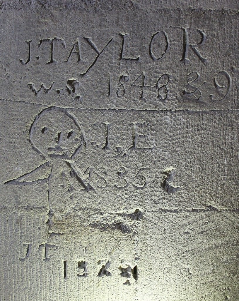
Previous
Previous

Archaeologia Cantiana, Volume CXLI (2020)

Next
Next

Archaeologia Cantiana, Volume CXXXIX (2018)