Archaeologia Cantiana, Volume CXXXIX (2018)

Front and back covers

PDF Link

Preliminaries

PDF Link

Contents and Illustrations

PDF Link

Members of Council

PDF Link

Table of Contents

PDF Link

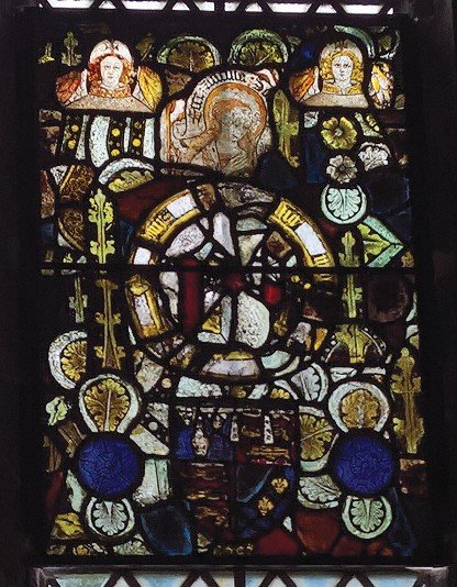
1. The Painted Glass at East Sutton Church and the Arms of a Duke of York

Marcus Herbert

PDF Link

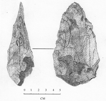
2. A Re-Examination of the Late Nineteenth Century Palaeolithic Finds in the Upper Ravensbourne Area, Bromley

Frank R. Beresford

PDF Link

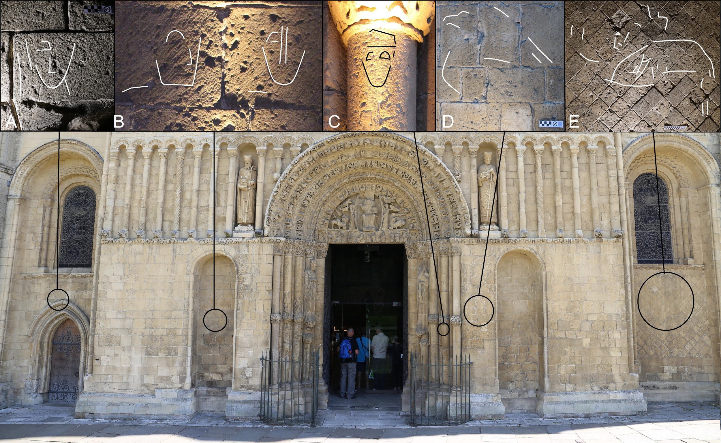
3. Pictorial and Symbolic Graffiti at Rochester Cathedral

Jacob H. Scott

PDF Link

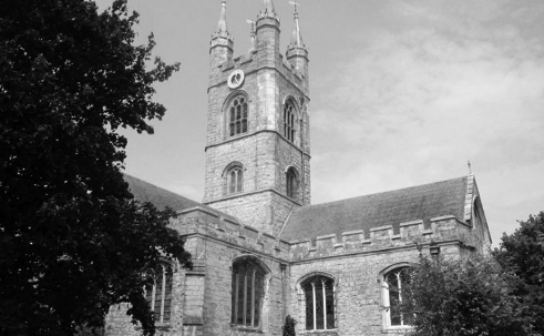
4. Education, Ashford College and the Other Late Medieval Collegiate Churches of Kent

Gillian Draper

PDF Link

5. Archaeological Investigations at St Augustine’s Abbey Canterbury 2004-5

Richard Helm

PDF Link

6. ‘Where Streams of (Living) Water Flow’ The Religious and Civic Significance of Archbishop Abbot’s Conduit in St Andrew’s Canterbury 1603 - 1625

Anne Le Baigue and Avril Leach

PDF Link

7. Archaeological Investigations in the Borough of Staplegate, Canterbury 2012 2015

Tania Wilson and Richard Helm

PDF Link

8. The Dutch in the Medway 1667 Commemoration and Reflection

E. Edwards

Link

9. Old St Albans Court, Nonington An Architectural Survey

Howard Austin Jones

PDF Link

10. The Contribution made by Local Volunteers to Archaeological Investigations in Lyminge (1953 - 1955 and 2008 - 2015

John and Rosemary Piddock

PDF Link

11. Prior Henry (1285 - 1331)- Rescuer of Eastry Church

Charles Coulson

Link

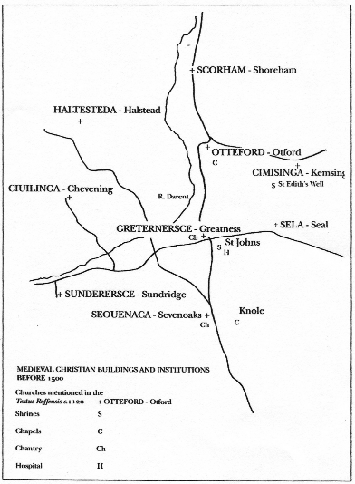
12. St Nicholas Church, Sevenoaks, and the Origins of the Manor at Knole

Jennifer Burgess

PDF Link

13. Berhtwold’s Letter to Forthhere and its Wider Context

Dominic Gibbs

PDF Link

14. Research notes

PDF Link

15. Research Note - Roman

Link

16. Research Notes - Medieval

Link

17. Research Notes - Early Modern

Link

18. Research Notes - Modern

Link

19. Reviews

PDF Link

20. Kentish Bibliography

PDF Link

21. Obituary

PDF Link

22. Notes on Contributors

PDF Link

23. Committees of the Society

PDF Link

24. General Index

PDF Link
ARCHÆOLOGIA CANTIANA ‌CONTENTS The Painted Glass at East Sutton Church and the Arms of a Duke of York. By Marcus Herbert . . . . . . . . . . . . . . . . . . . . . . . . . . . . . . . . . . . A Re-examination of the late nineteenth-century Palaeolithic finds in the Upper Ravensbourne area, Bromley. By Frank R. Beresford . . . . . . . . Pictorial and Symbolic Graffiti at Rochester Cathedral By Jacob H. Scott . . . . . . . . . . . . . . . . . . . . . . . . . . . . . . . . . . . . . . . . . Education, Ashford College and the other late medieval collegiate churches of Kent. By Gillian Draper . . . . . . . . . . . . . . . . . . . . . . . . . Archaeological Investigations at St Augustine’s Abbey, Canterbury, 2004-5. By Richard Helm . . . . . . . . . . . . . . . . . . . . . . . . . . . . . . . . . . . ‘Where Streams of (Living) Water Flow’: the Religious and Civic sig- nificance of Archbishop Abbot’s Conduit in St Andrew’s, Canterbury, 1603-1625. By Anne Le Baigue and Avril Leach . . . . . . . . . . . . . . . . . Archaeological Investigations in the Borough of Staplegate, Canter- bury, 2012-2015. By Tania Wilson and Richard Helm . . . . . . . . . . . . . The Dutch in the Medway 1667: Commemoration and Reflection. By Elizabeth Edwards . . . . . . . . . . . . . . . . . . . . . . . . . . . . . . . . . . . . . . . . Old St Alban’s Court, Nonington: an Architectural Survey. By Howard Austin Jones . . . . . . . . . . . . . . . . . . . . . . . . . . . . . . . . . . . The contribution made by local volunteers to archaeological investig- ations in Lyminge (1953-5 and 2008-2015). By John and Rosemary Piddock . . . . . . . . . . . . . . . . . . . . . . . . . . . . . Prior Henry (1285-1331): Rescuer of Eastry Church. By Charles Coulson † . . . . . . . . . . . . . . . . . . . . . . . . . . . . . . . . . . . . . . St Nicholas Church, Sevenoaks, and the origins of the manor at Knole. By Jennifer Burgess . . . . . . . . . . . . . . . . . . . . . . . . . . . . . . . . . . . . . . . Berhtwold’s letter to Forthhere and its wider context. By Dominic Gibbs . . . . . . . . . . . . . . . . . . . . . . . . . . . . . . . . . . . . . . . . 2018 VOL. 139 Research Notes - Prehistoric . . . . . . . . . . . . . . . . . . . . . . . . . . . . . . . . . . Research Note - Roman . . . . . . . . . . . . . . . . . . . . . . . . . . . . . . . . . . . . Research Notes - Medieval . . . . . . . . . . . . . . . . . . . . . . . . . . . . . . . . . . . Research Notes - Early Modern . . . . . . . . . . . . . . . . . . . . . . . . . . . . . . . Research Notes - Modern . . . . . . . . . . . . . . . . . . . . . . . . . . . . . . . . . . . . Reviews . . . . . . . . . . . . . . . . . . . . . . . . . . . . . . . . . . . . . . . . . . . . . . . . . . Kentish Bibliography . . . . . . . . . . . . . . . . . . . . . . . . . . . . . . . . . . . . . . . . Obituary . . . . . . . . . . . . . . . . . . . . . . . . . . . . . . . . . . . . . . . . . . . . . . . . . www.kentarchaeology.org.uk PAGE 1 17 47 75 89 111 135 155 163 181 199 225 237 247 269 280 299 316 323 329 337 ARCHÆOLOGIA CANTIANA 2018 Kent Archaeological Society image ‌Archæologia Cantiana image Images of Kent No. 14. Aylesford Bridge 1828. Reproduced from an original watercolour in the KAS Collection. Unattributed. Archæologia Cantiana Being Contributions to the History and Archaeology of Kent image VOLUME CXXXIX 2018 Published by the KENT ARCHÆOLOGICAL SOCIETY Registered Charity no. 223382 © 2018 Kent Archaeological Society ISSN 0066-5894 Produced for the Society by Past Historic, Kings Stanley, Gloucestershire Printed in Great Britain NOTICES Neither the Hon. Editor nor the KAS Council as a whole is answerable for opinions put forward in this Work. Each contributor is alone responsible for the contents of his/her paper. ‘Notes for the Guidance of Contributors’ can be found on the Society’s website or in Archaeologia Cantiana, 135 (2014), p. iv. Members are urged to encourage friends and colleagues, interested in archaeology/history, to join the Society. Young people (under 25 years) are offered a much reduced membership fee. An expansion of membership would enable the Society to publish a larger volume of material and provide more practical assistance for private researches. Information about the Society’s activities and a membership application form may be downloaded from the website: www.kentarchaeology.org.uk. Subscriptions are due on the lst of January each year and should be paid only to the Hon. Membership Secretary. It would be a great convenience if members paid their subscriptions by banker’s order. Members who do not pay by this means are requested to settle their subscriptions promptly. (A notice will be sent out in December for renewal of membership the following January). Details of subscription rates and payment by banker’s order may be obtained from the Hon. Membership Secretary, to whom any change of address should be notified. (Mrs S. Broomfield, 8 Woodview Crescent, Hildenborough, Tonbridge, Kent, TN11 9HD; membership@kentarchaeology.org.uk). Legacies have contributed much to the strength and independence of the Society. The Hon. Treasurer would be pleased to hear from any member who would like to bequeath money or other assets. Additional contributions in the form of donations, including those for particular activities of the Society, are also very welcome and should be sent to the Hon. Treasurer (B.F. Beeching, Holly House, Church Road, Hoath, Canterbury, Kent, CT3 4JT; treasurer@ kentarchaeology.org.uk). The Society’s room at Maidstone Museum is open to members who wish to consult its reference library. (It is essential to bring your membership card.) Any queries relating to the KAS Library and its wide range of contents should be addressed to the Hon. Librarian (Mrs R.G. Smalley, 116 Windmill Street, Gravesend, DA12 1BL; librarian@kentarchaeology.org.uk). Cover illustration: the square-headed Anglo-Saxon brooch found at Lyminge in 1954 (see p. 193; reproduced by kind permission of the Maidstone Museum & Bentlif Art Gallery; photo by John Piddock). ‌CONTENTS List of Officers and Members of Council vii-viii; Editorial Personnel viii The Painted Glass at East Sutton Church and the Arms of a Duke of York. By Marcus Herbert . . . . . . . . . . . . . . . . . . . . . . . . . . . . . . A Re-examination of the late nineteenth-century Palaeolithic finds in the Upper Ravensbourne area, Bromley. By Frank R. Beresford . . Pictorial and Symbolic Graffiti at Rochester Cathedral By Jacob H. Scott . . . . . . . . . . . . . . . . . . . . . . . . . . . . . . . . . . . . . Education, Ashford College and the other late medieval collegiate churches of Kent. By Gillian Draper . . . . . . . . . . . . . . . . . . . . . . Archaeological Investigations at St Augustine’s Abbey, Canterbury, 2004-5. By Richard Helm . . . . . . . . . . . . . . . . . . . . . . . . . . . . . . . ‘Where Streams of (Living) Water Flow’: the Religious and Civic significance of Archbishop Abbot’s Conduit in St Andrew’s, Canter- bury, 1603-1625. By Anne Le Baigue and Avril Leach . . . . . . . . . . Archaeological Investigations in the Borough of Staplegate, Canter- bury, 2012-2015. By Tania Wilson and Richard Helm . . . . . . . . . . The Dutch in the Medway 1667: Commemoration and Reflection. By Elizabeth Edwards . . . . . . . . . . . . . . . . . . . . . . . . . . . . . . . . . Old St Alban’s Court, Nonington: an Architectural Survey. By Howard Austin Jones . . . . . . . . . . . . . . . . . . . . . . . . . . . . . . . . The contribution made by local volunteers to archaeological invest- igations in Lyminge (1953-5 and 2008-2015). By John and Rosemary Piddock . . . . . . . . . . . . . . . . . . . . . . . . . . . Prior Henry (1285-1331): Rescuer of Eastry Church. By Charles Coulson † . . . . . . . . . . . . . . . . . . . . . . . . . . . . . . . . . . . St Nicholas Church, Sevenoaks, and the origins of the manor at Knole. By Jennifer Burgess . . . . . . . . . . . . . . . . . . . . . . . . . . . . . Berhtwold’s letter to Forthhere and its wider context. By Dominic Gibbs . . . . . . . . . . . . . . . . . . . . . . . . . . . . . . . . . . . . . . Research Notes - Prehistoric . . . . . . . . . . . . . . . . . . . . . . . . . . . . . . . Two Palaeolithic handaxes from Hawkinge, near Folkstone . . . . . Five arrowheads from the North Downs near Dover . . . . . . . . . . . A Mesolithic tranchet axe find: investigation at Wolverton Lane quarry, Alkham valley . . . . . . . . . . . . . . . . . . . . . . . . . . . . . . . . Prehistoric and early Roman remains at Dane Court grammar school, Broadstairs, and Herne Bay high school . . . . . . . . . . . . A late Iron Age and early Roman settlement at Leybourne Grange, near West Malling . . . . . . . . . . . . . . . . . . . . . . . . . . . . . . . . . . . Research Note - Roman . . . . . . . . . . . . . . . . . . . . . . . . . . . . . . . . . . . A Roman Villa at Marwood Farm, Falconhurst, Aldington . . . . . . . PAGE 1 17 47 75 89 111 135 155 163 181 199 225 237 247 247 248 252 258 262 269 269 16. Research Notes - Medieval . . . . . . . . . . . . . . . . . . . . . . . . . . . . . . . . . The medieval floor tile panel at St Lawrence Church, Godmersham. Notes on the identity and life of Sir Richard Hawte (d. 1492) of Swarling manor, Petham and Dame Katherine, his wife (d. 1493) . . . . . . . . . . . . . . . . . . . . . . . . . . . . . . . . . . . . . . . . . . . . . 280 292 280 17. Research Notes - Early Modern . . . . . . . . . . . . . . . . . . . . . . . . . . . . . ‘Paradise Found’; pinpointing The Embarkation Towers on a modern map of Dover . . . . . . . . . . . . . . . . . . . . . . . . . . . . . . . . . . 299 299 Discovering and Recording two lost hamlets in Thanet . . . . . . . . . A series of Kentish firebacks and the possible identification of their founder . . . . . . . . . . . . . . . . . . . . . . . . . . . . . . . . . . . . . . . . . 309 312 18. Research Notes - Modern . . . . . . . . . . . . . . . . . . . . . . . . . . . . . . . . . . Snodland and ‘Cementopolis’ 1841-1881. . . . . . . . . . . . . . . . . . . . . 316 316 Thanet’s defences in the twentieth century . . . . . . . . . . . . . . . . . . . 318 19. Reviews . . . . . . . . . . . . . . . . . . . . . . . . . . . . . . . . . . . . . . . . . . . . . . Anne Lehoërff and Marc Talon (eds). Movement, identity and exchange in Europe in the 2nd and 1st millennia bc: beyond frontiers . . . . . . . . . . . . . . . . . . . . . . . . . . . . . . . . . . . . . . . . . . . . 323 323 Gobor Thomas and Alexandra Knox (eds). Early Medieval Monast- icism in the North Sea Zone. Proceedings of a conference held to celebrate the conclusion of the Lyminge excavations 2008-15 324 David Shaw. ‘John Mower: Vicar of Tenterden in the Late Fifteenth Century: His Will, His Career and His Library’. 325 J. Pearce and J. Weekes (eds). Death as a Process: The Archaeology of the Roman Funeral . . . . . . . . . . . . . . . . . . . . . . . . . . . . . . . . . . 326 Cliff Ward. A Guided Walk around Otford Palace . . . . . . . . . . . . . Elizabeth Purves and Geraldine Tucker. Sevenoaks Forgotten Park Lodges and Coach Houses . . . . . . . . . . . . . . . . . . . . . . . . . . . . . 326 327 20. Kentish Bibliography . . . . . . . . . . . . . . . . . . . . . . . . . . . . . . . . . . . . . 329 21. Obituary . . . . . . . . . . . . . . . . . . . . . . . . . . . . . . . . . . . . . . . . . . . . . . 337 22. Notes on Contributors . . . . . . . . . . . . . . . . . . . . . . . . . . . . . . . . . . . 339 23. Committees of the Society . . . . . . . . . . . . . . . . . . . . . . . . . . . . . . . . 342 24. General Index . . . . . . . . . . . . . . . . . . . . . . . . . . . . . . . . . . . . . . . . . . 343 ‌KENT ARCHAEOLOGICAL SOCIETY officers and members of the council, 1st january 2018 President G. CRAMP, ph.d. Patrons THE VISCOUNT DE L’ISLE, m.b.e. THE COUNTESS SONDES A.I. MOFFAT C.R. POUT, m.a. J. WHYMAN, ph.d., b.sc. (econ), assoc.cipd PROFESSOR D. KILLINGRAY SIR ROBERT WORCESTER, k.b.e., d.l. Vice-Presidents MRS S. BROOMFIELD, f.s.a. M.L.M. CLINCH, m.a. R.F. LEGEAR, m.c.i.f.a. E.P. CONNELL Honorary Editor T. G. LAWSON, m.a.(cantab), dip.kent.hist. Lynwood, 102 Lower Vicarage Road, Kennington, Ashford, TN24 9AP Honorary General Secretary A.C. DREW 42 Crowhurst Road, Borough Green, Sevenoaks, TN15 8SJ Honorary Treasurer B. F. BEECHING, b.a.(hons), m.a. Holly House, Church Road, Hoath, Canterbury, CT3 4JT Honorary Librarian MRS R. G. SMALLEY, b.a., grad. dip. lib. sci., m.sc, m.a., dip. arch. 116 Windmill Street, Gravesend, DA12 1BL Honorary Membership Secretary MRS S. BROOMFIELD, f.s.a. 8 Woodview Crescent, Hildenborough, Tonbridge, TN11 9HD Honorary Curator F. RICHARDSON, b.a.(hons), m.phil., ph.d., f.s.a. Chiltern, 5 Farthingloe Cottages, Little Farthingloe, Folkestone Road, Dover, CT15 7AA Elected Members of the Council H. Basford Canterbury C. Blair-Myers f.g.s., f.b.c.s Maidstone D. Brooks, pgce Maidstone Prof. K. Brown, ph.d Charing P. Burton Charing R.N. Cockcroft, ph.d Ashford R.A.C. Cockett r.i.c.s Gravesend K.H. Kersey, b.a Bearsted S.M. Sweetinburgh, ph.d Canterbury P. Titley, m.a Maidstone C.P. Ward Otford S.H. Willis, ph.d Canterbury Editorial Personnel Honorary Editor Terence Lawson honeditor@kentarchaeology.org.uk Book Reviews Editor Dr Elizabeth Edwards Woodview, 13 Town Road, Petham, Canterbury, Kent CT4 5QT ecedwards84@googlemail.com All rights reserved. No part of this publication may be reproduced, stored in a retrieval system, or transmitted, in any form or by any means electronic, mechanical, photocopying, recording or otherwise without the permission of the Kent Archaeological Society. ‌CONTENTS /LVW RI 2I¿FHUV DQG 0HPEHUV RI &RXQFLO YLL YLLL (GLWRULDO 3HUVRQQHO YLLL PAGE 1. 4. 5. 6. The Painted Glass at East Sutton Church and the Arms of a Duke of York. By Marcus Herbert . . . . . . . . . . . . . . . . . . . . . . . . . . . . . . $ 5H H[DPLQDWLRQ RI WKH ODWH QLQHWHHQWK FHQWXU\ 3DODHROLWKLF ¿QGV LQ the Upper Ravensbourne area, Bromley. By Frank R. Beresford . . 3LFWRULDO DQG 6\PEROLF *UDI¿WL DW 5RFKHVWHU &DWKHGUDO By Jacob H. Scott . . . . . . . . . . . . . . . . . . . . . . . . . . . . . . . . . . . . . Education, Ashford College and the other late medieval collegiate churches of Kent. By Gillian Draper . . . . . . . . . . . . . . . . . . . . . . Archaeological Investigations at St Augustine’s Abbey, Canterbury, 2004-5. By Richard Helm . . . . . . . . . . . . . . . . . . . . . . . . . . . . . . . ‘Where Streams of (Living) Water Flow’: the Religious and Civic VLJQL¿FDQFH RI $UFKELVKRS $EERW¶V &RQGXLW LQ 6W $QGUHZ¶V &DQWHU bury, 1603-1625. By Anne Le Baigue and Avril Leach . . . . . . . . . . 1 17 47 75 89 111 7. 9. 10. Archaeological Investigations in the Borough of Staplegate, Canter- bury, 2012-2015. By Tania Wilson and Richard Helm . . . . . . . . . . 7KH 'XWFK LQ WKH 0HGZD\ &RPPHPRUDWLRQ DQG 5HÀHFWLRQ By Elizabeth Edwards . . . . . . . . . . . . . . . . . . . . . . . . . . . . . . . . . Old St Alban’s Court, Nonington: an Architectural Survey. By Howard Austin Jones . . . . . . . . . . . . . . . . . . . . . . . . . . . . . . . . The contribution made by local volunteers to archaeological invest- igations in Lyminge (1953-5 and 2008-2015). By John and Rosemary Piddock . . . . . . . . . . . . . . . . . . . . . . . . . . . 135 155 163 181 11. 12. 13. Prior Henry (1285-1331): Rescuer of Eastry Church. By Charles Coulson † . . . . . . . . . . . . . . . . . . . . . . . . . . . . . . . . . . . St Nicholas Church, Sevenoaks, and the origins of the manor at Knole. By Jennifer Burgess . . . . . . . . . . . . . . . . . . . . . . . . . . . . . Berhtwold’s letter to Forthhere and its wider context. 199 225 By Dominic Gibbs . . . . . . . . . . . . . . . . . . . . . . . . . . . . . . . . . . . . . . 237 14. Research Notes - Prehistoric . . . . . . . . . . . . . . . . . . . . . . . . . . . . . . . Two Palaeolithic handaxes from Hawkinge, near Folkstone . . . . . 247 247 Five arrowheads from the North Downs near Dover . . . . . . . . . . . $ 0HVROLWKLF WUDQFKHW D[H ¿QG LQYHVWLJDWLRQ DW :ROYHUWRQ /DQH quarry, Alkham valley . . . . . . . . . . . . . . . . . . . . . . . . . . . . . . . . 248 252 Prehistoric and early Roman remains at Dane Court grammar school, Broadstairs, and Herne Bay high school . . . . . . . . . . . . 258 A late Iron Age and early Roman settlement at Leybourne Grange, near West Malling . . . . . . . . . . . . . . . . . . . . . . . . . . . . . . . . . . . 262 15. Research Note - Roman . . . . . . . . . . . . . . . . . . . . . . . . . . . . . . . . . . . A Roman Villa at Marwood Farm, Falconhurst, Aldington . . . . . . . 269 269 16. Research Notes - Medieval . . . . . . . . . . . . . . . . . . . . . . . . . . . . . . . . . 7KH PHGLHYDO ÀRRU WLOH SDQHO DW 6W /DZUHQFH &KXUFK *RGPHUVKDP. Notes on the identity and life of Sir Richard Hawte (d. 1492) of Swarling manor, Petham and Dame Katherine, his wife (d. 1493) . . . . . . . . . . . . . . . . . . . . . . . . . . . . . . . . . . . . . . . . . . . . . 280 292 280 17. Research Notes - Early Modern . . . . . . . . . . . . . . . . . . . . . . . . . . . . . ‘Paradise Found’; pinpointing The Embarkation Towers on a modern map of Dover . . . . . . . . . . . . . . . . . . . . . . . . . . . . . . . . . . 299 299 Discovering and Recording two lost hamlets in Thanet . . . . . . . . . $ VHULHV RI .HQWLVK ¿UHEDFNV DQG WKH SRVVLEOH LGHQWL¿FDWLRQ RI WKHLU founder . . . . . . . . . . . . . . . . . . . . . . . . . . . . . . . . . . . . . . . . . 309 312 18. Research Notes - Modern . . . . . . . . . . . . . . . . . . . . . . . . . . . . . . . . . . Snodland and ‘Cementopolis’ 1841-1881. . . . . . . . . . . . . . . . . . . . . 316 316 Thanet’s defences in the twentieth century . . . . . . . . . . . . . . . . . . . 318 19. Reviews . . . . . . . . . . . . . . . . . . . . . . . . . . . . . . . . . . . . . . . . . . . . . . Anne Lehoërff and Marc Talon (eds). Movement, identity and exchange in Europe in the 2nd and 1st millennia bc EH\RQG frontiers . . . . . . . . . . . . . . . . . . . . . . . . . . . . . . . . . . . . . . . . . . . . 323 323 Gobor Thomas and Alexandra Knox (eds). Early Medieval Monast- icism in the North Sea Zone. Proceedings of a conference held to celebrate the conclusion of the Lyminge excavations 2008-15 324 David Shaw. ‘John Mower: Vicar of Tenterden in the Late Fifteenth Century: His Will, His Career and His Library’. 325 J. Pearce and J. Weekes (eds). 'HDWK DV D 3URFHVV 7KH $UFKDHRORJ\ of the Roman Funeral . . . . . . . . . . . . . . . . . . . . . . . . . . . . . . . . . . 326 Cliff Ward. A Guided Walk around Otford Palace . . . . . . . . . . . . . Elizabeth Purves and Geraldine Tucker. Sevenoaks Forgotten Park Lodges and Coach Houses . . . . . . . . . . . . . . . . . . . . . . . . . . . . . 326 327 20. Kentish Bibliography . . . . . . . . . . . . . . . . . . . . . . . . . . . . . . . . . . . . . 329 21. Obituary . . . . . . . . . . . . . . . . . . . . . . . . . . . . . . . . . . . . . . . . . . . . . . 337 22. Notes on Contributors . . . . . . . . . . . . . . . . . . . . . . . . . . . . . . . . . . . 339 23. Committees of the Society . . . . . . . . . . . . . . . . . . . . . . . . . . . . . . . . 342 24. General Index . . . . . . . . . . . . . . . . . . . . . . . . . . . . . . . . . . . . . . . . . . 343 ‌The PainTed Glass aT easT suTTon ChurCh and The arms of a duke of York marcus herbert This article discusses the heraldry of various shields in the stained glass of East Sutton Church dating from the fourteenth century to the seventeenth century. These include heraldry of the families of Valence, Hastings, St Leger, Mortimer of Wigmore, a Duke of York, Guildford, Halden, Argall, Scott and Filmer. The ownership of the manor of East Sutton from the early fourteenth to the seventeenth century is used to explain these shields, some of which at some time may have been transferred from the manor house to the church. The particular problem of the shield of a Duke of York is explained by the ownership of the manor of East Sutton being in the possession of the Darell family in the middle years of the fifteenth century. Their arms are not in the glass but both George (d.1474) and Richard (d.1489) Darell served the Yorkists and provide a convincing explanation of the presence of the arms of the Duke of York, probably Richard (d.1460). The parish of east sutton lies about seven miles south-east of maidstone. Together with the parishes of sutton Valence and Chart sutton it forms an area known locally as the Three suttons. The church is dedicated to st Peter and st Paul and was built using kentish ragstone. Construction phases from the thirteenth to early sixteenth centuries have been identified. During an ill-considered restoration in 1897-8 the interior walls were entirely stripped of their plaster rendered finish. This left the inside of the building with a stark stone-clad like appearance. in all other respects the church at east sutton is a beautiful and fascinating building. In 1898 Thomas Henry Oyler published a guide to the church. Better than most, it contained the usual information on the architecture, monuments and stained glass, but was rather more detailed. Among the latter was a reference to a window containing the arms of ‘richard duke of York father of edward 4th’. however because Oyler did not state why, in his opinion, the arms specifically related to Richard Plantagenet (d.1460) an examination of the arms borne by the fifteenth- century dukes of York is necessary. But first, a description of the glass remaining at east sutton is given in order to place the arms in their present physical context. The fourteenth- to seventeenth-Century Painted Glass at east sutton Apart from some fifteenth-century remnants of saints in the west window all the old glass is now in the south chapel. This area of the church has been known variously MARCUS HERBERT image fig. 1 heraldry in filmer Chapel window in east sutton Church containing the duke of York’s arms. as the Pembroke or filmer chapel. The glass in its south window comprises three panels containing fragments datable to the period from the fourteenth to the seventeenth centuries (Figs 1 and 2). The York panel measures 32 x 21½in. (810 x 545mm), the others are of comparable size. The left panel contains, i and iv, or a maunch gules (Hastings) quartering, ii and iii, barry of ten, argent and azure an orle of martlets gules (Valence). This was the coat borne by the hastings’ earls of Pembroke and appears on the seal of laurence Hastings (d.1348), the first of that ilk, datable to 1345. The Valence arms were derived from those of lusignan. laurence hastings’ great grandfather William de Valence (d.1296) was the son of Hugh de Lusignan 5th Comte de la Marche (d.1249). Above this coat is a small truncated, rectangular shield containing the arms of Mortimer of Wigmore, barry of six or and azure, on a chief of the first, three palets, between two based esquires of the second; overall an inescutcheon argent. This is the earliest shield remaining in the church and dates from the first half of the fourteenth century.1 in the upper right of the panel are the arms of st Leger, azure, fretty argent and a chief or. To the left of the hastings/Valence coat is a fragment of the st leger arms but of a later date than the previous complete coat and perhaps dating from the sixteenth/seventeenth centuries. Below and between the forgoing is a shield bearing the arms of Filmer, sable three bars or, in chief as many cinquefoils of the second. Beneath and either side of the Filmer coat are two shields bearing the arms of Argall, per fesse argent and vert, a pale counterchanged, three lions heads erased gules impaling Scott, argent, three Catherine wheels sable within a bordure engrailed gules. Between the Argall/Scott arms is a crowned fleur-de-lis. Fragments of foliate decoration have been placed around and among the shields. The centre panel is all seventeenth-century work. The primary subject is a shield displaying the Filmer arms surmounted by the family crest, on a broken tower or, a falcon rising proper, belled or. above the crest is another of the same but smaller PAINTED GLASS IN EAST SUTTON CHURCH AND THE ARMS OF A DUKE OF YORK image fig. 2 detail of the duke of York’s arms. in size. Below the central shield of arms to the left and right are two other Filmer coats. The arms of Richard, 3rd Duke of York, forms a part of the right hand panel pieced together using fragments of fifteenth- and sixteenth-century glass. In each of the top corners are the head and shoulders of a winged angel. Just below and between the angels are the head and shoulders of the Blessed Virgin with the legend ‘ecce ancilla domini’ around her halo. Below the Virgin is a fragmentary shield set within a garter for sir henry Guildford (d.1532). Guildford was Comptroller of the household to henry Viii. he was made a knight of the order of the Garter MARCUS HERBERT in 1526 and acquired the manor of East Sutton in 1528. His arms were quarterly, i and iv, or, a saltier between four martlets sable, a canton gules charged with a pomegranate or, slipped verts (Guildford), ii and iii, argent, a chief sable overall a bend engrailed gules, (halden) a mullet or in the nombril point. as they remain Guildford’s arms are difficult to interpret as only the third quarter survives in a vaguely recognisable state the second considerably less so and apart from some small pieces of yellow glass the Guildford quarters have gone. it is possible however to see the mullet, indicating a third son, at the intersection of the four quarters.2 Below the Guildford arms are the ducal arms of York with, either side, a roundel of blue glass showing a rose. The York shield measures 7 x 8¼in. (180mm x 210mm). a close examination of it reveals that the fourth quarter has undergone some repair where a portion of the glass was missing. This has resulted in the loss of the first fleur-de-lis which has not been replaced. As with the left panel, foliate fragments appear around and between the main subjects. When Oyler published his guide in 1898 a window in the north or Hastings chapel contained the arms of st leger and hastings quartering Valence. from a comparison of oyler’s account and the remaining old glass it is evident that during the 1897-98 restoration all the old glass from both chapels was brought together into the window in the south chapel. some losses have occurred since oyler wrote. He described a fragment, barry of six, argent and azure, in chief three torteaux (Grey of Ruthin) which may have appeared as it did on a seal datable to 1403, i and iv, Grey, ii and iii quarterly, i and iv, Hastings, ii and iii, Valence. This has now gone as has a lozenge bearing on a chevron three talbots gules. This last is more properly described, argent, on a chevron, gules, three talbots, passant, argent and refers to Joan the daughter of Robert Martin of Graveney, Kent, who was the first wife of Richard Argall (d.1588) of East Sutton. An account by the Reverend John Cave-Brown also from 1898 stated that in one of the windows ‘is a dirty fragment, which on careful examination discloses part of the banner of simon de montfort’. de montfort’s banner described as partir per pale indented argent and gules was not, however, recorded by Oyler. A recent study of the remaining glass by the author has revealed that Cave-Brown was in error and had incorrectly attributed a remnant of the third quarter of sir henry Guildford’s arms to de montfort.3 on 2 June 2015 the three panels of glass were carefully removed for conservation work. This was part funded by the Rochester Bridge Trust and was carried out by the Cathedral studios of Canterbury. The conserved panels were replaced in the church on 11 august. on 30 January 2016 a service of commemoration and rededication led by the Bishop of Dover was held in the presence of the Lord Lieutenant of Kent, Viscount De L’Isle, to mark the centenary of the death of Captain sir robert marcus filmer mc of the Grenadier Guards. sir robert was the tenth and last baronet filmer of east sutton Park and died on active service in France on 27 January 1916. He was also a warden of Rochester Bridge. The whole composition is known as the filmer armorial Window.4 The arms of the dukedom of York In heraldic terms the York arms at East Sutton are described; quarterly, i and iv, PAINTED GLASS IN EAST SUTTON CHURCH AND THE ARMS OF A DUKE OF YORK azure, three fleur-de-lis or (France modern), ii and iii, gules, three lions passant guardant, in pale, or, armed and langued azure (England), overall on a label of three points argent, nine torteaux gules. These are the arms as borne by the dukes of York from the early years of the fifteenth century. The quartering of the arms of france together with those of england occurred under edward iii at some point after the commencement of the Hundred Years War in 1337. From that time on the first and fourth quarters of the royal arms were described; azure, semée of fleur- de-lis or. Later, it has been said in 1376, the French king Charles V reduced the number of fleurs-de-lis on the arms of France to three. This date has undergone some revision and it is now thought that the change may have occurred around 1394 under his successor Charles VI. From the first years of the fifteenth century, under Henry IV, the English royal arms began to follow the same pattern, the earliest example being a seal of edward 2nd duke of York attached to a charter of 1403. To date there have been eleven dukes of York six of whom were living at some point during the fifteenth century. The first to bear the title was Edmund of Langley, Earl of Cambridge, fourth surviving son of Edward III, who was created Duke of York by his nephew Richard II on 6 August 1385. On Edmund’s death on 1 August 1402 the title passed to his son Edward, Earl of Rutland who died at the battle of agincourt on 25 october 1415. edward’s successor to the title was his nephew Richard, son of his brother Richard, Earl of Cambridge who had been attainted and executed for treason by order of henry V on 5 august 1415. on richard’s death at the battle of Wakefield on 30 December 1460 his son Edward Earl of March was styled duke of York but following his accession as edward iV on 4 march 1461 the title became vested in the Crown. king edward’s son richard was created 5th Duke of York on 28 May 1474. On 31 October 1494 Richard’s nephew Henry, second son of Henry VII and the future Henry VIII, was made 6th Duke of York.5 The change to the royal arms makes it extremely unlikely that the shield at east sutton was intended to represent edmund of langley but in their revised form they might be used by his successors to the title. However, it is doubtful that they relate to Edward (IV), the fourth duke as he was never officially raised to the dukedom and was only styled as such for nine weeks before his accession.6 likewise the arms at east sutton do not belong to his son (richard) as his Garter stall plate at St George’s Chapel, Windsor shows the dexter point of the label charged with a canton, gules. The arms on the stall plate of richard’s nephew henry include a label of three points ermine although it is interesting to note that the figure of ‘henrie dux ebor’ in his ‘coate armour’ was recorded as being in the chapter house at Canterbury Cathedral in 1599 when his arms were shown as those used by the second and third dukes. Clearly whoever was responsible for this particular example was unaware of the label actually used by henry and again his stall plate rules out any notion of him being the man represented by the east sutton shield. Thus far, by a process of elimination, it would appear that the arms at East Sutton were intended to represent either edward (d.1415) or his nephew richard (d.1460) the second and third dukes respectively. other examples of the York ducal arms with france modern quarterings remain at Canterbury Cathedral and serve as useful comparisons to the east sutton glass; two examples in the Water Tower are described as early fifteenth-century and in MARCUS HERBERT the east window of the Lady Chapel are the arms; i and iv, argent, a cross engrailed gules between four water bougets sable (Bourchier); ii and iii, gules billety or, a fess of the last (louvain). These are the arms of Henry Bourchier, 1st Earl of Essex (d.1483) and are shown impaling the arms of York for his wife Isabel of Cambridge (d.1484), sister of Richard 3rd Duke of York.7 The owners of east sutton manor at this juncture it is necessary to examine the history of east sutton and its owners but only from the second half of the thirteenth century as anything before that date has no bearing on the remaining early glass in the church. it should also be noted that because Anne, daughter of Roger Mortimer 4th Earl of March was the mother of Richard 3rd Duke of York, it may at first glance appear that the ducal arms of York and those of Mortimer are connected, not within their present modern context but by the appearance of both in the church. However, as will be shown this is not so. During this period East Sutton was held by Aymer de Valence, 2nd Earl of Pembroke, son of William the 1st Earl and a nephew of the half-blood to Henry III. On his death in 1324 it passed to his nephew John 2nd Baron Hastings (d.1325) son of John 1st Baron Hastings and Isabel an elder sister of de Valence. Hastings’ son Laurence (d.1348) became 3rd Baron Hastings and 1st Earl of Pembroke and married Agnes (d.1368) daughter of Roger Mortimer 1st Earl of March. Their son John (d.1375) became 2nd Earl of Pembroke and married Margaret a daughter of edward iii. There was no issue from their union. hastings remarried to anne daughter of sir Walter manny who gave birth to a son. east sutton then passed to their son John the 3rd Earl of Pembroke who first married Elizabeth daughter of John of Gaunt, Duke of Lancaster, then Philippa (d.1400) daughter of Edmund Mortimer 3rd Earl of March and Philippa, daughter of Lionel Duke of Clarence. There was no surviving issue from either union the second of which ended with Pembroke’s death during a tournament in 1389. Thereafter the manor passed to Reginald 3rd Baron Grey of Ruthin (d.1439). Reginald was the grandson of Roger 1st Baron Grey of Ruthin and Elizabeth daughter of John 1st Baron Hastings and Isabel, daughter of William de Valence 1st Earl of Pembroke.8 In early 1402 Grey was taken hostage by Owain Glyndŵr during the Welsh Revolt. A ransom of 10,000 marks was demanded so in May 1403, in order to raise the money for his release, Henry IV directed that certain of Grey’s manors be sold, east sutton and the other kentish manors of sutton Valence and hartley among them. On 25 May 1403 East Sutton was conveyed to Richard Bruges (d. c.1415) lancaster king of arms.9 on 2 July 1413 he and his wife katherine alienated the manor to John Mepersale, Thomas Enderby, John Botiller and Thomas Bank. The Darells of Littlecote, Wiltshire On 10 October 1414 Botiller and Bank conveyed the manor of East Sutton to William Darell (d.1450/1) and his brother John (d.1438). William and John were the sons of William and emma darell of sessay in north Yorkshire. an elder brother, Marmaduke (d.1423), inherited the family estates at Sessay whilst in 1410 John purchased Calehill in the parish of little Chart. in 1412 William married PAINTED GLASS IN EAST SUTTON CHURCH AND THE ARMS OF A DUKE OF YORK Elizabeth (d.1464) daughter of Thomas Calstone of Littlecote, Wiltshire, where the couple settled. The union produced at least five sons and several daughters. However, only the eldest sons, George and Richard, will be discussed in this paper. On 20 March 1435 John Darell issued a quitclaim to William and Elizabeth relinquishing any interest he may have had in east sutton manor. William’s career saw him appointed as sub-treasurer of England in 1399 followed by service in the shires as sheriff of Wiltshire then Oxfordshire and Berkshire for four terms from 1420 to 1433.10 In 1453 his eldest son George entered into the service of Richard, duke of York; This endenture made at fodringey the xxxth day of Jannuer the xxxith yere of the regne of oure souverain lord kyng Henry the sext Betwix the right high and mighty prince my lord richard duc of York on the toon part and George darell squier on the other part bereth witnesse that the saide George is belaste and witholden with my saide lord the duc for terme of his lyf. Prometting by the feith of his body and bind- ing him by these endentures for to doo true and feithful service unto my saide lord the duc. and with him for to be agenst all erthyly creatures of what estate priemi- nence or condition soo evere thay bee next the kyng oure soverain lord and his yssu kynges of england and of france. for the which witholding the saide George shal take of my saide lord the duc yerely the somme of x.li sterlinges to bee taken of the yssues proufites and revenues of his manour and lordeshipp of Fasterne in Wiltshire by the handes of the receveur and fermour and other occupiers of the same for the tyme being atte festes of the annuncacion of oure lady and mighelmasse by even porcions unto the tyme that the saide George bee provided by my saide lord the duc unto an office or an other resonnable rewarde of the valeu of xx mark by yere as by lettres patentes and lettres of warrant made theruppon unto the saide George, undre the seel of my saide lorde the duc hit may more clerely appere. in witnesse wherof to the toon part of these endentures remaynyng towardes the saide George, my saide lord the duc hath, doo set his signet the day place and yere aforesaide. That Darell was still the duke’s man by 1460 is confirmed by the issuing of a pardon to him on 16 march; ‘for £40 for all treasons and other offences etc’. The family had a history of service to the future Yorkist party. in may 1431 William darell (d.1450/1) acted as a trustee in the matter of various estates concerning the late Thomas montagu 4th earl of salisbury. This was for montagu’s son-in-law Richard Nevill 5th Earl of Salisbury and his wife Alice, Montagu’s daughter and heir. during the same period William’s nephew edmund darell had been retained by neville who became York’s brother-in-law and ally.11 from the 1450s George darell was appointed to a number of county shrievalties and in april 1461 was made keeper of the Great Wardrobe. in January 1462 he served on a commission to arrest adherents of henry Vi and other senior lanc- astrians in Somerset, Dorset and Wiltshire. The following month he was appointed to a commission of oyer and Terminer regarding treasons and felonies in Wiltshire. Soon after Easter 1465 he was made a Knight Bachelor then a Knight of the Bath on the day of the coronation of Elizabeth Woodville. Among other royal commissions one in June 1470 required him to assist in raising men against the duke of Clarence and earl of Warwick.12 He married firstly Margaret daughter of John 1st Baron Stourton. By his second marriage to Jane daughter of William Haute of Bishopsbourne and Joan Woodville MARCUS HERBERT daughter of Sir Richard Woodville of the Mote, Maidstone, he was a kinsman to the Yorkist monarchy. George died in March 1474. But returning to East Sutton, on 4 March 1450 William and Elizabeth Darell settled the manor on their second son Richard whose first public appointment took place on 7 November 1459 when he was made escheator for Southampton (Hampshire) and Wiltshire. He subsequently served as sheriff of Wiltshire in 1467-68 and Hampshire in 1469-70 and 1470-71.13 Before March 1463 Richard married Margaret, daughter of Edmund Beaufort 2nd Duke of Somerset (d.1455). Margaret was the widow of Humphrey Stafford (d.1458) the eldest son of Humphrey Stafford 1st Duke of Buckingham and was already the mother of two young sons, Henry, the future second duke of Buckingham and his brother Humphrey.14 from her marriage to darell came a daughter, also Margaret, who was probably born before 14 July 1464 when George darell issued a quitclaim to his brother richard respecting east sutton. The Plea rolls record that in 1465 richard darell described as ‘late of littlecote’ was summoned by suit of his brother Alexander, executor of their mother’s estate, to pay 45 marks owed to the estate, which had been withheld. On 1 August 1463 richard had placed his wife with his mother to whom he would pay 13s. 4d. a week for her ‘diets’ and would continue to do so for the whole time she was there. although margaret ended up staying with her mother-in-law for ‘the 45 weeks following’, until June 1464, Richard reneged on the pledge to reimburseimagehis mother. Elizabeth Darell made her will on 15 June 1464. Following her death soon after, Richard refused to pay her executor the balance owed to her estate a situation perhaps exacerbated by his exclusion from her will. The period referred to would seem to be when Richard’s daughter was born. Perhaps difficulties during the birth led to complications resulting in a protracted lying-in period. it has been suggested that margaret darell was an imbecile although no evidence appears to exist to support this statement which was almost certainly a conclusion drawn from the above.15 Be that as it may, events during this period must have plunged her into an inconsolable state of grief. in addition to the loss of her father who had been killed at the first battle of St Albans in 1455 the continued support given by her family to the lancastrian party resulted in the deaths of four brothers and a number of cousins.16 however worst of all was the loss of her younger son humphrey who probably died around April/May 1471.17 Throughout the tribulations of his wife’s lancastrian family richard darell remained a staunch supporter of the Yorkist monarchy. from november 1466 until June 1470 he served on a number of commissions of array and peace, several alongside the king’s brother-in-law, Anthony Woodville Lord Scales.18 The fact that his brother George had received an appointment to the royal household may be seen as a result of his long-standing loyalty, at least since 1453, to the house of York. richard might have hoped for similar advancement but although he received a knighthood in 1466 thenceforth his progress stalled, perhaps because of his close kinship to so many proven traitors, which may have meant that beyond regional appointments any higher ambitions were curtailed. In 1476 he acted as councillor for his stepson, the duke of Buckingham, serving as one of the justices’ itinerant presiding over the Great Sessions at Newport, Wales. In 1483 he was present at the coronation of Richard III. Buckingham’s fall came later that year but there seems to have been no evidence that darell had played any part in the rebellion that bore PAINTED GLASS IN EAST SUTTON CHURCH AND THE ARMS OF A DUKE OF YORK his stepson’s name unlike his cousin John Darell (d.1509) of Calehill, Kent, who suffered attainder. Owing to her death, his wife was spared the knowledge of her remaining son’s ignominious end.19 By July 1478 Richard had remarried to Joan (d. aft.1502) widow of Sir Walter Wrottesley of Wrottesley, Staffordshire (d.1473). Joan had given Wrottesley four sons and five daughters but her union with Darell does not appear to have been similarly fruitful. Around 1474/5 Darell decided to sell his lands at East Sutton. On 18 March 1475 the manor was conveyed to Thomas Waryn, John Feiamys and David Hopkins. By agreement of 26 April 1478 Darell sold East Sutton to the executors of the estate of William York for £336 13s. 4d.20 Richard Darell died on 6 August 1489 after which escheators for Hampshire and Wiltshire were ordered to examine his land holdings but only the inquisition post mortem for hampshire survives. This together with an inventory of his goods indicates that his principal residence was the manor of Paulton in hampshire. his place of burial is unknown but of interest are those religious foundations to whom the inventory shows he was indebted at the time of his death; 3s. 4d. was due to Saint Swithun’s whose location was not noted but was probably the Benedictine cathedral priory of St Swithun, Winchester. He owed the parish church at Eling, hampshire 13s. 4d. To the vicar of the same he owed 11s. while the chapel of ower in the same parish was due 10s. Possibly most significant of all was the £5 owing to the prior of Mottisfont Priory, Hampshire, an Augustinian house. A further debt was to an individual named or described as ‘Brekeman of Mottysfounte’ to whom was due £3. In the absence of firm testamentary evidence perhaps we may tentatively speculate that mottisfont was darell’s chosen place of burial.21 his daughter Margaret married James Tuchet, 7th baron Audley of Heleigh, Staffordshire to whom darell owed the large sum of 100 marks. Tuchet was executed on 25 June 1497 for his part in the Cornish Rebellion against Henry VII.22 darell’s heir was his six-year old grandson John Tuchet (b. c.1482/3) to whom the title was restored becoming 8th baron Audley in 1512. east sutton manor house To the south-east of the present Elizabethan mansion lies a large and well preserved homestead moat probably dating from the period 1250-1350. each arm measures 65m while retaining banks survive to the west and south. There is an inner rampart and an entrance causeway at the north-east corner. Was this the location of the manor house that the darells knew or does another lie beneath the present house? in 1546 the manor was acquired by the royal administrator Thomas argall of london (d.1563) and his wife margaret. on Thomas’ death the manor passed to their son Richard (d.1588). Probably most of the sixteenth-century parts of the present house can be attributed to the argall family as a richly carved screen in the hall bearing the date 1570 also displays the initials R.A. and M.A. for Richard and his second wife Mary, daughter of Sir Reginald Scott. After Argall’s death it was held by his son John. John’s sister Elizabeth married Sir Edward Filmer (d.1629) son of Robert Filmer of Little Charlton, East Sutton. in 1610 John argall sold east sutton to edward filmer to whom he owed money.23 The manor was then inherited by sir edward’s son sir robert filmer (d.1653) who MARCUS HERBERT is noted for his De Patriarcha a treatise on the divine right of kings. although published posthumously in 1680 it is believed to have been completed before the outbreak of the Civil War. This naturally put him at odds with the Parliamentarian side during the war and eventually led to his arrest and imprisonment in nearby Leeds Castle. Prior to this, in September 1642, East Sutton Place had been looted by the Parliamentarian army. apparently the house was attacked on no less than ten separate occasions resulting in the destruction of much personal property and the house being set ablaze. The church did not escape the depredations. Notes made by Sir Robert record that on 27 July 1643, Cornet May came to search East Sutton Belfry for arms there, he tore the surplice with his owne hands, tooke away a Bible, a service booke and a booke of homilies out of the Church and broke the glasse windowes. These notes appear to have been copied almost verbatim from his wife’s diary, or perhaps vice versa, the main difference being that Lady Anne Filmer apparently wrote ‘…and broke down the screen and the painted glass windows’. lady anne’s original has been lost since 1945.24 Conclusion In 1569 Mathew Parker Archbishop of Canterbury visited the church at East sutton following which it was recorded that ‘the high chancel of the church is in great decay, through the default of the Dean and Chapter of Rochester’. It is therefore possible that some of the glass was lost years before Cornet may and his cohorts arrived there; from the filmer account it would appear that practically nothing remained after 1643. Perhaps it was possible to salvage and repair some of it but if May and his accomplices took the time to destroy the rood screen, less effort would be required to wreak havoc on the fragile painted glass which by then was already over three centuries old and doubtless failure of the lead would have contributed to the losses. The arms of Filmer, Argall and Martin may have come from the manor house but whatever their original locality they possibly postdate the damage done to the church in 1643. The history of the medieval glass in the church is a little more complicated and requires some explanation. The ownership of east sutton manor followed the exact same pattern as its neighbour Sutton Valence from the time of Aymer de Valence, 2nd Earl of Pembroke to Reginald 3rd Baron Grey of Ruthin. As previously noted sutton Valence was sold in 1403 along with east sutton to raise the money required for Grey’s ransom. sutton Valence would then appear to have been purchased by Thomas St Leger (d.1408) of Otterden, Kent, as his daughter Juliana died possessed of it in 1417.25 When John Philipot, the antiquarian (d.1645), visited the church at sutton Valence he recorded the remnants of glass there among which were the arms of Hastings quartered with de Valence but by 1823 the building was in such a state of dilapidation that the decision was taken to rebuild on and within its original footprint. The work was completed in 1828 and no ancient glass now remains. Although much, if not all, of the remaining medieval glass at East Sutton came, in all probability, from the nearby manor house there remains a distinct possibility that some of it had its origins at sutton Valence particularly the arms of PAINTED GLASS IN EAST SUTTON CHURCH AND THE ARMS OF A DUKE OF YORK the st leger family which had no connection with east sutton at the beginning of the fifteenth century so therefore could not have formed part of a glazing scheme illustrating the descent of the manor. The later fragment of their arms in the left panel at East Sutton possibly relates to Ralph St Leger of Ulcombe (d.1519) who held the manor of East Sutton from 1507-14. Aside from the St Leger arms the other odd one out at east sutton is of course the shield of richard 3rd duke of York. York had no identifiable association with the manor. His inquisition post mortem reveals that at the time of his death his kentish lands comprised the manors of; Erith, Swanscombe, West Kingsdown, Tonge, Shillingheld (Chilham) and deptford le strand.26 The possibility exists that York’s arms came from one of these manors but this is not very likely. as previously noted there is also no connection between the arms of Mortimer and York in the church, the presence of both being purely coincidental. an examination of those members of the hastings family who would have had reason to place one or other coat in the church shows that whilst members of that family were still living at the relevant time to have installed the Mortimer shield, those same individuals were dead by the early years of the fifteenth century when the changes were made to the Royal Arms so could not have been responsible for the arms of York. The very earliest time from which the arms of York and mortimer could have appeared anywhere together with a familial connection was after 23 May 1408 when a papal dispensation was belatedly granted for the marriage between richard of Conisburgh the younger brother of edward 2nd duke of York and anne mortimer. The mortimer shield is the earliest coat remaining at east sutton and was probably commissioned to record the union of Agnes (d.1368), daughter of Roger Mortimer 1st Earl of March, and Laurence Hastings 1st Earl of Pembroke (d.1348).27 having discussed all other likely possibilities it may be concluded that the date of the arms falls within the period from 1453, when George Darell was indentured to Richard Duke of York, to 1460 when the latter died. If the Darell’s had earlier dealings with the duke it might push the date a little further back but no previous connections with York are known. in any case as William died in 1450/1 after settling east sutton on his son richard it is to the latter we should look as the individual who was responsible for commissioning the York arms. richard appears to have no identifiable record of service to the house of York before Edward IVs accession and thereafter only in the shires. it has been said that he served as under- or sub-treasurer to the exchequer just as his father and uncle had done before him but this has not been possible to establish. it must therefore have been family pride at his brother’s formal indenture to the duke and a desire to promote the fact that theirs was a family of rising fortunes that led to the installation of York’s arms at east sutton. The dimensions of the shield indicate that it probably came from a domestic context and in all likelihood was commissioned for the old manor house. Before the house was demolished the arms were removed perhaps on the instructions of richard argall and placed in the church where they remain. The darell arms one notable absentee among the arms at east sutton are those of the darell family themselves (Fig. 3). They are described, azure, a lion rampant or, ducally crowned MARCUS HERBERT image Fig. 3 Arms from tomb of John Darell of Calehill (d.1438), St James’ Church, Egerton, Kent. argent. From the beginning of the fifteenth century the collateral branches at Little Chart and littlecote introduced differences to the arms to distinguish themselves from the senior line. it is best left to an inscription set up in the church of st mary at little Chart in the seventeenth century to explain the differences: From the avncient howse of Darell of Seysey in the Covntie of Yorke, are disoend- ed twoe howses the one of Calehill by iohn the second sonne of sir marmadvke darell of seysey aforesaid knight the other of litlecott in the Covntie of Wilts: by William the third sonne of the said knight. The difference of which twoe howses by order was this, that Calehill shovld beare the Troyfoll in the showlder of the lyon, and Litlecott shovld carry the crossecroslet, for differenoe sake But by the death of Thomas Darell of Sesey aforesayde whoe, died withovt issewe Male 17o H: 8i: the Darelles of Calehill beinge nowe the eldest Heyres male, of right do give the avn- cient armes intire withovte difference.28 acknowledgements for frances. sincere thanks are due to the following who gave generously of their time during the preparation of this paper; Charles Worsfold, churchwarden at East Sutton, David Griffiths, Alison Eaton and Joy Bunclark of the Cathedral Studios, Canterbury Cathedral for their kindness, Duncan Harrington for his translation skills, Ruiha Smalley, Hon. Librarian of the KAS, Kate McQuillian of St George’s Chapel Archives and Chapter Library, Linda Clark of the History of Parliament PAINTED GLASS IN EAST SUTTON CHURCH AND THE ARMS OF A DUKE OF YORK Trust and hugh Wood for his knowledge of the mortimer arms. and lastly the reverend sheila Cox for kind permission to use the darell arms in egerton Church. endnotes T.H. Oyler, East Sutton Church, London, 1898, pp. 31-2. W. de Gray Birch, Catalogue of Seals in the Department of Manuscripts in the British Museum, 6 vols, London 1887-1900, vol. 3, pp. 75, 10, 537. William de Valence was buried in Westminster Abbey where his effigy of oak covered with decorated copper plates bears a shield with his arms in Limoges champlevé enamel. The inescutcheon on the mortimer arms appears to be gules! A good example of the Guildford/Halden arms, without the pomegranate, can be seen in the church of St Mary, Wiston, West Sussex. It is surrounded by a quatrefoil and appears among the remains of the monument to Sir Richard Shirley (d.1540). Elizabeth Guildford half-sister to Sir henry was his second wife. Oyler, pp. 31-2, 40. Kent History and Library Centre (hereafter referred to as KHLC), U120/ T1/2. ‘Proceedings, 1901’, ‘East Sutton Church’, Archaeologia Cantiana, 25, (1902), lv-lvii. This report followed a kas outing to the area during which a paper written by oyler was read in his absence by Edward J. Wells. Towards the end it says, ‘Mr Wells further gave a description of the ancient heraldic glass in the windows of the church’. frustratingly no further details are given. J. Cave-Brown, Sutton Valence & East Sutton: Their Early History, Maidstone, 1898, p. 41. The panel containing the York arms was conserved by Joy Bunclark while the other panels were cleaned and repaired by Alison Eaton, both of the Cathedral Studios, Canterbury. They were replaced in the south window by David Griffiths, Alison Eaton and Grace Ayson. J.H. and R.V. Pinches, The Royal Heraldry of England, London, 1974, pp. 88, 104. CChR 1341- 1417, p. 300. CChR 1427-1516, pp. 242, 271. Pinches’, pp. 113, 120; A. Darracott, Great Malvern Priory. Rebuilding of the Quire in the 15th Century, Maidenhead, 2005, p. 28. According to the herald Francis Sandford the arms used by the future Edward IV as earl of March were, quarterly, i and iv, barry of six or and azure, on a chief of the first, two pallets between two base esquires of the second, overall an inescutcheon argent (Mortimer), ii and iii, or, a cross gules (de Burgh). Some confirmation of this can be seen in one of the south clerestory windows of the quire at Great Malvern Priory, Worcestershire which shows, perhaps uniquely, the arms of Richard 3rd duke of York with the quartered arms of mortimer/de Burgh inescutcheon. They were probably installed between 1440 and 1460. It should also be noted that, before his marriage and creation as Viscount Lisle, Arthur Plantagenet the king’s natural son bore as his arms; quarterly, i, quarterly France modern and England, ii and iii, de Burgh, iv, Mortimer overall a baston sinister azure. The mortimer arms also appear on a sword of state for a Prince of Wales in the collections of the British Museum (SLAntiq. 364) datable to the period 1473-83. T. Willement, Heraldic Notices of Canterbury Cathedral, London 1827, p. 154. Corpus Vitrearum Medii Aevi, Medieval Stained Glass in Great Britain. CVMA inv. no. 000723, Canterbury Cathedral. North-west transept, north window. CVMA inv. no. 001028 & 001047, Water Tower. CVMA inv. no. 001018, Lady Chapel, east window. M.H. Caviness, The Windows of Christ Church Cathedral, Canterbury, CVMA, ii, London, 1981, pp. 264, 284, figs 466, 524. A solitary example of the York arms, of uncertain origin but perhaps dating from the sixteenth century, was given to the church of St Laurence, Hawkhurst, Kent in 1955. The lion of March forming part of the crest on the stall plate of richard 5th duke of York wears the label as a collar that also includes the canton gules. his arms in the north transept of Canterbury Cathedral have lost the canton. henry’s stall plate at Windsor has ermine tails across the whole label, not just on the points. Whilst a stall plate survives at St George’s Chapel for Edmund of Langley those for his son and grandson, the 2nd and 3rd dukes of York respectively, are lost. CIPM Edward II, vol. 6, 518 p. 321, Edward III, vol. 9, 118, p. 116, Edward III, vol. 12, 226, p. 202. The magnificent tomb of Aymer de Valence is located on the north side of the high altar in Westminster Abbey. Among the sixteen figures around the tomb is one that represents either John 2nd baron hastings or his son laurence the 3rd baron. The latter is perhaps more likely as the former did not live long after the death of his uncle. The tombs of the 2nd and 3rd barons’ hastings may be seen in St Mary’s Priory Church, Abergavenny. The effigy of the former is carved from oak. At one time MARCUS HERBERT laurence hastings appeared as a weeper on the brass of his uncle sir hugh hastings (d. c.1347/8) in the church of St Mary, Elsing, Norfolk. Court of Common Pleas TNA, CP 25/1/290/59. CPR 1401-05, pp. 171, 231-2. Richard Bruges was Lancaster herald to John of Gaunt, duke of Lancaster by 1389. He was Lancaster King of Arms by 1392 whilst still in Gaunt’s service. By the accession of Henry IV in 1399 he was made Lancaster King of Arms of the North. KHLC, U120/T1/1/1. KHLC, U120/T1/5/1, U120/T1/7/1. History of Parliament Trust, London. Unpublished article on William darell for 1422-61 section by linda Clark. The author is grateful to the history of Parliament Trust for allowing him to see this article in draft. KHLC, U120/T1/12. CFR 1413-22, p. 358. CFR 1422-30, pp. 12, 194. CFR 1430-37, 112, 113. Court of Chancery Deeds TNA, C 146/6400. CPR 1429-36, pp. 122-3. CPR 1452-61, p. 576. A.J. Pollard, ‘An Indenture between Richard Neville, Earl of Salisbury, and Sir Edmund Darell of Sessay, North Riding, 1435’, The Fifteenth Century IX, Essays Presented to Michael Hicks, pp. 67-75, Woodbridge 2015. Edmund was the son of Marmaduke Darell of Sessay (d.1423). He was indentured to salisbury sometime before 20 august 1435 the extant document being a later contract. in 1436 he went to france with salisbury as a part of the duke of York’s army. he made a will at Fécamp, Normandy on 6 September that year and died soon after. CFR 1452-61, pp. 101, 289; CFR 1461-71, pp. 128, 191, 221; CPR 1461-7, pp. 8, 17, 101, 132, 274. CPR 1467-77, pp. 196, 219, 220, 284. C. Parkin, An Essay Towards a Topographical History of the County of Norfolk, London 1808, vol. 9, p. 285. In 1463, John Southwell, alias Tatershall was presented to Wells Church, Norfolk, by margaret Countess of stafford. in 1465 William dudley was presented to the same church by sir Richard Darell, ‘in right of Margaret, aforesaid, his wife’. CFR 1452-61, p. 252. CPR 1461-71, pp. 210, 254, 268. margaret’s parents both appear as weepers together with their enamelled arms on the tomb of her grandfather Richard earl of Warwick in the Beauchamp Chapel of the Collegiate Church of St Mary, Warwick. C. Rawcliffe, The Staffords, Earls of Stafford and Dukes of Buckingham 1394-1521, Cambridge, 1978, p. 21 note 45. TNA, PROB 11/5/77. Collections for a History of Staffordshire, new series vol. 4, London 1901, p. 141. her highest ranking cousin was James ii king of scotland. he was killed when a cannon exploded while he was laying siege to roxburgh Castle. he was the son of James i and her paternal aunt Joan Beaufort (d.1445). CPR 1461-7, pp. 324, 463, 464. CPR 1467-77, pp. 175, 284, 285. Humphrey is first mentioned on 21 march 1464 when a grant was made to the king’s sister anne duchess of exeter of 500 marks for the ‘sustenance’ of himself and his brother who were minors in the king’s custody. further grants for the boys were made on 26 august and 3 september 1465 but this time to the queen because they had ‘for some time been maintained at her expense’. A grant was made 16 November 1469 to Walter Devereaux lord Ferrers of various offices during the minority of Henry; Humphrey is not mentioned but on 26 April 1471 they are both appointed to serve on commissions of array for Derbyshire, Staffordshire and Warwickshire. Confusingly they are shown thus; Humphrey duke of Buckingham, Henry stafford of Buckingham, knight. This would seem to be the last time Humphrey appears on record. A further commission of array of 11 May 1471 for Buckinghamshire shows only Henry but once again described as Humphrey duke of Buckingham. Despite his youth did Humphrey die at the battle of Tewkesbury? CPR 1461-7, p. 572; CPR 1467-77, pp. 56, 196, 220, 629. C. L. Kingsford, the Stonor Letters and Papers 1290-1483, London, 1919, 2 vols, vol. 1, no. 83, p. 87. No date for Richard’s knighthood is available. He is described as such together with his brother George in a letter datable to 1466. CPR 1461-67, p. 572. On 11 November 1466 he was present at a commission where he was not described as a knight but others were. A.F. Sutton and P.W. Hammond, The Coronation of Richard III: the Extant Documents, Gloucester, 1983, pp. 272, 332. Collections Staffs, new series vol. 6, pt 2, p. 258. Joan was still living when Walter her son made his will on 7 December 1502. Ancient Deeds, vol. 2, London, 1894. C 2770, p. 555. PCC and Other Probate Jurisdictions: Inventories Compiled Before 1661 TNA, PROB 2/164. TNA, PROB 11/16/51. His cousin Sir John Darell died in 1509 leaving £4 ‘for a stone to lye ouer me wt the epithappie’. PAINTED GLASS IN EAST SUTTON CHURCH AND THE ARMS OF A DUKE OF YORK C. L. Kingsford, Chronicles of London, Oxford 1905, p. 216. ‘And the same day was the lord awdley had from the Tower to Westm’. the axe of the Tower borne byfore hym. and there in the White hall a-Reyned and adjuged; and that after none drawen from Westm’ unto Newgate, and there Remayned all nyght. And upon Weddensday in the morning, aboute ix of the Clok, drawen from the said Gaole of newgate unto the Tower hill wt a cote armour upon hym of papir, all to torne; and there his hede stryken off: upon whose Soule, and all christen godhave mercy! Amen! And after his hede set upon the Brigge….And the Trunke of the lord Awdley was buryed wt in the chirch of the blak ffreres wtin Ludgate, fast by the Chapell of the Erle of Worcetir’. www.pastscape.org.uk, map reference TQ 8296 4930. KHLC, U120/T1/30/2. KHLC, U120/C4/1. C. Igglesden, A Saunter Through Kent with Pen and Pencil, vol. 16, p. 57, Ashford, 1923. D. Cleggett, The Filmers and the Wilsons 1255-1968, London 2005, p. 10. W.J. Hardy, The Home Counties Magazine, ‘Archbishop Parker’s Visitation, 1569. Transcribed by Arthur Hussey’, vol. 6, p. 109, London 1904; CFR 1383-91, p. 152. CFR 1391-9, p. 197. Thomas St Leger (d.1408) was a younger, perhaps second, son of Ralph St Leger of Ulcombe, Kent. Ralph was Sheriff of Kent and Keeper of Canterbury Castle in 1386/7. Thomas was appointed to the same post for 1396/7. He is commemorated by a fine brass in the chapel of St Lawrence, Otterden, Kent. CIPM Henry V, Henry VI, Edward IV, Richard III, vol. 4, p. 29 no. 37, London, 1828. Several sources are confusing and describe Juliana as st leger’s wife/widow but the IPM clearly describes her as one of his daughters, ‘una filiarum et heredum Thomæ Seintleger’. C.R. Councer, Lost Glass from Kent Churches, Maidstone, 1980, p. 122. The other heraldic glass at sutton Valence noted by Philipot related to the families of fawkham and norton plus one unidentified coat. Ralph St Leger was sheriff of Kent in 1503. He made his will on 22 July 1517, CIPM HV, HVI, EIV, R III, vol. 4, p. 342, no. 57. Calendar of Entries in the Papal Registers Relating to Great Britain and Ireland, London 1904, vol. 6, 1404-1415, p. 132. R. Griffin, ‘An Inscription in Little Chart Church’, Archaeologia Cantiana, 36 (1923), 131. ‘The style of the lettering of the inscription shews it to be c.1620, and its contents shew it to have been inspired by the heralds of the period, possibly by John Philipot’. The inscription begins ‘Heere lyeth the body of sr John Darell Knight, Sqvyre of the Body to K H: the VIIth who departed this lyfe 6 Septem: 1509’. It was once to be seen in the north chapel dedicated to St Katherine in the church of St Mary the Virgin and the Holy Rood, Little Chart. After its almost total destruction by enemy action on 16 August 1944 the surviving monuments were installed in a new church consecrated in 1956. In 2007 the monuments were moved again, this time to the church of St James the Great at Egerton whose tower sir John darell had begun. The monuments were restored through the generosity of a member of the darell family. ‌A RE-EXAMINATION OF THE LATE NINETEENTH-CENTURY PALAEOLITHIC FINDS IN THE UPPER RAVENSBOURNE AREA, BROMLEY frank r. beresford This is a study of some collections of Palaeolithic finds, first discovered between 1878 and 1898, in the parish of West Wickham (now part of the London Borough of Bromley). These collections lacked adequate publication and coherent curation of the finds, some of which were dispersed by exchange or sale. Parts of these collections as well as some other later finds from the same area were identified in the collections of two museums. The original finders gave partial accounts of their finds in various contexts during the period 1882 to 1908 and these accounts were also located. These accounts enabled the original find sites to be identified and their relationship with the distribution of fluvial deposits to be explored. Although some of the material is not diagnostic on typological grounds, analysis suggests that there are not only Acheulian attributes present but also Levallois and Mousterian. Palaeolithic flint material was located in the Upper Ravensbourne area at West Wickham in the period 1880 to 1905, mainly by George Clinch and Arthur Santer Kennard. The study area is in the southern end of the parish of West Wickham where it adjoins Hayes and Keston on the east and the former Kent/Surrey border on the West (Fig. 1). The original collectors wrote about their finds in academic journals, popular journals, personal notebooks and maps, personal scrapbooks, privately published papers and local newspapers during the period 1882 to 1908. The finds were considered to be of sufficient significance to be mapped onto the contemporary 1910 six-inch Ordnance Survey map of the area (see below). However, the collections and some of the accounts were subsequently dispersed. Consequently, in 1999, John Wymer, in his survey of the lower Palaeolithic occupation of Britain, was only able to note that the area was ‘alleged to have produced large numbers of surface palaeoliths in the 19th century, but few can now be found or identified as coming from the locations recorded’ (Wymer 1999, 167). In this study an analysis has been made of those parts of the original collections that are now in those of two museums as well as some other finds from the same area. The contemporary accounts have been located and studied. Visits have been made to all the sites. This is the final report on this work following two preliminary reports (Beresford 2013, 2014.) image frank r. beresford Fig. 1 Location map showing the current course of the River Ravensbourne and the location of West Wickham The Collectors and their Collections George Clinch (1860-1921): grew up on Rowes (or Rouse) Farm and collected Palaeolithic, Mesolithic and Neolithic material mainly from the surface of fields on the farm and surrounding areas from 1878 to 1888 when he moved away (Knowlden 2010). He wrote about these finds many times (see bibliography). His reports provide a range of useful information although they lack precision and consistency. In March 1881 he wrote ‘During the last few weeks, I have been successful in finding a good quantity of Palaeolithic implements upon the surface of the bank in the west side of Church Field’ (Clinch 1880a, 2). Clinch privately published a booklet about his finds in 1882 and sent a copy (Fig. 2) to Flaxman Spurrell (Clinch 1882b). Spurrell immediately visited the site and included the finds in his survey of Palaeolithic implements found in west Kent published the following year including his own illustration of one of them (Spurrell 1883, 100 and fig. 10). Two years later Clinch wrote The patches or terraces of drift-gravel and clay upon the sides of the valley are only superficial, and are amongst the last deposits which are to be found in the valley, and although they are for these reasons of no great geological importance, yet they are of great interest to the antiquary from the occurrence therein of palaeolithic relics, which prove them to be subsequent to the existence of man. I have collected from the terraces of drift in Church Field, as they have been turned up by the ploughshare and harrow, nearly three hundred of such palaeolithic remains (Clinch 1884, 213). He later recorded finding only 124 items in Church Field including 20 ‘Hatchets and almond shaped weapons’ and 34 ‘Scrapers and trimmed flakes’ (Clinch 1893, 136). Clinch also found Palaeolithic material in other fields on Rowes Farm (Clinch 1889a, 184). The remaining fragments of his collection are curated in the British Museum and Bromley Museum. All that remain had passed through the collection of at least one other collector and do not include the finds that he wrote about and illustrated (see Table 1). Arthur Santer Kennard (1870-1948): grew up in Beckenham, about five miles LATE 19TH-CENTURY PALAEOLITHIC FINDS IN THE UPPER RAVENSBOURNE AREA image image Fig. 2 The copy of Clinch’s 1882 pamphlet that he sent to Flaxman Spurrell with Spurrell’s original art work (which it contains) for the illustration in Spurrell 1883. away but from an early age was regularly visiting the study area to progress his growing interest in natural history. From 1888 until 1914 he belonged to the Bromley Naturalist Society and regularly talked at their meetings on a range of topics. Kennard reported these meetings and wrote other papers for the Bromley District Times and kept copies in a scrapbook (Kennard 1909). Many relate to his Palaeolithic finds in the study area. His first discovery of lithic material in the area was made in Gomans Pit Field in 1887 and he carried out a wider survey in 1894-5. He subsequently paid the farmworkers to supply him with any further material they found (Griffin 1906, 57). He found Palaeolithic material in Church Field but his search appears to have been more productive across North Pole Lane in Hackett’s Orchard on Nash Farm where he observed a gravel spread apparently connected with a bed of yellow clay. In this clay I have found, at a depth of 18 inches, and certainly undisturbed, a well-worked implement with the edges quite sharp. Still further up the valley 1 have obtained from the surface of the chalk numerous flakes and implements of Palaeolithic age but the worked portions are white (Kennard 1900). He appears to have been the only one to have found material in Chestnut Avenue Valley, the neighbouring valley to Church Field Valley (Kennard 1900). frank r. beresford TABLE 1 THE DISPERSAL OF THE UPPER RAVENSBOURNE MATERIAL – A PARTIAL ACCOUNT Original Finder No. of Pieces Collection One Collection Two Collection Three Collection Four Current Collection G. Clinch 5 John Lubbock - - - British Museum (1916 6-5 74-78) G. Clinch 3 John Goodchild G.J. Buscall Fox - - British Museum (1926 12-6,7 & 9) G. Clinch 4 John Goodchild G.J. Buscall Fox Essex Field Club Museum Passmore Edwards Museum Bromley Museum [95.181, 95.191, 95.194 95.214] G. Clinch 18 Robotham? William Sturge - - British Museum (not registered) G. Clinch 21 Probably retained by Clinch during his lifetime. Current location unknown* G. Clinch 1 Flaxman Spurrell - - - Natural History Museum? Described and illustrated so included G. Clinch 300+? Some noted in de Barri Crawshay sale catalogue at Stevens Auction House 17 April 1929 including Clinch’s catalogue of his collection (see Fig. 3.). Others sold/swapped? Not known; Clinch’s catalogue cannot now be found at the Welcome Collection or BM. A.S. Kennard 34 Hazeldine Warren - - - British Museum, not registered. A.S. Kennard 300+? Sold/swapped/retained? One piece presented to Maidstone Museum Not known – given to the Natural History Museum but now untraceable ‘Nash’ Collector unknown 43 de Barri Crawshay Welcome Collection A.D. Lacaille British Museum (P1982 10-4 1930) W.H. Griffin 3 2 cannot be located – 1 bought by Hercules Read British Museum (P1916 10-14 4) * Sufficiently described in contemporary accounts and, in some cases, illustrated to allow their inclusion in this analysis. His research at West Wickham coincided with his better known work at Crayford. He wrote: My own personal collecting at Crayford was between 1892 and 1900, and then the re-opening of the brickearth pit at Grays, the opening of the sections in London Wall and Dierden’s Pit, Swanscombe, as well as of those in the new reservoirs at Tottenham, claimed all my spare time (Kennard 1944). He subsequently made an outstanding contribution to Quaternary research while working full time and would seem never to have had the time to produce a full report on these finds (Preece 1990). The British Museum curates 33 artefacts from his collection that came to the museum as part of the Hazzeldine Warren LATE 19TH-CENTURY PALAEOLITHIC FINDS IN THE UPPER RAVENSBOURNE AREA Collection. Kennard left his remaining collections to the Natural History Museum but no lithic material associated with him is listed in the archives catalogue there. Other contemporary workers include A.E. Salter (Dewey 1927) who visited the area with Kennard as part of his research into the superficial deposits of central and parts of Southern England (Salter 1899 and 1904). In 1904, he noted that ‘At West Wickham, 261 ft. O.D., Mr G. Clinch, Mr A. S. Kennard, and myself have obtained Palaeolithic implements from the fields’ (Salter 1904, 9). Another was W.H. Griffin who published two accounts of the Geology of the Upper Ravensbourne Valley that included reports on the Pleistocene mammalian and lithic finds at the Hayes Pits in Tiepigs Lane, West Wickham (Griffin 1906, 1908). The British Museum curates material from Nash, West Wickham. Nash Farm forms the southern side of Church Field Valley and in late Victorian times was worked with Rowes Farm. The collection came to the British Museum as part of the Welcome Collection which had bought it in 1928 as part of the de Barri Crawshay collection. The catalogue of this sale shows that the Crawshay collection included material from the Clinch collection including the catalogue of the Clinch collection (Stephens 1928; Fig. 3). It is not now clear whether the Nash material was collected by Clinch, Crawshay or possibly Salter. Griffin (1905, 57) noted that ‘The farm- image image Fig. 3 The 1929 sale catalogue for the de Barri Crawshay collection which includes artefacts found by Clinch and the catalogue of Clinch’s collection. The extract reads: 59 Water-colour drawings by B. Harrison and G. Clinch; Catalogue of the Clinch Collection; and a number of letters connected with B. Harrison and others. frank r. beresford bailiffs and labourers have been so well instructed by Mr. Kennard and others, for whom they reserve their finds, that there is little chance for strangers’. So it is possible that the Nash material was collected for Crawshay who is known to have paid workers to collect for him in places as far away as Southampton (Lascailles 1960). Table 1 gives a partial account of the dispersal of these collections after they left the ownership of the original collectors. Today, eoliths are regarded as the natural products of geological forces (O’Connor 2007, 131). However, the 1890s was the period when the debate about these crude dark stained stones was at its height. They were proposed as the earliest evidence for toolmakers preceding the Palaeolithic period and were associated with the highest plateau gravels in north-west Kent including the study area (Prestwich 1891). Kennard was at this time a strong supporter of the validity of eoliths (Kennard 1898, 11) and found material on one side of Gomans field and in Longfield which he classified as eolithic. He wrote about ‘a very interesting patch (of gravel) in Long field and this is apparently of some thickness, perhaps five or six feet, and from this gravel I have found … Plateau implements’ (Kennard 1900). In Kennard’s joint paper this material was assigned to the ‘higher plateau gravels’ while his palaeolithic finds in West Wickham were linked to the lower level ‘hill gravels’ (Hinton and Kennard 1905, 91). The Surviving Lithic Material A total of 117 flint artefacts found in the study area are now curated in the British Museum or Bromley Museum and are numbered in this analysis in sequence [1- 127]. Ten items initially studied were subsequently excluded from the analysis. A further 23 artefacts were sufficiently described in contemporary accounts and, in some cases, illustrated to allow their inclusion in this analysis and are numbered in sequence [200-223]. [301] was transferred from a study of material found in the Cudham area as it was found in part of the Cudham Parish that covers the highest reach of the former Ravensbourne Valley. Details including a description of each artefact are given in the Appendix [published on the KAS website]. Most of the material was collected in the last two decades of the nineteenth century but some pieces found later have also been included. The artefacts are described in relation to the sites where they were found (Table 2 and the Appendix). The sites were identified using the contemporary accounts, the locations marked on some of the artefacts, the field names and find sites from an 1882 sketch map drawn by Clinch (Clinch 1889b) and field names on an 1838 tithe map (Knowlden 1980). Sites in Church Field Valley (TQ 463 640; 94-105m aod) (Fig. 4) This is the name given by Clinch to the small subsidiary dry chalk valley which passes through Church Field (Clinch 1886, 161). It meets the main eastern arm of the former Ravensbourne Valley about a mile south of its confluence with the western arm. Other fields in which artefacts were found in this valley include Moll Costen, Gates Green Field, Carthouse Field, Old Plantation, South Field, LATE 19TH-CENTURY PALAEOLITHIC FINDS IN THE UPPER RAVENSBOURNE AREA TABLE 2. THE CURRENTLY CURATED FINDS FROM THE AREA (Arranged by the find site marked on each artefact, plus some well described examples in contemporary accounts.) image Totals Flakes/ other Points Scrapers/retouch Cores Axes/ Bifaces Sites image Church Field Valley Sites 1. Church Field 9 0 13 0 7 29 2. Moll Costen 3 1 0 12 0 16 3. Hackett’s Orchard 5 2 2 0 3 12 4. Baldwins 1 0 0 0 0 1 5. Nash 3 0 37 0 0 40 6. Carthouse Field 0 0 2 0 0 2 7. Hublands 1 0 0 0 0 1 Total 22 3 54 12 10 101 Chestnut Avenue Valley (or Stony Bottom Valley) Sites 8. Gomers Pit Field 2 0 0 0 0 2 9. Wick. Court Farm 2 0 0 0 0 2 Total 4 0 0 0 0 4 Church Field Valley or Chestnut Avenue Valley Sites 10. West Wickham 19 0 2 0 0 21 11. W. Wick. Wood 0 0 0 0 1 1 Total 19 0 2 0 1 22 Hayes Pits Sites 12. East Pit 2 1 1 0 0 4 13. Priors Pit 0 1 1 0 0 2 Total 2 2 2 0 0 6 Keston Area Sites 14. Keston 2 0 3 0 0 5 15. Crown Ash Hill 1 0 0 0 0 1 16. Highams Hill 1 0 0 0 0 1 Total 4 0 3 0 0 7 TOTAL 51 5 61 12 11 140 Lower Hackett’s Orchard and Upper Hackett’s Orchard. The last three field were originally part of Nash Farm. Most of these fields are now used for grazing and have not been recently ploughed. frank r. beresford image Fig. 4 The fields in Church Field valley and Chestnut Avenue valley (top left) in which Palaeolithic material was found (based upon the OS 6in. sheet 1910). Church Field: in 1893 Clinch published a table of 124 flint artefacts that he had found in Church Field (Table 3). Both the Kennard and the Nash Collections have an object that can be linked to Church Field and probably more artefacts from these collections were found there. TABLE 3. THE TABLE OF FINDS IN CHURCH FIELD PUBLISHED IN SCIENCE GOSSIP (CLINCH 1893, 136.) Description or class Number Hatchets and almond shaped weapons 20 (9) Scrapers and trimmed flakes 34 (12) Flakes 50 (7) Miscellaneous 20 (1) Total 124 (29) Note. The numbers in brackets indicate those artefacts that are still in the Museum collections or that were described in contemporary accounts. LATE 19TH-CENTURY PALAEOLITHIC FINDS IN THE UPPER RAVENSBOURNE AREA Fourteen artefacts that are in the museum collections are marked Church Field and another five have been linked by their history and patination. A further 11 were described in contemporary writing and so included in this study. Together, they include 9 handaxes, 14 scrapers and 6 flakes. Clinch reported that his finds were found together in three gravel patches on the west side of Church Field occupying a space of about 100 yards across. They were on the side of the western bank of a small valley which runs north-south through the field and towards the south-west corner of the field. They were associated with stiff ferruginous or ochreous clay and partly or wholly stained by this deposit (Clinch 1882a, 5). Kennard also discussed these gravel patches writing: In Church Field it is best seen on the west side and though it is only a fragment, it is very well marked, consisting of rolled and angular flints stained a deep ochreous brown colour, and contrasting strongly with the black Eocene pebbles on which it rests (Kennard 1900). The nine handaxes are all from the Clinch collection. He described those he found as resembling in shape … those implements which Dr. Evans has described as ‘tongue-shaped’ and ‘almond- shaped’, and there are many intermediate forms. Thirteen are nearly of the same size, and they are all stained and worn, but in different degrees. Two appear to have belonged to larger implements, and afterwards to have been chipped down so as to be useful as small implements. One example [207] in this study [see Fig. 2] not quite 2 inches long and hardly 2 inches broad, seems to have been worn down to a mere stump by much sharpening (Evans 1872, 564, 566; Clinch 1886, 162; Spurrell 1883, 101 and fig. 10). Clinch described and drew the handaxes in his series of reports. They are mainly small pointed handaxes [201a, 201b, 202, 203, 204, 206 and 207] with dark yellow staining and range in length from 45 to 143mm (Fig. 5). Clinch gave one [1] (Fig. 6) to John Lubbock (Lord Avebury) in 1882 and this is in the British Museum (Clinch 1882e). Spurrell (1883, 102d) describes a pointed handaxe [208, illustrated in Fig. 2) with a broken tip of length 120mm that was in a sharp unworn condition and had a porcelain-like white patina. It was found in Church Field near the others, but, on the surface and independent of the gravel patches. Spurrell noted that it was almost identical to his Ightham ‘Wealden specimens’ and of a later date than the others. Clinch later also linked it to the ‘cave implements’. He wrote: Some of my collection do not bear marks of wear presenting, in their general features, characteristics which unquestionably belong to the river-drift implements, but in their sharp and unworn edges answering to cave implements. My friend, Mr. Benjamin Harrison (whose indefatigable labours in and around Oldbury Camp, at Ightham in Kent, deserve all praise), has shown me some specimens in his collection, found in association with river-drift implements, which seem to resemble very closely those types of flints which are usually considered to be characteristic of cave dwellings (Clinch 1884, 214; 1893, 135). Eight of the scrapers [2, 3, 8, 9, 11, 12, 13, 45] are now in the British Museum while three [209, 211, 212] are described in contemporary accounts. All except frank r. beresford image image Fig 5 Two handaxes [203, 201a] from Church Field. Original art work by Clinch. one was found by Clinch. [45] was found by Kennard around 1894 and is marked 310 Church Field West Wickham. They are mainly small convex side and/or end scrapers made on thin mainly proximal flake/blade fragments and stained yellow brown. On some, a blue grey patina is associated with the retouch on the edges. Clinch noted that the scrapers he found all had a rounded outline ‘produced by a succession of minor chips upon the edge of a large flint flake; the blows which formed these chips, having been all given on one side; have produced a sharp and fairly even edge’ (Clinch 1881, 4). This description matches the main retouch noted on [2] for example. Three flakes [4, 5, 10] found in Church Field are in the British Museum while two described by Clinch [210, 214] have not been traced. They also are thin mainly proximal flake/blade fragments with straight profile. Clinch described the flakes he found as: for the most part of a simple type, produced by blows from one direction, but some are large and much curved. Some chips are curved and twisted in a manner which seems to show that they were nothing more than mere waste chips struck off and rejected by the implement maker (Clinch 1886, 163). A further five artefacts found by Clinch were in the Buscall Fox Collection having passed through the John Goodchild collection. He was a local contemporary of Clinch, a publican in nearby Farnborough who also collected lithics. They are all marked WEST WICKHAM KENT G.C. and all, in their patina, closely match LATE 19TH-CENTURY PALAEOLITHIC FINDS IN THE UPPER RAVENSBOURNE AREA image image Fig. 6 A handaxe [1] from Church Field (ex Avebury Collection). Both faces are shown. those found in Church Field and so have been included here. Two are scrapers [116, 119] while two [7, 8] are flakes. All the artefacts except [208] are rolled and abraded. They have a gloss sheen and the edges show clear abrasion and damage. The arêtes are rounded. The basic flint has a glossy grey blue patina. Clinch noted ‘The angles and edges of some show considerable marks of wear, but this abrasion is found only upon the angles and ridges and is not to be found in the hollows and the depressions of the conchoidal fractures’ (Clinch 1893, 135). In a later paper he suggested that: while the result of Drift-wear is well shown upon a large proportion of specimens in the modified angles, and a general appearance of smoothness and roundness … some of the implements, particularly the larger examples, have been much bruised and crushed on the more prominent points by local influences, such as the ploughshare and the broad waggon-wheels employed by the farmer (Clinch 1900, 9). The markings on some of the scrapers and flakes that were found by Clinch illustrate his interchangeable use of West Wickham and/or Hayes as the find parish. Seven are marked 1882. Three are marked Church Field, West Wickham [2, 3, 9], frank r. beresford one is marked Church Field Hayes with WW in pencil [10] another [11] is marked Church Field, Hayes Kent nr W. Wickham and two are marked West Wickham Hayes Kent. Church Field on Rouse Farm is in the Parish of West Wickham but its postal address was Hayes (Kelly 1895, 652 and 857). [10] and [11] are each marked with the name Robotham. This could refer to Edwin Rowbottom who in 1914 was the Head Gardner at Wickham Court from which Rouse Farm was leased. Around 1882 he would have been a young man possibly working on Rouse Farm (Walker 1988, 1). Moll Costen: adjoins Church Field across a small lane and is further down the valley. Four artefacts can be directly linked by markings or documentation to Moll Costen. Clinch found a small ovate handaxe [200] with white patina there in 1878 which he also linked to the ‘cave implements’ (Clinch 1884, 214 and fig. 1). Three years later he discovered a ‘large roughly wrought Palaeolithic weapon’ in the same gravel patch [205]. A small thin cordate axe with a broken point [34] was found by Kennard. A double convex scraper [118] found in 1912 by M.E.O.J. (unknown) is in Bromley Museum. Both have yellow brown staining similar to the Church Field types. It is proposed in this study that twelve artefacts from the Sturge Collection and now in the British Museum were found by Clinch in Moll Costen field in West Wickham. They were purchased by Sturge directly from Clinch after 1899. The Sturge catalogue (Smith 1931, 124) lists this material as Neolithic. It is now placed in the Lower and Middle Palaeolithic collections in the British Museum and so became part of this study. Clinch described finding 300 worked flints in Moll Costen that he classified as Neolithic (Clinch 1882a, 1886 and 1889). In a final report he published a set of photographs of the various types found (Clinch 1899). The pictures show the material from Moll Costen included probable Mesolithic as well as probable Palaeolithic types that are similar to this group of twelve. All are marked ‘GC Hayes Kent’ and [19] is marked ‘Hayes near W. Wickham Kent’ similar to [11] which is also marked ‘Church Field’. Some of the Church Field material is marked ‘Church Field, Hayes Kent’ based on the postal address of Rouse Farm (see 1.1 above). Seven [15, 16, 17, 18, 19, 21, 23, 24] of these artefacts are marked ‘Robotham’ matching the markings on [10] and [11] found in Church Field (see above). [17] (Fig. 7) is marked ‘Published by G. Clinch in Antiquarian Jottings 1899’. Clinch published this book in 1889 not 1899. In it, he only described material from West Wickham locations including Moll Costen because in Hayes, he only found ‘flint implements chiefly flakes and arrow points inferior in every way to those found in West Wickham’(Clinch 1889a, 125). His Hayes collection consisting of 16 flakes in a wooden display case was given to Lord Sackville Cecil of Hayes Common in 1886 ‘to be kept in the parish’ (letters in Clinch 1889b). It is now in Bromley Museum. The reference marked on [17] could be to his 1899 work (Clinch 1899). The group comprises twelve small tools made on long blade/flake fragments of length ranging from 45 to 85mm. They have been produced from a prepared core utilising blade/flake fragments. There is mainly fine short retouch around the points and some of the edges. The scar pattern on the dorsal faces is unipolar in all cases except one [17] (Fig. 7). The patina ranges from creamy grey blue to creamy grey black. They are all moderately rolled and abraded. Some [18, 21, 24] have a remnant LATE 19TH-CENTURY PALAEOLITHIC FINDS IN THE UPPER RAVENSBOURNE AREA image image Fig. 7 A flake-point [17] from Moll Costen (ex Sturge collection). Ventral and dorsal faces are shown. of light brown cortex on the left edge similar to that on [51 and 52] from Hackett’s Orchard and the general condition and patina of all matches the range of colour in the patina of [51]. Two [17, 18] are marked as surface finds. However [15, 19, 23 and 26] are marked ‘2 to 3 feet from surface’ while [24] is marked 3 feet down. Lower and Upper Hackett’s Orchard: thirteen artefacts are marked Hackett’s or Lower Hackett’s Orchard or Hackett’s Orchard or LH and all have been allocated to Lower and Upper Hackett’s Orchard. This adjoins Church Field and Moll Costen on the other side of the valley across North Pole Lane. They are from the Kennard Collection and the Crawshay collection. It is likely that further items from these two collections marked West Wickham or Nash respectively are also from this field. Three of the handaxes [29, 33, 49] (see Fig. 8) are stained yellow brown and their length ranges from 79 to 166mm. A further two handaxes [44, 56] have a white grey patina and are of length 105 mm and 84mm respectively. [56] is broken. All the handaxes are very rolled and abraded. [52] is a large multi-platform core. It has a large platform at one end and the remains of another at the other end. They were used for the removal of relatively broad medium and long flakes. It is of length 166mm. It is included here because of its identical creamy grey white patina with blue patches to a small flake [51] frank r. beresford image image Fig. 8 A handaxe [49] from Lower Hackett’s orchard (ex Hazzledine Warren collection). Both faces are shown. which is marked Hacketts Orchard. Although [51] does not refit with [52] it would appear to be debitage from this core. [68] is a small core-like piece rather than a definite tool (Lascailles n.d. 82143/2). Below Lower Hackett’s Orchard and Church Field across a lane is Walnut Tree Field and Kennard wrote: ‘Walnut Tree field, or, as it is now called, Cookhouse Field, also contains a patch of gravel at its highest part, and this has yielded part of a beautiful implement’ (Kennard 1900). This has not been traced. Baldwins: is a field on Nash farm above Hacketts Orchard. A single pointed handaxe [117] with a flat wide base was found in this field by M.E.O.J. (not identified) in 1912 and is now in Bromley Museum. It has yellow orange staining with red iron staining on the ridges. Nash: is a small hamlet at the south-east corner of Rouse Farm and Nash Farm is below Rouse Farm across North Pole Lane. At the time of these finds it was worked as part of Rouse Farm and its fields included Lower Hacketts and Upper Hacketts. 45 artefacts from the Crawshay collection are marked Nash. Five have further pencil marks. One is marked ‘C H’ (Carthouse field?) and 4 others are marked ‘LH’ (Lower Hacketts). These five artefacts are listed in the appropriate sections leaving 40 artefacts that are just marked Nash. One is marked ‘C F’ which is possibly Church LATE 19TH-CENTURY PALAEOLITHIC FINDS IN THE UPPER RAVENSBOURNE AREA Field but it is distinct in patina from most of those found in that field. It would seem from the pencil marks noted above that the designation Nash refers to the Church Field Valley area and includes the fields in both farms in the valley. The three bifaces are all small and very rolled and abraded. One [109] has been made on a flake with crude edge retouch partially masked by edge damage of a distinct patina to the rest of the artefacts in a way that is similar to that on some of the scrapers. Another [110], described as slug-shaped (Lascailles n.d. 8162) with dark yellow brown staining, is very small and possibly the result of constant sharpening before final disposal. The other [111] was made on a small cobble with light yellow brown staining where flaked with the rest grey cortex. The thirty-six scrapers or flakes with retouch are rolled and abraded. They are generally characterised by expedient retouch frequently obscured by later edge damage, using the best available edges, often including the platform area to quickly produce a useable implement with scraper edges and rounded tips. They range in length from 47 to 98mm. Most have yellow brown staining with partial creamy white patina which, on some, is associated with retouch. Carthouse Field: known in 1838 as Courthouse Field, it is at the top of Church Field Valley and partially on the interfluve. Kennard wrote ‘Still further up the valley I have obtained from the surface of the chalk numerous flakes and implements of Palaeolithic age but the worked portions are white’ (Kennard 1900). Two artefacts are now related to it. One is faintly marked Court House in pencil while the other was referred to frequently by Clinch but has not been traced for this study. The first [69] (see Fig. 9) is a large Levalloisian flake (Lascailles n.d. 80949). It is a convex scraper on a large flake with alternate retouch or use wear on its distal edges. It has a white patina with iron staining on the ridges. image image Fig. 9 A Levallois flake [69] from Carthouse (Courthouse) field. Ventral and dorsal faces are shown. frank r. beresford The other [213] was described as a flake implement with edges and points quite sharp and unworn with dark yellow staining (Clinch 1886, 163: 1889a, 182). Across the lane to the south is South Field. Kennard wrote ‘In South field also is a well-marked patch of gravel yielding flint implements’ but no artefact can now be directly linked to this field (Kennard 1900). Hublands: is another field above Church Field Valley and on the interfluve with Chestnut Avenue Valley. Clinch made some of his first discoveries of ‘wrought flints’ in this field in 1878 and drew them in a series of drawings now preserved in Bromley Local Studies Library (Clinch 1889b). He made no mention of these early finds in his subsequent writing. However, he found the one artefact available for this study [14] in 1883 and it subsequently passed through the Sturge Collection. It is a pointed flake tool (Smith 1931, 125). Sites in Chestnut Avenue Valley (or Stony Bottom Valley) (TQ 394 644 aod range 78-96m) This is another small subsidiary dry chalk valley to the north of Church Field Valley. It meets the main eastern arm of the former Ravensbourne Valley about half a mile south of its confluence with the western arm, starting in Stony Bottom Field. The main field in which artefacts were found by Kennard was two fields further up in Goman’s Pit Field. This valley, including Goman’s Pit Field, is now partially built over by housing along a road called Chestnut Avenue although south-west of Weight’s Lane (now called Layhams Road) it remains in use for arable farming. Gomans Pit Field: Gomans, or Goddens, Pit Field was a large field on Coney Hall Farm that crossed from one side to the other of Chestnut Avenue Valley. It was originally called Goldsmith’s Pit field after an earlier owner and the pit at the bottom of the valley that is still in woodland among the 1930s housing that now covers the field. Kennard found a Neolithic flint here in 1887, his first find in the area and later recorded that this was the only place in the area in which he found middle Palaeolithic material similar to that found at Oldbury. There are several other patches of drift gravel in West Wickham which have yielded worked flints. Perhaps the best preserved patches are in the field north of Weight’s Lane, known, I believe, as Goman’s Pit Field, one situated on the east side, and one on the west, and from both I have obtained implements, both of the Plateau type, and of later stages, and it is on the west side of this field that I have found the only flakes from this district that can be referred to the rock shelter class, which are the latest Palaeoliths and approach in form and working the Neoliths (Kennard 1900). Two artefacts from the Warren Collection, obtained from Kennard, are marked Gomers Pit Field. One [36] is a crudely made biface and the other [40] is the remains of a bifacial tool with considerable frost damage removing most of one face. Both are very rolled and abraded. Wickham Court Farm: Chestnut Avenue Valley continues across Layhams Road (formerly Weight’s Road) into Wickham Court Farm which is still an arable LATE 19TH-CENTURY PALAEOLITHIC FINDS IN THE UPPER RAVENSBOURNE AREA farm. A pointed handaxe [113] was found by the farmer on the surface of a field on Wickham Court Farm, West Wickham, around 1972 and is now in Bromley Museum. It is mainly patinated creamy white with some iron staining (Broadfoot 1974). An ovate axe [221] with a white patina was also found on the surface of a field on the farm around 1980 (Coldray 1980). It is not known if these handaxes were found in the fields further up Chestnut Avenue Valley or in fields in the main valley to Addington. Church Field Valley or Chestnut Avenue Valley West Wickham: 21 artefacts from the Warren Collection that were collected by Kennard are just marked West Wickham. This group contains the largest number of handaxes (eighteen) from any group in this study as well as a bifacial tool [43] and two scrapers. Writing in 1900 about a ‘deposit of drift gravel that occupies portions of the sides and bottom of Church Field Valley’, Kennard stated ‘it is from this gravel that the majority of the palaeolithic implements found at West Wickham by Mr. Clinch and myself, have been obtained’. Consequently it is likely that Kennard found most of these artefacts in Church Field Valley. However some could have been found in Gomers Pit Field in Chestnut Avenue Valley (Kennard 1900). Ten of these artefacts, all handaxes [31, 39, 42, 46, 47, 53, 55, 57, 59, 60] have yellow brown staining similar to that associated with many artefacts from Church Field and Hacketts Orchard (Fig. 10). They range in length from 78 to 129mm. The longest [42] is ficron-shaped. Two [46, 47] are ovate. 47 was made on flawed flint with some large deep natural cavities on both faces including a hole from one face to the other. The others are pointed handaxes, one of which [31] has a broken point. The other eight handaxes [28, 30, 32, 35, 37, 41, 50 and 58] have a mainly white grey patina frequently with a red/brown stain on the ridges. They vary in length from 77 to 116mm. Four [28, 32, 41, 58] are pointed while four [30, 35, 37, 50] are ovate; [28 and 32] were each made on a cobble with minimal retouch to produce a point; [28], made on a flint nodule (cobble), has a similar crude form of manufacture to 36 found in Gomers Pit Field; [32] is a simple pointed core tool formed by limited retouch on distal end of a natural flint nodule. The other three artefacts [38, 43, 54] also have a mainly white grey patina frequently with a red/brown iron stain on the ridges. One [43] is best described as a bifacial double pointed tool and is possibly a resharpened ovate handaxe. Kennard stated that he had found artefacts of ‘the rock shelter class’ (see above), similar to those found by Harrison at Oldbury, at the west end of Gomers Pit field. West Wickham Wood: one flake [112] with yellow brown staining is marked ‘West Wickham Wood’. The most likely find location is Well Wood on the interfluve between Church Field Valley and Chestnut Avenue Valley. Hayes Gravel Pits - Tiepigs Lane (TQ 395 659 aod 61m) These pits were at the confluence of the two, now dry, arms of the Ravensbourne image image Fig. 10 Some of the handaxes marked ‘West Wickham’ collected by Kennard (ex Hazzledine Warren collection). Top left, 30 (both faces); Top right, 31; Bottom left, 37; Bottom right, 47; both faces shown for each. LATE 19TH-CENTURY PALAEOLITHIC FINDS IN THE UPPER RAVENSBOURNE AREA image Fig. 11 Hayes pits, Tiepigs Lane, West Wickham (based on OS 1910). 1: East pit opened c.1881 when railway built; 2: Prior’s pit opened c.1900? and were quarried from 1882 onwards (see Fig. 11). Dewey observed that the gravel in the quarry pits forms a continuous spread with that filling the narrow vale at the base of the tertiary escarpment south of Hayes Common and Keston (Dewey 1924, 101). The Hayes pits were located either side of Tiepigs Lane in West Wickham and exploited part of the large area of fluvial gravel that marks the area of confluence of the two former southern arms of the River Ravensbourne. The first pit was east of Tiepigs lane and was started in 1881 to provide gravel for the construction of the Mid-Kent Railway to Hayes and for the construction of the associated roads. The railway opened in 1882. A second pit known as Priors pit was opened later on the west of Tiepigs Lane. Six artefacts can be associated with these pits. One is now in the British Museum and two are in the Bromley Museum while the other three cannot be located. Two [115, 217] are bifaces while two [62, 216] are scrapers and two are cores [114, 218]. Clinch found four of these artefacts. The first two [217, 218] he found in 1882 in gravel extracted from the first pit and spread on the surface of the roads approaching the new station at Hayes. One [217] he described as ‘a small hatchet or celt’. The other [216] he described as ‘a good form of flake or scraper’. He resolved to keep a watch on the pits for further finds. He appears to have been successful because there are two artefacts in Bromley Museum from the Buscall Fox Collection (having passed through the John Goodchild collection). They are each marked HAYES PITS/KENT/GC. One [114] is a large prepared Levallois- like core with bipolar recurrent exploitation of the final flaking surface and yellow brown staining. Its dimensions, 154 by 108mm, are within the size range of the Levallois cores from Baker’s Hole, Northfleet. The other [115] is a crudely worked frank r. beresford image image image Fig. 12 Left: a Levallois flake [61] from Prior’s pit (ex Hercules Read collection). Dorsal and ventral faces are shown. Smith (1920; 1926) suggested it had been hafted. Right: the other artefact [218] found with it as illustrated in Griffin (1906; 1908). handaxe with bifacial working to a crude point. It has yellow brown staining with 45% cortex at the butt end. The other two [61, 218] were found in association with the remains of late Pleistocene mammals (mammoth, rhinoceros and horse) by Griffin around 1905 in Priors Pit and illustrated by him in two papers (Griffin 1906, 55: 1908, 11, nos. 15, 17 in plate 4). Griffin stated that they were found at the bottom of 15ft of river gravel (mapped by the BGS since 1998 as Kempton Park Gravel) which was above 8ft of white Thanet Sand. One [61] (Fig. 12) is now in the British Museum having been presented by Hercules Read in 1916. It is a large Levallois flake tool from a large core with a large dihedral platform. There is direct and indirect denticulate retouch, some invasive, and/or use wear on both edges but mainly on the dorsal face and two large unipolar flake scars on the dorsal face. There are two large notches and flake removals on either side of the platform and Smith (1920, 28; 1926, 41 and fig. 30) suggested that this was possibly for hafting and that the flake has Mousterian features. The other [218] has not been located. An examination of Griffin’s photograph shows that it was larger than the flake tool [61]. Its wavy outline and general shape suggests that it was possibly a large prepared core with lineal exploitation of the final flaking surface. Its dimensions, 162 by 110mm, are also within the size range of the Levallois cores from Baker’s Hole, Northfleet. LATE 19TH-CENTURY PALAEOLITHIC FINDS IN THE UPPER RAVENSBOURNE AREA South of Nash Seven artefacts in this study were found on either side of the dry valley that comprises the former eastern arm of the Ravensbourne and south of Nash. Keston Area: 5 artefacts were found in various locations in the Keston area. They were found on either side of the dry valley that comprises the former eastern arm of the Ravensbourne less than a mile from Nash. One handaxe [122], now in Bromley Museum, was found by John Goodchild in 1895. It is marked ‘Keston, Holwood Park’. It is a flat butted cordate handaxe and has a white/grey glossy patina. During excavations at Keston Church in 1950 a pointed Palaeolithic handaxe [220] was found in a pocket of sand close to a grave (NGR 541850 163000, aod 138m). No further information was given and this handaxe has not been traced (Jackson and Piercy Fox 1951, 111). Two scrapers that formed part of the Sturge collection are now in the British Museum. One [125] is a double sided convex scraper on a primary flake and is marked: ‘Near Keston June 1903’. The other [no. 126] is a convergent scraper on a thin secondary flake with a faceted platform and is marked: ‘Keston 4:6.03’. Griffin reported that a large tongue-shaped flint implement was ‘found on arable land, further up the valley, nearly opposite Keston Church’ (Griffin 1906, 55: 1908, 11, no. 16 in plate 4). Crown Ash Hill: a small ovoid handaxe was found at Crown Ash Hill which is situated on the eastern palaeochannel of the Ravensbourne at TQ 409 603 about a mile south of Keston Church. It has an extensive neat flake scar pattern on both faces with retouch and possible use wear around edges. Markings indicate a find date of November 1894. The BM accession register states that is was found between Norheads Farm and Saltbox and it was transferred from the collection of Lord Avebury to the British Museum in 1916. Highams Hill: in Cudham Parish, is located in a dry valley that was formerly an arm of the Upper Ravensbourne running from Coney Hall to Tatsfield. It is about 0.75 miles south of Keston Church. A pointed handaxe [301] with a broken point and yellow brown patina is in the British Museum. It is marked: ‘Highams Cudham’ and was bought as part of lot 4 at Sotheby’s in November 1928 by the Welcome Collection. The Geology of the Sites and their Context The fluvial landscape of Britain during the earlier Pleistocene period differed significantly to that during the latter part of the period. In the early Pleistocene the proto-Thames flowed north-eastwards from the Beaconsfield area across what is now East Anglia, entering the North Sea basin via the present north coastal area of Norfolk (Hey 1980) while the proto-Medway followed a north-eastern flow across what is now the Hoo Peninsular and Essex before also entering the North Sea. The proto-Ravensbourne originated in the earlier Pleistocene as either one of the Mole- Wey-Wandle group of south bank tributaries of the proto-Thames or as one of the Cray-Darent group of west bank tributaries of the proto-Medway, draining the dip frank r. beresford slope of the North Downs during periods of periglaciation. The route of the Thames across East Anglia persisted until the Anglian glaciation, which was more extensive than any ice advance in the succeeding cold stages. An ice sheet blocked the valley north of London and effectively dammed the proto-Thames river system. This brought about diversion of the proto-Thames into a small pre-existing valley through what is now the London area, cutting off the northern portions of all its tributary streams and the Medway and its tributaries (Bridgland and Gibbard 1997, 338). Consequently, the current Ravensbourne, which is about ten miles long from Keston Common to the Thames, is the remnant of a longer pre-Anglian river. The two main channels with numerous side channels of the proto-Ravensbourne started at least six miles further south on the North Downs with the main channel starting at the top of Westerham Hill, which here reaches the highest point in Kent at 823 feet, 251m aod. It also once flowed an unknown distance further north from its current confluence with the Thames, possibly in channels subsequently used by the River Lea (see Fig. 1) which was initiated at the end of the Anglian glaciation as an outwash stream from the ice fronts utilising the former valley of the Mole-Wey- Wandle river system (Corcoran et al. 2011, 131). The geology of the find sites is outlined in Table 4. They are located where the Weald Anticline in the south meets the edge of the London Basin in the north. In the south, there is an outcrop of the Upper Chalk of undifferentiated Lewes Nodular Chalk formation and Seaford formation representing a portion of the lower dipslope of the North Downs. The interfluves are capped by Clay-with- Flints (formerly known as plateau drift) and towards the edge of the chalk there are patches of the Thanet Sand Formation. Two main arms of the Ravensbourne Valley, now dry, with some smaller subsidiary valleys dissect the chalk with patches of higher level gravels along its course. The Harwich Formation occupies much of the northern part of the area. It forms a plateau with marked escarpments down to the valley and its two arms. On the fringes of the plateau are narrow outcrops of the Woolwich Formation of the Lambeth Group of Lower Eocene age, and the Thanet Sand Formation, but both are usually obscured by downwash from the Harwich Formation. (Burnham and McRae 1974; Ellison et al. 2004). Quaternary fluvial terrace deposits are recognised as a framework for the lower Palaeolithic record and this recognition dates back to the period of these finds (e.g. Lubbock 1865, 287). Accounts contemporary with the finds and recent field observation indicate that traces of fluvial terracing were and are evident in the study area even though they are not of a sufficient depth to be included on the current BGS geological map. These accounts are summarised in Table 5. Clinch, Kennard and Salter were all members of the Geologists’ Association and each was later elected as a Fellow of the Geological Society. They wrote about and discussed the geological context of their finds. Although the finds were mainly surface finds after deep ploughing, all three men linked them with river terraces and in particular the highest terrace. Clinch wrote: The second deposit of Drift-gravel occupies portions of the sides and bottom of a short valley (Church Field Valley) which branches off at right angles from the Gates Green Valley. He proposed this gravel as the source of his finds stating: LATE 19TH-CENTURY PALAEOLITHIC FINDS IN THE UPPER RAVENSBOURNE AREA The association of much-worn implements, unworn implements, and flakes, cores, and waste chips in the same bed of Drift gravel points to the fact that we have here a collection of material which has been brought from a great variety of places, and has undergone a great variety of conditions and changes (Clinch 1900). Kennard wrote: As to whether the gravel is in situ on the sides and bottom of the valley, I am positive that it is not. As I have stated before, what little there is in these positions TABLE 4. THE FIND LOCATIONS AND THEIR GEOLOGY. General Locations Fields/Pits in which artefacts were found. Geology Church Field Church Field, Moll Costen, Gates This valley meets the main Ravens- Valley Green Field, Carthouse Field, Old bourne Valley eastern arm about a mile (TQ 463 640; aod Plantation, South Field, Lower south of its confluence with the western range 94-105m) Hackett’s Orchard and Upper arm. Its sides represent a colluvial se- Hackett’s Orchard. Most of these quence with paleo-argillic brown earth fields are now used for grazing and soil on Clay-with-Flints at the top, and have not been ploughed for many shallow soils directly on the chalk on years but at the time of the finds, the downslope. The dry valley bottoms newer Victorian machinery was in have Pleistocene head (Coombe depos- use in these fields including deeper its) and Holocene hillwash. sub soil ploughs (Knowlden 2012, 61). Chestnut Avenue Goman’s Pit Field. This valley meets the main Ravens- Valley This valley, including Goman’s bourne Valley eastern arm about half (TQ 394 644; aod Pit Field, is now partially built a mile south of its confluence with the range 78-96m) over along a road called Chestnut western arm. Its sides also represent a Avenue. colluvial sequence with paleo-argillic brown earth soil on Clay with flints at the top, and shallow soils directly on the chalk on the downslope (Burnham & McRae 1974, 86). Hayes Gravel Pits Dewey noted that on account of ‘At the pit, the surface elevation Tiepigs Lane the erosion of the overlying beds is 210ft. Occasionally a clean (TQ 395 659; 61m by the river Ravensbourne, the perpendicular section is exposed, and aod ) chalk forms a re-entrant angle into exhibits 2ft. of vegetable mould, 15ft. of East Pit and Priors the Tertiary outcrop in the north of river-gravel, and Bft. of white Thanet Pit the area. These pits were dug for sand, resting upon unworn green- sand and gravel for the mid-Kent coated flints. Many of the waterworn Railway at this former confluence flints are of great magnitude’. (Griffin of the two, now dry, arms of the 1905). Ravensbourne. The East Pit is now covered with housing while Priors ‘A good section in the alluvial flat was Pit is a playing field (Dewey et al, seen. Unrounded flints rested sharply 1924, 74.) on Thanet Sand, and the President (Mr A.S. Kennard) suggested that these deposits were caused by Solifluction, during the later stages of the Glacial Period’ (Wood 1945). (This visit was to Prior’s Pit) frank r. beresford TABLE 5. GRAVEL SPREADS AND FLUVIAL TERRACING IN THE AREA Location Name (BGS mapping) Description References Valley Gravel Kempton Park The valley bottom of the two former arms Gibbard 1994, 92 62m aod at Gravel Formation of the Ravensbourne and their confluence Ellison et al. 2004, Hayes Pit; (BGS 270 South is floored by river deposits of the Kempton 63 circa London) Park Gravel Formation, formerly known as TQ 3951 6593 flood plain gravels or valley gravel. Terrace 1. A Terrace Deposit Leach noted a terrace deposit on the Leach (1933, 70) 71m aod; southern slope of the now dry western arm. circa (None) He wrote: ‘a trench recently cut across the TQ 3889 6457 meadow from the valley road up to West Wickham Church has passed through a coarse gravel, banked against the north- west flank of the outlier of Thanet Sand and constituting, apparently, a terrace deposit at about 230-250 ft. OD’. Terrace 2. Traces of a higher Dewy noted ‘Traces of a higher terrace Dewy et al. 1924, 90m aod; terrace lie at 20 ft. above the vale at the base of 101 circa the tertiary escarpment south of Hayes TQ 4055 6435 BGS 271 Dart- Common and Keston, as at Nash Farm, ford - 1920 to which may belong to the Boyn Hill Terrace 1968 editions) but confirmatory evidence is lacking’. This terrace was on either side of the confluence of Church Field Valley with the main eastern arm of the former Ravensbourne Valley. Terrace 3. A deposit of Clinch wrote: ‘The second deposit of Clinch 1900 96m aod; Drift-gravel Drift-gravel occupies portions of the sides circa and bottom of a short valley (Church Field TQ 4029 6401 (None) Valley) which branches off at right angles from the Gates Green Valley’. Terrace 4. A gravel spread Spurrell noted the remains of a higher river Spurrell (1886, 16) 128m aod; terrace in the study area on the eastern circa (None) escarpment of the eastern arm: ‘On the hill See also Berdinner, TQ 4145 6404 about half-a-mile S.E. from the farm called H.C. 1936; Upper Nash is a spread of red and co- Whitaker, W. and loured stones, flints, and Tertiaries, extend- Davies, G.M. 1920 ing along the brow of the hill towards West Wickham’. Possibly pre-Anglian – similar deposits noted further up the eastern arm at Biggin Hill and at the top of the western arm at Worms Heath. Both of these are referenced online by BGS in describing the Chelsfield Gravel Formation, a confirmed pre-Anglian deposit that is five miles east of the study area in the now dry Upper Cray Valley. LATE 19TH-CENTURY PALAEOLITHIC FINDS IN THE UPPER RAVENSBOURNE AREA has been trailed down from above. I have found the bulk of my examples above the valley (Kennard 1900). Kennard clarified his earlier writing in a lecture to the Bromley Naturalists Society in February 1904: Some implements found at West Wickham were shewn, and their characteristics pointed out, the lecturer remarking that they were very old, and that enormous geological changes must have taken place since the gravel was laid down there. The implements in the high terrace gravels were found in the gravels itself; but when they came to the middle terrace, it was different. In the middle terrace, the implements as a rule were found at the base of brick earth; and that appeared to be the exact spot where primitive man chipped the flints and formed his tools. There were to be seen chipped flints all around. The third terrace, formed after the stream had cut its way down again, was well marked, and lower still was a deep gorge, which had been subsequently filled up with a muddy deposit. In the high terrace, the implements were Palaeolithic with few exceptions. In the middle terrace, the large ovoid was commonly found; but they got no large ovoid in the high terrace. In the lower levels they got everything, the implements of all ages being mixed together (Kennard 1904). The following year, in a joint paper with Hinton, he linked the highest terrace with the Hill Gravels defined by Prestwich in 1889: The hill group tools, however, possess a stratigraphical position. They occur in gravels which were laid down between the Plateau Gravel and the highest terrace of the Thames … These hill gravels are perhaps best studied in the neighbourhood of Ightham, where they are well developed, but the two most prolific localities are West Wickham and Ash (Hinton and Kennard 1905, 91). discussion The Palaeolithic material considered in this study is mixed and consequently represents hominin activity over a long time frame. Although some of the material is not diagnostic on typological grounds, analysis suggests the presence of not only earlier Acheulian attributes, usually linked to the period MIS 13 to MIS 9, but also later Levallois attributes, usually linked to the period MIS 9 to 7 and early Neanderthals and also possibly much later Mousterian attributes, usually linked to MIS3 and late Neanderthals. Similarities of typology between groups of artefacts found in particular areas indicate that sub groups represent possible assemblages although they could equally represent a series of casually lost pieces over extended periods of time at a favoured locality. The main concentration of Palaeolithic material was found in the fields in Church Field Valley. However, the small group of material from the Hayes Pits is also significant. Other flint material was more widely distributed on the surrounding hills generally as individual finds. Hinton and Kennard’s association of this material with Prestwich’s Hill Group (Prestwich 1889, Hinton and Kennard 1905) proposed a link for some of the Church Field Valley material with a terrace higher than the highest of the Lower Thames terraces which would now be considered pre-Anglian – at least Marine Isotope frank r. beresford Stage (MIS) 13 (Shackleton 1987, Bridgland 1996). The height and description of terrace 4 (Table 4) noted by Spurrell in 1886 could represent a pre-Anglian deposit in the area. However, terrace 3 which Clinch linked to his finds could be a further deposit of terrace 2 (Table 4) which Dewey suggested but could not confirm as Boyn Hill now mapped to MIS 11 and consequently post-Anglian. Palaeolithic flint material has also been found in the adjacent North Downs area at similar high levels in the upper reaches of the River Cray at Cudham (Prestwich 1892, 144; Dewey 1924, 147, Beresford forthcoming), in the upper reaches of the River Darenth at Limpsfield (Field et al. 1999) and on the Clay-with-Flints around the headwaters of the River Wandle at Banstead (Surrey) (Carpenter 1960; Walls and Cotton 1980, Pemberton 1971, Cotton 1985; Harp 2005). The material found at Limpsfield was tentatively linked to the later stages of MIS 11 and early MIS 10 (Field et al. 1999, 28) and, this would also seem, for the moment, the appropriate tentative proposal for the earlier Church Field Valley material. The material found at Hayes Pits can be linked with a later period. The large Levallois flake that was found in association with later Pleistocene mammalian remains (mammoth, rhinoceros and horse) in Priors Pit may represent activity from MIS 7 but the remaining evidence is again too sparse to allow a precise proposal although these mammalian remains are also present within the MIS 7 assemblage at Lion Pit Tramway cutting at West Thurrock (Essex) (Schreve 2004, 74). The large Levallois flake found in Carthouse field could also represent contemporary activity. It is also possible that some of the material is much later being derived from lower level deposits or representing activity at all levels on the surface subsequent to deposit formation. McNabb (2012, 218) noted on typological grounds that some of the material, now located in Maidstone Museum, that was used to illustrate Prestwich’s 1889 paper ‘should be unambiguously Lower Palaeolithic, yet, it appears dominated by Neanderthal/ Mousterian tools of the later Middle Palaeolithic’. He proposed that, together with the Oldbury site, this suggests a hitherto unsuspected wider Mousterian Landscape on the North Downs. Some material found in Moll Costen, Church Field, Hacketts Orchard, and Nash has later Middle Palaeolithic attributes and includes points and smaller handaxes. That part of the material which is still available for research in museum collections represents a small part of what was found. However, when the evidence from the surviving lithics is supplemented by the finders’ own documents and the varied published evidence that is still available, they indicate that this area was occasionally visited by hominins during the middle and later Pleistocene. acknowledgements The writer would like to thank Nicholas Ashton and all of the team in the Sturge Room at The British Museum (Franks House) for their help as well as Marie-Louise Kerr and the team at Bromley Museum. Bromley Museum in Orpington was closed in 2015 and the collections are now curated as Bromley Historic Collections at the Bromley Local Studies Library. He is also very grateful for the help given to him at the Bromley Local Studies Library, the British Library, Bexley Reference Library, Maidstone Museum, the Natural History Museum and the Library of the Society of Antiquaries, Burlington House. LATE 19TH-CENTURY PALAEOLITHIC FINDS IN THE UPPER RAVENSBOURNE AREA bibliography Berdinner, H.C., 1936, ‘A section at Biggin Hill Aerodrome, Kent’, Proceedings of the Geologists’ Association, 47, 15-21. Beresford, F.R., 2013, ‘The Palaeolithic of the Upper Ravensbourne Valley, Kent - Research in Progress’, KAS Newsletter, 97, 8-9. Beresford, F.R., 2014, ‘A preliminary note on the Palaeolithic sites in the Upper Ravensbourne area, Bromley, Kent’, Lithics: the Journal of the Lithic Studies Society, 35, 54-58. Beresford, F.R., forthcoming, ‘A Re-examination of the Late Nineteenth Century Palaeolithic Finds in the Upper Cray Area, Bromley, Kent’. Broadfoot, D.N., 1974, ‘Palaeolithic Hand-axe from West Wickham’, KAR, 35, 158. Bridgland, D.R., 1996, ‘Quaternary River Terrace Deposits as a Framework for the Lower Palaeolithic Record’, The English Palaeolithic Reviewed, Trust for Wessex Archaeology, 23-39. Bridgeland, D.R. and Gibbard, P.L., 1997, ‘Quaternary River Diversions in the London Basin and the Eastern English Channel’, Géographie Physique et Quaternaire, 51, no. 3, 337-346. Burnham, C.P. and McRae, S.G, 1974, ‘The Relationship of Soil Formation to Geology in an Area Southeast of London’, Proceedings of the Geologists’ Association, 85, 79-89. Carpenter, L.W., 1960, A Palaeolithic Floor at Lower Kingswood, Proceedings of the Leatherhead & District Local History Society, 2, 4, 99-101. Clinch, G., 1879, ‘Sketch of the Geology of Hayes Common, Kent’, Hardwicke’s Science Gossip, vol. XV, 217-218. Clinch, G., 1880a, ‘Note book of Archaeology and Antiquities 1880-1882’, handwritten ms in the Library of the Society of Antiquaries, London. Clinch, G., 1880b, ‘The Geology of Hayes Common, Kent’, Hardwicke’s Science Gossip, vol. XVI, 93-94. Clinch, G., 1882a, ‘Note on the discovery of certain palaeolithic weapons and instruments at Church Field, West Wickham, Kent’, privately published by George Clinch 1881, in Bound Volume of Pamphlets, Reports and Proceedings, ca. 1872-1885’, Bexley Ref. Library CSSLS/B/1/1. Clinch, G., 1882b, ‘Note on the discovery of certain palaeolithic weapons and instruments at Church Field, West Wickham, Kent. Privately published by George Clinch 1881. The copy sent by Clinch to Flaxman Spurrell with Spurrell’s art work for the illustration in Spurrell 1883. Author’s collection. Clinch, G., 1882c, ‘Two original drawings 1882’, in ‘A scrapbook of material relating to Keston’, in Bromley Local Studies Library LSC 942.23. Clinch, G., 1882d, ‘On some Wrought Flints Found at West Wickham in Kent’, Archaeologia Cantiana, 14, 85-90. Clinch, G., 1882e, ‘Letter to Sir John Lubbock’, British Library Additional Manuscript 49677 fss 108 Avebury Collection. Clinch, G., 1884, ‘Palaeolithology near the Source of the River Ravensbourne’, Antiquary, 9, 212. Clinch, G., 1886, ‘A collection of Palaeolithic and Neolithic implements, found at Rowes Farm, West Wickham’, Proceedings of the Society of Antiquaries London, 2nd Series 1, 161-166. Clinch, G., 1889a, Antiquarian Jottings relating to Bromley, Hayes, Keston and West Wickham in Kent, printed for the author, Addiscombe, Surrey, by Turnbull and Spears, Edinburgh. Clinch, G., 1889b, Clinch’s own annotated copy of Antiquarian Jottings relating to Bromley, Hayes, Keston and West Wickham in Kent, Bromley Local Studies Library. frank r. beresford Clinch, G., 1893, ‘Notes on the Discovery of some River Drift Implements at West Wickham, Kent’, Science Gossip, 29, part one, 134; part two, 176. Clinch, G., 1899, ‘Prehistoric Man in the neighbourhood of the Kent and Surrey Border: Neolithic Age’, The Journal of the Anthropological Institute of Great Britain and Ireland, vol. 29, No. 1/2, 124-141. Clinch, G., 1900, ‘Note on Drift-Gravels at West Wickham (Kent)’, Quarterly Journal of the Geological Society, 56, 8-10. Clinch, G., 1908, ‘Early Man’, in Victoria County History, Kent, i, 307-338. Coldray, P., 1980, ‘Two flint implements from Wickham Court Farm’, KAR, 61, 10-11. Corcoran J., Halsey C., Spurr G., Burton E. and Jamieson D., 2011, Mapping Past Landscapes in the lower Lea valley, MOLAS Monograph 55. Cotton, J., 1985, ‘Palaeoliths from the North Downs at Lower Kingswood: some new finds’, Surrey Archaeological Collections, 76, 105-7. Dewey, H., 1927, ‘Obituary for Dr Alfred Edward Salter’, Proceedings of the Geologists’ Association, 38, 244-245. Dewey, H., Bromhead, C., Chatwin, C. and Dines, H., 1924, ‘Geology of the Country around Dartford’, Memoir of the Geological Survey of England and Wales, Explanation of Sheet 271. Duncan, L., 1908, History of Lewisham, Blackheath Press, London. Evans, J., 1872, Ancient Stone Implements of Great Britain, Longmans, Green, Reader and Dyer, London. Ellison, R.A. et al., 2004, ‘Geology of London’, Memoir of the British Geological Survey, Explanation of Sheets 256, 257, 270 and 271. Field, D., Nicolaysen, P. and Cotton, J., 1999, ‘The Palaeolithic Sites at Limpsfield … artefacts collected by A.M. Bell’, Surrey Archaeological Collections, 86, 1-32. Gibbard, P.L., 1994, Pleistocene History of the Lower Thames Valley, Cambridge. Griffin, W.H., 1906, ‘The Geology of the Upper Ravensbourne Valley …, South Eastern Naturalist for 1906, 50-59. Griffin, W.H., 1908, ‘The Geology of Lewisham and the Neighbourhood’, in Duncan, 1-16. Harp, P., 2005, ‘Work at the Palaeolithic site at Rookery Farm, Lower Kingswood’, Surrey Archaeological Collections, 92, 231-244. Hinton, M. and Kennard, A.S., 1905, ‘The Relative Ages of the Stone Implements of the Lower Thames Valley’, Proceedings of the Geologists’ Association, 15, 76-100. Jackson, E.D.C. and Piercy Fox, N., 1951, ‘Excavations at Keston Church 1950’, Archaeologia Cantiana, 64, 110-11. Kelly’s Directory of Kent, Surrey & Sussex, 1895, Kelly & Co. Ltd, High Holborn, London. Kennard, A.S., 1898, ‘The authenticity of Plateau Man’, Natural Science, 12, 27-34. Kennard, A.S., 1900, ‘The Pleistocene Gravels of West Wickham’, Bromley District Times, Friday September 7th; Dartford Chronicle, 11 September. Kennard, A.S., 1904, ‘The Relative Age of the Flint Implements of the Lower Thames Valley’, Bromley District Times, 10 February. Kennard, A.S., 1909, The Scrapbook of A. Santer Kennard 1882-1909, Bromley Local Studies Library. Kennard, A.S., 1944, ‘The Crayford Brickearths’, Proceedings of the Geologists’ Association, 55, part 3, 9-169. Knowlden, P., 1980, ‘Field names map for West Wickham Parish 1838 prepared from the tithe maps in Bromley Local Studies Library’; personal copy from the author. Knowlden, P., 2010, ‘George Clinch, Local Antiquarian’, Proceedings of the Croydon Natural History and Scientific Society, 19 (3), 128-136. Lascailles, A.D., 1960, ‘Massive Acheulian Implements from the Thames and Solent Gravels’, Man, vol. 60, 103-104. LATE 19TH-CENTURY PALAEOLITHIC FINDS IN THE UPPER RAVENSBOURNE AREA Lascailles, A.D., n.d., The Welcome Prehistoric Collection, Card Index. Now curated at the British Museum (Franks House). (Lascailles was the Archaeology Curator at the Welcome Collection from 1928-59. The cards were last revised in 1963.) Lubbock, J., 1865, Prehistoric Times, First edn, Williams and Norgate, London. Leach, A., 1934, ‘Field Meeting in the Ravensbourne Valley at Hayes and Keston, Saturday, July 1st, 1933’, Proceedings of the Geologists’ Association, 44, 134. McNabb, J., 2012, Dissent with modification: human origins, palaeolithic archaeology and evolutionary anthropology in Victorian Britain, 1859-1901, Archaeopress. O’Connor, A., 2007, Finding Time for the Old Stone Age, Oxford. Pemberton, F., 1971, ‘Lower Kingswood excavation at Rookery Farm’, Surrey Archaeological Collections, 68, 190. Preece, R.C., 1990, ‘Alfred Santer Kennard (1870-1948): his contribution to Malacology, Quaternary research and to the Geologists’ Association’, Proceedings of the Geologists’ Association, 101, 239-58. Prestwich, J., 1889, ‘On the occurrence of Palaeolithic Flint Implements in the Neighbourhood of Ightham, Kent; their Distribution and Probable Age’, Quarterly Journal of the Geological Society of London, 45, 270-297. Prestwich, J., 1891, ‘On the age, formation, and successive Drift Stages of the valley of the Darent; with remarks on the Palaeolithic implements of the district, and on the origin of its Chalk escarpments’, Quarterly Journal of the Geological Society of London, 47, 126-63. Salter, A.E., 1899, ‘Pebbly and Other Gravels in Southern England’, Proceedings of the Geologists’ Association, 9, 264. Salter, A.E., 1904, ‘On the Superficial Deposits of Central and parts of Southern England’, Proceedings of the Geologists’ Association, 14, 1. Schreve, D.C., 2004, The Quaternary Mammals of Southern & Eastern England, Quaternary Research Association. Shackleton, N.J., 1987, ‘Oxygen Isotopes, ice volumes and sea level’, Quaternary Science Reviews, 6, 183-190. Smith, R.A., 1920, ‘Recent acquisitions of the Stone Age at the British Museum’, Proceedings of the Geologists’ Association, vol. 31, issue 1, 26-29. Smith, R.A., 1926, British Museum Stone Age Antiquities, third edn. Smith, R.A., 1931, The Sturge Collection of Flints from Britain, British Museum. Spurrell, F.C.J., 1883, ‘Palaeolithic implements found in West Kent’, Archaeologia Cantiana, 15, 89-103. Spurrell, F.C.J., 1886, ‘A Sketch of the History of the Rivers and Denudation of West Kent’, Transactions of the West Kent Natural History, Microscopical and Photographic Society, 1885-1886, 53-104. Stephens Auction Rooms, 1928, ‘Sale no. 14452; catalogue for the sale of Prehistoric Flint Implements, the property of R.V.E. de Barri Crawshay Esq’, King Street, Covent Garden. Walker, J., 1988, West Wickham and the Great War, Hollies Publications. Walls, T. and Cotton, J., 1980, ‘Palaeoliths from the North Downs at Lower Kingswood’, Surrey Archaeological Collections, 72, 15-36. Whitaker, W. and Davies, G.M., 1920, ‘The section at Worms Heath’, Quarterly Journal of the Geological Society, 75, 7-31. Wood, A., 1945, ‘Field Meeting at West Wickham. Kent, Saturday, 13th May 1944’, Proceedings of the Geologists’ Association, 55, 190. Wymer, J., 1999, The Lower Palaeolithic Occupation of Britain 1, Wessex Archaeology and English Heritage. ‌PICTORIAL AND SYMBOLIC GRAFFITI AT ROCHESTER CATHEDRAL jacob h. scott This article summarises reports on many months’ recording and analysis by the members of the Rochester Cathedral Research Guild and of knowledgeable advisors from around Kent and further afield. Formed in September 2016 and comprising a small group of volunteers, the Guild supports the work of the Cathedral Archaeologist and the Surveyor of the Fabric in researching the extraordinary past of England’s second-oldest cathedral and recording the building’s architectural and artistic features to aid their interpretation and conservation. In doing so it provides invaluable backup to these professional advisors, and carries out recording and analytical work that the Cathedral Chapter could not realistically commission in any other way within its limited resources. The Guild collates the cathedral’s historical, archaeological and architectural documentation and researches the many buildings, artefacts and persons featuring in the long history of the site. Archive reports are made available on the Guild’s website: www.rochestercathedralresearchguild.org Graham Keevill Cathedral Archaeologist Rochester Cathedral is rich in surviving examples of most categories of graffiti outlined in Matthew Champion’s Medieval Graffiti, an overview of recent research in the field (Champion 2015a). Champion draws upon Violet Pritchard’s English Medieval Graffiti (1967) and the recent work of the Norfolk Medieval Graffiti Survey. These identifications of common graffiti types have been used in cataloguing and interpreting the collection at Rochester. The corpus recorded to date comprises a thirteenth-century decorative scheme containing over 100 human and animal figures, 178 arc, circle and multifoil graffiti, thirty-five cross and crucifix, 15 votive ships and a diverse array of other heraldic and pictorial designs, 127 possible examples of cult marks, 117 inscriptions featuring a decorative border and a plethora of other dates, names, symbols and text. Analysed en masse this corpus can provide insight into the art, rituals and beliefs of the worshippers at the site over the last 800 years. Here the word graffiti is used to refer to all forms of intentional marks except the large figurative decorative scheme and the cathedral’s collection of masons’ marks, both of which can be viewed as planned sequences which require separate JACOB H. SCOTT analysis, although both can also be correctly described as graffiti. The word graffiti was coined in the late nineteenth century to describe marks or incisions on a solid surface, but soon after it seems to have gained its familiar negative connotations (Champion 2017). There is, however, no evidence that creating earlier inscriptions was frowned upon at the time of their creation by any party. Most of the designs recorded at Rochester have been created in what would have been very public areas of the building and could only have been created with the sanction of the cathedral authority. That so many have survived the purges and restorations of the intervening centuries seems to attest to their continued acceptance and interest. There is one instance at the cathedral where a heavily graffitied medieval or early modern wooden beam in the roof spaces seems to have been intentionally preserved during nineteenth-century restorations. Early estimates from these recent surveys suggest some three thousand graffiti survive at Rochester Cathedral in total, dating from the mid-twelfth to the twenty- first centuries. The pictorial and symbolic graffiti described here comprise about a quarter of this corpus, masons’ marks around another quarter, and names, dates and text comprise the remaining half. Whilst occasionally dates and initials are used to suggest a context for the pictorial and symbolic graffiti analysed here, a full description and interpretation of these forms will follow in separate reports. It has been a central aim of the surveys at Rochester to develop a robust method- ology that can be replicated in the recording of graffiti elsewhere. Photographs of every individual graffito have been taken with a Canon EOS 100D with kit lens at 18mm focal length. An EOS 6D at 24mm has been used for the wide-angled shots featured here. A physical photo scale is used in all images which includes a colour-balance patch and a circular target to aid in readjusting perspective in post- processing. Photograph files are saved simultaneously in RAW and JPG format. During identification and photography, a consumer-end LED white light has been used to illuminate the surface of the stone and provide better contrast between this and the shadow cast over pits and scratches, a technique known as raking light. Many graffiti are virtually invisible to the naked eye without such specialised light. Photographed and recorded graffiti are plotted on a floor-plan and the height from the floor of the lowest scratch of each graffito is recorded. Photographs are rectified in post-production to remove perspective and barrel lens distortion. A high-contrast negative image is then created from the photo file, often bringing to attention more incisions than can be seen in the original image. All records are then digitally traced. Tracings to date have been produced using Microsoft Paint, although it is appreciated that vector graphic software would be preferable. It is hoped that the scenes will be retraced in this format in the near future. In archive reports, made freely available online, an unedited JPG photograph, its high- contrast negative and the digital trace are shown alongside each other in separate images for ease of comparison. Much interpretation here relies on the analysis of clustering of particular forms of graffiti, making their accurate recording on floor plans essential. Due to the limitations of print, these floor plans have not been reproduced in full here, but are available within their respective archive reports. Difficulties with defining the absolute extent of graffiti clusters has meant that a complete breakdown of their composition must follow in a separate report. PICTORIAL AND SYMBOLIC GRAFFITI AT ROCHESTER CATHEDRAL Whilst much of the external stone facing of the Cathedral has been renewed over the post-medieval and modern periods, substantial parts of the medieval walling survive inside the structure. However, these internal walls, piers and other architectural features are of different varying dates, particularly those of the nave arcades. From a structural point of view the cathedral can be divided into five parts: the nave, the east end with its crypt, the quire, the nave transepts and the western half of the original extent of the Lady Chapel, which also included the south nave transept before twentieth-century modification of its wooden screen. The dates of the fabric are often the only terminus post quem that can be identified for anonymous pictorial and symbolic designs. These dates are used alongside contemporary records of altars and shrines to provide an estimate of date for the clusters of graffiti. The date of the nave has long been debated. At one time, it was regarded as surviving from the time of Bishop Gundulf’s episcopate, 1077-1108. William St John Hope put forward the view that it had been rebuilt during the episcopate of Bishop Ernulf 1114-1124 (1898, 218). Canon Livett (1889) suggested John, c.1139-1142, and Colin Flight thought Ralph d’Escures, 1108-1114 (1997, 193- 195). The most recent work by Philip McAleer has suggested the 1140s, after the fire of 1137 (1996, 158). There now appears to be a broad measure of agreement amongst architectural historians that McAleer is correct. The east end, with the crypt, is regarded as dating from c.1180 to c.1200, the quire from c.1200 to c.1220, the nave transepts from c.1220 to c.1240, and the Lady Chapel to the early sixteenth century (McAleer 1996). The south face of the south nave arcade appears not to have been redecorated alongside the north. It has been suggested that this may have been due to an altar or shrine having been in the south aisle in the twelfth and thirteenth centuries. As discussed below, clustering of certain forms of graffiti in the nave and south aisle appears to support this interpretation. The thirteenth-century figurative decorative scheme The most artistically impressive of Rochester’s graffiti are undoubtedly the elements of the large figurative decorative scheme (Fig. 1) adorning the medieval fabric of the nave, west facade, crypt and sanctuary. By far the largest of Rochester’s graffiti, they range in size from a few centimetres to almost two metres. An overview of scenes within the scheme interpreted to date has been provided (Table 1) and ground floor and crypt plans show their general distribution (Fig. 2). The first published mention of this scheme in any literature seems to be a short article by G.M. Livett, published in a Rochester Diocesan Chronicle in the early twentieth century, but currently of unknown date. Livett briefly describes figures ‘in almost every part of the Cathedral not later than the thirteenth century – in nave, choir, and crypt’. Livett was a precentor at the cathedral and mentions discussing a date for the graffiti with William St John Hope, agreeing on the thirteenth century on stylistic grounds. An article later published in an early Friends of Rochester Cathedral Annual Report by the then Dean of the cathedral, Ernest Blackie (1939), independently identified several medieval figurative engravings depicting biblical scenes in the nave and crypt. In 1979 Professor M.J. Swanton provided an analysis and tracings of about JACOB H. SCOTT image Fig. 1 Some surviving portions of the thirteenth-century figurative decorative scheme on nave piers S4 and S5. TABLE 1. INTERPRETED SCENES WITHIN THE THIRTEENTH-CENTuRy FIGuRATIVE DECORATIVE SCHEME, SHOWING RECuRRING IMAGES image INTERPRETED SCENE OCCuRRENCE LOCATIONS image Condensed Last Supper 5 Crypt x 2, nave pier S4, sanctuary x 2 Condensed Tree of Jesse 5 West nave arcade x 3, nave pier N4, sanctuary Eagle emblem of St John 3 Nave piers S4 x 2 (parts of Tetramorph) Christ in Majesty 2 Nave piers N4, S4 (part of Tetramorph) west facade Baptism of Christ 2 Nave pier N3, west facade Angel emblem of St Matthew 2 Nave pier S1, S4 (part of Tetramorph) St Mark at the writing desk 2 Nave piers S1, N5 Lion emblem of St Mark 1 Nave pier N5 Ox emblem of St Luke 1 Nave pier S4 (part of Tetramorph) Palm Sunday 1 West facade Flight into Egypt 1 Nave Pier N1 image Note: for clarity, we have numbered the piers in the north and south nave arcades from west to east (Fig. 2, i and ii). This table does not include unidentified scenes. PICTORIAL AND SYMBOLIC GRAFFITI AT ROCHESTER CATHEDRAL thirty scenes from the nave and crypt, offering a detailed interpretation both of content and style but dating them to the twelfth century (Swanton 1979). Swanton suggested a possible motivation for the scheme could be the preservation of mural paintings after a documented fire in 1179 (1979, 134-135). The east end of the building, however, construction of which began around 1180 (Draper 2005), is too late for their creation to have resulted from this event. There has been no medieval fire recorded in the sanctuary or the crypt where many of the graffiti have been recently identified. The remains of this scheme are extensive enough to suggest that they covered almost every surface below two metres inside the thirteenth-century nave, sanctuary, crypt and the lower portions of the exterior of the west facade. The central placement of the majority of the figurative scenes within their respective piers or walls and their being located within areas that would have been accessible to either parishioners or pilgrims and those exclusive to the monastic community suggests their creation was either sanctioned or actioned by the cathedral authority. With the use of raking light and digital tracing of photographs of the Norman fabric, twenty-four more of these scenes have recently been identified: five more in the crypt, ten in the nave, four in the sanctuary, and five fragmentary remains on the west facade of the building (Fig. 3), with potentially several more yet to be deciphered or completely obliterated in the responding blind arcades (Scott 2016a). The four scenes in the sanctuary are located in the north-east corner (Fig. 2, v) and the east wall (Fig. 2, vi). The two in the central bay mirror each other and replicate the two scenes in the crypt interpreted as a Eucharist scene (Fig. 4, Fig. 2, ix), which is also present on nave pier S4. The figures and scenes in the crypt are spread across seven areas of the main body in such a distribution as to suggest that they were once present on almost all areas of available ashlar. Five scenes recently identified on the west facade have escaped the attention of all previous writers (Fig. 3, Fig. 2, i and ii). They comprise a head in the north window arch (Fig. 3, A), possibly once a standing figure which was cut by a small door in the creation of an oratory in 1327 (Hope 1898, 274-275). A single surviving line down the left side of the face may represent a headdress and thus the Virgin Mary, as can be seen depicted in other images in the sequence, or else is perhaps a condensed representation of the Tree of Jesse, present in the nave and sanctuary. There are two heads in the second north blind arch (Fig. 3, B), likely to have once been standing figures, now completely eroded. Their posture, with the right face forward and the left turned slightly to the former, resembles two images of the Baptism of Christ in the nave. The head of another, again possibly part of a standing figure now obliterated, sits at the top of a shaft to the south of the great west doors (Fig. 3, C). An eagle emblem of St John resides on the area of wall immediately to the south of the doors (Fig. 3, D). In the south window arch, a figure riding a horse or donkey has been deciphered, likely to be a Palm Sunday scene (Fig. 3, E). Livett tentatively suggests an interpretation of the scenes featuring Christ with two disciples at his breast and elements of a Eucharist around them (Fig. 4) as a ‘gross attempt to suggest the two natures of the Second Person’. Swanton interprets this scene as a Supper at Emmaus. However, it now seems likely, based on similar scenes at Canterbury, that these represent a condensed image of the Last Supper. In Swanton’s other suggestions as to the content of the biblical scenes, however, image Fig. 2 Simplified ground floor and crypt key plans showing distribution of thirteenth- century figurative decorative scheme and major clusters of pictorial and symbolic graffiti labelled by their possible associated features. For key plans detailing the location of individual graffiti see Scott (2017a, b, d, e and f) and Graham and Scott (2017a and b). Graphic design: Alan Minnerthey. image JACOB H. SCOTT image Fig. 3 Fragmentary remains of the thirteenth-century figurative decorative scheme on the west facade image Fig. 4 Thirteenth-century figurative graffito possibly representing a condensed Last Supper. Two large curving lines beneath the image may represent a carpet, rather than a road as suggested by Swanton. PICTORIAL AND SYMBOLIC GRAFFITI AT ROCHESTER CATHEDRAL little fault has been found. Several recently identified images match Swanton’s described examples, such as a recurring scene of three busts arranged vertically thought to represent a condensed Tree of Jesse. Along with the scenes of the Last Supper this image is the most numerous within the scheme, recorded on the inside west arcade of the nave, nave pier S4 and in the sanctuary (Fig. 2, v). Some complexity to interpretation is provided by the apparently condensed depictions of certain scenes. Care is also required in interpreting scenes in which a much smaller figure is seen amongst taller ones. This is a common means of signifying the presentation of a person’s soul to Christ, rather than a depiction of a child amongst adults. The difference in size in this context is representing their relative spiritual significance. A study of the medieval wall paintings of the cathedral was produced as a Master’s thesis by Beverley Jacobs (2005). Red ochre accompanying several of the figures was identified, although it was not possible to discern whether it is associated with the thirteenth-century scheme (2005, 9-11). The recent photographic surveys have not much remedied this uncertainty, although two figures on the south nave arcade do appear to show some colouring from demonstrably later schemes. The incisions of a standing figure on nave pier S5 are filled with a red ochre (Fig. 5). This is clear evidence that the red ochre is of a later date. This red has been image image Fig. 5 Overlaying of the thirteenth- century figurative decorative scheme on nave pier S5 with a later red ochre of uncertain date. Fig. 6 Overlaying of the thirteenth- century figurative decorative scheme with a St Christopher of c.1340 on nave pier S1. JACOB H. SCOTT thought to be the remains of a Norman paint scheme (Jacobs 2005, 8), perhaps suggesting the scheme described here belongs to the earlier part of the thirteenth century. As with any paint associated with the scheme itself, ongoing photographic surveys of paint fragments may yet provide a firmer estimate of dating. As no colouring or even darkening has been found on any other examples from Rochester to date, it appears that the majority at least were never coloured, either by design or perhaps lack of funds. The areas in which the decorative scheme survives would have likely been painted polychrome after their construction, as was typical in the middle ages. The incisions of the graffiti would have cut through the paint to reveal the pale stone underneath. As such the scheme would have been far easier to see when this polychrome was still present, perhaps not necessitating any colouring. However, soft darkening with substances such as charcoal or light ochre has yet to be ruled out. The dates for the construction of the sanctuary provide a terminus post quem for this graffiti. Swanton suggests most of those in the nave dated to the episcopate of Ernulf 1114-1124 (1979, 134); however, at Swanton’s time of writing it was still considered that Ernulf had rebuilt the nave. That rebuilding is now considered to be a generation later and hence the scheme must be later too (McAleer 1996, 158). Other than the distribution of the scheme around the building and the possible cut of the small west door of 1327 there is little evidence for a firmer estimate of date. Nave pier S1 features an angel, likely to be an emblem of St Matthew, overlain with a large painting of St Christopher. The St Christopher clearly post-dates the engraving and has been dated stylistically to the late thirteenth century (Fig. 6) (Whaite 1929, 17). Although extensive, the images at Rochester are of a similar enough style that one artist may be at work, particularly the manner in which figures, noses and eyes are composed. However, some isolated examples do suggest separate artists. A bust on the west face of nave pier S4, for example, possibly represents a bishop, and is much cruder stylistically than the other images. Two images of Christ in Majesty are reflected across nave piers N4 and S4, within one or two bays of the early nave rood screen and presumed altar in the centre aisle. The Christ in Majesty on nave pier S4 is surrounded by the four emblems of the evangelists in a scene known as a Tetramorph. Here the eagle emblem of St John has been emphasised by enlarging it some three times the size of the other emblems. There also appears to be other marked emphasis on St John in other representations of the eagle emblem in the scheme. From the thirteenth century, the use of the four evangelists surrounding a Christ in Majesty began to decline, as a new scene showing the wounds of the Passion came into use (Male 1914, 35-37). In most areas, modern ‘cleaning’, erosion from human touching or efflorescence has worn the scenes. Damage can be seen to have occured even since Swanton’s tracings in the 1970s, making them an immensely useful record. The most fragile of the recently identified graffiti is so degraded that any contact or significant gust of air would likely destroy its central surviving figure (Fig. 7). The face of a standing figure behind the high altar, as yet unidentified, has worn away entirely even though efflorescence damage to the surrounding stonework is mininal. Destruction of carved stone heads and grotesques at Rochester in proximity to the high altar and in the nave can be seen. unlike the other images here this may PICTORIAL AND SYMBOLIC GRAFFITI AT ROCHESTER CATHEDRAL image Fig. 7 Close-up of recently identified scene high on nave pier S5, possibly representing a Baptism of Christ, nearly completely eroded by efflorescence. At the centre of the image a figure stands with forearms raised. Two standing figures either side have already been destroyed, and are identifiable only by their legs and the outline of their robes. have been visible to those standing at the centre of the sanctuary, and was perhaps intent-ionially defaced on iconoclastic grounds. Similar and extensive graffiti survives on Norman fabric at Canterbury Cathedral (Turner 1967). Five unidentified figures and an eagle of identical style to those at Rochester have been recorded on the piers of the Norman crossing tower of St Clement’s Church, Sandwich (Fig. 8) (Scott 2017b). On a pier in the quire of St Mary the Virgin, Newington, is a scene identical to those at Rochester interpreted as the Last Supper, above which is an eagle emblem of St John and below are standing figures (Fig. 9) (Scott 2017b). The then Abbey Church of St Alban in Hertfordshire contains an eagle emblem in the north porch of the west facade and a lion emblem of St Matthew to the south of the inside of the Great West Door that are also very similar (Dean et al. 1998). It seems possible that these schemes may have been created by the same artist at work at Rochester Cathedral. It also seems likely that other similar schemes elsewhere have been lost, covered or await identification. Heraldic and pictorial graffiti The only other form of graffiti which had previously attracted any academic interest before recent surveys is a cluster of medieval votive ships on nave pier S4 JACOB H. SCOTT image image Fig. 8 One of five figurative graffiti located on the four Norman piers at St Clement’s Church, Sandwich, of an almost identical style to those at Rochester. Fig. 9 Identical figurative scenes to those at Rochester on one surviving Norman pier at the church of St Mary the Virgin, Newington. (Fig. 10) (see overview in Jones-Baker 1987). Fifteen examples ranging from 2cm to 35cm in size have been identified to date, twelve from this pier and three on the north face of the pier to the north of the Ithamar Chapel entrance in the crypt (Fig. 2, ix) (Scott 2017a). Champion provides an overview of ship graffiti recorded around the country up until 2015, largely by the efforts of the Norfolk Medieval Graffiti Survey (Champion 2015b). Most examples, although not all, are found in coastal churches. Rochester’s relatively numerous fifteen examples reflects the proximity of the cathedral to the River Medway and the vital role that ships played in the local economy. The Diocese of Rochester also contains a long string of parishes on the even busier Thames up to Deptford, a significant shipbuilding place in medieval times. As with those elsewhere, Rochester’s ships are thought to have been created by their crew members and captains within proximity to an altar, image or shrine dedicated to St Nicholas, the patron saint of those in peril on the sea (Champion 2015b, 347). At times of trouble on a sea voyage, such as a storm, a vow could be made to St Nicholas that if one survived a votive offering would be made in thanks, sometimes in the form of a model ship of wax or wood. Some of these models survive in coastal churches today (Champion 2015b, 345). At Rochester, the nave was occupied by the parishioners of St Nicholas until a separate church was built for them to the PICTORIAL AND SYMBOLIC GRAFFITI AT ROCHESTER CATHEDRAL image Fig. 10 Ship graffiti on the south face of nave pier S4, within proximity to the location of the twelfth-century altar or shrine to St Nicholas. north of the cathedral in 1423 (Hope 1898, 286). All recorded designs on nave pier S4 are located on the south face, so maybe this indicates the temporary position of the altar or shrine to St Nicholas in the twelfth and early thirteenth centuries whilst reconstruction was carried out on the north arcade. The interpretation of this ship graffiti as ex-voto in nature is important in our interpretation of other forms of graffiti to be found clustered around medieval altars and shrines. The remaining three of Rochester’s examples, recorded from the crypt (Fig. 2, ix, K), provide a challenge in interpretation. An altar to St Nicholas has never been rec- orded as being situated in the vicinity, although six or seven altars were situated here until the reformation (Hope 1898, 325-328). A bird, possibly a chicken or pigeon, appears on the same face of the pier as the ships. Perhaps this indicates the proximity of a previously unidentified medieval altar or shrine towards the centre of the crypt. The height of these ships from the ground, ranging from 44cm to 110cm, sug- gests that they were created from a kneeling height. Church pews and benches were not introduced to English churches until the fourteenth century, becoming commonplace in the fifteenth (Viola and Barna 2008, 35), although likely only for the wealthy until a much later date. The areas immediately surrounding earlier altars and shrines would have seen congregations and worshippers kneeling, sitting and even lying prostrate on the floor. This could provide a useful means of suggesting a date for earlier clusters of graffiti. Eight rather crude faces have been identified around the building, almost all depicted in profile. On nave pier N4 two 45cm-tall human figures stand in profile JACOB H. SCOTT image Fig. 11 Graffito of standing figures in profile on nave pier N4, possible featuring hoods and beards. Perhaps the only known surviving image of monks from Rochester priory. with what appear to be hoods and beards (Fig. 11), possibly the only recorded image of monks from Rochester (Scott 2017c). The figures are opposite the pier featuring the ex-voto ships on the south arcade. A 6cm hand with an index finger raised is located on the west face of the pier and slightly to the south resides a 19cm-long four-legged beast, possibly a dragon. As with the ex-voto ships these images were potentially left in the vicinity of the altar of St Nicholas when it was situated near this point in the nave from c.1080-1230, with the rebuilding or alterations to the nave in the 1140s providing a terminus post quem. These images were also created from a kneeling height and thus potentially are of a votive nature, although the motivations behind the monks and the four-legged beast are perhaps harder to discern. Other examples of pictorial graffiti recorded to date include a leg with a shoe on the south face of nave pier S5, also possibly of a votive nature. Seventeen graffiti in the shape of a heraldic shield (Fig. 12) have been identified mostly on the piers of the nave arcades and likewise created from a kneeling height, although they do not appear to cluster in any way. One example is located on the wall to the north of the altar of St Peter in the south quire transept and some fragmentary remains next to these may indicate that more were once present. Two designs are located on the north arcade of the Lady Chapel in amongst a cluster of marks described below. As with many heraldic inscriptions recorded in other buildings most of these designs appear so crude or stylised that identification of the heraldry would be impossible, even at the time of their creation (Champion 2015, 113-114). PICTORIAL AND SYMBOLIC GRAFFITI AT ROCHESTER CATHEDRAL image Fig. 12 Heraldic shield with a possibly associated stylised VV or W in the late fifteenth- century Lady Chapel. Just three other examples of pictorial graffiti from Rochester, not including those in the thirteenth-century decorative scheme, depict animals or beasts; a 10cm stag stands in profile on the west face of nave pier S3 and a small 5cm head and upper limbs of what may be a dragon sits on the south face of the pier dividing the east and west areas of the south quire transept. What may be a 10cm elephant is on the south wall of the transept. Only thirty-five graffiti in the form of a cross or crucifix have been recorded to date (Scott 2017b). Elsewhere these forms have traditionally come to be known as pilgrim crosses, although this relative paucity at Rochester, a cathedral on the major pilgrimage route in England, perhaps supports Champion’s suggestion that these may not have had such a close association with pilgrimage (2015a, 63-69). It could be that a significant number of the simpler cross designs could consist of incidental marks. Aside from the clear crucifix designs a more positive identification has been achieved at Rochester for those which consist of four drilled holes connected by two incised lines forming the cross, but still only twelve such designs have been identified to date. They do not appear to cluster at any location in the building and few seem likely to have been created from a kneeling height. Arc, circle and multifoil graffiti This section of the report constitutes the first known publication of an analysis of the symbolic graffiti at Rochester. 178 examples, about a third of all graffiti JACOB H. SCOTT recorded to date within the building that feature no letters or numbers, are those described throughout Europe as ‘daisy wheels’, ‘compass-drawn designs’ or ‘hexafoil’. However, the data from Rochester, as elsewhere, seems to suggest that none of these terms are appropriate to describe the entirety of recorded examples. Concentric circles, sexfoil, hexafoil and more intricate designs are all represented in some number. Here the word ‘multifoil’ has been used to refer to all designs more complex than those composed of individual arcs or a single circle. Both simple and complex designs appear across all clusters, confounding typological analysis. The large number of examples seems to support Champion’s suggestions that these were created with what would be better described as medieval shears, a more common tool than compasses in the middle ages (Champion 2015a, 39). The arc, circle and multifoil graffiti in particular appear in enough numbers that clustering around spiritually significant areas within the building can be observed. Six such clusters have been identfied to date. Some thirty examples have been recorded in proximity to the earlier site of the altar to St Nicholas in the nave between its original construction until c.1240. This latter date perhaps provides a terminus ante quem for this cluster. The ashlar piers on which this cluster resides were recased or rebuilt in the 1140s, offering a terminus post quem. St John Hope’s conjectural plan of the Romanesque building suggests the rood screen was located across nave piers N5 and S5. Although relatively spaced out, this cluster sits primarily on the pier also featuring the images of monks, the four-legged beast and hand. These were likewise created from a kneeling position. A note of caution is required when assessing the distribution of graffiti in this part of the nave, however. The two piers upon which most examples are located provide one of the most prominant surfaces in the nave due to its quatrefoil section and slowly curving surface. This may skew the distribution of graffiti in favour of these two piers. The later site of the altar to St Nicholas (further west in the nave than before) also features a cluster of some thirty arc, circle and muiltifoil graffiti. The altar was moved from its prior position c.1240 and was placed here until the creation of St Nicholas Church to the north of the cathedral in 1423 (Hope 1898, 215). Hope suggests the possible site of an altar of St Peter to the east of the south quire transept (Hope 1898, 300) which also features a small cluster of nine circles and multifoil (Fig. 2, E). The altar likely resided here from the creation of the east end until the Reformation, before being variously reinstated and removed since the rekindled interest in the medieval layout of the building in later centuries. Although yet to be fully recorded and deciphered there is also a collection of medieval text, presumed to mainly consist of names, and a number of bordered inscriptions in close proximity to this cluster. There is a very significant cluster of arc, circle and multifoil graffiti on and near nave pier S1 (Fig. 2, F, Fig. 13). In contrast to all other clusters of this form identified within the building, other than those above the stone bench close to William of Perth’s shrine described below, these were created from a standing height. The radiuses of these designs is also much larger than those in other clusters at Rochester. There are several interpretations that could be suggested for this. Perhaps the feature to which these designs were created near was of a different nature than those of other clusters and so were created with a different intention. Alternately, they could have been created with different tools. PICTORIAL AND SYMBOLIC GRAFFITI AT ROCHESTER CATHEDRAL image Fig. 13 Cluster of votive geometric designs, created from a kneeling position, possibly in proximity to the site of the medieval font. Champion describes an observed relationship between apparently apotropaic arc, circle and multifoil designs and fonts (2015a, 39-42). Apotropaic symbols are those created with the intention of warding-off evil spirits and bad luck. Baptism in the middle ages was seen as physical removal of sin and bad spirits, which would then need to escape the church. Some churches still leave the north door of the church open during baptism ceremonies for this purpose, the supposed preferred exit for such spirits (Champion 2015a, 41). Arc, circle and multifoil designs would then serve as a means of protection from these spirits, presumably for the family members and assembled congregations. Given this relationship between these designs and baptism elsewhere, this cluster may have been created in proximity to the site of the medieval and early modern font (Fig. 13). Much caution is required in interpreting the source for this cluster, however, as the Bishop’s consistory court was located at the west end of the south nave aisle from 1681 (Holbrooke 1994, 23) until 1742 (Holbrooke 1994, 114), when it was moved to the Lady Chapel until the nineteenth century. Seventeenth- and eighteenth-century consistory courts dealt largely with matrimonial and probate cases. An interesting further avenue of investigation would be whether arc, circle and multifoil or other apotropaic graffiti exist around the known sites of other early modern consistory courts and thus whether such cases were of an emotionally or spiritually charged enough nature to warrant such protection. Another consideration is the large St Christopher on the north face of nave pier S1 JACOB H. SCOTT dating to the late thirteenth century, a popular saint for pilgrims and worshippers. Paintings of St Christopher survive near to the west doors of many cathedrals and churches and were apotropaic in a sense themselves, in that even a glance through a doorway in passing was thought to protect an individual throughout that day. However, the majority of the arc, circle and multifoil being on the south-west face rather than below the St Christopher on the north perhaps indicates this is unlikely. A final challenge in interpreting this cluster is presented by the apparently common custom of inscribing graffiti on the furthest west pier of the south nave arcade in other churches or cathedrals. However, as the majority of this cluster is located on the south-east face of this octagonal pier it may indicate the source for this graffiti was something located in the bay furthest west in the south nave aisle; either the medieval font or the early modern consistory court, or else that the congregations or public primarily stood in this bay whilst the font or court was nearby. The shrine to William of Perth was situated in the north quire transept from the mid-thirteenth century until the Reformation and eighteen arc, circle and multifoil graffiti have been recorded in its vicinity to date (Fig. 2, D, Fig. 14). It may be that this cluster is associated instead with the chancel of John de Sheppey, although the cluster appears to be denser on the fabric closest to the shrine. No other pictorial designs, symbols or text have been recorded within this cluster. The average height of the arcs, circles and multifoil from the modern floor of the quire, not thought to be significantly different from the medieval level in this location, is 124cm. This differs from the trend in earlier clusters being created from a kneeling position, image Fig. 14 Cluster of arc, circle and multifoil graffiti, possibly created in proximity to the shrine of St William of Perth before its destruction after the Reformation. PICTORIAL AND SYMBOLIC GRAFFITI AT ROCHESTER CATHEDRAL taken here to be below about 1m in height. However, the majority of designs in this cluster have been identified above the stone bench surrounding the pier in the centre of the arcade separating the east of the transept. Perhaps then this cluster was created by seated individuals, or at least demonstrates the need to avoid the stone below the seat which is of a harder material and more difficult to inscribe. There is a small cluster of arc, circle and multifoil designs at kneeling-height on the east face of the pier towards the north of the the south quire transept (Fig. 2, E), in proximity to where the aforementioned altar to St Peter was possibly located in the middle ages (Hope 1898, 300). There are also what appears to be medieval inscriptions on this pier, yet to be fully deciphered, and a relatively low number of inscribed border graffiti on the pier’s east face. No pictorial graffiti has been recorded in the vicinity. A challenging cluster to interpret is that on the east wall of the south quire aisle where it has not yet been possible to identify any recorded altar or other feature (Fig. 2, G). undated names that are stylistically possibly of a medieval origin are spaced amongst the cluster of multifoil, several surrounded by a border which may be of some significance, discussed below. Most graffiti in this cluster seems to have been created from a kneeling position and includes the only example of any arc, circle of multifoil graffiti within the building located on a wooden surface; a small circle resides on the easternmost post of the painted oak screens in the south quire aisle. The screens have been dated to the thirteenth century (Tracy and Hewett 1995, 17). Cult marks, stylised letters and symbols Within and amongst the many hundreds of text and name graffiti recorded throughout almost all fabric of the building, 127 examples of stylised letters have been recorded to date; almost exclusively variations of an A, C, I/J or W/VV (Fig. 15). These have been analysed in isolation to identify those common to forms of image Fig. 15 Variations of stylised letters recorded at Rochester Cathedral to date. JACOB H. SCOTT graffiti which have been widely described elsewhere as cult or ritual protection marks. Challenging our analyses is that many of these stylised letters are identical to those resulting from trends in writing styles over the last few centuries. It appears that separating isolated marks from those included within words, names and initials may be of use in identifying genuine cult marks within this collection. The letter W does not exist in Latin and so this has been thought for many years to represent two overlapping V letters: the initials of a Latin name for the Virgin Mary Virgo Virginum, thus constituting a form of cult mark. However, its apparent longe- vity means the intention behind this mark is more than likely to have changed over time (Champion 2015a, 55). In this setting, any genuine cult marks would fall under the broad category of votive. However, it is readily apparent that this same form of overlapping V letters is also a relatively standardised way of writing a W in the early modern period and beyond, as can still be observed in some typefaces today. Ninety-two of these W/VV letters have been recorded to date throughout the building. Thirty-nine of these are included within names and three are dated; 1617, 1695 and 1735. Eight are inverted into an M shape (Fig. 15, E) and one is on its side (Fig. 15, B). Sixteen are included within single-line borders and only six are below 1m in height from the floor. Another example has been recorded high on the exterior of the south wall of the nave, next to a dated inscription 1664; thought to be the date of its last reconstruction (Holbrooke 1994, 10-11). The use of the VV symbol and other apotropaic designs has been well documented from domestic roofs and wooden structures and it appears that carpentry and other craftsmen had a particular affinity with many of these apotropaic designs (Easton 1999). Roofs and fireplaces would have been a particularly high fire risk in the middle ages and it is thought that many of these designs were created with the intention of warding off events such as lightning strikes. A W/VV symbol does indeed survive in the roof spaces, on the beam mentioned previously which seems to have been intentionally preserved during nineteenth-century restorations (Fig. 16). Perhaps it is for this apotropaic function that the beam was preserved and the symbol added to the 1664 inscription recording the south nave wall reconstruction. Fifteen stylised A letters in total have to date been recorded within the building in four variations; four examples with a single bent lower horizontal line and an extra horizontal line above (Fig. 15, C), eight with a single straight lower horizontal line (Fig. 15, B) and two with two straight lower horizontal lines. Two examples feature a bent lower horizontal line but no upper (Fig. 15, A). All other stylised A letters appear within the nave alone; however, they are not numerous enough for any other pattern to be discerned in their distribution and thus allow further investigation of any votive characteristics. Seven of these A symbols are included within initials, but none are dated. This perhaps indicates that many of these pre- date the mid seventeenth century when adding a date to insciptions became more commonplace. However, only two are below 1m in height suggesting they were mostly created from a standing position and so possibly after the fourteenth- century introduction of pews. Twenty-four examples of what can be considered today to be stylised letter I or J have also been recorded and analysed to date during the wider survey of stylised letters (Fig. 15, H). The letter J can be seen to resemble or match the letter I in much early script, such as frequently in the Christian cypher IHS or IC, the PICTORIAL AND SYMBOLIC GRAFFITI AT ROCHESTER CATHEDRAL image Fig. 16 Graffiti on a beam from the roof spaces which appears to have been intentionally preserved during nineteenth-century rebuilding. name of Christ. All examples consist of a typical modern letter I with a horizontal line across its centre. However, as almost all of these are included within names, words or initials it is not considered here to be of any ritual significance by itself, although the suggestion that these may have intentionially been stylised in order to closer resemble a crucifix has not been ruled out. All but four are above 1m in height from the floor and three are dated: 1716, 1735 and 1760. Other examples of stylised letter graffiti that have been recorded only a few times throughout the building include a stylised C (Fig. 15, H). Only three have been recorded to date, always within initials and all of an identical form. Pentangles appear to be represented in relatively low numbers, mostly in the nave with two in the quire. Other star-shaped designs exist: two resembling the Star of David and a few more complex designs. Champion interprets pentangles as apotropaic symbols (2015a, 45-52). Identifying examples of this form, however, is complicated by a number of identical mason’s mark on the nave arcades. In addition to the stylised letters, there is a diverse array of what seems likely to be a mixture of monograms and logograms, typically in the style of later inscriptions from the eighteenth or nineteenth centuries. Bordered inscriptions Photographic surveys of the enormous collection of inscribed, pen or pencil text JACOB H. SCOTT image Fig. 17 High-contrast negative photo of inscribed initials within a decorative border, resembling a house with flags flying from its roof. and names and dates graffiti are very much ongoing, although one category of inscriptions has been completed. Name and initial graffiti featuring a border, possibly in the style of a memorial plaque or wall monument, has been suggested to be of a commemorative nature (Fig. 17). The border has been thought an attempt at a small and inexpensive replica of wall monuments, appearing for the upper and middle classes from the later medieval and early modern periods. The marker of a family member or friend of a loved one who otherwise may have gone completely unrecorded (Champion 2015a, 203). Although often difficult to decipher, many if not most of these designs include a second set of different initials outside the border. One challenge to this interpretation is that often only one date or year is included, although suggestions can be made as to why this may be the case: friends or even some family members may not necessarily know for certain the departed’s year of birth. However, the complete exclusion of two dates in all examples from Rochester seems more likely to indicate a one-event commemoration. Another challenge to this interpretation seems to be the three well-formed examples in which a clear attempt to depict a tiled roof can be observed, perhaps suggesting these inscribed houses may have some association with dwellings or domestic life rather than mortuary rites, particularly in these examples. Some speculative thinking wonders if some of these inscribed houses may have more to do with domestic settings, such as a married couple’s first home and/or the blessing of a building. Alternately, they could be a depiction of God’s house and therefore PICTORIAL AND SYMBOLIC GRAFFITI AT ROCHESTER CATHEDRAL be commemorative in nature after all. Care should of course be taken in suggesting the motivations of many unrelated individuals over several centuries. Virtually any graffito that could be interpreted as commemorating a death can easily be interpreted as a visiting worshipper, pilgrim or tourist leaving an inscription as a record of their visit and providing a means of distinguishing it from the thousands of other names and text. One hundred and seventeen of these inscribed borders have been recorded to date at Rochester. Twenty-eight of these contain dates, ranging from 1595 to 1956 with six from the seventeenth century and eight from the eighteenth. Only four are below 1m in height. Sixty-six examples feature only a single-line border with no canopy/roof. Twenty-two include simple two or three-line roofs and four are of a more elaborate nature with depictions of tiles. Six include small flags and one has two crucifix protruding from its roof. Only two of the more elaborate designs are dated, 1642 and 1731. Several feature irregular shaped borders: three triangles, two lozenges, a heart symbol and a twentieth-century clear imitation of a frame/ plaque. Sixteen include the stylised letter W discussed above. Only two contain complete forenames: one crude example with an apparent couple Kate and Will and the other, resembling a medieval inscription, John. Nine contain surnames but unfortunately none of these are dated, perhaps hampering attempts somewhat at future geneaological research. Clustering can also be observed in these designs: on the north wall of the Lady Chapel (Fig. 2, L), in proximity to the tomb of John de Bradfield dating to c.1283 (Fig. 2, H) and possibly in association with the tomb of Hamo de Hythe dating to c.1352. The majority of the bordered inscriptions within these clusters appear to be far more recent than the dates of the tombs. A small fragmentary cluster can be seen on the east face of the pier opposite to the altar of St Peter in the south quire transept. Ongoing work: names, text and masons’ marks Numbers and letters present by far the biggest challenge in decipherment and it seems likely that many inscriptions will never be fully understood, particularly those of medieval origin. Of the majority of inscriptions not featuring a date it is generally possible to attempt an estimate of its era by the style of handwriting or the palaeography of stylised letters. Although some text can be seen to cluster around the sites of altars and were undoubtedly created from a kneeling height, most inscriptions are likely to be tagging of a territorial nature, akin to a signature, as most graffiti is today. Over 750 examples of some thirty forms of masons’ mark have been recorded within the cathedral to date (Fig. 18). These are symbols inscribed by the masons on decorated and dressed pieces of stone to identify their work. At Rochester they are located almost exclusively on twelfth- and thirteenth-century fabric. Five forms of mark occur only once or twice throughout the entire building. Fourteen forms are recorded across the contemporary crypt and quire and twenty-six from the nave, perhaps representing the larger or more complex building project. Full analysis of the pictorial and symbolic graffiti is ultimately reliant on the completion of these surveys, particularly when there are areas of overlap such JACOB H. SCOTT image Fig. 18 Numerous masons’ marks on a pier in the crypt. as the cult marks or bordered inscriptions. Similarities between certain masons’ marks and other symbols also make it difficult to discern their nature. It is hoped that upon completion of such an in-depth survey of masons’ marks, analysed alongside information from former and subsequent reports on the types of building stones and decoration found throughout the building, data can then be provided for analysis of the construction phases of the site and subsequently on Norman and later medieval building techniques. High or harder to access dressed stone has yet to be fully surveyed and thus their analysis will follow in future publications. Conclusions In our analyses of graffiti in medieval buildings, particularly those of much altered ecclesiastical sites, it is possible that only a fraction of the graffiti which has ever been created at the site survives. Many areas of the cathedral such as the north and south nave aisle walls, the nave transepts and quire aisles have seen much rebuilding, plastering or whitewash. Almost all wooden screens and furnishings from the middle ages, which may have been a more attractive target for some forms of graffiti, have been lost. The ashlar surfaces of the nave arcades, crypt, quire transepts and sanctuary, however, reveal nearly a millennium of surviving decorative schemes and graffiti. At Rochester Cathedral a thirteenth-century figurative decorative scheme can be deciphered, possibly by the same team or individual artisan as created those elsewhere in the South-East and maybe as far as St Albans. Ongoing graffiti surveys PICTORIAL AND SYMBOLIC GRAFFITI AT ROCHESTER CATHEDRAL at Canterbury will allow further analysis of this relationship. As no paint or ochre can be identified in the pits of the scratches in the vast majority of images in the scheme it has to be concluded that this constitutes either a design that was never carried out or that it was not thought necessary to paint. Ongoing photographic surveys of paint fragments may yet reveal such colouring. The presence of the scheme on the west facade of the building is particularly significant and may indicate this being a common means of decorating west fronts in the twelfth and thirteenth centuries. Fifteen examples of ex-voto ships have been recorded and several other pictorial examples also seem to have been votive in nature. Few graffiti have been interpreted as representing a cross or crucifix, many of those that have may be incidental marks, perhaps suggesting that they do not have such a close association with pilgrimage as has traditionally been thought. A plethora of other pictorial graffiti survive which can be divided into a number of distinct forms. unfortunately, none of these forms contain enough examples for conclusions to be drawn as to their motivations. Care must be taken not to overgeneralise these almost entirely anonymous designs, created by many individuals over several centuries. The arc, circle and multifoil designs have been recorded in enough numbers at Rochester that clustering around the known or suspected locations of medieval altars and shrines can be observed. The designs in these clusters are almost exclusively created from a kneeling height, appearing to support an interpretation of a ritual function. An apotropaic function has been ascribed to this form of graffiti in many contexts elsewhere such as in domestic settings, although the need for spiritual protection of shrines and altars does not seem likely. In view of the fact that ship graffiti at Rochester, where this clustering and creation from a kneeling height is also observed, has been interpreted as ex-voto in nature, perhaps the arc, circle and multifoil designs can be described as broadly votive. The shrine of St William of Perth would have been one of the most popular with pilgrims at Rochester and it is in close proximity to this altar that one of the more dense clusters of these designs are found. The clustering of arc, circle and multifoil graffiti recorded in the nave reflects the complex construction history. The graffiti appear near the earlier and later sites of the centre aisle altars and also close to the likely site of a shrine or altar to St Nicholas in the south nave aisle. The clustering in proximity to medieval altars and shrines at Rochester seems to suggest that whilst the location of these designs was important, the necessity for them to appear within line-of-sight of the altar or shrine was not. Variations of stylised letters A, I/J and W/VV have been recorded at the cathedral to date. The nature of some of these forms is likely to match those elsewhere described as cult marks, although many, probably most, are simply once-fashionable ways of writing letters. A full analysis of these designs will only be possible once wider surveys of names, dates and text graffiti are completed. Even then many questions will likely remain. It has been suggested that inscriptions featuring a border of some description, ranging from a simple single-line box to more elaborate designs featuring roofs and flags, are representations of wall monuments and plaques. Rochester features many such inscriptions and clustering can be observed in relation to the tombs JACOB H. SCOTT of Hamo de Hythe and John de Bradfield, as well as a few other sites perhaps of mortuary significance yet to be identified. However, some of the more elaborate designs more resemble houses with tiled roofs, rather than tombs or monuments with architectural canopies. There are very few examples of graffiti at Rochester created out of reach of standing height. However, two or three of such examples may have been created from individuals standing on box pews, located in the quire crossing in the early modern period. No significant clusters of graffiti have been identified in the crypt, but there are three circle and multifoil designs in proximity to the known site of a medieval family or guild altar, above which the vaulting is adorned with elaborate paintings. There are also three ships and a bird graffito on the north side of the piers featuring the thirteenth-century Eucharist scenes. Perhaps this indicates the proximity of a previously unidentified medieval altar or shrine toward the centre of the crypt. Systematic survey of graffiti at large ecclesiastical sites can provide a new dataset with which to interpret some of the most long-lived landmark sites throughout Christian Europe. Analysis is likely most fruitful on a site-by-site basis and is highly context dependent. It is only by rigorously recording all examples of graffiti within the building that observations such as clustering can be attributed. The use of photo scales and appropriate file formats means reasonably accurate measurements of graffiti can be taken from the photographs alone, aiding the preservation of this dataset. Whilst most designs are anonymous and undated, analysis of clusters of graffiti en masse can inform us of how generations of worshippers have related to the building and its features. It seems possible that they can even be used to suggest the nature of previously unknown extinct features. Historic graffiti are a finite and diminishing resource and deserve recording appropriately. It has been within this project’s list of ongoing aims to build a robust yet manageable methodology that other groups of archaeologists and volunteers can use within their own buildings and sites, so that the data within these corpora is not lost entirely. acknowledgements Much work on the thirteenth-century figurative decorative scheme was undertaken by Beverley Jacobs in a Master’s thesis in 2005 and Beverley works within the Guild and library volunteers today. Dr Jayne Wackett, Rochester Cathedral Librarian and Historian, has also advised on interpreting the content of the thirteenth-century figurative decorative scheme, as has Matthew Champion. Dan Graham has conducted much of the photographic surveys of the text, names and dates graffiti and particular thanks also need paying to Graham Keevill, the Cathedral Archaeologist, for continued advice and supervision of the Guild’s work, Alan Minnerthey for graphic design of the Guild’s report drawings and Joseph Miller, Dr Christopher Monk, Dr Ruth Nugent, Sarah Taylor and Alan Ward for their patient editing of the many drafts of this report. Thanks are also extended to all the volunteers, staff and friends of the cathedral, without whom the Guild’s ongoing research would also not be possible. PICTORIAL AND SYMBOLIC GRAFFITI AT ROCHESTER CATHEDRAL references All Guild archive reports are available online at www.rochestercathedralresearch guild.org Blackie, E., 1939, ‘Graffiti’, Friends of Rochester Cathedral Annual Report 1939, 29-31. Champion, M., 2015a, Medieval Graffiti: The Lost Voices of Britain’s Churches, London: Ebury Publishing. Champion, M., 2015b, ‘Medieval Ship Graffiti in English Churches: Interpretation and function’, The Mariner’s Mirror, 101:3, 343-350. Champion, M., 2017, ‘The Priest, the Prostitute, and the Slander on the Walls; Shifting Perceptions Towards Historic Graffiti’, Peregrinations: Journal of Medieval Art & Architecture, Vol. VI, No. 1. Dean, D. et al., 1998, A Short Graffiti Tour of St Albans Abbey, Alban Link Occasional Papers: New Series. Draper, P., 2006, ‘The Late-Twelfth Century East End at Rochester Cathedral’, in Ayers, T. and Tatton-Brown (eds), Medieval Art, Architecture and Archaeology at Rochester. Easton, T., 1999, ‘Ritual Marks on Historic Buildings’, Weald & Downland Open Air Museum. Flight, C., 1997, The bishops and monks of Rochester 1076-1214, Kent Archaeological Society Monograph VI, Stroud: Sutton Publishing. Graham, D. and Scott, J.H., 2017a, A photographic survey of bordered inscription graffiti at Rochester Cathedral, Rochester Cathedral Research Guild archive report rcl17r10. Graham, D. and Scott, J.H., 2017b, A photographic survey of cult mark graffiti at Rochester Cathedral, Rochester Cathedral Research Guild archive report rcl17r11. Holbrooke, D., 1994, ‘A record of maintenance, repair, alteration, restoration, decorat-ion, furnishing and survey of the fabric’, vol. 1, 1540-1799. Available at: www.rochester cathedralresearchguild.org/bibliography/1994-01 Hope, W.H.S., 1898, ‘The Architectural History of the Cathedral Church and Monastery of St. Andrew at Rochester’, Archaeologia Cantiana, 23.15, 194-328. Jacobs, B.D., 2005, The Medieval Wall Paintings of Rochester Cathedral. Available at: www.rochestercathedralresearchguild.org/bibliography/2005-01 Jones-Baker, D., 1987, ‘Medieval graffiti’, The Friends of Rochester Cathedral Annual Report 1987, 13-15. Livett, G.M., 1889, Foundations of the Saxon cathedral church at Rochester, Archaeologia Cantiana, xviii. Male, E., 1914, The Gothic Image: Religious Art in France of the Thirteenth Century, London: Collins. McAleer, P., 1996, ‘The Medieval Fabric’, in yates, N and Welsby, P. (eds), Faith and Fabric; A History of Rochester Cathedral 604-1994, Rochester: Boydell and Brewer, Friends of Rochester Cathedral. Pritchard, V., 1967, English medieval graffiti, Cambridge: Cambridge university Press. Scott, J.H., 2016a, A photographic survey of a thirteenth-century figurative decorative scheme at Rochester Cathedral, Rochester Cathedral Research Guild archive report rcl16r01. Scott, J.H., 2016b, A photographic survey of fragments of thirteenth-century figurative decorative schemes at St Clement’s Church, Sandwich: with a similar fragment at the church of St Mary the Virgin, Newington, Rochester Cathedral Research Guild archive report rcl16r02. Scott, J.H. 2017c, A photographic survey of ship graffiti at Rochester Cathedral, Rochester Cathedral Research Guild archive report rcl17r06. Scott, J.H., 2017d, A photographic survey of cross and crucifix graffiti at Rochester Cathedral, Rochester Cathedral Research Guild archive report rcl17r07. JACOB H. SCOTT Scott, J.H., 2017e, A photographic survey of arc, circle and multifoil graffiti at Rochester Cathedral, Rochester Cathedral Research Guild archive report rcl17r08. Scott, J.H., 2017f, A photographic survey of heraldic, pictorial and symbolic graffiti at Rochester Cathedral, Rochester Cathedral Research Guild archive report rcl17r09. Swanton, M.J., 1979, ‘A Mural Palimpsest from Rochester Cathedral’, The Archaeological Journal, 136, 1. Swanton, M.J., 1989, ‘The decoration of Ernulf’s nave’, Friends of Rochester Cathedral Report for 1989-1990, 11-18. Tracy, C. and Hewett, C., 1994-95, ‘The early thirteenth-century choir-stalls and associated furniture at Rochester Cathedral with drawings and carpentry notes’, Friends of Rochester Cathedral Annual Report 1994-95. Turner, J.H., 1967, ‘Medieval graffiti of Canterbury Cathedral’, Canterbury Cathedral Chronicle 1967. Viola, F. and Barna, G., 2008, Pagan Christianity? Exploring the Roots of Our Church Practices’, Carol Stream: Tyndale House Publishers. Whaite, H.C., 1929, St Christopher in English Mediaeval Wallpainting, London: E. Benn. ‌EDUCATION, AshfOrD COllEgE AND ThE OThEr lATE mEDIEvAl COllEgIATE ChUrChEs Of kENT gillian draper This article is based on a talk on Ashford College given by the author to the Friends of St Mary’s, Ashford, in 2002 and now updated. It also discusses the general character of collegiate churches including reference to the five other Kentish Colleges founded in the later Middle Ages. The role of Sir John Fogge (c.1418-1490) in establishing Ashford College is referred to in the paper. A more detailed study of the Fogges and their con- nections with other influential local families will appear in the next volume. Ashford’s was one of half a dozen large collegiate churches founded in parish churches in kent in the late medieval period, the 1300s to the early 1500s (Fig. 1, Plate I).1 Their development, as at Ashford, Cobham, maidstone and Wye, involved the setting-up of a chantry by a wealthy patron, an expensive and extensive rebuilding of the parish church and the building of an adjacent college for the priests. Wingham college was similar but earlier, and Bredgar ‘chantry’ a small though significant college (see below).2 Part of the purpose in the establishment of the colleges was to provide choristers, and part was to provide education to priests and scholars with, for instance, a ‘skolehous’ known at Cobham in 1383.3 image fig. 1 map showing locations of kent’s collegiate churches (from An Historical Atlas of Kent, 2004, p. 43). GILLIAN DRAPER PlATE I image image The parish church of st mary the virgin Ashford. The late 13th-century church was enlarged and heightened in the next century. The central tower was heightened as were the walls and roofs of the nave, chancel and transepts in the 15th century when sir John fogge established his chantry and college. (from the Ashford Heritage Trail by Ashford Borough Council and Ashford museum, by kind permission. http://ashfordsheritage.uk/ heritage-assets/central-ashford/parish-church-of-st-mary-the-virgin/) The Church had come to the view that a better-educated priesthood would more surely overcome the challenges of heresy from the late 14th century onwards, in particular the beliefs of John Wyclif and his followers or ‘lollards’. lollard beliefs were strongly supported by some in the Ashford area and in the nearby Weald and romney marsh. lollardy presented challenges to the established social and political order as well as the religious one. It could be contained not only by seeking a well-educated priesthood but also by monitoring priests locally and by burning of a number of local laymen and women who supported Wyclifite beliefs. Wyclif’s supporters wanted to hear or read and interpret the gospels for themselves, i.e. in English. Clearly, this required an ability to read and write since such heretics circulated biblical texts and manuscripts of their interpretations among themselves, as well as preaching their views in the market places of towns such as Ashford, and especially in nearby Tenterden. It posed a major threat to the Church to have alternative views propounded by laypeople and relayed to the wider populace.4 The nature of Collegiate churches What were the cultural, educational, spiritual and social activities of a collegiate ASHFORD COLLEGE AND OTHER LATE MEDIEVAL COLLEGIATE CHURCHES OF KENT church such as Ashford? They were usually intended by their so-called founders to be places where a group of priests or scholars served one particular church; there was normally a special residence in the church precinct. They were not intended to be a purely intellectual community. These men were in holy orders, but not monks who had taken vows and made a lifelong commitment to the institution. The priests and scholars of a college were likely to be members of it for a few years only while being educated, perhaps before moving on to university or becoming a royal servant or canon lawyer. The model for their communities was the medieval hospital rather than the monastic house. Those who endowed colleges with funds for the building and an annual income for the members expected those members to ‘eat and live together’.5 Archbishop John kemp’s foundation statutes for Wye ordained that there should be a master of grammar who was ‘to teach all scholars gratis, both rich and poor’, and there was still such a master at the Dissolution.6 At Maidstone College there were a Master, a submaster and five fellows (each also called capellanus or chaplain). One of the fellows who acted as steward was responsible for the vestments and plate, etc., ‘abowte the free schole’, as the inventory of 1548 put it.7 The number of surviving medieval stalls in the choir in Ashford church (eight on each side, with fine misericords) indicate the number of priests and scholars of the college here.8 At Cobham, founded in 1362, the surviving account roll for 1365- 6 shows a community comprising a master, four chaplains, two clerks and four choristers; by 1391 the number of chaplains had increased to thirteen.9 kent’s large collegiate churches varied in character but there are some important common elements. firstly of course, the worship of god, not least in singing, the display of status and undertaking chantry functions for the founders. These went together with the standard duties of a parish church – the daily masses and celebration of canonical hours, special services on feast days, and the pastoral care of parishioners – confessions and baptisms, weddings and funerals. All had links to the archbishops of Canterbury in various ways, and sometimes close involvement in the civic and other activities of the local community. lastly, they had a special involvement in the education and learning of both priests and laypeople. Education and literacy The surviving list of clergy in the deanery of lympne, in south-eastern kent, from 1374 covers the churches in romney marsh, on the marshland fringe, up towards (West) hythe and also towards Ashford as far as sevington, kingsnorth, hinxhill and Willesbrough (Fig. 2).10 most of the churches in the deanery had only a parish priest. A few churches had a ‘parochial’ or ‘celebrant’ chaplain as well as the priest (lydd, Brookland, st martin and st Nicholas – both in New romney – snargate and Ivychurch on romney marsh; and hinxhill). These men were probably acting as elementary teachers.11 They would have taught boys, and perhaps girls, from their own parishes and possibly from surrounding ones. The places on romney marsh just mentioned are ones where sizeable numbers of documents such as title- deeds are known to have been produced in the middle Ages, or where chantries existed. There is a large proportion of romney marsh parishes with such teachers on the list. This is due to the very early culture of literacy among places which were members of the Cinque Port confederation such as romney, lydd and hythe. GILLIAN DRAPER image fig. 2 map of lympne Deanery parishes. These places had particularly early traditions of urban record-keeping too, pre- dating other important market towns like Ashford by a couple of centuries.12 Medieval (parish) schools were generally not fixed in buildings, but were informal groupings of pupils around a particular teacher.13 These kinds of schools came and went according to demand and the teaching on offer, and did not generally have a permanent building. (They seem often to have been held in the church, sometimes in the porch: the ‘parvis’ room of st Nicholas’ Church, sevenoaks, is a good example). The establishment of schools in permanent buildings dedicated to the purpose was largely a post-reformation development, such as the grammar school buildings of sir Norton knatchbull in the quadrangular ‘close’ or ‘churchyard’ of Ashford. however, such grammar schools often had earlier origins in the chantries or hospitals or colleges of the medieval period. Educational Role of Chantries schools in later middle Ages were provided from charitable and religious motives. This was often closely linked to the endowment or re-foundation of a chantry, ASHFORD COLLEGE AND OTHER LATE MEDIEVAL COLLEGIATE CHURCHES OF KENT which could include setting up a college like the one at Ashford. The high mortality from the plague in the later 14th century refocused people’s thoughts on god. In practical terms, people wanted to make provision for the spiritual wellbeing of themselves, family and friends after death. They achieved this through charity to the church and especially through specific requests for services to pray for their souls. This particularly applied in the days, weeks and months immediately after the death. Chantry provision could be quite small or very large. Essentially it involved funding a priest or priests to pray for the soul of the founder and his or her family: a building, a separate chapel within a church, did not necessarily have to be part of this. The running of a school was a by-product or an accepted part of chantry foundation. The usual way that chantry foundations are known is from the existence of a will in which a person leaves a bequest to provide a certain amount every year to support a chantry priest to pray, i.e. chant, in the parish church. These chantries often lasted only a few decades. A good instance is at Ivychurch on romney marsh where one was founded by John lynot after the Black Death.14 John left some land to provide for a priest and it seems a relative, Elias lynot, was to be the chantry priest. That chantry was no longer operating by the 1420s, and in fact Canterbury Cathedral Priory had acquired the land. however, a man called robert stonestrete started another chantry at Ivychurch in 1449, possibly because the teaching of the children was an important activity which needed to be continued.15 It is a fallacy that in the middle Ages laypeople were uneducated and could not read. many boys, and some girls, were taught to read English, initially at home and probably by their mothers. some, mainly boys, went on to learn to read latin in school; some learnt to write English and even latin.16 Occasionally the will endowing a chantry mentions that the chantry priest should teach the local children. Occasionally his activities are revealed in a passing comment. In an example from east kent, the churchwardens of Ickham (near Wingham) made clear that it was the chantry priest who provided the only education in their parish: ‘There hath not bene any gramar scole kepte, preacher maytened or pore people releved, other then afore is declared by the same chauntreye’.17 some chantries were small local operations. Others could be very large. Whole institutions could be founded, or just as likely re-founded, as chantries. This could be a run-down leper hospital, for instance at New romney where John fraunceys re-established the hospital of ss stephen and Thomas in 1363-4.18 Archbishops and kings endowed colleges at Oxford and Cambridge which were chantries for their founders as well as part of the development of universities. But at a local, county, level, to found or re-found a college as a chantry was a feasible activity for people in the gentry or knightly groups, the lesser landowners. At Ashford, sir John fogge’s chantry of two chaplains and two secular clerks was founded in 1462 for the souls of Kentish men who had died fighting at the battles of Northampton, st Albans and Towton which had brought Edward Iv to the throne.19 The college, which was linked to the chantry, was headed by the master or prebendary, the vicar of Ashford parish church, its foundation taking place between 1462 and 1468.The college was identical with the choir of the church in the mind of Edward hasted, but there was also the (still-remaining) timber-framed college in the quadrangle or close surrounding the church, on the opposite side to knatchbull’s later school.20 GILLIAN DRAPER PlATE II image The surviving part of Ashford College (1468) on the eastern side of quadrangular churchyard. (from the Ashford Heritage Trail by Ashford Borough Council and Ashford museum, by kind permission. http://ashfordsheritage.uk/heritage-assets/central-ashford/ the-college/) Although only part of the college building survives (Plate II), it was the subject of a detailed report by the royal Commission on historic monuments and its layout has been reconstructed based on the details recorded by William Warren, a curate, in 1712 (Fig. 3). There were three ranges around a rectangular courtyard with rooms as below.21 The Kentish Colleges The college of Wye was founded by John kemp, the archbishop of York, in the 1430-40s in the parish where he was born. kemp and the provosts were granted a licence to acquire property in, and the churches of, Newington-next-hythe, Broomhill and Brenzett, on the marsh, and to grant these to the college. The kemps of Wye were connected by marriage to the fogges in the late 15th century.22 The college was built fronting onto Wye high street and next to the Wye parish church graveyard. It consisted of three ranges around a rectangular garden, with the range on the high street being the grammar or ‘latin’ school ordained by kemp. There ASHFORD COLLEGE AND OTHER LATE MEDIEVAL COLLEGIATE CHURCHES OF KENT image fig. 3 The layout of Ashford College (see note 21). hall. later a kitchen, then a dining room and at one time a schoolroom. The north wall (hatched) was rebuilt in 1765. Stairs enclosed in a stair turret, the hall having always been floored over. Cross Passage. The broken lines probably represent the original screen with its two doors (x1). At some time the screen was moved to its present position (x2). Earlier the stairs went from the hall. The Buttery, with its hatches (Warren, in 1712). A large kitchen (Warren). f. Three ‘ground rooms’ behind the kitchen (Warren). There is some evidence that they were here. g1/g2. These rooms were probably studies. The east wall of g has exposed timbers. h. This area may have contained stairs to the chambers above as in other similar colleges, e.g., Cambridge, Peterhouse. J. The corridor and new stairs were formed when the ‘modernisation’ was carried out when Dr Andrew was vicar (1765-1774). Porch (conjectural). gate house and wicket gate (conjectural). The Parlour (Warren). N. This section was probably similar to g1/g2. O. The Courtyard. GILLIAN DRAPER were also a master’s lodging and a hall. kemp had a small square chapel built on the south side of the eastern end of the chancel of the church, suggested to be for the daily performance of mass by the members of the college.23 Cobham College was founded in the parish church of st mary magdalene in 1362 by sir John Cobham (died 1408), one of the wealthier landholders of kent in the tax assessment of 1412.24 The medieval college buildings, which were linked to the church, were ‘refounded’ as an almshouse at the end of the 16th century, although its quadrangular building was probably essentially that of the medieval college.25 how did such colleges differ from chantries and chantry chapels in ordinary parish churches? Aspects of the communal life of their members have already been mentioned. The wealth of the men who endowed them, whether lay or ecclesiastical, was important. several colleges in kent (e.g. Wye and maidstone) were endowed by archbishops and were located where their estates were con- centrated. Archbishops sometimes used the colleges to provide ‘livings’, and possibly a residence, for their officials. For example, Wingham college was used in this way in the case of John kemp, future bishop of rochester, archbishop of York and of Canterbury, and cardinal, who entered the service of Archbishop Chichele before becoming a royal servant.26 Archbishops were not above using a college, especially All saints College, maidstone, as a place to contain a priest whose views were regarded as heretical. In 1420 master William James, m.a., a lollard heretic, foreswore his beliefs and was confined to Maidstone college where the master was roger heron, a member of the archbishop of Canterbury’s household and one of his administrative officials. Heron was later master of Wingham, which was ‘essentially a college for administrators’.27 In 1429 James Burbache, the archdeacon of Canterbury’s official, was ordered to ‘ride aboute and publisshe’ a papal bull promoting a tax of a tenth ‘against the heretics of Bohemia’ [hussites] and an accompanying indulgence. This was to take place ‘in especial’ in the central and Wealden parts of kent where heresy was known or suspected. A schedule of instructions relating to the tax was also to be written in English and affixed to various church doors, including in towns where there were collegiate churches associated with the archbishopric including maidstone, Wingham and Wye.28 The connections of collegiate churches with education is demonstrated by the increasing literacy of the major landowners themselves. The septvauntz and Brenchelse families with whom the fogge family closely associated were quite unusual, as laypeople, in the survival of manuscripts relating to the administration of their manors and estates in the later 14th century. some of these manuscripts, lists of tenants and rents, etc., may have been written by these landholders themselves.29 Certainly these landholders were familiar with the use of latin documents by their bailiffs in the management of their land locally. These sorts of men required education beyond the initial stages given at home or by the parish priest, and colleges such as Ashford provided it. many aspects of colleges in kent indicate the high level of literacy and learning associated with them. for example, the master of maidstone in the early 16th century was William grocyn, ‘a distinguished humanist, who had been tutor to [Archbishop] Warham at New College, Oxford’.30 Colleges had statutes and ordinances of which they usually possessed a copy in writing. This was supposed ASHFORD COLLEGE AND OTHER LATE MEDIEVAL COLLEGIATE CHURCHES OF KENT to be read out to the members of the college once a year so that they would know what their duties and privileges, or pensions, were. Archbishop Warham’s visitation of Wye College in 1511 found that although ‘the maister should rede or cause to be red the statuts holy that every man moo [more] or lesse may knowe what they are’, he did not do so and thus they ‘kepe not the same’. This was ‘because the fellows have them [the statutes] in their hands’.31 statutes were read out loud not because the members could not have read them for themselves if they had had a written copy, but because hearing, understanding and remembering a document, particularly as part of a group, was a normal way of being literate in the middle Ages. If this reading out did not happen, members would not know, either, what their rights such as their annual pension, should be.32 The collegiate ideal was sometimes lost when college livings were used to provide an income for the administrative officials of the archbishop of Canterbury, but there is no particular reason to believe most college members were not carrying out their duties properly in the 15th century. The small college at Bredgar, in origin a chantry for its founders including master robert de Bradgar, Archbishop Courtenay, and Thomas Chillenden, Prior of Christ Church Canterbury, Cathedral also had a notable role in education. robert de Bradgar himself was a canon of Wingham33 and was closely involved in archiepiscopal administration as the archbishop’s commissary-general in 1395.34 he had been involved in the choice of chaplains of the hospital of romney in 1395.35 John morton, the Bishop of rochester and then the archbishop of Canterbury (1485-1550), was a scholar at Bredgar in 1431. Certain ordinances concerning Bredgar were later recorded in morton’s register and also in one of Canterbury Cathedral Priory.36 Founders of colleges sometimes specified the duty of education: Bredgar college, for instance was to have priests who were scholars, but also (poor) scholars who were not priests.37 This partly reflected a demand for a new kind of curriculum in the later middle Ages, one which taught boys the skills of accounting and estate- management as well as fitting some boys to become priests. This kind of ‘business training’ flourished in the private grammar schools in Oxford, Cambridge and london from the late 14th century. One such school was that of a well-known master, Thomas sampson.38 robertsbridge Abbey (sussex), an important land- owner locally and on romney marsh, acquired a copy of a formulary written by sampson in the late 14th century.39 robertsbridge’s possession of this formulary indicates some of the educational contacts between those directing estates in this area and Oxford in the late 14th century. The formulary dealt with the concerns of a landowner such as the Abbey, and with the literate skills needed by its lessees: writing charters, conveyancing according to the law and custom of England, and the preparation of bills in connection with yearly accounts.40 These secular skills were the ones which men who leased land needed to possess, such as sir John fogge who leased land in the Ashford area from Canterbury Cathedral Priory towards the end of the 15th century.41 surviving manuscripts demonstrate that a number of lessees possessed these literate skills, and in the case of one John hochon, to have learnt them at a college in kent. The hochon family lived and held land on romney marsh and the Isle of Oxney. The college at Bredgar admitted boys from as far away as romney GILLIAN DRAPER marsh, since John hochon, aged 15, was a scholar at Bredgar in 1421.42 John and his family probably knew about the education available at Bredgar via a local connection with dominus John Promhelle who was the first chaplain of the college. Promhelle was the old spelling of Broomhill on romney (Walland) marsh, and a place with which the hochon family was connected. The Prior and Convent of Christ Church Canterbury made an agreement in 1398 with John Promhelle and two clerks and scholars of the college of Bredgar. This permitted two poor clerks from Bredgar ‘able to read and sing’ always to proceed to the almonry school at Canterbury.43 A few years after the admission of John hochon to Bredgar, in 1428, he is found as scribe of a deed concerning land in the parishes of Old romney, lydd, midley and stone.44 An earlier John hochon, perhaps father of the scholar, was one of the jurors at an inquest of 1365 into the boundaries of Broomhill marsh and the decay of its protective walls.45 A relative, probably the son of the scholar John, leased land at Ebony from Canterbury Cathedral Priory in the 1470s and 1480s, and wrote, in English, schedules of his expenses in so doing.46 One of these schedules contained a list of monastic houses, hospitals, prisoners in castro and the Westgate, Canterbury, etc., on the back, perhaps in connection with charitable purposes.47 Books Colleges providing education needed books and there are some details in an inventory of 1397 and an account of 1402-3 regarding Cobham’s holdings in its library and expenditures on books and bookbinding.48 There was an interesting bequest of books made to Ashford college by the Tenterden priest, master John morer (or more) in 1489. This priest possessed books in latin, greek and English and was interested in the new learning or humanism of the later 15th century. morer probably taught greek to Thomas linacre at Oxford and Canterbury. Linacre was later to study in Florence, and to become influential in the new learning as a royal physician. morer’s own bequests of books are remarkable. he left over fifty books, an extraordinary number at this time for a local priest, since most were in manuscript. They were bequeathed not only to Ashford and Wye college, but also to various Oxford colleges, Eton College as well as local religious houses in the Weald and Winchelsea.49 There were also bequests to a group of university-educated priests from this area and from Canterbury. This intellectual and educational climate should be seen as a significant context for Ashford church and college. sir John fogge’s gifts of ‘many a Book and Ornament’ to Ashford church, and the representation of books on his impressive memorial and his tomb, had been ordained in his will. The window on the north side of the cross aisle showed him ‘kneeling in full armour at his devotions, before him an open missal on a table covered by a cloth diapered with roses, at the side a representation of a church, the badge of a founder’.50 There is every reason to believe John fogge was literate. At the end of his life, fogge had his will written in English and signed it with his own hand.51 This short article has aimed to place Ashford church and college in its wider cultural, social and intellectual relationships. sir John fogge’s ‘foundation’ of ASHFORD COLLEGE AND OTHER LATE MEDIEVAL COLLEGIATE CHURCHES OF KENT the college of priests was crucial to this in the later middle Ages. Exploring the educational functions, in particular, of such colleges opens up both spiritual and secular aspects of learning associated with collegiate churches like Ashford. The building of Ashford college utilized ‘an earlier existing dwelling’, but was rebuilt along similar lines to other contemporary college buildings, not only at Cobham and Wye but also at Peterhouse College and Queens College, Cambridge, and lincoln College Oxford.52 This rebuilding reflected new wealth, renewed pious concerns, an imitation of patrons and the development of the universities. endnotes st mary’s church, Ashford, was transformed in 2013 into a performance venue, http:// revelationashford.co.uk/hire-us/ [19.08.2017]. Wingham was an earlier foundation of the 1280s, with the college building built next to the church, an adjacent provost’s house and row of houses for the six canons on the other side of the road, E.W. Parkin, 1977, ‘ Wingham, a medieval town’, Archaeologia Cantiana, xciii, 64-5. James m. gibson, 2005, ‘The Chantry College of Cobham’, Archaeologia Cantiana, cxxv, 100. r. lutton, 1997, ‘heterodox and orthodox piety in Tenterden, c.1420-c.1540’ (University of kent ph.d thesis, 255-313 and map 6.1); see also r. lutton, 2006, Lollardy and Orthodox Piety in Pre-Reformation England: Reconstructing Piety (Boydell Press). A. hussey (ed.), 1936, Kent Chantries (kent records 12), Ashford, kent, headley Bros, p. 22. P. Burnham and m. de saxe (eds), 2003, A New History of Wye: the Heritage of a Kent Village (Wye historical society), p. 81; Kent, victoria County history, ii, p. 236. C. Eveleigh Woodruff, 1897, ‘Inventory of the Church goods at maidstone’, Archaeologia Cantiana, xxii, 29-33. Described and illustrated by I. Pellett, 2013, ‘The medieval misericords of kent’s Parish Churches’, Archaeologia Cantiana, cxxxiii, 185-213. gibson, ‘Cobham’, 83-118. CCA-DCc/ChAnt/s/425. The list is discussed in g. Draper, 2000, ‘Church, chapel and clergy on romney marsh after the Black Death’, The Romney Marsh Irregular 16, available on the website of the romney marsh research Trust website http://rmrt.org.uk/the-romney-marsh-irregular-no-16- october-2000/. m.T. Clanchy, 1993, From Memory to Written Record (2nd edn), p. 242. Parochial chaplains could be members of a college of priests, Burnham and de saxe, New History of Wye, p. 3. G. Draper, 2007, ‘Writing English, French and Latin in the fifteenth century: a regional perspective’, The Fifteenth Century VII, ed. l. Clark. (Boydell Press, pp. 215-35, on https://kent. academia.edu/gillianDraper. g. Draper, 2008, ‘The education of children in kent and sussex: interpreting the medieval and Tudor ways’, Nottingham Medieval Studies, 52, 213-52, on https://kent.academia.edu/gillianDraper. g. Draper, 1998, ‘The farmers of Canterbury Cathedral Priory and All souls College on romney marsh, c.1443-1545’, in J. Eddison, m. gardiner and A. long (eds), Romney Marsh: environmental change and human occupation in a coastal lowland (Oxford University Committee for Archaeology 46), p. 115; http://rmrt.org.uk/farms-of-canterbury-cathedral-priory-all-souls- college-oxford-romney-marsh-c-1443-1545/ Kent Chantries, p. 169. Clanchy, Memory to Written Record, pp. 13, 321-52; m. Carlin and D. Crouch (eds), 2013, Lost Letters of Medieval Life, English Society 1200-1250 (University of Pennsylvania Press), pp. 13-15. This was at the dissolution of the chantry in 1548, Kent Chantries, p. 168. Now see also, g. Draper, ‘There hath not bene any gramar scole kepte, preacher maytened or pore people releved, other then … by the same chauntreye’: educational provision and piety in kent c.1400-1600’, in Pieties in Transition: Religious Practices and Experiences, c. 1400-1640, ed. r. lutton and E. salter (Ashgate, 2007). available on https://kent.academia.edu/gillianDraper. GILLIAN DRAPER A.f. Butcher, 1980, ‘The hospital of st. stephen and st. Thomas, New romney: the documentary evidence’, Archaeologia Cantiana, xcvi, 20-1. P. fleming, 2010, ‘The landed Elite 1300-1500’, in Later Medieval Kent 1220-1540, ed. s. sweetinburgh (Boydell), p. 222; m. mercer, ‘kent and National Politics, 1461-1509’, in sweetinburgh, op. cit., p. 251. E. hasted, 1798, repr. 1972, The History and Topographical Survey of the County of Kent, 7 (W. Bristow, Canterbury, 1798), p. 542. hasted set out the history of the foundation between 1462-68, http://www.british-history.ac.uk/survey-kent/vol7/pp526-545. http://ashfordsheritage.uk/heritage-assets/central-ashford/the-college/, citing Briscall W., 1987, Discovering Ashford’s Old Buildings, Ashford, lrB historical Publications [accessed 19.8.2017]; rChmE report, historic England Archive Bf039389. W.k. Jordan, 1961, ‘social Institutions in kent, 1480-1660’, Archaeologia Cantiana, lxxv, 70. Burnham and de saxe, New History of Wye, 83, 95-7, 101, 110, plate 20 (a). Webster, ‘The Community of kent in the reign of richard II’, 1377-99, Archaeologia Cantiana, c, 218-20. E.f. Jacob, with the assistance of h.C. Johnson, 1938, The Register of Henry Chichele Archbishop of Canterbury 1414-1443 (Oxford, Clarendon Press), I, 199; Aymer vallance, 1931, ‘Cobham Collegiate Church’, Archaeologia Cantiana, xliii, 139, 146-7; gibson, ‘Cobham’, 83-94. r.g. Davies, ‘kemp , John (1380/81-1454)’, ODNB, online edn, may 2011, http://www. oxforddnb.com/view/article/15328, accessed 23.8.2017. kemp was instituted to a ‘canonry and prebend’ in the college of Wingham in 1417, for two years, at which time he was aged about 40, Register Chichele, I, xxxvi, 149, 172. Register Chichele, I, 175-6, IV, 203-4. In 1440, Heron succeeded John Druell, who was the first clerk of works at All souls Oxford, reg. Chich. I, lxxv-vi. heron was closely involved in 1430 in the legal documentation surrounding Chichele’s acquisition of land on romney marsh with which to endow All souls College, Oxford, Bodleian ms dd All souls c129, deeds 56 and 57. It suggests the official church feared the popular Hussite heresy as similar to Lollardy. The other churches mentioned were Tenterden, faversham, lydd, Canterbury and sittingbourne, Reg. Chich. I, xlvii-xlix. g. Draper, 2004, ‘literacy and its transmission in the romney marsh area c.1150-1550’ (University of kent ph.d thesis, unpubl.), pp. 127-28, 250. k.l. Wood-legh (ed.), 1984, Kentish Visitations of Archbishop William Warham and his Deputies, 1511-12 (kent records 24), kAs, maidstone, p. 47. Ibid., pp. 188, 190. Wye college had a master (provost), two fellows, a minister or parochial chaplain, seven choristers and two clerks. A copy of the college statutes was said to be (and is) in merton College Oxford, victoria County history, Kent, ii, p. 235, n.3. vCh, Kent, ii, p. 230. Its building and history were described in detail by E.W. Parkin, 1975, ‘The Old Chantry house, Bredgar’, Archaeologia Cantiana, 91, 87-97. Kent Chantries, 243-4. members of the family known as ‘de Bredgar’ had been patrons of the hospital of st James, south-west of Canterbury in the 13th century, s. sweetinburgh, 2002, ‘supporting the Canterbury hospitals: benefaction and the language of charity in the twelfth and thirteenth centuries’, Archaeologia Cantiana, cxxii, 247-252. The college was said in 1438 to have been founded for the ‘soul of master robert de Bradegare’, formerly the rector of (nearby) hollingbourne, Reg. Chich. I, 250-1. Kent Chantries, 243-4. Reg. Chich. I, cxiii-iv, 273; Kent Chantries, 22. Kent Chantries, pp. 22-3. m. Bennett, 1994, ‘Education and Advancement’, in r. horrox (ed.), Fifteenth-Century Attitudes: perceptions of society in late medieval England (CUP), p. 89; Carlin and Crouch, Lost Letters, pp. 12-13. h.g. richardson, 1941, ‘Business training in Oxford’, American Historical Review, 46, pp. 259-80. ASHFORD COLLEGE AND OTHER LATE MEDIEVAL COLLEGIATE CHURCHES OF KENT This formulary is British library ms. longleat 37; Formularies which bear on the history of Oxford c. 1260-1420 (vols. I, II, 1942), h.E. salter, W.A. Pantin and h.g. richardson (eds), pp. 284, 339. Draper, ‘literacy and Transmission’, p. 250. Kent Chantries, p. 24. Kent Chantries, p. 22; victoria County history, Kent, ii, p. 230. Bodleian ms. dd All souls c129, deed 53. Bodleian ms. dd All souls c184, item 1 in wooden box. Canterbury Cathedral Archives [CCA], DCc-rE 313, item 24. CCA-DCc-rE 377. gibson, ‘Cobham’, 103. A.h. Taylor, 1915, ‘The rectors and vicars of st mildred’s, Tenterden’, Archaeologia Cantiana, xxxi, 215. A.J. Pearman, 1909, ‘Ashford Church’, Archaeologia Cantiana, xxviii, lxxxiii -lxxxiv. fogge’s will is in kent history and library Centre, maidstone [khlC], PrC 32/3, fols. 280- 281v. J. Everett, 1995, Changes to the College, Ashford, Kent over the years (friends of st mary the virgin, Ashford), pp. 2, 5 [khlC, k/Ashford EvE]. The similarity with Peterhouse is noted by http://ashfordsheritage.uk/heritage-assets/central-ashford/the-college/. ‌ARCHAEOLOGICAL INVESTIGATIONS AT ST AUGUSTINE’S ABBEY, CANTERBURY, 2004-5 richard helm Elements of three medieval building ranges were exposed during archaeological work at St Augustine’s Abbey, Canterbury. The work was carried out between 2004 and 2005 on behalf of the King’s School, Canterbury, prior to the construction of New Grange House, a new student accommodation block completed in 2007, and located within that part of the abbey designated as a Scheduled Ancient Monument and a UNESCO World Heritage Site (Fig. 1). To ensure that the construction had a minimal impact on the below ground heritage the archaeological works sought to establish the extents and depth of any surviving archaeology within the building footprint and surrounding area. Following a geophysical survey (GSB Prospection 2002) and an archaeological evaluation (Pratt 2004) the presence of significant buried remains, both within the proposed building footprint and immediately to the south, was confirmed (Fig. 2). Limited excavation within the development area was therefore deemed appropriate to provide sufficient information to inform the structural design of the building so that it could be constructed above the level of the extant archaeological resource. The excavated area measured 882m2 and was situated immediately west of Harvey House, erected in 1999, the footprint of which was also previously subject to archaeological investigation (Hicks 1997; 1998). To the east, the excavation was bounded by a walled garden, to the south by the school playing fields, and to the north by the grounds of North Holmes Campus, Canterbury Christ Church University. The ground surface had been modified by modern landscaping associated with former use as both a car park and tennis court, with a gentle rise from 15.26m od in the west to 16.52m od in the east. To the north, within the grounds of Canterbury Christ Church University, the ground surface had been ter- raced, with a drop to 13.33m od. The excavation work comprised machine removal of all modern overburden, including the fills from a large Second World War bomb crater (357) exposed on the southern edge of the excavation area and from the previously excavated eval- uation trenches (trench 5 and trench 6). The underlying archaeological surface was exposed at a depth of between 14.22m and 16.20m od. The bomb crater, which was to be utilised as a soak-away for the new build, was excavated to a depth of 13.26m od, but not bottomed. Here, the underlying geology, comprising a Head deposit of clay and silt (BGS 2014), was identified at a depth of 13.72m od. Full excavation of the exposed archaeological deposits was not pursued (Fig. 3); rather the purpose was image RICHARD HELM 90 Fig. 1 New Grange House, Canterbury, location plan. image ARCHAEOLOGICAL INVESTIGATIONS AT ST AUGUSTINE’S ABBEY, CANTERBURY 2004-5 91 Fig. 2 Detail plan showing abbey buildings and key archaeological features identified during excavation and geophysical survey. RICHARD HELM image Fig. 3 The excavated area showing the extent of the three main building ranges as exposed below post-medieval demolition and garden deposits. Looking south-east. Scale 2m. ARCHAEOLOGICAL INVESTIGATIONS AT ST AUGUSTINE’S ABBEY, CANTERBURY 2004-5 image Fig. 4 Early medieval features. to ensure that all significant archaeology be preserved in situ below the proposed building footprint. As such, interpreting the character, morphology and date of the exposed archaeology can only be tentative, and should be viewed as provisional until further opportunity for a fuller investigation arises. Early Medieval (c.1050-1250) Cultivated soils, pits and a ditch The earliest archaeology comprised a sequence of loamy soils exposed in the sides of the Second World War bomb crater (840 and 853) and the base of evaluation trench 6 (668, 669, 671, 721 and 725) (Fig. 4). An un-abraded sherd from a cooking pot in Canterbury Sandy Ware (EM1) retrieved from the surface of layer 840 indicated a late eleventh- to early twelfth-century date (Barber 2009). These soils, which were potentially formed through a process of agricultural land use, predated the construction of abbey buildings in this area and are comparable to excavated soils and pits from neighbouring sites located to the north-west, spanning the period from the late ninth to the early twelfth century (Bennett 1986, 88; Hicks 2015). Within evaluation trench 6 these soils were cut by a partially visible ditch (671), 0.6m wide and aligned north-east to south-west, indicating a later subdivision of agricultural land. Late Medieval (c.1250-1550) RICHARD HELM Truncating the agricultural soils and boundary ditch, three building ranges were partially exposed extending to the west, east and south of the investigation area. The western most building range was located adjacent to the supposed site of the early twelfth century abbey reredorter, or common latrine (Tatton-Brown 1984, 179-80). The eastern building range extended into an area commonly attributed to a suite of lodgings established by Peter of Dene in 1312 (ibid., 183). The southern building range can be tied with buildings previously identified in the 1903 and 1907 excavations (Hamilton Thompson 1934), and represent the northern limit of a complex of buildings projecting eastwards from the abbey’s infirmary. The western building range The eastern end of a masonry building overlay the cultivated soil horizon and field ditch identified in evaluation trench 6. Though the extents of the building were not fully exposed during excavation, visible elements, including later robber trenches and associated demolition material, revealed a rectangular structure which measured up to 7.9m wide (excluding the external buttresses), by at least 16.7m in length, continuing beyond the excavation area to the west (Fig. 5). image Fig. 5 Late medieval features. ARCHAEOLOGICAL INVESTIGATIONS AT ST AUGUSTINE’S ABBEY, CANTERBURY 2004-5 The northern (415), southern (663), and eastern (666) walls, were all identified to varying extents, measuring up to 1.09m thick, and formed of roughly coursed chalk blocks with internal faces of dressed flints rendered with a mid-greyish yellow sandy mortar. Two external buttresses (417 and 540), spaced 4.9m apart, abutted the face of the southern wall. The buttresses, measuring 2.1m by 1.4m and 2.3m by 1.6m respectively, were constructed of roughly coursed chalk blocks and flint, with the westernmost buttress (417) faced with an upper course of Caen stone ashlar encountered at 15.56m od, presumably the level of the former ground surface. A third buttress (446), of the same construction, was observed to the north, measuring 2.3m by 1.9m, originally abutting the robbed out northern wall. Internally, the building was subdivided by two parallel, east to west aligned walls (665 and 714), both 0.8m wide, and constructed of roughly coursed chalk blocks with mortar rendered flint faces to the north and south respectively. These walls defined a drainage channel, with an internal width of 0.8m wide, extending along the centre of the building (Fig. 6). Traces of an internal clay floor (286), surviving at a depth of 14.42m od, over a crushed mortar bedding (758, not illustrated), was visible south of the central drainage channel. This was overlain by remnant occupation debris including a small area of cess-like material (726) abutting the southern face of the central image Fig. 6 The western building range with central drain, looking north-west. Note the cushion capital visible to the south of the drain (lower left) and the sequence of fills with lenses of chalk infilling the drain (upper centre). Scale 0.5m. RICHARD HELM drain and a cushion capital from a free-standing column, potentially originally derived from an arcade. The cushion capital, in a fine-grained limestone, is typical of late eleventh- to early twelfth-century architecture, and had chamfered angles in a pseudo-broad leaf form including an inscribed line running vertically through the centre for the chamfer or ‘leaf’. The capital was square in plan, with octagonal necking, terminating in roll mouldings. An incised setting-out mark on the base of the capital demonstrated a shaft diameter of 195mm (Preston 2006). A roughly squared lamp or candle holder, carved from a fine-grained limestone, was recovered from the overlying post-dissolution demolition backfill, and was probably contemporary with the active use of the building (Bevan 2009), with comparable lamps or candle holders excavated from Winchester dated to the thirteenth century (Biddle 1990, fig. 308a, 3545, 3546, 3547, 991-993). On the northern side of the central drainage channel, wall (714) had a 0.22m wide offset foundation (716), capped with horizontally laid tiles (715) (Fig. 7). A image Fig. 7 Detail of the northern room of the western building range, showing walls 666 (left) and 714 (top), with offset 716 capped by horizontally laid tiles 715, looking south. Scale 0.2m. ARCHAEOLOGICAL INVESTIGATIONS AT ST AUGUSTINE’S ABBEY, CANTERBURY 2004-5 crushed mortar consolidation layer (718) abutted the face of this offset foundation at a level of 14.45m od. The central internal drainage channel, which presumably extended westwards along the full length of the building, had a base formed of rough chalk blocks (717), with a slight invert from 14.70m OD at its east end to 14.68m od at its west end. The drainage channel was filled by a sequence of six dark brown silty loams (675, 613, 658, 204, 294 and 292), up to 0.32m thick, separated by thin lenses, up to 0.02m thick, of clean crushed chalk (659, 612, 295 and 293) (Fig. 6). Sample excavation of these deposits identified an assemblage of 180 sherds (663g) of fresh, un-abraded cooking pots in Canterbury Sandy Ware (EM1). These included several flaring rim types of late eleventh- to early twelfth-century date (Barber 2009), which can be paralleled with an assemblage excavated from the Norman Keep of Canterbury Castle (Wilson 1982, 69, no. 45). Other finds included five fragments of residual Roman tile (Harrison 2005), two fragments of hearth lining and an iron crucible fragment and iron slag (Allison 2005; Bevan 2009), as well as a corroded iron object, possibly from a knife or tool-blade, and an iron nail head (Bevan 2009). A small assemblage of mammal (comprising cattle, sheep/goat and pig, in addition to hare and cat), bird (comprising domestic fowl and goose), and marine fish (mainly plaice/flounder, whiting, and herring) bone was recovered from these deposits, along with marine shell (comprising oyster, mussel and edible winkle) (Allison 2010a, 2010b; Jones 2010; Locker 2009). While a few mineralised plant remains were present in the lower strata, insufficient evidence was found to suggest that faecal material was present. Instead, a far greater proportion of charred plant remains were present within the drain, derived from processed spilt or spoilt food waste (Carruthers 2008). Cereal grains made up the bulk of the assemblage, with little associated cereal chaff, indicating that cereal processing waste and animal fodder was not being deposited in the drain to any great extent. The main crop represented was free-threshing wheat (with bread-type wheat probably the principal cereal being deposited as burnt waste in the drain), with hulled barley (probably six-row hulled barley) also common. Oats and rye were both present at low but constant levels, while other crops and gathered foods included horse bean, pea, and locally available fruit seeds, such as blackberry, sloe or cherry and hawthorn, and hazelnut shell fragments (Carruthers 2008). A wall (662), 0.8m wide, extended from the south-east corner of the western building range towards the south (Fig. 5). This wall was partially straddled by a later buttress (661), measuring 2.1m long by 1.7m wide, inserted against wall (663), and 0.35m to the east of buttress (540) (Fig. 8). A further wall (450) was partially exposed on the northern edge of the excavation extending from the north- east corner of the western building range eastwards towards the eastern building range (Fig. 5). The southern face of wall (450) was formed of roughly coursed and dressed flint nodules with a mortar render, and appeared to be integral to the construction of the western building range. A north to south aligned wall (546), measuring 1.36m wide, was also partially revealed, abutting the northern face of the western building range, along with two further short wall segments (575 and 650) abutting the northern face of buttress 446 (Fig. 5). RICHARD HELM image Fig. 8 Detail of later buttress 661 (centre) overlying wall 662 (to right) and adjacent to earlier buttress 540 (to left), looking north-east. Scale 1m. The eastern building range The eastern building range was located immediately east of the western building range, separated by an area of open ground (Fig. 5). The building comprised of three main structural elements: the primary building, a later extension attached to its west end, and an enclosed courtyard located to its south (Fig. 9). The eastern building range might be equated with a suite of buildings constructed in 1312 ‘near the front of the infirmary chapel, on the north side’ by Peter of Dene (Davis 1934, 399; Tatton-Brown 1984, 183). It was these same buildings that Peter of Dene later occupied when he sought refuge within the abbey in 1322 (See Appendix for a brief account of his earlier career and his subsequent escape from the abbey in 1330.) ARCHAEOLOGICAL INVESTIGATIONS AT ST AUGUSTINE’S ABBEY, CANTERBURY 2004-5 image Fig. 9 The eastern building range, looking south-east. Scale 2m. The primary building measured 5.9m (4.7m internally) east to west, by a minimum 3.9m (2.9m internally) north to south, continuing beyond the excavation area to the north. The visible east (496), west (495) and south (478) walls measured between 0.60m and 0.90m wide, and were constructed of rough chalk blocks with large flint nodules and occasional roughly dressed Kentish ragstone (Fig. 10). The remnants of a mortar render (498) were observed on the exterior face of the eastern wall and a plaster render (481 and 497) observed on the interior faces of the south and east walls, respectively. A 1m wide entrance way (633), with a dressed limestone threshold and internal rebated jambs (Fig. 11), provided external access through the west wall (495). Either side of the entrance were located two internal benches (307 and 807). The benches were formed of a chalk and flint core, with a plaster render. A later extension was added to the west side of the primary building forming the eastern building range. The extension measured 16.3m (14.9m internally) east to west, and a minimum 10.2m (9.01m internally) north to south, continuing beyond the excavation area to the north. Both the south (554) and west (499) walls of the extension, between 0.76m and 0.85m in width, were formed of a chalk and flint core, with a dressed flint face, and had traces of an internal plaster render. Between the existing building and the southern wall of the western extension was a 1.4m wide entrance way, marked by a limestone threshold stone (748). A later blocked second external entrance (592) was located through the west (499) RICHARD HELM image Fig. 10 Detail of wall 478 and 496 forming the south-east corner of the eastern building range, looking north. Scale 0.5m. wall of the extension, positioned slightly offset to the opposite entrance (633) into the primary building. Several partially exposed walls hinted at an internal arrangement of rooms within the extension. These included a possible partition wall (557) to the east, and two parallel walls (641 and 648), exposed in an exploratory section through the overlying demolition rubble, to the south, spaced 2.3m apart, and abutting against the internal plastered face of the southern wall (554). Both partition walls were constructed of limestone and chalk blocks, faced with plaster, and laid directly over an existing clay floor (673). On the south side of the eastern building range, a compacted flint gravel surface (422) formed an external courtyard. This courtyard measured 11.5m (east to west) by 11m (north to south) and was enclosed by three walls forming its western (424), southern (800) and eastern (505) sides. These walls, which measured 0.7m wide, were formed of a chalk and flint core with an external dressed flint facing. Wall 424 continued south of the excavation area and was identified in the geophysical survey (Fig. 2) adjoining part of a building range extending to the north-east of the infirmary misericord (Tatton-Brown 1991, 75). A single abraded body sherd of Canterbury Tyler Hill ware was recovered from the courtyard surface dated to the early thirteenth to mid fourteenth century. ARCHAEOLOGICAL INVESTIGATIONS AT ST AUGUSTINE’S ABBEY, CANTERBURY 2004-5 image Fig. 11 Detail of entrance way 633 between primary building and extension of eastern building range, looking south-east. Scale 0.5m. A layer of mortar (479) laid along the northern edge of the courtyard metalling and abutting against the external face of the eastern building potentially formed a bedding for a walkway, approximately 1m wide, running alongside the southern edge of the eastern building range. This bedding might also be associated with the construction of a wall (500), which extended across the courtyard from the south-eastern corner of the eastern building to the eastern courtyard boundary wall in a north-west to south-east alignment, closing off the courtyard’s north- eastern corner. This wall only survived as a chalk and flint footing, but presumably would have included a gateway adjacent to the south-eastern corner of the eastern building providing access through the wall onto the mortar path. Two drains were identified within the area of the eastern building range. Drainage channel (611) traversed the external courtyard, aligned approximately south-south-west to north-north-east, presumably built prior to the laying of the courtyard metalling but robbed-out during the post-medieval period. The drain passed though the foundations of the southern boundary wall (800) via an arched culvert constructed in chalk blocks. A second drain (811), aligned north to south and capped by ragstone slabs, was identified in the base of evaluation trench 5, extending below the eastern building range (Pratt 2004). Two further potential culverts (914 and 916, not illustrated) were partially visible in section only, located RICHARD HELM below the footings of the southern wall (554) of the western extension, and below the western boundary wall (424) of the external courtyard, respectively. Between the western and eastern building ranges, and offset to the north of the western external doorway was a well (762). The well was constructed of coursed Caen stone, limestone, ragstone, chalk and flint, constructed within a roughly circular cut with a maximum external diameter of 1.38m. The well shaft was square, with internal dimensions 0.52m by 0.52m, and was capped by a well head constructed in ragstone slabs. A fragment of late medieval window jamb with rebate and plain chamfer moulding was recovered from the backfill of the well. The southern building range Parts of a southern building range were identified parallel to, and approximately 8.5m south of the western building range (Fig. 5). This building was defined by two parallel, east to west aligned walls (364 and 746), spaced between 3.2m and 3.4m apart, forming a corridor-like structure along its northern side, and the remnants of a north to south aligned wall (706), representing a return at its eastern end. The walls were constructed of roughly dressed chalk and flint. The building had a visible external length of 17m and external width of 6.2m, continuing beyond the excavated area to the south and west. Parts of this building are seen to align with walls located during geophysical survey south of the excavated area (GSB Prospection 2002) and with the plan of the previously excavated infirmary range (Hamilton Thompson 1934). This would indicate that the southern building formed part of a structure extending east from the northern side of the infirmary hall. No evidence for the internal structure of this building was identified. Post Medieval Following the dissolution of St Augustine’s Abbey in 1538 parts of the existing abbey buildings were demolished, though this process does not appear to have been started immediately (Sparks 1997, 143-150). Work initially focused on the conversion of the former abbot’s lodgings into a royal palace, in preparation for the arrival of Henry VIII’s new queen, Anne of Cleves, in December 1539 (ibid., 143), and the process of demolition of those buildings not utilised in the palace did not begin on a large scale until 1541 when the king ordered the demolition of the abbey church to supply stone for fortification works in Calais (ibid., 144). Depictions of the former abbey indicate that by the 1640s the building ranges exposed within the excavation area were no longer extant. Only the northern end of the west wall of the adjacent dormitory appeared to survive, visible in a birds- eye view of the former abbey drawn by Thomas Johnson in c.1655 and in a pen and wash drawing by W. Schellinks in about 1661 (ibid., 147, figs 84 and 85). A drawing by William Stukeley in 1722 of the abbey ruins from the east showed that this had been demolished by the eighteenth century, leaving only the buttresses and the northern gable wall still surviving, along with fragments of what might be parts of the former reredorter walls (Fig. 12; Stukeley 1724, 117; Tatton-Brown, 1997, 126). ARCHAEOLOGICAL INVESTIGATIONS AT ST AUGUSTINE’S ABBEY, CANTERBURY 2004-5 image Fig. 12 St Augustine’s Abbey in 1722, from the east. Drawn by William Stukeley (1774, plate opp. p. 117). Within the excavation area deposits associated with the demolition and levelling of all three building ranges were recorded (Fig. 13). These comprised loamy soils intermixed with waste building rubble, including masonry fragments and ceramic building materials. Pottery recovered from these deposits was of little help in establishing a date for the demolition works, the assemblage composed entirely of residual sherds in early medieval and late medieval fabrics, though a tentative image Fig. 13 Post-medieval and modern features. RICHARD HELM date of the first half of the seventeenth century was indicated by clay pipe stem fragments collected from debris within the eastern building range (Barber 2009). Similarly, little information could be gleaned from these deposits regarding the processes of demolition itself, though documentary records indicate that the work was carried out in a methodical manner, with building materials salvaged for later re-use or sale (Colvin 1982, 61; Sparks 1997, 144). Across the three building ranges only twenty-nine architectural stone fragments were recovered from the demolition debris demonstrating that the bulk of materials had been removed from the site. These included fragments from windows (mullions, jamb, tracery), doors (jambs), shafts (capitals, colonnettes), and various fittings. Several bore mason’s marks and graffiti, and a number had tooling details (Preston 2006). The bulk of this material was medieval in date, with three dated to the late eleventh to twelfth century, and the remainder to the thirteenth to late fourteenth century. A larger assemblage of medieval tiles (count: 1,828; weight: 111.5kg) was recovered, presumably representing damaged tiles discarded as unsuitable for re-use (Pellett 2006, 1). The majority were roof tiles (count: 1754; weight: 109.81kg), the fabric of which suggested they were sourced from the local Tyler Hill tileries on the north-west side of Canterbury, though documentary sources also indicate that the abbey had its own involvement in this industry (Cotton 1939, 66–107), and a small number of ridge tiles (count: 12; weight: 1245g). The assemblage also contained floor tiles (count: 62; weight 445g), of which decorated examples could all be sourced to the Tyler Hill industry. Four designs were present (Pellett 2006). These included popular fleur-de-lis (Fig. 14, 1) and six-petalled daisy designs (Fig. 14, 2). A less common sixteen tile panel design with corner dragons, pelleted sextofoils and octofoils within a circle, between a double arc, and reclining dragons with knotted tails breathing fire was also recorded (Fig. 14, 3). In addition, two examples of a previously unrecorded design, were noted, comprising a geometric four pattern/ continuous design with lozenges contained within a double band; the two arcs combining in a corner; and the beginning of a cone shape within the arcs, which possibly forms a central lozenge containing foliage (Fig. 14, 4). A large proportion of tile was concentrated south of the demolished western building range, intermixed within a loamy soil (358 and 384), and laid over the demolition debris. This deposit, which abutted against two still upstanding buttress remnants on the south side of the western building range, might represent a purposefully laid bedding deposit, perhaps associated with landscaping for a garden lawn. From 1563 the royal palace, including the surrounding grounds of the former abbey precinct, had been leased as a private estate, and in 1612, this lease had been bought by Sir Edward Wotton, who invested considerably in developing the house and grounds, and between 1615 and 1623 employed the garden designer John Tradescant (the elder) to establish formal gardens (Sparks 1997, 149). Plausibly, both the bedding deposit, and several shallow, loam-filled features which cut into the demolition rubble (pits 354 and 545), perhaps representing planting pits, might be attributed to this garden, as could a series of loamy soil deposits concentrated to the south-east, overlying the former courtyard, which must have been imported onto the site presumably as part of this landscaping. A c.1640 map of Canterbury provides a stylised representation of knot gardens ARCHAEOLOGICAL INVESTIGATIONS AT ST AUGUSTINE’S ABBEY, CANTERBURY 2004-5 image Fig. 14 Decorated medieval floor tiles recovered from post-dissolution demolition waste. and orchards within the former abbey grounds, but the complexity of Tradescant’s design is probably better illustrated in a description by the diarist Lieutenant Hammond dated 1635, who described the whole of the original walled site as being planted with orchards of delicate fruits, walks – one with lime trees – groves, mounts, ‘Labirinth like wildernesses’, flower gardens and fountains, ‘Pretty contriv’d wooddy Mazes’ and a large fountain pool near the house dominated by Charon with his boat and dog, towards which stone snakes, scorpions and fish directed jets of water, with a stone water nymph on each side (Sparks 1997, 149). Three wall segments (361, 395 and 409), are also likely to be integral to the gardens. Constructed of irregularly coursed flint, interspersed with fragments of ashlar, re-used from the demolition materials, the walls formed a rectangular, east to west aligned space overlying the footprint of the former western building RICHARD HELM range. The northernmost wall (395), which extended west of the excavation area and had been previously exposed during evaluation below Harvey House (Hicks 1997; 1998), can be identified with a boundary illustrated on a map of 1752 by W. and H. Doidge, and which continued in use during the later nineteenth century as represented on a First Edition Ordnance Survey map of 1874. The south (361) and east (409) walls were not illustrated. To the north of wall 395, the ground had been dug away, forming a terrace-like feature (570). This feature had been previously recorded to the west below Harvey House, extending to a depth of 1.8m (Hicks 1998, 10). Pottery from these garden related features was mainly residual and of late medieval date, containing a notable quantity (count: 48 sherds, weight: 708g) of cooking pots, bowls, jugs and pitchers in hard-fired Late Tyler Hill ware (LM1), dated to 1375-1525. A smaller assemblage of pottery was dated to the later fifteenth through to the middle of the sixteenth century, dominated by hard-fired earthenware including Canterbury Fine Earthenware (LM2) and Canterbury Transitional Sandy ware (LM1.2) and Wealden Buff ware (LM4). However, a notable absence of pottery from the mid-sixteenth century to mid eighteenth century was noted, perhaps reflecting the area’s use as a garden following the Dissolution (Barber 2009). From 1658, the estate was passed to the Hales family, and in 1791 part of the former abbey grounds fronting Longport was sold off for the foundation of the Kent and Canterbury Hospital, which opened in 1793, and the County Gaol, which opened in 1808 (Sparks 1997, 152). Following the death of Sir Edward Hales in 1802, the Hales family obtained an Act of Parliament to allow the sale of the remainder of the estate, and between 1804 and 1805 the land was subdivided into thirty-two plots and sold by auction (Sparks 1997, 153). In 1848 St Augustine’s College was founded, and between 1847 and 1946 had acquired most of these plots, including the site of the former Kent and Canterbury Hospital, though demolition of this building did not take place until 1971. The present site, which occupied a plot known as Abbey Field, was secured by St Augustine’s College in 1900 (Sparks 1984, 331–332). A campaign of excavation was conducted, if somewhat sporadically pending funding, in tandem with the acquisition of plots, and between 1900 and 1907 the areas to the west and south of the present site, including the dormitory and infirmary ranges, were excavated. During this period, a series of deposits of flint, mortar and fragments of medieval masonry were dumped on the north side of wall 395, infilling the former terrace, and it is plausible that this material represented discarded spoil from these excavations (Hicks 1997; Sparks 1984, 338). Elsewhere across the site, four small pits (404, 477, 595 and 606) were tentatively attributed to this general late post-medieval period, presumably associated with post-garden horticultural activities. Finds included a fragment of a white earthenware plate with a blue willow transfer pattern (LPM14) dateable to the late nineteenth and early twentieth century from pit 595 (Barber 2009). Pit 404 contained the articulated remains of four juvenile pigs (Jones 2010). The latest, and by far the largest feature, comprised a large circular crater (357) exposed on the southern edge of the excavated area, approximately 12.5m in diameter, and over 3.06m in depth. The crater contained a mixed sequence of ARCHAEOLOGICAL INVESTIGATIONS AT ST AUGUSTINE’S ABBEY, CANTERBURY 2004-5 fills from which a range of residual materials, including Roman through to late post-medieval pottery, tile and brick, was recovered. More contemporary finds included a modern shotgun cartridge cap, a rubber bottle stopper, the aluminium lid from a tin of ‘Skoses’ tooth powder and a bone toothbrush head, as well as two lead toy figurines, one a goat, the other a horse, and an early plastic or bakelite mouthpiece for a toy whistle. A few plain mugs, cups and plates of military type issue, including the partial base of a mug with ‘RAF’ transfer-printed on its base, confirmed a mid-twentieth century date for the infilling of this feature, while the known distribution of bomb impacts dropped over Canterbury during the Second World War strongly suggests that the crater was a product of the Baedeker air raids of late May and June 1942 (Crampton 1989; Smith and Seary 2012, 180). conclusion The archaeological works were initiated to protect the buried heritage against loss from construction of the new student accommodation at New Grange House, but have also provided a welcome opportunity to investigate a previously unexplored portion of St Augustine’s Abbey. Though limited in extent, recording the exposed surfaces of the surviving archaeology has enabled valuable new data on the abbey and its buildings to be recovered. Identification of the three building ranges located north of the main claustral complex provides a significant new addition to the abbey plan, and the results from excavation are further complemented by the adjacent geophysical survey undertaken as part of the same works, which demonstrate the continuation of a further important range of buildings to the south and east. acknowledgements The project was funded by The King’s School, Canterbury. Particular thanks are extended to Gavin Merryweather, then the Estates Bursar at The King’s School, for support throughout the duration of excavation and post-excavation works. The project benefited greatly from the specialist advice of Professor Martin Biddle; Andrew Wittich of Clague Architects; Mike Hart of Fothergill Consulting Engineers; Richard Cross, then the Canterbury City Council Archaeological Officer; and Peter Kendall, Dominique de Moulin and Judith Roebuck of English Heritage, The archaeological fieldwork was carried out by Ian Anderson, Iain Charles, Ian Dixon, Ben Found, Abbey Guinness, Richard Helm, James Holman, Crispin Jarman, Simon Pratt, Dale Robertson, Don Rudd, Jess Twyman and Jude Westmacott. Finds were processed and catalogued by Louise Harrison and Jacqui Lawrence. This article draws on a range of specialist reports undertaken as part of the post- excavation analysis: Enid Allison (environmental, bird bone, marine molluscs), Susan Jones (animal bone), Lynne Bevan and Rob Ixer (small finds), Luke Barber (post-Roman pottery), Wendy Carruthers (plant remains), Louise Harrison (Roman ceramic building materials), Alison Locker (fish bones) and Irene Pellett (medieval ceramic building materials), and Jamie Preston (architectural stone). Copies of these reports are available as part of the project archive, presently held at the offices of the Canterbury Archaeological Trust. RICHARD HELM All figures have been drawn for publication by Peter Atkinson, except for Fig. 14 which was drawn by Irene Pellett. Peter Clark, Jane Elder, Alison Hicks, Terry Lawson and Tim Tatton-Brown all provided useful comments on an earlier draft of this report. Dr Margaret Sparks kindly contributed to the Appendix on Peter of Dene’s career. APPENDIx The story of Peter of Dene was recorded by William Thorne, a monk of St Augustine’s Abbey, writing at the end of the fourteenth century and is recounted in Davis, A.H. (trans.), 1934, William Thorne’s chronicle of St Augustine’s Abbey, Oxford, pp. 463- 481. Peter was a Doctor of both civil and ecclesiastical law who became extremely wealthy in his legal profession, attracting thereby the considerable enmity of ‘divers powerful men and great nobles’. (He went to York with Archbishop Greenfield and is seen as a donor figure in a stained glass window he gave to the Minster c.1307. He was a canon 1312-22.) His position became so precarious that he thought it advisable to seek sanctuary in St Augustine’s Abbey as a professed monk in 1322. He was welcomed having long provided valuable legal advice to the abbey. Such was the scale of the wealth which he brought with him that he was allowed to lead a semi- independent life, with his own household retinue and belongings. After some years it appears that he felt it safe to return to his previous secular existence and he made a dramatic escape from the abbey in 1330 when the abbot refused him permission to leave: ‘through his cellar to a door which leads into the cellarer’s garden, the lock of which he had previously broken, and thus they got across to the wall opposite the church of St Martin’, which he scaled by means of ladders provided by the rector of St Martin’s and his supporters’. He was found hiding in Bishopsbourne. After his recapture there followed a long and involved series of events – imprisonment in the abbey, recantation followed by an appeal to the pope, enquiry by the Prior of Christ Church, etc., all recorded in detail in Thorne’s chronicle. bibliography Allison, E., 2005, ‘Environmental data’, in R. Helm, 25-29. Allison, E., 2010a, ‘Bird remains from an archaeological excavation at New Grange House, The King’s School, Canterbury’, unpubl. report, CAT. Allison, E., 2010b, ‘Marine mollusc shell’ ditto. Barber, L., 2009, ‘The pottery’ ditto. Bennett, P., 1986, ‘Rescue excavations in the outer court of St Augustine’s Abbey, 1983- 84’, Archaeologia Cantiana, 103, 79-117. Bennett, P., 1988, ‘St Augustine’s Conduit House’, Archaeologia Cantiana, 106, 137-141 Bevan, L., 2009, ‘The small finds. The King’s School, Canterbury’, unpubl. report, CAT. Biddle, M. (ed.), 1990, Object and economy in medieval Winchester: Artefacts from medieval Winchester, Winchester Studies 7.2, Oxford. Carruthers, W., 2008, ‘The charred plant remains’ ditto. Colvin, H.M. (ed.), 1982, The history of the King’s works, Vol. 4: 1485-1660, HMSO, London. ARCHAEOLOGICAL INVESTIGATIONS AT ST AUGUSTINE’S ABBEY, CANTERBURY 2004-5 Cotton, C., 1939, ‘St Augustine’s Abbey, Canterbury. Treasurers’ accounts and others 1468-1469’, Archaeologia Cantiana, 51, 66-107. Crampton, P., 1989, The Blitz of Canterbury, Rainham. Davis, A.H. (trans.), 1934, William Thorne’s chronicle of St Augustine’s Abbey, Oxford. Gem, R. (ed.), St Augustine’s Abbey, Canterbury, London. GSB Prospection, 2002, ‘King’s School geophysical survey: survey results’, unpubl. report. Hamilton Thompson, A., 1934, ‘A descriptive note on Sir W.H. St John Hope’s plan of the infirmary of St Austin’s Abbey now first published in the complete plan of St Austin’s Abbey’, Archaeologia Cantiana 46, 183-191. Harrison, L., 2005, ‘Roman brick and tile: New Grange House, The King’s School, Canterbury’, unpubl. report, CAT. Helm, R., 2005, ‘Archaeological excavation at New Grange House, The King’s School, St Augustine’s Abbey, Canterbury: assessment report’, unpubl. report, CAT. Helm, R., 2006, ‘New Grange House, King’s School, St Augustine’s Abbey’, Canterbury’s Archaeology 2004-2005, 8-13. Hicks, A., 2015, Destined to Serve? Use of the outer grounds of St Augustine’s Abbey, Canterbury before, during and after the monks. Canterbury Christ Church University: excavations 1983-2007, CAT Occasional Paper 11, Canterbury. Hicks, M., 1997, ‘Archaeological evaluation at The King’s School (St Augustine’s Abbey): Trench 1’, unpubl. report, CAT. Hicks, M., 1998, ‘Archaeological evaluation at The King’s School (St Augustine’s Abbey): Trenches 3 and 4’, unpubl. report, CAT. Jones, S., 2010, ‘The animal bone assemblage from archaeological excavations at New Grange House, The King’s School, Canterbury, Kent’, unpubl. report, CAT. Locker, A., 2009, ‘The fish bone from New Grange House, The King’s School, St Augustine’s Abbey, Canterbury, unpubl. report, CAT. Pellett, I., 2006, ‘Ceramic building materials: tile, brick and mortar from the King’s School Site, St Augustine’s Abbey, 2004-2005’, unpubl. report, CAT. Pratt, S., 2004, ‘New Grange House, The King’s School: archaeological evaluation’, unpubl. report, CAT. Preston, J., 2006, ‘The architectural stone from excavations at New Grange House, The King’s School, Canterbury’, unpubl. report, CAT. Smith, T.C. and Seary, P., 2012, ‘Kent’s twentieth-century military and civil defences. Part 3 – Canterbury’, Archaeologia Cantiana 132, 153-188. Sparks, M., 1984, ‘The recovery and excavation of the St Augustine’s Abbey site, 1844- 1947’, Archaeologia Cantiana 100, 325-344. Sparks, M., 1997, ‘The Abbey site 1538-1997’, in R. Gem (ed.), 143-161. Stukeley, W. 1724, Itinerarium Curiosum: or an account of the antiquities, and remarkable curiosities in nature or art observed in travels through Great Britain, London Tatton-Brown, T., 1984, ‘Three great Benedictine houses in Kent: their buildings and topography’, Archaeologia Cantiana, 100, 171-188. Tatton-Brown, T., 1991, ‘The buildings and topography of St Augustine’s Abbey, Canterbury’, Journal of the British Archaeological Association 144, 61-91. Tatton-Brown, T., 1997, ‘The Abbey precinct, liberty and estate’, in R. Gem (ed.), 123-142. Thompson, E.M. (ed.), 1902, Customary of the Benedictine monasteries of St Augustine, Canterbury, and Saint Peter, Westminster, Henry Bradshaw Society, London. Willis, R.W., 1868, ‘The architectural history of the conventual buildings of the monastery of Christ Church in Canterbury’, Archaeologia Cantiana 7, 1-206. Wilson, M.G., 1982, ‘The pottery’, in P. Bennett, S. Frere, and S. Stow, Excavations at Canterbury Castle. The archaeology of Canterbury Vol. 1, Canterbury Archaeological Trust and Kent Archaeological Society, Maidstone, 66-69. ‌‘WHERE STREAMS OF (LIVING) WATER FLOW’: THE RELIGIOUS AND CIVIC SIGNIFICANCE OF ARCHBISHOP ABBOT’S CONDUIT IN ST ANDREW’S, CANTERBURY, 1603-1625 anne le baigue and avril leach In 1620 the Archbishop of Canterbury, George Abbot, gave the gift of a decorative, stone water conduit with five stopcocks to the city of Canterbury to provide running water to the city’s inhabitants. Shortly afterwards, a local clergyman, James Cleland, preached a sermon in the Cathedral which focused both on the importance of the gift itself and on the significance of water for the inhabitants of the city, spiritual water as well as physical water.1 The sermon was published under the title Iacobs Wel and Abbots Conduit, paralleled, preached and applied to the use of the city of Canterbury in 1626. The gift and the sermon came at an interesting time in Canterbury’s development. Over sixty years after the reintroduction of the Protestant religion, following the accession of Elizabeth I to the throne in 1558, conservative religious elements still existed within the city. The archbishop, in common with many post-reformation archbishops, rarely visited Canterbury and, despite the gift, seems to have had a less than amicable relationship with the city’s governors. Cleland, as a parish priest with previous Court experience stands here between the provincial city and the prelate, and this article uses the gift of the conduit and subsequent sermon as the organising idea to explore relationships between Archbishop Abbot, Canterbury Cathedral, the parish church of St Andrew’s, and the city’s borough corporation during the reign of James I. After introducing features of the conduit and the circumstances of its construction, the character and importance of parish religion in St Andrew’s is examined before turning to consider James Cleland and the context and content of his sermon. Drawing evidence from Cleland’s words, this article explores these overlapping relationships to support the argument that the sermon reveals a complex picture of civic and religious life in Jacobean Canterbury whilst also serving to boost the declining public profile of Abbot in the city and with a wider audience. Abbot’s Gift: The Conduit Archbishop Abbot’s conduit was built in the parish of St Andrew’s, a parish in the heart of Canterbury; surrounded by five other parishes and the cathedral precinct, it had a commercial character, encompassing dwellings, shops, markets and inns. The parish church was located in the centre of the High Street thoroughfare with ANNE LE BAIGUE AND AVRIL LEACH narrow passes either side, so representing a significant landmark to inhabitants and visitors alike.2 Slightly further along the High Street towards St George’s parish was the run of butchers’ shambles, where rented stalls were tightly controlled by the city corporation. The conduit sat between the church and this market, in Cleland’s words, sited ‘as the sunne is set in the midst of the Planets, and the Heart as the Fountaine of life and heate’ it is ‘placed in the midst of the members’.3 Piped water in towns, such as Canterbury enjoyed, was not universal but neither was it unusual in this period. Though it has been noted that inhabitants of Sevenoaks continued to use buckets to collect water in the 1640s, nearby Maidstone had had a town conduit since at least 1562 and by 1645 had no less than three sited in the main thoroughfare.4 Other major English towns such as Oxford, Cambridge and Norwich also constructed centrally located conduits around this period, often paid for by generous local benefactors.5 In Canterbury, piped water had entered the city via lead pipes from a mile away as early as 1134, though at this early date it supplied only Christ Church Priory.6 For the early seventeenth-century inhabitants of the city outside the precinct, individual water pumps were placed at key street sites including the High Street location chosen for Abbot’s conduit. In about 1622, a pump – possibly that removed from the ‘ancient well’ next to the new conduit – having been temporarily stored nearby in alderman John Pearce’s house, was carried along the High Street to ‘be laied into the house att the Courthall’ by ‘two poore fellowes’ who received three shillings each for their trouble.7 Nevertheless, the pump site appears to have been retained for use by the inhabitants even after the conduit was built and in 1629 chamberlain John Watson was presented at the quarter sessions for ‘not maintaining and keeping of the Comon’ pumpe neere adioyning to the Cundit at the end of st Andrewes Church to the use and great be[n]ifitt of the Inhabitants there formerly knowne of auntient standing’.8 The city corporation therefore appears to have continued to provide and maintain this particular water pump at its own expense even after the conduit was built. The conduit Abbot bestowed on the city was a large, tiered, stone structure decorated with columns and statuary and providing five separate stopcocks, no doubt a welcome addition to the existing water supplies. A documented inscription confirms it was built, or at least completed, in 1621 at the cost of Archbishop Abbot: ‘Structura Georgij Domini Archiepiscopi Cantuar’ in usum Civitatis Cantuar’: anno domini 1621’.9 The antiquarian, William Somner, aged about fourteen at the time the conduit was built, later described it as a ‘goodly Conduit…built for the common good and service of the same’.10 Though taken down in 1754, we gain a sense of its appearance from three different sources. The most detailed image accompanies the sermon delivered by Cleland and is described further below (Fig. 1). A second image decorates a city plan published in William Gostling’s Walk in and around Canterbury (first edition 1774) and confirms the conduit’s tiered structure, showing the lower level as entirely closed with an external staircase allowing access at a level higher than the road surface (Fig. 2).11 A more extensive search of city records might provide clues as to whether the base was indeed enclosed from the outset or initially open as in the sermon image; most likely the latter represents artistic licence to include the figures of Jesus and the woman of Samaria at the well and better support the sermon’s text. The final image is included on a seventeenth-century map of ‘WHERE STREAMS OF LIVING WATER FLOW’: ARCHBISHOP ABBOT’S CONDUIT image Fig. 1 Image of conduit from James Cleland’s sermon, © British Library 4473.aaa.50. Canterbury; a tiny feature on the original, recent digital enlargement has enabled a better view of the conduit and again shows the grey, stone, three-tiered structure, apparently topped with a pinnacle (Fig. 3).12 Though not providing great detail, the inclusion of the image on this map does provide an exact siting for the conduit in the city’s High Street, set between St Andrew’s church and the butchers’ shambles. ANNE LE BAIGUE AND AVRIL LEACH image Fig. 2 Image of conduit in Gostling, A Walk in and around the City of Canterbury (copy held at Special Collections and Archives, Templeman Library, University of Kent). To return to Cleland’s sermon illustration, this shows the structure at ground level supporting two hexagonal tiers decorated with statues and topped by a tiled ogee dome. The dome contains a small opening within which sits a new market bell ‘thereby to ring into our eares on every market day this advertisement, Remember the Poore, or bee charitable’.13 The whole structure is finished off with a decorated pinnacle including a pennant sporting Abbot’s coat of arms and ‘a Gilded Crowne in the top of this Conduit’ which Cleland likens to the ‘Crowne of glory that fadeth not away’.14 A series of heraldic shields adorn the structure between the first and second levels. Left to right these represent: the English version of the first Union flag, used from 1606; the arms of Christ Church cathedral; Canterbury city arms; Abbot’s own arms of three golden pears; centrally placed, the royal coat of arms of James I; the arms of Charles Stuart, Prince of Wales; an unidentified set of arms showing three fleur-de-lys; the arms of Edward, Lord Zouche of Harringworth who was Lord Warden of the Cinque Ports until his resignation of the post due to failing health on 17 Jul 1624; and a second unknown set of arms featuring a cross.15 Cleland refers to these also in his sermon: ‘look likewise to the painting on or about this conduit for ornament’, he writes, indicating that they are likely to ‘WHERE STREAMS OF LIVING WATER FLOW’: ARCHBISHOP ABBOT’S CONDUIT image Fig. 3 Detail from Map/123 (Reproduced courtesy of Canterbury Cathedral Archives). be representative of the actual decoration of the conduit rather than included solely for the illustration.16 The statues shown on the first tier are (left to right) Prudence, Justice, Fortune and Temperance; on the second tier are Faith, Hope and Charity; Cleland writes of them: ‘Above the Armes you may observe the speaking power of Pictures’.17 A number of these features are seen on other town conduits of this time; Oxford’s extant Carfax conduit is perhaps the most similar in style and decoration. Built by lawyer, Otho Nicholson, at a personal cost of £2,500 in 1616, this extant conduit also exhibits a tiered structure: a square enclosed base is surmounted by arches bearing an octagonal column featuring classical and other statues.18 Prominently placed mid-arch are statues of Prudence, Justice, Fortune and Temperance as seen at Canterbury.19 The top line of the base carries a series of heraldic arms representing the city, the university and Nicholson, and royal insignia are included elsewhere, again reflected in the design at Canterbury. Carfax conduit was designed by John Clark, a painter-stainer with probable links to those involved in designing James I’s royal pageants; he drew on Stephen Harrison’s triumphal arch pattern book for the Carfax design.20 Abbot had graduated from Balliol College, Oxford, in the 1580s, so long before the Carfax conduit was constructed; however, he retained strong links with the university and quite possibly witnessed the newly built conduit, perhaps being inspired to provide something similar in Canterbury.21 The stonework of Canterbury conduit is purported to be that of naval sculptor, Gerard Christmas, who similarly worked with Thomas Heywood on royal pageants; it has also been suggested that John Warner, later Bishop of Rochester, may have been involved in its design; however, it is worth revisiting and clarifying the basis of both claims.22 Though not documented, the link to Gerard Christmas arises from the similarity of features of the conduit, as witnessed by Cleland’s sermon illustration, with Abbot’s tomb (post-1633) and Canterbury Cathedral font (1639) ‘having a band of ‘scutcheons’ topped by slender allegorical statues and supported by Doric columns’.23 There is documented evidence which points to the font being ANNE LE BAIGUE AND AVRIL LEACH the work of Gerard’s son, John, in association with John Warner, and Abbot’s tomb carries an inscription confirming it as the work of John and his brother, Matthias.24 Nevertheless, as shown above, the statues, columns and scutcheons of Canterbury’s conduit are not entirely dissimilar to features of Oxford’s conduit. Furthermore, Maureen Wright, drawing on the work of Longstaffe-Gowan and Knox, is definitive in her assertion that ‘George Abbot himself employed Heywood to design the conduit’ though it is unclear where this claim arises from.25 The latter quote a personal communication as the source of their statement regarding Gerard Christmas as the likely sculptor of the conduit but nowhere do they suggest that Heywood was employed by Abbot to design the conduit.26 In addition, all base their interpretation on a construction date of 1626, an error arising from utilising the publication date of Cleland’s sermon. This error places the work only seven years in advance of Abbot’s memorial (post-1633) rather than twelve years based on its actual completion in 1621. Thus, it is still possible, and stylistically probable, the work was an early piece by Gerard Christmas but the earlier date and evidence of similar features on Oxford’s conduit should prompt some hesitancy in accepting it without question. John Warner’s possible involvement in the conduit design is also raised by Longstaffe-Gowan and Knox on account of the similarity between the conduit and cathedral font.27 Whilst this is possible, it should be borne in mind that the conduit was designed almost twenty years before the font and therefore much earlier in Warner’s career, though he had received an appointment to the first Prebend at Canterbury cathedral from Abbot in 1616, just a few years before the construction of the conduit.28 Again, it is still possible, therefore, that the claims regarding the involvement of Gerard Christmas and John Warner are feasible but perhaps should be accepted with more caution. Whatever the case regarding the designer and sculptor of Canterbury’s conduit, it is probable that Abbot retained some oversight of the design and his Oxford connection may have encouraged him to emulate the Carfax conduit. Evidence presented below regarding his involvement in the building of a hospital in his home town of Guildford, reveals a personal, emotional investment in his gifts, increasing the likelihood that he kept a close eye on their design. In financial terms, there is no doubt that Abbot’s gift was of great benefit to the city of Canterbury. As noted above, Nicholson’s Oxford conduit cost £2,500 and, though there are no records for Canterbury’s conduit it may have cost a similar amount being broadly comparable in terms of design. Somner notes that it was ‘A work as of great Charge to the Author, so of no less benefit to the City’.29 Certainly, the total lack of financial input by Canterbury city corporation is confirmed by the city accounts which bear no record of any payments relating to the conduit at this point in time.30 Despite the significant financial outlay, at the same time as endowing Canterbury with the water conduit, Abbot was also funding the building of a hospital in his home town of Guildford and a letter to Guildford’s Mayor and Corporation written in December 1614 provides some insight into the considerable thought he put into beneficial gifts to that town and which may have been similarly experienced in Canterbury though, again, no evidence exists for this.31 Abbot laid the first stone of the hospital on 5 April 1619 and a stone inscription suggests it was finished by 1621.32 It would appear, therefore, that the Canterbury conduit ‘WHERE STREAMS OF LIVING WATER FLOW’: ARCHBISHOP ABBOT’S CONDUIT was built very much in parallel with the hospital at Guildford, both signifying a purpose important at this point in Abbot’s life: ‘a meaning to do you some good’.33 In the years after Abbot’s conduit was completed, the corporation enhanced it by providing iron lanterns to hang over it and either replaced, or placed for the first time, some paving around it. By the time of paving in c.1628, the pipes were beginning to show signs of wear and tear and the city governors paid glazier, Thomas Browne, 20s. for his travel on 22 February 1628/9 to see Archbishop Abbot at Lambeth, carrying a ‘peticon’ of the Com’ons for repairing of the pipes of the Conditt’.34 The outcome of the petition is unknown. In 1746, the conduit was ‘illuminated’ for the occasion of the marriage of Sir Edward Hales. However, the late eighteenth century saw the complete opening up of the High Street with the removal of St Andrew’s church, the ‘large stone conduit’ and the ‘antient timbered meat shambles’.35 After 134 years the conduit was finally taken down in March 1754 during the mayoralty of John Tolputt, the lead from the pipes sold for a little over £124, and the city’s water supply removed to the towers of St George’s gate.36 In 1764, ten years after the removal of the shambles and conduit, the church of St Andrew was finally taken down, the new church being placed not far from the old but no longer in the centre of the street, completing the transformation of this area of the parish.37 St Andrew’s and Parish Religion The siting of the conduit in St Andrew’s parish is significant, a parish which, perhaps more than any other, reflected the overlapping interests of corporation, parish and cathedral. It was the gateway parish to the cathedral, much parish property was owned by the dean and chapter, and it encompassed several important city markets. It also played a significant role in the annual celebration for newly elected mayors. The Jacobean city accounts record frequent payments of 12d. to the clerk of St Andrew’s, John Chadd, for ‘rynging ther the bell to the Sermon on St mychels day … for the mayer & aldermen before the mayors going to take his oaths’.38 In 1611-12 the accounts record that this sermon was preached by the minister of neighbouring St George’s, Thomas Wilson, indicating a close relationship between the two parishes.39 Furthermore, the parish was home to a number of senior and future corporation members and research reveals their particularly close links with the parish church. For many of these corporation members service as a churchwarden of St Andrew’s provided useful experience in serving the community at parish level. In the Early Modern period the role of churchwarden was an important one. These men were elected by the parish to serve usually for two years and, while smaller parishes might have just one churchwarden and larger parishes could have as many as four, the most usual organisation was to have two men serving together, the situation which existed at St Andrew’s. Here, as elsewhere, it was part of the churchwardens’ role to oversee the implementation of the government’s religious policy within the parish and twice yearly they were called to account at the archdeacon’s visitations when, under oath, they were required to present the minister or any fellow parishioners who were not behaving as they should. So, who were the churchwardens of the parish? To some contemporaries and ANNE LE BAIGUE AND AVRIL LEACH also later historians the role has been described as fitting men who were not of the highest social status within the parish. During the later sixteenth century, for example, Sir Owen Hopton of Suffolk said in the Commons that churchwardens were ‘simple men’ and such as ‘woulde rather incurre the daunger of perjurie then displease some of their neighbours’.40 Churchwardens were not always literate and certainly it is true, as Hopton suggests, that on occasions they might succumb to intimidation and fail to present misdemeanours in the parish. In addition, while fears over the consequences of presenting a neighbour or social superior will have deterred some churchwardens, sometimes a lack of action may have been because they were themselves involved in the misdemeanours. However, despite examples of intimidation and laxity, it is clear from evidence across the diocese that many churchwardens did take their responsibilities very seriously. In his work on parish religion Clive Burgess has suggested that it might be more useful to describe churchwardens rather as managers or caretakers than as leaders or directors of the parish.41 This may well have been true for much of the work done by the churchwardens at St Andrew’s but it is clear that here the roles also regularly acted as a pathway to prepare men for wider responsibilities within the city. The rather negative impression which existed in some parishes was not universal and is not evident for the churchwardens of St Andrew’s. Not only are there no examples of intimidation at St Andrew’s during the Jacobean period as happened elsewhere, but certainly the churchwardens were more than the lowliest of the parish; they were men of at least modest standing. Indeed, the churchwardens of St Andrew’s parish were substantially linked with the civic elite. No ‘clearly delineated route’, or cursus honorem, within the structure of the corporation has been found to exist in Canterbury in the hundred years between 1560-1660 with ‘individual progression … largely an ad hoc affair’, however, it has been suggested that, in many sixteenth-century towns, serving as a parish officer ‘provided an early foothold in the civic cursus honorum for those who would go further’ and the evidence from St Andrew’s parish is consistent with this view.42 Patterns of residence confirm that St Andrew’s parish was home to significant numbers of corporation members. In the years 1544-1602, 27 per cent of a sample of sixty civic governors were found to be living in St Andrew’s at the time of their death, with just over 18 per cent residing in the neighbouring parish of St George’s.43 The 1641 poll tax for Canterbury confirms that a similar pattern existed in the mid seventeenth century with four of eleven aldermen and ten of nineteen confirmed common councilmen resident in St Andrew’s at the time of polling.44 Of a further twenty-nine identifiable individuals who would go on to become members of the corporation in the period to 1660 approximately one third (ten men) resided in St Andrew’s. In addition, since the homes of these men in St Andrew’s were almost certainly significantly larger and better furnished than many other city homes, the greater density of high status properties would have added further to the sense that this parish was inextricably connected with the civic elite.45 With large numbers of corporation members within the parish, it would perhaps be expected that so many might serve as churchwarden at some point in their lives; however, it is important to understand that often their service was prior to admission to the common council, reinforcing the idea of service as a parish officer ‘WHERE STREAMS OF LIVING WATER FLOW’: ARCHBISHOP ABBOT’S CONDUIT forming an ‘early foothold’ on the way to aldermanship and, ultimately, mayoralty. In Canterbury, by 1600, the St Andrew’s parish-civic link was firmly established with evidence for it as far back as 1485.46 In the period 1600 to 1625, seventeen out of twenty-three known churchwardens were at some point members of the civic corporation, with eight serving as aldermen and six of the twenty-three as mayor. Furthermore, when considered from the other side, in the single year of 1625-6 the corporation included three aldermen and five common councilmen who had served as St Andrew’s churchwardens in the period since 1600. This number represents almost one quarter of the corporation, and is a consistent pattern across the Jacobean period; Table 1 provides a snapshot for the period 1600-1625. TABLE 1. ALDERMEN AND COMMON COUNCILMEN HAVING SERVED AS ST ANDREW’S CHURCHWARDENS 1600-1625 Year Aldermen Common Councilmen 1600-01 0 0 1605-06 1 5 1610-11 1 6 1615-06 2 8 1620-21 2 7 1625-26 3 5 1630-31 3 6 Note: this does not take account of individuals who may have served as churchwardens before 1600. A group of four individuals serve as a brief example of the links between the men of the corporation and St Andrew’s parish. In 1606 draper, John Pearce, and mercer, Henry Bridge, were St Andrew’s churchwardens. Neither had served before and both only served for this one year. They were succeeded by vintner, Richard Lockley, and apothecary, Thomas Broome, who similarly just served for the single year of 1607.47 Of the four, Pearce, Bridge and Lockley were admitted to the common council in 1605 whilst Thomas Broome was admitted in 1606.48 Henry Bridge remained a common councilman until his death in about 1632 whilst the other three went on to become aldermen and both John Pearce and Richard Lockley served as mayor (1614, 1623 respectively). The local parish-civic links explored here were not unique but part of a widespread pattern across the towns of England, and the natural result of, as Tittler notes, emerging Tudor laws which ‘enhanced the civic functions of the parish [and] its relationship to the government of the town’.49 In Canterbury, therefore, service as a churchwarden, particularly in St Andrew’s parish, may have been the nearest thing to a formal pathway to mayoralty that existed and for this reason, if no other, this particular parish was significant to Jacobean life in the city. The choice of St Andrew’s for the siting of the conduit should be seen in this context and was an event which would have much enhanced the prestige of the parish. Furthermore, coming under ownership of the corporation, the conduit presented a significant ANNE LE BAIGUE AND AVRIL LEACH material symbol of their authoritative control and patronal link to Abbot, carefully placed in the heart of the most civic of city parishes. Such strong links between the parish of St Andrew’s and the civic corporation meant that religion in St Andrew’s had a potentially significant impact on the character and social cohesion of the urban corporation and its relationship with the archbishop. It is useful, therefore, to consider the kind of parish religion that Canterbury’s future leaders might have experienced week by week. At the time of the gift and the sermon Canterbury had twelve other parishes within the city walls and St Andrew’s was by far the wealthiest. In 1535, during the reign of Henry VIII, the Valor Ecclesiasticus listed its income as £13 6s. 8d. and whilst not a vast sum compared with other parishes across the diocese, since urban parishes were typically less wealthy than rural ones, St Andrew’s income should be regarded as above average. Only one other of the city’s parishes, that of St Mary Northgate, was worth more than £10 and several were worth less than £5.50 This would have enabled the patron of the benefice, the Archbishop, to attract a higher calibre of man to serve as rector, a relevant factor given the significance of the parish to the town corporation. In 1620, the rector of St Andrew’s was William Swift who was university- educated and who also served for a while as Commissary within the diocese.51 Swift had taken over the reins of the parish in 1592 on the death of his father, Thomas, who had himself served St Andrew’s for the previous nineteen years. This level of continuity, although more usual by the early seventeenth century, was by no means universal, especially amongst many of Canterbury’s smaller, poorer parishes, and could have enabled Swift to exert a real influence over his parishioners. He was resident in the parish, serving only one other cure during his career, that of Harbledown just outside of the city. Although the nature of the evidence often makes it difficult to glean very much about conforming parish ministers at this time, in the case of William Swift we are fortunate that he published a sermon which he had preached in January 1621 at the funeral of his fellow minister, the rector of St George’s, Thomas Wilson.52 This allows us a glimpse into the spiritual life of the parish and from this, and evidence from the twice-yearly Archdeacon’s visitations it would seem that the people of St Andrew’s were well served by their minister. Swift was a committed preacher, had clearly built strong relationships with other city clergymen and also had links with the Cathedral. In 1594, for example, he was left a watch and an hour-glass in the will of Andrew Peerson, a high-profile clergyman who had served as one of the Cathedral prebendaries since 1563, was chaplain to Archbishop Parker and who had been involved in the new translation of the Bishops’ Bible of 1568.53 Given the high number of Swift’s parishioners who were involved in city government, such links to establishment figures together with Swift’s strong Protestant leadership will not have been insignificant. Thomas Wilson’s funeral sermon clearly demonstrates the closeness not only of the two ministers but also of the two neighbouring congregations. Cleland’s sermon refers to the physical proximity of St Andrew’s and St George’s by pointing out that the conduit was located between these two particular city churches dedicated to the patron saints of England and Scotland respectively. He draws an analogy between the conduit and James I who bridged the divide between the two countries. ‘WHERE STREAMS OF LIVING WATER FLOW’: ARCHBISHOP ABBOT’S CONDUIT However, he pointedly implies, that the conduit’s final location very close to St Andrew’s church was ‘rather done of purpose, then by chance’.54 Although this may have been a reference to England as the larger and more powerful of the two countries at the time, he may also have been referring to the civic nature of St Andrew’s and the desire of city aldermen to have the conduit conveniently located for their own purposes. Dr James Cleland and his Sermon Little is known of James Cleland’s early life. It is known that he was born in Scotland in 1577 and came to England in 1603 at the age of 27 following the accession of James Stewart to the English throne. In the early years of his time in England he seems to have aimed at pursuing the life of a courtier rather than that of a churchman. In 1607, probably while serving as tutor to John Harington, a friend to King James’ son, Prince Henry, he wrote a guide for young noblemen, The Institution of a young noble man, which was popular enough to be reprinted in 1611 and again in 1612.55 He may have hoped this would raise his profile in court circles. His courtly aspirations are indicated by the names mentioned in the dedication to the book, including Charles Duke of York, Lord Hay, Lord Gordon, Sir John Harrington and Lord Essex, all of whom he described as ‘my especiall good friends’.56 However, in 1614 his career path changed when he was ordained by John King, Bishop of London, and almost immediately afterwards was collated to the rectory of Old Romney in the diocese of Canterbury.57 Archbishop Abbot held the patronage of this relatively lucrative appointment, the parish having been valued at £15 9s. 2d. in the Valor Ecclesiasticus thus putting it in the top 25 per cent of parishes in the diocese.58 With only 64 communicants listed in the 1588 returns, serving the parish is not likely to have been too arduous. Despite turning from court politics to a life in the church, Cleland still seems to have retained his ambitious outlook. In addition to his sermon on the conduit, another of the sermons he preached in the Cathedral survives in manuscript form and this sermon, too, has more than half an eye on his own preferment.59 On this occasion, the King was the object of his flattering words. The sermon, which was preached in August 1616, commemorates James’s safe deliverance from the Gowrie Conspiracy which had taken place sixteen years previously in Scotland. According to the official account, James had been lured to Ruthven House by John Ruthven, Earl of Gowrie and his brother, Alexander, with the aim of murdering him in retaliation for the execution of their father. In 1603 the anniversary of the event was designated as a day of thanksgiving by the Privy Council who wrote to all bishops naming the 5 August as a day of ‘public assembly, prayer and thanksgiving in all parish churches throughout the realm’ and a day of ‘cessation from work and labour’.60 However, the whole event was not without controversy and many people thought that the official account, with the king as the only witness of certain key events, had too many holes to be convincing. In contrast, Cleland’s sermon was very supportive of the king and his flattery indicates that he had not felt the need to leave politics behind despite entering the church. It was not just the King who received a positive report in the sermon. Cleland was ANNE LE BAIGUE AND AVRIL LEACH also able to draw attention to a subsequent event involving Archbishop Abbot, and praise Abbot for his involvement in the process. In 1608, George Sprot, a notary from Eyemouth, claimed that he had known of the Gowrie plot in advance and, although he subsequently recanted his story, his account appeared to corroborate the King’s view of events. Abbot had been sent to Scotland to witness the trial and execution of Sprot and afterwards contributed a preface to Sir William Hart’s published account of the trial.61 Cleland’s Gowrie sermon, including his mention of Abbot’s role, seems to have had the desired effect in raising his profile with important people, and in 1618, he was rewarded with the rectory of Chartham in Kent. Usually within the patronage of the archbishops of Canterbury, on this occasion the rectory was granted by the King.62 Chartham was a wealthy parish, valued at over £40 in the Valor Ecclesiasticus. At about this time Cleland was also made chaplain to Lodovick Stuart, Duke of Lennox and Richmond, showing that despite his ordination he maintained his Court connections. This, therefore, is the personal context of the sermon preached by Cleland on Abbot’s Conduit. While it is not possible to know exactly how often Cleland, and indeed other parish ministers of Kent, preached at the Cathedral, the evidence suggests that he was not unused to the Cathedral pulpit. In the Gowrie sermon, he suggests that it was perhaps his preaching style which had resulted in him being ‘earnestly entreated to supply this place so soone againe’ indicating that to deliver a sermon in Canterbury Cathedral was not an exceptional event.63 As noted above, Hasted considered the sermon to have been delivered ‘soon after the conduit was erected’ and Cleland himself writes that he was inspired by his initial sighting of the conduit: ‘at first when I saw my Lord Arch-Bishops Conduit in Canterburie, and being intreated then to preach in the Cathedrall Church of Christ there, I chose Iacobs Well for my Text’.64 He further writes that ‘Not long agoe, our Arch- Patriarch Abbot, at his second comming into Kent’ erected the conduit, indicating that Abbot was not present to hear Cleland’s sermon. The archbishop was a rare visitor to Canterbury though he does appear to have resided in east Kent from about Midsummer to Michaelmas in 1620 during the period of a diocesan visitation.65 He may have seen the conduit in the final stages of construction but was clearly not present when Cleland delivered his sermon since it was delivered after the conduit was completed in 1621. Nevertheless, Cleland did court Abbot on the occasion of his visit, sending gifts of sheep and cake on two consecutive weeks during Abbot’s temporary residence, perhaps suggesting he met with Abbot around that time.66 The sermon was apparently published some years after Cleland preached in the Cathedral by Robert Allot with a date of 1626, so five years later than the conduit’s completion (Fig. 4).67 It was printed by William Stansby who printed the works of several significant authors including the first folio of Ben Jonson; he also printed a range of sermons and other religious material.68 The printer’s device used on the first page of the sermon was utilised by Stansby in other publications around this time.69 The engraved image of Abbot included in Cleland’s published sermon is identified by signature as a copy of that produced by Simon Passeus or van de Passe, a Dutch engraver (Fig. 5).70 Between 1616 and 1622 he worked in London producing images of high profile individuals including James I and other members ‘WHERE STREAMS OF LIVING WATER FLOW’: ARCHBISHOP ABBOT’S CONDUIT image Fig. 4 Frontispiece of James Cleland’s sermon, © British Library 4473.999.50. of the royal family and the original image of Abbot from which the sermon copy is derived dates from 1616.71 The image alongside Cleland’s sermon omits a scenic background and the name of the earlier publisher, Compton Holland; presumably Cleland sought permission directly from Abbot to use the image in his publication. Inspired by his vision of the conduit, for the central theme of the sermon Cleland took as his text the story of Jesus’s meeting with a Samaritan woman at Jacob’s Well found in the Gospel of John and, in particular, the phrase ‘Now Jacobs Well was there’ (John 4:6). This was an obvious choice, perhaps, giving him the opportunity to draw parallels between the gift of ‘living water’ offered by Jesus and the gift of physical water offered by Abbot through the construction of the conduit. Cleland himself makes the parallels explicit, informing his listeners that, in the same way that Christ argued from things earthly to things heavenly, he too ANNE LE BAIGUE AND AVRIL LEACH image Fig. 5 Image of Archbishop Abbot from James Cleland’s sermon, British Library. will move between the physical blessings bestowed by the construction of the conduit to the spiritual blessings that are to be gained from a right understanding of Jesus as the sacred fountain of life. In this way, Cleland is using the sermon to boost Abbot’s reputation within the city as the overseer of a religion and religious establishment providing this direction. Cleland further uses the sermon as an opportunity not only to draw attention to Abbot’s beneficence but also to flatter the inhabitants of Canterbury. He describes how the city, ‘the Head-Towne of Kent, if not of All England’ with its almshouses, hospitals, school and Bridewell has now been further enhanced by Abbot’s generosity. He reminds the people of Canterbury of their good fortune to live in such a city compared to the godlessness of other places: ‘Diana at Ephesus, Lois at Corinth, Mahomet at Constantinople, Anti-Christ at Rome, but here at Canterburie omnia bene’. However, he does accept that dangers are ever present, particularly for the seat of the archbishop which is more likely to come under attack from the ‘WHERE STREAMS OF LIVING WATER FLOW’: ARCHBISHOP ABBOT’S CONDUIT devil than other towns. Cleland warns his listeners against complacency and uses the opportunity of the sermon to remind those in authority that ‘sinne priviledged, and corruption of Religion authorised or wincked at … are … the bane and ruine of the most flourishing Common-wealths and Churches of the World’.72 Like Abbot, Cleland was enthusiastically anti-Catholic and he further underlines the potential dangers by drawing a clear distinction between the life-giving qualities of the spiritual water that Jesus provides with the dirty water offered by the papists. People of the city who are thirsty need to come to Jesus to drink, not to angels nor to saints but to the only real fountain of life. In his words, the people should remember the sweetness of the crystal-clear water which ‘gusheth, floweth, and streameth’ from the sacred fountain of Christ, which tastes so sweet that it exceeds all other tastes. They should avoid the muddy cisterns created by and polluted by the Catholics’ ‘Traditions, Glosses, frothie Legends and Lying fictions of Miracles’.73 In this way Cleland is emphasising the importance of sound Protestant leadership if the people of God are to flourish, again, using the sermon as a means to praise Archbishop Abbot. This is a theme Cleland also touched on in his Gowrie sermon when he suggested that the real cause of the plot had not been the Gowrie brothers’ desire for revenge over the death of their father as was often assumed, but they were in fact motivated by links with Catholicism. He put forward the opinion that it was the Earl of Gowrie’s travels oversees and a time spent living at Rome, ‘the mint of all mischeefe’, that had led him to become seduced by ‘Jesuits, some masse priest or Jacobine freir’, which was the true motivation for his attempt to murder the king.74 Catholicism, or fear of it, was a very real issue in Jacobean Canterbury. In 1613, Benjamin Carier, one of the Cathedral canons and chaplain to the King, had defected to the Church of Rome, a high profile case which seemed to justify Abbot’s concerns over the ever-present threat of Catholicism from within the church, particularly from the anti-Calvinist or Arminian wing. As Kenneth Fincham has noted, Abbot did not deny the accusation that he had been primarily responsible for driving Carier out of the Protestant church, seeing it as ‘a signal victory to ferret out Protestant insincerity, especially in the heart of the establishment’.75 At the time of the defection Carier was deprived of his benefice of Old Romney, and it is interesting to note that the benefice was then bestowed by Abbot on James Cleland. The issue of Catholicism within the city did not go away, however. The parliamentary election of 1620 which came hot on the heels of Abbot’s visit stands as an early example of ‘Parliamentary election’ as opposed to ‘Parliamentary selection’, whereby traditional uncontested appointments of MP candidates developed into contests, and religious tensions may have played a part in the rivalry between parties.76 In 1623, Catholics rallied in the city as Prince Charles and the duke of Buckingham passed through en route to Spain, and in 1625 issues with Catholicism reached into the cathedral when a group of Catholics, including a priest, entered the cathedral and brazenly tore pages from the Great Bible there.77 Therefore, while anti-Catholicism was far from an unusual theme in contemporary sermons, in this case, whilst also reflecting national sentiments, Cleland’s words of warning appear particularly pertinent to the issue of religious orthodoxy within the city itself. Cleland’s Iacobs wel sermon also draws attention to the significance of the ANNE LE BAIGUE AND AVRIL LEACH Cathedral within the city and its relationship with parish religion. In the early seventeenth century there were some who regarded the continued existence of cathedrals as part of the unfinished business of the Reformation, seeing them as bastions of conservatism which should have been extinguished along with purgatory and the practice of praying for the dead. In 1572, for example, John Field and Thomas Wilcox, the puritan writers of the Admonition to Parliament described cathedrals as little more than dens of ‘ravening rabblers’ filled with men who not only lived in idleness when they should have been working hard in the defence of religion, but worse than this, they were seen to be working from within for the destruction of God’s kingdom, coming straight from the papacy ‘oute of the Troian horses bellye’ into the very heart of the city.78 Taking up a similar theme and writing specifically about Canterbury in the 1640s the clergyman Richard Culmer did not mince his words when he described the cathedral as that ‘huge, dry, flintie Rocke’, ‘built upon the sandy foundation of Ignorance, Superstition, Ambition, and Covetousnese’, ‘a nest of non-residents; an Epicurean Colledge of ryot and voluptuousnesse’. Instead of preaching the word of God, the canons and petticanons spent their time, according to Culmer, in ‘carding, dicing, dancing, swearing, drunkennesse, and drabbing too’.79 Cleland, however, describes the Cathedral in glowing terms. He praises the building itself, and the preaching and reading of scripture which took place within its walls on a regular basis, which he believed served to ‘continually refresh and make glad the citie of God’.80 The new Cathedral, re-founded in 1541, was provided with a dean and twelve canons, who Cleland likens to Christ and his twelve disciples. For a number of the thirteen men who were serving at the time of Cleland’s sermon, this was certainly undeserved praise, though some of the Cathedral chapter did take their responsibilities seriously, preaching regularly not only within the Cathedral itself, but also in the city and the wider diocese. At the re-founding of the Cathedral it had been decided that each of the twelve canons plus the dean was to preach at least once a quarter on Sundays ‘so that no Lord’s day of the whole year go without a sermon’. In addition, the dean or his deputy was to preach on ‘the holy days of Easter, Whitsunday and the Lord’s birthday, and the Archdeacon, or someone appointed by him, was to preach on the Feast of the Lord’s Ascension plus on the accession of the monarch’.81 Cleland also refers to the Cathedral’s lecturer who he describes as ‘fluviosum, such is the volubility of his speech and other divers gifts’.82 The importance of preaching had also been underlined at the re-foundation of the Cathedral through the establishment of the Six Preachers, six carefully chosen men whose raison d’etre was to preach the word of God in the Cathedral and surrounding parishes. Cleland’s published sermon demonstrates that even this potentially very high number of sermons was supplemented by parish ministers, such as Cleland, and other ‘rural ministers who come hither now and then upon intreatie’.83 As already shown, Cleland tells us explicitly that he had been invited to preach at the Cathedral before seeing the new conduit which gave him the idea for the text for his sermon. It should be noted that Cleland’s view of the importance of the Cathedral is one which is also supported by the St Andrew’s minister, Swift, who in his funeral sermon for Wilson describes the Cathedral as being of ‘no small benefit to this citie’, from which ‘as from a continued springing ‘WHERE STREAMS OF LIVING WATER FLOW’: ARCHBISHOP ABBOT’S CONDUIT fountaine you [i.e. the inhabitants of St Andrew’s and St George’s parishes] may fetch the water of life’.84 It is clear from his words that ordinary members of these two parishes, at least, were used to resorting to the Cathedral to supplement their diet of sermons. Abbot’s Relationship with Canterbury City Corporation Thus, the Cathedral should be seen as a significant element of religious city life and its importance also extends beyond the parish. The audience for Cleland’s sermon is likely to have included the mayor, aldermen and members of the common council whose places of religious worship were multi-layered. Each member was linked to their parish church by circumstances of residence – some particularly close links in St Andrew’s have already been shown – but on Sundays and celebratory occasions corporation members would have attended cathedral services together. It is important here to make a distinction between the city corporation’s relationship with Abbot, and with the cathedral. Abbot stood as a patron to Canterbury but as an occasional visitor the city corporation’s relationship with the cathedral was routinely with the dean and chapter and through attendance at cathedral services. Gifts exchanged between Abbot and the city corporation formed part of the pattern of patronage but their relationship was not always a happy one. Abbot’s first visit to the city in 1615 prompted the civic elite to send a banquet and hogshead of sack to him; in return, he bestowed a high-status gift of venison, a ‘fat buck’, and an invitation to dinner.85 During Abbot’s 1620 visit the corporation provided another banquet and hogshead of canary wine costing in total over £14; they also dined with him on Tuesday 8 August.86 However, the city’s gifts appear to have largely been limited to Abbot’s city visits, unlike the mayors of Winchester, Fordwich and Guildford who sent sugar loaves, trout and gifts of brawn respectively at other times to Abbot, the latter’s ‘sundry remembrances’ receiving thanks in Abbot’s hospital letter described earlier.87 Peter Clark goes so far as to suggest that ‘the magistrates had sought to snub Archbishop Abbot on every conceivable occasion’ and highlights the low-point of relations as the point at which Abbot ‘turned on them’ to pursue an investigation relating to misuse of hospital funds.88 Certainly, when Abbot was sequestered in 1627 he resorted to Ford Palace as he had a law suit pending within the city and did not wish to reside there.89 Ultimately, this difficult relationship caused Abbot to write a taunting and somewhat vengeful section in his will whereby he notes his original benevolent intention to leave money in support of the long-term maintenance of the conduit but, on account of the city’s ungrateful behaviour towards him, pointedly leaves nothing. ‘I had a purpose’, he wrote, ‘to have left some yearly revenue for the maintenance of a conduit which I built in the town of Canterbury, but the mayor of that city and his brethren by the instigation of two or three persons have used me so unrespectfully and ungratefully that I have held it fit to alter that purpose’.90 As a consequence, the city corporation was left with the ongoing responsibility for maintenance and repair of the conduit in spite of their attempt, as noted earlier, to petition Abbot for assistance. It is possible that Cleland’s sermon may reflect something of the early signs of ANNE LE BAIGUE AND AVRIL LEACH this strained relationship. Certainly, he feels secure enough in his position as an Abbot supporter to use the cathedral pulpit to pass comment on the behaviour of the city’s citizens with regard to the archbishop, even admitting his own daring in this respect. He confidently preaches: ‘let me be so bold as to admonish you (Citizens of Canterbury) that you be thankful towards our Benefactor; at least, beware that you be not thought unthankful’, continuing, ‘let it not grieve us to speak good of his Name’.91 Once more we see Cleland’s very public and active support for Abbot. It is worth noting that the disagreements between the city corporation and Abbot were of sufficient significance to remain in the memory of John Somner, brother of the antiquarian William, his whole life, suggesting it was the subject of some local fame. Post-Restoration, Somner was involved in petitioning Archbishop Juxon for new city gates to replace those destroyed in the Civil War, and in 1666 paid for the building of a new market house in the Buttermarket to replace the market cross ‘beaten down and swept away by the avarice and impiety of a beggarly factious Alderman’.92 Somner’s generous offer however, led to his own disagreement with the city governors and he published an account of the issue which he likened to the disagreement with Abbot some forty years earlier. He wrote of his publication as being a ‘Mirrour’, in that it represented ‘not the ill requital and unworthy usage of Arch-Bishop Abbot, the Founder of their noble Conduit, by a prevailing faction, (headed by a Peterling) among their praedecessors’, but ‘that which cannot but revive the memory of it’.93 Clearly, despite Abbot’s elaborate and expensive conduit gift, the developing sourness of his relationship with the civic elite was of great significance within the city. Conclusion The timing of Cleland’s sermon might suggest that he had more in mind than just the healthy souls of his congregation. Although we are not certain exactly when the sermon was preached it may have been some time in 1621, shortly after the conduit was completed, and at a time when Abbot was in quite a vulnerable position in terms of his leadership of the church. In July of that year, while visiting the Hampshire home of Edward Zouch, Lord Warden of the Cinque Ports, Abbot had accidentally killed a game keeper while out hunting. Although the King subsequently signed a dispensation to free Abbot from any irregularity following the game keeper’s death, this event certainly cast a shadow over the rest of his life and was a contributory factor in his growing loss of influence with James I. In addition, whereas once the King had been happy with Abbot’s anti-Catholic outlook, following the outbreak of the Thirty Years’ War in 1618 and James’s growing interest in a Spanish match for Prince Charles, Abbot’s perceived lack of action against Puritanism was seen by some as potentially dangerous. Indeed, Fincham sees Abbot’s involvement in ‘diplomatic intrigues’ between January and June 1621 to be of more significance in terms of his weakening influence at court than the trouble he faced over the death of the game keeper.94 We have no evidence of the impact Abbot’s falling reputation had on the corporation’s already tainted view of him but any poor public image he may have had could have reflected further upon the city corporation and undermined his position as patron to them. ‘WHERE STREAMS OF LIVING WATER FLOW’: ARCHBISHOP ABBOT’S CONDUIT Support for Abbot in a sermon given in Canterbury might therefore be interpreted as representative of streams of support flowing back from Cleland to his patron. Cleland’s decision to publish this particular sermon in about 1625/6 is also interesting, and perhaps indicates a desire by Cleland to boost Abbot’s public profile to a wider audience than just the city of Canterbury at this time. By the time of publication, James I had died and the new king, Charles I, was less well disposed towards the archbishop. The Duke of Buckingham and the growing influence of William Laud, both of whom had reasons to dislike the archbishop meant that Abbot’s star was even more in the descendent at this time. In conclusion, therefore, the construction of the conduit and subsequent sermon reveal the complexities of religious and political life in Jacobean Canterbury. Furthermore, the conduit stood as a material expression of political patronage, used and extended by Cleland’s sermon to speak to issues of Abbot’s national standing. It can be seen that streams of living water flowed from Abbot to Cleland in terms of friendship and patronage, and from Abbot to the city in his financial and practical benevolence. Cleland himself served as a conduit to reciprocate Abbot’s goodwill as the words of his sermon flowed locally and more widely. But the city corporation, despite intimate links with the parish, the cathedral and the archbishop, closed off the return flow. Thus, the conduit, a gift Cleland paralleled with Jacob’s Well and with Christ himself as the fountain of life, ultimately came to represent the ingratitude of the city corporation and yet served as a potent and visible reminder of Abbot’s charity, even as he fell. acknowledgement The authors would like to thank Canterbury Historical and Archaeological Society (CHAS) for a grant to support research for this article. bibliography Primary Sources 1641 poll tax data provided online by Christ Church Canterbury University: https://www. canterbury.ac.uk/arts-and-humanities/school-of-humanities/history/research/1641-poll- tax/home.aspx. British Library: Royal MS 17 B XIX BL 4473.aaa.50: Cleland, James, Iacobs wel, and Abbots conduit paralleled, preached, and applied (in the cathedrall and metropoliticall Church of Christ in Canterbury) to the use of that citie; now to make glad the citie of God (London, 1626). Canterbury Cathedral Archives (CCA): CC/A/A/56 CC/F/A/21, 22/1, 22/2, 23 CC/J/Q/ Box 17 CC-SuppMs/6 U326/1/1 Map/123 PRC/32/37/201b Lambeth Palace Library: MS 1730 ANNE LE BAIGUE AND AVRIL LEACH Early English Books Online: Cleland James, Hero-paideia, or The institution of a young noble man (London, 1607). Culmer, Richard, Cathedrall News from Canterbury (London, 1644). Hart, William, The examinations, arraignment & conuiction of George Sprot (London, 1608). Somner, John, A True relation or accompt of the whole procedure between the Corpo- ration at Canterbury, and Mr. John Somner, concerning the New-Market-House there (London, 1666). Swift, William, A sermon preached at the funerall of that painfull and faithfull seruant of Iesus Christ, Mr Thomas Wilson in his owne church at St Georges, in Canterbury the 25. day of Ianuary. In the yeare of our Lord God 1621 (London, 1622). Caley, J. and J. Hunter, eds., Valor Ecclesiasticus: Temp. Henr. VIII. Auctoritate regia institutus, vol. 1 (London, 1810). Cotton, Charles, ‘Churchwardens’ Accounts of the Parish of St Andrew, Canterbury, from A.D. 1485 to A.D. 1625: Part V 1597-1625’, Archaeologia Cantiana, xxxvi (1923/4), 81-122. Gostling, William, A Walk in and about the city of Canterbury, 2nd edn (Canterbury, 1777). Somner, William, The Antiquities of Canterbury (London, 1640; repr. 1977). Secondary sources Bland, Mark, ‘Stansby, William (bap. 1572, d. 1638)’, ODNB, online edition, 2008. Buckley, Judy, For the Good of This Town: Jurats of Maidstone 1549 to 1660 (Bearsted, 2009). Burgess, Clive, ‘Pre-Reformation Churchwardens’ Accounts and Parish Government: Lessons from London and Bristol’, The English Historical Review, 117 (2002), 306-332. Burke, Joseph, ‘Archbishop Abbot’s Tomb at Guildford: A Problem in Early Caroline Iconography’, Journal of the Warburg and Courtauld Institutes, 12 (1949), pp. 179-188. Cardwell, Edward, Documentary Annals of the Reformation Church in England (Oxford, 1839). Clark, Peter, ‘Thomas Scott and the Growth of Urban Opposition to the Early Stuart Regime’, Historical Journal, 21(1), 1978, pp. 1-26. Clergy of the Church of England Database (CCEd): Cleland, James; Swift, William. Cole, Catherine, ‘Carfax Conduit’, Oxoniensia, XXIX-XXX (1964-5), pp. 142-166. Durkin, Graham, ‘The Civic Government and Economy of Elizabethan Canterbury (unpubl. Ph.D. thesis, University of Kent, 2001). Fincham, Kenneth, ‘Prelacy and Politics: Archbishop Abbot’s Defence of Protestant Orthodoxy’, Historical Research, 61(144), 1988, pp. 36-64. Fincham, Kenneth, ‘Abbot, George (1562-1633)’, ODNB, online edn, 2008. Frere, W.H and D.C. Douglas, Puritan Manifestoes, (London, 1907). Green, Ian, ‘Warner, John (bap. 1581, d. 1666)’, ODNB, online edition, 2008. Hartley, T. E. ed., Proceedings in the Parliaments of Elizabeth I (Leicester, 1995). Hasted, Edward, The History and Topographical Survey of the County of Kent, vol. 12 (Canterbury, 1797). Hasted, Edward, The Canterbury Guide; or Travellers Pocket Companion (1807). Kishlansky, Mark, Parliamentary Selection: Social and Political Choice in Early Modern England (Cambridge, 1986). Longstaffe-Gowan, T. and T. Knox, ‘One Rare Piece of Novelty’, Apollo, 169: 533 (2006), pp. 49-57. Oldys, William, and Arthur Onslow, The Life of Dr. George Abbot, Lord Archbishop of Canterbury: Reprinted with Some Additions and Corrections from the Biographia Britannica; with his Character, by the Rt. Hon. Arthur Onslow, late Speaker of the House ‘WHERE STREAMS OF LIVING WATER FLOW’: ARCHBISHOP ABBOT’S CONDUIT of Commons; A Description of the Hospital, which he Erected and Endowed in his Native Town of Guildford in Surrey; Correct Copies of the Charter and Statutes of the Same, his Will, &c. (Guildford, 1777), in Eighteenth Century Collections Online. Palmer, James, ‘Politics, Corporation and Commonwealth: The Early Reformation in Canterbury, c.1450 – 1559’ (Unpublished Ph.D. thesis, University of Kent, 2016). Richardson, Catherine, Domestic Life and Domestic Tragedy in Early Modern England: The Material Life of the Household (Manchester, 2006). Russell, J. M., The History of Maidstone (London, 1881; repr. Rochester, 1978). Thrush, Andrew, ‘Canterbury 1604-1629’, History of Parliament online. Tittler, Robert, The Reformation and the Towns in England: Politics and Political Culture, c. 1540-1640 (Oxford, 1998). V&A, http://collections.vam.ac.uk/item/O121216/canterbury-cathedral-font-design-drawing- christmas-john/. Veldman, Ilja M., ‘Passe, Simon de (1595–1647)’, ODNB, online edition, 2008. White, Adam, ‘Christmas family (per. c.1610–c.1640)’, ODNB, online edition, 2008. Willis, Rev. Robert, ‘The Architectural History of the Conventual Buildings of the Monastery of Christ Church in Canterbury’, Archaeologia Cantiana, vii (1868), pp. 1-206. Wright, Maureen, ‘The tomb of Archbishop George Abbot’, Surrey Archaeological Collections, 97 (2013), 139-150. endnotes James Cleland, Iacobs wel, and Abbots conduit paralleled, preached, and applied (in the cathedrall and metropoliticall Church of Christ in Canterbury) to the use of that citie; now to make glad the citie of God (London, 1626), British Library 4473.aaa.50; this copy available in Early English Books Online (EEBO). Hasted remarks that the conduit was built in 1620 and notes the existence of Cleland’s sermon which he describes as ‘preached soon after the conduit was erected’, dating the sermon to 1625; Edward Hasted, The History and Topographical Survey of the County of Kent, vol. 12 (Canterbury, 1797), p. 643. An image of the church in its High Street location is given in William Gostling’s A Walk in and about the City of Canterbury (Canterbury, 1777), city plan. Cleland, Iacobs wel, p. 45. Judy Buckley, For the Good of This Town: Jurats of Maidstone 1549 to 1660 (Bearsted, 2009), p. 4. J.M. Russell, The History of Maidstone (London, 1881; repr. Rochester, 1978), pp. 227, 232; the title page of both the original work and the reprint carry an illustration of Maidstone’s early sixteenth-century conduit. In Cambridge, the Market Fountain and associated waterworks (1616) were funded by a carrier, Thomas Hobson; in Norwich, Gybson’s conduit (c.1578) was funded by a brewer, Robert Gybson. See below for more detail of Oxford’s Carfax conduit (1616). Rev. Robert Willis, ‘The Architectural History of the Conventual Buildings of the Monastery of Christ Church in Canterbury’, Archaeologia Cantiana, 7 (1868), 1-206 (pp. 182-3). The extensive network of water pipes at Christ Church are shown in a detailed drawing in the Eadwine Psalter of c.1165. For further discussions of water supplies see Gostling, pp. 133-4 and Hasted, The History and Topographical Survey of the County of Kent, vol. 11 (Canterbury, 1797), pp. 107-8. CCA-CC/F/A/23, fol.149r, 1622-23. CCA-CC/J/Q/ Box 17, Roll 428iii, fol. 3. Recorded both by Canterbury city alderman William Gray, CCA-CC/SuppMs/6, p. 157 and Edward Hasted in a scrapbook, CCA-U326/1/1, p. 244-5. The gift is also noted in the east end inscription on Abbot’s memorial in Guildford church. William Somner, The Antiquities of Canterbury (London, 1703, repr., 1977), p. 138. Gostling, city plan. CCA-Map/123, c.1642. Cleland, Iacobs wel, p. 52. ANNE LE BAIGUE AND AVRIL LEACH 14 Ibid., p. 53. The last is a cross formy-fitchy at the foot and is also seen on the city’s charter of James I granted in 1608 (CCA-CC/A/A/56). Cleland, Iacobs wel, p. 50. Ibid., p. 51. Catherine Cole, ‘Carfax Conduit’, Oxoniensia, XXIX-XXX (1964-5), 142-166 (pp. 142, 145). Cole, p. 155 and plate 1. Cole, p. 161-2. Kenneth Fincham, ‘Abbot, George (1562-1633)’, ODNB, online edn, 2008. Maureen Wright, ‘The Tomb of Archbishop George Abbot’, Surrey Arch. Coll., 97 (2013), 139- 150 (pp. 144, 145); T. Longstaffe-Gowan and T. Knox, ‘One Rare Piece of Novelty’, Apollo, 169: 533 (2006), 49-57 (p. 54). It should be noted that there is no such attribution in the ODNB entry for Gerard Christmas or his sons, see: Adam White, ‘Christmas family (per. c.1610-c.1640)’, ODNB, online edn, 2008. It is the ‘wayward’ nature of these columns and the freestanding nature of the statuary which are particularly of note. See V&A notes on the font drawing at http://collections.vam.ac.uk/item/ O121216/canterbury-cathedral-font-design-drawing-christmas-john/. See Longstaffe-Gowan and Knox. For more detail on Abbot’s tomb including discussion of the statuary see Joseph Burke, ‘Archbishop Abbot’s Tomb at Guildford: a Problem in Early Caroline Iconography’, J. of the Warburg and Courtauld Institutes, 12 (1949), 179-188. Wright, p. 145. Longstaffe-Gowan and Knox, p. 54, citing personal communication from Adam White. Longstaffe-Gowan and Knox, fn. 36. Ian Green, ‘Warner, John (bap. 1581, d. 1666)’, ODNB, online edn, 2008. Abbot appointed Warner as a Rector in London in 1614 and as Rector of Bishopsbourne, near Canterbury, in 1619. Somner, p. 138. CCA-CC/F/A/22/1, 2; CCA-CC/F/A/23. Later records begin to show entries for maintenance costs as well as rentals for conduit pipes supplying private houses. William Oldys and Arthur Onslow, The Life of Dr. George Abbot, Lord Archbishop of Canterbury etc. (Guildford, 1777), pp. 73-76, in Eighteenth Century Collections Online (ECCO). The Canterbury Burghmote book for the period 1603-1630 which may have included evidence of discussions and decisions concerning the conduit, is unfortunately missing. Oldys, p. 28. This inscription may still be seen within the hospital. Oldys, p. 76. CCA-CC/F/A/23, fol. 439v. Hasted, History, p. 657. Edward Hasted, The Canterbury Guide; or Travellers Pocket Compan- ion (Canterbury, 1807), p. 26. Margin note alongside the conduit inscription in Alderman Gray’s notebook, CCA-CC/ SuppMs/6, fol. 157; Hasted, History, p. 657. Hasted, History, p. 657. CCA-CC/F/A/22/1, fol. 71v. Idem. T.E. Hartley ed., Proceedings in the Parliaments of Elizabeth I (Leicester, 1995), p. 202. Clive Burgess, ‘Pre-Reformation Churchwardens’ Accounts and Parish Government: Lessons from London and Bristol’, The English Historical Review, 117 (2002), 306-332 (p. 312). Graham Durkin, ‘The Civic Government and Economy of Elizabethan Canterbury (unpubl. ph.d thesis, University of Kent, 2001), p. 81, provides evidence for the period 1558-1603. Ongoing research by one of the authors suggests a similar picture for the period 1603-1660. Robert Tittler, The Reformation and the Towns in England: Politics and Political Culture, c.1540-1640 (Oxford, 1998), p. 142. Durkin, fn. 257, p. 84. The exact figure is 26.7% representing a total of sixteen individuals, ten aldermen and six common councillors. ‘WHERE STREAMS OF LIVING WATER FLOW’: ARCHBISHOP ABBOT’S CONDUIT A searchable database of the 1641 poll tax data is provided by Christ Church Canterbury University at https://www.canterbury.ac.uk/arts-and-humanities/school-of-humanities/history/ research/1641-poll-tax. Some uncertainty of identification of individuals exists where there are two or more of the same name such that it is only possible to have a reasonable level of surety about nineteen of the twenty-four common councilmen. Though not in St Andrew’s parish, a detailed comparison of two late sixteenth-century elite/ non-elite homes in Canterbury is provided in: Catherine Richardson, Domestic Life and Domestic Tragedy in Early Modern England: The Material Life of the Household (Manchester, 2006), see especially pp. 86-95 and Appendices. James Palmer, ‘Politics, Corporation and Commonwealth: The Early Reformation in Canterbury, c.1450-1559’ (unpubl. ph.d. thesis, University of Kent, 2016), pp. 61, 296, 374-6. Appendix B lists known churchwardens of St Andrew’s parish for the period 1484-1565. Evidence for forty-eight individuals reveals that all were freemen, thirty-five served as common councilmen, of whom sixteen became aldermen with twelve going on be mayor. Charles Cotton, ‘Churchwardens’ Accounts of the Parish of St Andrew, Canterbury, from A.D. 1485 to A.D. 1625: Part V, 1597-1625’, Archaeologia Cantiana, xxxvi (1923/4), 81-122. CCA-CC/F/A/21, fols 151r, 190v. Tittler, Reformation and the Towns, p. 142. The other city parishes were: St Mary Northgate, £11 8s. 8d.; Holy Cross, £8 13s. 4d.; St Alphege, £8 13s. 4d.; St Mary Bredman, £8 13s. 4d.; St George, £7 18s.; St Mildred, £7 19s. 8d.; All Saints, £7; St Mary Bredin, £4 16s.; St Peter, £3 10s. 8d.; St Mary Magdalen, £4 10s.; St Margaret was not listed. Just outside the city walls St Paul’s was listed at £9 18s. 9d.; St Martin, £9, and St Dunstan £4 17s. 10d. Clergy of the Church of England Database (CCEd), ‘William Swift’, Person ID: 38693. William Swift, A sermon preached at the funerall of that painfull and faithfull seruant of Iesus Christ, Mr Thomas Wilson etc. (London, 1622), EEBO. CCA-PRC/32/37/201b. Cleland, Iacobs wel, p. 43. James Cleland, Hero-paideia, or The institution of a young noble man (London, 1607) in EEBO. Cleland, Institution, p. 2. CCEd, ‘James Cleland’, Person ID: 39547. J. Caley and J. Hunter, eds., Valor Ecclesiasticus: Temp. Henr. VIII. Auctoritate regia institutus, vol. 1 (London, 1810), p. 50. London, British Library, Royal MS 17 B XIX. Edward Cardwell, Documentary Annals of the Reformation Church in England (Oxford, 1839), vol. 2, p. 60. William Hart, The examinations, arraignement and conuiction of George Sprot (London, 1608), EEBO. CCEd, ‘James Cleland’, Record ID: 39547. Royal MS 17 B XIX, fol. 2. Cleland, Iacobs wel, p. 1. London, Lambeth Palace Library, MS 1730. Abbot’s household account book appears to show travel to and from Kent consistent with this period of time. He may have moved around between Canterbury, Ford Palace, possibly Bekesbourne Palace, and other places during his time in east Kent. MS 1730, fols 115v, 116r. Not to be confused with Robert Allot, publisher of England’s Parnassus. Mark Bland, ‘Stansby, William (bap. 1572, d. 1638)’, ODNB, online edn, 2008. For example, Querimonia Europae, printed in 1625 by William Stansby, in EEBO. Ilja M. Veldman, ‘Passe, Simon de (1595-1647)’, ODNB, online edn, 2008. An original print is held by the British Museum, P,1.121. Cleland, Iacob’s wel, pp. 43, 6. ANNE LE BAIGUE AND AVRIL LEACH 73 Ibid., p. 19. Royal MS 17 B XIX, fol. 13. Kenneth Fincham, ‘Prelacy and Politics: Archbishop Abbot’s Defence of Orthodoxy’, Hist. Res., 61 (1988), 36-64 (p. 54). Election writs issued 13 Nov 1620, first session 16 Jan 1621. For further detail see Andrew Thrush, ‘Canterbury 1604-1629’, History of Parliament online; Peter Clark, ‘Thomas Scott and the Growth of Urban Opposition to the Early Stuart Regime’, Hist. J., 21(1), 1978, 1-26. For more on this subject see Mark Kishlansky, Parliamentary Selection: Social and Political Choice in Early Modern England (Cambridge, 1986). Clark, pp. 11-13. Printed in W.H. Frere and D.C. Douglas, Puritan Manifestoes (London, 1907), p. 32. Richard Culmer, Cathedrall News from Canterbury (1644), p. 13, EEBO. Cleland, Iacobs wel, p. 44. Dean and Chapter of Canterbury, 1925, The Statutes of the Cathedral and Metropolitical Church of Christ, Canterbury, p. 31. Cleland, Iacobs wel, p. 24. Ibid., p. 25. Swift, p. 21. CCA-CC/F/A/22/1, fols 193v, 194r. MS 1730, fol. 115r; CCA-CC/F/A/22/1, fols 444v, 446r; CCA-CC/F/A/22/2, fol. 98v. MS 1730 fols 87v, 89r, 104v, 107r; CCA-CC/F/A 21-22. Clark, p. 13. Oldys, p. 48. Ibid., p. 67. Cleland, Iacobs wel, p. 47. John Somner, A True relation or accompt of the whole procedure between the Corporation at Canterbury, and Mr. John Somner, concerning the New-Market-House there (1666), p. 1, EEBO. The term ‘Peterling’ is clearly intended to be derogatory and is defined by the OED as ‘A Roman Catholic prelate’. Fincham, p. 53. ‌ArchAeologicAl investigAtions in the borough of stAplegAte, cAnterbury, 2012-2015 tania wilson and richard helm Within the northern quarter of the walled city of canterbury and east of the river stour lies the tiny borough of staplegate, its name now all but lost from modern references to this part of the city. covering just 1.5 acres (0.6 hectare), the borough remains ‘fossilised’ within the existing streets, being bounded by the borough, King street, Knott’s lane and church lane (Fig. 1). formerly known as stablegate, it occupies the historic location of the medieval archbishop’s stables which were first mentioned in a document recording the rent-rolls of Christ Church holdings, dated c.1206. the entry, in fact, relates to a holding in the borough – ‘terra iacet retro murum elemosinarie nostre. iuxta stabulum domini archiepiscopi’ (urry 1967, 356) which, Urry clarifies, ‘lies next to the stable of the lord archbishop’ (ibid., 202). in the fourteenth century William thorne, the chronicler of st Augustine’s Abbey, recorded that these stables now stood where st Augustine and his companions were lodged by King ethelbert of Kent following their arrival from rome in 596. thorne also noted that there had been a pagan oratory located here for the king’s family where worship and sacrifice was maintained (Urry 1967, 201). Following the conversion of ethelbert, the area was granted exemption from tax assessments and subsidies and was placed under the control of the archbishop, enjoying liberty from the city (hasted 1800, 292), a position formalised by a charter of henry vi (1422-1461) (somner 1640, 133). the borough of staplegate continued to be exempt from the city until 1835 (urry 1967, 104), when it was brought under the jurisdiction of the city by the local government Act. The current street configuration defining the borough of Staplegate was certainly established by the seventeenth century, as can be seen in a map of the city dated to around 1640 (Fig. 2). this depicts buildings situated along the street frontages of King street and Knott’s lane, with an entrance into the borough on King street close to what is now the entrance to cobden place. further properties are depicted in a ‘cul-de-sac’ arrangement within the borough. by the end of the eighteenth century the area had a poor reputation. hasted (1800, 293) refers to the area as ‘… in a state of ruin and poverty; the houses in it being inhabited only by poor and unprincipled people, who fly hither as to a sanctuary, and shelter from the liberty of the city’. Writing an account of his life in 1789, John Kirby, a convicted ‘house-breaker, horse-stealer and highway robber’ makes a passing reference to a ‘house of ill fame’ in Knott’s lane (Kirby 1789, 18). the layout of the area appears to have changed very little into the nineteenth and TANIA WILSON AND RICHARD HELM image fig. 1 the streets bounding staplegate borough. early twentieth century. the first edition ordnance survey map of 1874 (Fig. 3) and the goad insurance Map of 1912 show buildings fronting King street, which comprised from west to east: no. 23, a ‘lodging house’ on the corner of King street and Knott’s lane, nos 24 to 25 two retail properties, no. 26 a restaurant, and no. 27, the Little Rose public house, first documented in 1789 (Wilmot 1992, 44). buildings along the southern end of Knott’s lane comprised four domestic properties, nos 14 to 17, forming part of a terrace extending to the lodging house at the corner of King street and Knott’s lane. to the north, the borough was occupied by three rows of terraced housing, comprising staplegate place, cobden place and goulden’s buildings. some of these buildings can be seen in a ARCHAEOLOGICAL INVESTIGATIONS IN STAPLEGATE, CANTERBURY 2012-2015 image fig. 2 extract from a map of 1640 showing staplegate (canterbury cathedral Archives and library, Map 123). series of photographs dating to the 1930s (Fig. 4). staplegate place, cobden place and buildings along Knott’s lane were demolished in the 1930s as part of slum clearance. the properties along the King street frontage were demolished in 1946 (crampton 2011, 34). Major redevelopment of the area did not take place until 1985 when ‘homespire TANIA WILSON AND RICHARD HELM image fig. 3 first edition ordnance survey map of 1874 (approx. 1:1,000). house’ was constructed, and more recently, the present residential street of cobden place was re-instated in 2002. the southern area of staplegate, however, remained largely undeveloped being occupied for some years by a public convenience. proposals for the redevelopment of this area led to a programme of archaeological investigation conducted by the canterbury Archaeological trust between 2012 and 2015 (centred ngr 615020 158144; Fig. 5). this report outlines the main results from this investigation which comprised a series of archaeological interventions. initial archaeological evaluation was followed by a strip and map of the proposed development footprint which revealed and recorded the uppermost archaeological features and deposits. subsequent augering of the site confirmed the survival of a deep stratified sequence. opportunities to examine the full archaeological sequence were provided through monitoring undertaken during the diversion of a main sewer which crossed the area and, a small archaeological excavation conducted along the proposed route of new foul drainage. ARCHAEOLOGICAL INVESTIGATIONS IN STAPLEGATE, CANTERBURY 2012-2015 image fig. 4 (1) view along King street from palace street. (2) late seventeenth-century properties along staplegate place. (3) early nineteenth-century houses in cobden place. (photographs courtesy of paul crampton.) TANIA WILSON AND RICHARD HELM image fig. 5 site location plan. Archaeological background it was during the construction of new mains drainage in 1868 that civil engineer James pilbrow observed and recorded archaeological discoveries throughout the city of canterbury. At staplegate, pilbrow recorded a road or metalled surface encountered at a depth of approximately 1.5m, in addition to roman samian pottery, a coin of lucilla (c.164-169) and deer remains (pilbrow 1871, 154). More recent archaeological investigations have provided some evidence for pre- roman activity, but this is at present relatively scarce. in 1952, sheppard frere excavated buildings of late iron Age date within the cellar of no. 3 palace street ARCHAEOLOGICAL INVESTIGATIONS IN STAPLEGATE, CANTERBURY 2012-2015 (frere 1987a, 81-83). to the north, excavations in st radigund’s street during 1987 recorded a number of features including a ditch and a trackway dated to the first century bc or early first century ad (rady 1988, 12). During the roman period, a principal road linking canterbury (Durovernum Cantiacorum) with reculver (Regulbium) was situated to the east of the staplegate area and, perpendicular to this, another road lay to the north of the present site (Fig. 6). the latter, observed during excavations in 2002 at cobden place (helm 2012, 4), has also been recorded at st radigund’s street and in the Mint yard of the King’s school (rady 1988, 12; bennett 1980, 15). excavation undertaken at st radigund’s street revealed evidence to suggest that this, and an earlier street identified at the site, may have been established very early in the Roman period (rady 1988, 12). establishment of the roman road network was undoubtedly coupled with other developments and occupation within the area. rubbish and cess-pits ranging in date from the first to the early third century have been recorded at St Radigund’s street and nearby church lane (rady 1988, 14; bennett 1982, 80). At the latter, a timber-lined well of possible third-century date was discovered (bennett 1982, 80-82). to the south, along palace street, excavations at nos 20A-21A revealed evidence for a timber building thought to have been initially occupied between ad 70 and 200 (holman 2008, 7). At no. 7 palace street, a mid to late second- century timber building was recorded (bennett 1987, 88), and nearby at no. 3, a third-century masonry building, perhaps preceded by a timber structure of second- to early third-century date, was discovered (frere 1987a, 85). A building established around the late first to early second century was also documented at no. 53 King street (frere 1987b, 78). in addition to the section of road noted above, archaeological investigations associated with the recent development of cobden place recorded a metalled surface which was found in association with a roman masonry wall (helm 2012, 4). During the late third century the roman town wall was constructed, necessitating change to the layout of areas within the immediate locale of this structure. At st radigund’s street, excavated evidence suggests that one street was realigned at this time to follow the inside of the new wall circuit (rady 1988, 14). evidence from other roman towns such as london, silchester and Wroxeter, suggests that this was a time when the administration and character of towns was changing (frere 1984, 242-244). Within the northern quarter of roman canterbury, the building identified at 20A-21A Palace Street appears to have been demolished by 300 and subsequently replaced by a series of gravel courtyards (holman 2008, 7). At church lane, examination of a section of the roman wall noted the re-use of building material including a ‘large lump of opus signinum with fragments of tessellated floor still adhering to it’ (Bennett 1987, 83). Perhaps the infrastructure of roman canterbury was also changing at this time with the construction of the town wall being part of wider restructuring and redevelopment. the latest roman deposits at church lane and st radigund’s street were cut by a number of features dated to the mid to late saxon period including, at the latter site, two possible sunken-featured buildings (bennett 1987, 85-88; rady 1988, 14). evidence of late saxon or early norman intra-mural streets were also identified at Church Lane (Bennett, 1982, 78). However, to the west and south of image fig. 6 the staplegate area of canterbury showing the roman town wall, roman roads and location of previous excavations (1:2,000). ARCHAEOLOGICAL INVESTIGATIONS IN STAPLEGATE, CANTERBURY 2012-2015 church lane, possible agricultural or horticultural activities may be represented by a thick homogenous layer of dark brown soil. At st radigund’s street, this deposit produced artefacts dating from the late roman period through to the twelfth century (rady 1988, 14) and, at 20A-21A palace street, a similar deposit is thought to have developed ‘between 850 and 1125’ (holman 2008, 7). the arrival of Archbishop lanfranc in 1070 brought major changes to the cathedral, the precincts and the palace street area. At this time the roman street that ran towards northgate was moved westwards to create the current palace street, thus increasing the area of the palace precinct (tatton-brown 1991, 3). As documentary evidence suggests, by the early thirteenth century the Archbishop’s stables had been located beyond the boundary of the new precinct, with the likely location being staplegate (urry 1967, 201-202). in 1984, archaeological investigations undertaken during the construction of ‘homespire house’ on Knott’s lane recorded a stone foundation thought to be part of a range of the archbishop’s stables (blockley 1985, 9). however, the layout of staplegate at this time remains poorly understood. Archaeological excavation at church lane, north of the present site, demonstrated that timber-framed buildings had been established along this street frontage by the thirteenth century (ibid., 8). to the west of staplegate lies the precinct of a residence granted in c.1372 to the chaplains that served the black prince’s chantry in the cathedral (hussey 1932, 37). recent excavations at cobden place revealed evidence of a timber-framed building thought to have been constructed by the late fourteenth century. the building only partially survived. however, a series of hearths and a possible oven base suggested the remains of a service range, typical of a standard domestic medieval ‘open hall’ house (helm 2002, 2). gravel surfaces, possibly representing the early street frontage to the east and a courtyard to the north, were seen to abut against the building’s exterior walls, confirming that the basic street alignment into cobden place had been laid out at least by the fourteenth century (ibid., 2). the medieval building at cobden place survived until the sixteenth century. evidence at cobden place suggested that this area was subsequently open ground, until the development of staplegate place, cobden place and goulden’s buildings. properties along the frontage of King street and Knott’s lane were also established and, photographic evidence (see above) suggests that some of these buildings survived into the early twentieth century. results of the archaeological investigations opportunities to examine the full archaeological sequence were afforded in two areas of the development site. The first, a new foul drainage trench, located in the entrance to cobden place leading from King street (Klc-eX-13; hereafter Area 1) and the second, the new route of the mains sewer, situated running along a section of King street (Klc-Wb-13; hereafter Area 2). Within the main development area, only the uppermost archaeological features and deposits were exposed and recorded (Klc-ev-12; hereafter Area 3) (fig. 5). the underlying geology of the staplegate area is mapped as head deposits of clay and silt overlying seaford chalk formation (british geological survey TANIA WILSON AND RICHARD HELM 2017). however, augering and deep excavation at the site revealed chalk overlain with deposits of sand and gravel, the latter of which are potentially river gravels deposited during the pleistocene. Prehistoric Within Area 1, the natural sands and gravels were overlain by a series of deposits, the earliest of which produced a palimpsest of cultural material including struck and burnt flint, animal bone, industrial waste and pottery. Analysis of the struck flint suggests a Mesolithic or early neolithic date, whilst pottery dated to the early iron Age and the late Iron Age to early Roman period was represented. These findings provide evidence for early intermittent activity within what was undoubtedly a favourable riverine location. Roman By the late first century ad, the road network for the roman town had been established, which included principal streets situated to the east and north of the site. the earliest evidence for development within the site was recorded in Area 1 where two beam-slots may represent a timber building. unfortunately this structure was not fully observed in plan and no associated dateable material was recovered. however, pottery from underlying deposits indicated that the structure was constructed sometime after ad 70. subsequent development saw a more formalised approach to the layout of the area. in Area 1, the timber building was succeeded by a metalled surface, probably a courtyard, which appeared to have extended along the southern section of the site. this surface had been previously recorded in 2003 during investigations conducted in relation to the cobden place development, when a section of masonry wall was discovered (helm 2012, 4; Fig. 7). The wall, constructed of flint nodules bonded with a hard yellow mortar and aligned north-west to south-east, did not extend as far east as Area 1, and no further detail of the plan or extent of this building is currently known. Nevertheless, these findings provide tantalising evidence for a high status building, perhaps a domestic dwelling, at this location. in Area 1, patchy occupation deposits lying on the courtyard surface produced fragments of a possible Hod Hill brooch dated to the mid first to early second century ad, tegula, animal bone and pottery. the latter included sherds of a black burnished ware jar (north Kent bb2 fabric) that places this phase of occupation no earlier than ad 130. in Area 1, the courtyard and occupation deposits were subsequently cut by a series of pits and post-holes suggesting a change of use for the courtyard and perhaps the masonry building. The fills of these features produced an array of domestic waste including pottery, animal bone, oyster shell and charred plant remains comprising cereals and wild plant/weed seeds. pottery from this group has been dated to c.190-300. one free-threshing wheat grain (Triticum aestivum/ tugidum type) recovered from a pit has been radiocarbon dated to cal ad 226-421 (at 2 sigma 95.4% probability; ubA-32278; 1713 +/- 46 bp; intcal13.14c (reimer et al. 2013)). this suggests that the change of land-use was initiated in the third century, perhaps relating to broader changes associated with the construction of ARCHAEOLOGICAL INVESTIGATIONS IN STAPLEGATE, CANTERBURY 2012-2015 image fig. 7 early roman features. the town wall and other possible intra-mural redevelopment. These features were sealed by a series of deposits which produced significant quantities of cultural material, suggesting that the area was then used for the periodic dumping of waste. in Area 1, these deposits appear to have been reworked, perhaps as a result of horticultural or agricultural activities. however in Area 2, the deposits were interleaved with occasional features suggesting intermittent episodes of low-level activity. Analysis of the cultural material recovered from these dump deposits suggests TANIA WILSON AND RICHARD HELM that they were principally composed of domestic waste. the overall pottery assemblage comprised a wide range of vessel forms which suggest a date after c.270-300 for this activity (Fig. 8, nos 1-9). this assemblage included examples of black burnished ware (bb1 fabric) which is generally rare in late roman canterbury except for a period towards the end of the third century. it has been suggested that ‘this may be related to the walling of the city and movement of military units, bringing their pottery supply arrangements with them, to man these new defences’ (lyne 2016, 4). in total six coins were recovered from the sequence of deposits in Area 2. two were corroded together and illegible and the remainder comprised an illegible radiate or nummus dated c.270-380, a radiate of Antoninianus dated 260- 270, a radiate of salonina dated 253–268 and a barbarous radiate dated c.270- 290. The dates of these finds complement the dating provided by the pottery. other domestic items included a small quantity of glassware notably a fragment of a bottle that may have contained oil, a pottery spindlewhorl, a hone stone and a ceramic gaming piece. faunal remains were diverse, much of which was likely to have derived from food preparation and consumption. cattle, sheep or goat, pig, domestic fowl, teal, plover, woodcock, curlew, eel, shad, thin lipped grey mullet, chub mackerel, plaice/flounder, sole and shellfish are all represented. Deer and dog were also present. eggshell was common in one particular deposit. emmer and spelt wheat, barley and oat were all represented and analysis suggests that these remains originate from the final stages of crop-cleaning and food preparation. the status of the masonry building at this time is unknown, it may be that it continued in use, or that it was demolished or ruinous. building material recovered from the dump deposits comprised brick, tegula, imbrex and a single fragment of tessera. notably this assemblage comprised a wide range of fabric types suggesting that this material was not derived from one particular structure. it is possible that some of the assemblage derived from the masonry building. however, the diversity of the assemblage could indicate that waste material was being brought to the site from a number of sources around the town. fig. 8 roman pottery (1:4) (opposite) Jar, black transitional grog-tempered belgic/native coarse Ware. lid-seated jar in oxidised pink brown fabric c.ad 90-130. Cavetto-rim jar in similar fabric fired orange-brown with grey patches c.ad 120-200. tazza in similar fabric. Flagon in similar fabric fired buff with black patches c.ad 130-200. Corniced rim bag-beaker in hard red fabric fired rough-cast grey-black c.ad 60-130. necked bowl in transitional grog-tempered belgic/native coarse Ware. everted-rim jar in black native coarse Ware with knife trimming c.ad 170-300. Mortarium in very-fine dep pink fabric with feeble white external slip and crushed flint trituration grits c.ad 240-400. Everted-rim jar in late Roman grog-tempered ware fabric LR1.1 fired black c.ad 300-400+. one of two. Mayen ware dish, fired black with cream interior surface c.ad 350-400. ARCHAEOLOGICAL INVESTIGATIONS IN STAPLEGATE, CANTERBURY 2012-2015 image TANIA WILSON AND RICHARD HELM circumstantial evidence of small-scale industrial activities taking place within the general vicinity at this time derives from the metallurgical remains recovered. Quantities of hammerscale, along with a probably related forge bottom and hearth lining recovered from later deposits, suggest that iron smithing was taking place in the locality. cutting the uppermost dump deposits, and the reworked deposits in Area 1, was a group of pits and post-holes. in Area 2 one feature with evidence of in situ burning and ash was recorded, which may perhaps represent the site of a small hearth. cultural material recovered from these features is probably to some extent derived from the underlying deposits, and a similar range of artefacts was represented. Dating of the pottery recovered from these features corresponds with that of the underlying deposits. A small quantity of pottery of fourth-century date recovered from medieval deposits and a nummus of valens minted in 375 recovered from a modern service trench, represent the only evidence of fourth-century activity at the site. Medieval in Area 1 the roman activity was sealed by a thick dark deposit which produced pottery dated 800-900 and 1350-1450. some sherds of possible mid seventh- to mid eighth-century pottery were also present. other cultural material included residual Roman artefacts (Fig. 8, nos 10 and 11) and a significant assemblage of wattle- impressed daub in a fresh condition. plant remains recovered from this deposit included cereals (barley, wheat and possible oat) and wild plant/weed seeds. these are thought to be derived from crop-cleaning and food preparation activities. A free-threshing wheat grain (Triticum aestivum) and a rye grain (Secale cereale) recovered from the underlying late third-century horticultural/agricultural deposit produced radiocarbon dates of cal ad 428-611 (at 2 sigma 95.4% probability; ubA- 32280; 1519 +/- 35 bp; intcal13.14c (reimer et al. 2013)) and cal ad 721-963 (at 2 sigma 95.4% probability; ubA-32281; 1185 +/- 35 bp; intcal13.14c (reimer et al. 2013)), respectively. these cereals must be intrusive, but the dating does identify activity in the area during the Anglo-saxon period. comparisons can be made between this post-roman deposit and similar broadly contemporary deposits recorded at st radigunds and 20A-21A palace street (see above) and just to the north of the site at cobden place. the latter produced pottery of thirteenth-century date (helm 2002, 2). the factors leading to the formation of these deposits are not understood but the pottery suggests they developed over a long period of time, perhaps indicating a period of abandonment or horticultural/ agricultural use of the area. The horizon could not, however, be confidently identified in Area 2. here, the roman layers were found to be sealed by a thick sequence of metalled surfaces, measuring up to 1.5m in depth. these deposits continued up to the present road surface, and are thought to represent the establishment and continued use of a thoroughfare along the line of what is now King street. Dateable material, comprising fragments of medieval or post-medieval roof tile, was recovered from the latest of the metallings but no cultural material was recovered from the earliest phases. certainly the depth of metallings recorded here suggests that the thoroughfare is of some antiquity. urry’s ARCHAEOLOGICAL INVESTIGATIONS IN STAPLEGATE, CANTERBURY 2012-2015 research led him to suggest that within the city walls ‘the modern ground-plan can be carried back into the twelfth century’ (1967, 185). on this basis we can therefore suggest that this thoroughfare is medieval in origin. Late medieval the results of the excavation in Area 1 suggest that it is not until the mid fourteenth to mid fifteenth century that activity within the area resumes in earnest. Cutting the surface of the post-roman deposit described above, was a series of pits and post- holes. small quantities of cultural material including residual roman pottery and pottery dated 1350-1450 were recovered from the pits, suggesting that they were used for refuse. A row of four evenly spaced post-holes, on a north-west to south- east alignment, produced pottery of a similar date (1325-1425) and may represent the establishment of a boundary at this time. these features were soon superseded by the construction of a highly compacted metalled surface (measuring 0.2m thick), which was observed throughout Area 1. this deposit appears to mark a regeneration of the area and was probably set-down to act as a courtyard and a building platform. Within Area 1, a north-east to south- west aligned wall was constructed directly upon this surface. the wall measured 4.1m in length and extended beyond the limits of the excavation (Fig. 9). it was image fig. 9 late medieval features. TANIA WILSON AND RICHARD HELM constructed of large dressed blocks of chalk bonded with a light buff-grey fine mortar. A beam-slot survived on the upper surface of the wall suggesting that this was a dwarf wall for a timber-framed building. to the west, and contemporary with the wall, was a well-made surface of large stone and flint which produced pottery dated 1325-1425. of slightly later date, patchy deposits of compacted chalk recorded on both sides of the wall may represent floors or floor bedding associated with the structure. unfortunately it was not possible to determine the extent, plan or function of this building. A structure situated to the north-west in Area 3 may also relate to this phase of activity (fig. 9). of similar construction, this building comprised chalk block and flint dwarf walls bonded with light yellow-grey mortar. Rectangular in plan, the building measured 3.13 x 2.48m internally and was modified at a later date through additions to the north, south and west. probably associated with this building, but recovered from a demolition deposit, was an assemblage of medieval floor tiles. the tiles were decorated with foliage four-part designs or were plain with clear or green glazing and are thought to be fourteenth- or fifteenth-century in date. A copper alloy quarter penny token of charles i dated 1625-1634 was recovered in deposits within the later extension to the building. Also recorded within Area 3, and probably contemporary, was a chalk block and flint-lined well with the partial remains of an associated structure, and at least one peg-tile hearth. based upon the method of construction of these structures and the dating, it is tempting to suggest that these features are contemporary with the fourteenth- century building recorded at cobden place, which continued in use until the sixteenth century. Whether the structures identified on the present site were also demolished around this time is not known. Post-medieval the Kent hearth tax 1664 (harrington et al. 2000) shows that staplegate had a total of thirty-six dwellings, housing a population of around 140-180. by the nineteenth century, census returns suggest that the borough population had risen to 250 (terry lawson, pers. comm.). At cobden place, excavated evidence suggested that by the eighteenth century a series of three parallel tenement blocks had been constructed along staplegate place, cobden place and goulden’s buildings. by this time the properties along the King street and Knott’s lane frontages had no doubt also been constructed. Within Area 3, walls and cellars relating to the King street properties were recorded. to the rear, a number of brick-built outbuildings and wells were situated, some of which were no doubt added during the nineteenth century (Fig. 10). in Area 1, the fourteenth-century horizon was sealed by a sequence of deposits which suggested that the area was built up, perhaps in preparation for the development of these later buildings. these gravel-rich levelling deposits produced residual roman pottery, peg-tile and animal bone, suggesting that they may have been derived from the upcast of nearby cellar-digging. Within Area 3 demolition deposits relating to the twentieth-century clearance of the area completed the archaeological sequence. these deposits were also observed in Area 1, along with a further sequence of gravel layers. these surfaces were ARCHAEOLOGICAL INVESTIGATIONS IN STAPLEGATE, CANTERBURY 2012-2015 image fig. 10 post-medieval features. probably associated with the present roadway leading from King street to cobden place, which spans the period from the eighteenth century through to the present. conclusions this programme of archaeological works has shown that a masonry building was constructed at the site during the early roman period. by the late third century ad, the area appears to have gone into decline being used for low-level industrial activities and agriculture/horticulture. similar activities may have continued throughout the Anglo-Saxon period in this area. However, during the mid fourteenth to fifteenth century major redevelopment of the area takes place, with the construction of a number of timber-framed structures. by the eighteenth and nineteenth centuries the area had once again been redeveloped, with properties that endured into the 1930s and 1940s. over the centuries the southern area of the borough appears to have been subject to a cyclical pattern of decline followed by regeneration, a pattern that continues through to the present redevelopment of the area. the present development has provided a small window into the varied history of staplegate. the results of these archaeological investigations demonstrate that a deep stratified sequence of deposits survive, with the potential to inform on pre- TANIA WILSON AND RICHARD HELM roman canterbury through to the present day. this valuable resource suggests that there is still much to be learnt about canterbury’s ancient borough. acknowledgements this report includes contributions by enid Allison, ian Anderson, luke barber, rose broadley, John giorgi, tania Kausmally, Alison locker, Malcolm lyne, simon pratt and Andrew richardson. the archaeological programme was initiated by pettman homes ltd and completed on behalf of Waitt estates. canterbury City Council Archaeological Officers, Richard Cross and Rosanne Cummings, monitored the project. The fieldwork was directed by Richard Helm and Tania Wilson with the assistance of george carstairs, Adrian gollop, phil Mayne, hazel Mosley, Adrian Murphy, Dale robertson and Jessica twyman. Augering was supervised by simon pratt. Digital survey was conducted by ross lane. environmental archaeology was the responsibility of enid Allison. bulk sample processing was undertaken by Alex vokes. finds processing and recording was carried out by Michele Johnson and Jacqui Matthews. the project was managed by richard helm. this report incorporates information on the pottery supplied by luke barber, Malcolm lyne and Andrew savage. Analysis of ceramic building material and metallurgical remains was undertaken by Luke Barber. Registered finds, numismatics and glass were reported on by Andrew richardson, ian Anderson and rose broadley. enid Allison coordinated the bioarchaeological remains and the radiocarbon dating, and supplied information on the bird assemblage. charred plant remains, fish and animal bone were reported on by John Giorgi, Alison Locker and tania Kausmally. pottery illustrations were produced by barbara Mcnee. the figures in this report were prepared by Peter Atkinson. The photographs were provided by paul crampton. bibliography bennett, p., 1980, ‘the Mint yard site’, Canterbury Archaeological Trust Annual Report 1979-80, 15-18. bennett, p., 1982, ‘the church lane excavations’, in frere, s.s., stow, s. and bennett, p., Excavations on the Roman and medieval defences of Canterbury, the Archaeology of canterbury, vol. ii, 77-105. bennett, p., 1987, ‘no. 7 palace street’, in frere et al., 86-88. blockley, p., 1985, ‘church lane’, Canterbury Archaeological Trust Annual Report 1983- 4, 8-9. british geological survey, 2017, 1:50,000 digital map, accessed 10 March 2017 crampton, p., 2009, Canterbury’s Lost Heritage, stroud. crampton, p., 2011, Canterbury then and now, in colour, stroud. frere, s.s., 1984, ‘the cities of britain in the crisis of the third century’, in Revue archéologique de Picardie, no. 3-4, 239-244. frere, s.s., bennett, p., rady, J. and stow, s., 1987, Canterbury excavations: intra- and extra-mural sites, 1949-55 and 1980-84, the Archaeology of canterbury, vol. viii. frere, 1987a, ‘no. 3 palace street’, in frere et al., 81-85. frere, 1987b, ‘no. 53 King street’, in frere et al., 78-81. ARCHAEOLOGICAL INVESTIGATIONS IN STAPLEGATE, CANTERBURY 2012-2015 harrington, D. (ed.), pearson, s. and s. rose, 2000, Kent Hearth Tax Assessment Lady Day 1664, Kent records XXiX, Kent Archaeological society, 436-454. hasted, e., 1800, The history and topographical survey of the county of Kent, vol. 11, canterbury. helm, r., 2002, ‘cobden place, the borough, canterbury’. cAt, unpubl. stratigraphic report. helm, r., 2003, ‘cobden place’, Canterbury’s Archaeology 2001-2002, 10-12. helm, r., 2012, ‘Knott’s lane and King street, canterbury’, cAt, unpubl. archaeological assessment and mitigation strategy. holman, J., 2008, ‘20A-21A palace street’, Canterbury’s Archaeology 2006-2007, 7-8. hussey, A., 1932, Kent Chantries, Kent records Xii, Kent Archaeological society, Ashford. Kirby, J., 1789, A sketch of the life of that notorious house-breaker, horse-stealer and highway robber John Kirby, canterbury. lyne, M., 2016, ‘the roman pottery from Knott’s lane, canterbury (Klc eX 13 and Klc Wb 13)’, cAt, unpubl. pottery report. pilbrow, J., 1871, ‘Discoveries made during excavations at canterbury in 1868’, Archaeologia, xliii, 151-64. rady, J., 1988, ‘st radigund’s street’, Canterbury’s Archaeology 1986-87, 12-15. reimer, p.J. et al., 2013, ‘intcal13 and MArine13 radiocarbon age calibration curves 0-50000 years cal bp’ Radiocarbon 55(4). Doi: 10.2458/azu_js_rc.55.16947. somner, W., 1640, The Antiquities of Canterbury, london. tatton-brown, t., 1991, ‘the history of the Archbishop’s palace in canterbury’, in rady, J., tatton-brown, t and bowen, J.A., 1991, ‘the Archbishop’s palace, canterbury’, Journal of the British Archaeological Association, cXliv, 1-60. urry, W., 1967, Canterbury under the Angevin Kings, london. Wilmot, e., 1992, Eighty ‘lost’ inns of Canterbury, canterbury. ‌berhtwold’s letter to forthhere and its wider context dominic gibbs this paper takes as its principal subject matter the early eighth-century letter of berhtwold, archbishop of canterbury, to forthhere, bishop of sherborne, asking for his assistance in securing the release of a girl held in slavery by the abbot of Glastonbury, beorwold. although the letter is relatively well-known, its background and context contain a number of interesting points of detail that deserve closer study, hinting as they do at a wider political background, yet underpinned by a tale of personal tragedy in the unquiet times of the period. the letter itself is preserved in a collection of letters associated with boniface and his circle.1 its text appears in haddan and stubbs,2 and in translation in English Historical Documents:3 to his most reverend and holy fellow-bishop forthhere, berhtwold, servant of the servants of God, sends greeting in the lord. since my petition, which i made in your presence to the venerable abbot beorwold about the ransoming of a captive girl, who has kinsmen among us, has, contrary to my expectation, proved in vain, and i am importuned afresh by their entreaties, i have considered it best to send this letter to you by the brother of the girl, eppa by name. by it i implore you to obtain from the aforesaid abbot that he will accept three hundred shillings for that girl by the hand of the bearer of these presents; and give her over to him to be conducted hither, that she can pass the remainder of her life with her relations, not in the sadness of servitude, but in the joy of liberty. when your kindness brings this about, you will have both a reward from God and thanks from me. also, in my opinion, our brother beorwold loses nothing of what rights he had in her. i beseech you, as i should have done before, that, when you are mindful of yourself in frequent prayers, you will deign none the less to remember me. May Jesus christ our lord preserve your reverence unharmed to an advanced age. as can readily be understood, the archbishop is imploring forthhere to intercede with beorwold and to persuade him to accept a very substantial ransom in respect of the release of a captive girl (unius captivae puellae) offered by relatives of the girl living in Kent and evidently with the ear of the archbishop. the proposed ransom of three hundred shillings corresponds to the wergild prescribed by the laws of hloþhere and eadric4 for a nobleman, and this would suggest that the girl herself is of noble blood. further illustration of the very substantial nature of the proposed ransom is given by the fact that some twenty years earlier, King wihtred of Kent had made composition on behalf of his people DOMINIC GIBBS with ine of wessex for the killing of cædwalla’s brother, Mul, in an amount of thirty thousand, presumably sceattas. this, at the Kentish reckoning of twenty sceattas to the shilling,5 represented in respect of the death of a royal prince, no less, only five times that offered by the girl’s family here. With such substantial financial resources available to his family, it might be supposed that the girl’s brother, Eppa, could perhaps have been identified in another context, but this appears not to be the case.6 berhtwold’s archiepiscopate is securely dated from 6927 to 731,8 whilst forthhere is known to have been bishop of sherborne from 7099 until he undertook a journey to rome in 737.10 the letter, plainly, cannot therefore be dated earlier than 709. the latest date depends principally upon the reliability of a charter, s1253,11 concerning a grant of land at bleadney, somerset, to beorwold’s successor, ealdberht. as is not unusual with Glastonbury charters, the original has been lost, presumably at the time of the reformation, but the charter is attested by two copies dating from the 1340s: longleat 39, fo. 134v, and bodleian, wood empt. 1, fo.150r, the latter cogently considered by Kelly to be either a direct copy of longleat 39 or else of a common exemplar. neither copy reproduces a witness list, and the extreme brevity of the charter makes it difficult to analyse. the charter purports to date from 712, but this is inconsistent with the indiction, which would be consistent with a date of 718. as noted by Kelly, the discrepancy could arise from a miscopying of roman numerals, with a number of minims in an original dccxuiii date being omitted, perhaps due to confusion with the beginning of the following word, indictione. More positively, Kelly observes that the charter repeats the usage of the formula famulus famulorum Dei used in berhtwold’s letter above,12 and that the phrase in propriam substanciam also appears in s44,13 a south saxon diploma of the early eighth century which would appear to be authentic. Further, Kelly also identifies parallels in the wording of the statement of powers with a number of other early charters: s1164, s1179, s1799 and s1800. Beorwold is also named as the beneficiary of S248, a charter of King Ine conveying estates in the Polden hills, by the river sheppey, and at croscombe (all in somerset), surviving as a non-contemporary single sheet of uncertain date. Kelly considers it likely to have a genuine basis,14 perhaps as one of the substantial benefactions said to have been received by Glastonbury following the substantial reorganisation of west saxon episcopal lands on the death of bishop hæddi in 705, and the subsequent division of the former west saxon see into the separate dioceses of winchester and sherborne. s247 is a tenth-century forgery of s248, embellishing the title deeds for one of the estates at Pilton (somerset). Finally, Kelly identifies a further reference to Beorwold in the Life of Boniface by willibord,15 describing how ine had convened a meeting of a number of monastic leaders which resulted in the young boniface being sent as part of a delegation from wessex to Kent. two only of the monastic leaders are named: … wintra, who presided over the monastery which is called tisbury, and beorwold, who governed by the divine ordinance the monastery which is called by the name given of old, Glastonbury …16 this reference, which must predate boniface’s journey overseas in 716, attests BERHTWOLD’S LETTER TO FORTHHERE AND ITS WIDER CONTEXT to beorwold’s standing as one of the senior abbots in wessex, puts into context his evident and disobliging lack of co-operation with berhtwold’s initial request. wintra for his part is mentioned in s241, apparently a restoration by ine dated 699 of land near abingdon to abbot hean for the construction of a minster, but the charter contains a number of difficulties.17 somewhat more securely, wintra also appears as a witness to s245, a grant of exemptions from secular burdens to the churches and monasteries of wessex by ine apparently dated to 704. although the grant itself has a number of questionable features, the witness list is considered to be authentic and consistent with a date of 705x9. Whilst it is of course difficult to draw too firm a set of conclusions from this rather disjointed material, such indications as do present themselves are consistent with beorwold and his apparent contemporary Wintra being active in the first decade of the eighth century, such that we should probably be disinclined to push berhtwold’s letter too far back into the second decade. the traditional dating of tangl, followed inter alia by whitelock, of 709x712 is therefore on balance probably best left undisturbed. this dating, however, casts doubt on some of the more obvious explanations as to how a girl with well-connected Kentish relatives of substantial means might have become a captive in Glastonbury. although the Anglo-Saxon Chronicle entry for 695 records ine as ravaging Kent in revenge for the death of Mul, thereafter no further hostilities between wessex and Kent are mentioned by either the Anglo-Saxon Chronicle or bede for a good quarter-century or so. this silence in the principal narrative sources has generally, and plausibly, been interpreted as indicating a period of relative tranquillity between the two kingdoms.18 such military activity as is identified as having been undertaken by Ine was instead directed against Geraint of dumnonia in 710. the circumstances of cædwalla’s accession, his subsequent military adventurism and then abdication after a very brief reign of only two years or so would have presented ine with a far from straightforward political inheritance. Kent, too, was seeking to emerge from a period of blood-letting amongst the native dynasty that had seen both Mercia and the east saxons vie for political control, and wihtred’s composition for the death of Mul is consistent with a wish to put his own reign on as secure a footing as possible. both wihtred and ine may well have been realistic enough to have apprehended that any further strife between their kingdoms might have weakened them both sufficiently to render them vulnerable to fresh Mercian interference.19 instructively, both kings also promulgated a law-code at this time, by this period a not unfamiliar recourse for kings wishing to burnish their authority and prestige. indeed, the similarity of certain of the provisions of these codes suggest at the very least a degree of borrowing, if not indeed more substantial collaboration.20 in the absence, therefore, of any more obvious explanation of the background to berhtwold’s letter, earlier scholarship deduced a connection with ine’s raid on Kent in revenge for the death of Mul,21 but more recent commentary22 justifiably regards this as less secure. that eppa’s sister was still capable of being described as a puella in or around 710, even allowing for the possibility that berhtwold may have been seeking to downplay her importance or significance in an attempt to secure her release, would seem to suggest that she could hardly have been very much more than an infant at the time of a supposed capture around 695. even so, DOMINIC GIBBS a letter of Alcuin to an unidentified daughter of Charlemagne dated to c.799 leaves open the upper limit of the age range in respect of which puella might have been used by an eighth century writer. alcuin addresses the recipient of the letter23 as nobilissima puella, and whilst it would seem more natural to suppose that the letter was destined for either bertha (b.779x80) or Gisela (b.781), the possibility that it may have been written to rotunda (b.775) cannot be excluded on intrinsic evidence alone. It is perhaps helpful to reflect, however, that it may not be necessary to link the girl’s capture with military action by the west saxons against Kent. regard might instead be had to the common Jutish settlement of Kent, the isle of wight, and parts of hampshire attested to by bede in H.E. i.15.24 bede’s account of the ruthlessness of cædwalla’s conquest of the isle of wight in 686 is more than sufficient to suggest that any members of the aristocracy on the island were dealt with decisively and conclusively at that point: after cædwalla had gained possession of the kingdom of the Gewisse he also captured the isle of wight, which until then had been given up entirely to idolatry, and endeavoured to wipe out all the natives by merciless slaughter and to replace them by inhabitants from his own kingdom.25 bede does not suggest, however, that any descendants of an originally Jutish aristocracy on the hampshire mainland were dealt with quite so harshly at this time, such that some longer-established families of Jutish descent may have retained a degree of local prominence even into the eighth century. as is of course well-known, bede writes of the inhabitants of part of hampshire still retaining a Jutish identity even in his own time:26 the people of Kent and the inhabitants of the isle of wight are of Jutish origin and also those opposite the isle of wight, that part of the kingdom of wessex which is today called the nation of the Jutes. one might readily suppose how early in the eighth century this ongoing Jutish presence might have given rise to small-scale local skirmishes too insignificant to mention in the principal narrative sources. thus, the possibility that this unfortunate girl was captured in some isolated action against one of the remaining families in hampshire of Jutish descent should also be considered. this need not by any means necessarily have been as a consequence of royal policy. Perhaps a local family of Jutish heritage with Kentish connections that had hitherto managed not to draw attention to itself, was possessed of land coveted by one of its ascendant or emerging west saxon neighbours, or else was perceived to be exerting too much influence locally. In such a case their Jutish ancestry and Kentish connections, and their consequent political unreliability, real or imagined, may have provided a justification for their removal in the course of some small-scale local freebootery, leading to the girl’s captivity. A significant body of evidence speaks to a considerable degree of internal strife within wessex. willibord’s Life of Boniface27 records that the delegation sent to canterbury of which boniface was part was despatched in response to ‘a new dissension’ having “sprung up”, nova quadam seditione exorta. the reference to this having been a new dissension clearly implies that there had been earlier BERHTWOLD’S LETTER TO FORTHHERE AND ITS WIDER CONTEXT such instances. ine is recorded28 as having fought with coelred of Mercia at Wodnesbeorge (adam’s Grave, wilts.) and whilst this was no doubt in response to a substantial Mercian incursion, it remains for speculation whether coelred had received any encouragement from elements within wessex opposed to ine. finally, although probably falling too late in ine’s reign to bear directly upon the specific matters dealt with in this article, Kirby29 has cogently analysed a number of elliptical entries in the narrative sources as speaking to a crisis within his own close family. ine is recorded30 as having killed the aetheling cynewulf, whose precise relationship to ine is unknown. ine’s queen, aethelburh, is recorded31 as having destroyed taunton, which ine had caused to be built, apparently, following henry of huntingdon,32 in the course of besieging one ealdberht, deduced by Kirby as being possibly ine’s own son, or else the son of his brother, ingild, who died in 718, and who might be supposed to have been seeking recognition as ine’s heir. it is clear that ealdberht had widely-spread adherents in surrey and sussex and continued to make trouble for some years, since in 725 ine is recorded33 as having fought against the south saxons and having killed ealdberht. eppa and his unfortunate sister need not be linked directly with any of these events, still less as principal actors. the purpose here is merely to show that, against such a chaotic background as this, the events – whatever they were – leading to the enslavement of eppa’s sister might very readily have been undertaken as an act of private enterprise by a local potentate, with or without ine’s knowledge or approval. further support for this line of reasoning can perhaps be derived from a clause in ine’s Laws. a tersely-worded, under-studied and in consequence incompletely understood provision comprised in a series of clauses relating to the use and occupation of land confirms that this was a period of some turbulence, when even the nobly-born were at risk of displacement:34 ch. 68: if a nobleman is evicted, he may be expelled from his house, but not from the cultivated land. as noted by richardson and sayles,35 this ‘laconic and obscure’ provision concerned with land has no parallel in any of the surviving Kentish laws of broadly the same period. indeed, the terseness of the syntax of the dozen or so clauses preceding and following it is such as to have led richardson and sayles to have contended for an amalgamation of two or more texts of different dates and perhaps of different origins. certainly the matter admits of doubt, and their suggestion deserves fuller consideration. It is sufficient for the purposes of this paper, however, merely to note that this clause does on its face seem entirely consistent with a period of upheaval and insecurity within wessex as could give rise to the circumstances of berhtwold’s letter in the manner postulated. The final point to be developed concerns the extent to which Berhtwold’s letter may perhaps speak to the willingness of senior members of the church to intervene in matters of this sort on more than humanitarian grounds. as is well-known, bede’s principal source for the history of wessex, hampshire and the isle of wight was forthhere’s colleague and contemporary, bishop daniel of winchester. the abdication and death in rome on pilgrimage of cædwalla’s successor, ine, is dated to 726. although the matter does not admit of certainty, it is somewhat more likely than not that bishop daniel supplied his information on the origins of wessex DOMINIC GIBBS to bede after, rather than before, ine’s abdication and death. this might perhaps have emboldened daniel to give a more unvarnished account of these matters than might have been the case were ine still alive and in his pomp. barbara Yorke has drawn attention to a number of instances where bede’s account of the conquest of the Isle of Wight, presumably reflecting at least Daniel’s own opinions but perhaps those of berhtwold and forthhere as well, shows sympathy for the fate of the inhabitants and reservations about west saxon claims over the island.36 thus, bede asserts that the island came under alien rule, externae subiectionis, when conquered by the west saxons.37 similarly, in summarising the condition of the church at the time at which he was writing, bede takes some pains to explain that the bishopric of the isle of wight belongs to daniel, bishop of winchester.38 Yorke observes with some force that bede’s comments read as though he, again drawing on daniel, implies that the connection between wight and wessex still required comment, as if one might have expected the island, like other former kingdoms, to have had its own bishop. finally, there is the account given by bede of the ruthless murder by cædwalla of the two young princes, regii pueri, in H.E. iv. 16. the two unfortunates were the brothers of arwald, the defeated king of the isle of wight. despite having sought sanctuary in Jutish territory in modern hampshire, the two were betrayed to cædwalla and executed. bede’s account of the episode is diluted by his unconvincing attempt to turn the episode into an edifying tale of the power of baptism. he recounts that through the intercession of a local abbot, cyneberht, the execution of the boys was delayed until they were instructed in the christian faith and baptised, such that the boys apparently submitted willingly to their fate, being assured of their entry into the eternal kingdom. The account as it stands is plainly unsatisfactory, and Bede can justifiably be accused of not pressing sufficiently hard the ruthlessness of Cædwalla’s actions.39 e.w. watson castigates bede as ‘telling the story without abhorrence, as though it were a normal incident’.40 it may, perhaps, be nearer the nub of the matter to recall that the conquest of the pagan kingdom of the isle of wight was colluded in by bishop wilfrid, even to the extent of him receiving a quarter of the spoils:41 cædwalla … also captured the isle of wight ... binding himself, or so it is said, by a vow, though he was not yet christian, that if he captured the island he would give a fourth part of it for the service of the lord to bishop wilfrid, who happened to have come there from his own people at that time. the size of the island is 1,200 hides according to the english way of reckoning, so the bishop was given 300 hides. one possible interpretation of this passage is that the close association between cædwalla and wilfrid may have inclined bede somewhat to soft-pedal in his account of cædwalla’s more brutal exploits. bede might well have been reluctant to imply too trenchant a criticism of so close an associate of the central figure of his account of the synod of whitby, being content merely to drop the attentive reader a hint at wilfrid’s opportunistic motives with the snide superueniens. alternatively, or in addition, regard might plausibly be had to the well-known tensions42 between wilfrid and both berhtwold and his predecessor theodore. cædwalla’s links to wilfrid might well have provided another reason for canterbury ecclesiastics, even a generation or so later, to take a critical view of his conquests. BERHTWOLD’S LETTER TO FORTHHERE AND ITS WIDER CONTEXT Irrespective of precisely how these difficult matters are analysed, it is clear that the material supplied by bishop daniel to bede did not seek to conceal a number of, not wholly creditable, aspects of the early history of wessex. it is very possible that daniel’s sentiments on these matters were not his own alone, but were shared by a number of his episcopal colleagues, including berhtwold. berhtwold’s letter might, therefore, fall to be seen as rather more than an isolated humanitarian response to the personal tragedy of a prominent family within his diocese. if it is right to suppose that a number of prominent ecclesiastics such as berhtwold and daniel retained very considerable misgivings concerning certain aspects of the early expansion of wessex, very possibly extending to wilfrid’s opportunistic connivance in it, then such an outlook might well have reinforced their determination to intercede on behalf of eppa and his sister in a way that has hitherto been overlooked. endnotes M. tangl (ed.), Die Briefe des heiligen Bonifatius und Lullus (berlin, 1916), no. 7. a.w. haddan and w. stubbs (eds), Councils and Ecclesiastical Documents Relating to Great Britain and Ireland, 3 vols. (oxford, 1869-78), vol. iii p. 284. Reverentissimo atque sanctissimo Coepiscopo Forthereo Berhtwaldus famulorum Dei famulus salutem in Domino. Quoniam petitio mea – qua precatus sum coram te venerabilem abbatem Beorwaldum de concedenda unius captivae puellae, quae propinquos apud nos habere monstratur, redemptione – in irritum, contra quod credidi, cessit, et denuo eorumdem precibus inquietor, utillimum duxi, ad te per ejusdem puellae germanum vocabulo Eppa has litteras destinare. Per quas obsecro: ut ipse omnino optineas a predicto abbate, quatenus pro eadem puella trecentos accipiat solidos de manu presentium geruli; et ei tradat illam, huc usque perducendam, quo possit reliquum vitae suae spatium cum consanguineis suis, non in servitutis tristitia, sed in libertatis transigere laetitia. Quam rem dum ad effectum tua perduxerit benivolentia, et a Deo mercedem et a me gratiarum actiones habebis. Frater quoque noster Beorwaldus nihil, ut aestimo, de eo, quod in ea juste possedit, amittit. Quod ante debui facere, obsecro: ut, cum tui memoriam in crebris orationibus feceris, mei nihilhominus meminisse digneris. Incolumem reverentiam tuam aevo prolixiore Jesus Christus Dominus noster custodiat. d. whitelock (ed.), English Historical Documents, 2nd edn (london, 1979), no. 166 (pp. 794-5). lisi oliver, The Beginnings of English Law (toronto UP, 2002), pp. 126-7. for the original text, see strood, Medway archive and local studies centre, Ms drc/r1, formerly rochester cathedral library Ms. a.3.5, fo. 3v, repr. in Peter sawyer (ed.), eeMf 7, Textus Roffensis Part I (copenhagen, 1957). P. Grierson, ‘la function sociale de la monnaie en angleterre aux Viieme-Viiieme siecles’, in Dark Age Numismatics, Selected Studies (london, Variorum, 1979) passim, concurred in by K.P. witney, The Kingdom of Kent (Phillimore, london and chichester, 1982), p. 164 and d.P. Kirby, The Making of Early England (london, batsford, 1967), pp. 144-5. as originally noted by h.M. chadwick, Studies in Anglo-Saxon Institutions (cUP, 1905), pp. 7-20, 51-63 and cited with approval by n.P. brooks, ‘the laws of King Æthelberht of Kent’, in bruce o’brien and barbara bondi (eds), Textus Roffensis (turnhout, brepols, 2015), p. 120 n.39, the number of sceattas to the scilling follows clearly from the compensations for thumbs, fingers and their nails being provided for at twice the rate for toes and toenails in the laws of King Æthelberht. an Eoppa comes does appear as a witness in s54, ostensibly dated to 706, and s79, ostensibly dated to 709. Whilst the identification is strengthened somewhat by Berhtwold also appearing in the same witness lists, the variation in the name and intrinsic difficulties with the charters make it impossible to contend for a firm identification. An Eoppa also appears as a witness in s97, ostensibly a grant by Æthelbald of 716x717 to the church of st Mary, evesham, doubted by haddan and stubbs but which finberg was minded to consider authentic. s91, s92 and s96, all dating from the very late 740s, also have an Eoppa as witness, and appear more reliable. Pase considers that the charter DOMINIC GIBBS witnesses of S91, S92, S96 and S97 are the same individual, but on sober reflection this must be thought a somewhat bold conclusion. the suggestion that a brother of a sister young enough still to be described as a puella c.710, but old enough to conduct substantial ransom negotiations for her release, and who might accordingly therefore then have been supposed to be aged about twenty or so at the least, might just about have lasted long enough to pop up as a grizzled near sixty-year old in a trio of charters of the very late 740s is obviously problematic, even before considering any intrinsic difficulties with the charters themselves. H.E. v.8, including an acknowledgment from bede of berhtwold’s learning, whilst grudgingly holding him unworthy to be compared with his great predecessor, theodore. H.E. v.23. H.E. v.18. ASC, s.a. 737. susan Kelly (ed.), Charters of Glastonbury Abbey, anglo-saxon charters 15 (oxford, 2012), no. 9, pp. 255-7. dr Kelly mistakenly refers (ibid., p. 256) instead to a letter from daniel of winchester to boniface given in haddan and stubbs, Councils, vol. iii, pp. 304-6, EHD no. 167, but this is presumably no more than a muddling of references by her or her editors, since dr Kelly clearly intends to refer to berhtwold’s letter and indeed quotes it elsewhere. daniel’s letter instead uses the formula plebi Dei famulus. susan Kelly (ed.), Charters of Selsey, anglo-saxon charters 6 (london, 1988), no. 5. Ante, note 11, p. 23. haddan and stubbs, Councils, vol. iii, pp. 295-6, EHD no. 158. ….Wintra qui monasterio quod dicitur Dysseburg praesedebat, et Beorwold qui divina coenobium gubernatione quod antiquorum nuncupatur vocabulo Glestingaburg regebat. whitelock, commenting upon the document in EHD no. 65, notes that the witness list contains a number of names drawn from a Mercian charter of Æthelbald, whilst an alternative Ms, british Museum cotton claud. c ix, fo. 105rv, gives cædwalla as donor. thus, simon Keynes has suggested that wihtred and ine ‘entered into some kind of alliance which allowed the kingdoms to prosper independently of each other’. ‘england, 700-900’, The New Cambridge Medieval History, Vol. ii, c.700-900, r. McKitterick (ed.) (cambridge, 1995), pp. 18-42 at p. 26. on this and the foregoing paragraph, see also d.P. Kirby, The Earliest English Kings (rev’d edn, london, routledge, 2000), pp. 98-106. a suggestion originally made by felix liebermann, Die Gesetze der Angelsachsen (halle, niemeyer, 1897-1916) 3:30, followed by oliver, Beginnings, p. 179. h.P.r. finberg, Lucerna (london, 1964), p. 65 n.1, and barbara Yorke, Wessex in the Early Middle Ages (leicester UP, 1995), p. 262. Kelly, ante note 11, p. 23. alcuin, MGh, Epp., iv, p. 266, ep. 164. as is well-known, bede located the angles in east anglia and the north, the saxons in the thames valley and the south, and the Jutes in Kent, the isle of wight and part of modern hampshire. Whilst this broad generalisation does seem to be reflected in the distribution of various types of artefacts such as pottery, jewellery and dress fasteners in ways that are consistent with distinct regional identities, the archaeological context is undoubtedly considerably more complex than bede implies. see, for example, c.M. hills, Origins of the English (london, duckworth, 2003), passim. nevertheless, evidence for close cultural links between Kent and the isle of wight, including at the elite level, can be identified within the archaeological record: C.J. Arnold, The Anglo-Saxon Cemeteries of the Isle of Wight (london, 1982), pp. 97-109 and, in the context of the aristocratic female burial grave at chessell down and its resemblance to burials at sarre, pp. 26-8, 50-72 and 106-7. The discussion of Anglo-Saxon Style 1 brooches by L. Webster, ‘Style: Influence, Chronology and Meaning’, in h. hamerow, d.a. hilton and s. crawford (eds), The Oxford Handbook of Anglo- Saxon Archaeology (oxford, clarendon, 2011), pp. 460-500 at 467-70 is also of value. Postquam ergo Caedwalla regno potius est Geuissorum, cepit et insulam Uectam, quae eatenus erat tota idolatriae dedita, ac stragica caede omnes idigenas exterminare ac suae prouinciae BERHTWOLD’S LETTER TO FORTHHERE AND ITS WIDER CONTEXT necdum. bertram colgrave and r.a.b. Mynors (eds), Bede’s Ecclesiastical History of the English People (oxford, 1969), iv. 16, pp. 382/3. De Iutarum origine sunt Cantuari et Uictuarii, hoc est gens quae Uectam tenet insulam, et ea quae usque hodie in prouincia Occidentalium Saxonum Iutarum natio nominator, posita contra ipsam insulam Uectam. colgrave and Mynors, H.E. i. 15, pp. 50/1. Ante, n. 15. ASC versions a and e, s.a. 715. Earliest English Kings, pp. 111-2. ASC versions a and d, s.a. 721. ASC version a, s.a. 722. d. Greenaway (ed. and trans.), Henry, Archdeacon of Huntingdon, historia anglorum (History of the English People) (oxford, 1996), pp. 226-7. ASC version a, s.a. 725. ch. 68: [Be gesiþcundes mannes drafe of lande] Gif mon gesiþcunde monnan adrife, fordrife þy botle, næs þære setene. f.l. attenborough (ed. and trans.), The Laws of the Earliest English Kings (cambridge, 1922), pp. 56-59. h.G. richardson and G.o. sayles, Law and Legislation from Æthelberht to Magna Carta (edinburgh, 1966), pp. 14-5. barbara Yorke, ‘the Jutes of hampshire and wight and the origins of wessex’, in stephen bassett (ed.), The Origin of Anglo-Saxon Kingdoms (leicester, 1989), pp. 84-96 at 89. H.E. iv.16.. Episcopatus Uectae insulae ad Danihelem pertinent episcopum Uentae ciuitatis, colgrave and Mynors, H.E. v.23, pp. 558/9. compare, for example, the account of a similar exercise in dynastic purging reported by simeon of durham in the Historia de Regibus, s.a. 791: ‘the sons of King Ælfwald were taken by force from the city of York, being brought from the principal church by false promises, and were miserably killed by King Æthelred at Wonwaldremere; their names were oelf and oelfwine’, rev. Joseph stevenson (trans.), The Church Historians of England, Vol. iii, Part ii (seeleys, london, 1855), p. 30. Anno DCC.XCI filii Elfwaldi regii ab Eburaca civitate vi abstracti, et de ecclesia principali per promissa fallaciae abducti, miserabiliter sunt perempti ab Ethelredo rege in Wonwaldremere, quorum nomina Oelf et Oelfwine fuere. hodgson hinds (ed.), Publications of the surtees society, Vol. 51, Symeonis Dunelmensis Opera et Collectanea, Vol. i (durham, london and edinburgh, 1868). in contrast to bede’s sanitised account, note the trenchant miserabiliter and the evocative perempti, carrying implications for the soul, and reserved by bede for his note in H.E. v. 24 of the death of the pagan Penda. rev. e.w. watson, ‘the age of bede’, in a.h. thompson (ed.), Bede: His Life, Times, and Writings (clarendon, 1935), pp. 39-59 at 43. Caedualla … cepit et insulam Uectam … uoto se obligans quamuis necdum regeneratus, ut ferunt, in Christo quia, si cepisset insulam, quartam partem eius simul et praedae Domino daret. Quod ita soluit, ut hanc Uilfrido episcopo, qui tunc forte de gente sua superueniens aderat, utendam pro Domino offeret. Est autem mensura eiusdem insulae iuxta aestimationem Anglorum mille ducentarum familiarum; unde data est episcopo possessio terrae trecentarum familiarum, colgrave and Mynors, H.E. iv.16, pp. 382/3. Of which, and of their influence on Bede’s narrative, probably the fullest discussion is contained in walter Goffart, The Narrators of Barbarian History (notre dame, indiana, 1988), pp. 235-328, passim, especially pp. 307-20. ‌Old St AlbAn’S COurt, nOningtOn: An ArChiteCturAl Survey howard austin jones ... but wise men, wise men, choose, and mend with care, never, your house, let bungling workman touch, they do too little, or they do too much … William Hammond 1752-1821, owner of Old St Alban’s Court in 1986 the KCC’s teacher training College at St Alban’s Court, nonington, was closed. this led to the breaking up of the associated estate and the selling of various buildings and parcels of land as separate lots. the original brick-built sixteenth-century manor house (Old St Alban’s Court), located below the imposing victorian mansion that superseded it (designed by architect george devey), was purchased for re-use as a private residence (Fig. 1). under the new owners, Peter and victoria hobbs, Old St Alban’s Court underwent extensive renovation work between 1997 and 2001. Within the house, most of the interior walls had to be stripped of their plaster and substantial areas of flooring needed replacement. this work allowed a detailed architectural and archaeological examination of the building to be undertaken by members of the dover Archaeological group. there was also an opportunity for investigation outside the building, ahead of service trenching and the landscaping and replanting of the adjoining garden areas. Surprisingly little had been previously published concerning this interesting and important Kentish manor house. however, three articles have since appeared in Archaeologia Cantiana;1 and an updated and expanded entry has appeared in latest Buildings of England volume.2 this report is concerned with details of the surviving remains of the historic building. the Site the historic mansion of St Alban’s Court was originally the focus of a substantial farming estate that constituted the manor of eswalt, situated on the east Kent chalklands roughly mid-way between dover and Canterbury. the house shelters in the bottom of a dry valley about one kilometre to the east of nonington parish church. (ngr tr 2631 5252.) it stands at an elevation of about 32m aod, upon a clay and flint gravel sub-soil (Nailbourne deposit). the medieval house revealed by the archaeological excavation possessed gardens that have been identified on a Rent Roll of 1349, and the St Albans Abbots Roll image St Albans Court (late C19th by Devey) C20th KCC buildings C17th wall rebuilt C18th & C19th site of C17 & C18th wings C17th wall C17th flower wall site of C17th wall inner forstall gateway 1869 garden late C19th stable buildings (by Devey) outer forstall C19th buildings date on C17th wall pier rebuilt 1849 C19th C20th KCC buildings C17th building C17th walls 164 OLD ST ALBANS COURT NONINGTON image SITE PLAN HOWARD AUSTIN JONES 0 50 metres image Sandwich Road Fig. 1 St Alban’s Court site plan with the surviving Old St Alban’s Court shown in cross-hatch (including outbuildings at north-west). OLD ST ALBAN’S COURT, NONINGTON: AN ARCHITECTURAL SURVEY image image image image Phase 1 early fourteenth century Phase 1a mid fifteenth century Phase 1b early sixteenth century Phase 2 c.1556 Phase 2a image late sixteenth century image Phase 3 early seventeenth century Phase 4 image mid seventeenth century Phase 5 c.1790 image Phase 6 c.1869 image Phase 7 c.1880 image N OLD ST ALBANS COURT, NONINGTON, KENT CONSTRUCTION PHASES mens et del H A Jones January 1998 for the Dover Archaeological Group Fig. 2 Old St Alban’s Court, construction phases. records it was repaired extensively in 1399. the pottery evidence is slim, but a construction date of c.1315 would seem feasible. Analysis of the surviving fabric of the house provided a basic outline of its structural history and further refinements to this sequence have been possible through archaeological excavation and the use of documentary records. taken together, the evidence indicates a fairly complex development to the structure (Fig. 2), with regular – perhaps almost continual – alterations, additions and changes being made from the fifteenth to the nineteenth century, when much of the house was demolished (Fig. 3). Most importantly this included the complete demolition, probably in the late 1870s, of the main range. records suggest this was originally built c.1665 and itself completely reordered c.1790. Prints and an early photograph survive of the showing the principal north-east façade of the house, in the classical style of that time; a detailed plan of the extant structure was prepared by the architect george devey before this demolition work began. this now provides an extremely valuable record of the former extent of the mansion (Fig. 4). the portions of the original house that were kept seem closely to correspond with the earliest parts of the structure which, retaining the c.1869 coach yard, together formed a picturesque collection of medieval style buildings to be viewed from the new house. HOWARD AUSTIN JONES image Fig. 3 the 1878 replacement St Alban’s Court description of the Surviving Fabric of the building As surviving, the general plan of Old St Alban’s Court is in the form of a Z, with the principal axis being north-west by south-east (Fig. 4). Five rooms and an upper storey lie along this axis, with a drawing room to the south-east and Kitchens to the north-west. A garage and opposing ranges of store rooms lie at the north-west end, projecting south-west, and a Hall and entrance lobby, again with a first floor, are situated at the south-east end of the principal axis and project north-east. in the angle and set within a courtyard is a stair tower, with a walled garden beyond to the north-east. A curving brick wall extends away from the east corner of this garden (Fig. 1), flanking an area of lawn in front of the house. On the opposite south-west side is about an acre of what was by the 1870s a garden for flowers and exotic fruits, enclosed by tall brick walls. South-east (front) elevation (Figs 5-7) Facing onto the lawn, the south-east end wall of the house is quite thick (75cm), and built of small, thin orange-pink bricks off a base plinth with a chamfered top. All the brickwork is laid in English bond and has been repointed subsequently with cement mortar, but the original white lime mortar survives behind. Abutting and projecting from its south-west end is a tall (c.4m) kitchen garden wall running OLD ST ALBAN’S COURT, NONINGTON: AN ARCHITECTURAL SURVEY north-west by south-east, up to devey’s stable block of c.1869 beyond to the south-east. Positioned at the south-west end of this elevation but centrally with respect to the drawing room it lights is a two-storey angled bay surmounted by a tiled hipped pentice roof. there is a window of six front- and two angled side-lights respectively to each floor of this bay, with brickwork between and quoins to the comers. these, and the jambs, mullions and transoms which are cavetto in section, are formed of reused Caen stone. it is not known from where this was sourced – Canterbury or dover would seem the most likely places – but it certainly appears it could not have come from earlier buildings on or around the site. the glazing is supported by iron ferramenta. Above this bay is a (restored) crow-stepped gable all of brickwork, with canted tops, typical of the mid-sixteenth century, with a large sundial positioned centrally. recent cleaning of the sundial revealed an apparently genuine inscribed date of 1556, the same as that recorded on the building stone by a doorway further north-east to this same elevation. extending north-east from the drawing room but set back 0.6m from it and fronting the hall, is a wall of larger buff-red bricks laid in header bond and set in a cream lime mortar, all characteristic of the later eighteenth century. inserted in the centre of this is a ground floor and very wide mullioned six-light window with bath stone dressings. this would appear to be of mid to late nineteenth- century date, as is its surrounding patching and surmounting arch, all of which are of orange brickwork also laid in header bond. this latter is continued above first-floor window-cill level, over a dentil course of cut brick, and surmounted by ornamental stepped battlements with canted tops, in the style of the crow-stepped gable adjacent. All this is work of the mid to late nineteenth century. At first floor level and centrally above the wide window is a three-light dormer with a hipped tiled roof and metal casements set in a timber frame. Photographs show this was inserted c.1936-8. beside this dormer window to the north-east is a nineteenth- century chimney stack. the stack diminishes about a third of the way up and is set at 45 degrees, with the comers of the upper part in line with the faces of the lower. the top is capped with three outward stepping bricks courses with a wider continuation of the stack over. the whole is intended to match the stacks to the south-west kitchen garden elevation (see below). As noted above, the north-east end of the wall containing the bay window returned for some 0.60m. At first-floor level in this return is visible a straight vertical joint with queen closers, either an abutment with an earlier (medieval timber?) wall or the jamb of a blocked square-headed doorway (Fig. 8). the tiled pitched roof over this north-east part extends beyond the chimney, and is brought down to a guttered eaves over a set-back dwarf nineteenth-century timber framed wall with large studs. this is jettied at its south-east end. Abutted against this is a pentice roof at a lower level over the continuation of the eighteenth-century wall, containing a four-centred tudor style opening rebuilt in bath stone. next to this is a (presumably reset) date stone of Caen inscribed 1556, which if authentic seems fairly to represent the date of the bay window. the end of the eighteenth-century wall is truncated with nineteenth-century brickwork: the line is continued by a low garden wall, capped in the nineteenth century with two courses of stepped dentils and a canted brickwork top. HOWARD AUSTIN JONES bay window c.1790 late C19th garden wall on line front C18th house c.1790 house = rebuild of house c.1665 position of C18th block shown on C19th survey approx position block shown on survey c.1629 garden walls on line of walls to C18th block on late C19th survey walls to C18th block on late C19th survey line of building shown late C19th projection over on late C19th survey line of construction joint in C16th wall over ragstone quoin? reused window inserted 1998 flat plinth to later C16th/early C19 chamfered ragstone plinth to C16 C19th facing C17th wall window quoin wall relieving arch dovetail joint in beam = position of late C16th line of chamfered C19 successive plinth to C16th wall window windows blocked C late C19 door stairs post late C16 jamb mid C15th flint & tile C18/early C19 wall on low C18 garden wall changed to window 1998 C19th fireplace inserted 1998 beams over C20 blocking C16 ?drain C18 door blocked C19 C16 walls to garderobe, C18th over mid C16 fireplace C19th fireplace C18th fireplace shown on late C19th survey (dotted) C18th cistern under beam over doorway early C18th extension bee bole bee bole site of C18th/19th greenhouses joists to first floor over C19th buttresses C19th greenhouse/ boiler room Fig. 4 Old St Alban’s Court ground floor plan. C16th/17th garden wall image image image image image image image image image image image OLD ST ALBAN’S COURT, NONINGTON: AN ARCHITECTURAL SURVEY C19 garden wall bay window c.1790 wing added c.1869 C19 garden wall medieval footing C18th wing altered late C19th line of building shown on late C19th survey ragstone early C16th fireplace with late C19th window inserted line of construction joint in C16th wall over quoin? reused C18th facing C19 beam into late C18th wall C19 window chamfered ragstone plinth to C16 quoin wall C17 timber stair HALL over medieval flint rubble footing line of chamfered C19 successive plinth to C16th wall window windows jamb blocked C16 DRAWING ?drain C18 door blocked C19 mid C15th flint & tile walls to garderobe, C18th over mid C16 fireplace mid C16 timber doorframe ROOM mid C16 fireplace medieval flint rubble footing later C16/early C17 garden wall C16 doorway blocked C16 NB plinth to side wall 2 C18th door courses higher than end window ?replacing C16 window wall bee bole bee bole site of C18th/19th greenhouses phase 1 - late 15th/early 16th century N phase 2 - c.1556 phase 3 - c.1650 phase 4 - 18th century 0 1 2 3 4 5 10 metres C19th buttresses r phase 5 - c.1869 0 6 12 18 24 30 feet C16th/17th garden wall OLD ST ALBANS COURT, NONINGTON, KENT GROUND FLOOR PLAN mens et del H A Jones January 1998 for the Dover Archaeological Group on a base survey by Nicholas Blake image HOWARD AUSTIN JONES image image Fig. 5 The picturesque collection of medieval style buildings of Old St Alban’s Court viewed from the new house (now much obscured by tree growth. image Fig. 6 Old St Alban’s Court: south-west (flower garden) elevation; photo 1869. OLD ST ALBAN’S COURT, NONINGTON: AN ARCHITECTURAL SURVEY image Fig. 7 Old St Alban’s Court from the south-east: archaeologists have exposed the tudor courtyard which fronted the 1556 brick build. South-west (flower garden) elevation this fronts the drawing room and the dining room, part of the kitchen block on the ground floor, and four bedrooms above. Essentially this is of similar build to the south-east (end) wall, and must therefore be of mid-sixteenth century date: small orange-pink bricks in a hard lime mortar and a brickwork plinth which is however two courses higher than the plinth on the south-east elevation. For fifteen or so courses above the plinth, an arrangement of pairs of header and stretcher bricks is staggered to give a diaper pattern. Above this is the walling is in a fairly regular english bond. the wall is capped by projecting ornamental crenellations with chamfered faces and roll tops, alternately rising and falling, set off a dentil course, also of cut brick. to the north-west these stop short on the line of the north- west kitchen garden wall, the roof continuing further. Set in the wall are several square-headed windows of four lights, slightly taller than wide, with jambs, cill, hood and single transom and mullion all in bath stone, with the glazing again supported by iron ferramenta. Although evidently of the mid to later nineteenth century, these are fairly certainly replacements of earlier similar windows. to the north-west end at ground level is a small doorway, cut through the plinth, though appearing contemporary with it. It has a flat arch over, roughly formed in brickwork. At the other (south-east) end of this elevation is a door of perhaps the eighteenth century, with a segmental brick arch over, quite possibly formed by enlarging an earlier original window. there are two projecting chimney breasts to this elevation, that to the south-east Fig. 8 Old St Alban’s Court first-floor plan. C18th roof over late C19th extension late C19 extension later C16 timber framing late C16 window mid C16 timber framing position of C15 oriel window C17 HOWARD AUSTIN JONES timber stair window inserted c.1936-8 blocked C16 door window inserted 1998 opening formed 1998 position late C15 jettied gable C15 beam over dovetail joint in beam = position of late C16th post under mid C16 fireplace 172 mid C16 timber doorframe mid C16 fireplace late C19 window phase 1 - late 15th/early 16th century N phase 2 - c.1556 phase 3 - c.1650 phase 4 - 18th century 0 1 2 3 4 5 10 metres phase 5 - c.1869 0 6 12 18 24 30 feet OLD ST ALBANS COURT, NONINGTON, KENT FIRST FLOOR PLAN mens et del H A Jones January 1998 for the Dover Archaeological Group on a base survey by Nicholas Blake image OLD ST ALBAN’S COURT, NONINGTON: AN ARCHITECTURAL SURVEY being wider than the other. both have a canted brick topping, and at either end of each with a wide gap between is a tall chimney set at 45 degrees, with the comers of the upper part in line with the faces of the breasts. the chimneys are each capped with three outward stepping bricks courses with a wider continuation of the stack over, terminating in a pot. the wide gap between them implies it had perhaps been intended to accommodate further chimneys – probably to serve the third floor suggested by other evidence but which was never built. As well as the windows, much of the chimneys and crenellations appear to have been rebuilt in the later nineteenth century, probably c.1869 when other building works are known from documentary evidence to have been carried out. there is no reason however to suppose their original form is not retained. North-east (courtyard) elevation (Figs 9 and 10) in the south comer of the courtyard is a stair turret. the construction exactly matches that of the south-west kitchen garden elevation, including the change in brick bond from diaper to english. the windows are small, both arched and flat head, with reused Caen stone dressings. Adjacent the stair turret, within the courtyard on the return north-west elevation, is the projecting chimney-breast and stack to an inglenook fireplace within the Hall. Part of the flank wall to its base is a later nineteenth-century rebuilding, but overall the chimney is similar in form to the others. Although the brick tumbling to its sloping sides might suggest a seventeenth- rather than sixteenth-century date, they are not unknown at the earlier date, and the queen closers to the end to the stair turret indicated the latter is clearly a later abutment. the north-east (courtyard) elevation proper comprises a brickwork ground storey and a timber-framed upper level. the latter is in two distinct parts, evidently of two periods but close in date. the brickwork fronting the drawing room and part of the Kitchen contained a great deal of victorian rebuilding and indeed, where the building reduces in height at the north-west, the wall has been completely refaced. Much was repointed sometime in the mid twentieth century. this, the addition of a nineteenth-century timber framed jettied extension, plus the insertion of doors and windows, albeit probably replacing earlier openings, makes interpretation difficult. The brickwork in the south-east half is similar to that of the stair turret, and is fully bonded with it, but without the diaper work. it is noted that south-east end of the north-west wall of the tower has queen closers at its abutment with the first-floor timber-framed wall; these are absent from its return with the ground floor brick wall, and demonstrate the stair tower is earlier than or, more probably, contemporary with, the timber wall. A couple of vertical joints in the ground floor brick wall represented the positions of successive superimposed square windows, one small closely adjacent the stair tower, one larger. both appear to have been blocked up before or shortly after their completion. The wall is quite thick (c.70cm). halfway along the elevation at the base of the wall, and approximately in line with the junction between the sections of the upper storey timber wall, is a quoin of Kent ragstone (Fig. 3), similar to one used in the corner of the tower. Archaeological examination revealed that the wall had originally returned across the building at this point, incorporating a substantial section of an earlier flint wall image image mid C16th crow-stepped gable line of end jetty to queen closers to late C16th first corner & line of end jetty to floor extension abutment to first floor timber first floor replacing queen closers at abutment to earlier jettied first floor only garderobe lat e C16th window C16th windows blocked during buildi queen closers t abutment with chimney position of brackets supporting mid C16th oriel window later C19th windows & doors mid C16th chimneys beyond mid C16th image stair tower mid C16th chimneys beyond ng 1 o 2 174 late C16th/early mid C16th bay reused medieval plinth with ragstone quoin on plinth with flat top C17th garden wall window ragstone quoins with chamfered corner chamfered top line of C15th flint wall inside image later C19th remodelling of late C18th remodelling of medieval hall mid C16th rear wing ?C17th chimney replacing earlier late C16th extension HOWARD AUSTIN JONES later C19th lean-to early/mid C17th extension late C18th stable range beyond 0 1 2 3 4 5 10 metres image 0 6 12 18 24 30 feet OLD ST ALBANS COURT, NONINGTON, KENT NE ELEVATION (as in 1998) mens et del H A Jones January 1998 for the Dover Archaeological Group on a base survey by Nicholas Blake OLD ST ALBAN’S COURT, NONINGTON: AN ARCHITECTURAL SURVEY image Fig. 10 Old St Alban’s Court from the north-east: archaeology in progress on the foundations of the 1665 wing demolished in the late 1870s. within the house that had originally formed one side of a garderobe shaft (see below). it contained reused yellow medieval bricks of c.1300, and it is probable therefore that these and the ragstone had been reused from an earlier building, perhaps from the site of the earlier manor house some distance to the west. it is suggestive that silt from the disused garderobe shaft yielded what appeared to be a fragment from an angled jamb of Kent ragstone, socketed to receive a ferramanta. beyond this joint, on the face of the wall continuing to the north-west, the plinth has a flat rather than canted top, and when inspected inside the building, the brick bond is shown to be more irregular. it is apparent there are two separate phases of building work. the junction of the mid sixteenth-century brickwork with the timber-framed upper storey is crudely done, and its projection somewhat from the latter initially suggested it is a later substitution for an earlier timber wall. despite this, the appearance of the timber framing to the south-east part, close studded with a centre rail and concealed half-lapped curved braces, demonstrate it is in fact coeval with the brickwork. Scars on its timbers indicate the position of a central oriel window (Fig. 11). the presence and position of a dovetail joint inside the building (see below) indicates that the first floor of this north-east part was originally jettied, with the timber ground floor being replaced by brick sometime later. An inverted brace at the junction with the timber wall to the south-east suggested a date late in the sixteenth century or early in the seventeenth; the slightly projecting ten-light timber window, mostly original, has mouldings suggesting the former date. the HOWARD AUSTIN JONES image line of end jetty to late C16th first floor extension mid C16th doorcases opening into stair tower window d position mi C16th oriel late C16th window image late C16th extension mid C16th rear wing reconstructed outline of C15/C16th hall 0 1 2 3 4 5 10 metres image 0 6 12 18 24 30 feet OLD ST ALBANS COURT, NONINGTON, KENT SECTION THRO' NW WING mens et del H A Jones January 1998 for the Dover Archaeological Group on a base survey by Nicholas Blake Fig. 11 Old St Alban’s Court, section through north-west wing (1998). framing is again close studded vertical timbers with a centre rail, and shows signs of settlement, which are also reflected in the brickwork below. Further to the north-west the two rooms forming the Kitchen has bricks of similar size, a slightly darker hue, with an irregular bond. this is particularly conspicuous on the north-west end gable wall, and is very similar to the construction of the kitchen garden walls. Given the return of the plinth at the ragstone quoin (see above), the abutment of the kitchen garden walls to the mid sixteenth-century brickwork to the south-east (end) wall, and their lesser thickness (c.50cm), this wall can probably be assigned a date to the later sixteenth or early seventeenth centuries – probably the latter as it had replaced a timber ground floor of c.1600. the whole formed a single storey annexe with a large attic space to the residential wing. Interior The two ground floor living rooms (i.e. Dining room and, further south-east with the bay window, the Drawing room) each has a fireplace on their south west (Kitchen garden) elevation. in the drawing room this has a lintel and side supports of Kent ragstone or reigate stone with a brick relieving arch over, concealed by the plaster. the supports are plain, the lintel in two halves, comprising three OLD ST ALBAN’S COURT, NONINGTON: AN ARCHITECTURAL SURVEY carvings of a rose surrounded by a large circle alternating with two lozenges each with a lozenge-shaped centrepiece, and a four-centred arch under with a carved shield and ?chain in the spandrels. the initials there were originally eh (edmund hammond, ob.1616). the two timber beams to the ceiling were added c.1997, and the panelled partition to the hall to the north-east a replacement c.2000 of a nineteenth-century wall. The fireplace in the Dining room is less ornate: the simple wooden lintel was inserted as part of the c.1997 building works. Separating these two rooms is a late nineteenth-century partition in yellow brick, plastered. this abuts a sixteenth- century window in the south-west wall, blocked when the partition was added. no evidence for any earlier dividing wall on this line was found when the floor was lifted. The stair turret contains a finely formed oak spiral stair with an octagonal central pillar, more probably of seventeenth- than sixteenth-century date. each storey – including the roof-space – has a substantial oak door-frame, comprising a lintel pegged to uprights and forming part of the upper storey framework to the courtyard. these have a double roll moulding set in a cavetto on the staircase side only – the side fronting the room being plain, although the ogee architraves in softwood were evidently a nineteenth-century addition. the timber frame is built into the brick interior of the stair tower, which had been lime-washed rather than plastered. the doorframe at the second storey suggests that perhaps further accommodation was planned at this level. if so, it was never carried out. Each bedroom upstairs has a stone fireplace, though smaller than that in the drawing room. that in the rear (north-west) bedroom is plain. A curious feature of the principal posts to the north-east section of this wing is that they lack jowls to support transverse tie beams. instead they sit on the wall-plate, indicative that an upper (second) storey had been intended (see note above on door cases to stair). the underside of the second phase (c.1600) of the surviving timber first-floor structure to this wing is visible. the principal transverse beam, running north- east by south-west, has a dovetail set into its underside at the north-east end, well back from the present brick wall; this indicates a previous connection into a wall- plate below and very probably, a supporting post under that. this indicated the line of an earlier (timber framed) wall, and proved that the existing second-phase wall above was originally jettied. tenoned into the principal transverse beam is a lesser central longitudinal beam either side, with transverse floor joists tenoned into them. Their undersides are flush, plain, and intended to be concealed by a lath and plaster ceiling. remnants of a victorian one survived. On the south-west side, across a twentieth-century opening into a peculiarly long early eighteenth-century outbuilding, is visible a first floor sole-plate associated with the original timber framed structure of the second phase. Roof The roof over the main range is of nineteenth-century date, though as it fits easily behind the crow-stepped gable, it in all probability retains the profile of the original. the position of the surviving sixteenth-century transverse beam under the existing gable at first floor wall-plate level indicates that the north-west HOWARD AUSTIN JONES (end) gable of the c.1600 part of this wing had been jettied over a first-floor wall which is itself jettied. the roof over the south-west/north-east (front) rooms is eighteenth-century, reusing some sixteenth-century timbers, despite the presence of nineteenth-century walls below. Outbuildings On the south-western side of the Kitchen, and behind the kitchen garden wall, running north-east by south-west is a series of outbuildings. backing onto the kitchen garden wall, and indeed with its south-west wall forming a later insertion on the line of that wall, is a long narrow building (the long room) with a pentice style slate roof. the brickwork is soft, orange, of english bond laid in white lime mortar, and all reminiscent of the early eighteenth century. the presence of sockets in the wall high up inside, with the remains of horsehair and lime plaster, imply there was formerly a first-floor storey. The use to which such a peculiar structure was originally put remains unclear. Sometime between c.1790 and the early Victorian period its floor was lowered, a flue added, and the whole converted into a boiler room to serve adjacent green-houses. Probably at about this time also small a rectangular sunken room was butted onto the south-western end of the building. this was apparently demolished in the 1960s but its surviving wall tops were exposed in 1999. it is reported by the former College groundsman that this structure was the stoke-hole for another boiler heating the adjacent green-houses. The excavated filling, containing much coal ash, would be consistent with such a use. In the south-eastern (flower garden) elevation of the Long Room a set of three triangular-headed bee boles were unblocked in 1999 (Fig. 4), with a further three discovered more recently further to the south-west. each is about 32cm (12in.) high by 25cm (9in.) wide. the exterior of the south-west end wall shows evidence for a small, high level blocked window or niche, with chamfered edging. the whole structure has a marked lean to the south-east, which must explain the presence of two sloping buttresses, probably of eighteenth-century brick, added to the outside of the south-east wall. Further north-west and parallel to the above structure is a mid to late eighteenth- century building with a hipped tiled roof of which much of the brickwork, in Flemish bond, is a rebuild of the late nineteenth century. documentary evidence indicates its form had not changed: now a garage, it was probably originally a cart shed, projecting from the south-west wall of the Kitchen. below it is some sort of water catchment pit of considerable volume, with a substantial brick vaulted drain of c.1790 running under its south corner and leading to a large cistern in the far corner of the quarry that is now identified as the Pulham garden (see below). Further north-west again is a low eighteenth-century boundary wall to the garden, which was raised sometime during the later eighteenth and the nineteenth centuries to support a range of outbuildings set along the far side of a long narrow courtyard beyond the walled garden. these now have slate pentice roofs, but it is reported that they were formerly covered by pantiles and that there were three small dormer windows. OLD ST ALBAN’S COURT, NONINGTON: AN ARCHITECTURAL SURVEY acknowledgements grateful thanks are due to Peter hobbs, the owner of Old St Alban’s Court, Keith Parfitt of the Dover Archaeological Group and Sarah Pearson, formerly of the rChMe, for their ready help and assistance in the preparation of this article. endnotes P. hobbs, 2005, ‘Old St Albans Court, nonington’, Archaeologia Cantiana, cxxv, 273-90; g. daws and P. hobbs, ‘the variety of brick types and sizes used at Old St Albans Court, nonington’, Archaeologia Cantiana, cxxxvi, 281-93; P. hobbs, 2017, ‘A Pulham garden rediscovered at nonington, Archaeologia Cantiana, cxxxviii, 291-98. J. newman, 2013, North East and East Kent, Yale University Press, pp. 471-72. ‌The conTribuTion made by local volunTeers To archaeological invesTigaTions in lyminge (1953-5 and 2008-2015) john and rosemary piddock lyminge has a wealth of archaeological history and in the past seventy years has experienced a very considerable amount of archaeological investigation. notable excavations were carried out in the village by alan Warhurst from 1953 to 1955 in a field off Canterbury Road. In 2007 Dr Gabor Thomas of Reading University con- ducted a programme of geophysics and test-pitting of several sites around the village. over the next eight years he led seven large-scale excavations around lyminge. although much has been recorded from an archaeological perspective, less has been written from a social history point of view about the role and contribution of the local volunteers who assisted in these campaigns. This paper explores the impact of the ex- cavations on the village and records some of the memories of the volunteers involved. excavations in the field off canterbury road, 1953-1955 The first excavation was carried out in December 1953 after workmen discovered items buried in the soil when they were building a mushroom shed in the field (Fig. 1). This led to the discovery of what was then called a ‘Jutish cemetery’. Two further excavations were carried out in 1954 and 1955. sixty-four graves were excavated and many artefacts were discovered including brooches, pottery and glassware inc- luding a spectacular amber claw beaker. during these excavations local volunteers played an important part in excavating, processing and photographing the finds. One volunteer was Edney Eyres,1 who lived near the excavations in Canterbury Road at that time. Edney kept detailed records of the excavations and the contents of each grave that was excavated. his records were used as the basis for chapter six in the publication, Lyminge a history: Part 2.2 Whilst working on the ‘Jutish Cemetery’ excavation, Edney was particularly thrilled to discover a gold bracteate in grave 16 (Fig. 2).3 according to alan Warhurst this was probably worn as a centre-piece to a string of beads.4 During the 1953-55 excavations most of the photographs were taken on black and white film. Edney was responsible for taking some photographs (Fig. 3). the excavations carried out near the parish church and tayne field, 2008-2015 This series of excavations set out to study the anglo-saxon archaeology buried beneath the core of lyminge village. The excavations focused on areas near the JOHN AND ROSEMARY PIDDOCK image Rectory Lane The Old Rectory The Churchyard Tayne Field Fig. 1 Sketch map of excavation sites in Lyminge. taken form the Archaeologia Cantiana, 69 (1955) with the twenty first-century sites added. church and on Tayne Field. The excavations became a regular feature, not just in the university calendar, but also for the village and especially for the core of regular volunteers who came to help. more than thirty volunteers in total were on hand during the excavations and always in sufficient numbers for the various tasks required. The excavations provided remarkable new insights into the evolution of lyminge as an anglo-saxon royal centre, prominent in the early history of the Kentish church. The first large-scale excavation (2008) was in the grounds of the Old Rectory. The second excavation was carried out in the following year on adjoining land THE CONTRIBUTION MADE BY LOCAL VOLUNTEERS TO ARCHAEOLOGY IN LYMINGE image Fig. 2 The gold bracteate in grave 16. image Fig. 3 Photography with the help of ladders during 1953-55 excavations. JOHN AND ROSEMARY PIDDOCK belonging to the parish church of st mary and st ethelburga. From 2009 volunteers were encouraged to participate both on the excavations and in processing finds. In 2010 an excavation took place on land off Rectory Lane. The final series of excavations took place on Tayne Field from 2012 to 2015. The volunteer support established over this period was, in many ways, similar to the contributions of volunteers in the fifties, the one obvious difference being that there was a much greater emphasis on on-site training for volunteers in the recent campaign. Jackie Hall, a retired science technician, was one of those keen to help an archaeologist excavating on site in 2009 in the area behind the church. commenting in 2015, Jackie expressed the views of many of those who had helped as volunteers: i enjoyed being part of a wonderful community project in the village and especially sharing the excitement of the discovery of a ‘find’. The highlight of my summer for the last six years! Many volunteers, mainly ladies, worked on the processing of the small finds and artefacts from the various excavations. during the excavations a team was established to help with washing and sorting of the finds. Andrée Sladden, a volunteer from Elham, recalled that they were affectionately known as ‘The lyminge scrubbers’. While working on site, the archaeologists placed the finds into trays which were allocated specific numbers indicating where they had been excavated. The finds were then washed (with the exception of some items including daub and shell that would disintegrate or be damaged by washing). Toothbrushes and wooden skewers were used to remove the centuries of accumulated mud and dirt. Paddy Fraser remembered washing finds during the excavations on Tayne Field. it was for only the last – Tayne Field – years of the excavation that i became involved, and I’m so very glad I did: new friends, new interests, and new discoveries. Those will all endure, I hope. The strongest memory, however, will stay only as a memory: muddy bones. Washed finds were left to dry in a tray and once completely dry they were sorted into storage bags and labelled with their unique reference numbers. although most of the special artefacts were found by the archaeologists as they were excavating, sometimes when the finds were being washed a special discovery was made. Vanessa Carr, a volunteer and a retired archivist, commented that: During the 2015 excavation I picked up a tray of mud-encrusted items to clean. Sticking out of a lump of mud I found a section of a bone comb that actually fitted with another section found the day before. getting it out and cleaning it was insanely exciting! (Fig. 4) during the early stages of the 2015 excavations, rosemary selman, a volunteer from Lyminge, was washing some of the unwashed finds from the previous year that had been bagged at the end of excavation. as she washed the items she discovered a very well preserved brooch (Fig. 5). She recorded that: Working on an excavation that was on my door-step was brilliant! It was better than THE CONTRIBUTION MADE BY LOCAL VOLUNTEERS TO ARCHAEOLOGY IN LYMINGE image Fig. 4 The bone comb found in 2015. image Fig. 5 The raptor brooch found in 2015. washing tesserae in Tuscany. The excavations became great social events for the volunteers and, for me, the best part was finding the bird [raptor] brooch in 2015. Maureen Cox, a Lyminge resident, recalled that: i felt privileged to handle artefacts which had been buried for so long. The revelation of the long halls was fascinating but the greatest pleasure was seeing the excitement on site when anyone unearthed a special find. JOHN AND ROSEMARY PIDDOCK image Fig. 6 Photograph showing Ken Tanner from Folkestone preparing detailed drawings. Sometimes, volunteers thought they had discovered a very special item only to find out it was not at all important and would be thrown on to the spoil heap. eileen Jennings, a Lyminge resident remembered: on one occasion, i found a perfect round ball, about the size of a small cannonball. i felt sure it was man-made – but my hopes were dashed – it was iron pyrites! at the end of each of the excavations the volunteers organised an annual afternoon tea that became a welcome tradition for the archaeologists. Although all of the small finds in the more recent excavations were photographed, the opportunity to draw some of the finds was also taken when a volunteer such as Ken Tanner with the appropriate skills was present (Figs 6 and 7). Photographic recording Special finds such as jewellery, beads, iron, glass, worked pottery, bone combs and worked flint were recorded immediately after they were found. They were given a unique number and, after washing and cleaning, were photographed. This aspect of archaeological recording has obviously seen enormous advances since the 1950s. For the excavations carried out by dr Thomas digital photography THE CONTRIBUTION MADE BY LOCAL VOLUNTEERS TO ARCHAEOLOGY IN LYMINGE image Fig. 7 An example of Ken Tanner’s detailed drawings of loom weights. and other techniques have revolutionised the methods and ease of taking, editing, viewing and sharing the images on computers and other media. John Piddock was involved in taking photographs of the excavations and in particular developing a process for photographing the special small finds. During the four excavations carried out on Tayne Field, he photographed all the small finds to provide a database established by the University of Reading. During the period 2009 to 2015 he took several thousand photographs. This would have been extremely time-consuming and prohibitively costly in the days of film photography as in the 1950s excavations. For the first excavation on Tayne Field the photographs were taken on site in a portakabin (Fig. 8). This did not lend itself to the highest quality of image. Indeed, there were many difficulties to overcome including the lack of space to set up the equipment, the ever-varying light conditions, the dusty environment, the availability of a power supply for lights and the vibration caused when people moved about within the portakabin. As the project developed a temporary studio was set up in the authors’ home to overcome these problems. Open Days and Artefacts during the Tayne Field archaeological excavations 2012-2015, volunteers helped to facilitate a number of open days designed to give the feel of anglo-saxon life JOHN AND ROSEMARY PIDDOCK image Fig. 8 The temporary photographic apparatus in portakabin. in lyminge. These were arranged by dr gabor Thomas and his team. hundreds of people visited the open days and were able to experience re-enactments and displays of anglo-saxon life and learn about the results of the excavations. displays of food, clothes and weaponry provided direct evidence of the social history of lyminge at the period. The open days provided further opportunities for volunteers to assist with displays and demonstrations of working on the site. Katharine Barber, a retired school-teacher and Lyminge volunteer, recalled: For me, the most exciting aspect of the excavation was discovering how the anglo- saxons lived in lyminge. Through the artefacts such as pottery, tools, beads, jewellery and food remains, we could get closer to their lives. They became real people with needs and feelings and not fictitious inventions. some examples of iron spears and axes were on display at the open days (Fig. 9); a demonstration of flint knapping was also given. Visitors to the Open Days were able to view the working tools and implements used for weaving and producing clothing and other items. This enabled volunteers to relate the small finds, such as loom weights and bone needles and pins, to the various crafts leading to finished articles. Other displays at the Open Days featured food and eating and drinking vessels. These demonstrated the culinary skills that the Anglo-Saxons possessed and also THE CONTRIBUTION MADE BY LOCAL VOLUNTEERS TO ARCHAEOLOGY IN LYMINGE image image Fig. 9 an example of an actual spearhead found in Tayne Field in 2015 together with an iron spear found during the canterbury road excavations. the varied diet they enjoyed (Fig. 10). also on show were reproductions of glass vessels similar to the claw beaker and glass bottle discovered in the Jutish Cemetery in lyminge in 1954 (Fig. 11). According to Alan Warhurst: The amber-coloured glass claw beaker was found lying on its side … Although fractured it was recovered completely. The vessel stands 7¼ inches high and the diameter of the mouth, which is strongly flared, is 4 inches. The glass is extremely thin and has many air bubbles trapped in it. Warhurst con- sidered that the bottle would have originated from the Frankish Rhineland. He also suggested that both vessels were manufactured around the middle of the fifth century.5 although the Tayne Field excavations did not reveal any complete glass vessels, they did uncover large quantities of glass fragments for the volunteers to clean and record (Fig. 12). JOHN AND ROSEMARY PIDDOCK image Fig. 10 The photograph shows a table laden with food and includes modern reproductions of anglo-saxon pottery and glass vessels. image image Fig. 11 Claw beaker and glass bottle discovered in the Jutish Cemetery in Lyminge, 1954. THE CONTRIBUTION MADE BY LOCAL VOLUNTEERS TO ARCHAEOLOGY IN LYMINGE image image Fig. 12 examples of the variety and different colours of glass that were used by the anglo-saxons. JOHN AND ROSEMARY PIDDOCK image Fig. 13 The complete pot found in 1954. examples of pottery were prominently featured at the open days. although complete anglo-saxon pottery was not found in the more recent excavations, many sherds were cleaned by volunteers; a complete pot was, however, found in the ‘Jutish cemetery’ in 1954 (Fig. 13). of particular interest to the visitors at the open days and the team of volunteers were the brooches and beads. some of the items found off canterbury road can be compared to those found in the more recent excavations and some of these examples are given below. during the excavations in 1954 and in 2015 various button brooches were discovered. The two brooches shown in Fig. 14 look very similar. image image Fig. 14 Two button brooches, one found during the 1954 excavation (left) and one in 2015 (right). image THE CONTRIBUTION MADE BY LOCAL VOLUNTEERS TO ARCHAEOLOGY IN LYMINGE image Fig. 15 a circular brooch and a square- headed brooch found in 1954. edney eyres catalogued several brooches found during alan Warhurst’s excav- ations. These included a circular brooch and a square-headed brooch (Fig. 15). a gilded copper-alloy disc brooch inlaid with a central garnet, assessed as early 6th-century was discovered in Tayne Field in 2015 (Fig. 16). garnet-decorated jewellery developed into highly sophisticated forms in Kent during the late 6th and early 7th centuries, but this brooch represents an earlier, more restrained, horizon of this technique.6 it nonetheless represents a high-status piece of jewellery which would have been highly valued by its female owner. a copper-alloy ‘small-long’ brooch with punched ring-and-dot decoration from the 6th century (Fig. 17) was also unearthed. simpler forms of brooch such as this are very common finds in Anglo-Saxon cemeteries. One of the most notable finds was the bird brooch discovered in Tayne Field in image JOHN AND ROSEMARY PIDDOCK Fig. 16 The brooch discovered in Tayne Field in 2015, after conservation. image Fig. 17 A copper-alloy ‘small-long’ brooch with punched ring-and-dot decoration (6th-century). image Fig. 18 The bird brooch found in Tayne Field in 2014. 2014. it is approximately 2.5cm wide (Fig. 18). it is copper-alloy plate depicting a stylised bird, possibly a dove. This unusual piece has few parallels in the corpus of Anglo-Saxon metalwork and its original function is ambiguous since it is decorated THE CONTRIBUTION MADE BY LOCAL VOLUNTEERS TO ARCHAEOLOGY IN LYMINGE on both sides and lacks a clear means of attachment. One possibility is that it forms the head of an elaborate pin, the shaft of which has broken away. during the excavations in the Jutish cemetery several beads were discovered in some of the graves. They were carefully removed and some were restrung in the same order in which they were found. it is interesting to compare some of these beads with those found in the Tayne Field excavations (Fig. 19). image image Fig. 19 a selection of restrung beads from the Jutish cemetery and a selection from the Tayne Field excavations. JOHN AND ROSEMARY PIDDOCK The Commemorative Tapestry When the final excavation by Dr Thomas was finished in the summer of 2015, Katharine Barber and eleven other volunteers decided that they would undertake a project to commemorate the excavations that had been carried out on Tayne Field. The team of ladies set about designing and producing a tapestry. margaret Keeble, a retired school-teacher and one of the team, described the project: When the excavation was completed, it was suggested that we swopped toothbrushes for needles and threads to create a tapestry of life as it might have been in anglo-saxon lyminge. now completed, this project is much more than a piece of embroidery. it is a memory of many happy hours spent on the Tayne Field site from 2012 to 2015. Nikki Barratt, a local artist, drew the picture for the tapestry and this was transferred on to a canvas. The first stitch was made by Pam Sidders on 15 September 2015, and on 16 April 2016, the finished tapestry (Fig. 20), was unveiled in The Tayne centre, lyminge where it is now on permanent display. The tapestry depicts scenes and events associated with anglo-saxon lyminge in the 7th Century including the hall and sunken-featured buildings, the arrival of the Anglo-Saxon King, ploughing, fishing, eating, tending livestock and cooking. everything depicted on the tapestry is based on the artefacts and evidence found during the excavations. image Fig. 20 The commemorative tapestry. THE CONTRIBUTION MADE BY LOCAL VOLUNTEERS TO ARCHAEOLOGY IN LYMINGE For all the volunteers who have worked on the archaeological excavations in lyminge during the 1950s and in the 21st century, it was not only an exciting opportunity to discover and learn about the history of lyminge in the anglo-saxon period, a time of great historic interest, but also an opportunity to learn and develop new skills and to take part in a most rewarding social history project, leaving a legacy for the future. acknowledgements The authors wish to thank all the volunteers who provided their memories. Thanks also go to Paddy Fraser who spent time proofreading the original draft. special thanks go to Dr Gabor Thomas for his support in providing descriptions of the small finds and artefacts. The photographs of the excavations off canterbury road have been reproduced with permission of the relatives of Edney Eyres. The photographs of the finds from the Jutish Cemetery were taken by John Piddock and reproduced with the kind permission of the Maidstone Museum & Bentlif Art Gallery which retains the copyright for them. The other photographs used in this publication are copyright of John Piddock. bibliography eyres, e., ‘Journal of the archaeological excavations in lyminge 1953 to 1955’ (unpubl.). Piddock, R., 2011, The Discovery of a Jutish Cemetery 1953, Lyminge a history Part 2. Thomas, g., 2009, Uncovering an Anglo-Saxon Monastery in Kent – Interim Report on University of Reading Excavations at Lyminge, 2008. Thomas, g., 2010, ‘Daily Life in a Double Minster’: Interim Report on University of Reading Excavations at Lyminge, 2009. Thomas, g., 2011, ‘Life before the Anglo-Saxon minster’: Interim Report on University of Reading Excavations at Lyminge, 2010. Warhurst, a., 1955, ‘The Jutish cemetery at lyminge’, Archaeologia Cantiana, 69. university of reading Website – www.lymingearchaeology.org. endnotes sadly, edney eyres died on 26 april 2016, aged 94 years. during the second World War he served as a navigator in the RAF taking part in many missions in Lancaster Bombers. He had played a very important part in the archaeological excavations off canterbury road (when he was a schoolteacher) and for many years had supported the lyminge historical society and, although unable to participate, had been very interested in the recent excavations. edney was extremely happy to know that his work as a volunteer on the excavations off Canterbury Road was being recorded. He was a member of Kas from 1955 until his death. Published by the lyminge historical society. The finds from the excavations in 1953 to 1955 are kept at Maidstone Museum & Bentlif Art gallery. Warhurst, a., 1955, ‘The Jutish cemetery at lyminge’. Ibid. ‘horizon’ refers to a distinctive type of sediment, artefact, style or other cultural trait that is found across a large geographical area. ‌ST NICHOLAS CHURCH, SEVENOAKS, AND THE ORIGINS OF THE MANOR AT KNOLE jennifer burgess This article examines the history of the Knole area of Sevenoaks, particularly the circumstances prevailing in the thirteenth century and the relationship between St Nicholas Church and the Knole Estate, including the early development of the latter. The evidence suggests that despite the close physical proximity, the two sites developed independently, with the church being significantly older. Whereas it is thought that there was a manor house at Knole prior to the existing buildings, there has been much debate as to the location and date of foundation. The documentation examined in this study suggests that although there were families claiming the appellation de Knolle (or variations of the same) in Kent earlier than 1227, the manor at Knole was not named as such until the fourteenth century, but was part of a manorial system in place from the middle of the thirteenth. It is likely that there was a substantial residence on the site before the constitution of the manor and use of the name of Knole. Sevenoaks sits on high ground north of Tonbridge, and within easy travelling distance of London. The Parish Church of St Nicholas lies alongside the London to Hastings/Winchelsea/Rye road, and is almost opposite the entry gates to the Knole Estate. The house at Knole is surrounded by the parkland and set nearly half a mile back from the public road; this distance, as well as the property having a private chapel, seems to indicate only a tenuous link with the local church, despite it having been in the ownership of archbishops, including Cranmer until he surrendered it to Henry VIII. The Knole house is multi-phase and the earliest history in relation to the original manor house is obscure. The development of Sevenoaks was identified as early as 1926 as being different from the normal pattern, when Knocker concluded that the usual sequence of foundation of manor, church and then market did not apply.1 He suggested that the land, being agriculturally unproductive, but close to main routes, would have been attractive to squatters and that a market grew up alongside the tracks, with the church beginning as a wayside chapel for the community and travellers, seeing it as significant that the dedication is to St Nicholas, protector of sailors, merchants and travellers. Killingray in his Brief History of St Nicholas Church supports the idea of an early timber building on the existing church site as a wayside shrine for the swineherd drovers.2 If this were the case, then the development sequence of the town would be market, church and then manor. JENNIFER BURGESS Witney, in looking at the pattern of settlement of the Weald, concludes that places of worship were located at convenient intervals along the drove roads and that markets then grew around these.3 This would make the sequence church, market and then manor; in both the Knocker and Witney models the manor arrived last and the evidence supports this as being the case. The separate, and later, founding of a manor may not be an isolated instance in this area of Kent, as at least one other community research project can find no direct correlation of foundation of church and manorial estate, suggesting a similar evolution to Sevenoaks. Witney discusses several specific instances of villages with such a pattern in his analysis. The Road Network The area is known to have had an extensive range of local tracks from a very early date. In Roman times, there was a major road system linking London, Rochester, Canterbury, the coast and places of commercial, military and transport significance. According to Margary, the main route south from the Ridgeway and Pilgrims Way did not then pass through Sevenoaks, but went from Wrotham through Tonbridge to the coast at Rye and Hastings;4 it must have been very important as evidenced by the extensive archaeological record of Roman sites and finds around Ightham, Plaxtol and Shipbourne. As well as use made by the drovers, the route to the coast was busy with the transport of fish inland and Parkin believes this trade to have been important in the 1140s and probably earlier.5 It was also a pilgrim way and the ports served by it, including Rye and Winchelsea, were departure points for Continental shrines, particularly Santiago de Compostella. Knocker’s article also claims that the east-west route along the Holmesdale Valley (Guildford to Folkestone via Riverhead and Maidstone) was well used from the Bronze Age to the end of the sixth century.6 The concentration of archaeological finds along it seems to support that contention. Du Boulay, by looking at the various original documents relating to medieval land transactions, concluded that, as well as extensive local lanes and access tracks, there were major routes from Sevenoaks to Otford, Sevenoaks to Tonbridge running through the middle of the town, Sevenoaks to Chipstead and Riverhead to Whitley Wood.7 Although changes in the routing of roads is inevitable over time, the modern pattern seems to follow that in Du Boulay’s analysis and shows the significance of the communication links. Sevenoaks was therefore at the meeting point of several major routes well back into history and would have been a hub for trading, hospitality and religious observance (Fig. 1). The Church of St Nicholas The first known reference to a chapel in Sevenoaks is in the Textus Roffensis, a collection of ecclesiastical documents dating to around 1120, compiled under the direction of Ernulph, Bishop of Rochester. Although Sevenoaks is in the Diocese of Canterbury, the Rochester bishopric was historically awarded by the Archbishop of Canterbury and not the Crown, so the functional relationship between the dioceses was different from that which existed later. Sevenoaks could also have been part ST NICHOLAS CHURCH, SEVENOAKS, AND THE ORIGINS OF THE MANOR OF KNOLE image Fig. 1 The location of Sevenoaks/Knole in relation to local routeways and the Darent valley; the medieval Christian buildings and institutions in the area. The map covers an area of 6 x 4 miles approximately. (Map published in Killingray, D. (ed.), Sevenoaks People and Faith, 2004 (Phillimore), p. 13, reproduced with kind permission.) of Shoreham, which was a peculiar of Canterbury in the Rochester diocese. The second known reference is in the Papal Registers of 1218, where a chaplain and clerk by the name of Aaron was officiating and the church name was cited as ‘the chapel of St. Nicholas, Sevenoaks’. The mandate gave him permission to hold another living in Sevenoaks; this might or might not be construed as being an indication of the link with Shoreham, but, having occurred at a period of hardship for the clergy, the reason could have been economic rather than ecclesiastical. JENNIFER BURGESS There was also a Chapel of St John (Fig. 1), associated with a hospital, at Great- ness, but there seems to be no evidence of a hospital as such at Sevenoaks. Both the St Nicholas and St John establishments were mentioned in the Textus, and state, as Fielding quotes,8 the chrism fee due to Rochester (paid to the See in the week before Easter for blessing holy oil for use in ceremonies and baptisms). At that time it was 9 pence for Sevenoaks and 6 for St John’s, so Sevenoaks must have been the larger or more active establishment. Fielding also considered that St John’s must have been served from Sevenoaks after 1386, as it had no chaplains appointed later than that. Sweetinburgh believes that St John’s was of a very early, although unspecified, date and that although archiepiscopal, was little more than a chantry chapel when surrendered to Henry VIII in 1538 and among the first to be disbanded.9 The Valor Ecclesiasticus (Henry’s 1535 valuation of church income for taxation purposes) shows a hospital at Greatness in the Diocese of Canterbury under Otford and a chapel of St John under Senock in the Deanery of Shoreham in the Diocese of Rochester; the combined value for St John’s was well below the cap for survival. The Valor Ecclesiasticus figure for St John’s, was 16s. 3½d. Sevenoaks, considerably more valuable (the vicaria entry alone being more than 30s.) is also shown under both diocesan headings. The separation of the entries at Greatness into chapel and hospital in different contexts, and placing of Sevenoaks both in Otford and Shoreham, suggests a complicated split of administrative, ecclesiastical and financial control and a greater prominence of Sevenoaks. Indeed, the papal valuation of 1291 shows the Greatness hospital as being in the manor of Otford (under Rochester) rather than as an ecclesiastical establishment.10 Everything points to the Sevenoaks church being the major one in the immediate area and by implication serving a significant population. Although the present ground plan of St Nicholas Church is mid-thirteenth century, as described earlier the origins seem to lie much further back and are overlaid by later developments. The investigation by the Oxford Archaeological Unit found not only a few prehistoric artefacts and post-holes of indeterminate date and nature, but also evidence of an early two-celled church building.11 The building of the chantry chapel from the grant from Boniface in 1257 was thought to have been accompanied by a general increase in size and possibly also included a bell-tower. Later developments obscured this, but the arcades installed at the time remain. The upgrading of the church points to an active and affluent community around the middle of the thirteenth century, at a time of general population growth in England as a whole. The Town, Market and Manor Sevenoaks has no separate entry in Domesday, being at that time under the administration of Otford, and there appears to be no mention of a manor in the area of what is now the town. Likewise, the time Sevenoaks market came into being is not identifiable in the documents.12 There seems to be no known charter, although the market can be shown to be active in 1313 (there was an entry in the Pleas of the Crown for Eyre of Kent, 6 Edw II concerning a heifer taken there for sale and running amok). There are entries in the Lambeth Charters dated 1281 and 1292 indicating a permanent market place, which point to an institution already well- ST NICHOLAS CHURCH, SEVENOAKS, AND THE ORIGINS OF THE MANOR OF KNOLE established.13 McLain does not record a Sevenoaks market in 1200, but indicates that those markets coming into being after that date were by royal charter and aimed at maximum profit for the manorial landholders.14 The absence of such a charter led Knocker to conclude that the revenue from market fees was insufficient to interest later lords of the manor and that this would imply that the structure of fees was laid down in early times.15 Otho de Grandison, the major landholder around Sevenoaks in the latter part of the thirteenth century, held charters for markets in Chelsfield and Farnborough,16 and he would have been unlikely to have missed the opportunity of profit from Sevenoaks were that viable. It is therefore very likely that the market local to Knole was already in existence and well-established before the manor. Knole as a manorial entity in the Honour of Otford is well attested in the record from about 1400 onwards. The Manor of Sevenoaks existed in 1550 when Edward VI granted it to the Earl of Warwick and additionally a market was shown to be active in Cranmer’s surrender of 1537. The prior history has been less clear. The land which came to be named as Knole was at various times part of larger holdings, often under the manor of Seal (or Sele), itself associated with Kemsing, and so the name Knole may not have been used when it was only a part of a greater whole. The extent and precise boundaries at specified dates are not easy to trace in the currently available documents, although those known as land holders throughout were all of considerable standing. One such was the 4th Earl of Norfolk, Roger Bigod, who died c.1270 (and so would be contemporary with the foundation of the Chantry Chapel) and subsequently by his nephew of the same name, the 5th Earl, before being conveyed to Otho de Grandison in 1283. The original of the 1283 land transfer entry in the Close Rolls does not detail boundaries and buildings, but it is unlikely that a person of such substance would fail to have a dwelling appropriate to that status, and Otho may well have acquired such along with the land. Historians believe that ownership remained with the Grandison family for many years, even after Otho reorganised his affairs to move abroad. The Lambeth Charters show entries of 1364 and 1392 with the reference to the manor of Knole.17 That for 1392 suggests that the manor is passing into less distinguished ownership than previously (and also subsequently), perhaps indicating a decline in the fortunes of the estate alongside that of the countryside in general, as discussed later, before an upturn when the social and economic conditions improved. The challenge is therefore to identify when the manor of Knole was established in relation to the place name, and whether the use of the family name de la Cnolle (and variants of it) indicates a link with a specific area of Sevenoaks. Knole as a place and family name Unravelling the origin of the Sevenoaks Knole as an entity is fraught with difficulty. There are many variations across the UK of the place name (such as Knolle, Knoll, Knole and Knowle) and families have several different appellations including de Knole and de la Cnolle meaning that it is all too easy to be misled. The documents such as Inquisitions Post Mortem, Charter Rolls, Close Rolls and Patent Rolls have many entries illustrating this. In medieval times there were two Knolle estates in the West Country and one in Warwickshire, as well as references JENNIFER BURGESS in York. There was a Knoll in Benenden which Witney refers to as a drof-den,18 and also a Knell at Wingham. Citing an unreferenced document dated 1204, Bridgman claims the Sevenoaks Knole to have been part of the settlement for Alice, daughter of Baldwin Bethun on her marriage with William Marshall, son of the earl of Pembroke and Marshal of England.19 Bearing in mind the groom’s status and extensive land holdings, supporting documentation would be expected, but nothing has yet come to light to substantiate this and it has not so far been possible to identify whether Bridgman’s personal papers are archived and available to locate his source. The pregnant Alice was killed shortly after the marriage, certainly by 1215, and there was a second marriage, which further complicates the information trail; that William succeeded to both his father’s title and state office in 1219 and the passing of lands through the female line has added to the problems of clear identification. Varied usage of names, titles and places of origin might also be part a factor. However, as the estates of the earls were spread widely and Bridgman’s source still has not been identified, his conclusion is still unvalidated and may likely prove to be relating to places other than Sevenoaks. The family name of de Knolle and the variants also occurs widely. There are several non-Sevenoaks references for Kent.20 Possibly the earliest is that of 1227, when Alice, widow of William de Cnolle entered at Canterbury a claim for dower for land in Westwell (near Ashford).21 In the 1290s there was a de la Cnolle (and with other spellings for the same individual) active in Sevenoaks; Robert was known to be bailiff of the Liberty at least between 1292 and 1295 and so likely to be associated with the household of the archbishop of Canterbury.22 His appellation could have come from his secular origins or from his delineated responsibilities to the see. It is conceivable that a bailiff would have taken the name had the Church held the Sevenoaks Knole lands, but the evidence is strong that the Knole area did not form part of the archiepiscopal holdings, even though the landholder Otho de Grandison was reorganising his affairs before going to live abroad and could have disposed of it. It is unlikely that the see would have acquired such rights, as the Church was at odds with the Crown over the question of taxation and ecclesiastical assets were being seized, rather than accumulated – the value of Liberty declined markedly between 1279 and 1291.23 Edward I’s relationship with the church in general and Archbishop of Canterbury, Robert of Winchelsea (1293-1313), was highly volatile. The previous Archbishop (1279-92), John Pecham, had arranged a survey of the see’s Kent manors between 1283 and 1285;24 whereas there is no mention of Knole, there is of Sevenoaks tenants. The Papal valuation of 1291 shows ecclesiastical, but not manorial, values for Sevenoaks.25 It is possible that any connection with a place of the name Knoll would have been that of the drof-den, as in 1285 Benenden was part of ecclesiastical land.26 There are earlier documents relating to management of archiepiscopal estates which mention a Knolle, but there is nothing to suggest that this is a place other than Benenden.27 Whereas Robert de la Cnolle, was active in property transactions in Sevenoaks, there being sixteen entries in the Lambeth Charters involving him and his heirs between 1278 and 1329, some of these mentioned his wife, so he presumably was building up his personal land-holdings rather than acting on behalf of the Liberty. The lack of ST NICHOLAS CHURCH, SEVENOAKS, AND THE ORIGINS OF THE MANOR OF KNOLE references in Sevenoaks to others of his name before and during this time suggests that there was no other family presence and that he would most likely originated from somewhere else, possibly from the Benenden or Westwell areas. The inference is that had there been a manor of Knole at the time of Robert’s service with the archbishop, it would most likely be in possession of Otho or his family, while the see held diverse lands around the area. Although the Grandison family continued to have extensive property in and around Sevenoaks after Otho went to live abroad, the various Inquisition Post Mortem entries do not show Knole per se. The Origins of the Manor of Knole Looking at central Sevenoaks itself, the picture emerging going into the twelfth century is of a small settlement growing around the road junctions and having common land, a market and established chapel; the area of St John’s Hospital appears to be undeveloped by comparison. The records indicate that by the middle to late thirteenth century there was a flourishing and prosperous community, boasting gardens and a fulling mill.28 The church expanded, possibly also adding a bell- tower and gaining a grant for the chantry chapel in 1257. The chantry was endowed by the then Rector, Henry de Gant, who was Keeper of the King’s Wardrobe for Henry III and wealthy enough to have provided for this from his own funds.29 It was also accompanied by an upgrade in the incumbency arrangements; until that date the responsible clergyman was a rector, but the post of vicar was created additionally and they ran side-by-side. This arrangement was used to ensure proper spiritual guidance where rectors were absentees from their incumbencies, doubtless a consequence of rectors combining secular and ecclesiastical responsibilities. The original market site is generally accepted as being close to St Nicholas Church, about where Chantry House is now, and according to Parkin,30 had moved to the High Street by the 1280s, as the Lambeth Charters indicate.31 This would fit comfortably with known changes to the church fabric – as early markets were often held in churchyards, it is possible that the disruption caused by building the chantry chapel and the general expansion (and possibly bell-tower) provided one reason at least for the relocation. The growth and redevelopment of the area around the church, while reflecting increased prosperity, would also be consistent with the establishment of an associated manorial structure, which may or may not have influenced, or been influenced by, the general affluence and levels of activity. Witney’s analysis that landowners were re-taking direct control of their holdings from about 1200 onwards and that the medieval manorial system achieved its fullest development throughout the 1200s and into the early 1300s would give credence to the hypothesis that the manor was founded in the middle of the thirteenth century.32 The settlement of Sevenoaks could well have undergone something of a decline early in the fourteenth century. The Lambeth Charters show that there was considerable activity in the transfer of property rights in Sevenoaks during the mid to late thirteenth and early fourteenth centuries – the documents record forty- seven entries for Sevenoaks between 1278 and 1329 (sixteen of these involved Robert la Cnolle). This activity could be a ripple effect from Otho de Grandison’s JENNIFER BURGESS rationalisation of his assets prior to moving abroad permanently, but could also be an indication of pragmatism or opportunism from the political unrest and agricultural crisis. Harvest failures, adverse weather conditions, murrain sickness in livestock and wheat ergot devastated the crop yields and led to the Great Famine affecting the desirability and value of agricultural land from about 1315 onwards. Continuing war with France and the Black Death in 1348-1350 also played a major part. As the earliest currently known mention of Knole manor in Sevenoaks is for 1364,33 a working hypothesis is that the manor had been in existence for some time, but that the name came into use for a specific portion of a larger and otherwise named estate (likely to be Seal) which was split from the rest during the hard times. As discussed earlier, it would have been unlikely that during his tenure Otho de Grandison lacked a substantial and impressive dwelling on his lands; the 1297 story of his royal connections suggest that he had such and that this would most likely to have been at Knole which was closer to the centre of activity than the more outlying Seal. There are entries in the Calendar of Patent Rolls which show pertinent visits from Edward I and his son. The first is an unwitnessed letter by the King dated from Sevenoaks on 5 August 1297, followed by another on the same day at Tonbridge. Subsequent entries show that Edward then moved on to Pembury, Combwell and Robertsbridge in the next few days before spending time at Udimore (near Winchelsea) and Winchelsea itself before embarking around 22 August to deal with the troubles in France – the Chancery Warrants record him as being in Ghent by 3 September. Left behind as nominal regent was his thirteen year-old son, the future Edward II, and on 27 August the latter deposited the Great Seal of England at Tonbridge Castle to be lodged for safety during his father’s absence. The younger Edward ‘tested’ paperwork produced during the regency. His name appears in the Calendar of Patent Rolls entries for Tonbridge documents of 27, 28 and 31 August and between whiles he seems to have returned to Sevenoaks to conduct business there. He attended to two matters in Sevenoaks on 30 August and a further one on the 31st. Doubtless he lodged at Tonbridge Castle for part of his time in the vicinity, but he must also have had facilities at Sevenoaks suitable for formal audiences and providing some kind of hospitality. The situation in 1297 was highly dangerous, verging on outright rebellion against the Crown. The King and his son on their respective journeys must have required prestigious, extensive and highly secure accommodation for themselves, retinue and armed escort. The settlement of Sevenoaks was already well known by that name, so it would be unlikely that the patents would have used that designation had they been written from Chevening, Kemsing or one of the other large estates. The question arises of where in Sevenoaks the royal parties lodged or rested while conducting business. The most likely domestic accommodation of sufficient status would have been that of Otho de Grandison. As well as having considerable tracts of land in the area, he was very close to the King and highly regarded by him. Although he was abroad at the time he would doubtless have made his estates available, and would be the most trusted of the King’s adherents to have conveniently located property.34 Whereas another prominent aide was Thomas de Capella,35 his position as Rector may not have provided the scale of assistance needed and doubtless ST NICHOLAS CHURCH, SEVENOAKS, AND THE ORIGINS OF THE MANOR OF KNOLE he lived elsewhere, as the additional post of a vicar for St Nicholas Church suggests. Bearing in mind the tension between Church and Crown, and his having employment with both, his circumstances were likely to have made it impolitic for him to become involved in such dealings. There must have been other major holders of lands in the vicinity who could have had the necessary facilities and security, indeed, the Kent Records show that there were six individuals in the Hundred of Codsheath (although including those with landholdings mainly at Chevening and Kemsing) affluent enough to have been paying 10s. or more Kent Lay Subsidy in 1334/5.36 However, the greatest contributor was still one of the Grandisons, so the other families probably are less likely options and Otho’s residence remains that expected to be the principal one in the area. It is reasonable to assume that, with the lapse of time from Domesday, the growing importance of Sevenoaks as an entity and the social movement towards consolidation into manors, the one said to have been at Knole by 1364 would already have been founded by 1297 and been settled, grand (and presumably defensible) enough to receive royalty. It would have been near the centre of commercial activity, and that for Sevenoaks was around the road junctions and church. The residence of the Knole manorial bailiff is also understood to have been at the junction of the London and Dartford roads rather than on what is now Knole parkland,37 which adds weight to the argument and suggests that the manor site lay close to St Nicholas Church. Thomas Bourchier later made several purchases of land around the area of the church to consolidate into the Knole estate. Ward38 carried out a detailed analysis of one of Bourchier’s acquisitions of 1481, namely a building known as the New Inn, which he was able to place as being on the main road opposite the church until vanishing in the 18th century; it was thought to be where the Manor House now is. It is interesting to speculate whether the current building name is suggestive in terms of the original use of the site it occupies, and whether any manor buildings were where Sevenoaks School now stands. Another consideration in the building of a manor house must have been defensibility when society was in such a state of upheaval. The Knoll in the current deer park is the highest point in the immediate area and this siting would doubtless have been given due weight under the circumstances. The history of this part of the Knole parkland is enigmatic but recent investigations have recorded ploughing (pre-dating the landscaping which created the deer park) which therefore could have formed part of the manorial farm system; there is also some suggestion that parts of what had been regarded as folly buildings have early beginnings. Another scenario could be that there had been structures on more than one site, say the manor house on the Knoll and farm or ancillary buildings on the main road near the church. Conclusion The economic and social development of Sevenoaks appears to have been a long evolution resulting from its position in the early network of roads and tracks. The church and market came into being well before Norman times and although the area of Sevenoaks was administered under Otford at the time of Domesday, St JENNIFER BURGESS Nicholas Church was already of greater importance than the St John’s Hospital and Chapel (which were at the foot of St John’s Hill), and grew steadily through the succeeding centuries, which St John’s did not. The place and family names of Knole appear all over Kent and elsewhere in the UK, but cannot (so far) be shown to belong to the Sevenoaks estate before 1364. It is most probable that what is generally understood to be a manorial entity was established in the general locality of the present Knole in the middle of the thirteenth century, but not identified separately under that name at the outset, and that there was a substantial dwelling there. It was most likely located in Sevenoaks near to the church and by the main London to Tonbridge road or on the Knoll. It is also possible that the house itself may have been sited on the Knoll, with other subsidiary buildings near the church. The manor came into being after the town had already become an important community containing a church and market, both of early foundation. The manor and town co-existed, with the manor being a prestigious and extensive holding, but probably declining in importance during the early to late fourteenth century before regaining high status. The Knole estate then went through a phase of independent development, absorbing town and manor lands in the process of consolidation and landscaping in the time of Bourchier and subsequently, producing a complex multi-phase building within gardens and deer-park. acknowledgements Heartfelt thanks to the people at National Trust Knole for starting the research process and the staff of Kent History Centre for their kind, tolerant and professional help in finding sources and sorting out confusions. Also to those at the National Archives, Lambeth Palace Library and Library at Trinity College, Cambridge, for obtaining information despite technological blips, plus everyone who contributed with comments in the hypothesising and drafting stages. endnotes Knocker, H.W., 1926, ‘Sevenoaks, the Manor, Church and Market’, Archaeologia Cantiana, 38, 51 et seq. Killingray, D., 1990, St. Nicholas Parish Church – A Brief History, Sevenoaks, p. 2. Witney, K.P., 1976, The Jutish Forest – A Study of the Weald of Kent from 450 to 1380 AD, London, p. 144. Margary, I.D., 1965, Roman Ways in the Weald, pp. 298-299. Parkin, M., 2009, The History of Sevenoaks Market, pp. 4-5. Knocker, op. cit. (see note 1). Du Boulay, F.R.H., 1974, ‘The Assembly of an Estate: Knole in Sevenoaks’, Archaeologia Cantiana, 88, 3. Fielding, C.H., 1910, The Records of the Rochester Diocese, pp. 248-252. Sweetinburgh, S. (ed.), 2010, ‘Hospitals of Mediaeval Kent’, in Later Medieval Kent 1220-1540, Boydell, pp. 116, 135. Pope Nicholas IV, 1291, Taxatio Ecclesiastica Angliae et Walliae. Oxford Archaeological Unit, 1994, St. Nicholas’ Church, Sevenoaks, Archaeological Excavations 1993, sections 2.3, 2.5. The Placito de Quo Warranto, considered to be the most accurate available record, has no mention of a Sevenoaks market. ST NICHOLAS CHURCH, SEVENOAKS, AND THE ORIGINS OF THE MANOR OF KNOLE Dorothy M. Owen (ed.), 1968, Lambeth Charters, a catalogue of manuscripts 889-901. The 1281-2 entry (p. 117) is a grant by Maurice, son and heir of William le Falke of Sevenoaks to Richard of Groffhurst of two shops in the common market place of Sevenoaks. The entry dated 27 March 1292 covers several matters, but concerns a quitclaim of right by Roger of Sevenoaks to Robert of la Cnolle in all the shops, booths and plots in Sevenoaks market which once belonged to Peter the merchant of Sevenoaks and also rent charges of ten pence from a house on the market. McLain, Bradley A., 1997, ‘Factors in Market Establishment in Medieval England: the evidence from Kent 1086-1350’, Archaeologia Cantiana, 117, 83-103. Knocker, op. cit. (see note 1). The Charter Rolls entry of May 28 1290 shows the grant. Lambeth Charters (see note 13). Entry dated 18 August 1364 is a quitclaim of right by Walter Codyng to Roger Asshebounhamme in a fourth part of the manor of Knole (plus other lands in Sevenoaks and elsewhere), inherited after the death of Hy Grofherst, clerk. Entry dated 9 November 1392 is a grant by Roger Aschbonham to Thos. Nevitone, citizen and mercer of London, Thos. Remys and Rd Ayland of his manor of Knole in Sevenoaks. The Jutish Forest (see note 3), p. 181. The Benenden drof-den was said by Hasted (The History and Topographical Survey of the County of Kent) to be in Hemsted Park. Bridgman, J., 1817, An Historical and Topographical Sketch of Knole, pp. 1-5. For example, the Inquisitions Post-Mortem, 10 July 1315, show a Richard de Knolle holding Brenchley from Gilbert de Clare; Patent Rolls 10 August 1289 have someone of the same name as a monk in Dover; a William de Knolle witnessed a gift of lands in Leeds (Kent) in the Charter Rolls of 1285. Calendar of Kent Feet of Fines, 1956, Kent Records, KAS, p. 100. Du Boulay, F.R.H. (ed.), 1964, Documents Illustrative of Medieval Kentish Society, Kent Records, vol. 18, p. 50. From the Pipe Roll Account of the See of Canterbury, under the Liberty (PRO Pipe Rolls (E372), no. 141, 1292-1295). Du Boulay, F.R.H., 1966, The Lordship of Canterbury – An Essay on Medieval Society, opp. p. 243. Witney, K., 2000, The Survey of Archbishop Pecham’s Kentish Manors 1283-85, Kent Records, vol. xxviii, 273-86 (Otford manor). See note 10. Lordship of Canterbury, opp. p. 217. Trinity College, Cambridge, library M.S. 0.9/26 fo. 76v is a volume of communications between Archbishop Boniface and the Prior and Convent of Canterbury Cathedral Priory; p. 137 has a mention of Knolle in a list of locations detailing produce rentals. There is an incomplete document with this entry in Lambeth Palace Library dated 9 December 1259, Cartae Miscellanae XIII. Lambeth Charters (see note 13). Garden mentioned in e.g. entry for 1286/7, fulling mill 1317-18 and unknown late thirteenth-century date. Kent Records – Kent Chantries (1936), pp. 282-287. Parkin, op. cit. (see note 5). See note 13. The Jutish Forest, p. 161. See details at note 17. Otho de Grandison had served Henry III and been on the Ninth Crusade with Edward before his accession in 1272, and continued in the royal service afterwards. He was close to the King and was entrusted by him with important and delicate missions; his name appears frequently in the Close Rolls and Patents both as a witness to documents and as having an official remit. He travelled extensively and he and Robert Burnell were responsible for the groundwork leading to the successful settlement at Amiens in 1279. The Calendar of Patent Rolls shows that Otho was already was out of the country on July 4 1297 and in Rome in early April 1298. Edward had granted the Rectory of Sevenoaks to Sir Thomas de Capella, who worked in the Chancery Courts and carried out much business for the King; he is recorded in the Calendar of Close Rolls in 1285 and at other dates as King’s Clerk (not to be confused with a roughly contemporary eccentric East Anglian cleric of the same name). The King wrote to the archbishop of Canterbury in JENNIFER BURGESS 1298 (Calendar of Close Rolls) asking that Thomas be excused church duties for state business, so he must have been a valued aide, particularly bearing in mind the frosty relationship between Edward and Robert of Winchelsea. Fielding, The Records of the Rochester Diocese (see note 8), p. 356, shows Thomas de Capella as Rector of Sevenoaks 1295-1314. Medieval Kentish Society (see note 22). Ibid., p. 37. Ward, G., 1931, Sevenoaks Essays (reprinted 1980), pp. 190-191. ‌RESEARCH NOTES – PREHISTORIC‌ TwO PAlAEOlITHIC HANdAxES fROm HAwkINgE, NEAR fOlkESTONE during 1978, Alan Rye and a colleague whilst digging a new grave at Hawkinge Cemetery discovered two handaxes, one three times larger than the other, at a depth of approximately five feet (1.52m). The larger one came from a deposit 15cm above the smaller. (Unfortunately, since retiring Rye has lost contact with his former colleague, the owner of the second, larger axe.) In August 2014 by chance Rye’s smaller axe was shown to the author (Fig. 1). The finder remembers the soil conditions within the new grave said to have been an isolated chalky outcrop with heavy inclusions of dark orange clay (described as nasty stuff to dig), whereas elsewhere in the large cemetery the soils are much softer image Fig. 1 The Palaeolithic handaxe from Hawkinge. (Illustrated by William Laing.) Height 11.4cm, maximum width at butt-end 6cm, maximum body thickness 3.6cm; weight 208.1gm. RESEARCH NOTES – PREHISTORIC and easier to excavate. The find spot lies on the high North Downs (NGR 20681 40016) at an elevation of 150m aod, the surface geology being Clay-with-Flints. In detail the axe typology is primitive in character representational of the early period of these Acheulian implements belonging to a period around 230,000 bc. Roughly worked into a pear-shape by deep and shallow flaking on the dorsal side, the flakes removed would produce pronounced negative bulbs of percussion resulting from the technique of hammer-stone flaking as opposed to bone or wooden bar workmanship. The acute blade point was formed by trimming the flint down by taking three longitudinal flake removals one resulting in a hinged ridge finish near the central ridge. On the ventral side the flake removal is mostly diagonal from both lateral edges flattening and reducing the implement thickness towards the point. An unusual large almost vertical deliberately struck flake was removed between the central right-hand side and the butt-end blunting the edge for 40.43mm. The butt retains a small area of cortex allowing the implement to be griped in the hand. A semilateral high ridge on the dorsal butt-end encloses a deep core bed of crystalline silica rimmed by a narrow band of cortex rendering the axe ergonomically uncomfortable to be used in the right hand and thus undoubtedly a left-handed implement. The sharp edges and unabraded features indicate the axe was little used and not travelled far, if at all, from where it was discarded, stored or lost. This sharp and fresh bifacial axe was originally manufactured from a flint that would have been a creamy-grey or ivory white colour patination; however, concealed deep within the Clay-with-Flints layer, the axe has taken on a glossy light through to dark brown iron stained patina. The writer would like to thank Mr Rye for bringing the implement to his attention and for allowing its publication. His thanks to Mr William Laing for illustrating this important find. vince burrows ‌RESEARCH NOTES – PREHISTORIC fIvE ARROwHEAdS fROm THE NORTH dOwNS NEAR dOvER During 2013-2014 five arrowheads were brought to the author’s attention (Fig. 1). These represent further Neolithic and early-late Bronze Age activity along the high North Downs between Shepherdswell, Whitfield, Guston and West Cliffe, near St Margaret’s at Cliffe, a site known particularly for its Mesolithic finds (Parfitt and Halliwell 2010). Two rare Beaker-period arrowheads were recently found on the surface of fields 1.56 miles (2.51km) apart between Guston, near Dover, and West Cliffe. Other examples of important Beaker flint arrowheads from the region include; three finely-made ‘Fancy’ barbed-and-tanged examples from a burial in Thanet, only the third such burial finds recorded in Kent, with other single examples known from Cliffe and possibly Sittingbourne. a fourth crudely executed ‘none fancy’ Sutton B type barbed-and-tanged example came from a second grave (Hart and Moody 2008). a fine barb and tanged arrowhead was recovered from a site at Laundry Road, Minster in Thanet (Boast and Gibson 2000). RESEARCH NOTES – PREHISTORIC image Fig. 1 The five arrowheads from the North Downs. (Illustrated by William Laing.) F1 Miscellaneous oblique type arrowhead, middle to late Bronze Age: 33.51mm in length, 18.74mm at the widest point, maximum thickness 3.7mm; weighs 3.2g. F2 Leaf-shaped Neolithic arrowhead: 38.74mm in length, a maximum thickness of 3.63mm, width 17.65mm, weighs 2.6g. F3 Tang and barbed arrowhead, Neolithic-early Bronze Age: tang to tip 28.69mm, barb to barb 26.46mm, maximum thickness 5.40mm; weighs 3g. F4 Tang and barbed arrowhead, Neolithic-early Bronze Age: tang to tip 22.31mm, barb to barb 22.26mm, maximum thickness 9.91mm; weighs 1.5g. F5 Middle-late Bronze Age arrowhead: 23.17mm in length, 17.59mm at the widest point, maximum thickness 4.84mm, weigh 1.6g. The typologies of the five newly-discovered arrowhead are as follows: F1. NGR 29183 45227 (centred), at an elevation of 130m aod. A miscella- neous oblique type, ‘Sutton Series A’, type d. ‘none fancy’ (Green 1980), triangular in shape. Semi-abrupt retouching on both lateral edges forms the point of the central barb, broken in antiquity. The types ‘none fancy’ are in a form from a broad spectrum subdivided dependent on whether the barbs are absent, vestigial, unshaped or pointed. Created from a series of lateral flake removals leaving two central ridges on the dorsal side, the missile was manufactured from a mottled grey flake with a flat ventral surface. The bifa- cial serrated edges were formed by crude pressure flaking on the dorsal side, the tang broken in antiquity. A small area of creamy-brown cortex remains RESEARCH NOTES – PREHISTORIC on the dorsal tip. Dating from the middle to late Bronze Age periods, many occur in the Upper Thames, Cotswold and Midland regions (Green 1980). The arrowhead came from a ploughed field near Temple Farm, Whitfield. F2. NGR 25633 46569 (centred), 115m contour. Recovered from the topsoil of a ploughed field near Shepherdswell, this leaf-shaped Neolithic arrowhead dates between 4,000-3,500 bc. Fashioned from a mottled creamy-grey flint, this near translucent flake has small black speck inclusions. The projectile ventral side has one singular iron stain at its centre. There are two minor modern damage sites on the right just below the tip and another right just above the bottom angle. On the dorsal side there are four small iron stain spots just below the tip. F3. NGR 34724 45374 (centred), 90m contour. Found on the plough soil at West Cliffe, this finely worked tang and barbed arrowhead is a Green Low type ‘g’ ‘fancy form’ (Green 1980). Formed from a semi-translucent mottled grey flint the arrowhead has one minor white inclusion. The footprint is an identical match to both the Thanet A1 and A2 Beaker examples. F4. NGR 32684 44415 (centred), 100m contour. Also recovered from the plough soil near Guston, Dover, this second finely worked but much smaller tang and barbed arrowhead is a Green Low type ‘j’ ‘fancy form’ (Green 1980a). Manufactured from a mottled grey flint and exhibiting four small iron stain spots, both types F3 and F4 are found rarely outside of England and Wales, both finely worked by invasive bifacial pressure flaking. F5. NGR 34847 45521 (centred), 85m contour. Recovered from the plough soil at West Cliffe, this crude middle-late Bronze Age arrowhead, was produced from a small flake exhibiting part of the platform and percussion bulb with scar indicating the flake was hard hammer struck. Albeit crudely fashioned, the tip bifacial serrated by pressure flaked edges are micro-finely retouched sharp and fresh. There are two shallow parallel contemporary scars on the dorsal side that may be the result of the arrowhead striking a hard object when fired. The dorsal side is traversed from point to stem by a high dorsal torsion ridge. Made from a rectangular shaped translucent flake with light brown inclusions, the tang was broken in antiquity. A similar specimen is recorded (Hoskins 1997). In regard to the Neolithic arrowhead F2, the Portable Antiquities Scheme website, Archaeologia Cantiana and Kent Archaeological Review record only a small assemblage of leaf-shaped arrowheads from Kent, fewer still from the east Kent coastal region. However, further examples are recorded in various Unit papers in the public domain, plus others unpublished. Even so, there is a relatively small number in the context of the large quantity of other period flint implements recorded from Kent. The few coastal zone examples recorded in Archaeologia Cantiana and Kent Archaeological Review are as follows: an undated broken arrowhead from near the Valiant Sailor public house near folkestone, although the description and illustration given in the article agrees a Neolithic date (Keene 2003). RESEARCH NOTES – PREHISTORIC a second arrowhead from Crete Road West, near Folkestone, also undated but certainly of Neolithic date (Keene 2005), a third undated arrowhead from north of Castle Hill, Folkestone, also suggests a Neolithic date (Keene 2007). a small Neolithic arrowhead from Tolsford Hill, Etchinghill (Hoskins 1996). an early-middle Neolithic leaf-shaped arrowhead albeit broken, was discov- ered in a field near Pineham (Burrows 2013). a typical, intact fresh example recovered from just above the natural clay un- der the Roman Villa at Folkestone, dates between c.4000-3500 bc (Coulson 2013). an unrecorded intact Neolithic specimen viewed by the author was found over twenty years ago near Shepherdswell (NGR 25475 46751) (Clarke, A. pers. comm. 1990s), only 241m east of F2 findspot. discussion Despite being recovered from the surface, arrowheads F2 to F5 are fresh, sharp and undamaged. With only minor damage, F1 is also sharp and fresh although it has some dorsal abrasion. These finds represent further important artefacts from the Neolithic and Bronze Age periods increasingly being discovered by members of the public along the North Down high ridges, extending from Folkestone to Dover and between Shepherdswell, Whitfield, and St Margaret’s. Many of these finds come from locations sited along the coastal upland Clay-with-Flint ridges; however ‘it is more noticeable that Neolithic flint work was more common on the brickearth soils in the valleys than on the clay-with-flint soil’ (Gaunt, Parfitt and Halliwell 1977). Generally, these ridges run in a NNE-SSW direction towards Wingham, Sandwich and Deal. The five arrowheads covered in this report came from high contours between 85-130m. The two barb and tanged arrowheads are generally uncommon finds and more notably recovered from archaeological contexts. Both specimens F3 and F4 are thought to be prestigious objects possibly specifically made for inclusion in burials although these types have been found in other contexts (Green 1980). The theory of prestigious arrowheads is not necessarily well supported as demonstrated by the paradoxes of the Stonehenge Archer burial discovered in 1978. This burial dates to the Beaker period (2340- 2195 cal bc [95% probability] (Evans 1984). An examination of the skeleton of the Stonehenge burial confirmed the Archer died from three strikes in the back by barbed and tang arrowheads, these of a similar typology to those found in Thanet and examples F3 and F4 recorded here. The cause of the Archer’s death together with other ‘out of context’ arrowhead discoveries, may hint at the possibility of everyday use of bow/arrow for hunting or personal protection; and occasional deposition in more important burials such as the Amesbury Archer burial discovered in 2002, and the Boscombe Bowman buried 3 miles away at Amesbury. Both burials are contemporary with the Stonehenge Archer. In terms of the arrowheads considered in this report, it may be useful, rather than simply recording these finds, to note the observation of the close proximity arrowheads F1, F3 and F4 have to known ploughed-out former barrow monuments; their ring-ditches identifiable from aerial photography, certainly a factor worth RESEARCH NOTES – PREHISTORIC taking into account, whether coincidence or not. With the growing number of barb and tang arrowhead finds in the north of Kent and Sussex in the Portable Antiquities records, future study of the relationship to barrow monuments or ploughed-out ring-ditches could prove worthwhile. It is important to the overall growing picture of prehistoric Kent, that the finders ensure such items are recorded. The author would like to thank Marc and Kevin Bousted for bringing the finds to his attention and allowing them to be published here. His appreciation to William laing for producing the illustrations and Philippa foulds for some outlines of the finds. vince burrows bibliography Boast, E. and Gibson, A., 2000, ‘Neolithic, Beaker and Anglo-Saxon remains: Laundry Road, minster in Thanet’, Archaeologia Cantiana, cxx, 359-372. Burrows, V., 2013, ‘An Arrowhead from Pineham, near Dover`. Archaeologia Cantiana, cxxxiii, 294. Coulson, I., 2013, Folkestone to 1500: a Town Unearthed (Canterbury), p. 16. Evans, J.G. 1984, ‘Stonehenge – the environment in the Late Neolithic and Early Bronze Age and a Beaker-Age burial’, Wilts. Arch. and Natural History Magazine 78: 7-30. Gaunt, J., Parfitt, K. and Halliwell, G., 1977, ‘Surveys Along the Dover By-Pass’, KAR, 48, 196-200. Green, H.S., 1980, ‘The Flint Arrowheads of the British Isles’, BAR British Series 75 (i), p. 122-3. Hart, P. and Moody, G., 2008, ‘Two Beaker Burials Recently Discovered on the Isle of Thanet’, Archaeologia Cantiana, cxxviii, 173. Hoskins, R., 1996, ‘Neolithic Arrowhead from Etchinghill’, KAR, 124, 97. Hoskins, R., 1997, ‘Flint Artifacts from Folkestone’, KAR, 30, 241-243. Keene, M., 2003, ‘Flint Arrowhead from near Folkestone’, KAR, 151, 22-23. Keene, M., 2005, `Artefacts from the North Downs, near Folkestone’, KAR, 159, 245-215. Keene, M., 2007, ‘Flints from Castle Hill, Folkestone’, KAR, 168, 186. Parfitt, K. and Halliwell, G., 2010, ‘A New Mesolithic Site at Westcliffe, St Margaret’s, near dover’, KAR, 180, 233-239. ‌RESEARCH NOTES – PREHISTORIC A MESOLITHIC TRANCHET AxE FIND: INVESTIGATION AT WOLVERTON LANE qUARRy, ALKHAM VALLEy During July 2014, members of the Alkham Valley Historical Research Group, led by the author, undertook an examination of three exposed sections of the quarry faces at a small site near the top of wolverton Hill lane, near the hamlet of Ewell Minnis (Fig. 1). The site is situated at TR 26143 43182 (centred), at 115m aod, on the south-facing slope approximately 86m down from the summit of the North Downs ridge, orientated NNE-SSW. Here in 2014 Mrs S. Mickleborough recovered a large mesolithic Tranchet Axe seen protruding from a section within the central area of the quarry between the Upper and Lower man-made terraces (Burrows V. 2015). The Alkham Valley is enclosed by steep escarpments bisected by softly contoured coombes leading to the mainly dry chalk bottom. Along the valley, several early ancient manors, now small hamlets, comprise of the main village of Alkham image RESEARCH NOTES – PREHISTORIC 253 Fig. 1 Location map of Alkham valley and Wolverton site. (Crown copyright Ordnance Survey. All rights reserved.) RESEARCH NOTES – PREHISTORIC (known as Malmains), Chilton, Evering (now Everden), Halton, Hoptons, Standen, Wolverton, and Halmede (the latter site now lost to memory are all situated at the foot of the hills (Lees and Humphreys 1985). The valley is serviced by the road leading from River, Dover, to the north-east, and connects with the Hawkinge road leading to Folkestone to the south, the valley being some 6.30km (3.9 miles) in length. The North Downs enclose the valley on its northern and southern sides and are known for numerous prehistoric lithic finds, derived from the predominant Clay-with Flint soil particularly towards the Folkestone fringes of the valley. The earliest implement discovered to date, in or around the central region of valley, comprises a finely worked late Palaeolithic handaxe (Halliwell, G. and Scott, B. 2011). A number of other finds from the hinterland include important finds published by Hoskins and Keene (ibid.) (see five arrowheads from the Downs listed at pp. 248-52) and two Palaeolithic handaxes from Hawkinge (see pp. 247-8). The small quarried area was excavated within the past few years to provide access to Neckwood owned by the Woodland Trust, and leased to private management, and lies on a reducing gradient of about ten degrees from the summit. Beyond the quarry’s eastern perimeter, the slope falls away more steeply through Neckwood towards the valley floor. The site was excavated by machine into the south side of this asymmetric valley, that in itself is cut by an ancient dell with Wolverton Hill Lane on the north-eastern side and residential buildings; property field divisions extend down the northern slope of the dell, adjoining the Alkham road in the right- angled valley below. The aim was to provide important substrata information, not normally accessible, surrounding the discarded, lost or deliberate deposition of the Tranchet Axe recovered in 2014 (Burrows, V. 2015). In these particular areas of the North Downs, Palaeolithic and Mesolithic artefacts can be found in the solifluction deposits eroded down-slope from the plateau. The fieldwork was undertaken by hand with the minimum invasive disturbance to the site’s flora and fauna. The following three sections were cut on the exposed faces on two terraced levels left by the mechanical stripping. Section 1 was situated against the northerly facing quarry cut within the middle terraced area where the Tranchet Axe was extracted by the finder in section One (Figs 2 and 3). The section measured 3m in length by 0.70m in depth, the Tranchet Axe being recovered from 0.27m into the section from the man-made terrace above. Using a level-line across the section from the adjacent north meadow field, the line was fixed across the north down-sloping bank of the quarry to the southern bank. The original depth of the Tranchet axe was confidently estimated from the original land-surface before stripping at about 1.08m. The section consisted of seven contexts including the natural clay layer capping the Upper Chalk, after the machined removal of the layers above the terrace. In the central lower terraced area (Fig. 3) a deposit of modern soil accumulated on top of this terrace which included dumped modern concrete, plastic and glass [context 01]. The deposit measured 02-33cm in thickness. The following undisturbed layers were capped by [01]. Consisting of orange silt clay, containing mainly nodular but occasional tabular flints, context [02] contained the horizontal Tranchet axe jutting out of the eastern RESEARCH NOTES – PREHISTORIC image Fig. 2 Wolverton quarry plan. facing transect at a depth of 9cm, into the layer that measured between 16-46cm in thickness. Orange silt clay with occasional small to medium nodular flints formed the next layer [03] and measured in depth between 5-22cm. Sandy orange silt clay with (sorted) larger nodular flints intermixed with occasional patches of small nodular flints [04] made up the most dense flint context examined within the quarry and measured 7-19cm in depth. The lowest two contexts confined to the eastern and western extremities either side of the section, consisted of an indistinguishable matrix of sandy orange clay with occasional large nodular flints [05] and measured between 2-12cm. Context [05a], marginally thicker, measured between 2-16 cm. Both layers exhibited a noticeable absence of smaller flints. The unexcavated natural clay capping the Upper Chalk [15a] continues for an unknown depth, the natural chalk not being encountered. Section 2, measuring 1.84m in length and 0.80m deep, was located against the west bank of the quarry. The topsoil layer (mechanically pushed-back) consisted of modern soil [09]. The area was not fully accessible and the measurement of depth is approximately 1.3m and sealed the orange silt clay, mixed with mainly large nodular flint inclusions with occasional tabular flints [10]; this measured between 2-28cm thick and caps an orange silt clay layer containing four nodular flints [11], albeit the nodular flints were smaller in size than [10], a similar context that measured 17-36cm. The next deposit capped a further sandy orange silt clay with more dense patches of medium to large nodular flints, intermixed with occasional RESEARCH NOTES – PREHISTORIC image Fig. 3 Wolverton quarry, sections 1-3. patches of smaller nodular flints, more so towards the northern end of the section and larger flints towards the southern [13]. A similar context as in section one [04] measures between 11cm and a maximum of 28cm sealing a deposit of sandy orange silt clay with occasional medium nodular flint inclusions [14]; however, there is a noticeable absence in quantity of the larger and smaller flints. This band measures 9-23cm and corresponds to contexts in section one [05 and 05a]. The final layer [15] comprised natural orange clay with no inclusions. At the base of this exposed sequence only a minimal depth of this natural layer was exposed to a depth of 16cm. The natural Upper Chalk was not encountered. Section 3, orientated east-west, measured 3.20m in length by 0.80m deep located above the Upper terrace had a deep band of modern topsoil that had been mechanically pushed-back from the quarry’s steep bank [06]. There was no physical access to record the layer thickness that is estimated at 1.3m (Figs 2 and 3). The next layer [07] contained glass, plastics and tree roots, one large and several small nodular flints. This context seals the broad band of orange clay containing patchy, mainly large, nodular flints with occasional smaller nodules. The layer measures a minimum of 11cm to a maximum of 38cm thick. Context [12] was more irregular in thickness compared to [08] and notably made-up of slightly lighter orange clay containing mainly small to medium sized nodular flints and one tabular flint, dispersed throughout the layer and measures 6-31cm thick. RESEARCH NOTES – PREHISTORIC Context [16] forms the lowest level exposed before arriving on the Upper terrace floor. This orange clay layer forms the top of section one [01] the section examined on the northern edge of this terrace. There were no flints present however; two small chucks of iron stone were recovered. Only a narrow band of this context was exposed to a depth of 22cm. Conclusion The two-day quarry investigation gave a seldom available opportunity to glimpse and record a horizon containing an in situ Tranchet Axe. The layers capping the find and those below it are infrequently exposed on the sides of the dry chalk valleys of east Kent. The slopes are often deeply mantled by material derived from solifluction deposits containing Clay-with-Flints as seen here at Wolverton, but also mixed with chalk in other areas of these valleys. The stratigraphic sequence comprises sediment clay containing flint. The sequ- ence has been summarized by the materials’ colour, size and types of flint inclus- ions. The weathering phases for most of the sequences are clearly defined how- ever; where the sedimentation is thicker containing accumulation built-up over successive periods of time, the different individual phases were imperceptible. The material at wolverton is made up of marginal variations of lighter or darker compacted, stiff, sandy orange silt clay that includes varying amounts of natural annular, nodular and intermittently tabular flints. There were no traces of organic material within any of the sections examined. Over thousands of years these flints randomly eroded under weathering and with the down-slope gravitational process from the interfluves above created by frost action, freezing-thawing and prolonged periods of wet weather at the top of the valley, perhaps indicate the absence of natural protection of vegetation and trees at least in the proximity to the valley rim. With the solifluction deposits being considerable in depth on this south facing side of the valley, the expected Upper natural chalk was not encountered within the quarry. The examination produced eighteen individual contexts, of which thirteen corresponded to other sections exposed. The fine orange silt clay layers were clearly made-up from numerous silting events, many imperceptible individually although the layers surrounding the site of the Mesolithic axe find (section one and two), revealed distinctive layers of flint concentrations formed by periods of an extremely wet climate moving higher densities of smaller and larger flints down- slope. These episodes of prolonged periods of wet weather led to comminuted collections of small, medium and larger flints throughout all three sections examined. Periods of drier weather appear to be recorded in the layers containing irregular or sporadic flint deposits. The climatic events are also captured in the opposing section two located at a right angle to section one on the eastern section of the quarry. Section three, situated on the terrace above sections one and two, also records a later period of similar wet weather attrition within context [12]. Continued erosion over the centuries has clearly mixed and transported the Clay-with-Flint deposits downhill, quite likely re-depositing the derived Mesolithic Tranchet axe with them. As seen by the dense quantity of variously-sized flints surrounding the axe in contexts [02] and [04], it may have originally moved by weathering downwards from further up RESEARCH NOTES – PREHISTORIC the slope; however, the final position of the axe in context [02], at 1.08m below the estimated original modern land surface, demonstrates the potential depths to which early prehistoric material can be buried. Further down-slope these depths are likely to increase. These multiple erosion events provide interesting climate evidence surrounding the Tranchet axe find, useful in the future assessment of other potential sites in the valleys of east Kent. acknowledgements The author would like to thank the following volunteers who made the project possible; Elissia Burrows (independent archaeologist), Veronica Reilly (independ- ent archaeologist) and volunteer Ken Ogilvie. vince burrows references Burrows, V., 2015, ‘A Tranchet Axe From The Alkham Valley, Near Dover’, Archaeologia Cantiana, 136, 213-214. Halliwell, G. and Scott, B., 2011, ‘Lithics: a late Middle Palaeolithic-type handaxe from East kent’, Journal of Lithic Studies Society, 32, 63-65. Lees, S. and Humphreys, R., 1985, A Pictorial Study of Alkham Parish, Meresborough Books. Kent. ‌RESEARCH NOTES – PREHISTORIC PREHISTORIC AND EARLy ROMAN REMAINS AT DANE COURT GRAMMAR SCHOOL, BROADSTAIRS, AND HERNE BAy HIGH SCHOOL Oxford Archaeology carried out a programme of archaeological investigations between December 2008 and July 2010 in advance of redevelopment of part of the grounds of Dane Court Grammar School, Broadstairs (NGR TR 380 679) and Herne Bay High School, Herne Bay (NGR TR 167 670) as part of the Kent Building Schools for the Future programme. (The full reports of both sites are available at Kent Archaeological Reports online.) Dane Court Grammar School (Fig. 1) The only feature that certainly predated the late Iron Age was a pit (1132) that had been largely truncated by more recent ploughing and survived only as a shallow smear of darker soil, but contained a fragmented body sherd from a carinated bowl (c.4000-3700 bc). Two further pits (1210 and 1214) were sealed beneath a buried soil of late Iron Age/early Roman date and so may have been similarly early, but neither contained artefactual material and so they cannot be assigned a more precise date. Worked flint dating from the Mesolithic period until the late Neolithic/early Bronze Age was also recovered from fills of later features. Late Iron Age and early Roman activity was represented by a sequence of curved boundary ditches and associated features. Near the northern limit of the site, a broad, shallow ditch (1130) and three smaller ditches may have defined successive phases of a boundary that was re-dug on several occasions and shifted over time. Some 9.5m further south lay a boundary that had likewise been recut on several RESEARCH NOTES – PREHISTORIC image Fig. 1 Phased plan of all archaeological features at Dane Court Grammar School. occasions, albeit in this instance with no change in its location. Two insubstantial ditches that branched off the south side of this feature appeared to define a small rectilinear enclosure measuring 12 x 8m that adjoined the boundary. The ceramic image RESEARCH NOTES – PREHISTORIC 260 Fig. 2 Phased plan of all archaeological features at Herne Bay High School. RESEARCH NOTES – PREHISTORIC evidence indicated that the entire sequence fell within the period of currency of ‘Belgic’ wares, that is c.50 bc to ad 70, and the presence of sherds of North Kent fine ware and sand-tempered oxidised ware in the later phases indicates that it extended into the post-conquest period. Conversely, the absence of these post- conquest wares from the earlier phases of the ditches suggests that the features originated before the introduction of these types. Two cremation burials (1116 and 1118) and a rather irregular four-post structure (1207) were situated within the putative rectilinear enclosure, and a third cremation burial (1196) lay immediately to the east. All these features were of post-conquest date. Large jars had been used for the cinerary urns, and burials 1116 and 1118 were accompanied by additional vessels. The ancillary vessels in burial 1116 comprised a small carinated bowl and a small, beaker-sized jar, and a copper alloy Colchester brooch had been placed with the cremated remains, which comprised a young adult of uncertain sex. Burial 1118 was the burial of an adult of uncertain sex and was accompanied by a small jar or bowl. Although cremation burial 1196 contained no ancillary vessel in the strictest sense, the rim and shoulder of a necked jar were found that appeared to be the remains of a vessel that had been inverted over the cinerary urn to serve as a lid. This burial contained only 39g of cremated bone and no diagnostic elements were present from which the age and sex of the individual could be established. The features excavated at dane Court grammar School clearly represent agricultural boundaries and burials associated with a nearby settlement whose precise location has not yet been identified. Herne Bay High School Nine features in the northern half of the excavation area at Herne Bay High School contained small amounts of flint tempered pottery of late Bronze Age to early Iron Age date (Fig. 2). They were all shallow oval or sub-circular pits and yielded no other artefactual material. An e-w aligned ditch (074) that extended across the site contained nine sherds of grog-tempered pottery of late Iron Age to early Roman date. In three equidistant locations along the ditch were three irregular features (020, 069, 057) that may have been tree-throw holes, perhaps evidence that after the ditch had silted up the boundary continued to be defined by a treeline. Three shallow pits to the south of the ditch also dated to the late Iron Age/early Roman period. The site was located immediately to the north of an area of Iron Age and early Roman settlement that was excavated during 1999-2001 by Hertfordshire Archaeological Trust (now Archaeological Solutions) in advance of installation of an all-weather sports pitch (see Archaeologia Cantiana 129 (2009), p. 383). It is likely that the remains form part of the same settlement, of which ditch 074 may define the northern limit. andrew simmonds and kate brady ‌RESEARCH NOTES – PREHISTORIC A LATE IRON AGE AND EARLy ROMAN SETTLEMENT AT LEyBOURNE gRANgE, NEAR wEST mAllINg Archaeological excavations were undertaken in four areas (A to D) in 2009 by Oxford Archaeology ahead of development by Taylor Wimpey SW Thames of a former hospital at Leybourne Grange to the west of the village of Leybourne, near image Fig. 1 Leybourne Grange: Site Location. RESEARCH NOTES – PREHISTORIC West Malling (Figs 1 and 2). A watching brief was maintained from 2011 on other areas, though archaeological remains were confined to one area (E and trenches x and y). Occupation in the area of Leybourne Grange during the Mesolithic period is attested by the presence of residual flint microblades in later deposits, and flint scrapers and a polished flint axehead identify Neolithic activity. The material adds to the general background of earlier prehistoric activity in the Medway Valley, and complements a flint tranchet adze and microlith of late Mesolithic date, a late Neolithic arrowhead, and a variety of Neolithic to Bronze Age blades, bladelets, scrapers, flakes and cores found along the West Malling-Leybourne bypass, mainly in site A but all redeposited (Leivers 2009, 16). Worked flint of Neolithic to Bronze Age date has also been found in Snodland (Birbeck 1995, 81). Pottery and flint collected from ditch 4042 in Area D tentatively dates the feature to the late Bronze Age, and support is provided by a pit given the same date on the basis of pottery and flint, which was recorded by Archaeology South-East in an evaluation trench in Area D (Riccoboni 2008, 24). More late Bronze Age pits and ditches were recorded in sites A and E along the bypass route (Ellis 2009, 5). The Neolithic axehead recovered from pit 1298 is a curiosity and given the date of deposition – a matter of years after the Roman invasion of ad 43 – could be interpreted as a curated object specially placed during a time of change and uncertainty, possibly to maintain tenure of the land. A relatively large early Roman pottery assemblage, some 150 sherds, was found alongside the axe, but its jar and coarse ware emphasis does not obviously set it apart from other groups across the site. A settlement was established in the late Iron Age (Fig. 3). Excavation uncovered an enclosure, defined by ditches (1377 and 1381), open at one end, and measuring some 50m by 60m. Smaller ditches (1079, 1109 and 1179) within the enclosure may have sub-divided the enclosure, or marked the position of internal stockades, although they may instead represent earlier features. The dating evidence cannot pinpoint when occupation commenced. The pottery is not inconsistent with a start date in the late 1st century bc, but no groups were identified that must belong to that time. A bow brooch from pit 1299 shares traits with continental types that date from the late 1st century bc to early 1st century ad, but this is not sufficient to firmly isolate late 1st century bc occupation. There is more certain evidence to place the late Iron Age enclosure in the first half of the 1st century ad. Assemblages from ditch 1381 included imported Gallo-Belgic wares, such as white wares and terra rubra fine ware, in addition to a mass of locally made pottery, and date deposition to the early 1st century ad. No evidence of buildings was uncovered, but features within the enclosure still suggest something of the nature of activity. Pits in the northern part of the enclosure were straight-sided and flat-bottomed, with storage being a likely function. Other pits had profiles – steep on one side and a gentle gradient on the other – that pointed to a different function. This remains unknown, although a dump of plant remains in pit 1268 suggests that the pits served as waste pits. Two small pits (1137 and 1139) in the southern part of the site had been burnt around the edges and contained charcoal-rich fills. These can be more definitely identified as hearths. The features possibly had a domestic function, although given the apparent absence image RESEARCH NOTES – PREHISTORIC 264 RESEARCH NOTES – PREHISTORIC image Fig. 3 Leybourne Grange: Iron Age settlement. of domestic buildings, they may instead have had an agricultural function, for example parching grain or malting. Although from a later ditch (1107), detached sprouts and embryos of possible barley potentially provide evidence for the on-site charring of grain to prevent further sprouting of the crop following germination. A four-post structure (1132) is likely to have provided storage; structures such as this are typically interpreted as raised granaries (Bersu 1940, 97-8). Another enclosure (5038) was uncovered in Area E. Ditches in Area D (4040, 4041 and 4043) and the south-eastern corner of Area A RESEARCH NOTES – PREHISTORIC (1379 and 1380), which shared orientation and were spaced at c.10-20m intervals, are likely to have formed part of an extensive field system. The ditches suggest that the area of land to the east of the enclosure was put to agricultural use, being available for the cultivation of crops (mainly wheat, but also including barley, oats, flax, and possibly legumes). Livestock was also kept in and around the site. The animal bone assemblage indicates that cattle were the most important species, followed by sheep or goats, pigs and horses. The economic basis of the site may also have included pottery manufacture. Sandstone and glauconite temper used in much of the pottery recorded at the site was locally available (Biddulph 2018). There is, however, no evidence of kiln-like structures or hearth bases on which a clamp kiln may have been erected, or certain evidence of pottery wasters. The enclosure was replaced by another enclosure that was defined by ditches 1107, 1383 and 1385. The replacement, trapezoidal in plan, was narrower than its antecedent, at 30-50m, but was roughly the same length at 65m. The pottery from the ditch fills indicate that the features filled in the early Roman period, probably no later than ad 70, given the continued dominance of grog-tempered ware and other fabrics of late Iron Age tradition, but it is possible that the ditches were cut before ad 43. Internal features were restricted to a cluster of pits. Like those of late Iron Age date, the pits varied in shape, though generally conformed to two types – pits with concave sides and bases (essentially U-shaped in profile) or pits with an asymmetrical profile, steep on one side and gentler on the other. Pit 1259, which cut 1268, was identified as a hearth, and potentially the pit complex as a whole related to the cycle of crop processing, storage, and waste management. The late Iron Age field ditches south-east of the enclosure were replaced by a set of ditches orientated ese-wnw. Their layout has the appearance of a coherent set of narrow enclosures or fields, but in reality each ditch was dug in turn after the previously dug ditch had filled, so the arrangement was presumably unplanned when the first ditch in the sequence (1363) was dug. The sequence evolved, with the layout of subsequent ditches building on that of the earlier ones. The ditches may have marked field boundaries, although the inclusion of shorter ditch 1365 and sets of postholes to the south of 1363 suggests a function related to livestock control, for example herding and corralling. The east terminus of 1363 was recorded in Trench x. The stratigraphic and economic evidence points strongly to a rural settlement largely concerned with crop cultivation, processing and storage, but also included animal husbandry. The absence of domestic structures suggests that the focus of settlement lay beyond the area of excavation, although this need not have been far away, judging by the relatively well-preserved character of the pottery assemblage. Despite the collection of relatively exotic imported wares – such as the terra rubra, olive oil amphorae from southern Spain, and South gaulish samian ware – the profile of the ceramic assemblage is consistent with the suggested site function, a low-status, rural settlement. The late Iron Age and early Roman activity finds a very close match in the archaeology of the adjacent West Malling and Leybourne bypass. Excavations along the route uncovered two concentrations of contemporaneous occupation. Two parallel ditches recorded in one part of the site (Site A; Fig. 1), c.1km east of Leybourne Grange, were replaced or incorporated within an enclosure with RESEARCH NOTES – PREHISTORIC slightly tapering sides. This was replaced by a second, wider, enclosure, whose north side was shifted some 20m south of the north side of the first enclosure. No domestic buildings were seen, but a four-post structure was associated with the second enclosure (Ellis 2009, 5-7). An enclosure with tapering sides and an open end was recorded at site E2 almost 1.5km south-east of Leybourne Grange (Fig. 1). A number of pits were found within the enclosure, although dating evidence suggests that these dated to the middle/late Iron Age (Ellis 2009, 9). Both the bypass and Leybourne Grange sites were occupied in the late Iron Age and earliest Roman period, although activity appears to have commenced along the bypass in the 2nd century bc (Ellis 2009, 52); there was little evidence to push the dating at Leybourne Grange earlier than the mid/late 1st century bc. All sites were abandoned more or less at the same time. Pottery and radiocarbon give a terminal date for the bypass sites within the period ad 50-75 (Ellis 2009, 52). The morphology of the bypass and Leybourne Grange sites – rectilinear D-shaped or trapezoidal enclosures whose location shifted slightly with each phase – is so similar as to suggest links between the populations that worked those areas, though whether the areas belonged to a single, extended community, or represented separate neighbouring settlements is uncertain. The group of square pits (1251), arranged in a semi-circle or oval pattern, was the only significant post-Roman feature to be uncovered in the excavations. Modern ceramic building material recovered from the pits suggests that the feature is of 18th- to 20th-century date, but it does not appear on any edition of Ordnance Survey map and is unlikely to be a structure. The feature might instead relate to the extensive tree-planting that has been undertaken since the 19th century (Waterman CPM 2008, 3). [The full report is available at Kent Archaeological Reports online.] acknowledgements The author is grateful to Taylor wimpey Sw Thames for funding the archaeological fieldwork, post-excavation programme and publication, and to Wendy Rogers, Senior Archaeological Officer for Kent County Council, for her support. The fieldwork was directed by Dan Sykes and managed by Timothy Haines. Dan Sykes also undertook the watching brief, which was managed by David Score. Finds and environmental information was provided by the author (pottery), K.L. Hunter (plant remains), David Mullin (worked flint), and Lena Strid (animal bone). The pottery report is published in the Journal of Roman Pottery Studies. edward biddulph references Andrews, P., Dinwiddy, K.E., Ellis, C., Hutcheson, A., Phillpotts, C., Powell, A.B. and Schuster, J., 2009, Kentish sites and sites of Kent: a miscellany of four archaeological excavations, Wessex Archaeology Monograph, 24, Salisbury. Bersu, G., 1940, ‘Excavations at Little Woodbury, Wiltshire’, PPS, 6(1), 30-111. Biddulph, E., 2018, ‘A late Iron Age and early Roman pottery assemblage from Leybourne grange, west malling, kent’, J. Roman Pottery Studies, 17, 74-91. RESEARCH NOTES – PREHISTORIC Birbeck, V., 1995, ‘Excavations on a Romano-British villa at Churchfields, Snodland, 1992-94’, Archaeologia Cantiana, 115, 71-120. Ellis, C., 2009, ‘Archaeology of the West Malling and Leybourne bypass’, in Andrews et al., 2009, 1-55. Leivers, M., 2009, ‘Worked flint’, in Ellis, 2009, 16-18. Riccoboni, P., 2008, ‘An archaeological evaluation on land at Leybourne Grange, Birling Road, Leybourne, West Malling, Kent’, unpubl. report, Archaeology South-East. Waterman, C.P.M., 2008, ‘Leybourne Grange, Maidstone, Kent: Specification for Strip, Map and Record Excavation’, unpubl. report. ‌RESEARCH NOTE – ROmAN A ROMAN VILLA AT MARWOOD FARM, FALCONHURST, ALDINGTON This site, which lies in the parish of Aldington some 2½ miles (3.8km) to the west of the Saxon Shore fort at Lympne, was first noted in the late 1960s when ploughing brought up Roman material to the surface (Kent Heritage reference TR 03 SE7) (Bradshaw 1969). It is situated at the bottom of a long slope with a small stream immediately to the west, about 150m to the north of the Royal Military Canal at an elevation of about 4m aod (TR 0780 3440). following an inspection of the site, a resistivity survey was carried out in the summer of 2013 which indicated a possible rectangular building. A small trench was dug, which was later extended, and this confirmed the 1960s findings of Roman CBMs and pottery. It was decided to carry out a limited excavation aimed at characterising the building and, if possible, dating its period of occupation. Two local groups, from Dover and Folkestone, were invited to take part. The Dover group, led by Keith Parfitt, took responsibility for the excavation of the main evaluation trench (A) and the Folkestone group, under Ian Neilson, undertook the recording, classifying and cleaning of all the artefacts. Following the mechanical removal of topsoil, the main excavation took place on 16th-17th November 2013. An aerial photo shows excavation in progress (Fig. 1). The Evaluation Trenches Excavated at marwood farm The excavation work comprised three trenches: a main evaluation trench (A) run- ning roughly southnorth: a short trench (B) running westeast, to the west of the main trench: and a small trench (C) in the north-west corner of the building (Fig. 2). Trench A This trench was 25.5m long and 1.25m wide, aligned roughly n/s and followed the natural slope of the ground. The excavation revealed a series of low, ragstone walls and foundations in the southern half of the trench. Associated brick, tile and pottery left no doubt that these walls were of Roman date and that they were part of a larger building. The trench revealed the external south wall of the building, a dividing wall running n/s inside the building and a corridor forming the northern part of the building. To the west of the dividing wall, Room A had a n/s wall length of 5.5m. To the east of the dividing wall, there were two rooms, divided by a wall. The more southerly Room B measured 1.90m from north to south. Room C, to the north of Room B had a n/s wall measuring 3.40m. RESEARCH NOTE – ROmAN image Fig. 1 Aerial photograph The southern wall (50) measured 0.66m in width, the main n/s dividing wall (51) was 0.46m in width, the east wall dividing rooms B and C (52) measured 0.57m in width and the northern internal wall dividing the corridor from the rooms (53) measured 0.58m in width. A butt joint was noted between the n/s wall (51) and the southern e/w wall (50). Room A: located on the western side of the n/s wall, this was the largest of the three rooms. No clear evidence of a floor surface remained but two features worthy of note were recorded. Much of the central part of the room was covered by an area of broken tile, fairly certainly evidence of an in situ roof collapse. Secondly, in the southeast corner, a complete pottery vessel had been set upright below ground level (see below). Scattered around the pot were fragments of bone and charcoal and there were also minute quantities of bone and charcoal inside the pot. The layer of charcoal, bone and daub were cut through by the foundation trench for wall 50, indicating that the deposition predated the construction of this wall. Room B: this was a small room located on the east side of the central wall 51. No clear floor surface was recognised. A layer containing many fragments of burnt clay was examined but proved to have been dumped. Room C: this lay to the north of Room B and was larger. It was characterised by a deposit of clay and ragstone rubble. In the northwest corner of the room was a large lead weight, seemingly set with some care among the stones in such a way as to suggest a deliberate deposition. Room D: this room was located on the north side of Rooms A and C. The n/s wall RESEARCH NOTE – ROmAN image Fig. 2 Plan of the excavations at marwood farm 51 did not extend into this room. Two parallel walls, 53 and 55, gave a n/s width of c.2m. A clear floor level was identified, consisting of a compact, dense layer of small and mediumsized pieces of ragstone set in clay. There was no overlying occupational deposit. This area was interpreted as the north corridor of the building. A composite photograph (Fig. 3) of part of the main trench shows: a portion of wall 50 at the south end wall 51, which divided room A on the west side from rooms B and C a portion of wall 53 which divided the corridor at the north end from the rooms of the villa. The main trench extended beyond the north wall 55 but the only noticeable feature was a layer of slightly discoloured clay in the northern half. It was decided to cut RESEARCH NOTE – ROmAN image Fig. 3 Composite photograph of Main trench (Courtesy of Thierry Biot) three one-metre slots at intervals along the trench to test the ground outside the building (Fig. 2): Slot 3: closest to the building, simply revealed a thin layer of grey clay containing occasional flecks of charcoal and small fragments of Roman tile and a few potsherds on the surface. Slot 2: dug about 9m north of the building, revealed a series of layers of re- deposited tile fragments, pottery sherds, charcoal and ash mixed with soil to a depth of nearly a metre. It was clear that the deposits continued in all directions beyond the cut slot and that they had been tipped into an area that had been previously dug out, perhaps for a pit or ditch. The majority of the pottery sherds at the lowest level were of second-century date, around ad 130-200. Slot 1: it became clear that slot 1 revealed a similar pattern of successive layers of redeposits but only to a depth of half a metre. In this slot the deposits were primarily tegula tile fragments but the slot also contained some pieces of combed and patterned box tile, some pieces of bipedalis tile and moderate quantities of charcoal and ash. It was clear that slots 1 and 2 revealed the presence of a dump of tile, pottery and burnt wood built up over the period of occupation of the nearby building (Fig. 4). Trench B This hand-dug original trial trench was cut at right-angles to the main N/S trench, about 4m to the west of it and measured 5.60mlong and 1.001.40m wide. It revealed further lengths of wall 53, a length of wall 54 running south (part of the western wall of Room A) and quantities of Roman tile and brick. A butt joint in wall 53 indicated two stages of construction. Trench C A small trench, measuring 2.5 x 1.3m was dug to verify the position of the north- west corner of the building. The trench revealed a break of about a metre in wall 56, which was interpreted as an entrance to the villa via the corridor. An iron slider key was uncovered a short distance from the entrance (see below). A short length of wall 57, the western outer wall of the villa, was uncovered. The depth of plough soil over the building was examined to test for potential damage through ploughing. Above the walls of the building was an intact layer RESEARCH NOTE – ROmAN image Fig. 4 A cross-section of slot 2 of dark brown silty clay whose thickness varied between 0.12m to 0.35m. Above this layer, the depth of plough soil varied between 0.25m. and 0.30m. It appears, therefore, that the building is not under immediate threat from ploughing. The finds and the dating evidence No coins were uncovered within the building during the excavations and only four coins were found in the surrounding field; a Trajan sestertius (98-117), a Julia Domna denarius (196-211) and two as coins in poor condition but probably second-century. The most interesting find was an almost complete pot buried below floor level in the south-east corner of Room A (Fig. 5). It contained soil and a small quantity of burnt charcoal and a few small fragments of bone. Scattered around the pot was a larger quantity of burnt bone and charcoal. Seven identifiable pieces of this burnt bone were identified by Alan Pipe (Museum of London) as belonging to a sheep’s left side. The pot, which contained a small quantity of the bone, was of a type in use from about c.100-c.250. It is interpreted as a votive offering laid down during the construction of the villa. In Room C a lead weight in the form of a truncated cone with an iron loop on top, had been placed among stones in a manner to suggest a deliberate deposition (Fig. 6). The practice in Roman Britain of making offerings prior to the construction of buildings and other man-made structures like kilns and wells is fairly well known. less well known is the practice of leaving an offering when the structure ceased to be used (Merrifield 1987). In Trench C, very close to the entrance to the building in the north-west, an iron slider key was uncovered which, it is presumed, fitted the lock on the nearby door of the building. RESEARCH NOTE – ROmAN image Fig. 5 The deposited pot in situ in the S.E. corner of room A In the absence of any coins uncovered during the excavation, dating evidence for the construction and occupation of the building depends heavily on two sources, the pottery assemblage and two pieces of patterned flue tile. The patterned tile fragments were found in the spoil heap and were identified as examples of die 16 and die 96 by Ian Betts (Museum of London). Die 16 has two context datings from Canterbury, i.e. a context dated to 90/120 and a second context also dated late 1st/ early 2nd century (Betts, Black and Gower 1997). The pottery assemblage, although relatively small (338 sherds) was referred to M. Lyne for identification and dating and a summary of the main points of his report is at Appendix (the full report is published on the KAS website). It is clear that the bulk of the pottery originated from the north Kent and Thameside industry kilns but there is a small quantity of foreign imports present. It is also evident that the bulk of the pottery dates from the second/third centuries. Based on the evidence of the pottery and the patterned tile, this Romano-British building was probably built in the first quarter of the second century and ceased to be occupied in the last half of the third century and there is enough evidence to conclude that the building was a modest corridor villa or farmhouse. marwood farm villa in its contemporary environment Unusually, the villa was sited probably only a few metres above the level of the RESEARCH NOTE – ROmAN image Fig. 6 The Truncated Cone lead weight tidal inlet, facing a lagoon and the lowlying ground of what is now called the Romney Marshes on the other side (see Fig. 7). About two and a half miles to the east of the marwood site lies the remains of the late Roman Shore fort at lympne, constructed around 250, guarding the same inlet (Davies 2017). About a mile and a quarter to the north-east of the villa is a large, designated Romano-British site discovered in 1972, where limited coin evidence suggests early occupation to the mid second century and occupation in the late third and fourth century (Bradshaw 1972; Alpin 1997), similar to the occupational pattern which was derived from the pottery at the Lympne fort. Clearly, the second-century villa at Marwood farm would have been contemporary to both this larger Romano-British villa site and also to the earlier naval fort at Lympne. In those parts of Romney Marsh that existed in Roman times there is substantial evidence of Roman pottery and briquetage of the first and second centuries which indicates that the marshlands were being exploited for salt production during this period. This in addition to the sheep grazing and cattle herding that were almost certainly being carried on during the summer months (Cunliffe 1988). One possible economic model for the Marwood farm villa would have been to supply the early fort with meat, corn, shell fish and salt, exploiting the various local resources. The abandonment of the villa in the last quarter of the third century is possibly part of a much wider pattern. Recent evidence suggests that the Folkestone villa was also abandoned in the late third century, although reoccupied in the fourth RESEARCH NOTE – ROmAN image Fig. 7 Romney Marsh in the Roman period: a tentative assessment ((B. Cunliffe 1988) century. In addition, there is little direct evidence of occupation on the lands of Romney Marsh after the end of the second century and extensive fieldwalking found no Romano-British artefacts after the middle of the third century (Reeves 1995). The discovery of at least 13 coin hoards along the Sussex coast, deposited between 275-290 (Cunliffe, 1973) strongly suggests that the threat of pirates was RESEARCH NOTE – ROmAN a reality at that time, highlighted by the imperial decision to appoint Carausius in 275 ‘to rid the seas of Belgica and Armorica of pirates’, i.e. the North Sea and the English Channel (Eutropius ix, 21). In addition, the decision, whether by Probus or Carausius, to build the Lympne Shore fort with its massive defensive walls and bastions, near the entrance to the inlet is the clearest possible evidence of a perceived seaborne threat. However, recent evidence has also shown that many inland Romano-British sites in Kent also experienced contraction during the third century and the abandonment of the Marwood farm villa may simply reflect this socioeconomic trend (Booth 2011). Perhaps the decline of the ironmaking and pottery industries in much of Kent after the second century and the abandonment of early naval forts like Lympne and Dover in the early third century, together with the contraction in inhabited sites and the threat from Saxon pirates, all stem from a diminished Roman naval presence in Kent compared with the previous century. acknowledgements The author would like to thank Paul Bowden and his parents, who own and farm the land where the villa is sited, for all the support they gave to this archaeological investigation. He is also indebted to the following who took part in the excavation work in November 2013: The Dover Archaeological group: gareth daws, mike Hartley, Christine Hodge, David Holman, Richard Hoskins, Gordon Hutchinson, Brian McNaughton, Les Moorman, Rob Mundy, Tina and Keith Parfitt and Pauline Sieben. The Folkestone Archaeological group: Anne and Thiery Biot, Lawrence Blom- field, Monica Butcher, Catherine HolthamOakley, Iain Neilson, Harry Platts, Marilyn White and Barry Wright. Others who took part were Keith Dorman (Ashford A.G.) and Lorraine and Ken Harrison. He would also particularly like to thank Keith Parfitt and Iain Neilson for offering the services and expertise of their respective groups. Keith Parfitt’s notes on the excavation of Trench A were particularly valuable. And he wishes to thank Monica Butcher and Catherine HolthamOakley of the Folkestone group for the many hours they spent annotating and cleaning the finds, pottery and tile. malcolm davies Alpin, J., 1997, ‘The Roman Villa at Aldington’, Kent Archaeological Review, 128, 194-5. Betts, I., Black, E. and Gower, J., 1994, A Corpus of ReliefPatterned Tiles in Roman Britain. 878, Journal of Roman Pottery Studies, vol. 7. Booth, P., et al., 2011, On Track: The Archaeology of High Speed 1. Section 1. Kent, 3346. Bradshaw, J., 1969, ‘Aldington’ (Reports from Local Secretaries), Archaeologia Cantiana, lxxxiv, 234. (A brief note on F. Newington’s fieldwalking discoveries at Falconhurst, i.e. Marwood Farm.) Bradshaw, J., 1972, ‘Aldington’ (Reports from Local Secretaries), Archaeologia Cantiana, lxxxvii, 231. Cunliffe, B., 1973, The Regni, 30. Cunliffe, B., 1988, Romney Marsh in the Roman period, in Eddison and Green, 856. RESEARCH NOTE – ROmAN Davies, M., 2017, ‘The findings of various Archaeological Investigations at the Roman Naval Fort, Stutfall Castle, Lympne, 2014-16, Archaeologoa Cantiana, cxxxviii, 165-178. Eddison, J. and Green, C.S (eds), ‘Romney Marsh: Evolution, Occupation and Reclamation, Monograph 24, OUCA, Merrifield, R., 1987, The Archaeology of Ritual and Magic, pp. 136. Reeves, A., 1995, ‘Romney Marsh: The fieldwalking evidence’, in Eddison and Green. APPENdIx The Roman Pottery from marwood farm by Malcolm Lyne The excavation yielded 338 sherds (3,644g) of pottery from 41 contexts, of which the bulk belongs to the late 2nd and 3rd centuries. A few sherds are of Iron Age and earlier Roman date and there are a couple of Saxo-Norman cooking-pot fragments. c.25 bc-ad 100/120 There is very little ceramic evidence for Late Iron Age and pre-Flavian activity on the site, other than a fragment from a closed form in Gallo-Belgic White ware fabric BER7 from Square AA Context 5 (Rigby and Freestone 1995, Fabric 1B, c.ad 10- 70/100): some of the hand-made grog-tempered ware sherds could, however, be from Late Iron Age and pre-Flavian pots but their non-diagnostic nature makes this uncertain. c.120-270/300 The near complete but disturbed grog-tempered cremation pot from Context II 5 beneath the floor level of the building is unfortunately not closely datable, although it is unlikely to be earlier than c.100 and later than 250. This cremation was probably a foundation deposit laid down at the time of the construction of the building and indicates that this event probably took place at some time after 100. Significant pot assemblages are present on the site from c.ad 120 onwards. The largest pottery assemblage from the site is from a broken tile and rubbish dump to the north of the villa building in Square I. The various contexts associated with this feature (I 7, I 10 and I 15) yielded 78 sherds (681g) of pottery between them, ranging in date between c.120/150 and 270+. The bulk of the sherds come from the Thameside industry kilns around the estuary of the River medway and include two in Cliffe BB2 fabric R14 from a Class 5C bowl and a 5E.2 dish (Monaghan 1987, c.150/70-250 and c.120-350 respectively), and 13 from Class 3H2 jars in very fine- sanded greyware fabric LR2.1 (c.150-250). There are also 21 fragments in North Kent Fineware fabric R16 from a type 5B1.1 Dr.38 bowl copy (c.140-250) and a globular poppyhead beaker (c.130-200). Imported finewares include fragments from Central Gaulish Samian forms Dr.33 and Dr 37 (c.120-200), a Moselkeramik beaker (c.200-275) and a cornice-rim rough-cast bag-beaker in Rhenish Sinzig fabric (c.130-250). Nine fresh joining sherds from another cornice-rim bag-beaker, but in silty orange fabric R8 with clay rough-casting, came from Context I 15 and are probably from a vessel which originated at the Dane John kilns in Canterbury (Kirkman 1940, c.130-200). RESEARCH NOTE – ROmAN The presence in Context I 7 at the top of the midden of jar fragments in Late Roman grog-tempered fabric LR1.1 (c. 250/70-400+) and coarse-sanded Late Thameside fabric LR2.4 (c.270-370), as well as beaker fragments in New Forest fabric LR12 (c.260-340) and Oxfordshire Red Colourcoat (c.240-400+) indicate that the rubbish dump continued being added to until after c. 270. The latest Roman pottery from the site includes fragments from a developed beaded-and-flanged bowl in coarse-sanded Thameside greyware fabric LR2.3 from Context AA 2 (c.270-370) and a dish of Bestwall type 8/6 in Dorset BB1 fabric R13 from Context GG 3 (Lyne 2012, c.220/70-290/300). There are a number of sherds which can be broadly dated to c.270-400 but none which belong specifically to 4th-century forms. A large number of coastal and other occupation sites in Sussex and Kent were abandoned at the end of the 3rd century but whether this was due to pirate raids, rising sea levels or some other factor is uncertain: the one thing they have in common is the appearance of Dorset BB1 vessels from production sites around Poole Harbour during their final occupation. It seems possible that the Marwood Farm villa was one of those abandoned occupation sites. (The full report is published on the KAS website) Lyne, M., 2012, ‘The Late Iron Age and Roman Black Burnished Ware Pottery’, in Ladle, L., Excavations at Bestwall Quarry, Wareham 19922005. Volume 2: The Iron Age and Later Landscape, Dorset Natural History and Archaeol. Soc. monograph Ser. No. 20, 201242. ‌RESEARCH NOTES – mEdIEvAl THE MEDIEVAL FLOOR TILE PANEL AT ST LAWRENCE CHURCH, gOdmERSHAm This small Saxo-Norman church underwent major restoration and enlargement by Butterfield in 1864-6. The elegant 13th-century chancel escaped apart from the replacement of the medieval floor tiles with Victorian copies. Most of the old tiles were probably consigned beneath floors of the new south aisle, transept and vestry as hardcore. Fortunately, some rare examples in excellent condition were retained and re-set into a special panel. This was placed behind the choir stalls on the south side of the chancel on a low sill that separates the choir from the vestry (Fig. 1). The source of these decorated tiles was the Tyler Hill industry, located north of Canterbury, which was active in the late 13th/early 14th centuries (Pellett 2011). Tile wasters, retrieved during field walking at the foot of Canterbury Hill, Tyler Hill, and excavation of two pits at the top of the hill where it merges into St Stephen’s Hill, confirm them as products of these two prolific tileries. The layout of the 1860s tile panel The layout of the panel and the designs identified are set out in Fig. 2. The numbered designs are detailed in Table 1 below. The panel is made up of five rows of tiles with seventeen complete tiles and two part tiles (front) tapering to nine tiles and six part tiles (back). Thus it comprises an assemblage of sixty-eight complete examples plus thirteen part-tiles. Forty- six complete and part tiles are decorated, using twenty-one different designs, five unique to this church. There are thirty complete plain tiles plus five plain part-tiles in the panel. Description of each row (from front to back) 1st: single tiles (designs 7, 8, 4, 2, 3 and an extremely worn 20) set with two plain tiles between each as spacers. At the right-hand end a part tile (8) com- pletes the row. Design 8 thus occurs twice, once on its side and secondly upside-down. 2nd-3rd: five quadrants are separated by single plain tiles. quadrants 1 and 5 at either end have a complete design of four fleurs-de-lis (1). The middle three quadrants are composed of a range of designs. There was obviously a prob- lem in finding four compatible tiles. In the second quadrant design 14 is image RESEARCH NOTES – mEdIEvAl 281 Fig. 1 The Tile panel at Godmersham Church. (Photo Paul Tubby.) image RESEARCH NOTES – mEdIEvAl 282 Fig. 2 Layout of the tile panel (a) by design numbers (b) with designs drawn. RESEARCH NOTES – mEdIEvAl added to three tiles of design 10. quadrant three has two each of 9 and 14. quadrant four has four different designs (nos 11, 12, 15, 18). Fragments of the hunting stag tile 4 guard each end. 4th: made up of no. 18 (part tile), 3, 1, 3 and 5 (upside-down) with plain tile spacers. 5th: this last row is made up mostly of part tiles suggesting the medieval floor was very damaged with only a few tiles good enough to be retained. Some of the tiles are laid sideways or upside-down (nos 1, 6, 8, 12, 16, 17, 18, 19). TABLE 1. THE TILE DESIGNS AT GODMERSHAM image No. design details No. in image panel Notes Single tiles Large fleur-de-lis set diagonally across the tile with a distinctive flattened frond pressed against one side. 9+1 frag Found in many churches in Kent; wasters recovered field walking at Tyler Hill. (British Museum catalogue no. 2127). Six-petalled flower with central eye, set within a double circular band; small trefoil in each corner. Hunting dog wearing a collar, barking and leaping over a branch of an oak tree. A beautifully drawn animal full of vigour and movement. (See Fig. 5) Another frequently used design and found as wasters at Tyler Hill. (BM no. 2325). A rare design. Recorded from ex- cavations at St Augustine’s Abbey, Canterbury, and Saltwood Castle. (BM no. 1912). Stag in flight, fleeing from a dog, jumping over a branch of an oak tree. Another elegantly drawn design matching the hunting dog (no. 3). 1+2 frags Very rare. One much worn tile recorded at St Clement’s Church, Sandwich. (See Fig. 6) Stooping figure grasping a long staff, wearing a tunic with decorated cuffs, a long pointed hood covering the head and shoulders; the face is veiled. The tile has a distinctive white border. (See Fig. 7) A mythological griffin, the upper half a winged eagle; the hind part a lion. The head is more like a bull than an eagle although the creature is winged. The ‘lion’ hindquarters are cloven hoofed. A long tail sweeps forward between the legs. A white border to this tile. A large crenellated castle set diagonally across the tile. The castle has a central tower with two arched Norman-style windows and two doors on either side. Set back are two further doorways in possible gatehouses. 1 Set upside down. This rare design is recorded from St Nicholas, Harbledown, St Mary, Upchurch, the Maison Dieu, Ospringe and at St Gregory’s Priory, Canterbury. 1 Set upside down. Rare example, only recorded at Adisham, the Maison Dieu, Ospringe and Poor Priest’s Hospital, Canterbury. Recently found as a waster at Tyler Hill. 1 quite rare. It does occur more often as the corner element in a single tile. RESEARCH NOTES – mEdIEvAl A flowering plant set within a droplet. A pair of leaves escape at either side. Tile has a white margin. Quadrant designs Tree of Life. Central stylised tree whose branches terminate in flowers with a central eye; set within a double circular band; small saltires enclosed in border; in each corner two half-flowers and a quarter box contain- ing more saltires. Outer double ring with small double central ring. Foliage contained within the double bands. Stalked trefoils radiate out from the centre. In the corner a flower with a pair of leaves. Geometric; diamonds radiating from centre, smaller triangles within triangles; enclosed within a double band; corners quarter diamonds. 2+2 part- 2 (x 4) 3 (x 4) 2 (x 4) Found in Canterbury Cathedral, at St Mary, Brook, and St Catherine, Preston next Faversham; recorded from excavations at St Augustine’s Abbey and St Gregory’s Priory, Canterbury. (BM no. 1278). when set with four matching tiles a complete pattern emerges. A very popular design occurring frequently. Recovered as a waster at Tyler Hill. (BM no. 2831). A variant of the Tree of Life [no. 9] but much less common. Only other record from Holy Innocents, Adis- ham. Scored across diagonally. Other examples: Canterbury Cathedral, St Mary, Brook; tile waster recovered from Darwin kiln, University of Kent at Canterbury. Triple arcs containing sun, crescent moons and stars. Sun surrounded by stars with full moons; saltires enclosed within a triangular double band. Double interlocking arcs; diamonds are contained within the bands; a pair of stylised leaves occupies one segment. Continuous designs Two birds within double cusped arcs; single fleur-de-lis in one corner enclosed within a quarter arc. Interwoven arcs; central six-petalled flower within a circle; single oak leaf in each corner; small motifs along sides. 1 +half Other examples: St Augustine’s Abbey, Canterbury; St Mary, Brook and Duck Lane, Canterbury (Bennett and Ward 1995); Waster recorded at Tyler Hill. This design can also be used to form a six-tile, or a nine-tile design. 1 frag. Other examples: Canterbury Cathedral, St Augustine’s Abbey, St Gregory’s Priory, Canterbury. 3 NB both quadrant/continuous design. Other examples: Canterbury Cathedral, St Augustine’s Abbey, St Gregory’s Priory, Canterbury; St mary, Maison Dieu, Ospringe. NB both continuous/quadrant design. Only example: St Augustine’s Abbey, Canterbury; wasters found in a pit in 1992 at the top of Canterbury/St Stephen’s Hill; also beside the Sarre Penn stream, Tyler Hill. Unique to Godmersham. (See Fig. 8) RESEARCH NOTES – mEdIEvAl Chequer-board of small brown and cream diamonds. Bobbin effect set at right-angles produced by semi-circles set against the side of the tile. (See Fig. 9) half tile 1 + half Not previously recorded. To produce a ‘windmill’ effect each tile is set at a quarter turn to the pre- vious. (BM no. 2054). Corner fragment with ellipse intercut by two arcs; a large dot in the corner. 1 Not previously recorded. Similar but not identical to other geometric, in- terlocking ellipses from Tyler Hill. Linked interlocking double circles. 1 Extremely worn with no pattern remaining. Identified only by the depression caused by the stamp during production. Other examples: St Augustine’s Abbey, Canterbury; St Mary Ospringe. (British Museum no. 2065) Triple interlocking ellipses; central seven- petalled flower with pelletted eye. Very worn; only identified by de- pression remaining after slip and glaze worn off. The replacement tile in the victorian chancel pavement is a direct copy suggesting it was quite numerous in the medieval layout. Not previously recorded. The Tiles The decorated tiles have the design inset in white slip. When glazed the slip results in an attractive honey colour with a chestnut background. The plain tiles are all glazed but without slip resulting in a dark brown colour, setting off the decorated examples. The tiles could have been used singly, or where so-designed as quadrants or as continuous repeating patterns on the original chancel floor. Details of the twenty-one different designs featured in the Godmersham tile panel are set out in Table 1 and are illustrated in Figs 3 and 4. [table 1 here] discussion Of the twenty-one designs recorded at St Lawrence six have been recovered as wasters at Tyler Hill (see Table 1) confirming the provenance of these tiles. These were mainly from the tile-yard at the foot of Canterbury Hill. The geometric design of diamonds (no. 11) was found incorporated into the kiln excavated at Darwin College, University of Kent, in 1968. A waster of two birds (no. 15) was found in a waster pit at the top of Canterbury Hill in 1993. Five designs (nos 16, 17, 19, 20, 22) are unique to St Lawrence Church and thus not found in the assemblages of tiles recorded in other churches having medieval tiles produced at Tyler Hill. The single designs are perhaps the most revealing as they are specific pointers to medieval religious belief and social life. Foliage plays an important part with the image RESEARCH NOTES – mEdIEvAl 286 Fig. 3 Tile designs 1-11. image RESEARCH NOTES – mEdIEvAl 287 Fig, 4 Tile designs 12-21. RESEARCH NOTES – mEdIEvAl image Fig. 5 Tile 3 Hunting dog. (Photo Paul Tubby.) oak tree, ivy and acanthus prominent. Celestial bodies appear as the stars, sun and moon. The quadrant and continuous designs display the skills of the designer in producing complex, flowing patterns that make up the greater part of a medieval pavement, usually with a border of plain tiles to enhance their effect. Fleur-de-lis (no. 1): the fleur-de-lis or lily was frequently used in the medieval period to refer to the Virgin Mary. It appears carved in stone, in roof bosses and paintings. It was adopted by Edward lll appearing on the Royal Coat of Arms in the 14th century, supporting his claim to the French crown. (The fleur-de-lis was removed from the Royal Coat of Arms in 1801 when George III replaced it with the Hanoverian lions). Hunting scenes (nos 3, 4) (Figs 5 and 6): England was famous for breeding pedigree hunting dogs and they were much in demand. Hunting was a favourite pastime of the medieval kings with their barons and churchmen. Two sets of hunting scenes have been identified as wasters in the Tyler Hill database. The Godmersham set is composed of two tiles; hunting dog on one, stag on the other. Both are elegantly drawn with agile animals gracefully leaping over branches. They were produced in a kiln at the foot of Canterbury Hill as confirmed by the recovery of a waster during field walking. At the excavations at St Augustine’s Abbey the same design of tile of the hunting dog appears. There is also a second version, featuring a dog clearing the branch of RESEARCH NOTES – mEdIEvAl image Fig. 6 Tile 4 Stag inflight. (Photo Paul Tubby.) a different species of tree (rather than an oak) and there is a different retriever-type dog below. The tile also has a margin. A second set of hunting scenes can be seen in the Jesus Chapel, Canterbury Cathedral. It is a simplified version featured on two tiles: the stag with an arrow through its neck being attacked by a dog on the first; and the huntsman having released his arrow from his bow hiding behind a tree on the second tile. These tiles were excavated from a waster pit at the top of Canterbury Hill in 1993 where it merges into St Stephen’s Hill during pipe-laying by the water board (Cotter1995) confirming its provenance as a Tyler Hill product. Tiles with different hunting scenes have been recovered from excavations at the Poor Priests’ Hospital, Canterbury, from 1976-81. There are two designs in this set. In the first a stag in flight, arrow through its neck is being attacked underneath by a dog, similar to but not identical to the Jesus Chapel tiles. On the second tile of the huntsman hiding amongst trees is more of a caricature with a symbolic tree. This further distinct set suggests a third, as yet undiscovered tile-yard operation in Tyler Hill in the late 13th/early 14th century. A fourth, very basic set of hunting scenes was recorded from St Gregory’s Priory, Canterbury, between 1988-1991 (Hicks and Hicks 2001). They are crudely drawn depicting a stag in flight and the second of two dogs running. Unusually, slip provides the background. Horton (ibid.) suggests that a different technique, ‘stamp RESEARCH NOTES – mEdIEvAl image Fig. 7 Tile 5 Stooping figure. (Photo Paul Tubby.) on slip’ was used in the production whereas the majority of the tiles were ‘slip over impression’. He proposes these as later tiles, possibly an off-shoot from the known tile-yards using another set of stamps. Stooped figure (no. 5) (Fig. 7): pilgrim or leper? This figure could be interpreted as a pilgrim who would have been a familiar figure on medieval roads after the murder of Becket in 1170. Alternatively, it has been proposed that this is a leper begging for alms. This seems less likely as reference to such a dreadful disease might not seem appropriate in such a work of art as a tile pavement although it does serve to emphasise man’s tenuous hold on life. The pilgrim theory is reinforced by the fact that of the four examples so far recorded, three occurred in churches along the Watling Street pilgrim route to Canterbury. Thus examples of this tile, all made from the same mould, can be seen from the Maison Dieu, Ospringe and in St Nicholas Harbledown. St Mary, Upchurch, has a much worn example. St Lawrence, Godmersham, is however on a south-western approach to Canterbury, the famous Pilgrims’ Way. The Castle (no. 7): this probably represents the castle of Castile, a reference to the birthplace of queen Eleanor, beloved wife of Edward I (d.1290). The castle tile surviving at Brook and a similar one in Canterbury Cathedral both have four doors in their design whereas Godmersham’s only has two. The footprint of all three is identical suggesting either that the mould was damaged losing the central section but remaining in use or that in the replacement mould the design was simplified. RESEARCH NOTES – mEdIEvAl image Fig. 8 Tile 16 Complex of arcs, flowers and leaf. (Photo Paul Tubby.) image Fig. 9 Tile 18 Bobbin, windmill effect. (Photo Paul Tubby.) RESEARCH NOTES – mEdIEvAl The Tree of Life (no. 9): the medieval tree of life has been proposed as the Peridexion Tree. It had healing properties so was associated with the suffering of Christ nailed on the wooden cross, suggesting the healing power of Christ. The Tree of Life was guarded by a griffin. Winged Griffin (no. 6): this hybrid mythological creature was brave and strong. Its lion traits supposedly made it strong enough to carry off an ox or capable of tearing a man to pieces. yet it was also credited with attributes of the eagle combining clear vision with the ability to soar into the heavens. A redeeming characteristic was its role in the guarding of the Tree of Life. Conclusion This interesting panel, rarely noticed by visitors to St Lawrence Church behind the choir stalls, adds valuable information about the production of tiles in Tyler Hill in the late 13th/ early 14th century. New designs have been added to the database. The tiles were probably commissioned by Christ Church Priory (which held the church throughout the medieval period), thus accounting for their fine quality. After decorating the chancel floor for five hundred and fifty years most must have been much worn. Those fortunately rescued by Butterfield give us a hint of the splendour of the pavement in the 14th century. For that we are grateful. irene pellett bibliography Bennett, P. and A. Ward, 1995, ‘Duck Lane Car Park’, Canterbury’s Archaeology 1993-4, 10-13. (Unpubl. tile report by I. Pellett in archive.) Cotter, J., 1995, ‘Tyler Hill Rising Main’, Canterbury’s Archaeology 1993-1994, 15-17. Eames, E., 1980, Catalogue of Medieval Lead-glazed Earthenware Tiles in the Department of Medieval and later Antiquities of the British Museum, London. Hicks, M. and A. Hicks, 2001, St Gregory’s Priory, Northgate, Canterbury. Excavations 1988-199, Vol. ii, 187-211, The Archaeology of Canterbury New Series, CAT. Horton, M.C., 2001, ‘The Floor Tiles’, in Hicks and Hicks. Pellett, I., 2011, ‘The Medieval Decorated Tile Pavement at St Mary’s Church, Brook: the finest survival of the Tyler Hill floor tile industry’, Archaeologia Cantiana, cxxxi, 43-64. ‌RESEARCH NOTES – mEdIEvAl NOTES ON THE IDENTITy AND LIFE OF SIR RICHARD HAWTE (D.1492) OF SWARLING MANOR, PETHAM AND DAME KATHERINE, HIS WIFE (D.1493) A research project has been underway into the history of Swarling Manor in Petham. It has been sponsored by Christopher Lamb of Swarling Manor, with research carried out by Nicola Waddington of Archives Alive, and the will transcriptions made by Alison Creswell. In the course of that research two wills have been uncovered which were proved in the Prerogative Court of Canterbury at the National Archives, which contain information on the Haute/Hawte family genealogy, their social life, their family life and their geographical connections in Kent and London. The wills belong to Sir Richard Hawte who died in 1492 (PROB/11/9) and Dame Katherine his RESEARCH NOTES – mEdIEvAl wife (PROB/11/10), who died in 1493 and transcripts of these wills have been are published here. The Hawte surname can be written with either a ‘u’ or a ‘w’ and in this article the variant ‘Hawte’ is used as that is the spelling form used most frequently in the original wills. The transcriptions have not been edited in any way and present the original spelling, punctuation and grammar. From the reading carried out to ascertain the link between Swarling Manor and the Hawte family of Kent it is clear that the identity of the 15th-century Richard Hawte is open to interpretation. There were two Richard Hawtes in this period, who were probably cousins and who both led prominent political lives. The historiography suggests that certain aspects of the lives of the two Richards are easily confused. Antiquarian work to positively identify and distinguish between the two Richard Hawtes has been unsuccessful but recent research by Peter Fleming has clarified much of the ambiguity. From a family tree of the Hawtes presented by Peter Fleming we can see that the two Hawte brothers, Nicholas of Petham and William of Bishopsbourne, themselves the sons of Sir Nicholas Hawte and his wife Alice de Cawne, each had a son or a grandson called Richard, who were similar in age.1 The Richard descended from Nicholas was the younger of the two and married firstly, Eleanor Roos and, secondly, Katherine Boston; he died in 1492. It appears he was the first cousin once removed of William’s son, Richard, who died in 1487. Fleming’s research has found that both Richards were involved in South Wales and the Marches under Edward IV and cannot be distinguished in their political careers until Richard (descended from Nicholas as his son or grandson) was knighted in 1482.2 These two wills give interesting detail on the genealogy, social life, family life and geographical connections in Kent and London of one of these Richard Hawtes. They tie the man who was knighted in 1482 to being the man who married Katherine TABLE 1. FAMILy TREE SHOWING THE RELATIONSHIP OF THE TwO RICHARd HAwTES Sir Nicholas Hawte 1358-1416 = Alice de Cawne | | Nicholas (Petham) 1396x1400- d.by 1473 = (unknown) William (Bishopsbourne) 1390-1462 = Joan woodville | | Unnamed son = Marjorie aka Margaret (?) Bruyn Richard d.1487 | Richard d.1492 (Knighted 1482) | Henry (1) =Eleanor Roos (2) =Katharine Boston d.1493 (Note: based on the fuller family tree published in Fleming 1987 with some extra detail gleaned from Blake 1988.) RESEARCH NOTES – mEdIEvAl Wrytall (neé Boston) to being the Richard, son of Marjory alias Margaret, and to being the Richard who died in 1492. They then further link this Richard to Swarling Manor in Petham. Richard’s will stated that his mother was to reside at Swarling, which confirms not only that his mother outlived him but that Swarling was a habitable dwelling in the late 15th century (see Note below). It is Katherine’s will, written one year later, that names her husband’s mother, firstly as Marjorie and then as Margaret. Likewise the two wills together show that the couple had a son called Henry. In Richard’s will he is referred to as a ‘little’ son, which suggests he may have been a young child when his father died. The wills also give some unexpected details of the people Richard and katherine were close to. For example, in Richard’s will, named servants and other men, possibly friends, were left a large selection of identified horses, each given the horse he most preferred to ride. The naming of friends extends our knowledge of the social circles of the period but the naming of some servants briefly identifies in history some people who would not otherwise be recorded. Luxury clothes of satins and velvets and jewellery were also bequeathed in both wills and great detail is given as to the nature of each garment and sometimes to the identity of the recipients. The research value of the wills therefore extends beyond the medieval landed gentry to the history of textiles, fabrics, fashion, and jewellery. The descriptions of property in the wills, show not only the income generating lands and estates that the landed gentry would be expected to have but also suggest that Richard and katherine used Swarling manor in Petham as well as one or two houses in London as personal residences. Richard states that his mother is to reside at Petham, unless his wife wishes to. Katherine mentions her share of a London house in St Pancras parish in Soper Lane and refers to ‘this house’ in Aldermanbury, which suggests she was living in it when she made her will. It could suggest a town and country lifestyle for the couple, which would be in keeping for a family of this status. Transcription of the will of Sir Richard Hawte In dei nomine amen I Richard Hawte knyght the 15th day of Decembyr the yere of our Lord MCCCClxxxxij [1492] hole of mynde make this my testament in this wyse First I bequeath my soule to allmighty God and my body to be buried in the church Also I bequeath to my wif all my goodes and my landes aswell purchased as inheritance whom for the more security I make my sole executure and the remayndre of my landes after hir decesse I bequeath to my litle sonne Henry provided allwey that my loving moder abide at Swarling and kepe and Injoye[?] all that manor with the landes and tenementes longing thereto un less then my wif will come dwell therein her self and if she will Then I desire her that my said moder may have a convenient lyving as is meet for her for my sake Also I bequeath to my moder 5 pounds to be paid at Warhone [Warehorne?] of the next rent day aftre this present writing Item I bequeath to the supervisior of Saint Johnys 20 shillings Also I bequeath to the grey Friers of London five shillings the which I had my letter of pardon Item I bequeath unto the Church of Alldermannbury 13 shillings 4p Also I bequeath unto the Church of [blank] a cowe Also I bequeath unto my servant Thomas Greneway sorell of Kent Item I bequeath unto John Hyllingham my gray gelding which he is wonte to ride on Also I bequeath unto my servant Lawrens my gray gelding which he is wont to ride on Also I bequeath to Olyver my bay horse with cutt erys RESEARCH NOTES – mEdIEvAl Also I bequeath unto my servant Andrew Sorell tyrells Also I bequeath to Cotton my litille hunting gelding Also I bequeath to Cotton my doblet of crymsen saten of Brugge Also I bequeath to my servant Thomas Greenway my tawny gown furred with feyves [feathers] Also I bequeath to Thomas Green my gown of tawny lyned with black velvete Also I pray my wife to be good lady to John Smallwood and to suffer hym to have a lyving with her Also my will is that my said wife canne reteyne William Dryman she shall geve hym 40 shillings for me thinket he can desire it well Also I bequeath to Johanne [?]ewell a younge cowe Also I bequeath to Robert Cheston a cowe Also I bequeath to Flekeney the bayleyshippes of Swalfeld of Swallfeld and Shenfield with 20 shil- lings in fee3 Also I bequeath to Lyngham the parkship of Swalfeld with 20 shillings in fee with his hors found and five kine Furthermore I geve to my wife all my goodes movable and unmovable except that as except in this present writing charging hir with my dettes Also I bequeath to the church of St Martin’s in Dover 13 shillings 4 pence to be buried there and chested tyll my body may be removed to the Augustyne fryers in Canterbury - writen the day and yere abovesaid Thees bering wittnes the old prior of Dover Sir William Bekenden, Master Thomas Haute, Master Stephen, Thomas greneway, Thomas Hall, Oliver Eton, John Cotton, lawrence Northy- cote, Thomas Thyrwall John a madocke and many other [PROVED 24th day of January 1492/3] Transcription of the will of dame katherine Hawte In dei nomine amen the 12th day of July in the yere of our Lord god MCCCClxxxxiij [1493] I Dame kateryn Hawte hoole of mynde and memory make this my testament in this maner First I bequeyth my soule to allmighty god my maker to our blessed Lady and to all the seyntes of hevyn And my body to be buried in the parish church of seynt pancrasse with my father Item I bequeyth to the parson of Highenger4 [High Ongar?] in recompense of forgoton tythes 20 shillings Item I bequeyth to the parson of Bobyngworth5 in recompense of forgoton tythes of the park and other 16 shillings and 8p beside 16 shillings and four pence that he oweth me for brasse Item the parson of magdalyns6 in like wise three shillings and 4p Item to the vicar of merton in like wise three shillings and 4p Item I give and bequeyth my vestment that is paled of damask white and reed with two the best ha- lowed auter clothes of the same and best chaleys with a corporas to the church of Bockyn- gworth to pray for me and my three husbandys Item I will that all my purchased landys in Fyshyde, Morton, Eston and Blackewatyr and in Peck- ham7 that my husband Sir Richard Hawte bought in Kent and also my part of the house in saynt Pancrasse parish be sides Soper Lane and this house in Aldermanbury in London be sold and with the money thereof my children to be fownd and kepte to scole Item I geve and bequeth to John my Eldest son my wedding ring Item I give and bequeyth to everich of my four sons that is to sey John, Humfrey, Richard and the younger John £66.13s and 4d To everych of them severally the said some as it may grow And to Besse my dougther a hundred and £51 of my goods woll stierche [stretch] thereto after my burying and dettes payd all my legaces and bequethinges performed or els no more but a hundred increase as everich of hir brethern shall have And if eny happen to dye the money then to be disposed for my soul and my husbands, my father and mothers soul and all Christians and if nede be part thereof to be disposed to the help of fynding of my Children Item I will that there be stowed so the removing of my husbondys bones Sir Richard Hawte, when the tyme shall come and to be buried at Austeyn Freres at Canterbury and moved ten marcs Item I gyf unto my suster Denton a litill payr of bedes of gold for a tokyn RESEARCH NOTES – mEdIEvAl Item I gyff to my suster John Tirelles wyff a pair of bedes of white ambyr gawded with gold Item I guff to my suster Catesby my ring wyth a sharpe diamond to pray for me and my husbond grene Item I give to my Reve Lytton ys wyff a Rynge with a flatte diamond to pray for me and my husbond grene Item I give to my cosyn Thomas Marow ys wyff a ringe with a rube Item I gyf to my sonne walsyngham and my dougther his wife the valew of 4 pounds in stuff of house hold and mass books a chaleys and a vestement of grene velvet Item I give to my dougther walsyngham a fruntell wrought in the stole Item I gyf to her dougther Kateryne my god dougther a bonet of crymasyn velvet and 5 marcs in money if my goods will stretch thereto Item I gyf it to my son Rochester that wedded my dougther Grisell the valew of 40 shillings of stuf in household Item I gyf to my dougther his wif my best prymour clasped with sylver and gylt and a pair of Erylettes with hangyng perlys my best bond and frontell of [gap] Item I gyf to Besse my dougther my second primour and the bonett of Cremesyn saten with a frontell of silver satin and an other frontell with trunkys Item I gyf to my Eldest son John a litill prymour clasped with silver Item I gyf my son Henry Hawte a standyng cuppe covered sylver and gilt with a l[at] the botom and a littel cheyn of gold Item I gyf to John a Wood a litill white bolle pece[?] Item I gyf to Cicell Grene 100 shillings and a gown purseled with Tawny damask Item I gyf to Thomas Grene a knyfe the pomell gilt and a dublet of blak saten Item I gyf to my husband’s moder Marjorie Hawte four yardes of blak cloth for a remembraunce And I will that 4 pounds be payed unto her the which I owe her as my cosyn Marow knowyth and all such stuf as I receyved of hir I gyf hit all to hir a gayn except the harneys Item I gyf to SirThomas Tyrell the value of 40 shillings in stuf to thentent that he shall be frendly to all my children Item I gyf to Leget ys wyff in London a payre of shetys a table cloth of dyapur Item I gyf to the paynting of our Lady in Aldermanbury church six shillings and four pence Item I gyf to my gostly fader of Aldermanbury six shillings and 4pence Item I gyf to the priour of Esyng spytell for tithes forgoton six shillings and eight pence Item I gyf to Margarett Stanborne six shillings and eight pence Item I gyf to Hallys wyf of Dovor a table cloth of dyapur and a sengell towell of the same Item I gyf and bequeyth to John Lyngham besides his wages in money 20 shillings And in lyke wyse the yoman that wayteth upon me at this day Item I gyf to Flekeney of Swalefeld 20 shillings Item I gyf to Joky my horse kepar six shillings and 8d beside his wagis Item to Richard that was child of my chamber six and 8d Item to Robert Cheston six and 8d Item to Richard vicar 6 and 8d Item to my cosyn Riche my best phanter[?] Item I gyf to Jane Orwell a payre of shetis and 30 shillings in money with this condicion that she make a good deliveraunce and rekenyng of my stuf at Astelyns Item I gyf to Williams Dryman ys wyf a paire of shetis and to Agnes Gugges a tablecloth Item I gyf to Swarder of London 40 shillings Item I gyf to Water Olyfaint in recompense of a dede that my husbond did to hym 40 shillings Item I gyf to Thomas Kynge of Magdalyne a table cloth of dyapur and a paire of shetis Item I gyf to John Clyf and to hys wiff a tablecloth of dyapur and a pair of shetis Item I gyf to the person of Hugh laver a paire of shetis Item I gyf to John Green and his wyff a table cloth and a Ewer towell of dyapur Item I gyf to Sir William Brown a paire shetis and to Sir William a prest of my husbondes a payre shetis Item I gyf to everich of myne Executours that be namyd in this my Testament 5 pounds Item I gyf to Thomas Greneway 40 shillings Item I will that if my goodes will not suffice to satisfy my dettes and my said legates and to pay for the convenyent fyndings of my Children then I will that my said legates could be apporcyoned RESEARCH NOTES – mEdIEvAl by the discretion of myne Executours and for the performyng of this my will and testament I ordeyn and make william denton squyer, John Shawe goldsmith, Jamys walsingham gentylman, and William Deyman my servant to be myn executors And my cosyns Richard Higham and Thomas Marowe to be overseers to thentent that they shall by their wisdomes see that all may be doon by their ordynaunce and Rule And to this I have put my seall the day and yere abovesaid And I charge my executors with the keping of Thomas Henham as long as he lyveth Item I gyf all the breke [unidentified] at Swardling to my mother Margaret Hawte to pay my husbonds dettes with all in that country as ferre as it will strecche Item I will that Sir Thomas Tyrrell my cosyn, Higham my brother, Denton my cosyn, Thomas Marow, Robert Rochester, and my son Jamys Walsingham have the Rule and disposition of all the rightes tytels and possessions of such lands as I had by my husband Waychell and that they doo see the direcion thereof for the weylle of my children accordyng to the will of my said husbond and the same power that I had in that will that I geve it to the foresaid persons and I require you all to be as right requirith in that behalf Item I gyf to Henry Legen besides all that he has lost of myne 13 shillings and 8p Item I will that Andrew has his wagis fro[m] the day after the month after hiss comyng over the see with my husbond and 20 shillings of reward besides And I geve to the parson of saynt Pan- cras in London 40 shillings to his own use so that he will lay me under the stoone that my father lyeth under accordyng to the appoyntment made with william deyman And also I gyf to saint kateryns auter in the said church a vestment of Crymasyn saten complet unhalowed Item I gyf to my dougther Walsingham the christening bason which I gave her when she was right litill [No probate clause] Note. Swarling Manor we see today is late eighteenth-century in date (Newman 2013). Research is still continuing to find any physical trace of the earlier fabric. Richard Hawte’s will clearly implies a habitable dwelling existed in 1492 but so far nothing has been found. The basement of the current house (TR 129 528) floods when the local Nailbourne flows but there is higher ground to the east and east-south-east. This would be a drier location than the current position, but this area is now occupied by farm buildings and heavy tree cover. Some limited archaeology has been done on this site (TR 130 528) by the University of Kent and their survey found prepared ground going down some distance and no finds. Aerial photography via Google has been examined and a drone has also been flown over the site but without finding any evidence of an earlier structure. If the previous house had been on this higher ground it would not be visible from the air due to later development and the tree cover. The rest of the property is laid to ploughed fields and formal gardens. The aerial research has not shown evidence of any structures underneath these areas. Further work remains to be done to look for evidence of an earlier structure within the present house. nicola waddington and alison cresswell bibliography Blake, Philip H., 1988, ‘Barham Church: the Brasses, Memorials and Glass’, Archaeologia Cantiana, cv, 201-3. Fleming, P.W., 1987, ‘The Hautes and their Circle: Culture and the English Gentry’ in Williams, D. (ed.), England in the Fifteenth Century. Proceedings of the 1986 Harlaxton RESEARCH NOTES – mEdIEvAl Symposium Woodbridge), pp. 85-102. Fleming, P.W., ‘The Haute Family’, Oxford Dictionary of National Biography On-Line, 2017. Newman, J., 2013, North East and East Kent (Buildings of England series), yale University Press, p. 485. Other works consulted in preparation of this paper Baker, Sir John, 2012, The Men of Court 1440-1550: A Prosopography of the Inns of Court and Chancery and the Courts of Law (Seldon Society). Calendar of Inquisitions Post Mortem, Henry VII, Vol. I (HMSO, 1898). Conway, Agnes Ethel, 1925, ‘The Maidstone Sector of Buckingham’s Rebellion Act, Oct. 18, 1483’, Archaeologia Cantiana, xxxvii, 97-120. Greenstreet, James, 1878, ‘No 296. KENT FINES, 7 EDWARD II’, Archaeologia Cantiana, xii, 289-308. Harrison, Edward, 1937, ‘The Court Rolls and other records of the Manor of Ightham as a contribution to Local History. Second and final part’, Archaeologia Cantiana, xlix, 1-95. Hill, Ernest, R.A, A.R.I.B.A, 1909, ‘MSS. Relating to Goudhurst and Neighbourhood’, Archaeologia Cantiana, xxviii, 10-21. Hovenden, R. (ed.), 1898, The Visitation of Kent Taken in the Years 1619-1621 by John Philipot (London). Hussey, Arthur, 1915, ‘Further Notes from Kentish Wills’, Archaeologia Cantiana, xxxi, 25-53. Smith Ellis, William, 1883, ‘Early Kentish Armory’, Archaeologia Cantiana, xv, 1-30. Vallance, Aymer, 1933, ‘Ightham Mote: Notes’, Archaeologia Cantiana, xlv, 116-123. Wedgewood, Josiah C. and Holt, Anne D., 1936, History of Parliament - Biographies of the Members of the Commons House 1439-1509 (HMSO). Woodruff, Rev. C.E., 1900, ‘Notes on former owners of Ightham Mote House’ Archaeologia Cantiana, xxiv, 195-200. Woodruff, Rev. C.E, 1927, ‘Letters to the Prior of Christ Church, Canterbury from University Students in the 1290s’, Archaeologia Cantiana, xxxix, 1-33. Fleming, P.W., ‘The Hautes and their Circle: Culture and the English Gentry’, in Williams, D. (ed.), England in the Fifteenth Century. Proceedings of the 1986 Harlaxton Symposium (Woodbridge, 1987), p. 87, appx 1. Fleming, Peter, ‘Haute Family’ entry in the Oxford Dictionary of National Biography [accessed August 2017]. Possibly the Shinfield and Swallowfield near Reading (Berks.). High Ongar in Essex? Presumably Bobbingworth in Essex, very near High Ongar. Presumably Magdalen Laver in Essex, close by the places mentioned in note 5. East or West Peckham in west Kent; the other places here not identified. ‌RESEARCH NOTES – EARLY MODERN ‘pARADiSE fOuND’; piNpOiNTiNg the embarkation TOwERS ON THE MODERN MAp Of DOvER Of the many plats and maps that show the early harbour situated at what is now the Dover western Docks, possibly the most interesting is dated 1538 and resides in the British Library.1 it shows an overwhelming amount of detail of what constituted the earliest phases of harbour development on that side of Dover (Fig. 1). The origins of this harbour, started around 1500 and named ‘paradise’ are, however, rather obscure. image fig. 1 Section of BL Cotton MS Augustus i.i.22.23 showing paradise pent at Dover, c.1538 (archaeologia Cantiana, xlix, 1937, facing p. 112). RESEARCH NOTES – EARLY MODERN image fig. 2 the embarkation of henry Viii. at Dover, may 31, 1520, Royal Society of Antiquaries, 1845, engraved after the original picture preserved in Hampton Court. More or less contemporary with this plat is the painting the embarkation at Hampton Court palace and which depicts Henry viii leaving Dover paradise in 1520 with a fleet of warships to visit the French King, Francis I (Fig. 2).2 the embarkation famously shows Henry aboard a powerful warship, thought to be the henri Grace-de-Dieu, amongst a large fleet, with Dover Castle strikingly in the background and in the foreground, a pair of large gun towers.3 the embarkation is the only image to show the two towers at full height, only the remains of one of them being visible in the BL plat. Both the date and artist of this painting are unknown and the Royal Collection website, where the painting is listed, dates it to between 1520 and 1540. (its value as a guide to the topography of paradise harbour is therefore questionable, as discussed below). Today the area that constituted paradise harbour is reclaimed land with a road and a grass covered bank leading to a viaduct. Over the last few centuries much has been written about the development of the western harbour, largely in the form of ‘potted histories’ of the town, port and garrison, using mostly second and third-hand intelligence. This reliance is certainly due to the scarcity of reliable primary documentation. One must also recognise that these ‘perambulations’ were compiled and published with a spirit of commercial opportunism rather than a dogged adherence to historical authenticity.4 Nevertheless, using some of the details in these potted histories together with some plats and the few surviving primary documents from the sixteenth century it is possible to discern the key stages in paradise harbour’s creation. it is generally accepted that the two towers which stood in paradise were located in what centuries later became Round Tower Street and Round Tower Lane, and of course, this makes sense.5 unfortunately for our purpose, those two street names change location depending on the date of map referred to (see below).6 RESEARCH NOTES – EARLY MODERN The stages in the development of the harbour which emerge from the various published histories of Dover seem to be as follows. probably in 1495 Sir John Clerk, Master of the Dover maison Dieu, completed a pier or strong bank under the shadow of Archcliffe to enclose that end of the bay.7 This pier was intended to prevent the bay filling up with shingle and sand (‘beach’). On the pier he built two stone towers which had rings attached to them with which to tie off ships.8 This area of water constituted a safe haven for shipping and for this reason became known as ‘paradise’.9 Perhaps a single tower was built firstly at Paradise around 1500 by John Clerk.10 Alternatively, a bank of earth and chalk was constructed during the reign of Henry vii (1457-1509), and on it a single tower built, and the bank extended and a second tower added at some time in the structure’s life.11 Or controversially, a pier was built out from the cliff under Archcliffe fort towards the approximate site of the present Lord warden House during the reign of Henry vii, with two towers being built at different times.12 By around 1530 the eastern of the two towers was ruinous and paradise was silting up again with beach.13 finally, upon John Clerk’s death the next Master of the Maison Dieu, Sir John Thompson also prepared a plan for improving the harbour, and proceeded to build another pier.14 The limited primary sources do suggest that masonry work was carried out to an existing stone structure at Dover paradise in 1510, and that masonry and timber repairs were completed between 1513 and 1515.15 John Clerk is not mentioned until he becomes a ‘warden of the wyke’ along with Richard fineux in March 1518, at which time the accounts mention ‘the repayryng and byldying of the seid wyke made by the seid master of the mesonduwe’.16 in 1521 Clerk is paid for supervising works at the wyke for the proceeding four years.17 Comparison of the two towers in the embarkation do show substantial differences in design and these along with this reported expenditure in the wyke accounts could point to a rebuilding or modernizing of the outer tower (stylistically the later of the two). This could very likely give the inner tower a date nearer 1500 and the outer perhaps being the subject of these 1517-21 works. As noted earlier, using the the embarkation depiction as evidence of changes in the early harbour is problematic. Over the years this work has been the subject of much academic study with various dates and authors being proposed. for example; it has been argued that even though it depicts an event that happened in 1520, it cannot have been painted any earlier than 1537 because the figure of Henry standing on the Grace-de-Dieu is modeled after Holbein’s portrait of the King of that year.18 Another theory dates it to at least about 1550 because neither it nor its sister painting (the Field of the Cloth of Gold) show up in a 1547 inventory of whitehall palace, yet this could simply be because both paintings were set into its walls at this time.19 Indeed the style of dress displayed by the figures in the embarkation seem to favour this later date according to one academic.20 The painting has also been attributed by some to the Dutch painter, Cornelius Anthonisz (1505-1553), again relying on the clothing style of the people milling around the scene. This view argues that the figure of Henry VIII in the painting is less in the style of Holbein and more in that of Anthonisz, giving it a latest date of production of 1553.21 And one final possible clue, a Tudor inventory of warships22 produced by Anthony Anthony, a government contractor-cum-official, earlier (in 1546) may have been inspired by the embarkation.23 RESEARCH NOTES – EARLY MODERN image fig. 3 Detail of BL plat (see fig. 1) showing the remains of John Clerk’s eastern tower and to the left of it the remains of his pier, c.1538. The lack of consensus regarding its provenance weakens its authority as a reliable record and as one historian has aptly put it (writing about the provenance of both paintings), ‘the fragmentary nature of the available evidence lends itself to a fantasy of identifications … one could accumulate many such tempting hypotheses’.24 One thing is certain and perhaps all we will ever be able to say for sure is that the painting ‘must have exercised the hands of artists of considerable skill’.25 On the BL plat is shown the remains of one of Clerk’s towers, and to the left (west) of it the remains of a pier-like structure (Fig. 3). This tower is reduced in height compared to the towers in the embarkation, and seems to have survived in this form for at least a century, indeed it appears like this along with the pier-like structure in two plats at The National Archive dated to 1577 and between 1558 and 1597 respectively.26 in all three plats the tower’s height is greatly reduced, the pier- like structure partly demolished and the shortened tower has a timber building atop. This is clearly the remains of the eastern tower. Because Paradise continually filled up with beach, piers (jetties) were built further out to sea (presumably by Clerk and then by Thompson) in an effort to arrest the process, and this theory would make the eastern tower later in date than the western one. it would seem logical then that by the time the plat was produced the one inside paradise (the western one) was not shown because it had become dilapidated and had been washed away. This would make the pier-like structure in the plat Clerk’s pier, its western end damaged and now redundant. RESEARCH NOTES – EARLY MODERN The early pier that Clerk had a hand in maintaining and repairing could not in due course stop beach rounding its end and blocking paradise. Throughout his tenure during the 1520s Clerk sought solutions to this problem.27 By November 1533 the harbour was in such a poor state that John Thompson, Rector of St James’ Church (who was to succeed Clerk as Master of the maison Dieu in 1535) sent a petition to Henry’s minister, Thomas Cromwell, asking for the King’s indulgence in getting it repaired. He claimed that it was ‘now utterly destroyed’.28 Another petition was sent in January 1534 from the mayor and burgesses of Dover asking that a new harbour be built, outlining that ‘the harbour is quite closed up’.29 By July 1535 work had started on what was in fact Thompson’s harbour scheme, and this involved building new piers further out to sea from Clerk’s pier in an effort to prevent yet again, the accumulation of beach.30 it is probably the BL plat that was produced at Henry’s request after visiting Dover in September 1538, having spent considerable time at Thompson’s new harbour workings.31 The British Library attributes this plat to Richard Lee, surveyor of fortifications at Calais from 1536 to 1542, but Lee was in England in 1538 so could have drawn this plat as the BL suggests.32 However, Henry demanded that Thompson produce the plat within two weeks, and at such short notice it is perhaps more likely that Thompson himself would have drawn it. One problem, however, in using this plat to untangle the harbour’s development is that it reveals both what had been built and what was proposed to be built which has confused later commentators.33 Trying to position Clerk’s towers onto a modern map using Tudor sources alone is impossible. in order for it to be successful there would have to be Tudor or earlier structures still standing to use as reference points, and alas there is none. As already noted, the area that Paradise once filled is now fairly featureless reclaimed land. Nevertheless, william Batcheller’s 1828 perambulation does in fact give the location of one of the towers in relation to buildings that were standing in the late eighteenth century.34 He draws a graphic but pointed picture of the process by which paradise silted up: ‘the space occupied by the harbour in Little paradise … became a waste, useless, and unhealthy swamp, covered with reeds and bull rushes … the ground was occasionally raised … houses were built on it … prior to the year 1798’.35 He goes on to pinpoint the position of one of the towers in relation to buildings that were possibly still standing when he was writing; ‘the foundations of this tower remain in Round Tower Street, under three houses built by Mr. Church in 1798, and under a storehouse belonging to Mr Reynolds’.36 Mr Reynolds remains elusive, but Jatt Church has proved easy to trace. He was a shipwright and Clerk of Dover Harbour and owned property in Round Tower Street until his death in April 1808.37 His property was insured by Sun alliance, and their ledger from 1789 lists three houses owned by him in Round Tower Lane.38 Also, a plat dated 1796 of Dover paradise as reclaimed land, complete with streets and properties laid out, shows precisely where his houses were in Round Tower Lane (Fig. 4).39 Although there are two apparent anomalies in these details – Round Tower Street/ Lane and 1798/1789 – we know that the road names were variously recorded from time to time and it is conceivable that Batcheller transposed the last two digits of the year. Although he offers no direct evidence that the remains are of one of the towers, he mentions its position in relation to structures that perhaps he was familiar with. RESEARCH NOTES – EARLY MODERN image fig. 4 plat of Dover paradise as reclaimed land and laid out for streets and houses, 1796. Jatt Church’s houses marked with a star (East Kent History & Learning Centre, DHB/ p96). Fig. 5 shows plat KHLC DHB/P96 overlaid onto Ordnance Survey map Dover Number 3 Edition (1905).40 By careful alignment of the two layers, Jatt Church’s houses fit perfectly along the north side of Round Tower Lane. The key to this plat indicates that the row of houses is situated in what was the ‘wet’ side of the southern boundary of paradise. Fig. 6 shows the same plat of paradise overlaid onto a modern map of Dover. This shows Jatt Church’s houses pinpointed across what is now Bulwark Street, giving us the position of the western tower. placing a tower at this point correlates with the theory that Clerk’s pier was not built out from Archcliffe to the then south pier head (site of the present Lord warden House). However, Batcheller could be mistaken and the remains he refers to under Church’s houses could be another ancient structure, although their position on this edge of paradise on a piece of land that had only recently been sea water makes this theory most likely. According to the Dover express (1866), during the demolition of buildings at Round Tower Street on land then owned by the London, Chatham & Dover Railway, contractors found what they believed to be part of one of the towers.41 These demolitions seem to have been carried out in relation to improving the steamer service between Dover and Calais, which entailed the building of new structures in this area.42 we know that these foundations were not of the tower image RESEARCH NOTES – EARLY MODERN fig. 5 Map overlay of KHLC DHB/p96 onto Ordnance Survey, Dover Number 3 Edition (1905). Jatt Church’s houses marked with a star. that Batcheller mentions because the area pinpointed for the western tower is still extant on a map of 1905, some 40 years after the railway excavations. it does seem feasible for the eastern tower to be at the other end of Round Tower Street (or Lane) close to the course of the railway because this is where the south side of the ‘neck’ of paradise once was; this area can be seen on the 1905 Ordnance Survey map overlay (fig. 5) and is just south-west of where a later railway spur veers away from the mainline, today locating the eastern tower approximately in a piece of disused land sandwiched between the railway and a pair of sewage treatment tanks. The generally accepted narrative regarding the towers at Dover paradise perpetuated the idea that they were both built by John Clerk. it would seem reasonable to accept that there were indeed two towers at paradise, certainly the westernmost one by 1510, perhaps 1500, and the easternmost one maybe either around the same RESEARCH NOTES – EARLY MODERN image Fig. 6 Map overlay of EKHLC DHB/p96 onto Open Street Map of Dover pier District © OpenStreetMap contributors. Jatt Church’s houses marked with a star. date but repaired and remodeled by 1521 or alternatively, built from scratch at this later time. The aptly named Round Tower Street and Round Tower Lane that once existed give a good idea of where the towers were situated approximately, but until now the towers have not been positioned on a modern map of Dover. Batcheller’s perambulation of Dover pinpoints the location of the western tower, and although he has no a priori evidence that the foundation that he writes about is that of one of the towers, using the plat of paradise, the insurance ledger and Jatt Church’s will it is clear where his houses were, and positioning the western tower at this point makes sense. The discovery of what was supposedly the remains of the eastern tower by railway workers in 1866 is fortuitous, and if the relative positions of the two towers in the embarkation is anything to go by, it seems a very likely spot for the eastern tower, notwithstanding the painting’s shortcomings as a source. Long before the turn of the century when the Eastern Docks complex was not the vast acreage of reclaimed land that it now is, the relatively small paradise haven on the other side of Dover bay had probably passed from Dover’s consciousness. Yet the determination of those trying to combat the elements and control the ‘cruel sea’ five centuries ago illustrates the importance of Dover’s political and economic relations with the Continent during the sixteenth century. And with the current ongoing enlargement of the western Docks, what more apposite moment to be able to pinpoint precisely where the embarkation towers stood at Dover paradise.43 Fig. 7 shows the embarkation towers on the modern map of Dover. RESEARCH NOTES – EARLY MODERN image fig. 7 Open Street Map of Dover pier District © OpenStreetMap contributors. The two stars mark the positions of ‘The Embarkation’ towers. acknowledgements The author’s thanks to paul wells for constructing the map overlays and to Dover Harbour Board for permission to use plat of Dover Paradise lodged at the Kent History & Library Centre, Maidstone. jeff howe bibliography Anon., 1837, ‘A Naval Officer’, a brief history of Dover and ramsgate harbour ….. London. Anglo, S., 1966, ‘The Hampton Court painting of The field of the Cloth of gold Considered as an Historical Document’, the antiquaries Journal, vol. XLvi. British Library, Cotton MS Augustus i.i.22.23. Batcheller, w., 1828, a new history of Dover and of Dover Castle during the roman, Saxon & norman Governments, with a Short account of the Cinque Ports, Dover. Bavington Jones, J., 1938, annals of Dover, Dover. British School, 16th century, The Embarkation of Henry viii at Dover c. 1520-40, Royal Collection Trust website, https://www.royalcollection.org.uk/collection/405793/the- embarkation-of-henry-viii-at-dover, accessed 7 September 2017. RESEARCH NOTES – EARLY MODERN Colvin, H.M. (ed.), 1982, the history of the king’s Works, Vol. iV 1485-1660 (Part ii). Dover express, 25 November 1865, ‘important Schemes for international Communication via Dover’. Dover express, 9 March 1866, ‘Henry the Eighth’s Tower’. Hasensen, A., 1980, the history of Dover harbour, London. Hasted, E., 1749, the history and topographical Survey of the County of kent, Volume iV, Canterbury. Holinshed, Chronicles 1587: iii, the holinshed Project http://english.nsms.ox.ac.uk/ holinshed/texts.php?text1=1587_9135#p17271 accessed 10 November 2017. Kent History and Library Centre DHB/P96. London Metropolitan Archive 359.554656. Lyon, Rev. J., 1813, the history of the town & Port of Dover & of Dover Castle with a Short account of the Cinque Ports, Dover. MacDonald, A., 1937, ‘plans of Dover Harbour in the Sixteenth Century’, archaeologia Cantiana, 49. Member Biographies, Lee, Sir Richard (1501/2-75), of Sopwell, Herts, The History of parliament website, http://www.historyofparliamentonline.org/volume/1509- 1558/ member/lee-sir-richard-15012-75, accessed 1 November 2017. Millar, O., 1963, the tudor, Stuart and early Georgian Pictures in the Collection of her majesty the Queen, London. Open Street Map of Dover pier District © OpenStreetMap contributors. Ordnance Survey, Dover Number 3 Edition (1905). Statham, Rev. S.p.H., 1899, the history of the town and Port of Dover, London. ‘The Embarkation’, Royal Society of Antiquaries, 1845. The National Archive Mpf 1/122/2; Mpf 1/122/3. The National Archive, will of Jatt Church, pROB 11/1483/289. BL Cotton MS Augustus i.i.22.23. British School, 16th century, The Embarkation of Henry viii at Dover c.1520-40, Royal Collection Trust website, https://www.royalcollection.org.uk/collection/405793/the-embarkation-of- henry-viii-at-dover, accessed September 7 2017. Millar, 1963, 55. Thus Batcheller’s Dover perambulation introduction states, ‘ground plans would have been very desirable in our description of the harbour … but the expense would have greatly enhanced the price of the work’. This could be interpreted as clarity making way for profit. He also ran the King’s Arms Library in Dover, was a publisher and started the Dover telegraph newspaper in 1833. The Rev. Statham’s history contains his publisher’s full catalogue which runs to an extra 32 pages of books available for purchasing. These street names go back at least as far as 1641 and disappear in the early twentieth century during slum clearances. for example, Round Tower Lane on Eldred’s 1641 plan of the harbour becomes Round Tower Street on the Ordnance Survey map of 1905. On this later map Round Tower Lane is the road under which it is presumed that one of the towers is located. Statham, 1899, 90, 91. The name ‘Archcliffe’ is used to indicate that part of the cliff upon which Archcliffe fort now sits, notwithstanding that a fort or bulwark was not constructed there until the 1540s. Statham, 90. Anon. 7, 8. Holinshed, Chronicles 1587: iii, the holinshed Project http://english.nsms.ox.ac.uk/holinshed/ texts.php?text1=1587_9135#p17271 accessed 29 September 2016 (1536).; Hasted, Volume iV, Canterbury, 1749, 81; John Bavington Jones, annals of Dover, Dover: 1938, 91. Reverend John Lyon, 1813, 150, 151. RESEARCH NOTES – EARLY MODERN Batcheller, 1828, 280. ibid., 281. Bavington Jones, 92, 94. Colvin (ed.), 729. ibid., ‘Warden of the Wyke’ being an official position in connection with the harbour, the Wyke being the harbour. ibid. Millar, 55. ibid. British School, 16th Century. Millar, 55. N. Beets, ’Cornelis Anthonisz: i. De Historie-stukken’, oud holland, 56 (1939), 184. Millar, 55. C.S. Knighton and D.M. Loades, ed., 2000, the anthony roll of henry Viii’s navy, 20. Anglo, 305, 306. John gough Nichols, ‘Letter’, archaeologia, 39 (Jan 1863), 28. The National Archive Mpf 1/122/2 & Mpf 1/122/3 Colvin (ed.), 731. ibid.; James gairdner (ed.), 1882, Letters and Papers, Foreign and Domestic, henry Viii, Volume 6 (London) item 1472, 591. gairdner (ed.), Letters and Papers, item 66, 27. Colvin (ed.), 732. MacDonald, 111., Colvin, 744. Member Biographies, Lee, Sir Richard (1501/2-75), of Sopwell, Herts., The History of parliament website, http://www.historyofparliamentonline.org/volume/1509-1558/member/lee-sir- richard-15012-75, accessed 1 November 2017. Colvin (ed.), 744. Batcheller, 280. Batcheller, 295. ibid., 280. The National Archive, will of Jatt Church, pROB 11/1483/289. London Metropolitan Archive 359.554656, 278. Kent History and Library Centre, DHB/P96. Overlays done using Adobe photoshop Elements v.9.0 on windows 10 pC. Dover express, 9 March 1866, 2. Dover express, 25 November 1865, 3. The site of the western tower is at NgR TR 31644 40406 and that of the eastern at TR 31674 40464. ‌RESEARCH NOTES – EARLY MODERN DiSCOvERiNg AND RECORDiNg TwO LOST HAMLETS iN THANET This note compares and contrasts the character and history of two neighbouring Thanet hamlets, upton (in the parish of St peter the Apostle) and Hollicondane (St Lawrence) (Fig. 1), and is a summary of a longer study of both (published on the kaS website). The Trust for Thanet Archaeology (TTA) excavated the grounds of the demolished Upton house in 2006. As a member of the isle of Thanet Archaeological Society (iOTAS), the author became involved and later discovered that the nineteenth- century house had replaced an earlier farmhouse. Across the road was Little Upton, a grade ii former farmhouse c.1675. it was determined that here were the remains RESEARCH NOTES – EARLY MODERN image fig. 1 Extract from OS first Edition map of Thanet (1889) showing location of the two hamlets, 1.75 km (1 mile) apart. of a farming community that had been swallowed up by the expansion of the developing seaside resort of Broadstairs. further research revealed that upton farm had been owned by one family for at least 200 years, namely the goodsons; the land they farmed at one time reaching down to the coast. it transpired that the goodsons had been living in St peter’s for 400 years, but by the late twentieth century were no longer in the area. fellow iOTAS member Jenny price (a family researcher) discovered, as well as many of the above, william goodson, a farmer, had died in 1876 at St Lawrence. The author sought out his grave and the stone stated, wiLLiAM gOODSON LATE Of HOLLiCANDANE. This place name is not shown on modern maps but has RESEARCH NOTES – EARLY MODERN been noted in various spellings for 400 years on old maps and documents, so more research was undertaken (kaS newsletter Summer 2017). The author has shown that a footpath passing north-south through upton connected to tracks and roads that ran between Reading Street and the west side of Ramsgate in a direct line, was metalled in the Roman period in the northern section with three farms with ‘street’ in their names located on it. This trackway passed upton on its west, passed Hollicondane to the east within 200m (fig. 1). The goodson family could walk between the two in under 20 minutes. upton Literally high farm/hamlet, it is on a plateau above the coast at Broadstairs. The name has probably remained unchanged since first recorded; although Lewis gave an alternative spelling of uptown. As well as Little upton mentioned above, eight other properties connected to the hamlet survive. They are: Upton Lodge, Listed grade ii, much altered and of uncertain date, eighteenth- century or earlier. At one time had large ornate grounds and was likely the ‘delightful summer residence’ mentioned by John Mockett 1836, is now sur- rounded by 30 bungalows on its former land. Weasel Cottage c.1888 adja- cent, housed the Lodge’s gardener. minters c.1770 of brick and flint was originally two cottages known as Hogbins but was converted into one for a goodson with the middle name of Minter. Single storey orchard Cottage c.1760 and of flint and brick was originally a farm building but used as domestic accommodation from the nineteenth century. Next door is the oast house listed Grade II in flint and brick with a slate oast roof, tiled elsewhere is probably eighteenth-century. wooden stables are still in the yard but a cottage has gone. Another was originally the farm’s slaughter house, little original surviving. brazier Farm, demolished 1861, was close by. the Cottage, of uncertain date and again originally probably an agricultural single storey building became two-storey 1 and 2 Upton Cottages until unified in 1955. 5 and 6 upton Cottages were built in 1860 but 3 and 4 upton Cottag- es were demolished in the 1960s to make way for road re-aligning. A legal document mentions a 9 upton Cottage but research has not located it but Orchard Cottage is the most likely, and presumably there were numbers 7 and 8, but these also are unknown unless they are the Hogbins Cottages (see Minters above). The last owner of upton House mentioned wooden farm buildings around the house when he bought it and photos, paintings and lo- cal memory attest to other lost agricultural buildings including a Dutch barn. Hollicondane Of uncertain meaning it is located in a dip on a south-facing slope, the farm fields crossing the valley to Ramsgate’s boundary. Twenty-two different spellings were noted (see KAS Newsletter). A recent discovery is Howlettendane in a 1617 Church Rate Book. ‘The farmhouse … is brick with gables, and is dated 1678’ both according to Cotton’s history of St Lawrence, 1895. Curvilinear gables? RESEARCH NOTES – EARLY MODERN One possible survivor is a ‘potato’ store that was close to the farmhouse north of College Road. Other buildings were south of the road – only a track in the middle nineteenth century. A fire in 1865 destroyed farm buildings and a barn but the house and two or four cottages (depending on source) survived – one a tavern. The latter was replaced by a fine Victorian building but in turn that closed and was demolished. The whole site taken over by South Eastern (now St Lawrence) College with land from Newlands grange and Hollicondane farm being purchased in small and large plots from c.1877-1890. Thus both hamlets were farmed by the goodson family and connected by the north-south track together with some significant archaeology – Bronze Age barrows and Roman remains at Hollicondane, iron Age/Roman route and Roman remains at upton. The contrast between the two are revealing. Although both on Chalk their topography is different. The tiny hamlet of Hollicondane had an inn, the larger upton did not. pictorial representations of upton survive, none have been located of Hollicondane. No fewer than twenty-three spellings of Hollicondane have been noted, only two of upton. The goodsons of upton, in good years, invested in property so had many assets to sell when farming got difficult. Upton (and associated investments) was sold off in 48 transactions over 49 years. The goodsons sold their holding at Hollicondane in one transaction. upton has nine surviving buildings, Hollicondane only one. Thanks are due to Mr M. Daniel of Daniel & Edwards for allowing access to over 200 years of documents relating to the goodsons; Andrew Brown of St Lawrence College for their early history; Jenny Price of IOTAS; Kent’s libraries and the residents of upton. d. gordon taylor ‌RESEARCH NOTES – EARLY MODERN A SERIES OF KENTISH FIREBACKS AND THE POSSIBLE IDENTIFICATION OF THEiR fOuNDER in volume 29 (1911) of archaeologia Cantiana H.S. Cowper described a group of iron firebacks that all bear the same heraldic shield in relief though repeated in differing numbers.1 He identified the arms as those of William Ayloffe (c.1535- 84), a judge from Hornchurch in Essex, and his wife Jane née Sulyard. Cowper established a distant connection between the Ayloffes and the Kentish village of Boughton Aluph (near Ashford) but suggested a possible religious motive behind their production. More likely is that the Essex Ayloffes commissioned a fireback from one of the Kent furnaces, providing the armorial stamp for the purpose. Remaining at the furnace, this was subsequently available for re-use. Cowper’s interest had been inspired by his ownership of one of these firebacks at his then home of Loddenden Manor, Staplehurst. He noted several other examples at locations in west Kent, most of which bore a date separating one or other of two pairs of initials, CT or RS, inside a rectangle with a cavetto-moulded frame. The single appearance of initials on a fireback is usually thought to represent the person who commissioned it. Sometimes initials occur in triad for a husband and wife. However, the repeated occurrence of the same initials on different firebacks, RESEARCH NOTES – EARLY MODERN sometimes over a period of time, suggests that they are those of either the founder or the pattern-maker. A group of firebacks cast in 1582 all bear the initials IA though clearly made for different people.2 As the decorative details on those firebacks were individually stamped into the mould the initials are likely to have been those of the founder. By contrast, the single wooden patterns carved to form the moulds of another group, dating to the 1640s and 50s, were evidently the work of a craftsman identified as IM but who has not otherwise been identified.3 The small rectangular panels bearing the dates and initials on the Ayloffe firebacks are positioned centrally above the arrangement of shields. Of the 12 dated examples identified by Cowper or known to the author, the initials CT appear on nine, dated to between 1601 and 1630, and evidence has emerged that suggests this founder’s likely identity. With one exception the dated examples of Ayloffe firebacks that Cowper recorded were in Kent locations; the exception was at ‘Pounceford’ Farm. This is Poundsford Farm, at Burwash Common in East Sussex, and the fireback had been first noted there in 1869,4 although it was not identified as one of the series until nearly 30 years later.5 The fireback is still there (Fig. 1).6 Most of the dated Ayloffe firebacks bear between 13 and 17 shields and all but one are in excess of 1.2m (4 feet) in width and, therefore, cast for large fireplaces. Examples on public view are in Scotney Castle and in great Dixter, at Northiam, neither of which were noted by Cowper. The poundsford back is much smaller at 92cm (3 feet), with only seven shields and is, accordingly, more portable. it is dated 1629 and has the initials CT. In his will of 1694 Charles Tyler of Heathfield, Sussex, bequeathed Poundsford to his widow Mary to be a source for the payment of his debts.7 Charles was the son of Elias Tyler who, in turn, was the eldest surviving son of Charles Tyler, an iron image Fig. 1 Iron fireback of 1629 bearing the arms of Ayloffe impaling Sulyard, at Poundsford farm, Burwash, East Sussex (photo, author). RESEARCH NOTES – EARLY MODERN founder. it is likely that Elias was also in the iron trade as a ‘Charles Tayler and his sonne’ are listed among the founders and fillers at the furnace of the Brenchley gunfounder, John Browne, at Horsmonden in 1628-9.8 The elder Charles Tyler had married Mary Allarde at goudhurst in 1599. Living initially in goudhurst where, recorded as Charles Stiller, he appeared in a recognizance in 1603,9 he seems to have moved to Cranbrook in the same year where his wife bore five children: Elias in 1606 and the last there in 1612. He was in Biddenden in 1615 where his daughter Elizabeth was baptised, but from 1618 the baptisms of two further sons and a daughter indicate that he was in Hawkhurst. Charles died there in 1629, his son Elias being his residuary legatee.10 Describing himself in his will as a founder, the possessions at his house and land called Tubbs Lake indicate the prosperity he achieved, with money and domestic items capable of providing bequests to his widow, his four sons and five daughters. Elias Tyler remained in Hawkhurst initially, acting as bondsman in the marriage of John Levett and Joan Burkham in 1634.11 By 1648 he was in Burwash where he was one of those who took the inventory of the possessions of Simon Coney.12 The following year he is recorded as occupying the manor of woodknowle, a property of 150 acres on the northern edge of the parish.13 predeceased by his son Charles, he died at Burwash in 1697. The large size, cumbersome nature and predominantly Kentish distribution of the dated firebacks – and there are many more small examples that are undated – suggested to Cowper that they had been the products of one of the furnaces operating in the county at that time, a conclusion with which this author does not disagree. These were Barden (Speldhurst), Bedgebury (Cranbrook), Biddenden, Cowden, frith (Hawkhurst), Hawkhurst, Horsmonden and Scarlets (Cowden).14 Of these Barden and the two furnaces at Cowden are distant from the main distribution area of the dated firebacks, which leaves furnaces in parishes where Charles Tyler was known to have been living or working. The potential for these firebacks to have been cast at a succession of furnaces, depending upon where Charles Tyler was working at the time, implies that he would have had possession of the Ayloffe shield and date/initial stamps rather than they being part of the stock of one particular ironworks, as would have probably been the case with most such moveable decorative stamps. It is the author’s contention that the Poundsford fireback was brought to the property by Charles Tyler’s descendants and that the initials CT on most of the dated Ayloffe firebacks are his.15 jeremy hodgkinson H.S. Cowper, ‘A Series of Kentish Heraldic Firebacks and the Identification of the Arms,’ archaeologia Cantiana, 29 (1911), 40-6. J. Hodgkinson, british Cast-iron Firebacks of the 16th to mid-18th Centuries (Crawley, HodgersBooks, 2010), 112. J. Hodgkinson, ‘A Seventeenth-Century Sussex woodcarver: the Evidence of Cast ironwork’, regional Furniture, 28 (2014), 39-48. C.f. Thrower, ‘Burwash’, Sussex archaeological Collections, 22 (1869), 113. J. Starkie gardner, ‘iron Casting in the weald,’ archaeologia, 56, 1 (1898), 14; he erroneously identified the arms as those of the de la Warr family. RESEARCH NOTES – EARLY MODERN The author is grateful to Mr and Mrs C.J. Mees for allowing him to photograph the fireback at poundsford. East Sussex Record Office, Moulsecoomb (hereafter ESRO), PBT 1/1/42/196. R.f. Monger (ed.), acts of the Privy Council of england: new series. Vol. 44 June 1628-april 1629 (London, HMSO, 1958), 71-2. J.S. Cockburn (ed.), Calendar of assize records: Sussex indictments, elizabeth i (London, HMSO, 1975), no. 2084. Kent History and Library Centre, Maidstone, PRC/1767/297. J.M. Cowper (ed.), Canterbury marriage Licences, Second Series 1619-1660 (Canterbury, Cross and Jackman, 1894), 616. ESRO, AMS 5744/147. West Sussex Record Office, Chichester, Wiston/1325. H. Cleere and D. Crossley, the iron industry of the Weald (Cardiff, Merton priory press, 1995), 309-67, 392-93. The author acknowledges a debt to the late Brian Awty whose research into the families of wealden ironworkers, due to be published in his book adventure in iron, revealed the connection between the Tyler family and poundsford farm. ‌RESEARCH NOTES – MODERN SNODLAND AND ‘CEMENTOpOLiS’ 1841-1881 ‘Cementopolis’ is a word coined by victorian newspaper writers to describe the group of industrial workings which had grown up on the banks of the Medway, especially in the four parishes of Burham, Halling, Snodland and wouldham. Some of the largest lime and cement factories in the country were developed here in what had hitherto been a predominantly rural area and their activities caused some amazement for visitors expecting the delights of the ‘garden of England’. Encouraged and accompanied by travellers as enterprising as myself, i have recently employed a summer holiday in visiting a town known as Cementopolis, of which i had for years only heard dim, vague, and doubtful accounts. it is not unpleasantly situated in an amphitheatre of hills with a river branch for its base, filled with a flotilla of shipping. Its inhabitants are numerous and industrious, though what it is they are doing it is not easy for a stranger to discover. The courteous Alderman of the arrondissment i visited controls the Cementopolis and North Down Railway and chartered a special train for us, by which we were taken from the dockyards to the distant hills, passing serried rows of furnaces and mounds of coal; through realms of stacked wood and mighty masses of piled bricks, through tunnels, one more than half a mile long, over viaducts and under bridges, the latter giving a pleasant spice of excitement to the expedition, for if the traveller is too curious, or not careful enough in ducking, he runs some danger of being scalped. These perils surmounted, you arrive at immense excavations, which recall the quarries of Syene, and there you see scores of men, at various altitudes blasting (with gunpowder), picking, prising, and shovelling lumps of some cretaceous mineral, with which a long row of railway trucks is speedily filled. These lumps are carried away by a snorting Shetland-pony-like locomotive to a spot where the first of a series of gigantic and demoniacal machines takes charge of them and claws and scratches the lumps to pieces. The resulting mass is then mixed and macerated with a darker mineral, dug from a nearer spot, and twirled and drenched until it loses its pristine purity, the resulting compound being pumped to distant beds, where it rests for some days to settle. This peaceful period over, the water is poured off the stuff, which is toasted over plutonic fires in enormous kilns, the result being nodules as hard as iron. These again are taken to immense iron jaws and cracked and crunched and ground, and punched and stamped and triturated until they reach the stage of almost impalpable powder. Then it reaches something like rest and is stored into 2 cwt barrels. These barrels are also made in Cementopolis and, as pepys says, ‘it is mighty pretty’ to see the strips of timber brought from the spreading stacks outside into the sawdust-laden atmosphere of the noisy cooperage and turned into barrels in the twinkling of a bed-post to the tune of six hundred a day. Swishsh ! sweeshsh RESEARCH NOTES – MODERN ! the heated staves are shaped. Rattle ! thud ! thump ! bang ! the staves are forced into form and held by iron rings. Whirr ! whirr ! the edges are bevelled. Krunch ! prrsh ! kerrishe ! prrsh ! the head is rounded. Tap ! tap ! the wooden hoops are on. Tank ! tank ! the iron ones follow, and then the final tub is sent rolling down the gangway to be branded and stored in capacious sheds. i haven’t space to tell you of all the resources of the place, the extent of its productions, or the ingenuity of its appliances. Suffice it to say that it is well worth a visit and of travelling some distance to see. if you want to go to this terra incognita you must take steamer to New Hythe or the coach to Burham, and when there seek the friendly aid of Mr. Butler, the energetic manager of the flourishing Burham Cement Company. He has something like a thousand men to look after, but, like all busy men, he can often find half an hour to devote to interested tourists who desire to explore this wonderful but almost unknown locality. (South eastern Gazette, 10 September 1889, by ‘verax’.) A former Rector of Snodland suggested that within the garden of England Snod- land might be considered as ‘one of the tool-sheds’. The description would not have been valid before the mid-nineteenth century when Snodland was small, like its neighbours (a population of 300-400 in 50-60 houses) and dependent on farming for its livelihood. The years between about 1840 and 1880 were perhaps the most momentous in Snodland’s history. The village changed from relying on agriculture as the principal way of life to one in which the paper and cement industries came to dominate employment. it is true that both industries had gained a foothold here many years before, but then on a small scale and farming (as with so many other local communities) continued to provide the food, follow the seasons, and infiltrate the lives of all. Reporting on the opening of the Strood to Maidstone railway in 1856 the South-eastern Gazette noted ‘The next conspicuous object [after Larkfield church] is the extensive lime works at Burham […] from which a large proportion of the builders of the metropolis are supplied. This is a flourishing little industrial colony, creating and diffusing wealth, both by what they consume and what they produce’. Thomas Cubitt’s brick and lime works at Burham (in which many Snodland men worked) evoked much admiration from the writer of an article in the illustrated news of the World (8 October 1859): … on viewing the whole field, with its various and numerous engines, buildings, tramways, kilns, wharves, &c., one cannot but see that here are what may be justly termed the model brick-works. Here are concentrated the results of near half a century’s experience and improvements. Everything is in the right place. Nothing superfluous. Every possible attention has been given to economise labour and material, and every advantage taken of the natural position of the estate. when in full work, between 600 and 700 men and boys are employed, and from 25,000,000 to 30,000,000 of bricks, besides tiles and pipes, can readily be turned out from the works; which, however, can be considerably augmented without any great outlay, or increasing the present steam power. At Snodland and Halling the lime works of poynder and Hobson, one of the earliest in the district, began in 1819 and with a companion works at Northfleet again supplied materials for major building projects in London and elsewhere. This factory expanded after william Lee bought it in 1844 and he was one of three brothers also involved in major national building projects. poynder and Hobson’s first manager William Peters went on to create his own works at Wouldham in the RESEARCH NOTES – MODERN 1850s, which was said to have become the largest of its kind. Again Snodland men were employed there and by 1880 some 600 men were said to cross the Medway to and fro daily in the small ferry boats of Snodland, Halling and New Hythe. Meanwhile Charles Townsend Hook took over the paper mill in 1855 and built it into a large and successful enterprise. These were years of social change too as the enterprising victorians set about exploring and regulating communal life. The area workhouse had replaced poor relief in individual parishes, schools were inspected, the conditions for children working in factories were investigated, the advent of the railways opened up business and travel for many, a plethora of newspapers spread news of all kinds, whether, local, national, or international. Societies were set up to assist parishioners in planning for hard times – the foresters, Shepherds, Odd fellows – and in seeking greater fulfilment in their lives - Gardeners’ Societies, evenings of lectures, readings and music, sport, and the creation of the working Men’s Club. This account is laid out as a series of interlocking essays, each focussing on a particular aspect, exploring Snodland’s development in the years 1841 to 1881, and naturally taking in links with Halling, Burham and wouldham. [these essays are published on the kaS website in the ebooks section.] Of course, local industry continued to expand at a similar rate between 1881 and the outbreak of the first world war, but its roots were founded in the forty years before that date. in particular in Snodland the leadership and philanthropy of Charles Townsend Hook (1832-1877) at the paper mill and william Lee (1801-1881) at the cement works gave so much to the local area, not only in employment, but also in enriching its social life. Both lived in the village and served as parish officers in several capacities, endeavouring to improve the lot not only of their workers and their families, but of the whole community. andrew ashbee ‌RESEARCH NOTES – MODERN THANET’S DEfENCES iN THE TwENTiETH CENTuRY in 2013 the trust for thanet archaeology drew attention to the value of undertaking a detailed historical and archaeological study in order to better understand the development of thanet’s defences during the 20th century. this idea was supported by the historic Defences Committee of the kaS and by the heritage Conservation Group of kCC which commissioned a review by the writer of the available sources. this yielded a wealth of historical information, including the location of several hundred defence sites. Clearly, ample potential exists for continuing and expanding documentary and field surveys, with important further discoveries likely. Historically Thanet, and Kent as a whole, were militarily significant parts of Britain not only because of their vulnerability to raid or an invasion from the Continent but also because of the presence of important surrounding sea lanes that had to be protected. Added to this, the skies over and around Kent became a countering zone for the home forces against enemy air attack. Defence was the sum of its land, sea and air elements. RESEARCH NOTES – MODERN Geography and strategic significance Once an island separated from the mainland by a waterway later known as the wantsum Channel, Thanet is, in effect, a plateau of chalk. Looking out to the Thames Estuary and the English Channel, it is defined to seaward by cliffs, in whose larger gaps developed coastal towns and communities, of which the more prominent are Margate, Broadstairs and Ramsgate, all having a harbour or jetty. There are, besides, numerous narrow gaps along the line of cliffs. The terrain falls inland to the wantsum and Stour rivers which run through a broad band of marshes and levels on the line of the former wantsum Channel. These join the coast at the ends of the cliffs at Minnis Bay to the north-east and at pegwell Bay to the south- east, so marking the landward limits of Thanet as a geographical and geological entity. To the west on the mainland side, the land rises again. Off the coast are areas of sandbanks, the more prominent of these being (a) Margate Sands defining Margate Roads and (b) the Goodwins extending south off Ramsgate and pegwell Bay to offshore of Deal and walmer. The channel between the goodwins and the land provided the space for a large anchorage called The Downs, used especially during the great war. Thanet entered the 20th century with coastal communities served by a round-the island ‘loop’ road, joining with inland roads of varying quality connecting with towns and villages such as Minster, Monkton, Sarre and St Nicholas at wade, as well as with other hamlets. There were few roads across the marsh zones of the wantsum and Stour linking Thanet to the mainland. from junctions at faversham and Canterbury, railway lines crossed into Thanet at Hillborough and Sarre, curving round to connect Margate with Ramsgate. A second line between the latter two ports was later abandoned. A divergence of the Thanet loop from Minster ran south along the coast to Deal, Dover, folkestone and Hythe. Thanet’s roads and railways joined with a wider transport infrastructure in Kent and the South-East, ultimately connecting with London. This, in varying degrees, was of value both to an attacker for the purposes of providing routes to advance inland and to a defender for sending reinforcements to repel an enemy. thanet as a possible beachhead for invasion Dividing the two strategic waterways of the River Thames and the English Channel, Thanet is a prominent and exposed part of Kent. It has served as a gateway for invaders and settlers throughout early history including those of the Romans, Saxons and Danes. Although during the 20th century the whole of the eastern and south-eastern coasts of England were, in varying degrees, considered vulnerable to landings, Thanet was then, for the most part, judged to be a possible setting for smaller-scale disruptive injections of forces or raids, rather than as a place for a main invasion which was expected to occur elsewhere: french staff planning during the period of tensions in the later 19th century had envisaged, in the event of war, invading at points along the coastline from Deal to Hythe, with the capture of a port such as Dover or folkestone presaging an overland advance on London. german schemes of the 1890s saw a main landing in the Thames, perhaps at Sheerness and/or the coast to the north of this river, also with a march on the capital as the objective. Although a landing in Thanet and an advance through RESEARCH NOTES – MODERN north Kent towards London was possible, the assumption by defence planners during the two world wars continued to be the island’s subsidiarity in the event of invasion. Nonetheless, as part of general anti-invasion precautions, the importance of that subsidiarity was amply sufficient for it to be given defences, in places on a significant scale, especially so during the Second World War. The coastline of Thanet is about 27km (17 miles) long and was officially believed to be only partly inaccessible to a significant descent. Pegwell Bay was however from time to time seen as having considerable potential requiring, in the event of war, dedicated defensive provision. North of this and breached by spaces occupied by the harbours at Ramsgate, Broadstairs and Margate, accessible parts of the cliffs for a sizeable landing force were considered to be few and were thought to have been defensible by small forces armed with field guns and small arms, an optimism questioned during the two world wars when heavier provision was made. west of Margate the gaps, small bays and stairs are more numerous but the shore is less favourable for a landing, except by small forces in shallow-draught boats at high tide and for which various gradations of defences were provided in the exigencies of war. Ramsgate had been designated a harbour of refuge for the Royal Navy before the start of the 20th century, of value to an attacker and a defender alike. Because of its smallness, Broadstairs was less attractive to an attacker. Likewise Margate but offshore there was the earlier-mentioned Margate Roads forming another useful anchorage. Despite being officially regarded as ‘indifferent’ harbours, Margate, Broadstairs and Ramsgate were nevertheless capable of being used by an invader in some degree and represented, in however limited a way, points of entry, being provided with defences, especially coastal artillery during the Second world war. Inland, and especially during the latter conflict, were defences and land forces intended to act as a brake on the progress of an invader across the island. in theory, the marshes on either side of the wantsum and Stour rivers could have been at least partially flooded to isolate the island from the mainland but the effects of this would not have been an insurmountable obstacle to an attacker. naval operations Limited german sea bombardment of Thanet and of targets in the surrounding waters during the great war was of a desultory nature rather than actions of measured and serious strategic intent. However, this led to the establishment of sea batteries at foreness and North foreland as well as the deployment of naval gunboats and heavy- gun monitors offshore. in both world wars the threats to Britain and the reality of mine and submarine attack were serious and Thanet was to have significance in relation to defensive naval operations, with Ramsgate harbour being used as a base for small boats to patrol coastal waters and to sweep mines. The activity of these vessels was, in varying degrees, integrated into the plans and operations of the naval commands at the Nore, as well as those at Dover and Harwich. Local Thames and Medway naval forces, reinforced where necessary by the main British fleet, were available to oppose landing forces, whether destined for Thanet or for the Thames area elsewhere. in the great war the waters east of Thanet were additionally important as an entry/exit to the Downs security anchorage, being defended on one side by a line of net mines. As well as this, the broader war-strategic value of Thanet was underscored by the creation of a port at Richborough in 1916 for the transit of RESEARCH NOTES – MODERN supplies across the Channel on their way to the western front. During the Second world war as in the great war, the waters around Thanet were defensively mined. The maritime significance of Thanet could not easily have been fully predicted at the opening of the 20th century and arose from the circumstances of war. air defence The advent of aviation was to confer a special significance on Thanet whose bare, generally unobstructed plateau topography made it very suitable for air operations. its position was thus ideal for launching air patrols of the important waters of the southern extremity of the North Sea and the eastern part of the English Channel, as well as of the Thames Estuary including for anti-submarine operations. Not only that but it was a place for interception of raiders crossing its airspace to reach targets, both within the island and elsewhere beyond. Air bases were established during the great war at westgate and Manston, coordinating their operations with others elsewhere. Manston continued into the Second world war and into the Cold war. Although attacked from the air in the two world wars, with notable raids on Ramsgate and Manston, Thanet contained few war-industry assets attractive to bombing forces. A suite of specialist detection radars in and around Thanet during the Second world war and into the Cold war was integrated into air defence systems and defence against surface targets. The island was also part of a national ubiquity of civil or passive air defence having a considerable infrastructure, especially during the Second world war and to a lesser extent during the Cold war. Thanet’s role in military aviation and in ground-based air defence whether increasing, or diminishing, was an element of much wider regional and national strategic systems. indeed, the triad of home defence on Thanet was, in fair measure, guided by wider national planning imperatives which determined its origins, development and, in time, its operational demise. Future study proposals The varied historical findings are described in more detail elsewhere.1with a view to exploring the possibility of a longer-term and detailed local (Thanet) led investigation, a Thanet defences steering group was formed from among military and other historians of Thanet and beyond. in support of this committee Dr Mark Samuel, an architectural archaeologist and Emily greenaway, Heritage Engagement Officer of Thanet Council have framed a project proposal and a draft bid for Heritage Lottery funding. As an indication of one of the possibilities for the future, in June 2016 and under the leadership of Lara Band, the CiTiZAN archaeological initiative carried out training of local volunteers in recording Second world war anti-invasion defences at pegwell Bay. Continuing consideration is being given to a longer term project which could be supported by the KAS Historic Defences Committee and to the production of a consolidated version of the reports which were serialised in Casemate. victor smith in Casemate, the journal of the international fortress Study group, vols 107, Sept 2016, 46-54; 108, Jan 2017, 20-24; May 2017, 10-17. ‌REVIEWS Movement, identity and exchange in Europe in the 2ndand 1st millennia bc: beyond frontiers. Eds Anne Lehoërff and Marc Talon. 304 pp., numerous b/w illustrations. Oxbow Books, 2017. Hardback, £24. ISBN 9781785707179. The discovery of the Dover Boat in 1992 initiated a new phase of archaeological activity focused on cross-Channel connections, comprising publications, conferences and a major international research project, ‘Boat 1550 BC’. The last two decades have also seen an explosion of development-led archaeology on both sides of the Channel, which has transformed our knowledge of the later prehistory of south-eastern England and northern France, and provided a context for the boat. It is now possible to see the broad-scale cultural similarities that existed in these maritime regions, as well as the more localised patterns of intra-regional variation. This volume includes the papers given at a seminar held at Boulogne-sur-Mer in 2012, devoted to the themes of identity and mobility. Though most of the papers are concerned with the Channel region, others focus on the Rhine as a routeway and a place of deposition, and on the crossing of the Alps. The idea of an Atlantic Bronze Age, defined mostly by metalwork, is now well accepted, but recent work has allowed the definition of a Channel/North Sea (Manche-Mer-du-Nord) zone, from Brittany to Belgium and southern England, with a much wider range of shared cultural practices; the boundary between major cultural groups lies not along the Channel, but across northern France some distance inland. The Channel was not a barrier to communication, and several of the papers aim to define the chronological, spatial and material patterns of these interactions, from the Early Bronze Age into the Early Iron Age. Equally, however, it is now clear that, within this zone of interaction, the Channel did form some sort of boundary, as some cultural elements are found only on one side. Several of the papers deal more specifically with the results of recent work in northern France. Circular funerary monuments are now well known and detailed analysis of the structural histories of the monuments and of the burial rites associated with them are yielding interesting results. Though they are generically similar to those found in Britain and the Netherlands, and share many characteristics of form, chronology and practice, there are also distinctive regional features. A review of the evidence for open settlement sites in northern France also shows similarities to Britain: such sites become common in the Middle Bronze Age, and circular houses and rectangular granaries are shared architectural features. Study of the pottery shows broad formal and decorative similarities, but very different manufacturing traditions on either side of the Channel. This is an important volume for anyone interested in the later prehistoric archaeology of southern England and its connections with the continent. The patterns of similarity and difference in settlement architecture, material culture and REVIEWS technology are becoming more sharply defined, but we still have some important questions: How do these patterns relate to communities with shared identities? What was the nature of the interactions? How rare or how frequent were the crossings, recrossings and relocations? Did many move, or only a special few? TIMOTHy CHAMpION Early Medieval Monasticism in the North Sea Zone. Proceedings of a conference held to celebrate the conclusion of the Lyminge excavations 2008-15. Eds Gabor Thomas and Alexandra Knox. Anglo-Saxon Studies in Archaeology and History, 20. 148 pp., b/w and colour illustrations throughout. paperback, £30. ISBN 978- 1-905905-39-3. The excavations at Lyminge from 2008-15 led by Gabor Thomas have produced extremely important results relating both to early Anglo-Saxon seats of secular authority and also the establishment of middle Anglo-Saxon monasteries. For the first time in Kent, although documentary evidence attests a number of villae regales, or royal estate centres, the physical remains of a seventh-century ‘great- hall complex’ have been revealed. Like other such sites excavated elsewhere it lacks continuity in this role, perhaps reflecting the peripatetic and sometimes transient nature of royal and lordly governance at this time. Here there is clear evidence of change and, roughly coinciding with the demise of the halls, the establishment, on an adjacent site, of a minster complex in the form of a royal nunnery, in the second half of the seventh century. The structural remains are impressive and there is excellent supporting evidence for the high status of the site in the rich finds’ assemblage. In contrast the minster itself is known mostly from the antiquarian endeavours of Canon Jenkins, recent work relating to a possibly outer precinct reserved for some domestic occupation as well as agricultural processing and industrial activity. The conclusion of the fieldwork project at Lyminge was rightly celebrated with a conference providing a time for initial reflection on the results and this volume comprises for the most part the conference proceedings. An initial section contains two papers re-examining the Frankish background to monasticism in Anglo-Saxon Kent, underlining the kingdom’s special relationship with the continent. The second part reviews what an early monastic precinct would have looked like and how it would have functioned, drawing on case studies in Northumbria, Ireland and the Loire valley. Additionally there is a review by professor Rosemary Cramp of the lay-out of Anglo-Saxon monastic settlements and the function of buildings within them, reflecting on the debates and changing perspectives of the last forty years. Indeed can a monastic site be distinguished from an elite secular one solely on the basis of archaeological evidence and are there overlaps spatially and chronologically? The final four papers look at Lyminge itself, the first of which, by Gabor Thomas, focuses very much on the ‘great hall complex’, looking both at the physical remains and what they say about the exercise of authority, with special reference to Kent. A little more discussion of the findings of the project’s initial years, relating to the outer realms of the later nunnery, would have been welcome within a volume which focuses on early medieval monasticism, although an overview is available REVIEWS elsewhere (see Antiquaries Journal 93 (2013), 109-46). The other three papers are essentially interim reflections on the important glass assemblage (the largest from an early Anglo-Saxon rural site), and the archaeobotanical and zooarchaeological evidence. The editors and contributors are to be congratulated on bringing this volume out so speedily after the conference. Analysis of the results of such significant investigations at Lyminge will inevitably require time and resources, but full publication, which will surely greatly enhance our understanding of the secular and ecclesiastical worlds in Kent and further afield during the early medieval period, is something to be eagerly looked forward to. JOHN H. WILLIAMS ‘John Mower: Vicar of Tenterden in the Late Fifteenth Century: His Will, His Career and His Library’. By David Shaw. Extract from The Library, The Transactions of the Bibliographical Society, Seventh Series, vol. 18, no. 2, June 2017. Available in full online (enter title) and at OUp via a site with a subscription. In a meticulous study of the records for John Mower, David Shaw has provided a fascinating insight into the intellectual culture of secular clerics in the late fifteenth century during the development of the English interpretation of the Studia Humanitatis. In a varied career from a scholar at New College Oxford in 1446 to his final position as rector of St Benet Sherehog, London in 1482, and as perpetual vicar at St Mildred’s, Tenterden, from 1479, John Mower collected an impressive library and rubbed shoulders with other humanist scholars. On the cusp of the printing revolution, the collection included manuscript and printed books. This exemplary study highlights the challenges for the researcher to make a positive identification of an individual, given the wide range of possible candidates with similar names, amid numerous different spellings, and similar careers and overlapping dates. Having established the institutions linked to this John Mower, Shaw brings in the Canterbury connection between Christchurch Cathedral priory and Canterbury College, Oxford, with a secular teaching role in the Benedictine houses of both Christchurch and St Augustine’s. prior Selling had a leading role in education at Canterbury and Oxford, and was patron to the young Mower who was ordained in 1462 and was acquainted with the humanist scholar, Thomas Linacre. Most of the evidence for the article comes from the bequests of the Library in the Will of Mower and the Kentish connection was obviously very strong. After bequests to Eton College and Magdalen College, Mower also left books to Wye and Ashford Colleges, the last named getting a significant number. Bequests also went to rectors of local Kent parishes including Biddenden, Sandhurst, Chartham and St George’s Canterbury, as well as to the Franciscans at Winchelsea, the Carmelites at Lossenham, and the Trinitarians at Mottenden. Fifty books were left in bequests, but more were sold under the terms of the will, and Shaw also lists surviving books with ownership inscriptions where the provenance is secure. Shaw’s conclusion from the evidence of the Library and the Will is that Mower was a humanist scholar of quality. The principal sources for the study are given in the Appendices: a full translation of the Will in Appendix I and a list of the items in the Library in Appendix III, REVIEWS with Mower’s career in Appendix II. This is an article where the reader is further rewarded by a careful reading of the detailed footnotes. ELIzABETH EDWARDS Death as a Process: The Archaeology of the Roman Funeral. Studies in funerary Archaeology, J. pearce and J. Weekes, eds, Vol. 12, Oxbow Books 2017. 272 pp., b/w photographs, figures and illustrations throughout. Paperback, £38. ISBN: 9781785703232. The study of funerary practice has become one of the most exciting and rapidly developing areas of Roman archaeology in recent decades. This volume draws on large-scale fieldwork from across Europe, methodological advances and conceptual innovations to explore new insights from analysis of the Roman dead, concerning both the rituals which saw them to their tombs and the communities who buried them. In particular the volume seeks to establish how the ritual sequence, from laying out the dead to the pyre and tomb, and from placing the dead in the earth to the return of the living to commemorate them, may be studied from archaeological evidence. Contributors examine the rites regularly practised by town and country folk from the shores of the Mediterranean to the English Channel, as well as exceptional circumstances, as in the aftermath of the Varian disaster in Augustan Germany. Case studies span a cross-section of Roman society, from the cosmopolitan merchants of Corinth to salt pan workers at Rome and the rural poor of Britannia and Germania. Some papers have a methodological focus, considering how human skeletal, faunal and plant remains illuminate the dead themselves and death rituals, while others examine how to interpret the stratigraphic signatures of the rituals practised before, around and after burial. Adapting anthropological models, other papers develop interpretive perspectives on the funerary sequences which can thus be reconstructed and explore the sensory dimensions of burying and commemorating the dead. Through these varied approaches the volume aims to demonstrate and develop the richness of the insights into Roman society and culture which may be won from study of the dead. [This is a preliminary notice: a full review will appear in the next volume.] A Guided Walk around Otford Palace. By Cliff Ward. 48pp, b/w illustrations throughout. Otford and District Historical Society, 2017. paperback, £7.00, email: info@otfordhistoricalsociety.co.uk. ISBN 978-0-9956479-2-3. Otford Palace was first gifted to the Church in ad 821 by King Cenwulf who ruled Kent until his death the following year. year by year its lands and status, as one of the archbishop’s manors and palaces in Kent, continued to grow with major alterations made in 1501 during the short archiepiscopate of the unenthroned Henry Dean and some further improvement by Archbishop Warham between 1510-15. Twenty-two years later it was acquired by Henry VIII and thereafter began to fall into decline as Elizabeth I refused to spend money on it. But Warham made good REVIEWS use of the palace, receiving the papal Legate, Campaggio, there in 1518, and the King and Catherine of Aragon in 1520 with a retinue of 5,000. Thus, Cliff Ward sets the scene and importance of Otford during its first 700 years and whets the appetite for a walk around this large medieval site, which has been rescued and made available as a public space, offering much to locals and visitors. The preservation work continues today ensuring that the history of both the original manor and its survival are kept alive. This is an excellent guide book for a walk, with clear diagrams and highlighted photographs, set alongside an informed and well illustrated text. All are enhanced by the careful architectural analyses, historical context and local myths. Sevenoaks Forgotten Park Lodges and Coach Houses. By Elizabeth purves and Geraldine Tucker. 120 pp, b/w photographs, illustrations and maps throughout. Sevenoaks Society, 2017. paperback £12. ISBN: 978-0-9572631-1-6. This well-organised and produced book is essentially a guide to the lesser buildings in and around Sevenoaks associated with grander estates and institutions. The photographs and illustrations are well-chosen and displayed, giving due prominence to the lodges, and keeping the large houses duly remote. They are accompanied by an accessible text and the few maps of the various areas and estates are useful for the stranger to Sevenoaks. The book begins with the Old Sevenoaks estates including inter alia, Knole, Wildernesse, Bradbourne and Greatness. It then moves on to the impact of the railways and the dramatic changes to the Kippington estates of Oak Hill, Mount Harry and developments to the south and within Sevenoaks town. Not forgotten are the School Lodges and outlying estates at Broughton House, Combe Bank and Chipstead place. The range of architectural styles, including the many varieties of Arts and Crafts buildings, becomes very evident throughout the book. There are also some good comparative photographs from various periods. This is an illustrated guide and the text is clear, but quite basic giving the more inquisitive walker/reader the incentive to do further research. ‌ANNUAL BIBLIOGRAPHY OF KENTISH ARCHAEOLOGY AND HISTORY Compiler: D. Saunders, Kent History & Library Centre. Contributors: Prehistoric – K. Parfitt; Roman – Dr J. Weekes; Anglo-Saxon – Dr A. Richardson; Modern – Prof. D. Killingray. A bibliography of books, articles, reports, pamphlets published in the calendar year 2017 (unless otherwise stated). GENERAL AND mULTI-PERIOD Betts, P., ‘A Lost Drove Road?’, Cranbrook Journal, 28, 9-10 [footpath between Place Farm and Chickenden]. Bolton, m., St. Laurence in Thanet: a parish history (London: Ariana Press, 2016). Bull, C., St. Peter & St. Paul, Swanscombe: a guide to Swanscombe and Greenhithe’s Mother Church, updated and extended (Gravesend: Christoph Bull). Burnham, C.P., A Window on the Church of England: a history of Wye Parish Church (Wye: Wye Historical Society, 2016). Chester-Kadwell, B., ‘Changing patterns of routeways in the landscape of the eastern High Weald from the end of the Roman period to the building of the turnpikes’, Archaeologia Cantiana, cxxxviii, 227-255. Clayton, R., Fordwich: Britain’s smallest town (Fordwich: Roger Clayton). Gibbons, V. and T., ‘The remarkable multi-period finds at Minnis Bay, Birchington: the major contribution to inter-tidal zone archaeology made by Antoinette Powell-Cotton (1913-1997)’, Archaeologia Cantiana, cxxxviii, 257-278. Graham, D., ‘History & mystery scratched on the walls of the [Rochester] cathedral’, Bygone Kent, 38, 6, 34-41. Helm, R. and Sweetinburgh, S., ‘The Home Farm of St Augustine’s Abbey, Canterbury, before and after the Dissolution’, Archaeologia Cantiana, cxxxviii, 65-88. Higgs, J., Watling Street: travels through Britain and its ever present past (London: Weidenfeld & Nicolson). Howell, I. et al., Excavations of Prehistoric, Roman and Saxon Remains by the Medway Estuary at Kingsnorth (London: moLA, 2016). Keevill, G., ‘Archaeologists Report: The Chapter House and 82a, High Street [Rochester]’, in Friends of Rochester Cathedral Report 2016/2017,11-16. (Rochester). Webster, m., ‘A Succession of Town Clerks’, Kent Family History Society Journal, 15, 4, 264-271 [Edward Knocker of Dover]. PREHISTORIC Adams, S., ‘The Contents and Context of the Boughton monchelsea late Bronze Age hoard’, Archaeologia Cantiana, cxxxviii, 37-64. KENTISH BIBLIOGRAPHY 2017 Beresford, F., ‘Palaeolithic material from Kent collected by Peter Tester’, KAS Newsletter, 107, 4-7. Beresford, F., ‘Early Palaeolithic Find from Cudham’, KAS Newsletter, 106, 4-5. Goldsmith, D., ‘A Neanderthal Reminder from the Hoo Peninsula’, KAS Newsletter, 105, 18-19. Holman, D., ‘Iron Age Potin Coins in Britain, a brief guide’, KAS Newsletter, 107, 8-11. Hoskins, R., ‘An Upper Palaeolithic Crested Blade from St margaret’s-at-Cliffe’, KAR, 204, 162-164. may, D., ‘mesolithic site on the North Downs at Cuxton’, KAR, 203, 138; KAR, 204, 170- 174. may, D., ‘mesolithic Ranscombe [Strood]’, KAS Newsletter, 107, 50-53. Nicholls, R. et al., ‘The Bronze Age Landscape of the Greenwich Peninsular’, London Archaeologist, 14, 283-288. Parfitt K. and Hoskins, R., ‘A Prehistoric Ring-Ditch at Martin, near Dover’, Archaeologia Cantiana, cxxxviii, 129-148. Parfitt, K., ‘Fieldwalking NW of Stringman’s Farm, Badlesmere, December 2016’, KAS Newsletter, 107, 28-29. Parfitt, K., ‘The Curious Case of the Concealed Mound at Holly Grove [Lees Court Estate]’, KAS Newsletter, 107, 32-33. Parfitt, K., ‘Bronze Age Hoards from the Lees Court Estate’, KAS Newsletter, 107, 38-39. ROmAN Broadley, R. ‘The Roman Villa at minster-in-Thanet Part II: The Glass’’, Archaeologia Cantiana, cxxxviii, 89-103. Canterbury Archaeological Trust., ‘Rhodaus Town Revisited’ in Canterbury’s Archaeology 2015-2016. 15-21 (Canterbury: CAT). [Further reports of a significant late Romano- British cemetery]. Clifton, S., ‘The Roman Site at East Farleigh’, KAR, 204, 149-158. Davies, m., ‘The Findings of Various Archaeological Investigations at the Roman Naval Fort, Stutfall Castle, Lympne, 2014-2016’, Archaeologia Cantiana, cxxxviii, 165-178. Fromings, K., ‘Churchfield, Otford. A game of several halves’, KAS Newsletter, 105, 6-7. macintosh, A., ‘East Wear Bay Archaeological Field School: Season 3’, KAS Newsletter, 105, 58-61. Weekes, J., ‘Funerary archaeology at St Dunstan’s Terrace, Canterbury’, in J. Pearce and J. Weekes (eds), Death as a Process. The Archaeology of the Roman Funeral. (Oxford: Oxbow Books), 83-122. Weekes, J., ‘Afterword – Process and Polysemy: an appreciation of a cremation burial’, in J. Pearce and J. Weekes (eds), Death as a Process. The Archaeology of the Roman Funeral (Oxford: Oxbow Books), 287-300. [interpretation of a burial at Crundale Limeworks, near Canterbury]. Weston, A., ‘more Classis Britannica tiles from East Wear Bay, Folkestone’, Archaeologia Cantiana, cxxxviii, 301-308. Worrell, S. and Pearce, J., ‘Finds reported under the Portable Antiquities Scheme’, Britannia, Vol. 48 (2017), 29-30. [See also Table 1.] ANGLO-SAxON Baldwin, R., ‘Antiquarians, Victorian Parsons and re-writing the Past: how Lyminge Parish Church acquired an invented dedication’, Archaeologia Cantiana, cxxxviii, 201-226. Hines, J., ‘The Dwarf is Dead’, British Archaeology (November-December 2017), 52-57. (References a runic inscription in Kentish dialect found in Norfolk.) KENTISH BIBLIOGRAPHY 2017 mEDIEVAL Draper, G., ‘Fields of Food for London? Supplies from the Hoo Peninsula, Kent in the middle Ages’, London & Middlesex Archaeological Society Transactions, 67 (2016), 197-208. Koopmans, R., ‘”Water mixed with the blood of St Thomas”: contact relic manufacture pictured in Canterbury Cathedral’s stained glass’, Journal of Medieval History, 42, 5 (2016), 535-558. Lloyd, J., ‘The Saxon Steed and the White Horse of Kent’, Archaeologia Cantiana, cxxxviii, 1-36. mahooney, P. et al., ‘Deciduous enamel 3D microwear texture analysis as an indicator of childhood diet in medieval Canterbury, England’, Journal of Archaeological Science, 66 (2016), 128-136. Pickvance, C., ‘”Kentish Gothic” or imported? Understanding a group of tracery-carved medieval chests in Kent and Norfolk’, Archaeologia Cantiana, cxxxviii, 105-128. Sweetinburgh, S., ‘Shepsters, Hucksters and other Businesswomen: female involvement in Canterbury’s fifteenth-century economy’, Archaeologia Cantiana, cxxxviii, 179-199. Thomas, G., Early Medieval Monasticism in the North Sea Zone: recent research and new perspectives (Oxford: Oxford University School of Archaeology). Ward, J., ‘The Elham Annunciation’, Archaeologia Cantiana, cxxxviii, 279-290. EARLY mODERN Burr, G., ‘The Lullingstone Vervel: small artefact, troublesome treasure’, KAS Newsletter, 105, 4-5 [Sir Percyval Harte 1568-1642 of Lullingstone Castle.] Dimmock, S., The Origin of Capitalism in England 1400-1600 (Leiden: Brill, 2014). [Pt 2. economic and transformation in Kent, a case study.] Knafla, L.A. (ed.), Kent at Law 1602 Vol V Courts of Enquiry – Requests (Kew: List & Index Society, 2014). Knafla, L.A. (ed.), Kent at Law 1602 Vol VI Courts of Equity – Wards and Liveries (Kew: List & Index Society, 2016). Pittman, S., ‘Prodigal years? Negotiating luxury and fashioning identity in a seventeenth- century account book’, Luxury, 3, 1-2, (2016), 7-31. [Account book of Sir Edward Dering (1598-1644), of Surrenden Dering, Pluckley mP and antiquary.] Taylor, I., ‘One for the (farm) workers? Perpetrator risk and victim risk transfer during the “Sevenoaks fires” of 1830’, Rural History, 28, 2, 137-159. Taylor, L., ‘Philip Symonson’s map, A New Description of Kent: the “finest specimen of English cartography before 1600”’, Archaeologia Cantiana, cxxxviii, 149-165. Ward, C., A Guided Walk Around Otford Palace (Otford: Otford District Historical Society). mODERN Ardley, N., Rochester to Richmond: a Thames Estuary Sailor’s View (Stroud: Fonthill media Ltd). Austin, J.K., Mud and Marsh: the Medway’s southern shore from Otterham Quay to Sheerness (Rainham: Rainmore Books). Baines, T., A Pub on every Corner, Gravesend & Northfleet: new colour photographs, a list of public houses 1917- 2017 (Gravesend: Tom Baines). Baldwin, R., ‘Antiquarians, Victorian Parsons and Re-Writing the Past: how Lyminge parish church acquired an invented dedication’, Archaelogia Cantiana, cxxxviii, 201-226. Ballard, m., ‘Tales of Inheritance from West Kent’, in Robert Clark (ed.), Jane Austen’s Geographies (London: Routledge Studies in Nineteenth-Century Literature), 68-94. KENTISH BIBLIOGRAPHY 2017 Burnett, T.C., ‘How formal Anglican pew-renting worked in practice 1800 -1850’, Journal of Ecclesiastical History, 68, 4, 766-783. [many refs to Kent churches.] Collins, m., Pictures from the Hoo Peninsula (Dortmund: Kettler). Cragoe, m., ‘The parish elite at play? community and the “middling sort” in eighteenth century Kent’, History, 102, 1, 349, 45-67. Daniel, P., 2nd Lieutenant Wilfred Salmon and the First Blitz (Crayford: Crayford Reminiscence and Youth) [Wilfred Graham Salmon 1894-1917, an Australian pilot shot down in an air raid.] Davies, T., ‘Repton’s Country masterpiece, Sundridge Park 1794-2015’, Bromleag, 2, 43, 26-28. Dillon, B., The Great Explosion: gunpowder, the Great War, and the anatomy of a disaster on the Kent marshes (London: Penguin Books, 2016). Dodd, P., The Spirit of Rochester: Dame Sybil and the Thorndikes (Rochester: City of Rochester Society). Easdown, m., Poignant Journey: remembering one hundred years on those who suffered in the German air raid on Folkestone and its neighbourhood on Friday 25 May 1917 (Seabrook: martin Easdown). Easdown, m. and Sage, L., Hythe: the postcard collection (Stroud: Amberley Press). Easdown, m., Lost Country Houses of Kent (Stroud: Amberley Publishing). Ferris, A., ‘The Story of Smarden Post Office’, The Smarden Journal, 4, 1-4. Filmer, J., ‘Law and order in early Bromley’, Bromleag, 2, 41, 23-27. Gidman, S (ed.), The Changing Face of Weald (Sevenoaks: Weald History Group). Greaves, A., Forgotten snippets and gruesome history of Tenterden (Debinair). Griffin, P., ‘The Weald of Kent Fire Brigade’, Cranbrook Journal, 28, 11-14. Gunnill, m., ‘Lukin, the lifesafer dogged by imitators’, Bygone Kent, 38, 6, 10-15. [Lukin - inventor of the lifeboat.] Gunnill, m., ‘Sailor’s friend or ruthless politician who stole from philanthropist?’ Bygone Kent, 38, 1,10-17 [Samuel Plimsoll who lived and died at Folkestone and his plagiarism of the work of James Hall, a Northumberland shipbuilder.] Gunnill, m., ‘Zealous cleric in a damp village plagued by disease’, Bygone Kent, 39, 1, 28-35. [Upchurch and marsh fever.] Hayward, N., ‘Arts & Crafts Artisans’ Cottages in Cranbrook’, Cranbrook Journal, 28, 15-16. Historical Research Group of Sittingbourne, ‘We will remember them: the men of Sittingbourne and milton who died in January and February 1918’, The Archive, HRGS, 142, 4-6. Hobbs, P., ‘A Pulham Garden re-discovered at Nonington’, Archaeologia Cantiana, cxxxviii, 291- 299. Hodgkinson, J.S., ‘The location of Mayfield Finery Forge: a critique and an alternative view’, Wealden Iron, 37 (2nd series), 29-37. Holden, C., Kent: Britain’s Frontline County (Stroud: Amberley Press). Homer, J., Brewing in Kent (Stroud: Amberley Press, 2016). Homer, J., Whitstable and Herne Bay Pubs (Stroud: Amberley Press, 2016). Jones, A.G., ‘When the railway came to Tonbridge: the workers’, Invicta, Journal of the South Eastern and Chatham Railway Society, 89, 37-40. Kay, P., The London, Tilbury & Southend Railway: a history of the company and line. Vol. 6: The Gravesend Ferry (Wivenhoe: Peter Kay). Legood, A., ‘Edward Thomas in Bearsted and beyond’, Journal of Kent History, 85, 8-11. Linkin, C., ‘Acrise and Paddlesworth School 1876-1945’, Kentish Connection, 30, 3, 83- 87. mcDougall, P., Chatham History Tour (Stroud: Amberley Press). KENTISH BIBLIOGRAPHY 2017 mcKean, S., Herne’s Heroes: remembering the Fallen on Herne’s war memorial 1914- 1918 (Herne: Herne & Broomfield Local History Group). maggs, C., A History of the Southern Railway (Stroud: Amberley Press). miller, C., The Amiable Mrs Peach (Norwich: Lasse Press, 2016). [Elizabeth (Betsy) Reading, later Leathes then Peach (1748-1815).] moore, S., Thanet Seamarks: the story of the lighthouses, lightships, beacons, buoys and the hazards they mark around Thanet’s coastal waters (Broadstairs: michaels Bookshop). Parry, D., Kemsing Under Fire: story of V1 Flying bomb ‘Doodlebug’ attacks as they affected Kemsing in the period June to September 1944 (Kemsing: Kemsing Heritage Centre). Pittman, S., Thomas Wood & Sons Ltd. of Crockenhill, Kent. Engineers and General Contractors 1861-2017 (Darenth: S. Pittman). Poole, R., Between Downs and Thames: railways of Gravesend, the Hoo Peninsula (R. Poole and completely.novel.com, 2016). Preston, J., Kent’s Transport Heritage (Stroud: Amberley Press). Purves, E. and Tucker, G., Sevenoaks Forgotten Past: lodges and coach houses (Sevenoaks: Silver Pine Press). Rayner, C., ‘Van Gogh of the Romney marsh’, Bygone Kent, 39, 1, 10-17. [Harold Gilman 1876-1919.] Robinson, P., ‘The Sheerness Air Raid: June 5 1917’, The Archive, Historical Research Group of Sittingbourne, 136, 3-6. Robinson, P., A Town at War: the story of the people of Sittingbourne and Milton during the First World War (Sittingbourne: Historical Research Group of Sittingbourne, 2016). Rooney, E.D., ‘Folkestone and the Belgian refugees during World War 1’, (Folkestone: E.D. Rooney). Rootes, A., ‘Homes fit for Heroes: but first, here’s an old hut’, Bygone Kent, 39, 1, 36-47. [Post-war housing shortages in Kent and the use of military camps and Nissen huts.] Rootes, A., ‘Panic, maps and bayonets: a county gripped by spy fever’, Bygone Kent, 38, 1, 44-51. [measures taken to deal with spy fever in Kent following outbreak of WW1.] Rootes, A., ‘From the Ruins of a Great Estate, a country park for the people’, Bygone Kent, 38, 1, 18-25. [Earls of Darnley and Shorne country park.] Rose, J., ‘The WW1 Diaries of F.J.F. Foot: Dartford resident and soldier’, North West Kent Family History Soc., 14, 5, 202-205. Saggers, S., ‘Hopper Huts in the Rolvenden area’, Cranbrook Journal, 28, 17. Salzer, V., On the Origin of Biggin Hill (Biggin Hill: V. Salzer). Simmonds, B., Whitstable Priest and Sow Corner and other Swalecliffe Mysteries (Whitstable: B. Simmonds). Singleton, T., ‘Hat-making in Cranbrook: the Tooth family’, Cranbrook Journal, 28, 1-4. Smith, m., A Schoolgirl’s War. The Story of School life in World War 2 (maidstone: maidstone Grammar School for Girls, 2016). [Helen Keen (art teacher) recorded in paint and drawings the effect WW2 had on pupils.] Smith, T., ‘New finds at Horsmonden Furnace’, Wealden Iron, 37 (2nd series), 38-44. Spear, E., ‘Smarden Gardener’s Society: records from the minute books 1931-1939’, The Smarden Journal, 4, 17-20. Still, m. (ed.), ‘A Stranger’s Guide to Dartford by Sgt. Robert mcGlashan (1897-1977)’, Dartford Historical & Antiquarian Society Newsletter, 54, 27-33. [An account of Dartford by an Australian soldier written whilst recuperating at Orchard Hospital.] Streeter, D., ‘The Boyd Alexander Collection of British Birds’, Cranbrook Journal, 28, 5-8 [Boyd Alexander 1873-1910.] Swallow, K., Much Drinking in the Marsh: a History of the Pubs and Breweries of Romney Marsh (Pett, East Sussex: Edgerton Publishing Services). KENTISH BIBLIOGRAPHY 2017 Thanet Road Club., Cycling for Generations 1947-2017 (Thanet: xube for Thanet Road Club, 2016). [DVD video-recording.] Tittley, I., Bulletin Kent Field Club 62 (Sittingbourne: Kent Field Club). Tritton, P., ‘How Chatham’s shipwrights prepared for dangers on the high seas’, KAS Newsletter, 105, 22-23. [Wills of artisan shipwrights.] Tritton, P., ‘Searching for Ebony: a long lost village on an inland island’, Journal of Kent History, 85, 4-7. Turcan, R., Faversham at Work: people and industry through the years (Stroud: Amberley Press). Turcan, R., Secret Canterbury (Stroud: Amberley Press). Ward, J., ‘The Elham Annunciation’, Archaeologia Cantiana, cxxxviii, 279-290. Wilson, C. and Young, m., ‘Early accidents at Tonbridge’ & ‘more accidents at Tonbridge’, Invicta Journal of the South Eastern and Chatham Railway Society, 89, 22- 27. Woods, N., ‘Flushing Street: one of milton’s ‘lost Streets’’, The Archive, Historical Research Group of Sittingbourne,133, 8-11. Wright, m., ‘Bulldozed: the last of a wooden village disappears’, Bygone Kent, 39, 1, 18- 21. [Walderslade village near Chatham.] Wynn, S., Chatham in the Great War (Barnsley: Pen & Sword). Wynn, S., Dover in the Great War (Barnsley: Pen & Sword). Wynn, S., Folkestone in the Great War (Barnsley: Pen & Sword). Wynn, S., Isle of Sheppey in the Great War (Barnsley: Pen & Sword). Wynn, S., Maidstone in the Great War (Barnsley: Pen & Sword). Wynn, S., Isle of Thanet in the Great War: (Broadstairs – Margate – Ramsgate) (Barnsley: Pen & Sword). RECENTLY CATALOGUED ARCHIVES The following is a selection of material in Canterbury Cathedral Archives and Kent History & Library Centre at Maidstone which was catalogued in 2017. CANTERBURY CATHEDRAL ARCHIVES Canterbury City Council Notebooks of Frank Higenbottam, City Librarian and Curator at the Royal museum and Public Library, 1950s-1960s (CC-W/29) Plans for Canterbury cemetery c1950-2000 (CC2/D/13/A) Canterbury Cathedral Engraving by John Pine of the Canterbury magna Carta, 1733 (DCc/Addms/391) Additional plans relating to enthronements, 1942-1980 (DCc/SV1 addl) A.A. Noakes slide of the old treasury ruins, c.1900; George Washington Wilson slides of South West Porch and Bell Harry Tower, late 19th century; slide of the altar screen, c.1900; slide of the Warriors Chapel, early 20th century (DCc/GPSN addl) minutes of the Greater Chapter, 1943-1983 (DCc/mR/A/GC) Photographs of the Cathedral and Precincts by J.G. Charlton, fl. 1893-1925 (DCc/PHOTO/ addl) Penance of Henry II before Becket’s Shrine, 1794; line engraving of Geoffrey Chaucer, 1742; ‘The Blue Girls of Canterbury’ from the Pictorial World, 1874; portrait print of John Finch, Baron Finch of Fordwich, late 18th century; portrait prints of William Gostling, Cathedral minor Canon, late 18th century (DCc/PRINDRAW addl) Parish and Diocese KENTISH BIBLIOGRAPHY 2017 Additional material for the following parish collections: Ash, St Nicholas (U3-274) Canterbury, St martin and St Paul, including the Cooper and Adkinson Almshouse Charity (U3-81) Cheriton, St martin (U3-148) Crundale, St mary (U3-116) Eastling, St mary (U3-208) Elham, St mary (U3-32) Faversham, St mary of Charity (U3-146) Folkestone, St Saviour (U3-124) Harbledown, St michael (U3-194) Hoath, Holy Cross (U3-119) Lynsted, St Peter and St Paul (U3-248) Norton, Saint mary (U3-248) margate, St John in Thanet (U3-140) Otterden, St Lawrence (U3-260) Postling, St mary and St Radegund (U3-252) Preston next Wingham (U3-245) Stalisfield, St Mary (U3-264) Swalecliffe, St John (U3-144) Throwley, St michael and All Angels (U3-171) Harbledown and Rough Common Parish Council minute book, 2012-2015 (PC9 addl) Unofficial Canterbury Sound and Video Recordings: cassette of ‘Canterbury Carols for Today’, 1987; digital audio files of walking tour led by William Urry, 1975 (U80 addl) Deeds and papers relating to property formerly part of the Hales Place Estate, 1843-1968 (U85/42) Deeds, 1620-1923; Sales particulars and related items relating to properties in Canterbury, Wickhambreaux, Stodmarsh and Whitstable, 1829-1938 (U538 addl) Festival of the Cathedral Friends orders of service and programmes, 1924-1970; Scrapbook relating to the 100th birthday celebrations of Queen Elizabeth the Queen mother, 2000 (U167 addl) manuscript map of the mote, near Canterbury, 1635 (map/227) Papers of Dr Victor de Waal, Dean of Canterbury from 1976 to 1986 (U566) Papers relating to William Henry Longhurst, Cathedral Organist from 1873 to 1898 (U568) School reports for Ernest and John Ingleton, Cathedral choristers, with photographs and other papers, 1918-1947 (U567) KENT HISTORY AND LIBRARY CENTRE Miscellaneous Ashford, Urban District Registers (UD-AS) Ashford, Public Assistance (C/PA/A addl.) Edenbridge, Town Council minutes (PC317) Gravesend, David Varchell’s Charities Records (Ch185) Folkestone, Public Assistance (C/PA/Fo addl.) Lenham Sanatorium Visitors’ Book, (mH/md5/Am1/1) KENTISH BIBLIOGRAPHY 2017 North East Kent, Public Assistance (C/PA/Ne addl.) Thanet, Public Assistance (C/PA/Th addl.) Parish Allington, Barming and Capel, additional Bishop’s Transcripts (DRb/RT2) Bobbing, St Bartholomew: Registers of Baptisms, 1938-2012, Burials, 1894-2012, mar- riages, 2007-2016, Banns, 1980-2000; papers regarding church bells, 1804-1935 (P33) Ightham, Documents establishing George Petley and William James’ charities, (P202/25/ A/7/1, P202/25/A/8/1) Langley, Parish Council minutes (PC262) Maidstone, St Michael, PCC minutes; Westborough house minutes; presentation volumes (P241E) Sittingbourne, St michael: notes of location and dates of burial (P338/1/L/2) Sittingbourne, Holy Trinity: marriage Registers, 1998-2016 (P338C) Upchurch, Parish Council minutes (PC257) Schools Ashford, National School log books (C/E/S/10/7/2/1-3) Benenden, Church of England School records (C/E/S/20) Burham, CEP School records (C/E/S/52) Cheriton, Pent Valley Secondary School and predecessors: admission registers, 1948-1990 (C/ES 87) (closed access) Dartford, West Central Boys’ School records (C/E/S/110/24) milton, National School records (C/E/S/253/3/1) Tunbridge Wells, Schools records: Ramslye CP, Huntley Secondary, County Secondary (C/E/S/371E) Wye, Lady Joanna Thornhill Endowed Primary School foundation scheme, 1893; Stock accounts, 1957-1973 (C/ES 407) Transcripts Colyer-Fergusson Parish Transcripts (TR/1732) Sevenoaks, Petty Sessions Calendar (TR/3060/1) Thanet, St Johns: Transcripts of land tax and inhabited house assessments (TR/3945) Unofficial Barming, St Saviours’s Chapel, Oakwood Hospital: photographs and reminiscences (U4104) Elmsted, Court Farm records (U2916) Elmsted, Court Farm, copies of photographs (U2916 addl.) Recipe book [Romney collection] (U1515/Z26) Shepherdswell, Title deeds for land (U4101) ‌OBITUARY nesta caiger Nesta Caiger passed away in March 2017 aged 88. She was born in Auckland, New Zealand, in 1928 but four years later the family moved back to the UK, firstly settling in Brixton before moving to Addiscombe, Surrey. Her father was an enthusiastic golfer and encouraged her to take up the game. At six years old she was hailed as England’s youngest golfer and was interviewed by British Movietime News and several journals. At the same time she was also having dance lessons and soon showed she was much more interested in dancing. During the Second World War she lied about her age and became a member of the Canadian Legion Entertainment Service giving shows to entertain the troops. She became a professional dancer and also helped in her father’s photographic business. Nesta had been associated with archaeology in Kent from the early 1950s when she assisted her future husband, John Caiger, to survey and record many deneholes and chalk mines in the county. Before then she had been a member of the Croydon Natural History and Scientific Society and helped on a number of excavations with them, her first being at Banstead in 1953. John and Nesta were married in 1956 and they became well known figures in local history and archaeology. Living in Barnehurst they helped to form the Bexley Antiquarian Society (now the Bexley Historical Society) and conducted many excavations and earthwork surveys in the north-west Kent area. Nesta was an expert photographer and made a photographic record of their work. She also did most of the documentary research prior to publication of the sites in Archaeologia Cantiana. After John’s death in 1975 (see obituary in Archaeologia Cantiana, xci, 1975, 225) Nesta continued her interest in archaeology and became more involved with the Society (which she had joined in 1970). She served on the KAS council for 17 years from 1983 and was also an active member of the Membership and Publicity Committee. She revived the society’s newsletter, producing it from 1989 to 1996, and had the worthy reputation of always publishing on time. After typing up twenty-two editions of this important communication for the membership Nesta was made an honorary member of the Society when she stood down as its editor. Outside the KAS Nesta was involved with many other societies. She was on the management committee of the Bexley Archaeological Society when it was formed in 1979 but reluctantly had to step down soon after in order to spend more time on the London Archaeologist magazine where she was the secretary for over 20 years. She maintained her interest in underground sites and was a member of the national society Subterranea Britannica and attended their conferences in Cambridge and Imperial College, London. When the Kent Underground Research Group (KURG) formed in 1981 Nesta was enthusiastically involved from the beginning and became the group’s first chairman, a role she held for 18 years. OBITUARY Nesta had a great interest in Egyptology and worked part time at the Petrie Museum in London. She was a member of the Egypt Exploration Society and visited the country over 40 times. Her particular interest was depictions of ancient dance in the tomb and temple decorations. She was instrumental in discovering the ‘Valley of the Colours’ with Alastair Fox and experimented with the pigments found there and was able to match the colours with those on the tomb walls. Another interest was the Amarna period in Egypt and in 1996 she self-published a book entitled Amarna Royals or who was Nefertiti? which was well received. More recently she did not enjoy good health but still maintained a great interest in the KAS and KURG and would chat on the phone about the latest underground surveys and enjoyed hearing about what was being discussed on the KAS Council and committees. rod legear ‌NOTES ON THE CONTRIBUTORS Andrew Ashbee: is chairman of Snodland Historical Society and honorary curator of the town’s museum. He has written extensively on Snodland and recently completed a book on Thomas Fletcher Waghorn (1800-1850, its most famous inhabitant, founder of the overland postal route to India). Frank Beresford: has been a member of the Kent Archaeological Society for over forty years. He retired in 2007 from a career in School Inspection and Improvement. Subsequently he assisted as a volunteer at the British Museum in the Sturge Room at Franks House which contains the Palaeolithic and Mesolithic Collections and now continues to work there on a weekly basis as an Independent Researcher. He works regularly with the Shorne Woods Archaeology Group and has led Palaeolithic research there particularly in relation to old collections that have been given to the group. Jennifer (Jenny) Burgess: originally qualified in biological sciences with research special- ism in biochemical genetics, later adding finance, counselling and teaching adults with specific needs to the list. Work areas included in-depth investigations and research in business contexts. With a life-long interest in history, natural history and social change, she likes to work across disciplines and as well as being a member of KAS is with Southborough and High Brooms Amateur Archaeological Society and the archaeology team at National Trust, Knole. Anne Le Baigue, b.a., m.a.: after a career in teaching, Anne returned to academic study in 2009 to complete an m.a. in Medieval and Early Modern Studies at the University of Kent. This re-ignited a passion for the study of History and she is currently completing her ph.d. there as a result. The focus of her research is religious history of the Early Modern period, specifically the impact of the Reformation in the diocese of Canterbury during the reigns of Elizabeth I and James I and VI. Edward Biddulph: grew up in Kent and attended Maidstone Grammar School. He studied at UCL Institute of Archaeology between 1992 and 1996, gaining b.a. and m.a. degrees. He joined Oxford Archaeology in 2001, and is a Roman pottery specialist and a senior project manager responsible for managing post-excavation projects. He is a co-author of Settling the Ebbsfleet Valley: HS1 Excavations at Springhead and Northfleet. He is a Fellow of the Society of Antiquaries, a Member of the Chartered Institute for Archaeologists, and has been a member of the Kent Archaeological Society since 1991. Charles Coulson, f.s.a., f.r.hist.s.: Dr Coulson has combined documents with archaeology in analyses of the social aspects of castles since 1973 (his works listed in Castles in Medieval Society, OUP, 2003). His fieldwork has included churches. His early mentors were R.C. Smail, of Sidney Sussex College and R. Allen Brown of UCL. His analysis of Bodiam (1992) inaugurated ‘Revisionisn’ in castle studies. Latterly he has been Research Fellow at UKC. The present article draws upon his intimate acquaintance with St Mary’s Church, Eastry, where he was an active member of the congregation. Charles died suddenly on 25 September 2017. CONTRIBUTORS Alison Cresswell, b.a., dip.a.a.: worked at the Maidstone Archives for over thirty years. Author of a number of books and articles based on sources found in the archives, she has now retired, but is still involved in local historical research. Gillian Draper, ph.d., f.r.hist.s., f.s.a.: teaches Kentish and landscape history at Canter- bury Christ Church University and the University of Kent where she is an Associate Lecturer. As the Events and Development officer for the British Association for Local History, she speaks at local history conferences and family history fairs around the UK. She receives commissions for independent research in Kent and Sussex on house history and for bodies such as Historic England. Publications appear on https://kent.academia.edu/ GillianDraper. Elizabeth Edwards, ph.d.: is Honorary Senior Research Fellow at the University of Kent, where she taught Early Modern European History and Kentish Regional and Local History until 2007. Her doctoral studies at University College, London, were on late seventeenth- century Dutch politics. Her research interests developed more widely into cultural history, international relations and the close links between Kent and the near Continent in the early modern period. She is currently Reviews Editor of Archaeologia Cantiana and Chair of the Society’s Publications Committee. Dominic Gibbs, m.a.(cantab.), a.c.a., a.t.i.i.: is a solicitor working in commerce. He is currently studying part-time for a ph.d. at the Institute of Advanced Legal Studies entitled ‘The Laws of King Æthelberht’. Richard Helm, h.n.d, b.a.(hons), ph.d.: studied archaeology at the universities of Bournemouth, York and Bristol, and is a Senior Project Manager at the Canterbury Archaeological Trust. He has conducted a broad range of excavation projects in Kent and the South-East, and has also carried out research and excavation in north and east Africa. He is currently a member of the Sealinks Project investigating maritime connections between the earliest societies around the Indian Ocean rim (www.sealinksproject.com). Marcus Herbert: is a Probate Researcher and genealogist with a particular interest in church fixtures and fittings of the fifteenth and early sixteenth centuries. This has led to articles being published by the Richard III Society on alabaster monuments in the Kent churches at Minster in Sheppey and Mereworth. An ongoing research project concerns the Cheyne families of Kent. Jeremy Hodgkinson, m.a., f.s.a.: is a retired school teacher and has lectured and written about the Wealden iron industry for more than 40 years. He has held office in the Wealden Iron Research Group since 1980, currently as Hon. Editor, and has also served on the Councils of the Sussex Archaeological Society and the Historical Metallurgy Society. He is the author of two books: The Wealden Iron Industry (2008) and British Cast-Iron Firebacks (2010). Jeff Howe, b.a.(hons), m.a.: has research interests in the history of Dover and is a founding member of Dover’s Western Heights Preservation Society and co-writer of two books on the history of Dover. He began his academic career at the University of Sussex, where he will return to complete a ph.d. His general interests also include the philosophy of art and music, and early twentieth-century British literature. Howard A. Jones, b.a.(hons), dip.arch. riba: is a retired architect who has spent a lifetime recording and restoring historic buildings, and many years in Kent as an amateur archaeologist. CONTRIBUTORS Avril Leach, b.sc., m.a.: completed an m.a. in Medieval and Early Modern Studies at the University of Kent in 2010 and is currently completing a ph.d. there. Her focus of study comprises the cultural practices and material and spatial environments of the borough corporations of seventeenth-century Canterbury and Maidstone. Irene Pellett, b.a. (hons): her research into medieval floor tiles from Tyler Hill has now widened into the study of the furnishings of Kent’s medieval churches. John Piddock, b.sc.(hons): studied physics at Edinburgh University and worked in the Nuclear Industry for a number of years. He then qualified as a Chartered Company Secretary and held a number of senior managerial positions in the private and public sectors. He has been a resident of Lyminge for over 30 years and was actively involved in the Lyminge archaeological excavations and photographing the small finds and artefacts from 2008 to 2015. Rosemary Piddock, b.a.(hons): studied Social and Economic History at the University of Kent and qualified in accountancy and became a Chartered Company Secretary working as a senior manager in the private and public sectors. She is actively involved in local history research and has had a number of chapters published in Lyminge a history published by the Lyminge Historical Society. She has lectured to local societies and professional groups on a range of subjects including social history and the First World War. Jacob H. Scott, p.c.i.f.a: has worked at Rochester Cathedral for seven years as a verger and member of the events and maintenance team. He currently works in a role akin to archivist and assistant to the cathedral archaeologist. He is in his last year of a distance- learning b.a. in Archaeology at the University of Leicester and is director of the newly formed Rochester Cathedral Research Guild. Gordon Taylor: educated at Harrow High (Grammar) School, spent school holidays on farms in Hertfordshire and Devon. His interest in period buildings (especially rural) dates from this time. After 12 years in the RAF, he settled in Kent and learned of historic houses due to working in an estate agency in Thanet. Now concentrating on early modern history of east Thanet. His study of curvilinear gables in East Anglia is nearing completion. A former Chair of the Isle of Thanet Archaeological Society he is married and has three grandchildren. Nicola Waddington, m.a., r.m.a.r.a., f.r.s.a: was formerly employed for 10 years at Canterbury Cathedral Archives. She now runs the heritage consultancy, Archives Alive, which provides archive and research services to organisations and individuals, predominantly in Kent and London. Tania Wilson: began her career as a field archaeologist in 1987, working initially in the field and moving on to finds for the Canterbury Archaeological Trust. Moving to the Yorkshire Museum in 2000, she studied for a Master’s Degree at University of York, specialising in field archaeology. Returning to Kent, and to Canterbury archaeology, she was field supervisor at the excavation at the Beaney Institute and directed the excavation of the Anglo-Saxon cemetery at The Meads, Sittingbourne. ‌COMMITTEES OF THE SOCIETY chairman secretary contact email address Churches (Special Interest) Hon. General Secretary J. Scott secretary@kentarchaeology.org Education Mrs E.A. Palmer Miss M. Green lyn.palmer@kentarchaeology.org.uk Fieldwork K. Parfitt Ms A. Partridge keith.parfitt@kentarchaeology.org.uk Finance Hon. Treasurer treasurer@kentarchaeology.org.uk Historic Buildings Mrs D.J. Goacher M.L.M. Clinch deborah.goacher@kentarchaeology.org.uk Historic Defences V.T.C. Smith victor.smith@kentarchaeology.org.uk Industrial Archaeology J. Preston M.L.M. Clinch industrialarchaeology@kentarchaeology.org.uk Lees Court Estate Hon. General Secretary secretary@kentarchaeology.org.uk Library and Muniments Hon. Librarian Mrs H. Orme librarian@kentarchaeology.org.uk Marshes Study Mrs P. Jardine Rose paula.jardine-rose@kentarchaeology.org.uk Media S. Elliott simon.elliott@kentarchaeology.org.uk Place Names Dr M. Bateson Mrs A.L. Thompson mark.bateson@kentarchaeology.org.uk Publications Dr E.C. Edwards Dr E. Blanning elizabeth.blanning@kentarchaeology.org.uk Members are invited to forward any enquiries regarding the activities of individual committees using the email address given. Any member who feels that his/her knowledge and experience would be useful to any particular committee(s) is encouraged to make contact. ‌general inDeX illustrations are denoted by page numbers in italics or by illus where figures are scattered throughout the text. The letter n following a page number indicates that the reference will be found in a note. The following abbreviations have been used in this index: C – Century; Cambs. – Cambridgeshire; d. – died; e. Sussex – east Sussex; eds. – editors; Herts. – Hertfordshire; illus – illustrated; lt – lieutenant; m. – married; n – note; Oxon. – Oxfordshire; revd – reverend; St/SS – Saint/Saints; Wilts. – Wiltshire Aaron (clerk) 227 abbeys/religious houses see Canterbury (Austin Friars; Cathedral Priory; St Aug- ustine); Dover, Maison Dieu; Roberts- bridge; St albans Abbot, George, Archbishop of Canterbury 111–12, 114, 115–17, 120, 121, 122–9, 124 Aethelburh 241 Alcuin 240 Aldington, Manor Farm, Roman villa excavation context 274–7, 276 excavation evidence 269–73, 270, 271, 272 finds and dating evidence 273–4, 274, 275, 278–9 location 269 Allarde, Mary, m. Charles Tyler 314 Allot, Robert 122 Andrew (servant) 294, 297 animal bones Iron Age–Roman, Leybourne Grange 266 Roman, Canterbury 146 medieval, Canterbury 97 post-medieval, Canterbury 106 see also fish bones Anne of Cleves 102 Anthonisz, Cornelius 301 Anthony, Anthony 301 apotropaic symbols 63–4, 66, 67 architectural fragments, medieval 96, 102, 104 argall family arms of 2, 2, 10 Elizabeth, m. Edward Filmer 9 Joan (née Martin) 4 John 9 Margaret 9 Richard (d.1588) 4, 9, 11 Thomas 9 arrowheads Neolithic 248–52, 249 Bronze Age 248–52, 249 Arwald 242 Aschbonham (Asshebounhamme), Roger 235 n17 Ashbee,Andrew, ‘Snodland and ‘Cementopolis’ 1841–1881’ 316–18 ashford college and church of St Mary 75–85, 76, 80, 81 grammar school 78 asshebounhamme see Aschbonham Augustine, St 135 axes Mesolithic 252–8 Neolithic 263 see also handaxes Ayland, Rd 235n17 ayloffe Jane (née Sulyard) 312 William 312 Baigue, Anne le, & Leach, Avril, ‘‘Where streams of living water flow’: the Religious and Civic Significance of Archbishop Abbot’s Conduit in St Andrew’s, Canter- bury, 1603–1625’ 111–34 Bank, Thomas 6 Barber, Katharine 188, 196 Barratt, Nikki 196 Batcheller, William 303–6, 308n4 beads, Anglo-Saxon 195, 195 Beaufort Edmund, 2nd Duke of Somerset 8 Margaret, m. Richard Darell 8, 9 Bede 241, 241–3 bee boles 178 GENERAL INDEX Bekenden, Sir William 295 bellringing 213–15 Benenden, Knoll 230 Beorwold, Abbot of Glastonbury 237–9 Beresford, Frank R., ‘A Re-examination of the Late Nineteenth-century Palaeolithic Finds in the Upper Ravensbourne Area, Bromley’ 17–45 Berhtwold, Archbishop of Canterbury, letter to Forthhere 237–43 Bethun Alice, m. William Marshall 230 Baldwin 230 Biddenden fireback 314 Tyler family 314 Biddulph, Edward, ‘A Late Iron Age and Early Roman Settlement at Leybourne Grange, near West Malling’ 262–8 Bigod Roger, 4th Earl of Norfolk 229 Roger, 5th Earl of Norfolk 229 Bishopsbourne Hawte (Haute) family 7 Peter of Dene 108 Blackie, Ernest 49 Boniface, Archbishop of Canterbury 228, 240 books, medieval 84 Boston, Katherine, m. Richard Hawte 293 Botiller, John 6 Boughton Aluph, Ayloffe family 312 Bourchier Henry, Earl of Essex 6 Thomas 233, 234 bracteate, Anglo-Saxon 181, 183 Bradfield, John de, tomb of 69, 72 Bradgar, Master Robert de 83 Brady, Kate see Simmonds, Andrew, & Brady, Kate Bredgar, college 75, 83–4 Brenchelse family 82 Brenzett, church of St Eanswith 80 brick see tile and brick Bridge, Henry 119 Broadstairs Dane Court school, investigations 258–61, 259 harbour 320 Bromley Naturalist Society 19, 41 brooches Iron Age, Leybourne Grange 263 roman Broadstairs 261 Canterbury 144 Anglo-Saxon, Lyminge 184–5, 185, 192–5, 192, 193, 194 Brookland, church of St Augustine 77 Broome, Thomas 119 Broomhill (E. Sussex) Broomhill Marsh 84 church 80 Brown, Sir William 296 Browne John 314 Thomas 117 Bruges Katherine 6 Richard 6 Burbache, James 82 Burgess, Jennifer, ‘St Nicholas Church, Sevenoaks, and the Origins of the Manor at Knole’ 225–36 Burham, ‘Cementopolis’ 316, 317 burials see cremations Burkham, Joan 314 Burrows, Vince ‘Five Arrowheads from the North Downs near Dover’ 248–52 ‘A Mesolithic Tranchet Axe Find: Invest- igation at Wolverton Lane Quarry, Alkham Valley’ 252–8 ‘Two Palaeolithic Handaxes from Hawk- inge, Near Folkestone’ 247–8 Burwash (E. Sussex) Poundsford Farm, fireback 313, 313, 314 Tyler family 314 Woodknowle manor 314 Buscall Fox, G.J. 20, 26, 35 Cædwalla 239, 240, 242 Calstone Elizabeth, m. William Darell 7, 8 Thomas 7 Cambridge, earl of see edmund of langley Cambridge (Cambs.), conduit 112 Canterbury archbishops of see Abbot, George; Berht- wold; Boniface; Chichele, Henry; Court- enay, William; Juxon, William; Kemp, John; Lanfranc; Laud, William; Morton, John; Parker, Matthew; Pecham, John; Theodore; Warham, William; Winchel- sea, Robert Austin Friars 295 Cathedral chantry 143 font 115–16 graffiti 57, 71 sermons preached by Cleland 113, 121–9, 123, 124 tomb of Henry of Eastry 199, 200 York arms 5–6 Cathedral Priory Bredgar college, association with 84 GENERAL INDEX Canterbury (cont.) Cathedral Priory (cont.) conduit 112 possessions 79, 83, 84 see also Henry of eastry churches St Andrew 111–12, 117, 120–1 St George 120 County Gaol 106 defences, Roman 141, 144–6 Kent and Canterbury Hospital 106 St Andrew’s parish, conduit 111–31, 113, 114, 115 St Augustine’s Abbey, archaeological investigations background and location 89–93, 90–2 excavation evidence (illus) early medieval 93 late medieval 94–102 post-medieval 102–7 St Augustine’s College 106 St George’s parish 117, 118, 120, 127 St James’s hospital 86n34 St Mary Northgate parish 120 shambles 112, 113, 117 Staplegate, archaeological investigations background and location (illus) 135–43 results 143–4 prehistoric 144 Roman 144–8, 145, 147 medieval 148–50, 149 post-medieval 150–1, 151 summary 151–2 water supply 112 Capella, Thomas de 232–3 Carier, Benjamin 125 Carr, Vanessa 184 Catholicism 125 Cave-Brown, Revd John 4 Cecil, Lord Sackville 28 ‘Cementopolis’ 316–18 cemetery, Anglo-Saxon, Lyminge 181 Chadd, John 117 Champion, Timothy, book review by 323–4 chantries Ashford 76, 79 Canterbury 143 collegiate churches 75, 83 educational role 78–80 Sevenoaks 228, 229, 231 Charles II 156, 158 Chartham, clergy 122 Chatham, dockyard 158 Chelsfield, market 229 Cheston, Robert 295, 296 Chichele, Henry, Archbishop of Canterbury 82 Chilham, Shillingheld manor 11 Chillenden, Prior Thomas 83 Christmas Gerard 115–16 John 116 Matthias 116 Church, Jatt 303–5, 306 churches, collegiate 75–85, 75 churchwardens 117–19 Clark, John 115 Cleland, James 111–15, 120–9 Clerk, Sir John 301, 302, 303, 305 Clinch, George 18, 38–9 discoveries by 20, 21, 22, 24–8, 32, 35 pamphlet 19, 26 Clyf, John and wife 296 de la Cnolle family 229, 230 Alice 230 Robert 230–1, 235n13 William 230 Cobham almshouse 82 collegiate church of St Mary 75, 77, 82, 84, 85 Cobham, Sir John (d.1408) 82 Codyng, Walter 235n17 Coelred of Mercia 241 coins, Roman 146, 148, 273; see also token collegiate churches 75–85, 75 comb, Anglo-Saxon 184, 185 Coney, Simon 314 Cotton, John 295 Coulson, Charles, ‘Priory Henry (1285–1331): Rescuer of Eastry Church’ 199–223 Courtenay, William, Archbishop of Canterbury 83 Cowden fireback 314 Scarlets 314 Cox, Maureen 185 Cranbrook Bedgebury, fireback 314 Tyler family 314 Crawshay, Barri 20, 21–2, 29, 30 Crayford, flint collecting 20 cremations, Roman, Broadstairs 261 Cresswell, Alison see Waddington, Nicola, & Cresswell, Alison Cromwell, Oliver 156 crucible fragment, medieval 97 Cubitt, Thomas 317 Culmer, Richard 126 Cyneberht 242 Cynewulf 241 Daniel, Bishop of Winchester 241–3 Darell family Alexander 8 arms 11–12, 12 GENERAL INDEX Darell family (cont.) edmund 7 Elizabeth (née Calstone) 7, 8 George 7–8, 11 John (d.1438) 6, 7 John (d.1509) 9 Margaret, m. James Tuchet 8, 9 Richard 7, 8–9, 11 William 6–7, 8, 11 Davies, Malcolm, ‘A Roman Villa at Marwood Farm, Falconhurst, Aldington’ 269–79 defences, C20 Thanet 318–21 Denton, William 297 Deptford, Le Strand manor 11 Devey, George 163, 165 Deyman, William 297 Doidge, W.& H. 106 Dover churches St James 303 St Martin 295 Maison Dieu 301, 303 Paradise harbour 299–306, 299, 300, 302, 304, 307 Round Tower Lane 300, 303–6 Round Tower Street 300, 303, 304–6 Downing, Sir George 157 Draper, Gillian, ‘Education, Ashford College and the other Late Medieval Collegiate Churches of Kent’ 75–87 Druell, John 86n27 Dryman, William 295, 296 Dudley, John, Earl of Warwick 229 Dutch Republic, wars with 155–61, 157, 160 Ealdberht 241 east Sutton church of SS Peter & Paul 1–15, 2, 3 East Sutton Park 4 East Sutton Place 10 Little Charlton 9 manor 4, 6–1 moated site 9–10 Eastry, church of St Mary (illus) 200–21 Ebony, land at 84 Edmund of Langley, Earl of Cambridge, Duke of York 5 education, role of collegiate churches 75–85 Edward I 232 Edward II 232 Edward of Norwich (d.1415), Earl of Rutland, Duke of York 5 Edwards, Elizabeth ‘The Dutch in the Medway 1667: Com- memoration and Reflection’ 155–61 book review by 325–6 Egerton, church of St James 12, 12 eggshell, Roman 146 Elizabeth of Gaunt, m. John Hastings 6 The Embarkation of Henry VIII 300, 300, 301–2, 306 enclosures, Iron Age–Roman Broadstairs 259–61 Leybourne Grange 263–7, 265 Enderby, Thomas 6 eoliths 22 Eppa and sister 237, 238, 241, 243 Erith, manor 11 Ernulf, Bishop of Rochester 56, 226 Essex, earl of see Bourchier, Henry Ethelbert of Kent 135 Eton, Oliver 294, 295 Evelyn, John 159 Ewell Minnis, Wolverton Lane Quarry, invest- igations 252–8, 253, 255, 256 Eyres, Edney 181, 193 Falke Maurice le 235n13 William le 235n13 Farnborough, market 229 Faversham, James II captured 160 Feiamys, John 9 Field, John 126 field system, Iron Age–Roman 266 Filmer family Lady Anne 10 arms of 2–3, 2, 10 Edward 9 Sir Robert 9–10 Sir Robert Marcus 4 Fineux, Richard 301 firebacks 312–14, 313 fish bones Roman 146 medieval 97 Flekeney, – 295, 296 flint and stone tools Palaeolithic Hawkinge 247–8, 247 West Wickham (illus) 17–42 Mesolithic Ewell Minnis 252–8 Leybourne Grange 263 Mesolithic–Neolithic, Canterbury 144 Mesolithic–Bronze Age, Broadstairs 258 Neolithic Leybourne Grange 263 North Downs 248–52, 249 West Wickham 32 Bronze age Leybourne Grange 263 North Downs 248–52, 249 see also arrowheads; axes; handaxes GENERAL INDEX floor tiles, medieval Canterbury St Augustine 104, 105 Staplegate 150 godmersham description of panel 280–3, 281, 282 designs 283–5, 286–7, 288, 289, 290, 291 discussion 285–92 Fogge family 80, 82 Sir John 76, 79, 83, 84 Ford, James 213 Foreness, battery 320 Forthhere, Bishop of Sherborne 237–43 four-post structures, Iron Age–Roman 261, 265, 267 Fraser, Paddy 184 Fraunceys, John 79 Frere, S.S. 140–1 gaming piece, Roman 146 Gant, Henry de 231 garden features, Canterbury 104–6 Gibbs, Dominic, ‘Berhtwold’s Letter to Forthhere and its Wider Context’ 237–45 glass vessels Roman 146 Anglo-Saxon 189, 190, 191 Godmersham, church of St Lawrence floor tiles (illus) 280–92 Goodchild, John 20, 26, 35, 37 Goodson family 310–11, 312 William 310 Gostling, William, illustration 112, 114 goudhurst Scotney Castle, fireback 313 Tyler family 314 Grace-de-Dieu (ship) 300, 300, 301 graffiti see Rochester, cathedral Grandison family 233 Otho de 229, 230, 231–2 Gray, William 131n9; see also grey Grays, flint collecting 20 Greatness, hospital and chapel of St John 228, 231, 234 Green, John and wife 296; see also grene Greenfield, William, Archbishop of York 108 Greenway, Thomas 294, 295, 296 grene Cicell 296 Thomas 296 see also green grey of ruthin family arms of 4 Reginald, 3rd Baron Grey 6, 10 Roger, 1st Baron Grey 6 see also grey Griffin, W.H. 20, 21–2, 36 Grocyn, William 82 Groffhurst (Grofherst) Hy 235n17 Richard of 235n13 Guildford (Surrey), hospital 116–17 Guildford, Sir Henry (d.1532), arms of 3–4, 3 Hales family 106 Sir Edward 106, 117 Hall Jackie 184 Thomas 295 Halling ‘Cementopolis’ 316, 317 ferry 318 Hallys, –, wife of 296 Hammond Lt – 105 edmund 177 handaxes Hawkinge 247–8, 247 West Wickham 25, 26, 27, 28, 29, 30, 30, 33, 34, 36, 37 Harbledown, clergy 120 Harington, John 121 Harrison, Benjamin 25 Hart, Sir William 122 Hartley, manor 6 Hasted, Edward 79, 122, 131n9, 135 Hastings family, earls of Pembroke arms of 2, 2, 4, 10, 11 Elizabeth, m. Roger Grey 6 John, 2nd Baron Hastings 6, 13n8 John, 2nd Earl of Pembroke 6 John, 3rd Earl of Pembroke 6 Laurence, 3rd Baron Hastings, Earl of Pembroke 6, 11, 13n8 Haute see Hawte Hawkhurst church of St Laurence 13n7 firebacks 314 Frith 314 Tyler family 314 Hawkinge, handaxes 247–8, 247 Hawte (Haute) Alice (née Cawne) 293 Henry 294, 296 Jane m. George Darell 7–8 Dame Katherine (d.1493) (née Boston) 292–3, 294, 295–7 Marjory (Margaret) 293, 294, 296, 297 Sir Nicholas 293 Nicholas of Petham 293 Richard (d.1487) 293 Sir Richard (d.1492) 292–5 Master Thomas 295 William of Bishopsbourne 7, 293 GENERAL INDEX Helm, Richard, ‘Archaeological Investigations at St Augustine’s Abbey, Canterbury, 2004–5’ 89–109; see also Wilson, Tania, & Helm, Richard Henham, Thomas 297 Henry VIII 300, 303 Henry of Eastry, Prior 199–221 Herbert, Marcus, ‘The Painted Glass at East Sutton Church and the Arms of a Duke of York’ 1–15 Herne Bay, Herne Bay school, investigations 260, 261 Heron, Roger 82 Heywood, Thomas 115–16 Higham, Richard 297 Hinxhill, church of St Mary 77 Hoath, Ford Palace 127 Hochon John the elder 84 John 83–4 Hodgkinson, Jeremy, ‘A Series of Kentish Firebacks and the Possible Identification of their Founder’ 312–15 Holland, Compton 123 Hollicondane, hamlet of 309, 310–12, 310 Hollingbourne, clergy 86n34 hone, Roman 146 Hook, Charles Townsend 318 Hope, W.S.J. 49, 62 Hopkins, David 9 Hopton, Sir Owen 118 Horsmonden, fireback 314 hospitals, medieval see Canterbury, St James; greatness; guildford; new romney Howe, Jeff, ‘‘Paradise Found’; Pinpointing the Embarkation Towers on the Modern Map of Dover’ 299–309 Hyllingham, John 294 Hythe, literacy 77 Hythe, Hamo de, tomb of 69, 72 Ickham, church of St John 79 Ightham, Oldbury Camp 25, 32 Ine, King of Wessex 238, 239, 241–2 Ingild 241 ironworking, Roman 148 Isabel of Cambridge 6 Ivychurch, church of St George 77, 79 Jacobs, Beverley 55 James I 121–2, 125, 128 James II 160 James, Master William 82 Jennings, Eileen 186 John of Gaunt, Duke of Lancaster 6, 14n9 Johnson, Thomas 102 Joky (horse keeper) 296 Jones, Howard Austin, ‘Old St Alban’s Court, Nonington: an Architectural Survey’ 163– 79 Juxon, William, Archbishop of Canterbury 128 Keeble, Margaret 196 Kemp family 80 John, Bishop of Rochester, Archbishop of York and Canterbury 77, 80, 82 Kemsing, manor 229 Kennard, Arthur Santer 18–21, 22 discoveries by 25–6, 28, 29, 30, 31, 32, 33, 38–41 key, Roman 273 King, John, Bishop of London 121; see also Kynge Kirby, John 135 Knatchbull Sir John 160 Sir Norton 78 Knox, Alexandra see Thomas, Gabor, & Knox, alexandra Kynge, Thomas 296; see also King Lacaille, A.D. 20 lamp, medieval, stone 96 Lancaster, duke of see John of gaunt Lanfranc, Archbishop of Canterbury 143 Laud, William, Archbishop of Canterbury 129 Laver, Hugh 296 Leach, Avril see Baigue, Anne le, & Leach, avril lee Richard 303 William 317, 318 Leeds Castle 10 Legen, Henry 297 Leget, –, wife of 296 Lehoërff, Anne, & Talon, Marc (eds.), Movement, identity and exchange in Europe in the 2nd and 1st millennia BC: beyond frontiers, reviewed 323–4 Lennox, duke of see Stuart, Lodovick Levett, John 314 Leybourne, Leybourne Grange, excavations 262–8, 262, 264–5 Linacre, Thomas 84 literacy, medieval 77–84 little Chart Calehill 6, 9 church of St Mary 12 Littlecote (Wilts.) 7 Livett, G.M. 49, 51 Lockley, Richard 119 Lollardy 76, 82 London, bishop of see King, John GENERAL INDEX loom weights, Anglo-Saxon 187 Lubbock, John 20, 25, 37 Lydd, church of All Saints 77 Lyminge, archaeological investigations, vol- unteer contribution 181, 182, 196 Canterbury Road, field off (1953–1955) 181, 183 parish church and Tayne Field (2008–2015) 181–97 Lympne, Saxon Shore fort 275, 277 Lympne Deanery parishes 77–8, 78 Lyngham, John 295, 296 lynot Elias 79 John 79 Lytton, –, wife of 296 Madocke, John a 295 Maidstone All Saints College 75, 77, 82 conduits 112 The Mote 8 Manny Anne, m. John Hastings 6 Sir Walter 6 Manston, air base 321 March, earl of see Mortimer, Edmund Margate, harbour 320 Marow (Marowe), Thomas 297 wife of 296 Martin family arms 10 Joan, m. Richard Argall 4 robert 4 masons’ marks Canterbury, St Augustine 104 Rochester Cathedral 69, 70, 70 May, Cornet 10 Medway, River, Dutch raid 1667 155–61, 160 Mepersale, John 6 moated site, East Sutton 9–10 Mockett, John 311 Montagu, Thomas, Earl of Salisbury 7 Montague, Alice, m. Richard Nevill 7 Montfort, Simon de 4 Morer (More), Master John 84 Mortimer family Agnes, m. Laurence Hastings 6, 11 Anne, m. Richard of Conisburgh 6, 11 arms of 2, 2, 11 Edmund, 3rd Earl of March 6 Philippa, m. John Hastings 6 Roger 6 Morton, John, Bishop of Rochester, Archbishop of Canterbury 83 Mul 238, 239 Nevill, Richard, 5th Earl of Salisbury 7 Nevitone, Thomas 235n17 New Hythe, ferry 318 new romney churches 77 hospital of SS Stephen & Thomas 79, 83 Newington, church of St Mary 57, 58 Newington-next-Hythe, church of St Nicholas 80 Nicholson, Otho 115 nonington church of St Mary 222n21 Eswalt manor 163 Old St Alban’s Court, architectural survey site 163–5, 164–5 surviving fabric 166, 168–70, 172 interior 176–7 north-east elevation 173–6, 174, 175, 176 outbuildings 178 roof 177–8 south-east elevation 166–7, 171 south-west elevation 171–3 St Alban’s Court 163, 166 Norfolk, earls of see Bigod, Roger North Downs, arrowheads from 248–52, 249 North Foreland, battery 320 Northbourne, church of St Augustine 204 Northfleet, lime works 317 Northiam, Great Dixter, fireback 313 Northycote, Lawrence 294, 295 Norwich (Norfolk), conduit 112 oast house, Upton 311 Old Romney, clergy 121, 125 Olyffaint, Water 296 Orwell, Jane 296 Otford, manor 228, 233 Otterden, church of St Lawrence 15n25 Oxford (Oxon.), Carfax conduit 112, 115– 16 Oyler, Thomas Henry 1, 4 painted glass, East Sutton 1–15, 2, 3 Parker, Matthew, Archbishop of Canterbury 10, 120 Passeus (van de Passe), Simon 122–3 Pearce J. & Weekes, J. (eds.), Death as a Process: The Archaeology of the Roman Funeral, reviewed 326 John 112, 119 Pecham, John, Archbishop of Canterbury 230 Peerson, Andrew 120 Pegwell Bay, defences 320 Pellett, Irene, ‘The Medieval Floor Tile Panel at St Lawrence Church, Godmersham’ 280–92 GENERAL INDEX Pembroke, earls of see Hastings family; Valence, Aymer de Peter of Dene 94, 98, 108 Peter the merchant 235n13 Peters, William 317 Petham, Swarling Manor 292–3, 294, 297 Pett, Peter 158–9 Philipot, John 10 Piddock, John & Rosemary, ‘The Contribut- ion made by Local Volunteers to Arch- aeological Investigations in Lyminge (1953–5 and 2008–2015)’ 181–97 Pilbrow, James 140 plant remains Iron Age, Leybourne Grange 263–5 Roman, Canterbury 144, 146 medieval, Canterbury St Augustine 97 Staplegate 148 Plantagenet Edward, Duke of York 5 Margaret, Countess of Pembroke, m. John Hastings 6 Richard (d.1460), Duke of York, arms of 1–3, 2, 3, 4–6, 7, 11 Richard (d.c.1483), Duke of York 5 pottery Neolithic, Broadstairs 258 Bronze Age, Leybourne Grange 263 Bronze Age–Iron Age, Herne Bay 261 iron age Canterbury 144 Leybourne Grange 263 iron age–roman Broadstairs 261 Herne Bay 261 Leybourne Grange 266 roman Aldington 273, 274, 274, 278–9 Canterbury 144, 146, 147, 148 Leybourne Grange 263 Anglo-Saxon, Lyminge 192, 192 Anglo-Saxon–medieval, Canterbury 148 medieval, Canterbury 97, 106 pottery manufacture, Iron Age–Roman 266 Poynder & Hobson 317 Promhelle, John 84 Purves, Elizabeth, & Tucker, Geraldine, Sevenoaks Forgotten Park Lodges and Coach Houses, reviewed 327 radiocarbon dates, Canterbury 144, 148 Ramsgate, harbour 320 Ravensbourne, River 37–8 Read, Hercules 20, 36 red ochre 55–6, 71 Remys, Thomas 235n17 Reynolds, – 303 Richard (child of chamber) 296 Richard (vicar) 296 Richard of Conisburgh 11 Richborough, port 320 Richmond, duke of see Stuart, Lodovick roads roman Canterbury 140, 141, 144 Thanet 311, 312 Roman–medieval, Sevenoaks area 226, 227 medieval, Canterbury 148–9 Robertsbridge Abbey (E. Sussex) 83 robotham – 20, 28 Edwin 28 Rochester bishops of see Ernulf; Kemp, John; Morton, John; Warner, John cathedral, graffiti 47–9 description arc, circle and multifoil 61–5, 63, 64 bordered inscriptions 67–9, 68 cult marks, letters and symbols 65–7, 65, 67 figurative decorative scheme (C13) 49–57, 50, 52–4, 55, 57 heraldic and pictorial 57–61, 59, 60, 61 names, text and masons’ marks 69–70, 70 discussion 70–2 church of St Nicholas 58–9 Rochester, Robert 297 Rochester Bridge Trust 4 Roger of Sevenoaks 235n13 Romney Marsh, draining of 199–200 roof tiles, medieval 104 Roos, Eleanor, m. Richard Hawte 293 Rutland, earl of see Edward of Norwich St Albans (Herts.), abbey church 57, 70 St Lawrence in Thanet, Goodson family 310 St leger family arms of 2, 2, 4, 11 Juliana 10 Ralph (d.1519) 11 Thomas (d.1408) 10 St Peter in Thanet, Goodson family 310 Salisbury, earls of see Montagu, Thomas; Nevill, Richard Salter, A.E. 21, 38 Sampson, Thomas 83 Sandwich, church of St Clement 57, 58 Schellinks, Willem 102, 159, 160 schools, medieval 78–80 Scott, Jacob H., ‘Pictorial and Symbolic Graffiti at Rochester Cathedral’ 47–74 GENERAL INDEX Scott family arms of 2, 2 Mary, m. Richard Argall 9 Sir Reginald 9 Seal, manor 229, 232 Selman, Rosemary 184–5 Septvauntz family 82 Sevenoaks church of St Nicholas origins 225–6, 226–8, 231, 232–4 school 78 Knole manor 229–34 manor 225–6, 228, 229 market 225–6, 228–9, 231, 233 mill 231 New Inn 233 water supply 112 Shaw, David, ‘John Mower:Vicar of Tenterden in the Late Fifteenth Century: His Will, His Career and His Library’ in The Library, The Transactions of the Bibliographical Society, reviewed 325–6 Shawe, John 297 Sheerness, dockyard 158 shellfish Roman 146 medieval 97 Sherborne, bishop of see Forthhere Sidders, Pam 196 Simmonds, Andrew, & Brady, Kate, ‘Prehist- oric and Early Roman Remains at Dane Court Grammar School, Broadstairs, and Herne Bay High School’ 258–61 Sladden, Andrée 184 slag Roman 148 medieval 97 Smallwood, John 295 Smith, Victor, ‘Thanet’s Defences in the Twentieth Century’ 318–21 Snargate, church of St Dunstan 77 Snodland ‘Cementopolis’ 316–18 ferry 318 paper mill 318 Somerset, duke of see Beaufort, Edmund Somner John 128 William 112 spearheads, Anglo-Saxon 188, 189 Speldhurst, Barden, fireback 314 spindlewhorl, Roman 146 Sprot, George 122 Spurrell, Flaxman 18, 20, 25 Stafford, Humphrey 8 Stanborne, Margaret 296 Stansby, William 122 Staplehurst, Loddenden Manor 312 Statham, S.P.H. 308n4 Stephen, Master 295 Stiller, Charles 314 Stonestreet, Robert 79 Stourton John, 1st Baron Stourton 7 Margaret m. George Darell 7 Stuart, Lodovick, Duke of Lennox and Rich- mond 122 Stukeley, William, drawing by 102, 103 Sturge, William 20, 28, 32, 37 sundial 167 Sutton Valence, manor 6, 10–11 Swanscombe flint collecting 20 manor 11 Swanton, M.J. 49–55, 56 Swarder, – 296 Swift Thomas 120 William 120, 126 Talon, Marc see Lehoërff, Anne, & Talon, Marc Tanner, Ken 186, 186, 187 Taylor, D. Gordon, ‘Discovering and Record- ing Two Lost Hamlets in Thanet’ 309–12 Tenterden, heresy 76 tessera, Roman 146 Thanet, C20 defences 318–21 Theodore, Archbishop of Canterbury 242 Thomas, Gabor, & Knox, Alexandra (eds.), Early Medieval Monasticism in the North Sea Zone. Proceedings of a conference to celebrate the conclusion of the Lyminge excavations 2008–15, reviewed 324–5 Thompson, Sir John 301, 302, 303 Thorne, William 108, 135 Thyrwall, Thomas 295 tile and brick, Roman 146, 274; see also floor tiles; roof tiles Tirelles, John, wife of 295 token, post-medieval 150 Tolputt, John 117 Tonbridge, castle 232 Tonge, manor 11 Tottenham, flint collecting 20 Tradescant, John the elder 104–5 Tuchet James 9 John 9 Tucker, Geraldine see Purves, Elizabeth, & Tucker, Geraldine Tudor, Henry, Duke of York 5 Tyler Charles 313–14 elias 313–14 GENERAL INDEX Tyler (cont.) elizabeth 314 Mary 313 Tyrell, Sir Thomas 296, 297 Upton, hamlet of 309–11, 310, 312 Valence family arms of 2, 2, 4, 10 Aymer de, Earl of Pembroke 6, 10, 13n8 Isabel 6 villa, Roman see Aldington, Marwood Farm votive deposition, Roman 270, 273, 274 Waddington, Nicola, & Cresswell, Alison, ‘Notes on the Identity and Life of Sir Richard Hawte (d.1492) of Swarling Manor, Petham and Dame Katherine, his Wife (d.1493)’ 292–7 Walsingham, James 296, 297 Ward, Cliff, A Guided Walk around Otford Palace, reviewed 326–7 Warham, William, Archbishop of Canterbury 82–3 Warner, John, Bishop of Rochester 115–16 Warren Hazledine 20–1, 33 William 80 Warwick, Earl of see Dudley, John Waryn, Thomas 9 Watson, John 112 Waychell, – 297 Weekes, J. see Pearce, J., & Weekes, J. weight, Roman 270, 273, 275 well, medieval 102 Wells, Edward J. 13n3 West Kingsdown, manor 11 West Wickham Hayes Pits 21 Nash Farm 19, 21–2, 30–1 Palaeolithic flint material background and location 17, 18 collectors and collections 18–22 discussion 41–2 geology and context 37–41 surviving material 22, 23 Chestnut Avenue Valley 23, 24, 32–3 Church Field Valley 22–32, 24, 26, 27, 29, 30, 31 Church Field Valley or Chestnut Ave- nue Valley 23, 33, 34 Hayes Gravel Pits 23, 33–6, 35, 36 South of Nash 23, 37 Rowes (Rouse) Farm 18, 21, 28, 30 Westgate, air base 321 Westwell, dower lands 230 Wihtred, King of Kent 237–8, 239 Wilcox, Thomas 126 Wilfrid, St 242, 243 William the Englishman 221n5, 222n13 William Marshall 230 William of Perth, St 64, 71 William of Sens 221n5 Williams, John H., book review by 324–5 Wilson,Tania, & Helm Richard, ‘Archaeo- logical Investigations in the Borough of Staplegate, Canterbury 2012–2015’ 135– 53 Wilson,Thomas 117, 120, 126 Winchelsea, Robert of, Archbishop of Canter- bury 230 Winchester, bishop of see Daniel Wingham college 75, 82, 83 Knell 230 Wintra, Abbot 238–9 Witt, Johan de 157–8 Wood, John a 296 Woodville Anthony, Lord Scales 8 Joan, m. William Hawte (Haute) 7–8 Sir Richard 8 Wotton, Sir Edward 104 Wouldham, ‘Cementopolis’ 316, 317–18 Wrottesley Joan, m. Richard Darell 9 Sir Walter 9 Wrytall, Katherine (née Boston) see Hawte Wyclif, John 76 Wye church of SS Gregory and Martin 82 college 75, 77, 80–2, 83, 84, 85 York archbishops of see Greenfield, William, Kemp, John; Tudor, Henry dukes of see edmund of langley; edward of Norwich; Plantagenet, Edward; Plantagenet, Richard York, William 9 Zouch, Edward 128
Previous
Previous

Archaeologia Cantiana, Volume CXL (2019)

Next
Next

Archaeologia Cantiana, Volume CXXXVIII (2017)